Unnamed
summit at GR330515 attempt
(Mary Barclay’s Mountain)
March 6, 2004
Mountain height: approx. 2,250
m
Elevation gain: approx. 850
m (we came up approx. 250 vertical metres short)
Ascent time: 4:40
Descent time: 2:00
Scrambling
and snowshoeing with Mark.
I’m
sure we are not the first to eye this minor summit from Highway 40, at the Mount Baldy
(Barrier Mountain to climbers) pull-off, thinking
“that looks easy”. I’m also sure that we are not the first to make it about
three quarters of the way up, to find that the summit is guarded by huge, steep
walls that are far beyond the ability of your average scramblers (like us!).
The roadside view of this peak is very deceiving, as a “bump” along the ascent
ridge hides the impenetrable wall.
We
choose this ascent for several reasons: 1. bad weather forecast; 2. a
conveniently frozen lake between us and the mountain, eliminating a lengthy
approach around the lake; 3. we had been looking at the peak throughout the Mount Baldy
traverse last week and thought it would be easy. The weather turned out to be
fine, and crossing frozen Barrier
Lake was a huge time and
energy saver, however, the ascent was anything but easy.
After
the short and fascinating lake crossing (the ice was clear and you could see
the thickness of the ice made by huge cracks), we started the ascent on a
shallow layer of snow. As we gained elevation, the grade increased quite
dramatically and so did the depth of the snow. Add to this the fact that the
ascent is through relatively dense forest and you have a little less than a
thrilling trip. We thought that we would get above the treeline within an hour,
but it just went on and on and on.
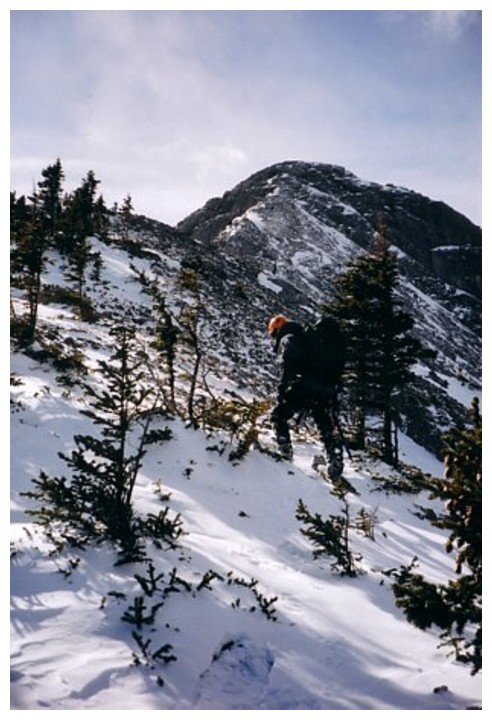
Eventually,
we ran into a steep snow covered rock slab – time to rope up and get the
helmets out! We tried to ascend it without any luck and then traversed to the
right where we struggled to get up a shorter, but very steep section to the
ridge. Had we traversed about ten metres further, we would have found an easy
hiking route around the slab. Back into the trees… and more trees….and more
trees!
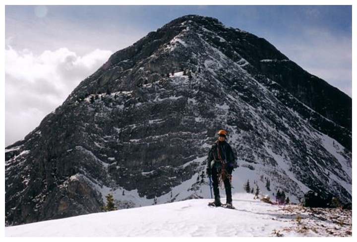
Finally,
after the 4 hour mark of the trip, we made it out of the trees. Ahead, we could
see the ridge rising to a plateau and the summit behind. At this point, we were
still fully expecting to make the summit. However, as we gained the plateau (fighting
against a violent wind throughout), disillusionment set in when the remainder
of the route became visible. After the plateau, the ridge dropped down a
little, and then rose with steep walls of rock rearing up about 250m vertical
metres to the summit. It was a no-brainer and we didn’t even make an attempt.
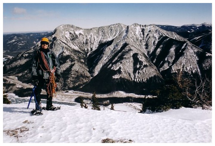
Fortunately, the wind was non-existent at this plateau and the sun on the
snow-covered mountains around us, helped to make it a pretty respectable
viewpoint.
The
descent was thankfully easy. Obviously, this will not be an ascent we will be
repeating (unless my mountaineering and climbing skills suddenly increase by a
factor of about 2 million!), however, I’m glad we made the attempt and it was a
nice change to try something without the aid of a guide book or route
information.
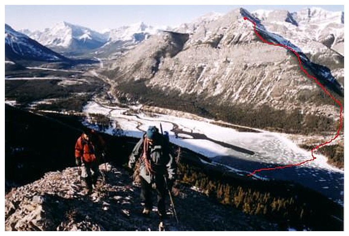
Red-line of the route we took, as seen from from Mount Baldy a week earlier
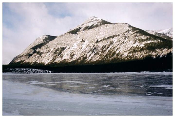
Ready to walk over Barrier Lake
Finally getting some views
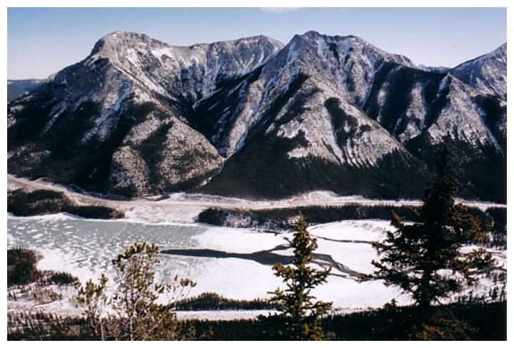
The three summits of Mount Baldy
Thin snow-pack, but snowshoes helped with traction
End of the line for today
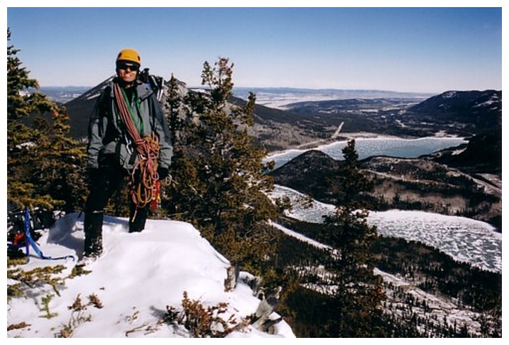
Me and Mount Blady