Lost Mountain, Mount Anderson,
Mount Bauerman
September 5, 2005
Mountain heights:
Lost:
2,509 m (8,230 ft)
Anderson: 2,698
m (8,849 ft)
Bauerman: 2,409
m (7,902 ft)
Elevation gain:
Car
to Lost: 1,010 m
Lost
to Anderson:
approx. 240 m
Anderson to Lost to
Bauerman: approx. 300 m
Ascent time:
Car
to Lost: 3:30
Lost
to Anderson and
back: 0:50
Lost
to Bauerman: 1:35
Descent time:
Bauerman
to car: 2:30
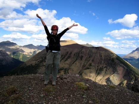
Scrambling with Jodi.
Feeling a little short-changed, after the
previous days failure to reach the summit of Mount
Anderson, Jodi and I spent the night
at Crandell campground and then returned to the Red Rock Canyon parking lot, to give the mountain
a second try. This time I vowed not to abandon the planned ascent route, via
the south slopes of Lost
Mountain, even if a more
interesting route revealed itself. In fact, it did, about 3-4 km along the
trail and then again a kilometer further. The first route looked very similar
to the route we had tried the previous day, but a little less steep. The second
was not as appealing, but presented a straightforward route to the col between Anderson and Lost
Mountain. In retrospect,
this second route would have provided the most logical ascent route, avoiding a
double visit to the summit of Lost
Mountain.
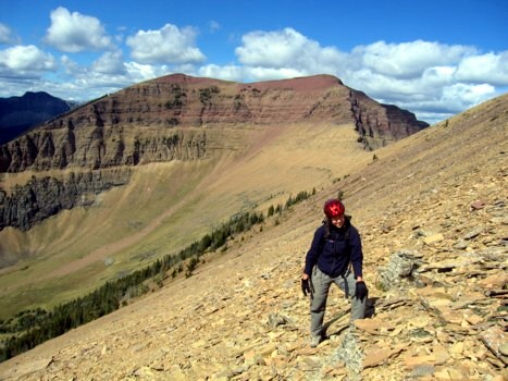
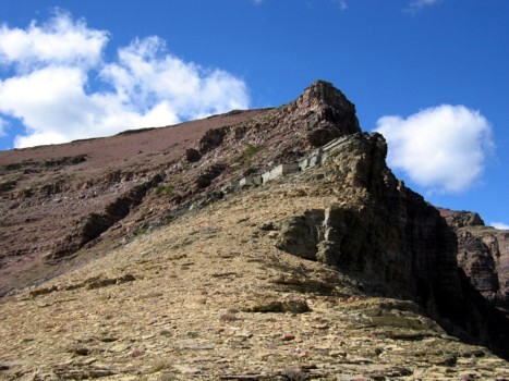
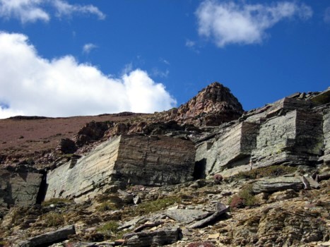
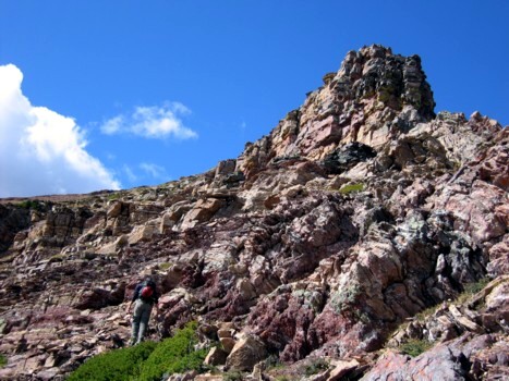
Continuing along Blakiston trail, I neglected to notice the clearing indicated
on the map that led straight to the summit of Lost Mountainand
we ended up wasting time and energy, bushwhacking through trees and
shrubbery. Traversing a couple of hundred metres to the right would
have saved
us that hassle. Above the treeline, steepish, treadmill scree slopes
led
arduously to the ridge, left of the summit block. Unfortunately, Jodi
didn't
have hiking poles with her and this foreshortened slope was a less than
aesthetic experience, as she groveled up the fine scree, sliding down a
step for
every two taken. The grade lessened towards the top and soon we were at
the
first summit of the day - a far longer than expected ascent time of 3.5
hours
(I imagine taking the other route directly to the Anderson/Lost col
would cut
a good hour off that time).
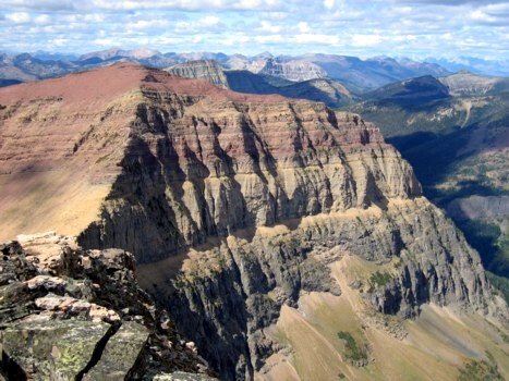
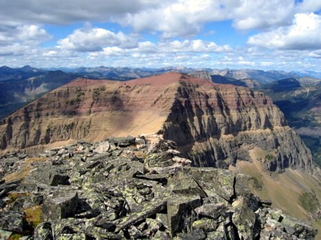
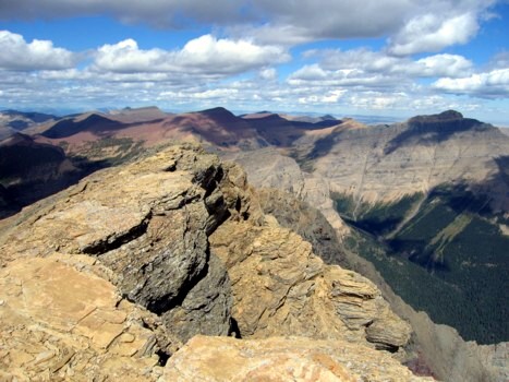
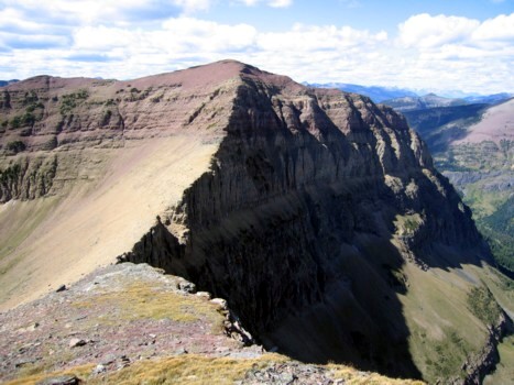
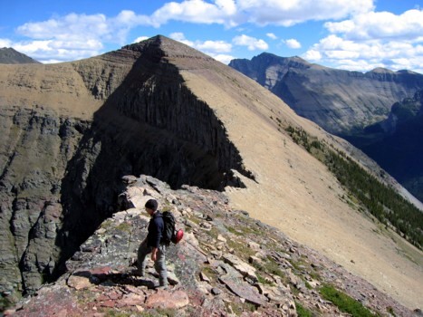
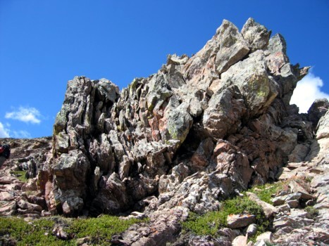
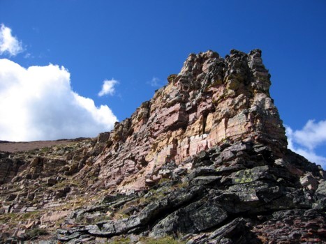
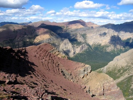
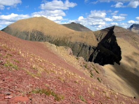
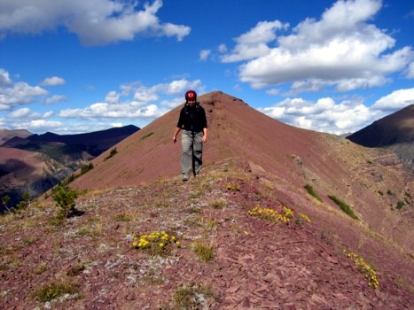
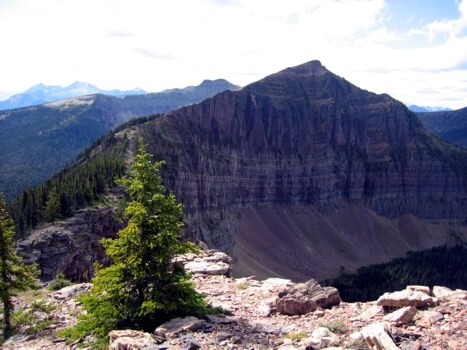
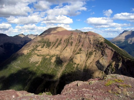
The summit view was very respectable and as is often the case in the Waterton
area, a vast array of magnificent shades of red, green, gray, and brown
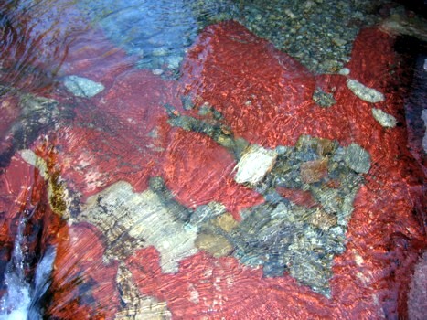
coloured in landscape wonderfully. Especially eye-catching was the red hue of
the unnamed peak between Lost and Bauerman.
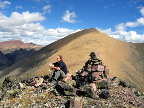
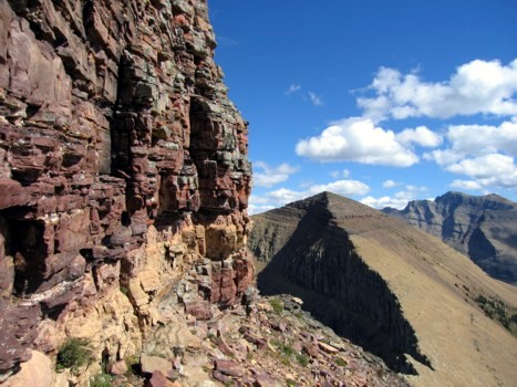
At this point, Jodi decided to rest at the summit of Lost
Mountain while I ran over to tag Anderson. The short
descent to the col and then ascent of Anderson
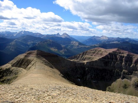
was very fast and easy (30 minutes there, 20 back), if not exciting. The summit
panorama was not terribly different from that of Lost
Mountain, but did include good views
towards, Galwey, Dungarvan, and Glendowan, as well as the impressive east and
north faces of Anderson.
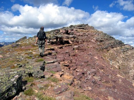
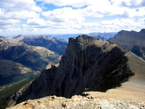
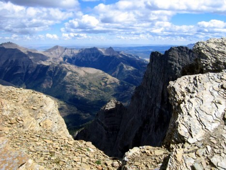
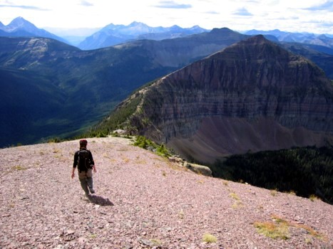
Returning to Lost
Mountain, we then turned
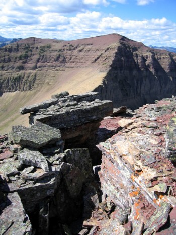
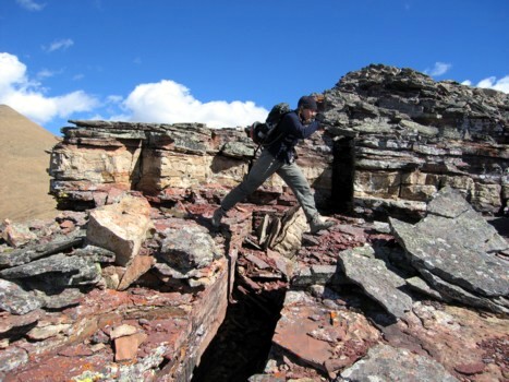
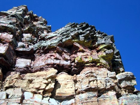
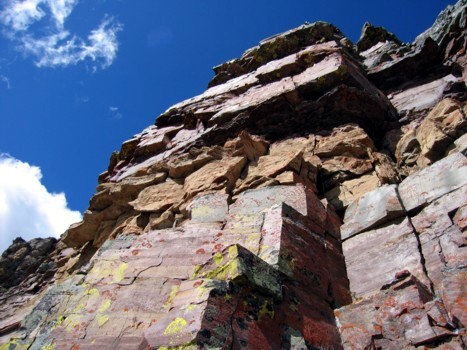
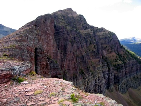
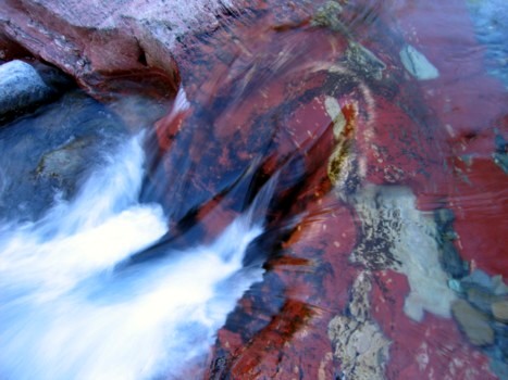
west and started down to the col between Lost and unnamed. This, for me, was
the highlight of the trip - fantastic rock colours, shapes, and formations, the
vertiginous drop-offs down the north side of both peaks, a great view back
towards Lost Mountain, and even some hands-on
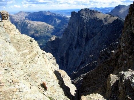
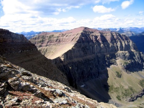
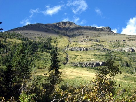
scrambling before the summit. Once there, the remainder of the route became
visible - a pleasant drop to a treed col, followed by a gentle slope to the
summit of Bauerman. Although it appeared to be a fair distance away, travel was
easy, enjoyable, and the scenery was fantastic throughout.
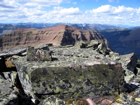
In addition to being the third summit of the day, getting to the top of Bauerman
provided the luxury of a wonderfully easy descent route directly down the
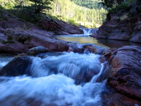
mountain's south slopes. A couple of hundred metres of terrific scree surfing,
followed by grassy slopes, and light forest, and we were back on Blakiston
trail, where a 9 km hike took us easily back to the car.
Most of the trip is just steep hiking, with very little scrambling, however, 3
summits, and typical, wonderful Waterton scenery throughout make this a more
than worthwhile trip, that both Jodi and I thoroughly enjoyed.
LOG