
Mountain height:
Anderson
: 2698 m
Lost:
2509 m
Total elevation gain:
approx. 1400 m
Ascent time: 6:00
Traverse time to Lost: 0:35
Descent time:
2:40
Scrambling with Mark.
I’m the least superstitious person around – I don’t believe in fate, destiny, the alignment of the stars, reading tea leaves, four-leaf clovers, rabbits feet, or lucky numbers. I did find strangely fitting, however, that on the seventh day of the seventh month of the seventh year (and on the seventh day of the week), we would stumble onto one of the most enjoyable scrambles we’ve ever done, and witness some very unusual weather conditions to boot. This also happened to be our Dad’s birthday (but then I’m not superstitious, am I??).
Last year, Mark and I intended
to attempt this route as a more difficult alternative to the route as described
in my Scrambles book. Unfortunately, by the time we got around to it, we
realized the
We drove down to Waterton with a pretty decent weather forecast in hand, only to find that the entire area was blanketed in low-lying clouds. This was disappointing to say the least – doubly so when a warden informed us that there was a 40% chance of rain and no chance of sun for the day. Cursing and swearing, we had little option but to go anyway.
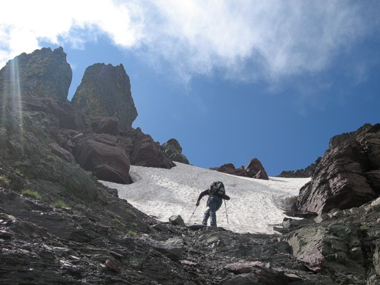
After hiking along Blakiston Trail to the ascent drainage, we started up, quickly arriving on steep scree slopes that were far less than enjoyable to ascend. It seemed the route would be a dud. Suddenly that changed, very much for the better. We traversed left into the dried-up drainage to find amazing scrambling up step-like terrain. Not only was the scrambling terrific, but the variety of interesting rock left visible by water erosion was phenomenal.
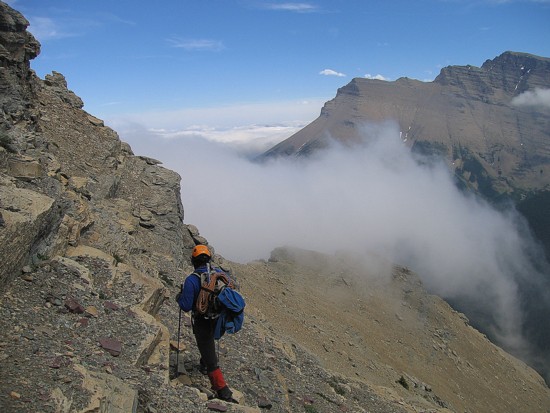
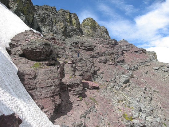
We expected the good scrambling and interesting rock scenery to last a short distance before scree and rubble reared their ugly, unwanted heads. To our surprise, the drainage went on and on and though scree did eventually appear, the quality of the scrambling remained consistently good. The only thing we now needed was a break in the bad weather and hallelujah…….we got one. Suddenly there was a little clearing to the west. What was unusual about this was that the low-lying clouds were streaming in from the east at a phenomenal pace. At this point, we were at the same height as the clouds and watching them speed right by us was amazing. They would quickly dissipate upon reaching an invisible border to the west of us.
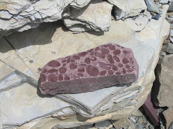
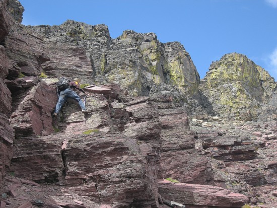
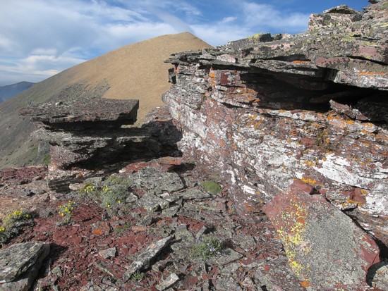
Near the top of the ascent
route, the infamous burgundy band of red argillite below a layer of black
igneous rock made its appearance. Though we had now seen this striking example
of rock layering on ascents of Blakiston, Dungarvan, Cloudy Ridge, Glendowan,
and Drywood, it was nevertheless, still breathtaking. We soon reached the ridge
to almost perfectly clear skies - above us, anyway. A quick and scenic traverse
took us to the east summit and a wonderful panorama. Most interesting was the
cloud layer below us and to the east. Except for the summit, the entire of
After a 35 minute traverse over
to
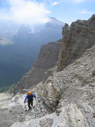
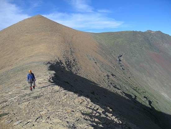
Mark tackles some pretty steep terrain early on
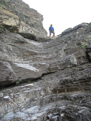
Mark at the top of less steep terrain typical of the ascent
More typical terrain
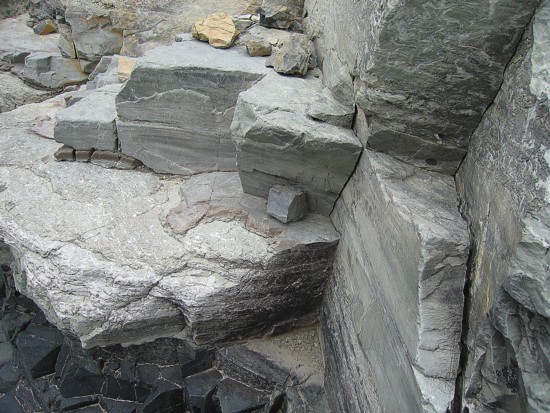
Some of the beautiful rock of the ascent drainage
Same as above
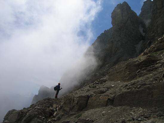
Clearing to the west; Mount Hawkins behind
The clouds race by
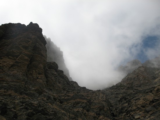
More interesting weather
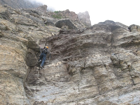
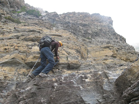
The steepest rockband of the ascent
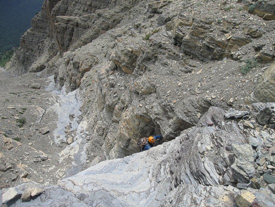
Mark ascends the same step
More clouds, with Mount Blakiston at the right
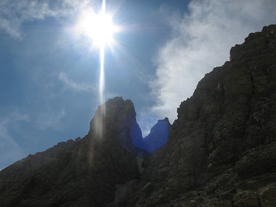
Almost clear
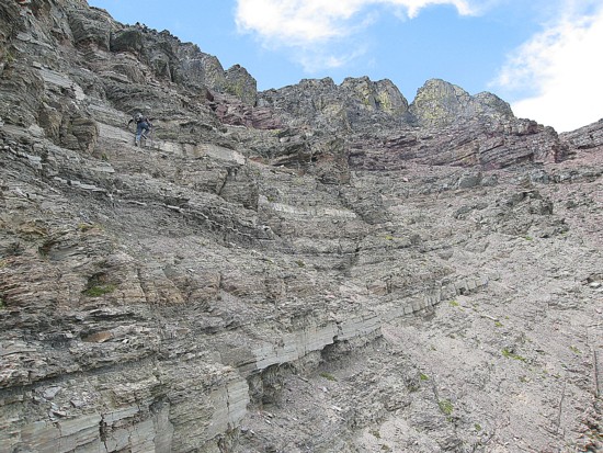
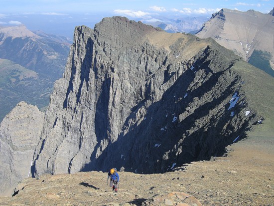
Approaching the burgundy rockband
A snow patch persists near the ridge; the snow was too hard to kick-step up
.....and pretty steep at that!
Scrambling up the argillite
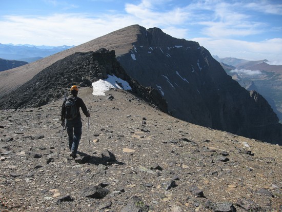
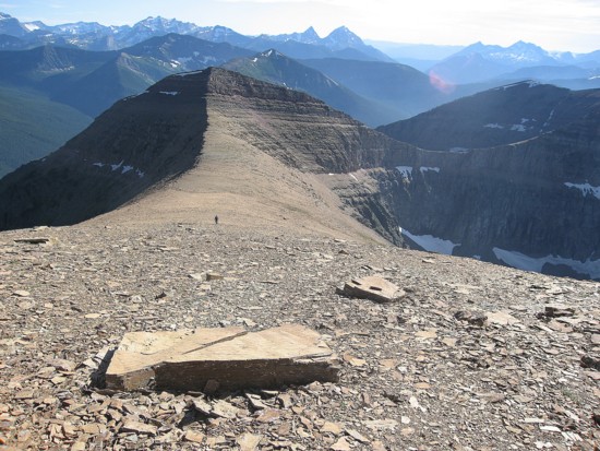
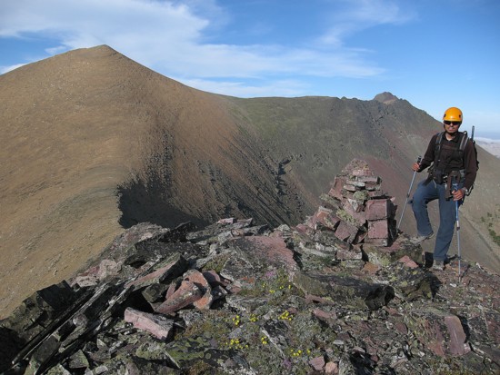
A scenic diversion on the east ridge; the east summit is at the left
More great rock on the east ridge
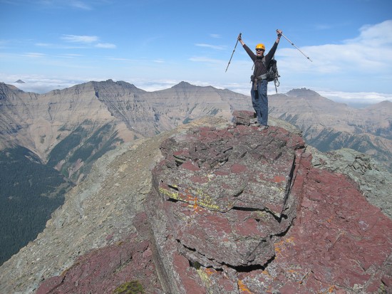
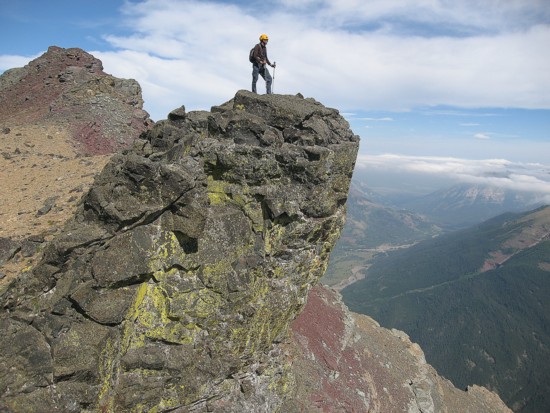
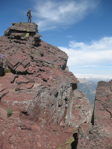
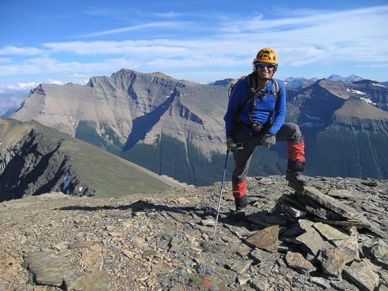
At the summit
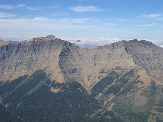
Mount
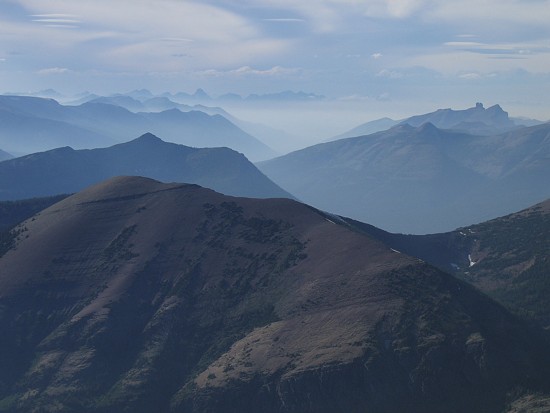
Glendowan (left) and Cloudowan Peak (right);
the summit of Mount Roche can be seen sticking out
of the clouds in the distant centre
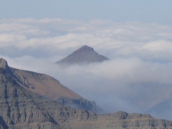
A close up of Mount Roche
Heading to the true summit
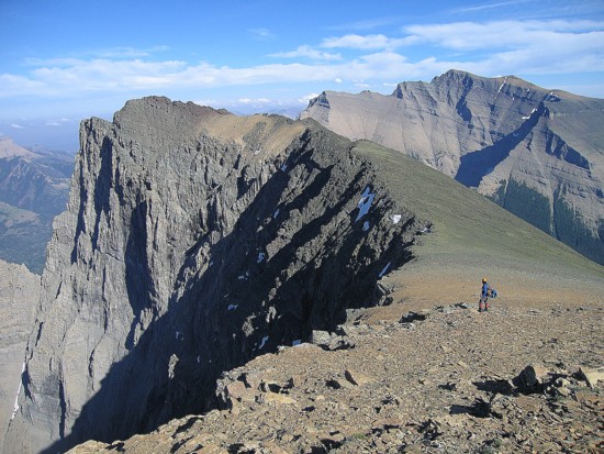
Looking back to the east summit (left)
Same as above; the northeast side of Anderson Peak is most impressive
Mark at the top; Blakiston to the left
Misty conditions to the northwest; Castle Peak is the small knob at the right
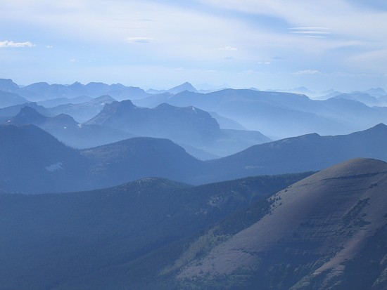
Same as above
Traverse over to Lost Mountain
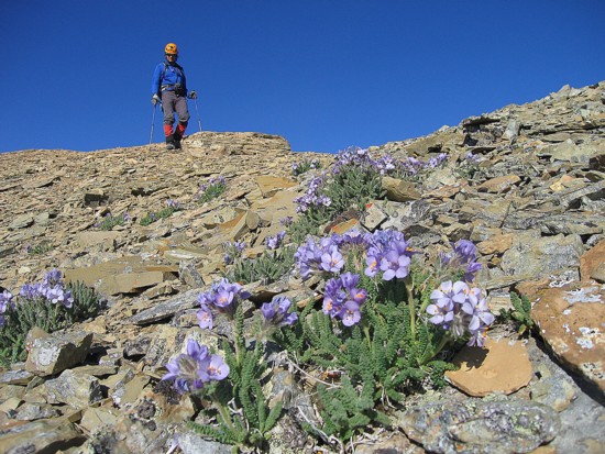
Lots of flowers on the slopes
Mark at the col, with the two summits and Anderson behind
At the top of Lost
More interesting rock and colours
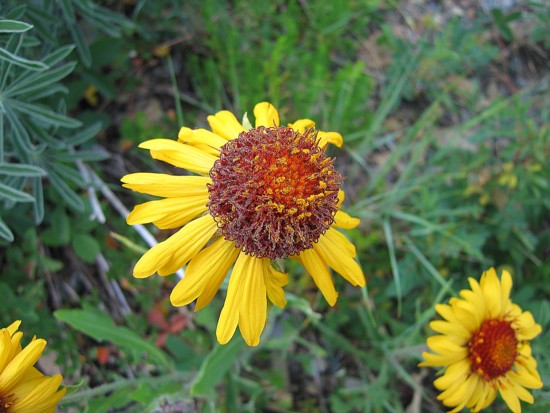
A flower shot that actually worked for me!
Click HERE
to see our first attempt
Click HERE to see
our second attempt