Mountain height:
2804 m
Elevation gain:
1200 m
Ascent time:
8:00
Descent time:
4:05
Scrambling and a little mountaineering with Mark and Raff.
Hoping for a repeat of last
week’s conditions, where we were able to bike the approach to
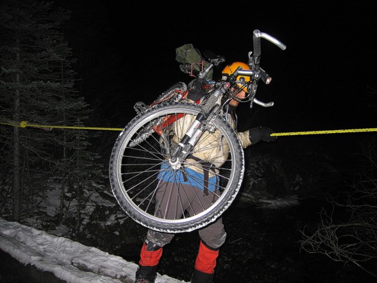
The first creek crossing was
the crux of the approach. Thankfully, not only were there two logs bridging the
stream, but also a rope to hold onto. Bikes on our shoulders, we crossed and
continued on. We ditched the bikes shortly after, at about the 8 km mark. The
snow was becoming too deep and the creek crossings more difficult. Throughout
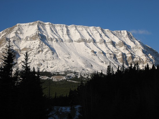
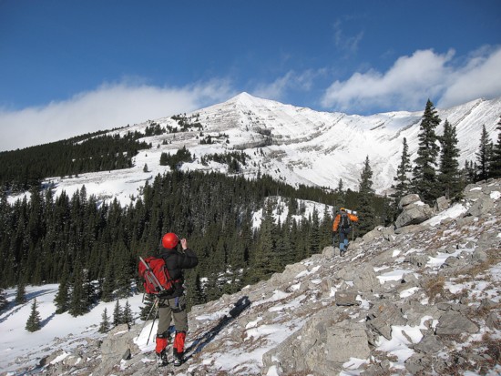
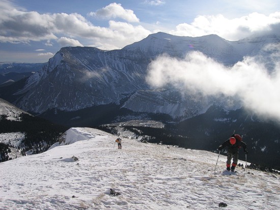
the approach, we were granted terrific views of our snow-covered objective and
Arriving at the south end of
Armstrong, where the trees were fewer and the view more open, was even more
spectacular.
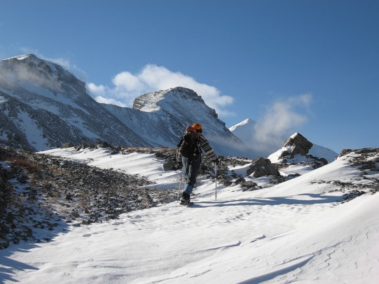
The slog up to Daffern’s
highpoint initially was beautifully scenic. Unfortunately, as we ascended, the
clouds from the west started to build and we reached the highpoint in a total
whiteout and very low visibility. Another repeat of last week’s Threepoint
trip was now in order. We traversed that long ridge in a brutal snow storm, with
very limited visibility. We arrived at the Threepoint summit to a total
whiteout, but just as we were about to leave, the skies miraculously cleared,
granting us magnificent views. On Armstrong, we were expecting the views to be
even more breath-taking and so we decided to continue on in the hopes that the
skies would clear later in the day. Raff, at that point, very astutely pointed
out that we were not in the
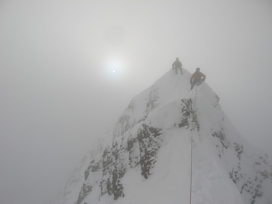
Nevertheless, the ridge traverse itself was very enjoyable and the low visibility and stark white background against the white snow did increase the challenge. Mark led the entire traverse. A short distance along, we decided to rope up. With sheer whiteness all around, it was becoming difficult to judge the contour of the ridge and often we couldn’t see what was more than 5 metres in front of us. In addition, there was definitely some significant exposure on both sides of the ridge. A few short downclimbs were a little tricky with the added snow, but in general, the traverse was straightforward.
Exactly eight hours after leaving the car, we arrived at the summit to our most disappointing summit view to date, simply because we were expecting it to be one of our best summit views to date. With about 2 hours of daylight remaining and brutally cold conditions, staying at the summit to wait for clearing was not an option and we started down almost immediately. Going back along the ridge, the sky would occasionally open up a little, but not for more than a few seconds. Back at the first highpoint, we did see a taste of the view to the south and west, as patches of open sky would appear.
The remainder of the descent was uneventful and we did the last 2.5 hours by headlamp. Certainly, not a bad day, but I think we all would have sacrificed the summit for a clear view at the first highpoint. Definitely a mountain and an area we’ll be returning to.
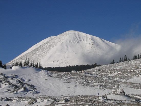
The east face of Mount Armstrong
Same as above
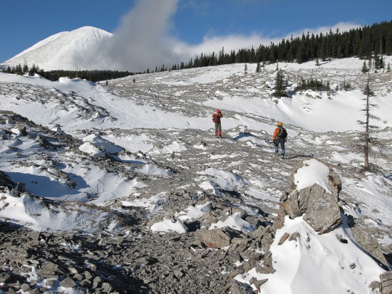
Out into the scenic terrain of the Fording Pass area
Mount Bolton
More open terrain
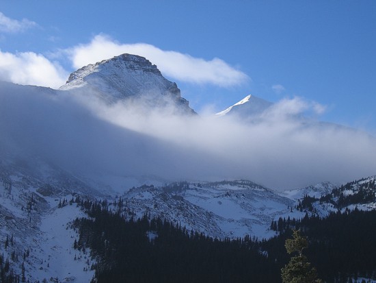
Low cloud below the outliers of Cornwell
Mount Bolton pokes above the the clouds
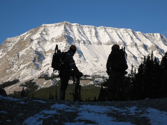
Heading towards the westerly south ridge of Armstrong
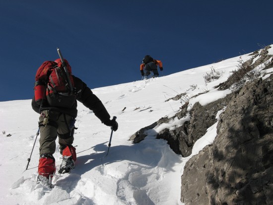
Ascending snow slopes to the ridge
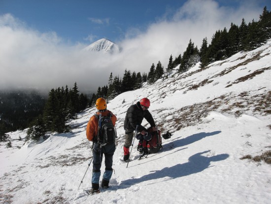
Preparing for the slog to the highpoint
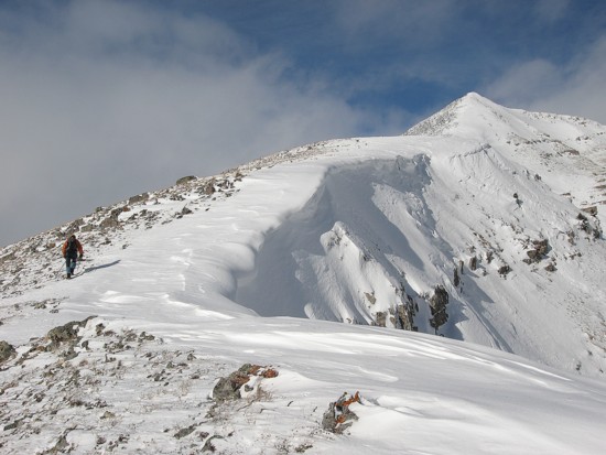
On the corniced ridge, with the highpoint at the right
Raff and Mark ascend the ridge; Baril Peak in the background
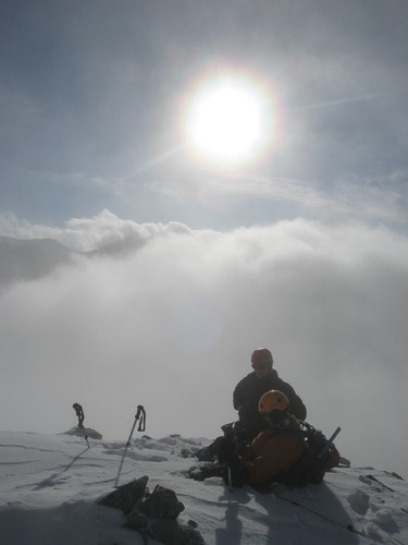
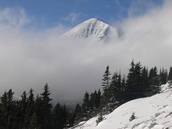
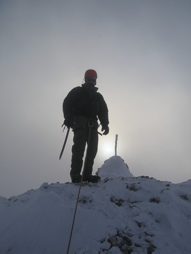
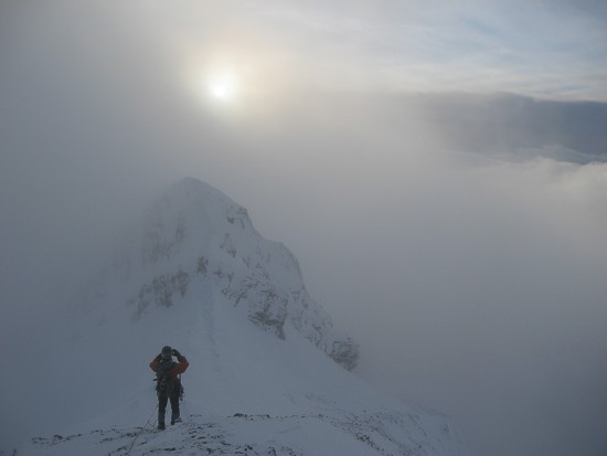
At the first highpoint; the last we'll see of the sun for a long time
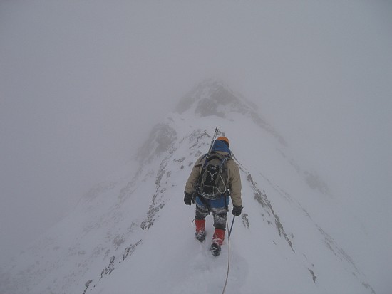
Mark leads the ridge traverse
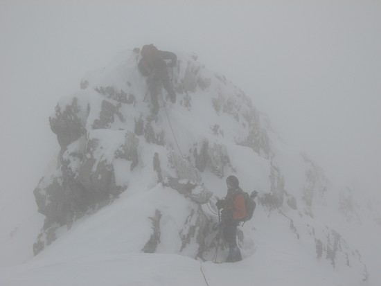
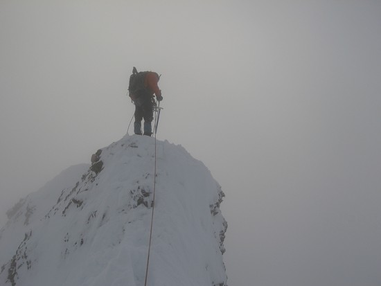
Raff downclimbs a small step along the ridge
Raff and me on the ridge
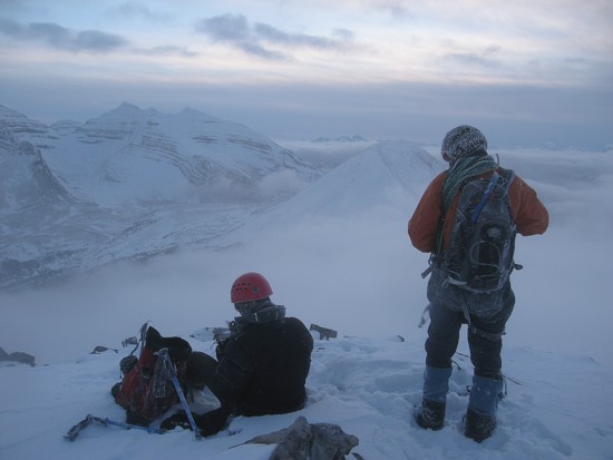
The only good view at the summit!
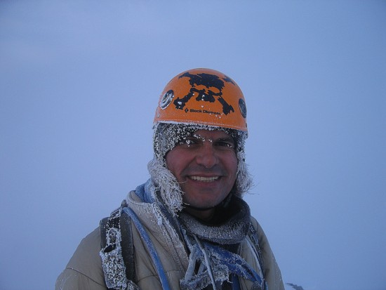
Raff at the summit
Heading back along the ridge
A brief moment of slight clearing
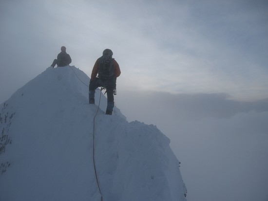
More of the narrow ridge
Back at the first highpoint, with another brief break in the cloud cover
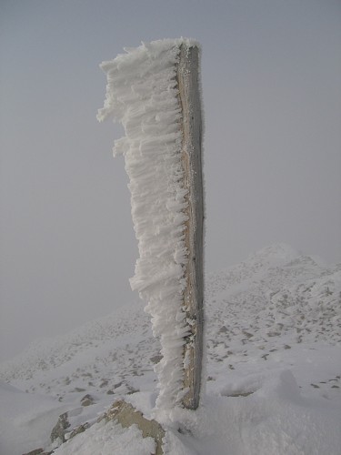
Signs of winter