Gog Lake, Point Raeder,
Chucks Ridge, The Nublet
Mountain heights: 2737 m, 2425 m, 2545 m
Total elevation gain: approximately
1600 m
Round-trip time: approximately
10 hours
After a typical
restless night of sleep in the hut, we awoke to foggy, cloudy conditions.
However, a clearing trend was forecast, and optimism was high. The first
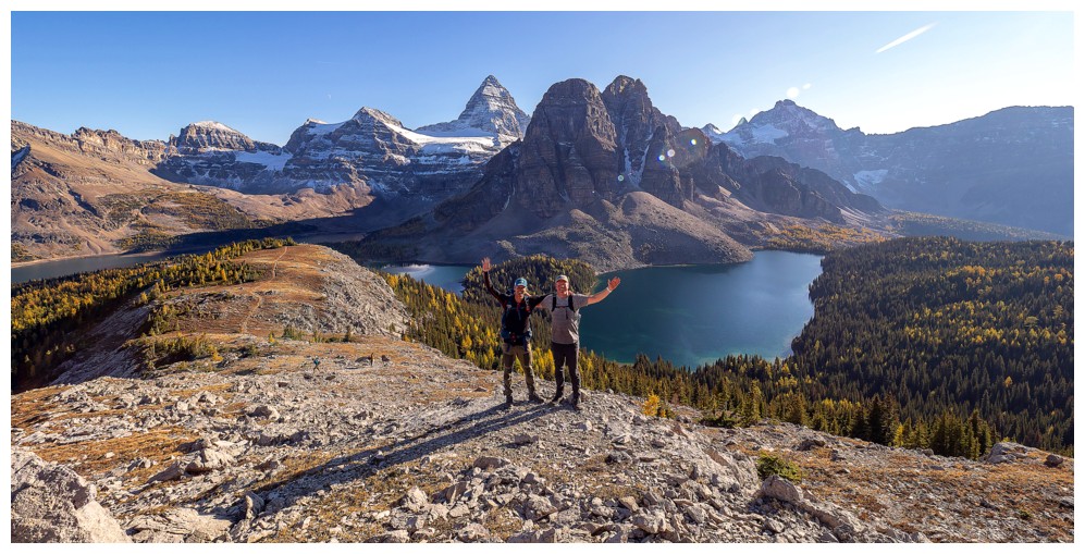
objective of the day was the lowest of the three Sunburst Peaks - Point Raeder. However, Marko, Sean, Orlagh, and I couldn’t
resist a quick early morning visit to nearby Gog Lake. Marko and Sean brought
their fishing gear, while Orlagh and I just hiked some of the lakeshore and terrain
above. We then all returned to the hut, just in time to head off to Raeder.
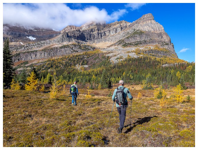
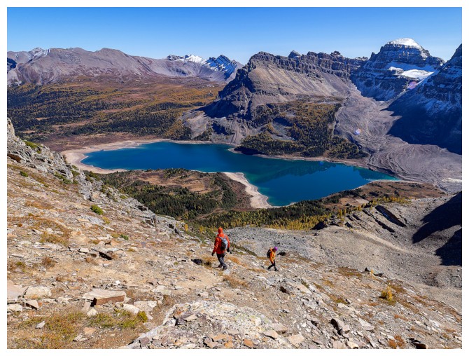
At
Magog Lake we split into two groups. One followed the lakeshore, the other a
trail above the lake. We all met sometime later and started up the mountain.
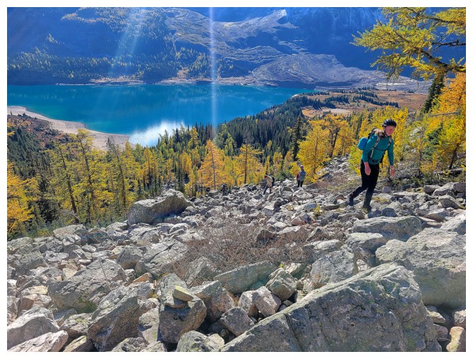
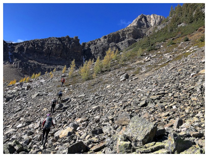
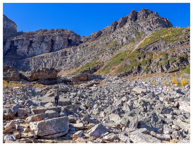
The first section consisted of a short bushwhack and then a longer section of
steepish boulder hopping. Srdjan again led
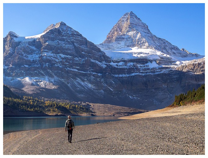
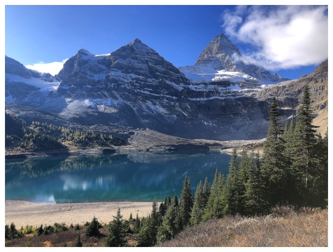
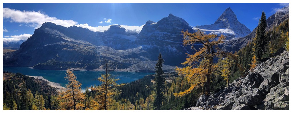
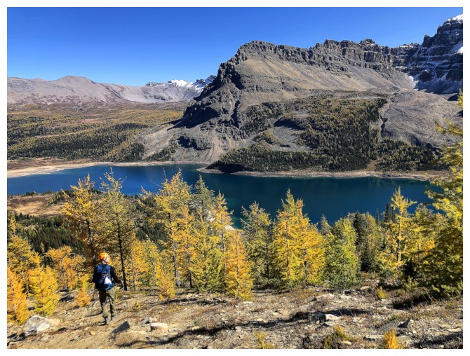
throughout at a breakneck speed. Views of Mount Assiniboine and Lake Magog were
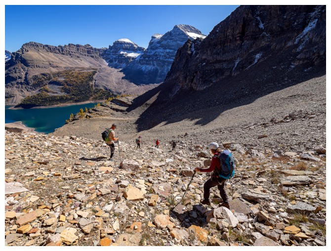
mesmerizing. After a traverse left above the boulders the grade steepened
significantly and the terrain became more serious. 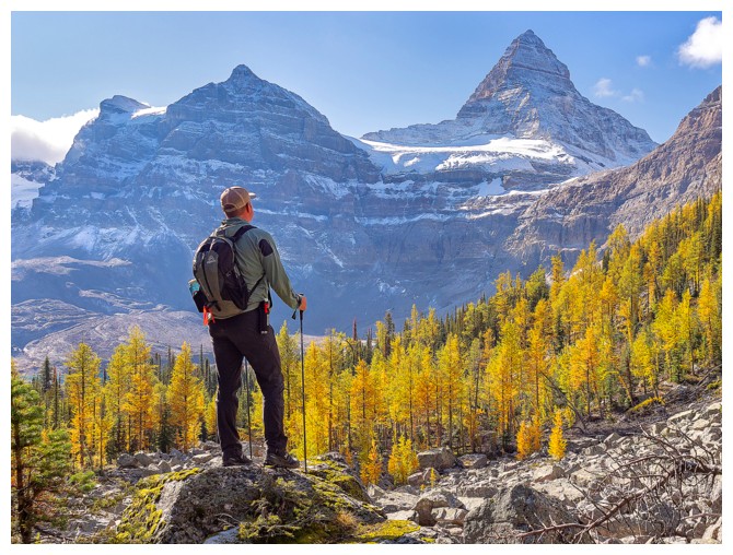 Again, we decided to split
up. Natasha, Shawn, and I veered hard left, hoping that a ramp would ease the
grade. It did a little, though we chose steeper lines, mostly on solid
quartzite. Shawn took a particular challenging line – he’s a natural scrambler.
Again, we decided to split
up. Natasha, Shawn, and I veered hard left, hoping that a ramp would ease the
grade. It did a little, though we chose steeper lines, mostly on solid
quartzite. Shawn took a particular challenging line – he’s a natural scrambler.
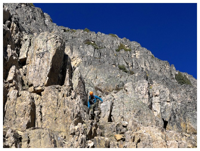
We
eventually intercepted the route the rest of the group took but they were far
ahead of us. The final push to the summit involved scrambling up steep, ledgey
rock that was unfortunately littered with lots of loose stuff. Extra care was
needed to avoid unleashing a volley of rocks.
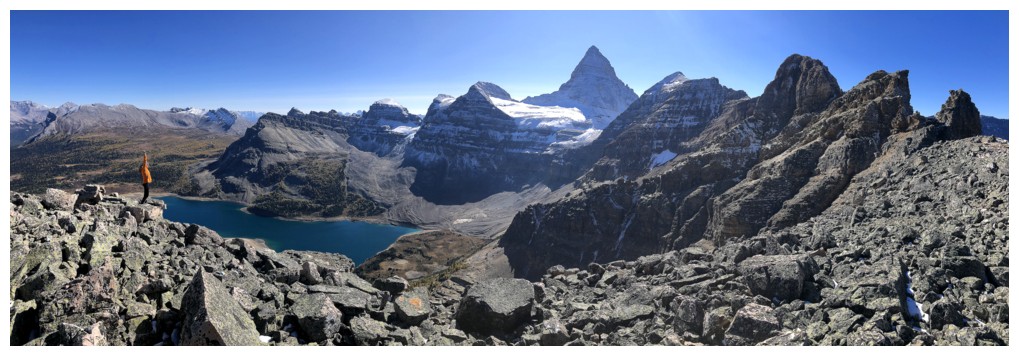
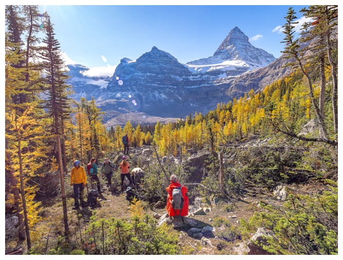
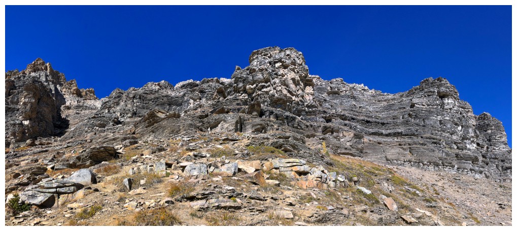
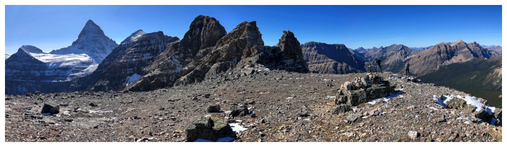
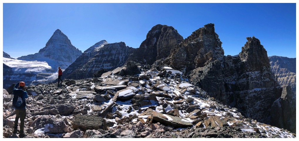
Some
wickedly cool rock scenery lined the ridge, and it became very clear why the
lowest summit of the massif was the only one achievable by non-technical means.
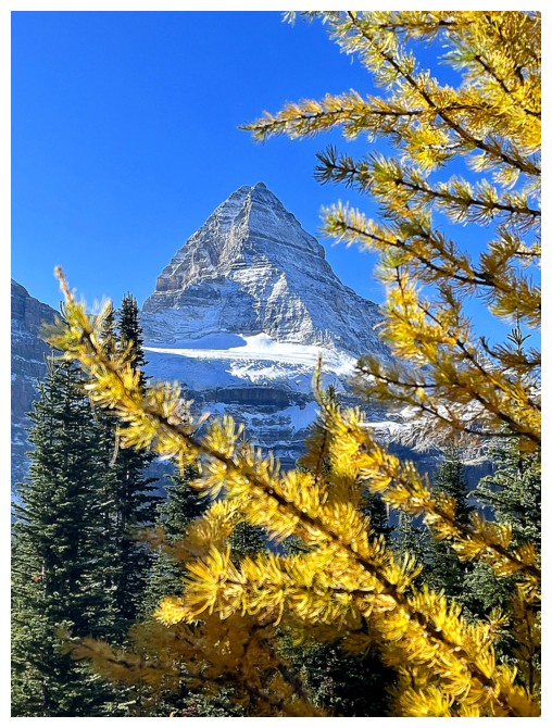
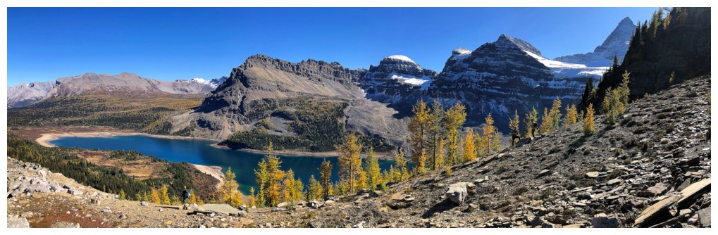
 However, that fact did little to deter from a mind-blowing summit view. Of
course, Assiniboine was front and centre, but so was Mount Magog, Terrapin
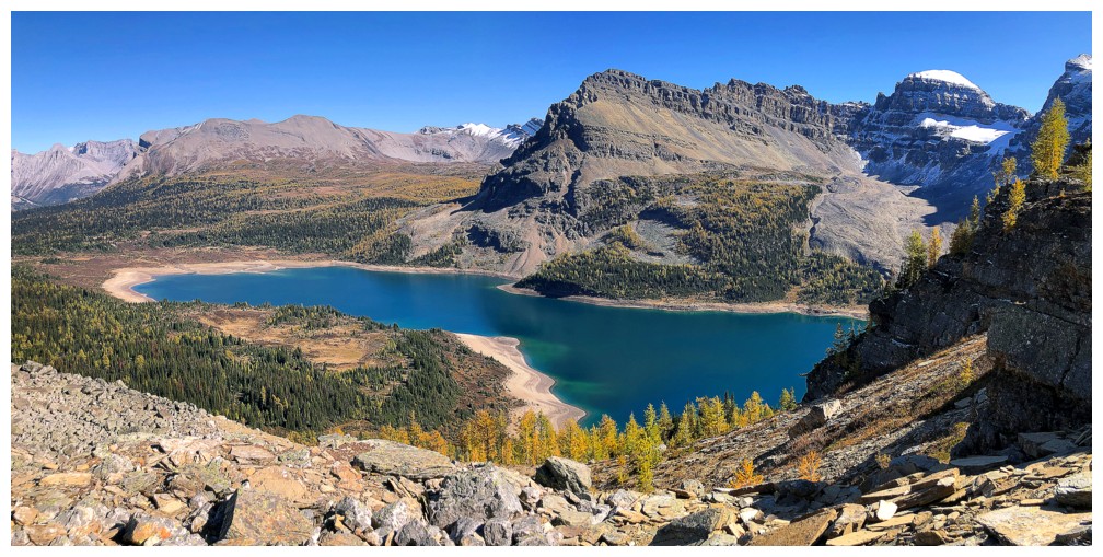
Mountain, Naiset Point, Nub Peak, and many, many others. Also eye-catching were the Cerulean
and Sunburst lakes, directly below the north side of the objective. One glance
was enough to put the rusty gears in my brain in motion – I had to see those
lakes up-close.
However, that fact did little to deter from a mind-blowing summit view. Of
course, Assiniboine was front and centre, but so was Mount Magog, Terrapin
Mountain, Naiset Point, Nub Peak, and many, many others. Also eye-catching were the Cerulean
and Sunburst lakes, directly below the north side of the objective. One glance
was enough to put the rusty gears in my brain in motion – I had to see those
lakes up-close.
We
all enjoyed a lengthy and extremely gratifying summit stay before retracing our
steps down the mountain. Near the base we decided to follow the lakeshore route
out, before splitting up again at the Magog Lake outlet. The plan was a later day ascent of The Nublet
and as such the group returned to the Naiset Huts for lunch. However, still smitten
with the Cerulean and Sunburst lakes, and at the mercy of my impatient
tendencies, I decided to visit those lakes immediately. I could then attempt to
reach the summit of Nub Peak and descend to meet the group on the summit of The
Nublet. At least, that was the plan!
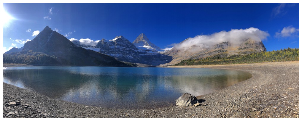
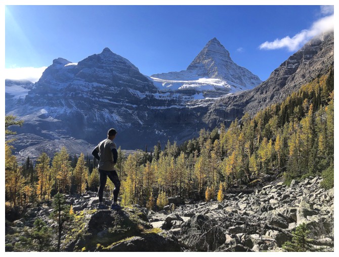
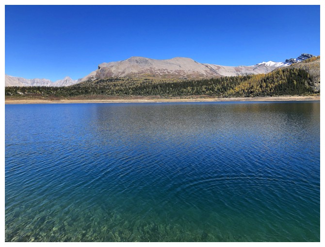
Both
lakes were beautiful, however their aerial view was arguably more aesthetic
than the up-close views. To my surprise, the lake that did provide a super cool
lakeshore view was Elizabeth Lake, perhaps because it is dramatically backdropped
by Nub Peak.
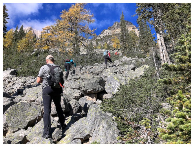
Cruising
right by the lake, I missed a key turnoff that leads directly to Nub Peak,
eventually ending up at the base of Nub’s southwest ridge. The Canada topo map
identified it as Chucks Ridge and the widely spaced topo lines led me to the
erroneous conclusion I could find my way up Chucks Ridge and then continue easily
to the summit of Nub Peak. 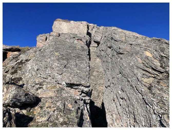 Had I done a little research beforehand I would have
known that there is no scramble route from one to the other. Even getting to
the lowly summit of Chucks required route-finding and some tricky scrambling.
Had I done a little research beforehand I would have
known that there is no scramble route from one to the other. Even getting to
the lowly summit of Chucks required route-finding and some tricky scrambling.
Nevertheless,
the view was fantastic, compliments of Elizabeth Lake. After a short stay I
started retracing my steps down, hoping to find a high-level traverse over to
the Chucks/Nub ridge. That didn’t happen. After multiple attempts I was
resigned to the fact I would have to lose all the elevation gained from Elizabeth
Lake and find a way up Nub from there. 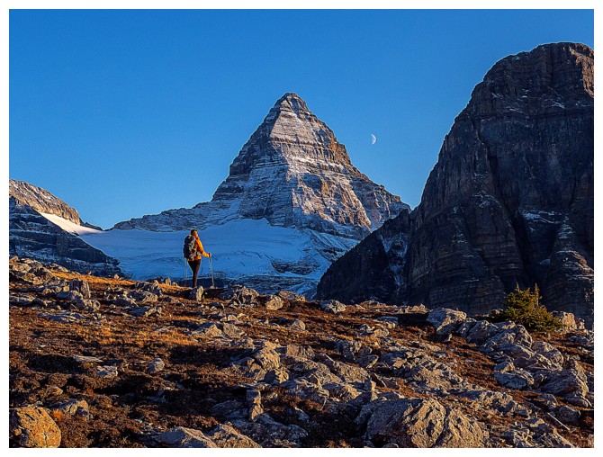 Approaching the lake, I stumbled onto a
well-defined trail in the scree and concluded this was the trail I was supposed
to be on in the first place. Odd that it wasn’t signed, as the signage in the
area generally seemed to be very thorough.
Approaching the lake, I stumbled onto a
well-defined trail in the scree and concluded this was the trail I was supposed
to be on in the first place. Odd that it wasn’t signed, as the signage in the
area generally seemed to be very thorough.
At
this point reaching the summit of Nub Peak was very much in jeopardy – not
because of any difficulties en route, but because of the time of the day. The
rest of the group had planned to enjoy the view from The Nublet around Sunset
and that time was rapidly approaching. I reached the ridge and had to make a
decision. If I went to Nub Peak, I would miss the sunset with the group from The Nublet – an
experience that is reported to be quite magical. Given that views always come
before summits for me, I chose to skip the summit of Nub Peak and head down to
The Nublet to rejoin my friends.
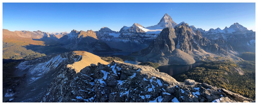
It
was great to be reunited with the gang and as advertised, the views were as
beautifully aesthetic as beautifully aesthetic gets. Several hundred photos of the stunning
scene of Mount Assiniboine, Point Raeder, and the Cerulean and Sunburst Lakes
were taken by the group before we made the easy descent and return to the huts.
Another
wonderful meal ensued. Noticeably, there was a hidden agenda, as we each tried to convince the
others to consume as much of the food we individually brought with us. Given
each would have to hike out with the remaining food the following day, everyone wanted to lighten their load. I was
all over Shawn’s Two-Bite Brownies!!
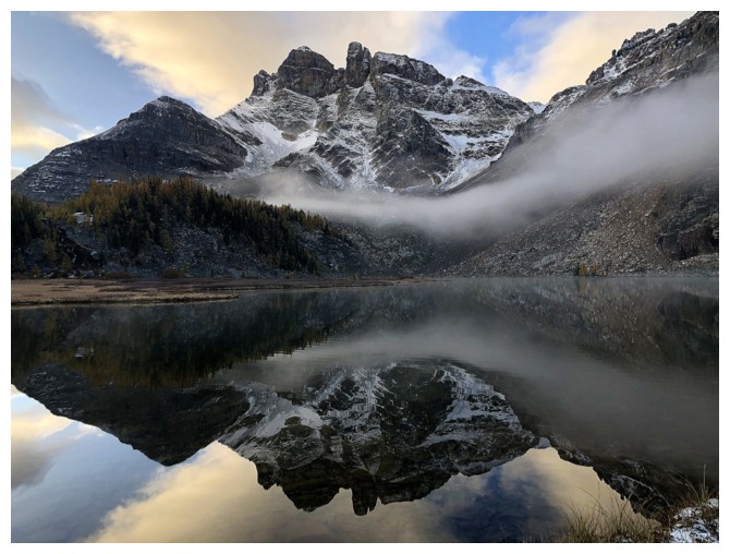
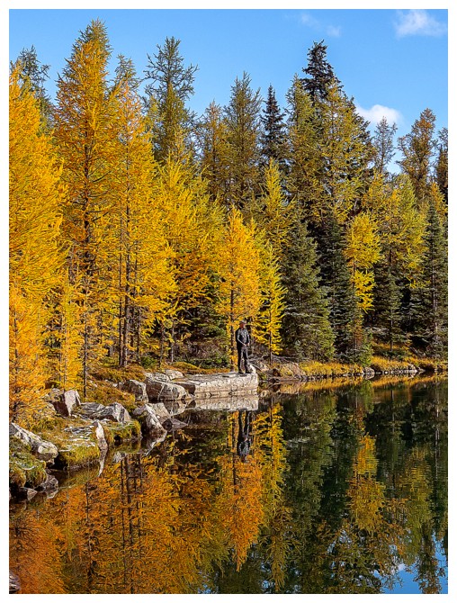
Gog Lake
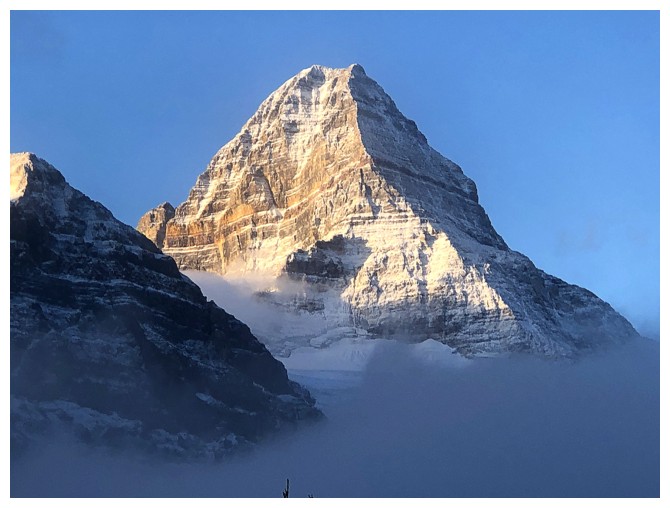
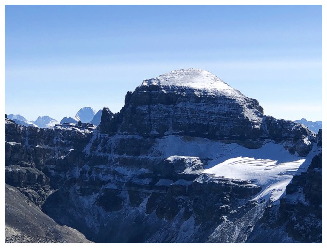
Early morning view of Assiniboine's east and north faces
Sean leads us around the west side of Gog Lake
The Towers (left) and Naiset Point reflected in the lake
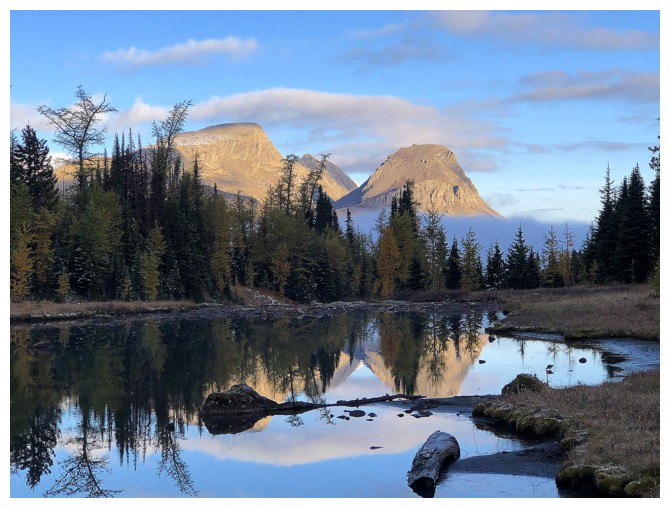
Looking north to the Nub Peak area
The Towers
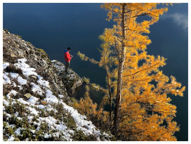
Naiset Point. I ascended the small hill in front. Sean and Marko are already fishing.
The view north from the top of the hill
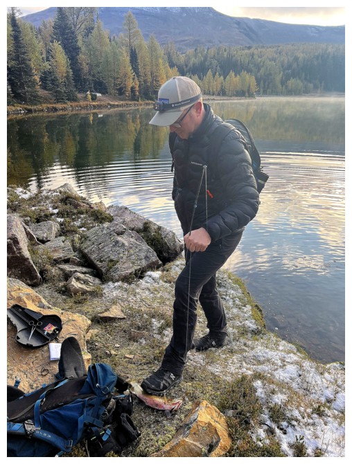
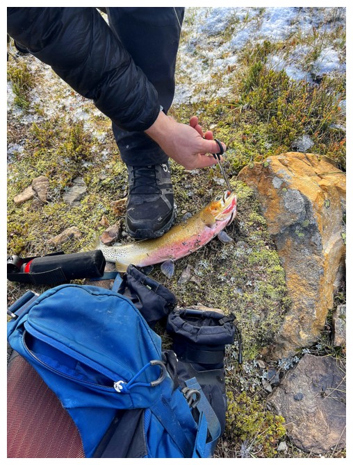
Within minutes of starting, Marko has caught lunch! (photos by Orlagh)
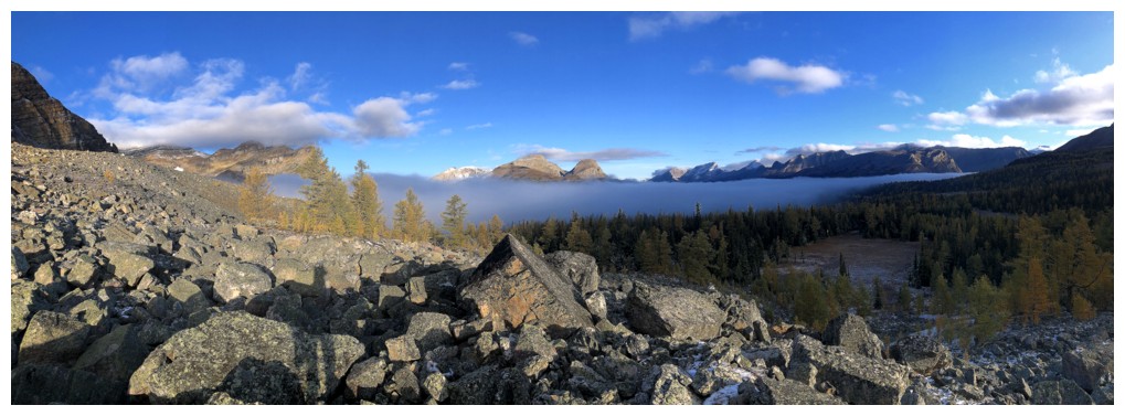
Low-lying fog made for some cool views
A very serene and peaceful scene with Sean (photo by Orlagh)
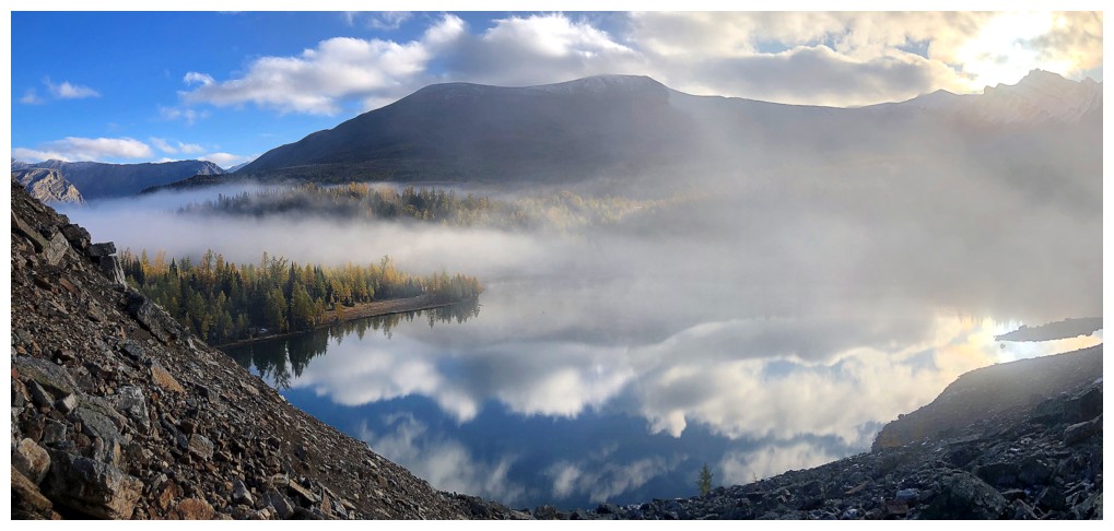
The mysterious conditions persist over the lake
Sean and a very isolated larch
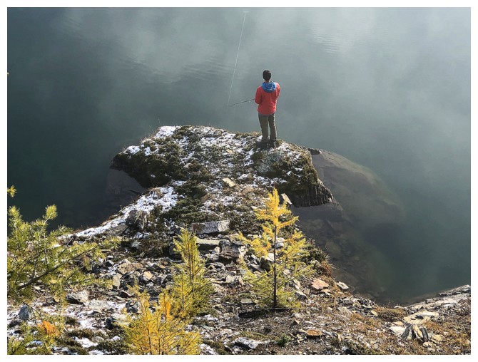
Sean has found a great fishing spot
Down to the lakeshore. Orlagh and Marko are both in the photo but hard to see.
There's Marko (photo by Sean)
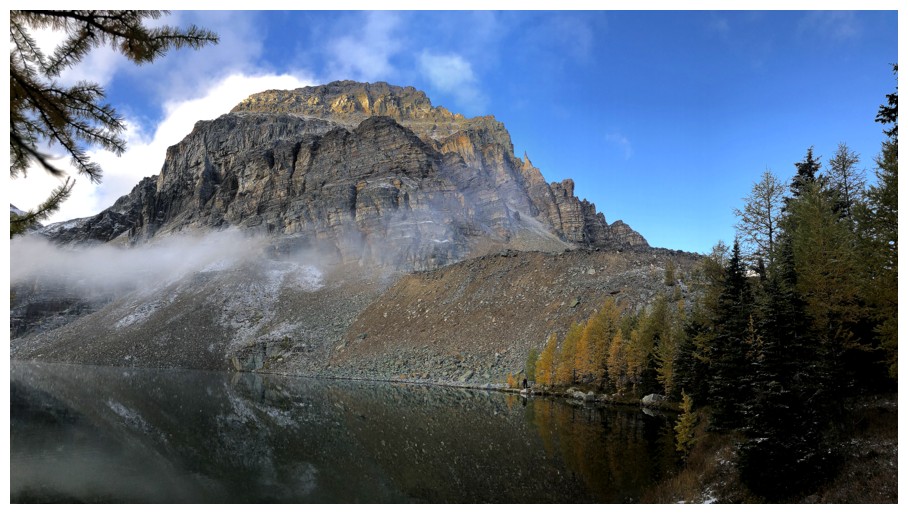
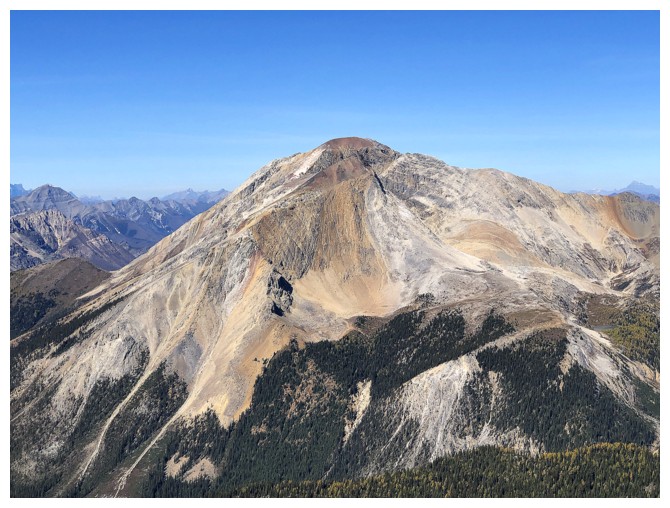
Point Raeder
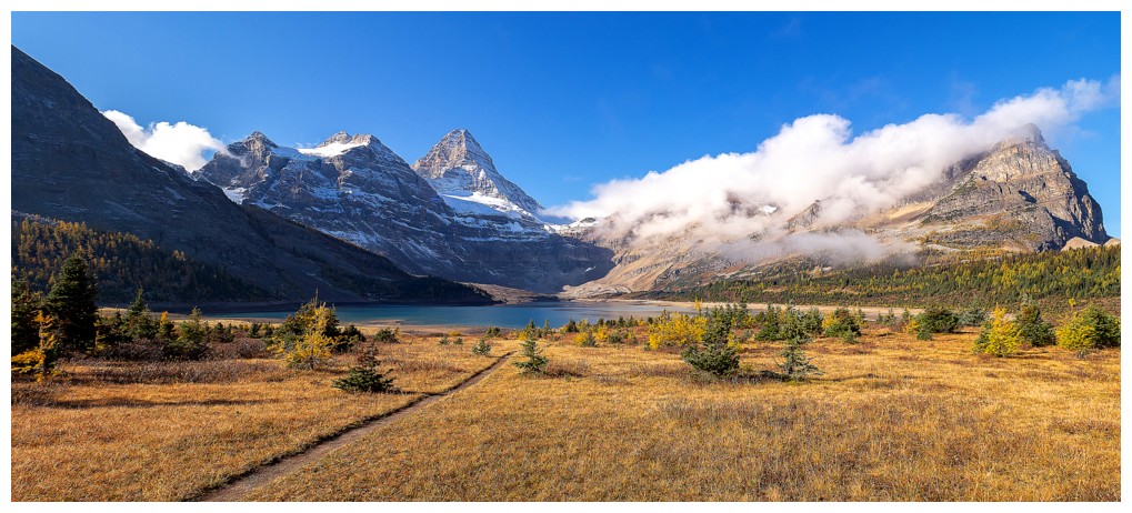
The clouds are clearing, but linger over our objective at the right (photo by Sean)
Same as above with some our group heading for Lake Magog
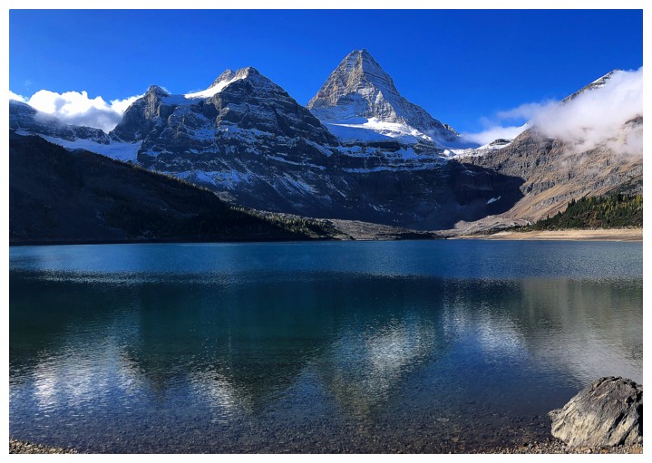
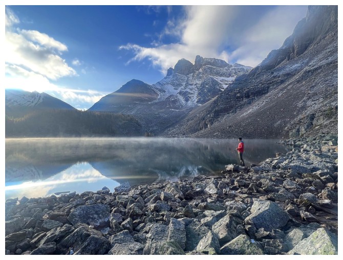
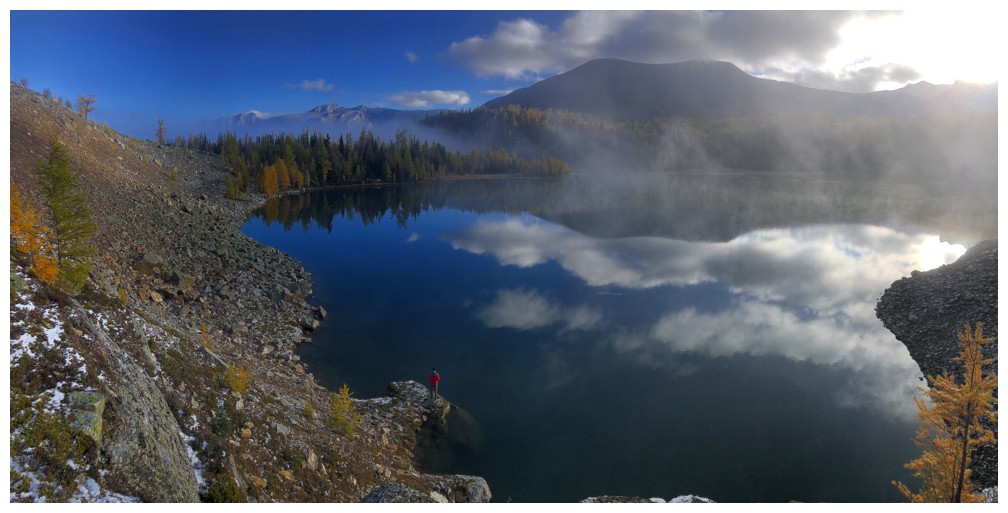
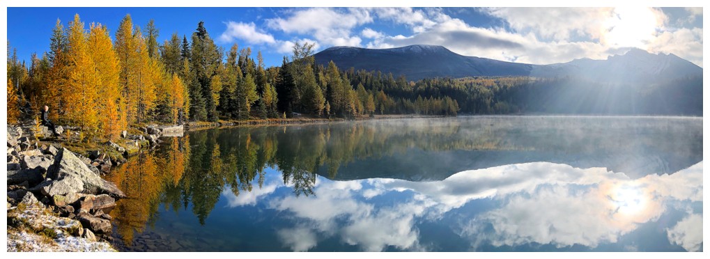
Four of us went down to the lakeshore, hoping for some mountain reflections in the lake
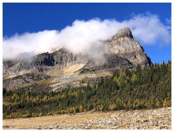
Raeder is still flirting with the morning clouds
The best reflection we got
Meanwhile,
Meggie and the others are on the trail above the lake, also enjoying
great views of the great mountain (photo by Natasha)
Stunning views of Mount Assiniboine regardless of the route you take (photo by Sean)
Same as above (photo by Sean)
Natasha frames Assiniboine perfectly (photo by Natasha)
Finally the clouds have lifted off the summit of Point Raeder (far right)
Now they are heading for Assiniboine
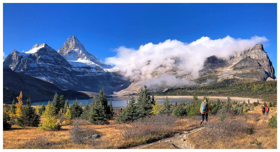
After leaving the lakeshore Sean and Marko hike towards the objective to meet the others
The gang takes a short break to admire the view, before hitting the boulder field (photo by Sean)
Shawn finds a great spot to view Assiniboine
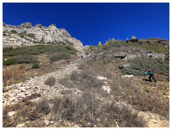
The start of the boulder field
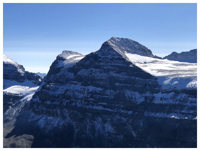
Of course, views that are already great are going to improve dramatically throughout the ascent
Orlagh and Lake Magog (photo by Srdjan)
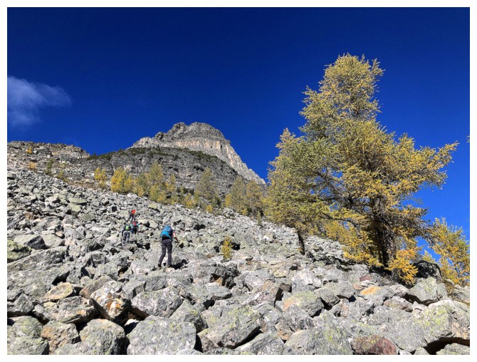
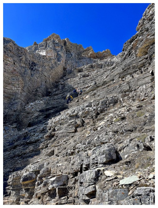
In general, the boulders were stable and the ascent straightforward, but the terrain did get steeper as we ascended
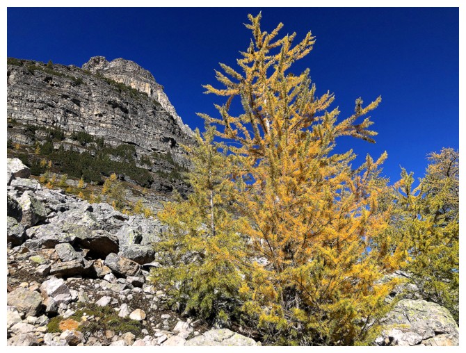
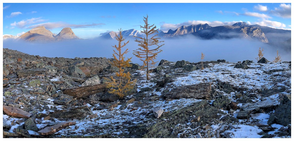
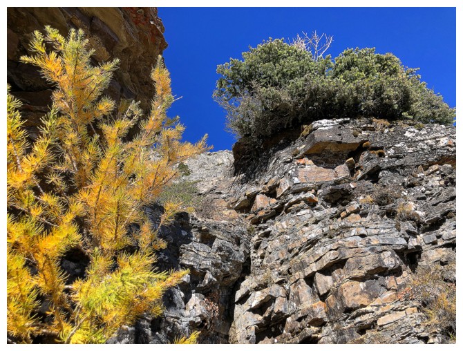
The odd larch was a welcome sight
Improving view again
Another short break (photo by Natasha)
Natasha has made a new yellow friend (great selfie by Natasha)
Sean is no slouch with the camera either! (photo by Sean)
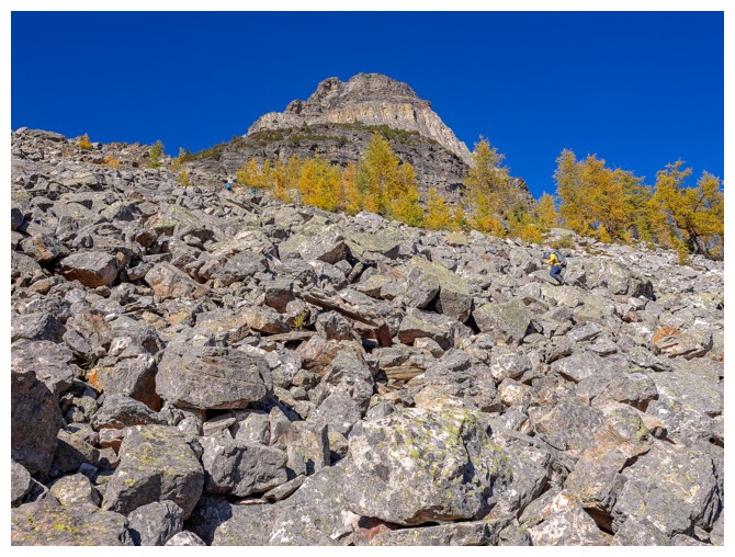
Getting even steeper (photo by Sean)
Top of the boulder section (photo by Sean)
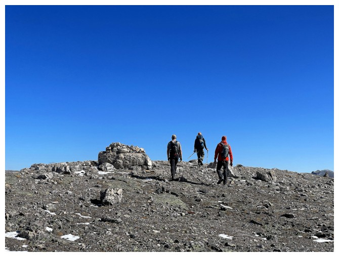
A nice orderly ascent
Five of the group went up this slope. It's steeper than its looks.
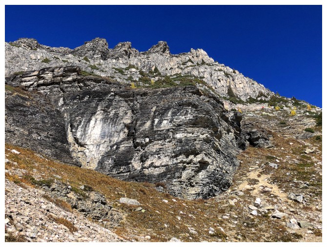
Natasha, Shawn, and I went left here looking for a ramp that goes above the rock band in front
Srdjan and the lake (photo by Sean)
I snuck up to the ramp above through this gap
Shawn waits for me and Natasha before we hit the quartzite band
Up we go
Natasha traverses right, to find a route through the steep rock bands
Shawn is checking out a stiff route up through them
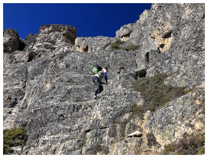
Up he goes - definitely some difficult scrambling above
Meanwhile, Sean has found the weakness above the ramp and is leading the way (photo by Meggie)
Srdjan and Meggie follow (photo by Sean)
Shawn, Natasha, and I have fallen behind. The rest of group are in the gully at the far left.
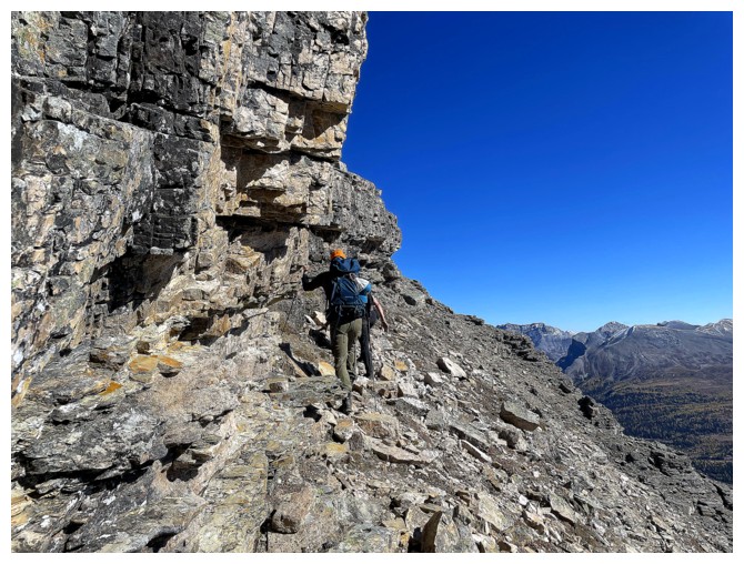
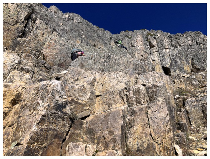
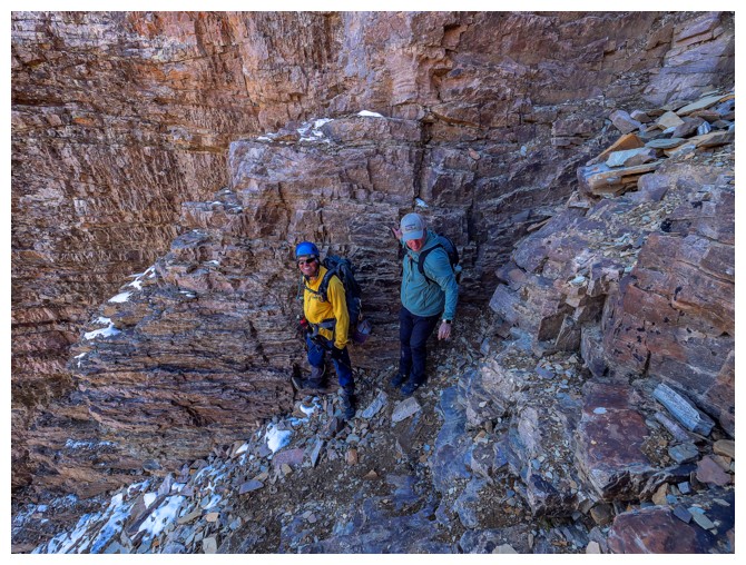
Above the gully, vertical rock bands require the group to traverse below them (photo by Meggie)
Srdjan is back in front and headed for the summit (photo by Sean)
Some of that vertical rock
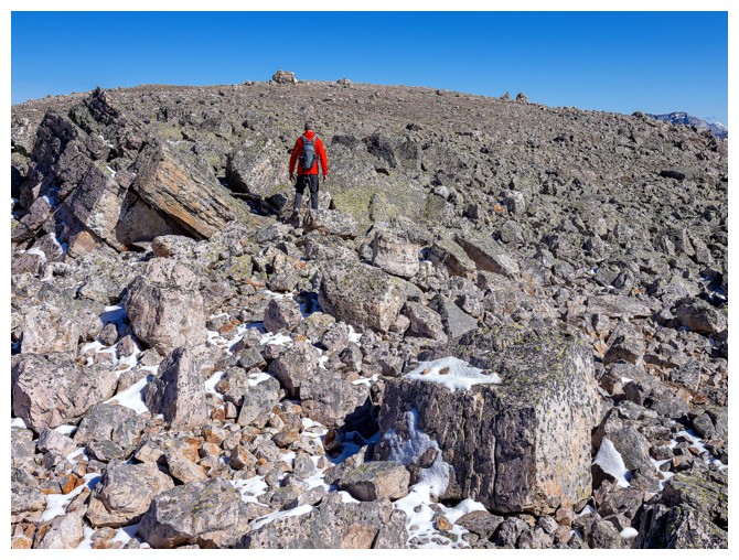
Easy walk to the top (photo by Meggie)
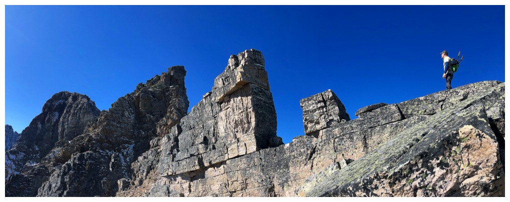
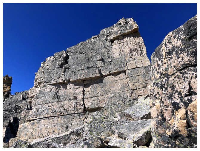
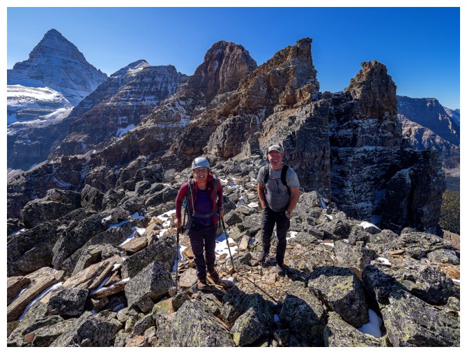
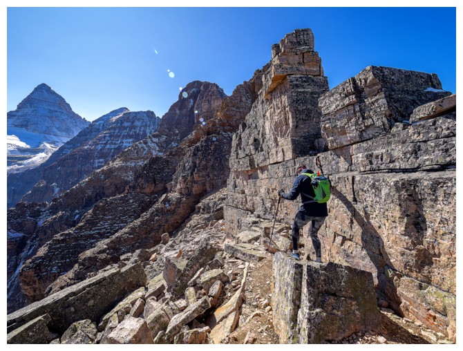
Shawn checks out the super cool rock that makes up the stunning ridge
Sean and Marko (photo by Meggie)
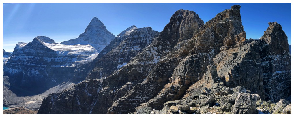
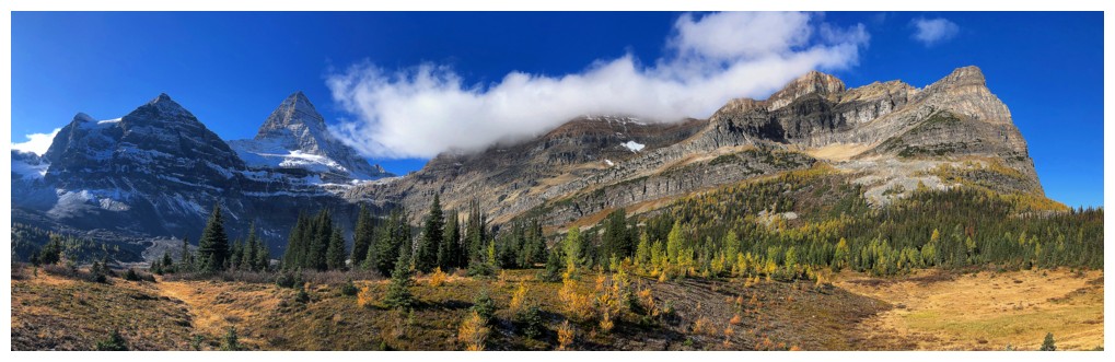
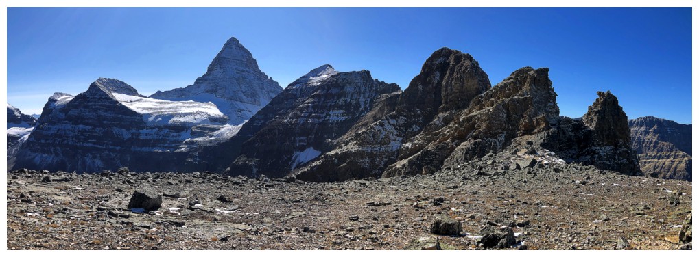
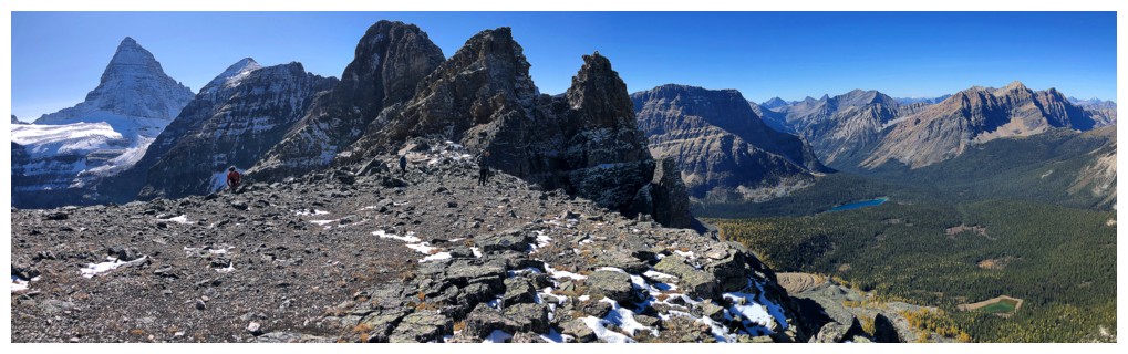
The
impressive and daunting ridge than eventually leads to Mount
Assiniboine. Right of Assiniboine sit Wedgwood Peak (3024 m), Goats
Tower (2849 m), and Point Bergsland (2793 m). Refer to David Jones' Rockies South,
page 241 for the name and route descriptions. Apparently there is a 4th
class route up Goat's Tower, the highest of the Sunburst Peaks, first
climbed in 1910.
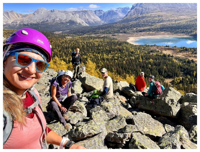
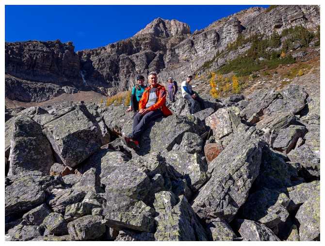
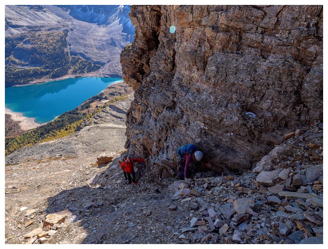
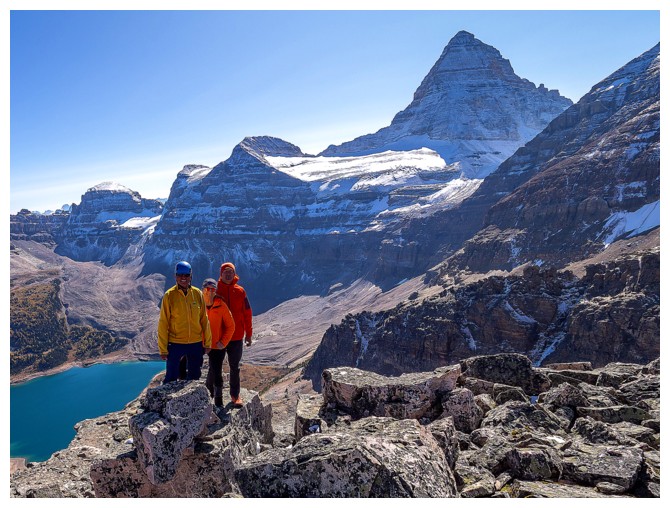
Meggie and Marko are all smiles as they approach the summit (photo by Sean)
View from the ridge
Meggie negotiates the rocky ridge (photo by Sean)
Natasha and Nestor Peak (photo by Sean)
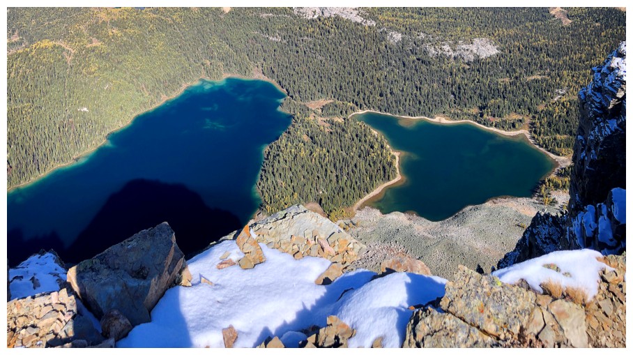
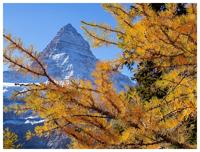
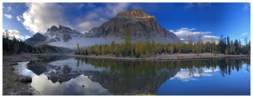
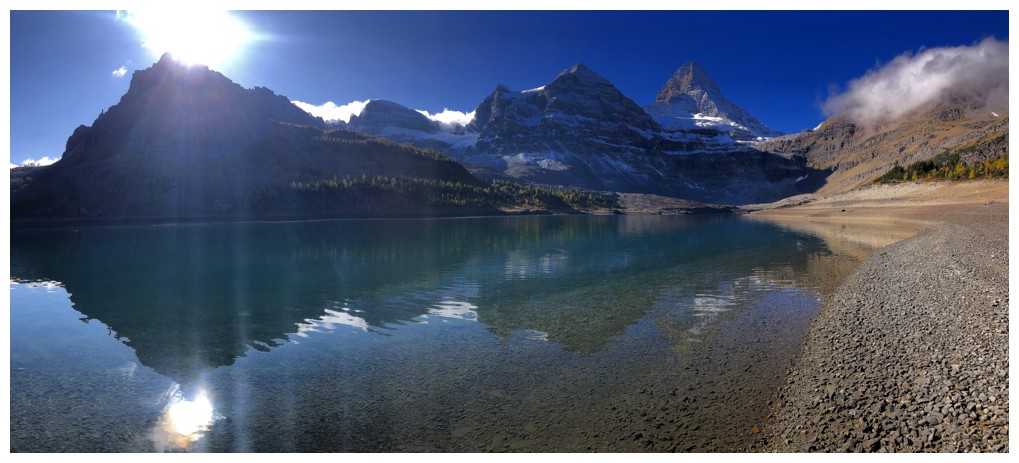
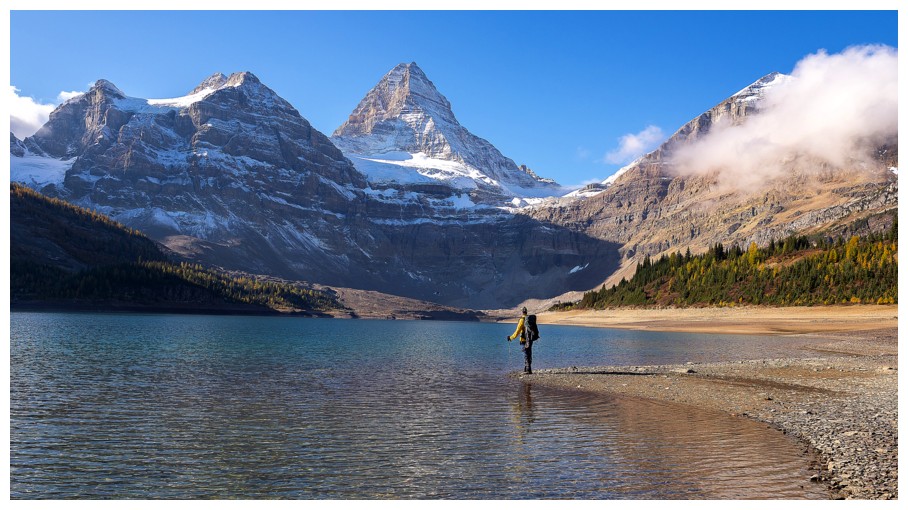
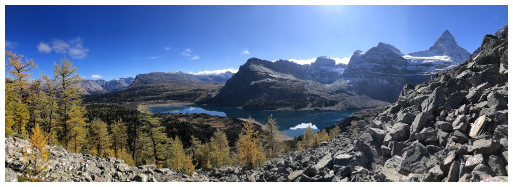
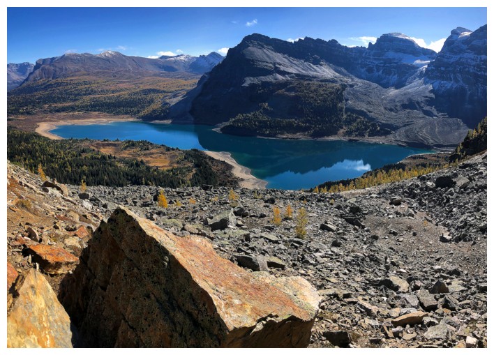
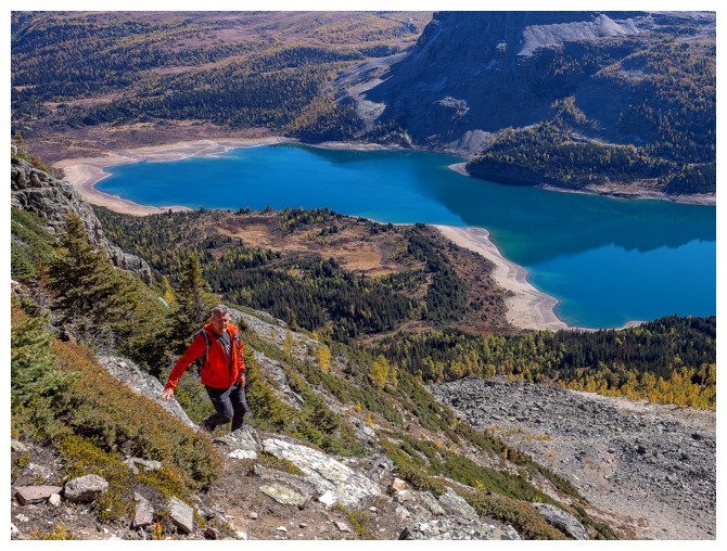
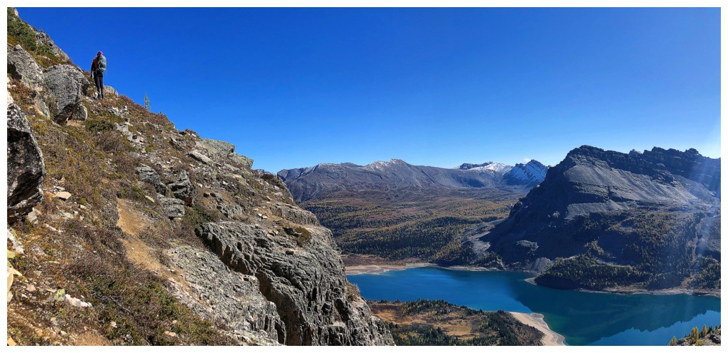
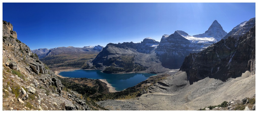
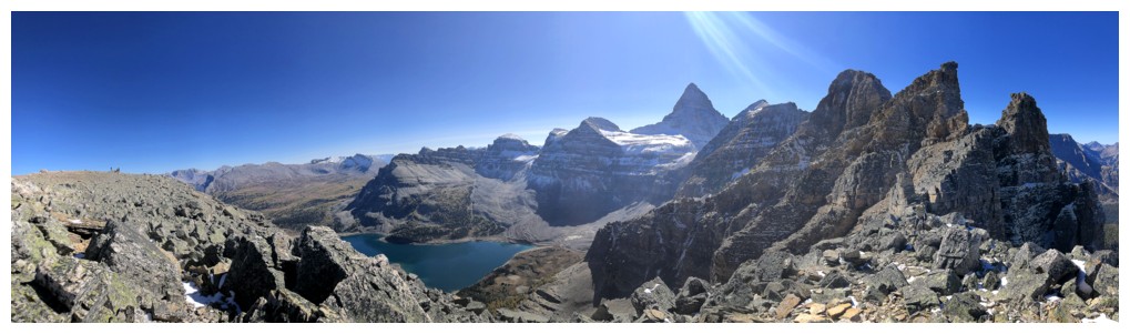
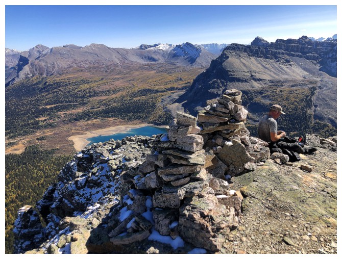
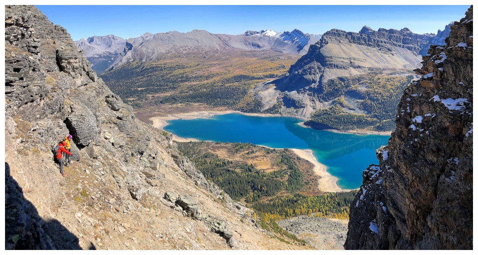
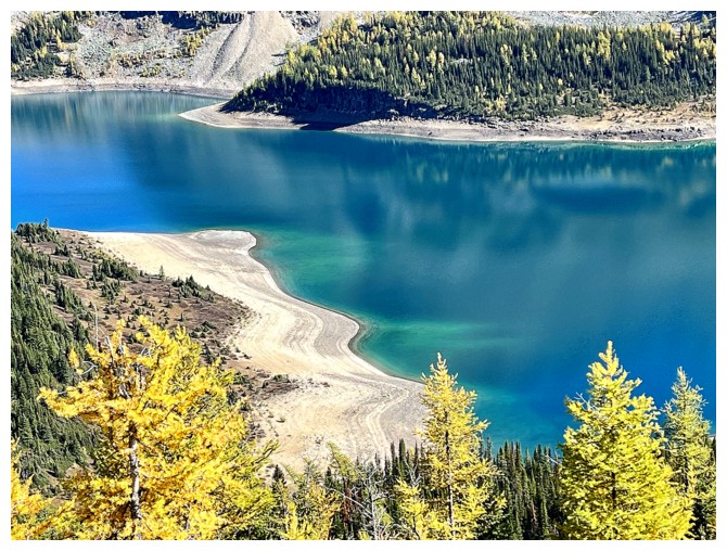
The Cerulean and Sunburst lakes
Waltzing to the summit! (photo by Sean)
Shawn does the same. Wedgwood Lake in the centre (photo by Sean).
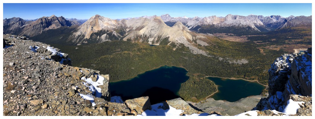
View to the northwest, north, and northeast
View to the south, southwest, and west
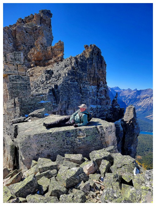
The summit cairn almost doubles as a shelter
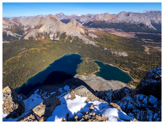
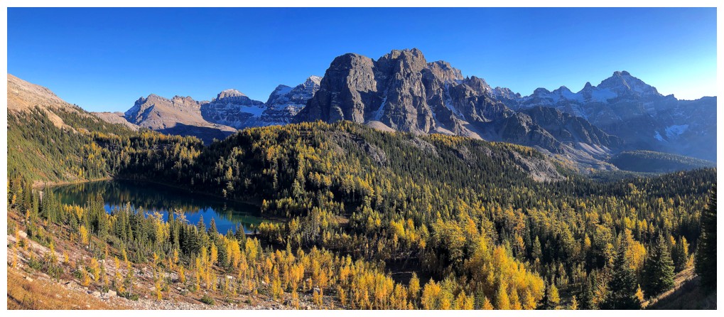
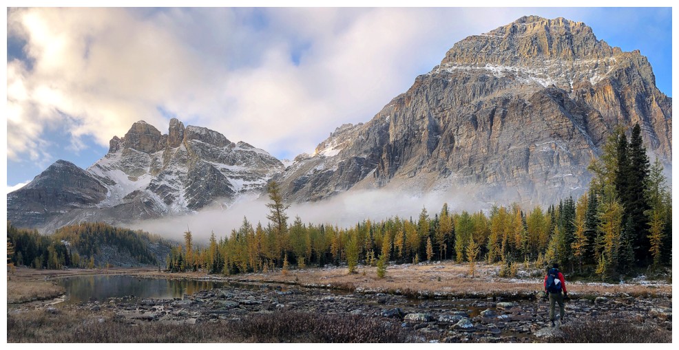
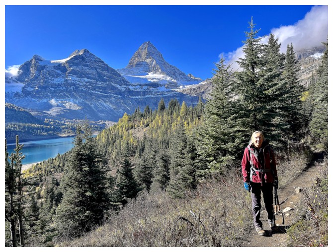
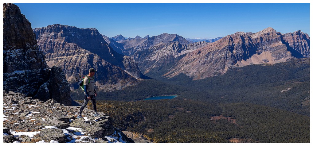
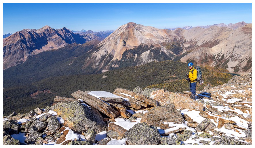
Nub Peak and The Nublet sit north of the lakes
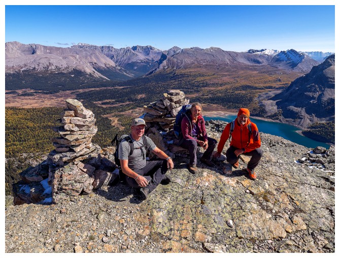
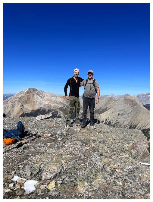
MMS at the cairn (photo by Sean)
Nestor Peak
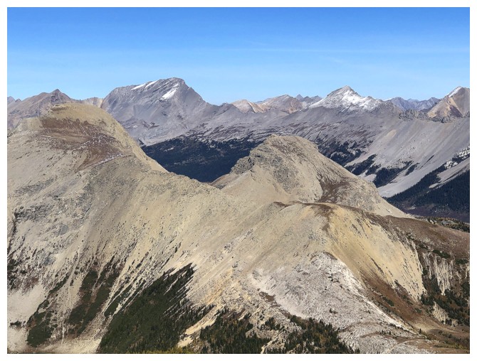
Nub Peak (far left) and The Nublet (foreground right)
The distant Goodsirs
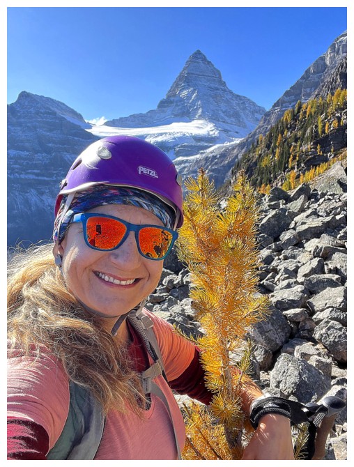
This view was irresistible so I had to take a million photos!
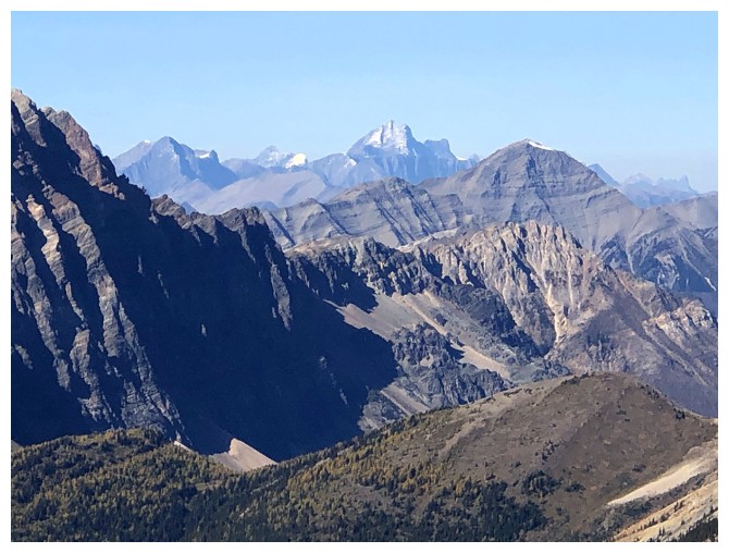
Terrapin Mountain
Mount Magog
Srdjan, Natasha, and I have the ROY of ROYGBIV covered! (photo by Sean)
That view again with a little more to the northwest
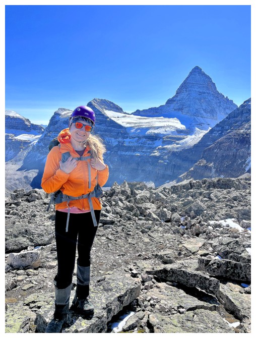
Our awesome organizer! (photo by someone other than Natasha)
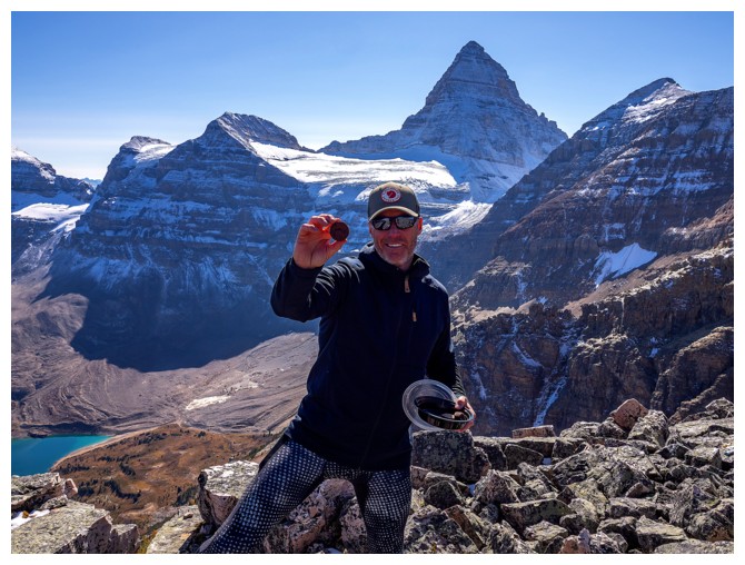
Our awesome Two-Bite Brownie supplier!
Our awesome dentist/skier
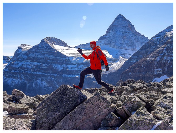
Srdjan clearly still has lots of energy and some cool dance moves! (photo by Sean)
 That view, once again
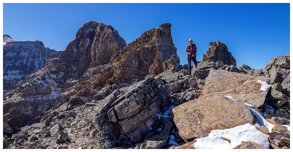
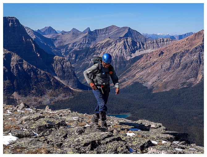
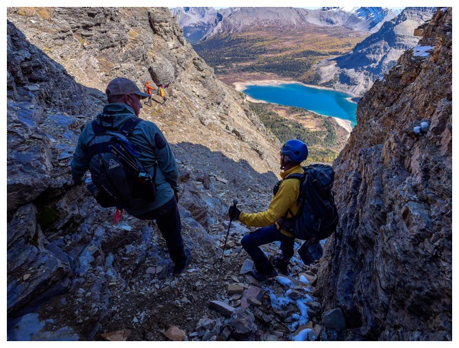
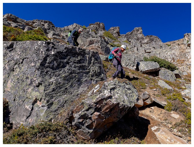
Returning along the ridge
This photo of Marko perfectly captures his personality - cool, chill, easy-going, and light-hearted (photo by Srdjan).
Plus he can carry 50 pounds of delicious food in his backpack in
additional to everything else, so he's a real catch to have on your team!
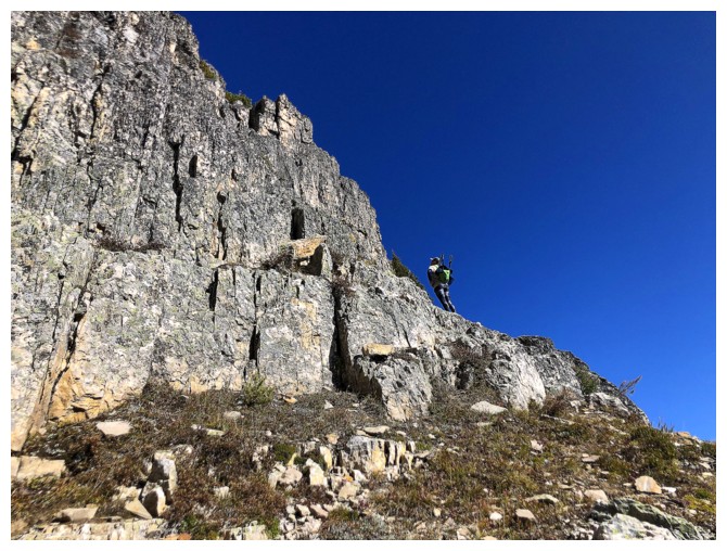
Shawn negotiates the upper ridge (photo by Sean)
Srdjan and Natasha pick a route down
Marko and I waiting our turn (photo by Sean)
We
had a nice chat about the upper limit of Marko's food carrying capacity
and agreed on one third my body weight (photo by Sean)
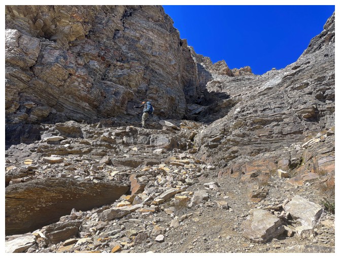
Descending the loose gully
Easier terrain for a short stretch (photo by Sean)
Same as above (photo by Sean)
Sean carefully downclimbs a tricky section
Same as above
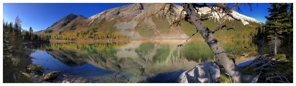
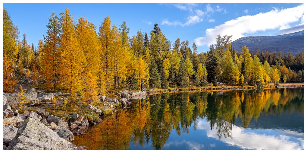
Lake Magog is a real beaut!
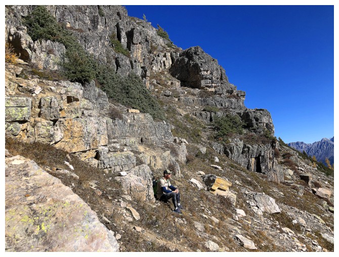
Looking back at the route, while I'm trying to blend into the lichen-covered rock (photo by Sean)
Sean heads into the larches
Bigger view of the same
The wonderful hues of the lake (photo by Natasha)

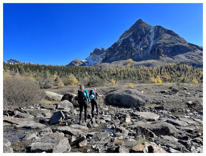
Orlagh and Meggie take the lakeshore route back
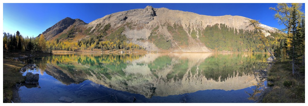
Looking across the lake to Mount Cautley
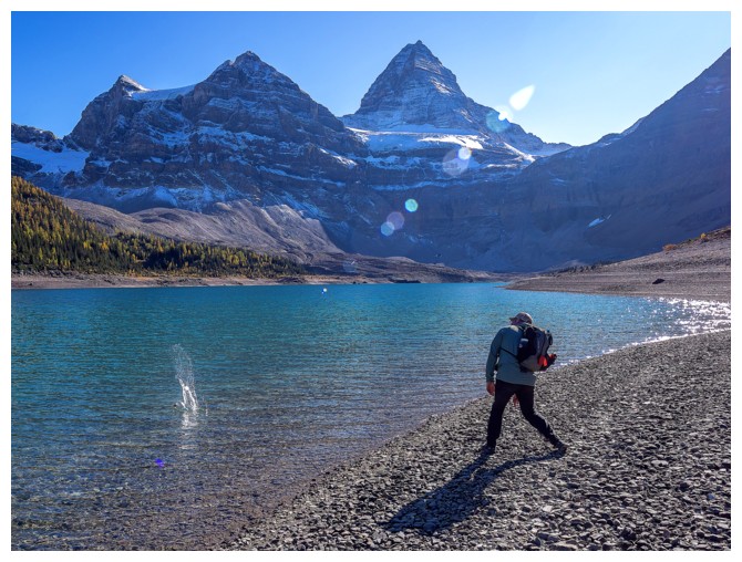
Marko skipping stones. His skills as a rock skipper are good, but not as good as his ability to carry too much food.
At the end of the lake and heading back to the Naiset Huts
Continue to the remainder of the photos for Day 2