Mount Athabasca II
June 24, 2018
Mountain
height: 3491 m
Elevation gain: 1500 m
Mountaineering with Mark.
A
disturbing trend seems to have emerged in our mountaineering careers - that is,
peaks we have ascended in the past with relative ease have totally thrown us a
curve ball when repeating them. Such was the case with Goat Mountain and now
Mount Athabasca joins that list (…….granted it’s only a list of two peaks right
now, but who knows how big the list could get!!)
 Having
first ascended Mount Athabasca, as part of our Snow/Ice Weekend way back in
2003, we had always vowed to return to complete the trip with better weather –
the 2003 trip was plagued with cloudy skies and a whiteout at the summit.
Having
first ascended Mount Athabasca, as part of our Snow/Ice Weekend way back in
2003, we had always vowed to return to complete the trip with better weather –
the 2003 trip was plagued with cloudy skies and a whiteout at the summit.
Perhaps
our struggles with Athabasca II started with the planning. Basically we wanted
to leave Calgary around 9 pm, drive to the Athabasca parking lot, sleep for a
few hours and then get a very early start. In short, we didn’t make it all the
way to the parking lot, slept too long at Castle Junction, and then didn’t
start the trip until 5:30 am, approximately 2 hours behind schedule. Aggravating
a back injury about 5 minutes into the trip didn’t help matters!
 That
being said, the first several hours of the ascent were outstanding. The skies were
beautifully clear and of course the scenery on the mountain was stunning. We
choose the North Face route, instead of the AA col route this time. Conditions
on the mountain were also perfect and we seemed to be making good progress.
That
being said, the first several hours of the ascent were outstanding. The skies were
beautifully clear and of course the scenery on the mountain was stunning. We
choose the North Face route, instead of the AA col route this time. Conditions
on the mountain were also perfect and we seemed to be making good progress.
However,
that soon changed, as the Sun and temperature rose. Our pace slowed and I, for
one, started to feel quite drained and lethargic. Nevertheless, we weren’t
about to stop and continued the terrifically scenic ascent at perhaps a less
urgent pace than required.
The
ascent turned out to be relatively straightforward from a technical standpoint
– definitely less steep than the AA col route, but with more objective hazard.
Soon, we were greeted by the parties who had got an actual alpine start, all on
their way down.
Once past
the tough stuff, the ascent became considerably easier, but we both continued
to struggle with exhaustion, probably due to a lack of sleep and the radiant
Sun beating down on us. Needless to say, the stunning views made it hard for us
a retreat. At that point we had decided to descend via the AA col route.
Heading
towards the top of the Silverhorn (the very prominent “horn” along the ridge),
we fortuitously ran into Cody Nelson and Wyatt Bronson, on their way down. They
had come up the AA col route and announced it to be very icy and precarious.
This was confirmed as we watched another party below setting up a rappel from
the col – usually this route is a simple (though steep) walk-down, not
requiring any rappels. Cody and Wyatt said they were going down the North Face
route. We would have to make that decision later.
After
parting ways we completed the ascent at a painfully slow pace. Shockingly,
after enjoying clear skies all day, we arrived at the summit to another
whiteout – but, for the first time in my mountaineering career, I simply didn’t
care! I was too exhausted to enjoy any view and we both just collapsed at the
cairn to try to recover.
10 minutes
later we started down. The skies did clear shortly after, but I still didn’t
care! Thankfully, the descent was mercifully easy. We could see Cody and Wyatt
far below and since they had made it down the North Face safely, we opted to
follow that route down. No issues and several hours later we were back at the
start.
Despite
the unexpected hardships and the whiteout at the summit, it was an awesome day out, overall. Hopefully that
aforementioned list is now complete at 2 ascents!
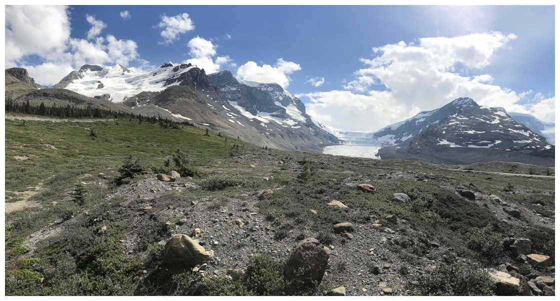
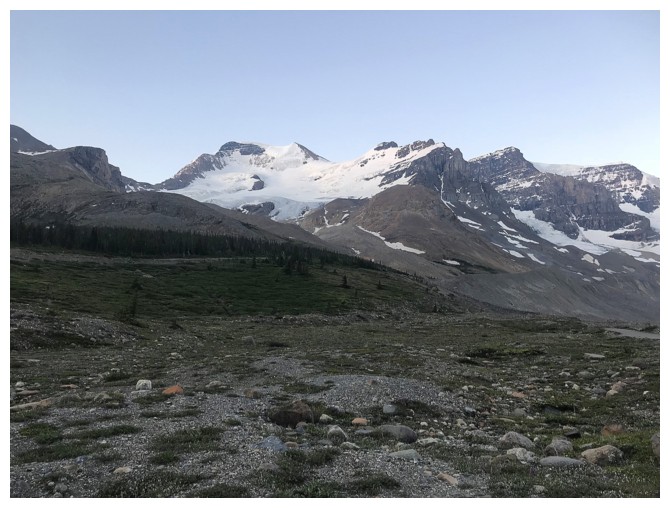 The objective from near the parking lot - that's a lot of daylight for the start of this trip!
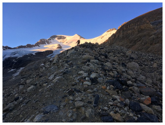
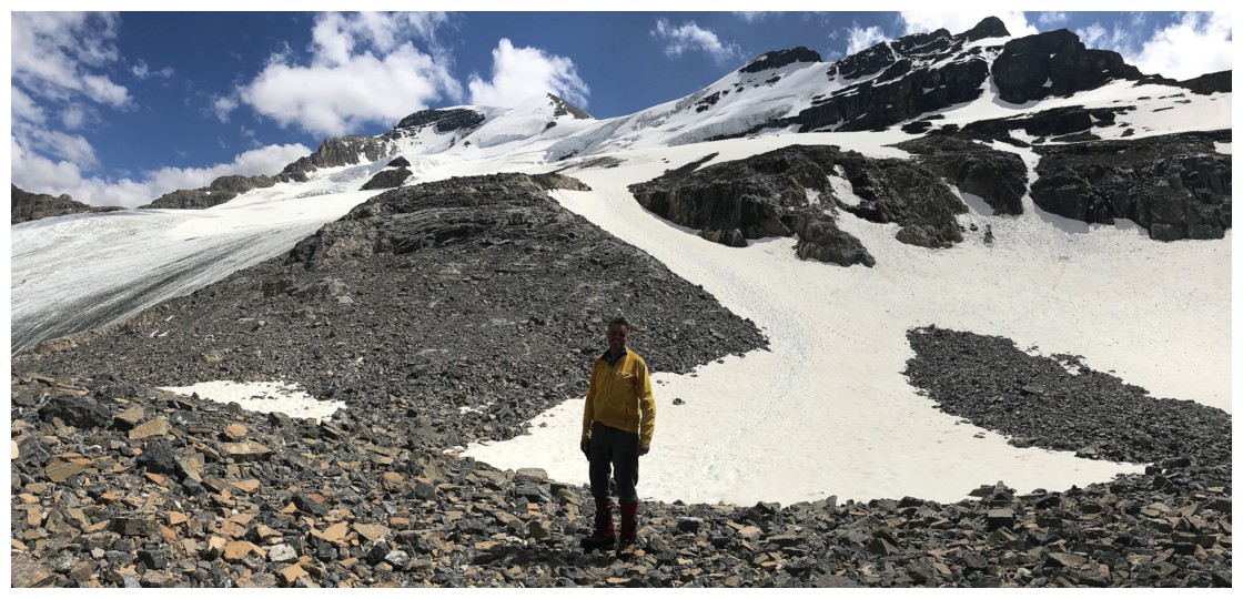
Mark at the upper reaches of the moraine and Here Comes the Sun!
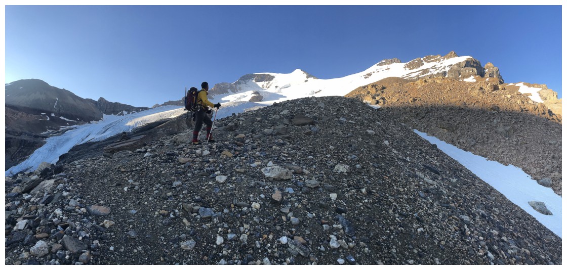
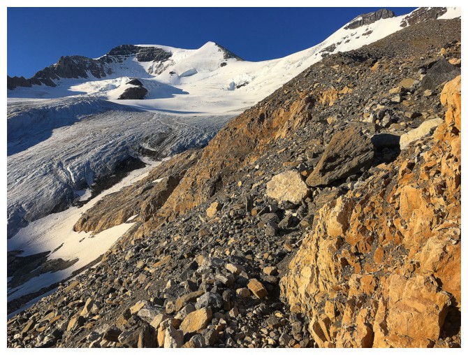
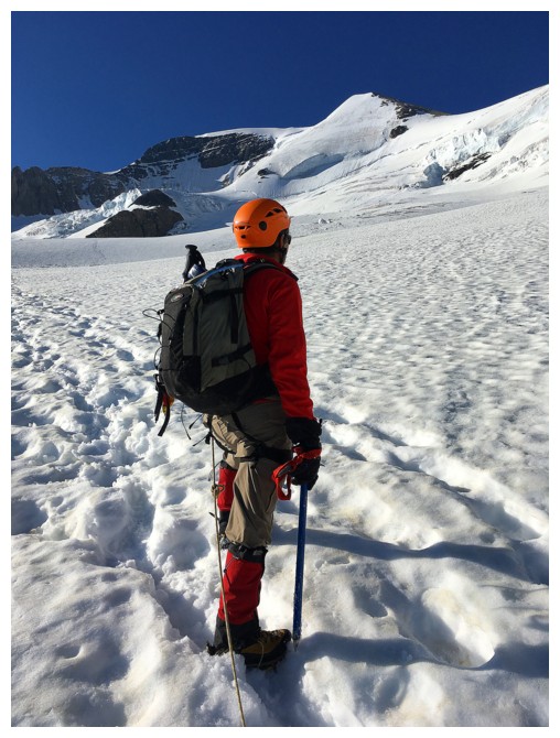
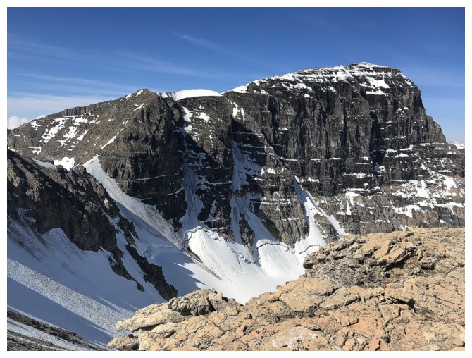
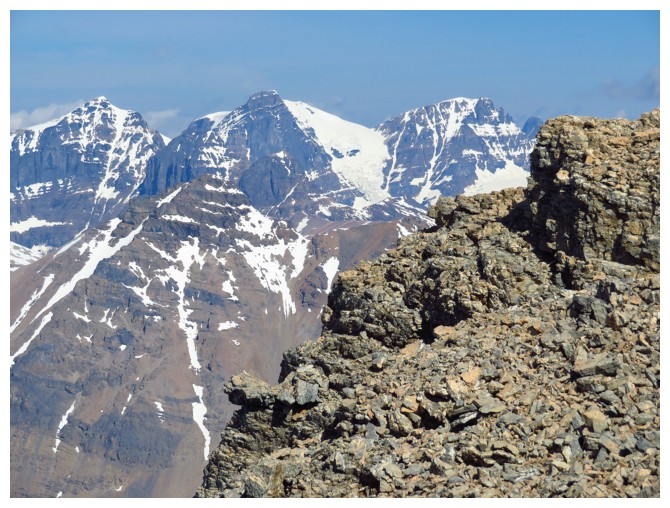
Admiring the objective
Time for 10 straight hours of glacial Sun exposure (minus the 20 minute whiteout at the summit!)
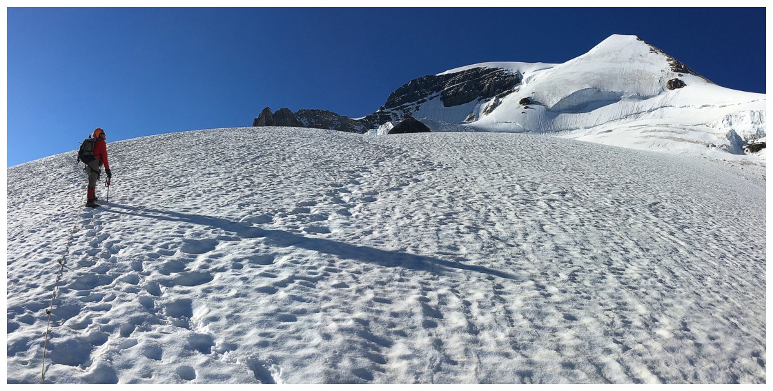
There she is - the North Face of Mount Athabasca
Looking north. The peak above Mark's head in the distance is K2 - but not THE K2!
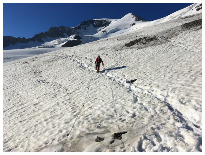
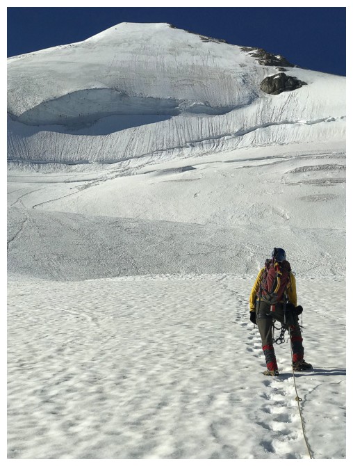
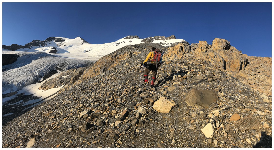
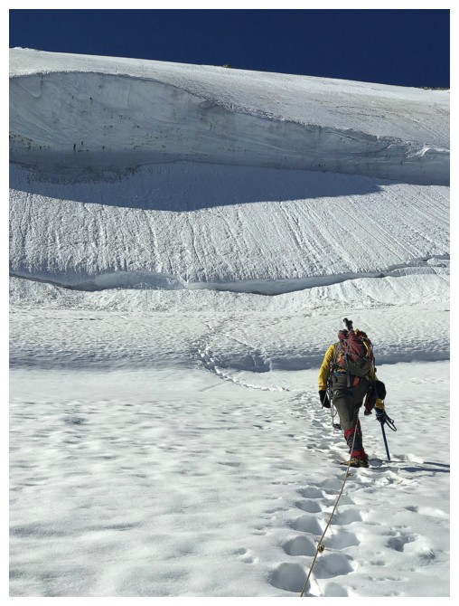
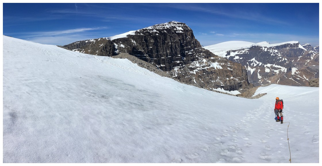
Glacier travel begins
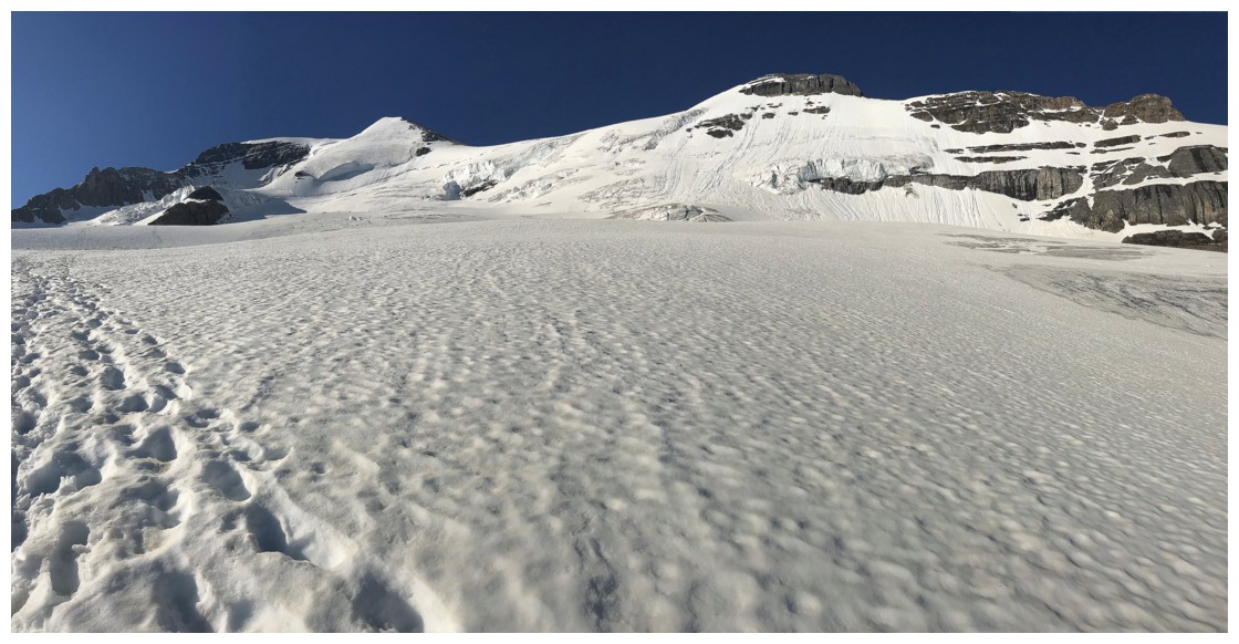
The foreshortened expanse of the lower glacier
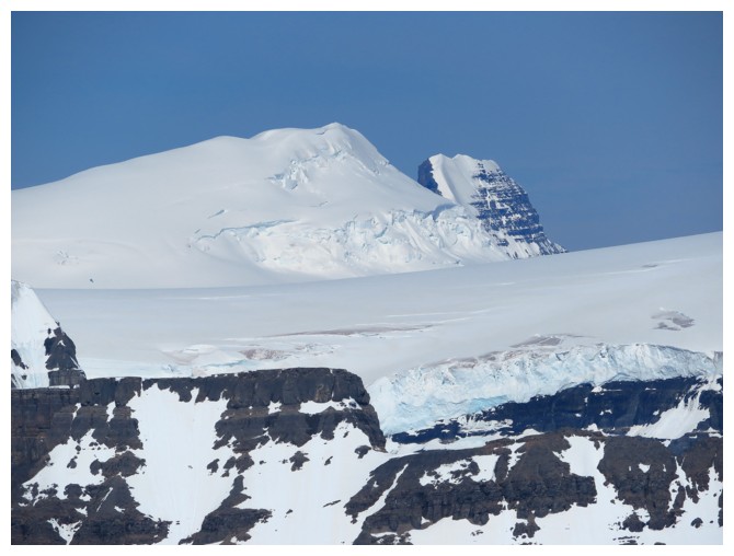
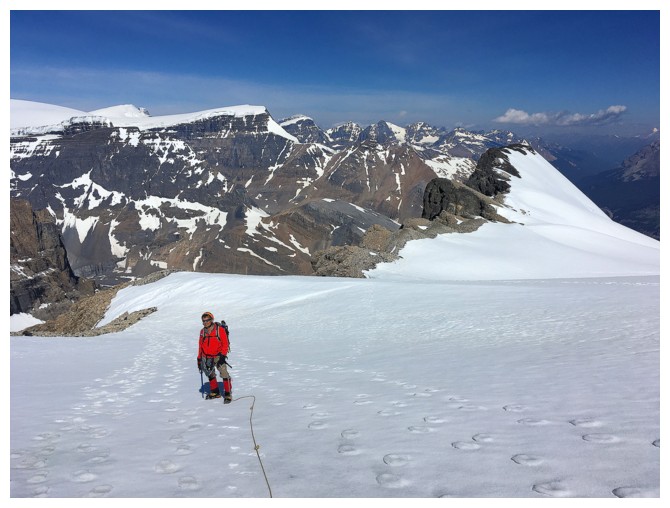
K2's partner, glacier capped Mount Kitchener (an old favourite!?) is now visible
Lots of rest breaks en route
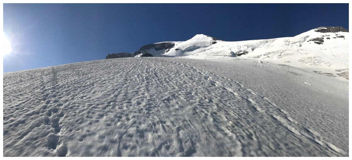
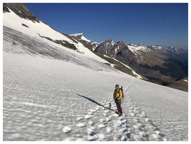
More glacial expanse. Getting to the steeper terrain takes longer than you might predict.
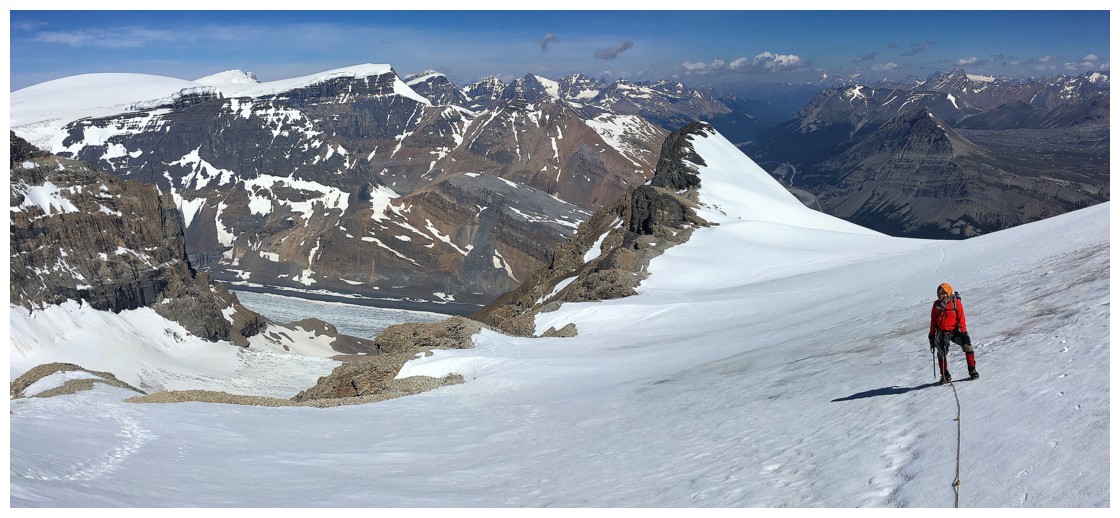
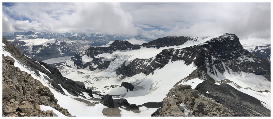
The Canadian Rockies are simply awesome!
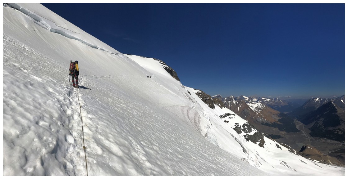
Approaching the Silverhorn. The North Face route swings around to the right,
while the Silverhorn route goes up the left skyline. A party of two is high up on the Silverhorn.
More plodding
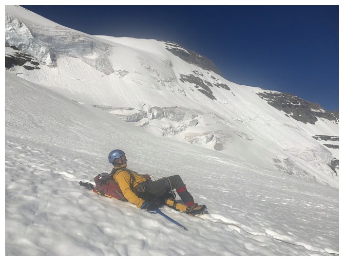
You know things are getting bad when your rest breaks downgrade to a prone position.
At least my colour coordination of yellow red and blue looks good!
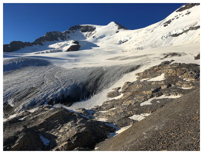
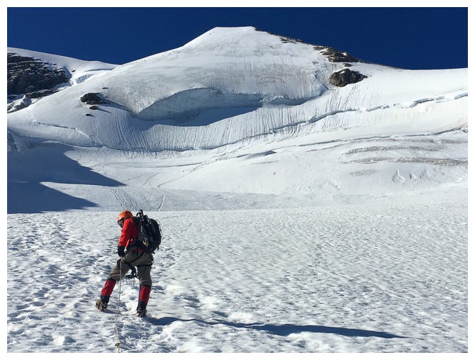
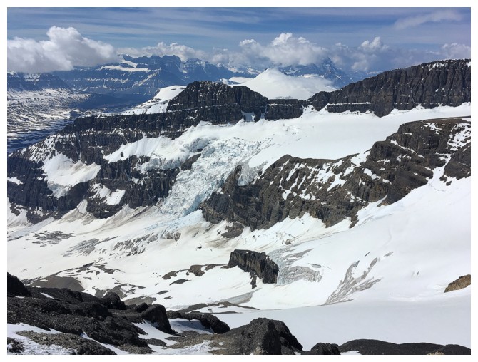
Under the huge serac of the lower Silverhorn. Not a place for a long break and a cup of tea.
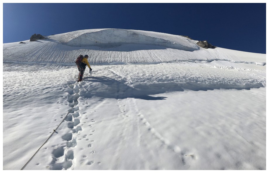
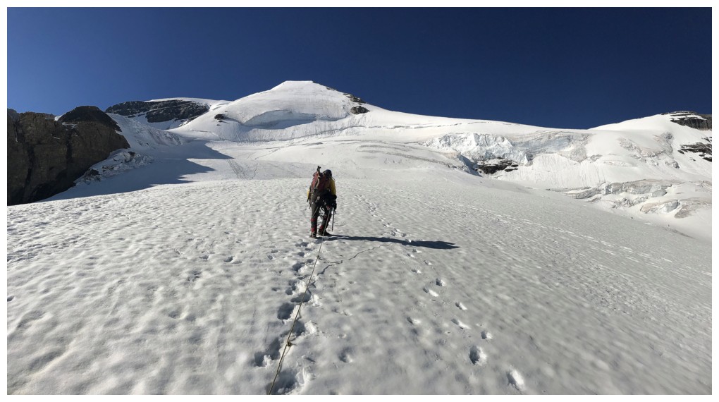
Onto steeper terrain
The big North Face traverse and most dangerous part of the ascent. Another party approaches.
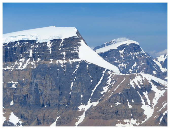
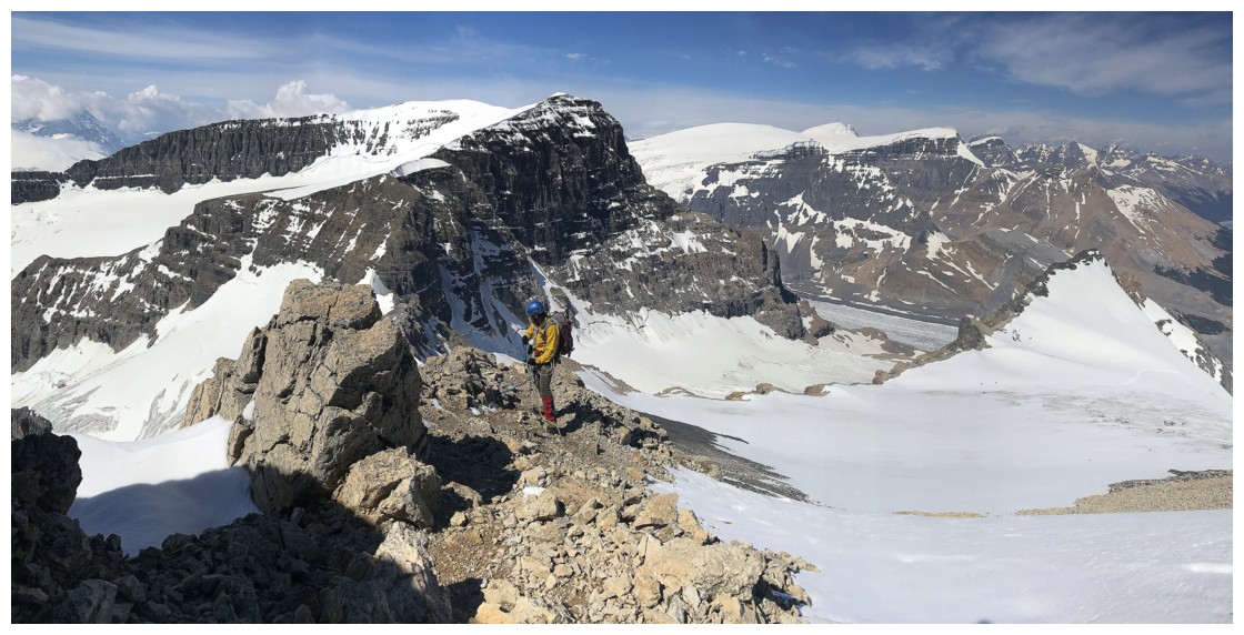
Upon gaining the northwest ridge, the first mountain you see is Mount Andromeda - another perennial favourite!
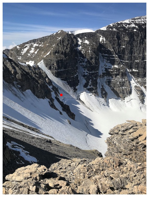
The red dot marks the spot where we spent a night sitting on a carved out snow ledge,
waiting for the snow to freeze. Slipping into the bergschrund below would have sucked!
You also see North Twin (centre) and the daunting ridge of Twins Tower (right)
And of course, the swell East Ridge of Kitchener!
Mounts Woolley (centre) and Diadem (right) lie a little farther north
All the aforementioned peaks from our vantage point, as we ascend the northwest ridge
There was lots of time to photograph the amazing views because we were both so tired at point we had to stop every 2 minutes.
The Canadian Rockies are simply awesome - The Sequel
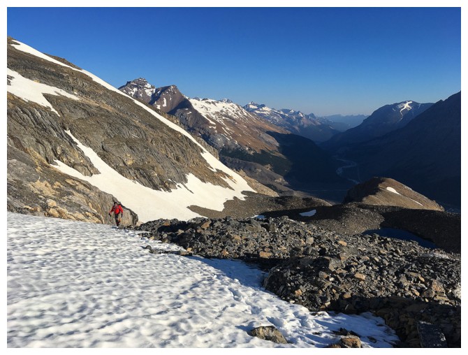
Off the glacier for a while
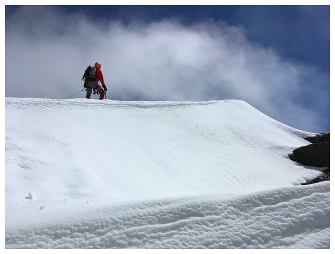
Here Come the Clouds (someone should write a song)
Castleguard Mountain (a wonderful 18 hour day in 2007) is the snowy peak in the distant centre
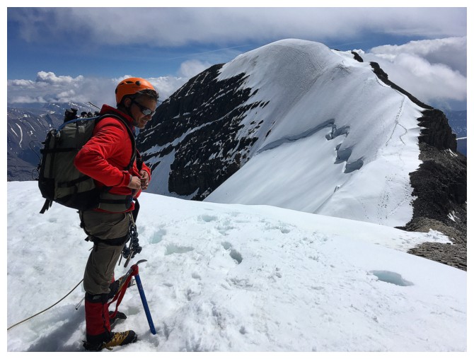
Mark prepares for the final stretch to the summit
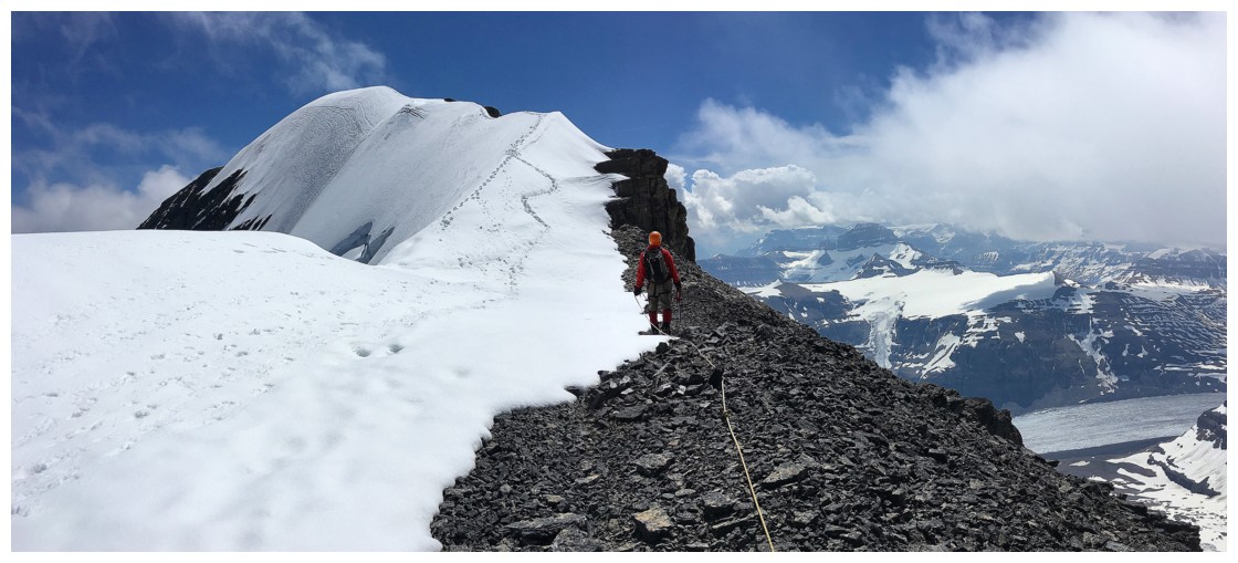
Stunning ridge, but Here Come the Clouds from the west
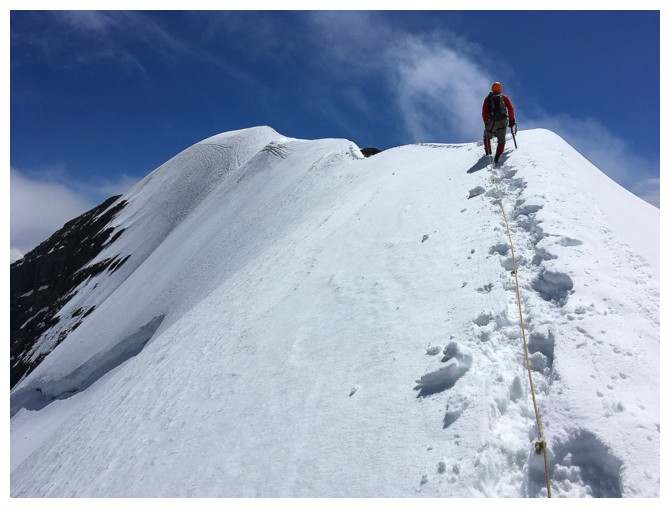
Minutes away from the top. Hard to believe we would be in whiteout based on this view.
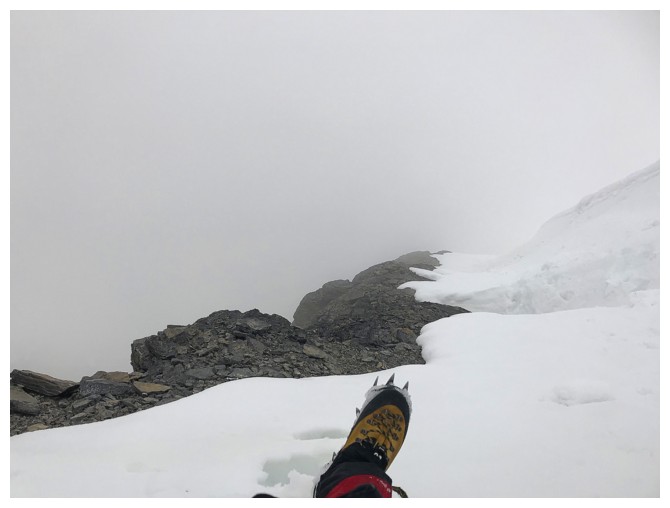
Summit view - yeah!
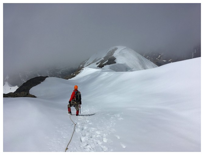
Heading down, the clouds start to lift a little
Last look at Andromeda
Back down onto the moraine
A parting look at Athabasca, Andromeda, the Athabasca Glacier and Snowdome
The End