Mount Black Prince
August 13, 2005
Mountain height: 2,932 m (9,617 ft)
Elevation gain: 1,190 m
Ascent time: 6:45
Descent time: 4:30
Scrambling/climbing with Mark.
Like Eon Mountain of July 31, of this year,
Mount Black Prince is an excellent trip that undeservedly receives very little
attention – 9 recorded ascents (including ours) in the past 19 years attests to
the peak’s lack of popularity.
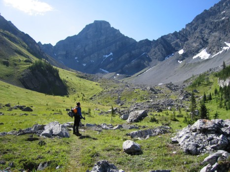
This trip actually started of as a planned
attempt of Mount Warspite. Having eyed a possible ascent
route up the east face (north of the summit) of Mount Black Prince, last year,
however, we decided to bring along some climbing gear, in case the spirit moved
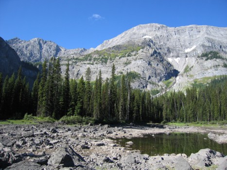
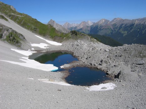
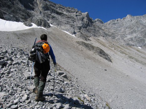
us – apparently it did, as we arrived at the Black Prince Tarns, and started
up scree slopes towards the least steep section of the face, with the intention
of turning around at the first sign of difficulty and heading up Warspite instead.
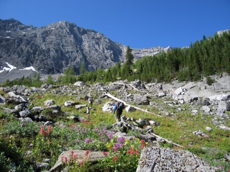
The scrambling was initially quite
straightforward, but started to get steeper as we slowly progressed up the
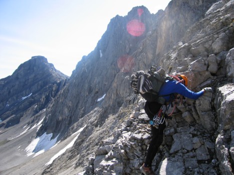
face. Eventually, we did arrive at a short rockband that was more technical
climbing than scrambling (maybe 5.2 or 5.3). Though I had armed my harness with
about 10 kilos of cams (well it felt like 10 kilos!), the rock was loose and
downsloping and there was absolutely nowhere to place protection. Luckily, the
step was only about 5 m high and I was able to climb it and find safe spot to
belay Mark up. This short step turned out to be the crux of the trip and easier
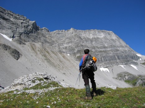
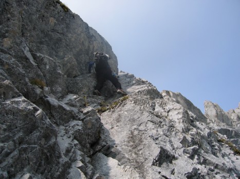
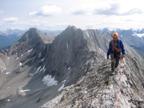
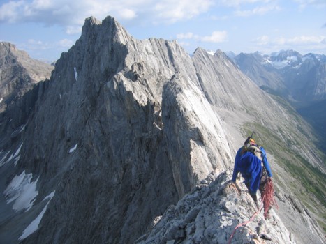
terrain led to the stunning ridge.
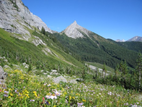
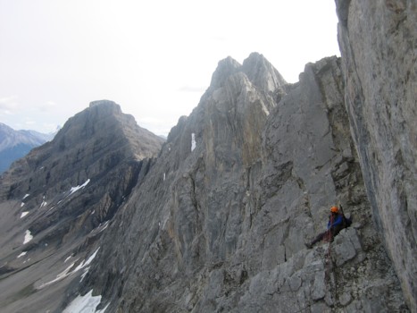
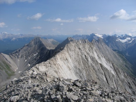
Looking at the profile of Black Prince from
the below, one would think the ridge to be a highway wide. We were both stunned
to find it was anything but! To the south, huge vertical gendarmes of rock
lined the undulating ridge and to the north, the long route to the summit
appeared to be severely narrow and exposed. I guess we were lucky the summit
was to the north, because the gendarmes were definitely beyond our level. We
were also very unpleasantly stunned to see the sky turn from a beautiful shade
of blue to the noxious and hazy shade of B.C. forest fire smoke!
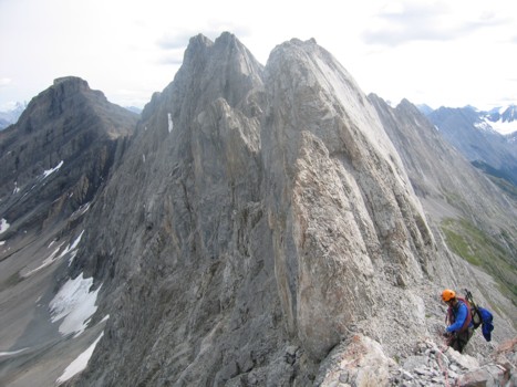
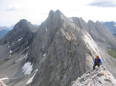
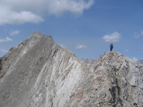
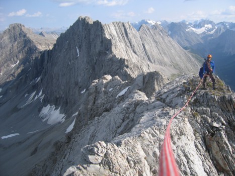
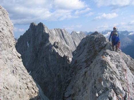
The ridge was probably the highlight of the
trip and if long exposed ridgewalks are your thing, then this is the route for
you. Fortunately, the terrain never narrowed to the point where protection was
needed and we traversed the ridge standing up with the occasional belay. Having
done the ascent without any route information, we thought that at any time we
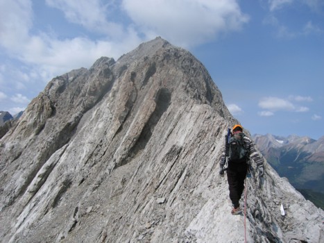
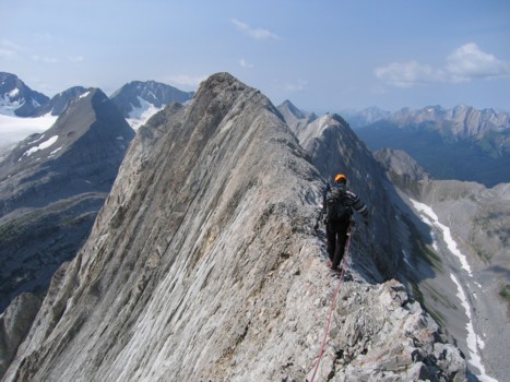
might arrive at an impassable section, but that never came. The final 50 m or
so of ridge was particularly exhilarating, as the drop-offs on both sides
increased to precipitous heights – one of those, “one guy falls, the other guy
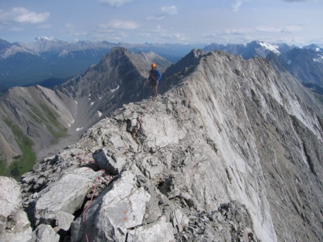
jumps down the other side and both pray the rope doesn’t snap!” The summit
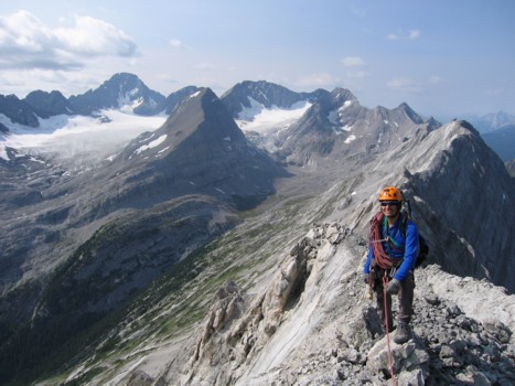
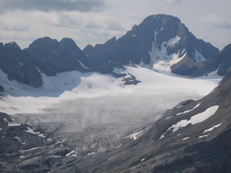
followed shortly after, sporting an absolutely magnificent view. Most prominent
was the Haig Glacier to the north, surrounded by Mounts LeRoy, Munro, Maude,
Jellicoe, French, Robertson and, of course, Sir Douglas. Most eye-catching was
the long and spiky ridge of Black Prince to the south, with Warspite at the
end.
The sparsely filled register was placed at
the summit in 1986 by Alan Kane and Kris Thorsteinsson and included the other
notable names of John Martin (co-author of “Sport Climbs in the Canadian
Rockies”) and Don Forest (the first person to summit all 52 (or 54 now!) of the
Canadian Rockies 11,000ers (I assume it was that
Don Forest - I guess there could be another one).
For the descent, we short-roped the ridge
traverse and then started down the east face, hoping we could find an easier
route around the crux step. We were able to downclimb everything except for a
small section that required a short rappel. I think with a little more
searching a scramble route might have became evident.
A more than satisfying day on a terrific
mountain – there are few things more rewarding than finding your way up an unknown
mountain, with no route information.