Mount Burke – January 29, 2005
Mountain height:
2,540
m (8,333 ft)
Elevation gain:
880
m
Ascent time to true summit: 2:40
Traverse time to south summit: 0:50
Descent time from south summit: 2:45
Roundtrip distance:
approx. 20 km
Solo hike/scramble.
In Alan Kane’s description of Mount Field,
he states “the view is worthwhile, but the accomplishment may not totally amaze
your friends”. Much the same can be said of the easy hike to the summit of Mount Burke.
Fortunately, the upper portion of the trip is interesting enough to keep you
moving and there are options to continue to other high points along the
ridge.
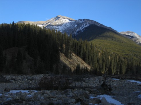
The first few kilometers, alongside Salter
Creek and then up heavily treed slopes were not terribly exciting and
post-holing in knee-deep snow, higher up, was tedious and a little frustrating.
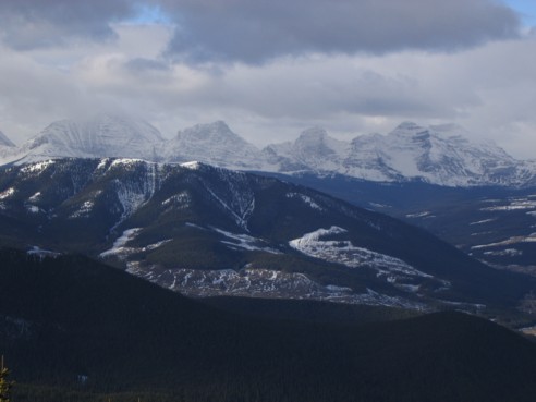
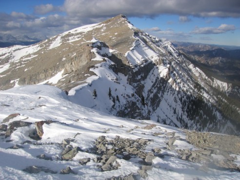
Once above the treeline, however, a splendid (though cloudy) view to the west
was revealed, highlighted by shapely Mounts Pierce, Farquhar, Holcroft, Scrimger,
and Holcroft. The remainder of the route to the summit also took on a far more
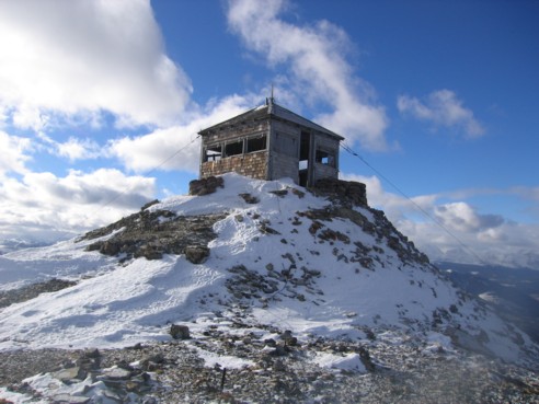
appealing appearance, with the Cameron Fire Lookout perched on the summit and
vertical cliff bands on either side of the route….not that this increased the
difficulty of the hike at all – it remained a plod from beginning to end.
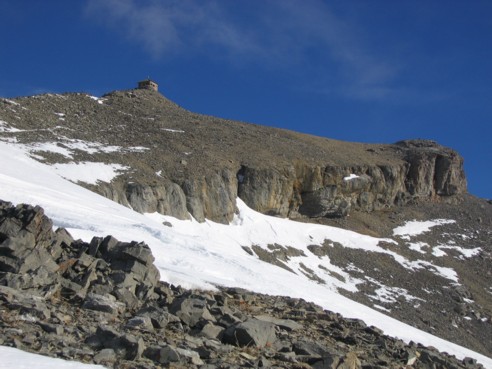
As expected, the wind at the summit was
very strong and the shelter of the lookout was more than welcome. The very
respectable summit panorama included Mount
Storelk and Mist
Mountain to the northwest, Holy Cross
and Mount Head
to the north, the foothills, prairies, and good old Calgary
east and northeast, and Sentinel Peak and Plateau
Mountain to the south.
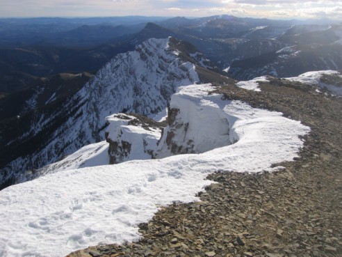
After warming up in the Lookout, I decided
to continue south to the lower summit. This was definitely the best part of the
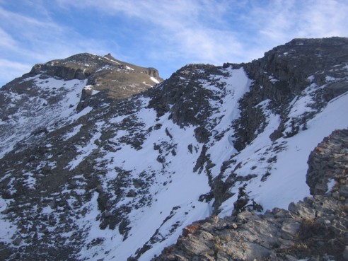
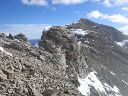
trip, with interesting scenery and even a little bit of scrambling. Descending
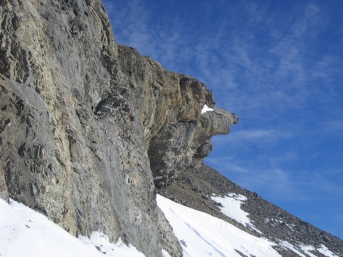
the first cliff band was the crux. I tried to stay right along the east side of
the ridge, however, a short downclimb proved to be too much for me and an
alternate route on the east side of the mountain was plastered in snow and ice
and quite exposed at that. In order to circumvent the cliff band, I had to
traverse above to a weak point, descend and then traverse back to the ridge
below the cliff band. Although time consuming, it was a beautifully scenic
little detour.
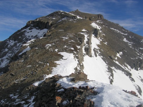
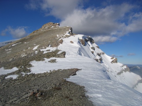
Back on the east edge of the mountain, I
continued to a low point and then up towards the top. Just when I though the
summit would be a push-over, along came a couple of interesting steps along the
ridge that required a little extra care. Throughout, the best scenery of the day
was that of the snow-plastered and corniced east face of the mountain, that
actually reminded me of the stunning north face of Edith Cavell (Mount Burke
and Edith Cavell in the same sentence….very questionable?!).
I stayed at the south summit for only a few
minutes and then started the descent. Ascending all the way back to the lookout
was not necessary, although an ice axe was,
to ascend a short, steep, snow patch back up to the ridge. The remainder of the
descent was simple. If you’re looking for a very easy and pleasant day out,
this is a worthwhile effort – interesting scenery, good summit views, and
plenty of room for exploration.