GR565088
and GR555096 (east end of Burns Ridge) –
June 4, 2006
Mountain height:
GR565088 2532 m
GR555096 2622 m
Elevation gain: approx.
1200 m
Ascent time:
6:20 to GR555096
Descent time: 5:30
Scrambling with Mark.
Feeling a little short-changed after a solo trip
up Burns Ridge two days earlier, I returned, with two important additions: a
rope and my brother. Most importantly, we wanted to see if we could reach the
unnamed summit at GR555096, but if possible, try to find a route to the top of
GR565088 (the closer, but more daunting-looking peak) also.
Instead of gaining the
We were both surprised to find the scrambling up this side to be easy and
straightforward. That is, until we were almost at the summit, where the final
and much steeper rockband barred our route to the top. There appeared to be a
single weakness in the rockband by traversing along and up a very narrow ledge.
Going up it was fairly easy, however, there weren’t any good handholds and the
exposure was fairly significant – getting down it was going to be tough.
The summit was only a minute from the top of the band and we took a quick break at the cairn. We very much wanted to find an easier way down from the summit and so we did an extensive search of the summit block, but unfortunately came up empty. The best way down was the way we came. I tried to downclimb the crux with a belay from above. It wasn’t too bad with a belay, but I knew that without the security of the rope I wouldn’t have felt comfortable downclimbing it. We therefore decided to rappel down the step. Our 30 m rope barely reached the bottom, but the rappel was very easy.
Now below the crux we needed to find a route to the west side of the block, without going all the way and around the south side, as I did two days ago. Again this turned out to be much easier than appearance dictated and very quickly, we were back on the ridge and heading towards the higher summit at 555096. The connecting ridge was every bit as enjoyable as it was two days ago – even more so with company. When we reached the crux section where I had backed down, we noticed that most of the snow that was present on the north side of the ridge two days earlier, had melted, revealing an easy way to circumvent the crux on good ledges. Given that 565088 had taken far more time and energy than anticipated and we were both starting to suffer from fatigue, we chose to use these ledges. Back on the ridge, the remainder of the ascent was a scree slog, with a couple of tense traverses across steep snow slopes.
The summit view was marred slightly by cloudy
skies, however, it was still a very pleasant one with many familiar peaks in all
directions. Continuing along the ridge towards the summit of
For the descent, we were both craving an
alternate and easier way back to the car and so we heading south directly from
the summit towards the
Almost at the river, the drainage suddenly narrowed and with a small torrent of water rushing down, became quite treacherous to negotiate. The worst that could have happened would be that one or both of us fell into the pool of water at the bottom and spent the remainder of the descent soaked to the skin, so we were able to have a little bit of a laugh as we tried to stem the sides of the gully to avoid falling in. We managed to get by the little canyon and breathed a sigh of relief, thinking we had cleared the crux of the descent. That was until two minutes later when we arrived at a 10 metre waterfall that completely blocked the route down. The walls on both sides of the canyon were vertical. We both swore, thought about it for a few seconds and then in desperation, actually considered rappelling right down the middle of the waterfall off a large boulder stuck at the top – fine if there was no water, but there was a torrent rushing down it. We quickly realized that the whole concept of rappelling down the middle of a waterfall might be symptomatic of a complete mental breakdown or other form of insanity and considered other options. Thankfully, there was another way and we backed up a little, scrambled by a steep and exposed embankment and then traversed into the safety of the trees.
We breathed another sigh of
relief when a small trail appeared just before the
Finally, on the Sheep River Trail, we hiked the last 3 km in a “Zombie-like” state. Except for the very “interesting” alternate descent route, a wonderful day of exploration.
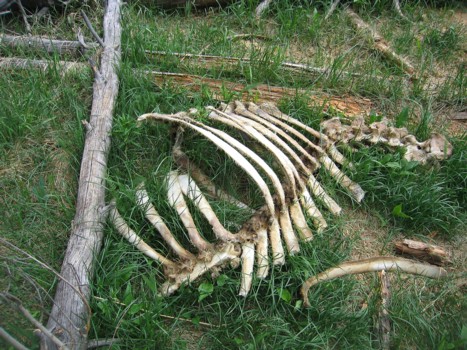
Some skeletal remains of an elk
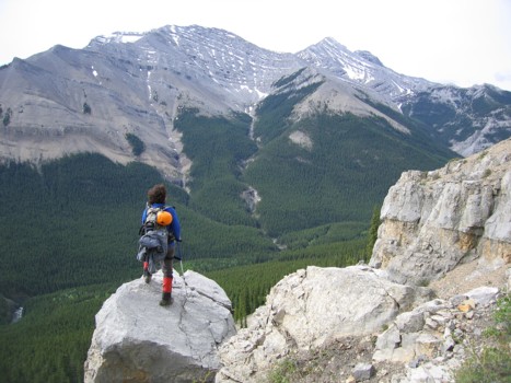
Mark stops to look at Shunga-la-she
Above one of the lower cliffbands
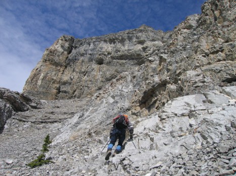
Heading up to the upper cliffbands
A little scrambling to the way to the ridge
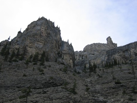
On the ridge with GR565088 to the right
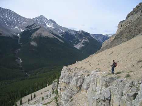
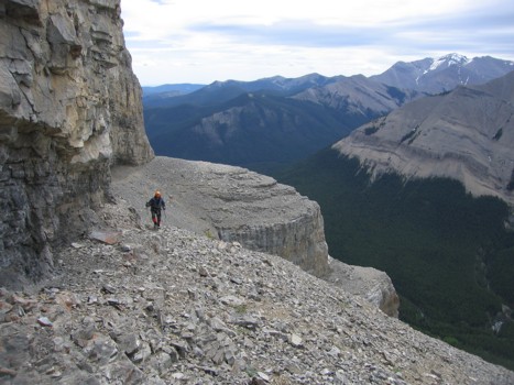
Traversing scenic cliffbands below the ridge
Same as above
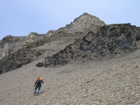
Approaching the cliffbands
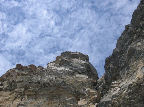
Wishful thinking
The clouds and sky here, looked like something from a Van Gogh painting
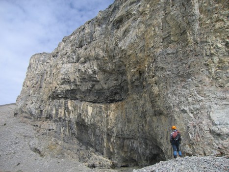
More of the cliffbands
The "tiered" nature of the south side of the mountain
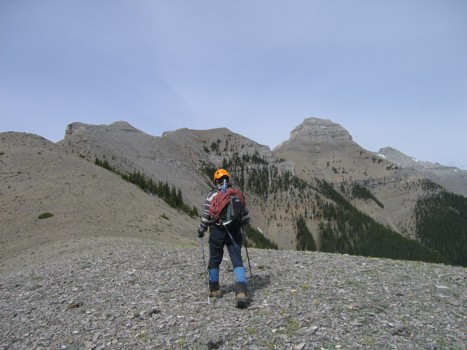
Gaining the ridge again
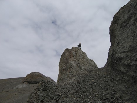
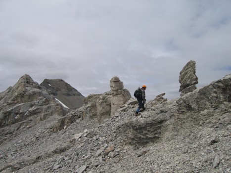
Mark checks out a pinnacle and the cliffband we traversed underneath
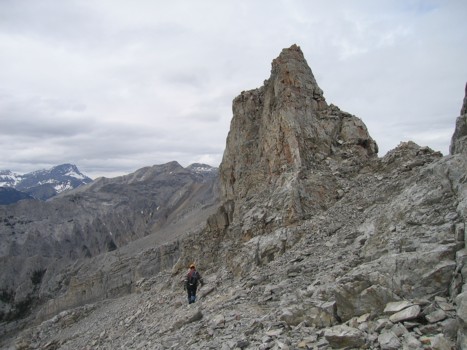
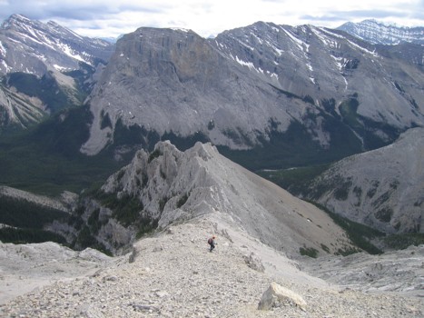
On the ridge with GR565088 ahead
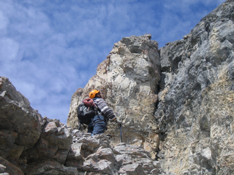
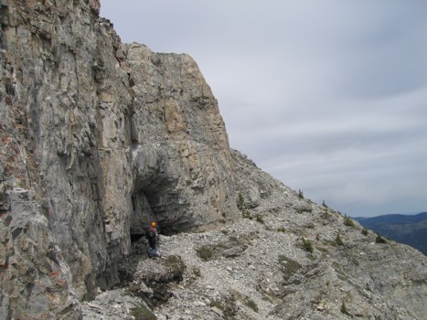
Gaining the first ledge
Atop the first ledge
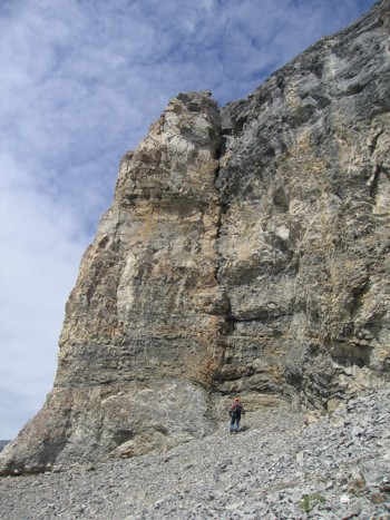
The scary side of 565088
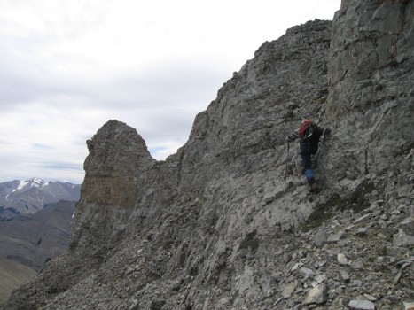
Traversing around to the easy side of 565088
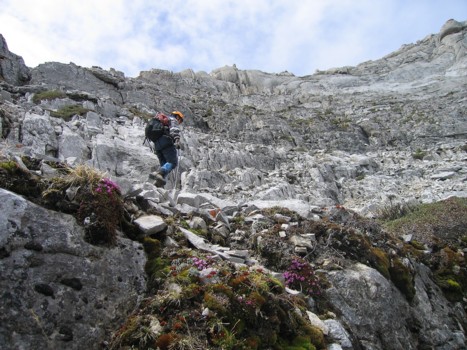
Pleasant terrain on the northeast side of the mountain
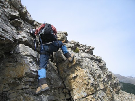
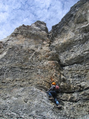
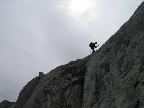
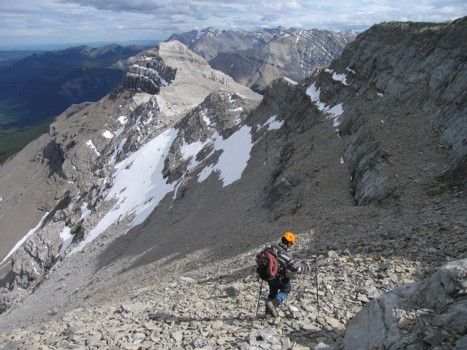
Enjoyable scrambling just before the crux
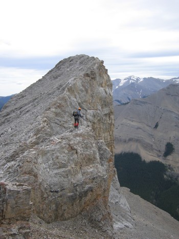
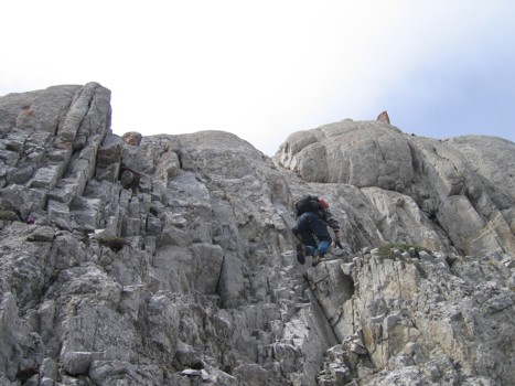
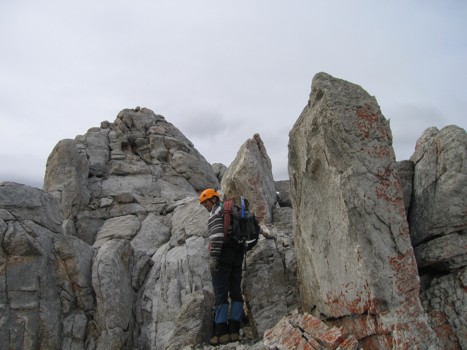
Heading up the crux; it doesn't look too bad from this angle, but there is a drop-off to the right
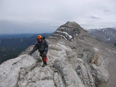
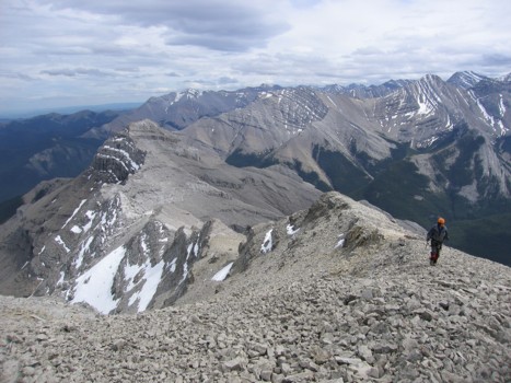
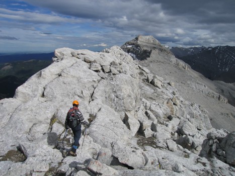
At the summit of GR565088; Bluerock Mountain to the right
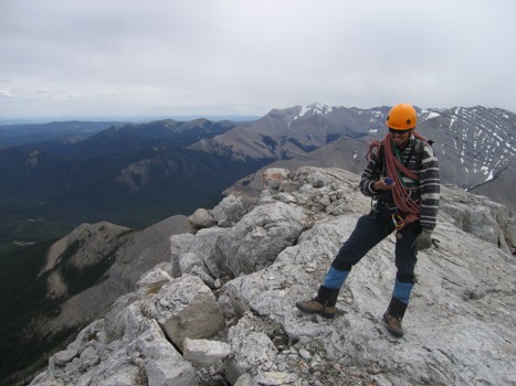
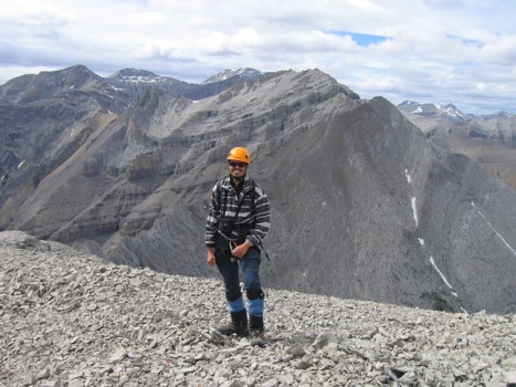
Checking to see that we're on the right summit!
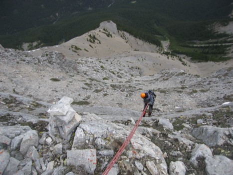
Mark rappels down the crux step
My turn to rappel
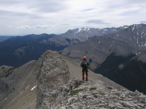
On the connecting ridge between 565088 and 555096
Scenery on the ridge
Same as above
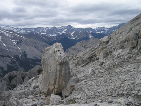
A very large free-standing boulder; the peak in the distant centre is Storm Mountain; Mist to the far left, Rae just visible to the far right
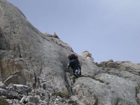
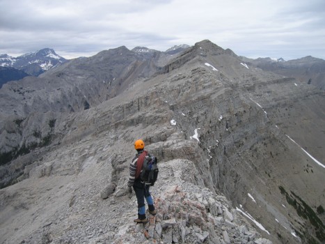
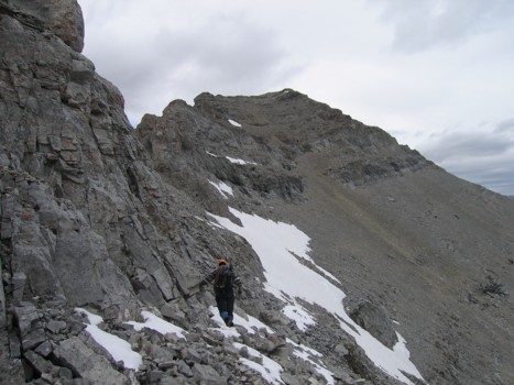
Approaching the crux of 555096, with the summit to the right
Approaching the crux
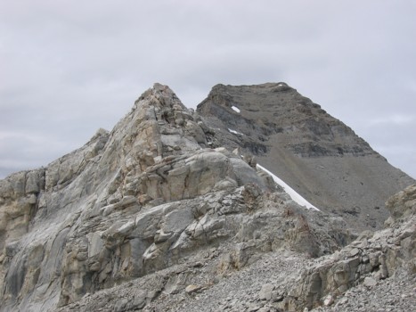
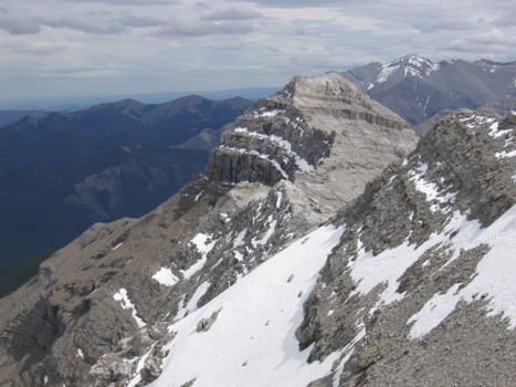
Past the crux, with 565088 behind
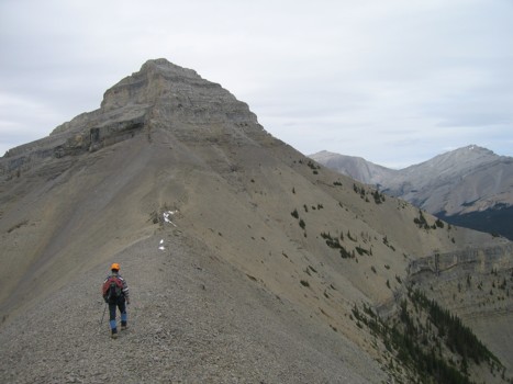
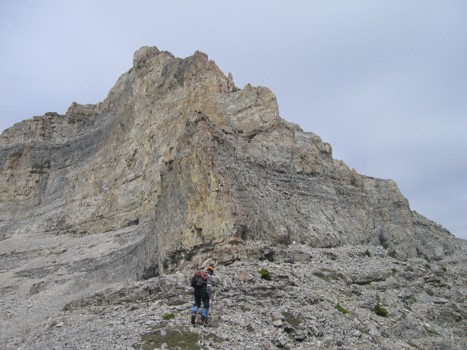
Approaching 555096; the route goes up the centre
Looking back to the beautiful form of 565088
Mark completes the final few metres of the trip; the route and 565088 behind
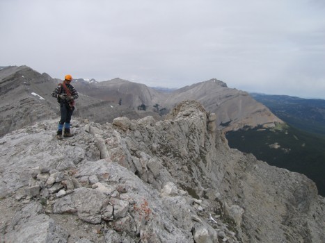
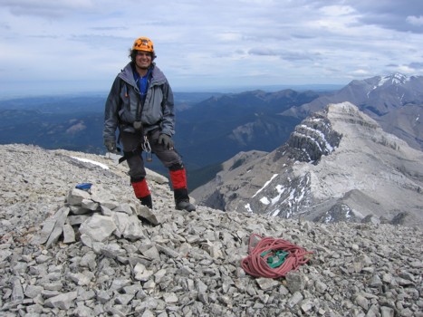
Me at the summit, with more of the many highpoints of Mount Burns behind
Mark at the summit, with 565088 behind
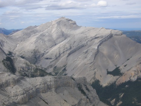
Bluerock Mountain
Our first attempt at an alternate descent; Gibraltar Mountain in the centre
Back on the original route
The rock was a very light colour and the same as the rock at the summit of 565088
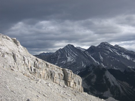
Dark clouds over several of the higher unnamed peaks in the area
Our second alternate descent route
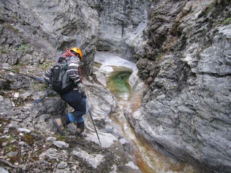
The interesting canyon we had to negotiate
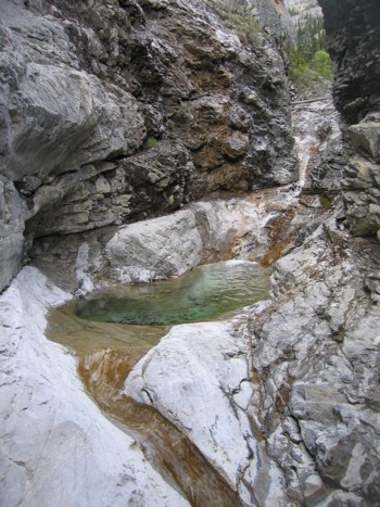
Looking back at the canyon
LOG