
Mount
Mountain height: 3274
m
Elevation gain: 1630
m
Ascent time:
9:45
Descent time:
8:00
Scrambling and a little mountaineering with Mark.
I thought that after a marathon 4 peak day in Yoho, 5 days
earlier,
We left the parking lot at 6:00 am and soon arrived at the
scenic
On the way, another party caught up with us, with the
northeast face of
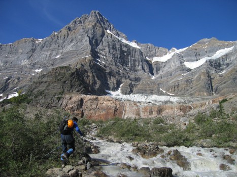
Back to our trip: getting over the second of two melt-water streams proved to be problematic. In the end, we had to ford the stream, though it was thankfully only several metres wide – but bone-chillingly cold none-the-less. Then we decided to try and shortcut up to the crest of the moraine – another bad choice, requiring us to actually get the rope out on the steep terrain.
Finally on the lower slopes of the mountain, we started up. The scenery was stunning throughout, and thank God, for it was a more than a 3 hour slog just to make it to the start of the actual scrambling. We worked our up the first rockband (the crux of the route) slowly and carefully - as Kane mentions, it is quite steep. At the top, we noticed a rappel anchor set up about 30 m away. The next part of the route was a much easier combination of scree bashing and easy scrambling up pleasant ledges and cairns marked the way nicely.
We thought we might make the summit block without running
into snow, but our luck ran out just before turning the corner to start the
final push. There wasn’t a great deal of snow, but enough to warrant concern
and extra care. Crampons, axes, and the occasional belay were instrumental in
getting us past this section. By the time we turned the corner to the striking
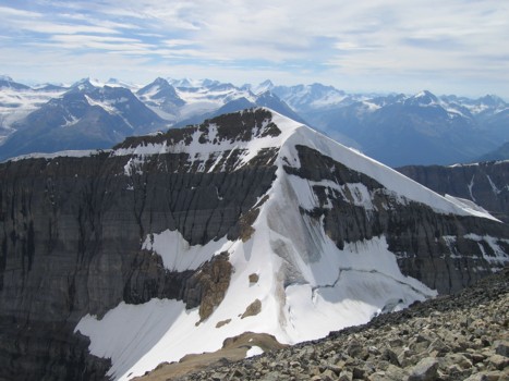
view of the White Pyramid/Chephren col and White Pyramid’s chilling
We chose Kane’s direct route to finish the ascent and it was quite interesting, especially when we started up a steep chute, to find a very new-looking, fat, white rope hanging halfway down. That’s when your mind starts playing with you. Common-sense says don’t touch or use anything you haven’t set up yourself or know for a fact is reliable. Of course, a big, juicy rope, at the 9 hour, 1300 vertical metres of elevation gain, part of your day is like Adam and The Apple – ultimate temptation. Let me refrain from divulging whether I used that rope or not – let’s just say I like a good apple as much as the next guy.
We crawled up to the summit at 3:45 pm and both collapsed – a 9.75 hour ascent. Our summit stay was a long one for two reasons: as stated, we were exhausted and needed recovery time and secondly, high clouds had unfortuitously rolled in, marring the “unequalled” summit panorama (Kane). We could see everything, but everything always looks better beneath a blue sky. As Kane stated, the summit view was exceedingly impressive – too many 11,000ers to mention, the stunning Freshfield Icefield, massive Mount Murchison, the turquoise Waterfowl and Chephren Lakes, and of course the entire magnificent northeast face of Howse Peak. Looking down the tremendous, vertical east face of Chephren, it was hard to believe that some people climb one of two routes directly up the face from the valley bottom.
After exploring the summit ridge, we started down at 4:45
pm, taking Kane’s “other” route, via the west ridge. This route yielded
some additional views of the hanging glacier on the northeast side of White
Pyramid and again, looking at the narrow snow/ice arête of the mountain’s
The two meltwater streams had increased in size
dramatically, by the time we arrived at the lake. This meant having to reascend
the moraine and circumvent the first one. Luckily we able to navigate the
boulder field before darkness set in, but complete exhaustion had long since
passed and the last 2 hours were mind-numbing. A couple of times, while on the
Chephren Lake Trail, I actually almost fell asleep while hiking. Needless to
say, we spent the night at the nearby campground, instead of driving back to
An unbelievably scenic and enjoyable trip that involves an almost equal amount of suffering – well worth it.
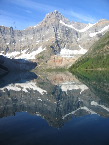
Howse Peak reflected in the waters of Chephren Lake
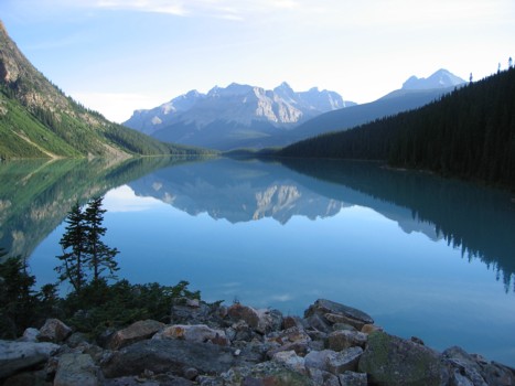
Same as above, further alongside the lake
Mount Murchison
Around the lake and looking up at Chephren
Approaching the second stream, with Howse Peak behind
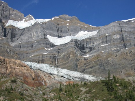
More of Howse Peak
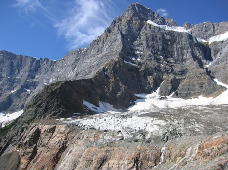
Another view of Chephren, from the moraine
Howse Peak
Looking back to Howse Peak
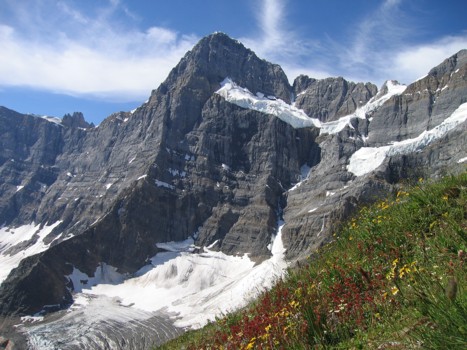
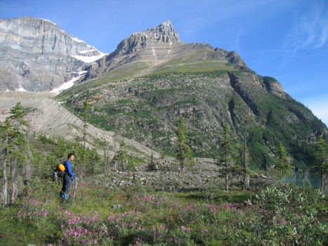
More of Howse with some flowers thrown in for colour
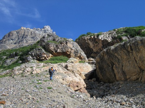
The gully we took to gain the lower slopes
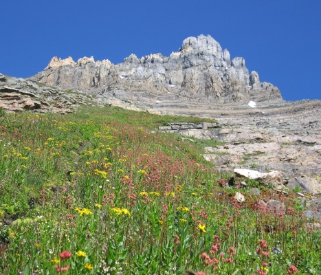
The summit block and more flowers
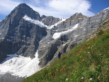
More Howse, more flowers, and Mark
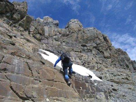
Starting up the easy rock steps
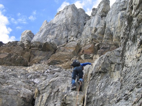
More enjoyable scrambling after the crux rockband
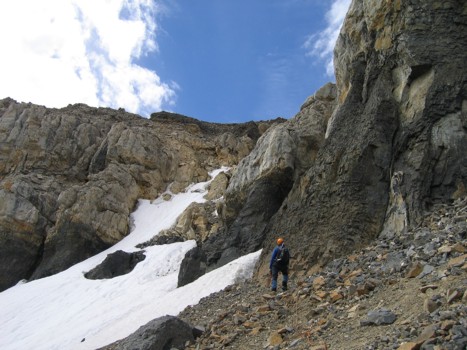
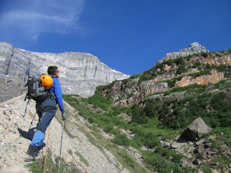
Assessing the route on the upper section
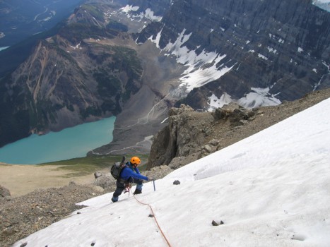
Traversing snow slopes, with the lake far below
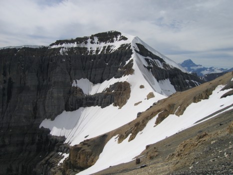
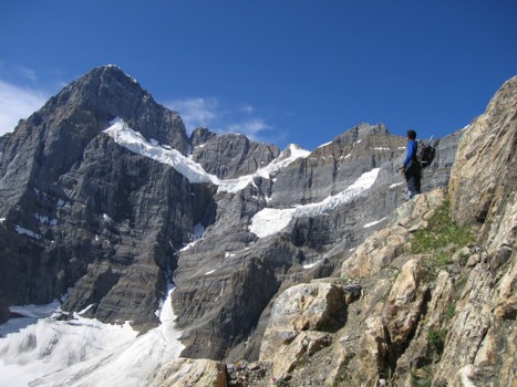
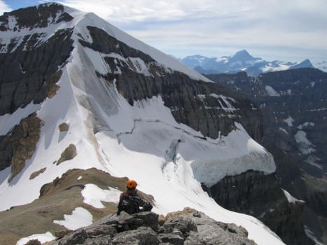
White Pyramid and its east ridge; Mount Forbes to the right
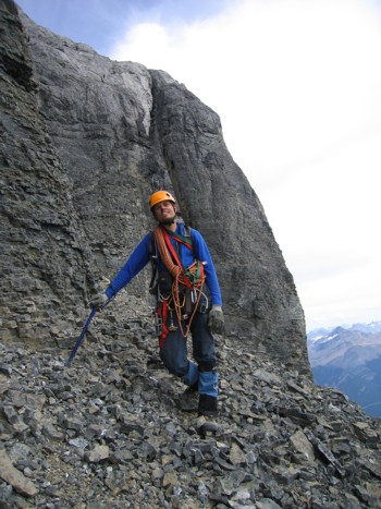
Exhausted and we're not even close to the summit
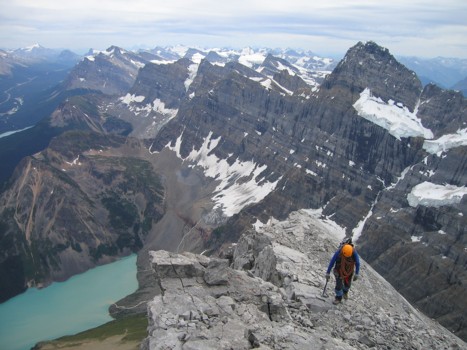
The upper ridge
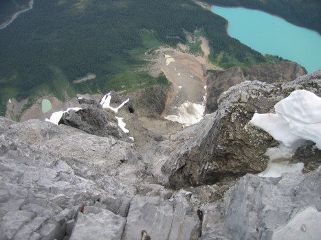
Looking down Chephren's east face, the lake is 1.5 km below
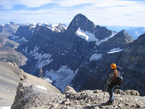
A summit view of White Pyramid, with the Freshfields behind
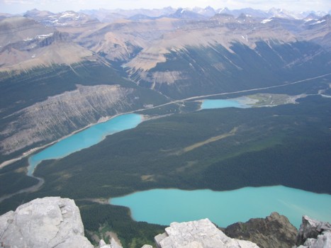
The Waterfowl Lakes and Chephren Lake
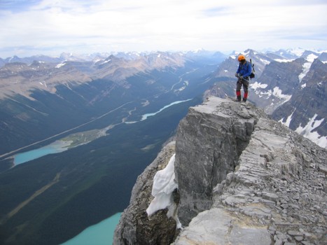
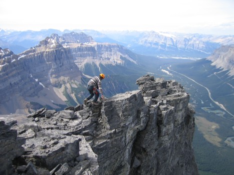
Mark looks down the east face
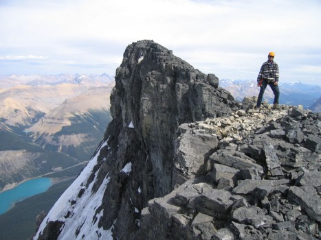
Exploring the summit ridge
Same as above
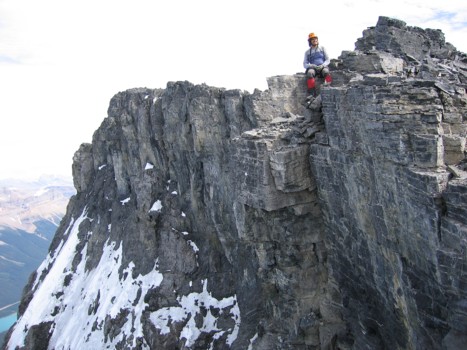
Same as above
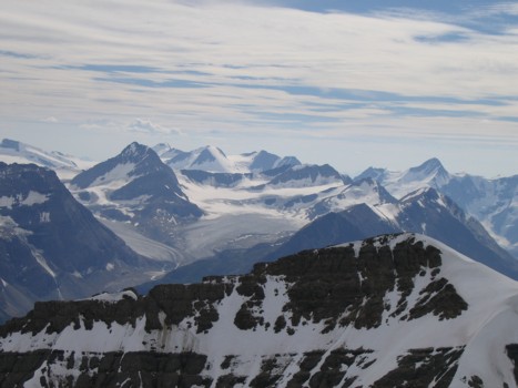
The Freshfields
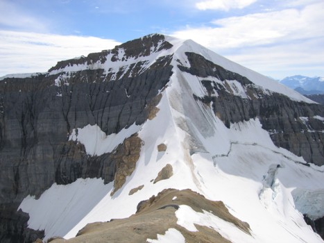
A closer look at White Pyramid
The hanging glacier on White Pyramid
A last look at Howse Peak
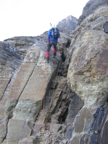
Mark rappels the crux
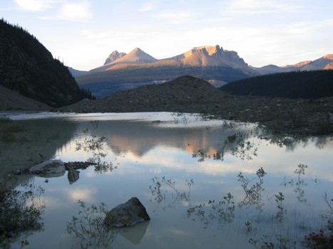
Evening reflections in a meltwater lake
HOME
SCRAMBLES
MOUNTAINEERING
OTHER TRIPS
PHOTO GALLERY
LOG
FAVOURITES
LINKS