Cloudy Ridge Junior III
March 13, 2021
Mountain height: 2585 m
Elevation gain: 1316
m
Round-trip time: 11:45
Scrambling with Dave, Brad, and Mark Klassen.
What an epic day! Fortunately for all, it was
a “good” epic. The nice thing about having a larger group is that the
suffering, tough-decision making, and unexpected challenges get divided and
shared, often making the tense moments far less tense – and there’s no group
out there I’d rather suffer and fret with than these cool, Southern Alberta dudes!
 Having spotted what Dave and I thought would be
an easier route up Cloudy Ridge Junior during our recent trip up Mount Yarrow,
the objective of this trip was to ascend Junior, traverse over to Cloudy Ridge
Senior, and then possibly over to “Cloudowan Peak”, with an alternate descent,
thus making a loop route. On paper this was an awesome plan. In execution,
“delusional” turned out to be a far more fitting adjective!
Having spotted what Dave and I thought would be
an easier route up Cloudy Ridge Junior during our recent trip up Mount Yarrow,
the objective of this trip was to ascend Junior, traverse over to Cloudy Ridge
Senior, and then possibly over to “Cloudowan Peak”, with an alternate descent,
thus making a loop route. On paper this was an awesome plan. In execution,
“delusional” turned out to be a far more fitting adjective!
This would also be my first trip with Mark
Klassen, a biology professor at Lethbridge College and colleague of Dave and
Brad. Chatting with Mark throughout the day, was a sheer pleasure and it didn’t
take long to see the commonalities he shares with his colleagues – a
soft-spoken, humble individual, who simply loves the mountains for their
intrinsic beauty (maybe Dave and Brad are not entirely soft-spoken, but the
others fit😊).
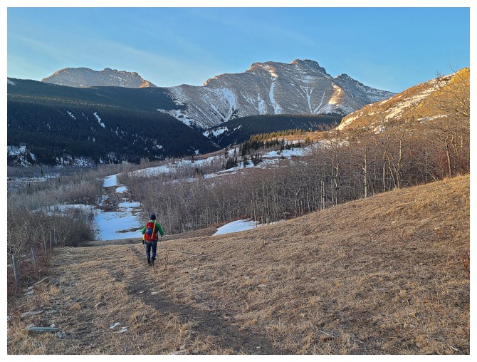
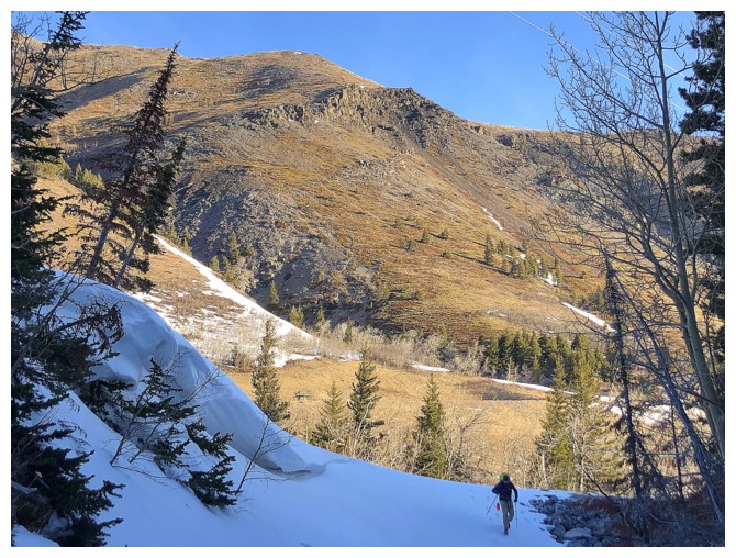
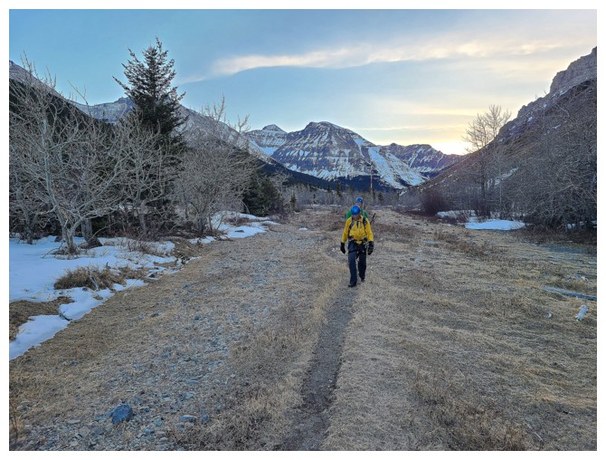
Hiking the Yarrow Creek trail seemed to take
no time at all and before long we were standing in front of a drainage on
the north side of Junior with one of the many important decisions of the day
upon us – which way up? We agreed that going straight up the drainage had
potential and would avoid the nasty looking bushwhack on either side of it. We
started up on wonderfully solid snow, but that honeymoon was short-lived - the theme of the day. When
Dave broke through the snow and took a very brief one-leg dip into the deep creek
below, it was time to leave the drainage.
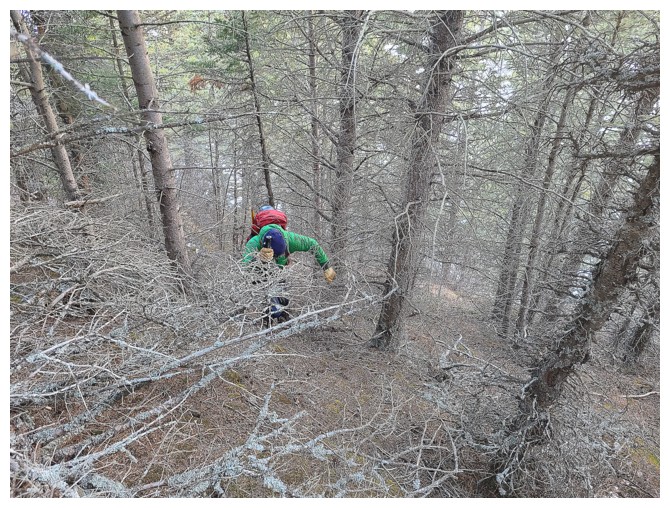
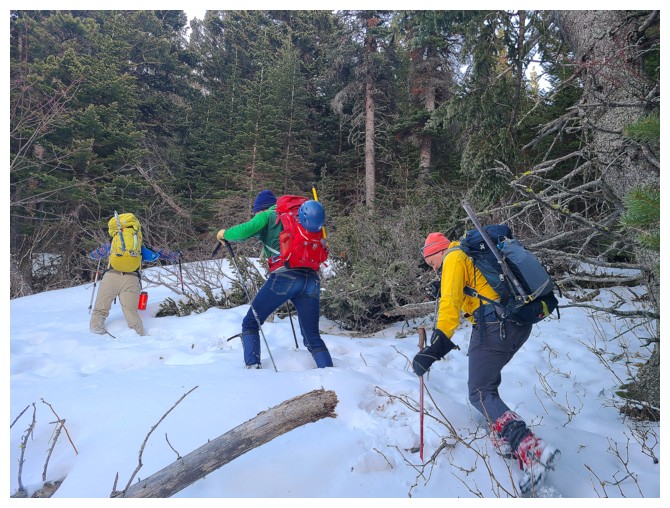
At first, travel through the forest above the
drainage was quite tolerable, the snow either fully supportive or non-existent.
That slice of heaven didn’t last either. Snow depth increased dramatically and
for the most part was completely unsupportive. Luckily, we had Brad! Not only
is Brad a trail-breaking wonder, but he is one of the few people on the planet
who actually enjoys wading through endless fields of waist-deep snow! Attacking
the deep snow like a rabid gopher Brad skillfully guided us through what seemed
like a never-ending stretch of forest, and across a steep snow-filled gully
onto dry ground. Chalk one up for the big fella!
 This part of the trip, however, was
time-consuming and energy-zapping to the exponent 10! By the time we cleared
treeline, any hope of attempting a traverse to Senior was out the window. With
an enormous amount of elevation still ahead of us and then a somewhat tricky
ridge to negotiate, we all felt that just making the summit of Junior would be
a huge victory.
This part of the trip, however, was
time-consuming and energy-zapping to the exponent 10! By the time we cleared
treeline, any hope of attempting a traverse to Senior was out the window. With
an enormous amount of elevation still ahead of us and then a somewhat tricky
ridge to negotiate, we all felt that just making the summit of Junior would be
a huge victory.
Gaining elevation towards the summit ridge,
we suddenly arrived at the rock-band that looked conspicuously familiar to me –
yes, we had ended up on exactly the same route I had took on August 13, 2016
–
a route with a nightmarish beginning and end! This fact was hardly a
concern (ignoring the fact that my memory is now about as reliable as a
Pinto in a rear-end collision) as
we were now above all the difficulties. At least we knew the summit
ridge would
be reached easily from this point. A fair amount of slogging, followed by an equal amount of
fun
scrambling later and we were ready to tackle the final section of the
trip.
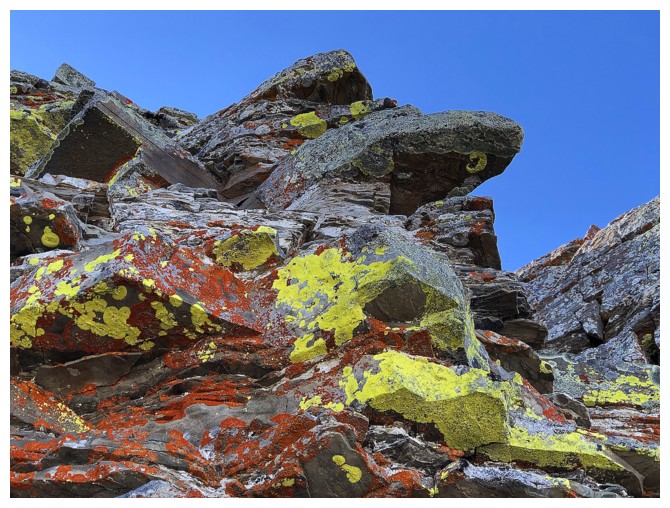
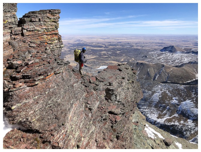
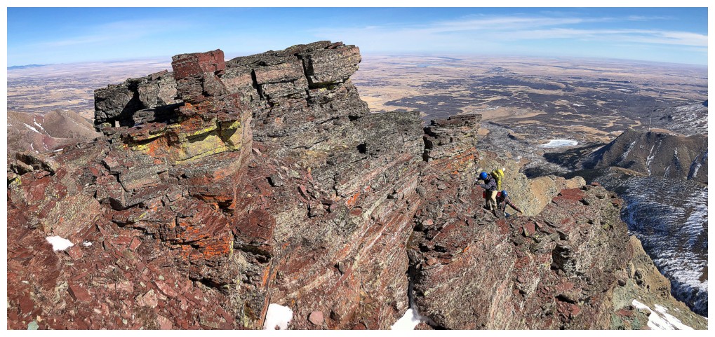
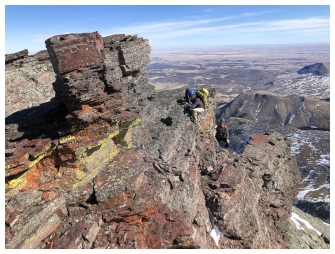
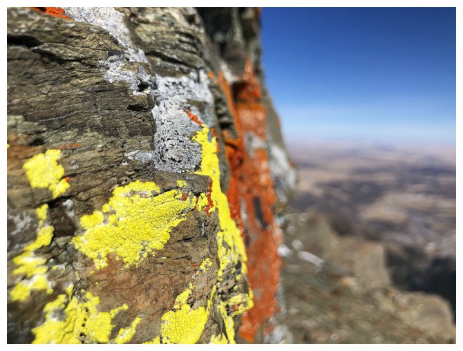
The best part of the ascent occurs just before
you reach the huge cairn marking the far east end of the ridge, featuring
wildly colourful red argillite, splashed with yellow lichen, and the summit
ridge itself that features interesting route-finding and some scrambling
challenges. We all enjoyed this section immensely and arrived at the spacious
summit in great spirits.
Even if we had made the summit of Junior
without the enormous effort required, the traverse over to Senior was looking
pretty fierce. A long, relaxing summit stay in perfect weather was infinitely
more appealing – and that’s exactly what we did, taking in the terrific views
in all directions, and sharing a few laughs about the ascent.
Descent time and more important decisions to
make: 1. via the normal route; 2. retrace our ascent tracks down. The potential
for long sections of new trail-breaking for option 1 was foreboding enough to
prompt us all to choose option 2.
We made excellent progress down to the point
where much earlier in the day Brad led us across the huge snow gully. Now we
could see a very prominent trail running down the mountain, alongside the
gully. That trail suckered us in like flies on you know what. Travel down the trail and then in
the gully was super fast and before we knew it, we were back down in the
drainage we started in, but farther upstream.
 It didn’t take me long to recognize the
surroundings and come to the grim realization this was exactly the same alternate
descent route I had used in 2016, just with the addition of a ton of snow – and,
like my ascent route for that day, it wasn’t a good route either! Nevertheless,
as alluded to at the beginning of the report, there is strength in numbers and this
“Fantastic Four????” wasn’t going to let a few trivial things such as insanely
dense forest, a metre of completely unsupportive snow, and an unknown drainage
probably harbouring horrors that make The Borg look like Teletubbies (for Trekkies
only), get in our way. And we didn’t – sort of!
It didn’t take me long to recognize the
surroundings and come to the grim realization this was exactly the same alternate
descent route I had used in 2016, just with the addition of a ton of snow – and,
like my ascent route for that day, it wasn’t a good route either! Nevertheless,
as alluded to at the beginning of the report, there is strength in numbers and this
“Fantastic Four????” wasn’t going to let a few trivial things such as insanely
dense forest, a metre of completely unsupportive snow, and an unknown drainage
probably harbouring horrors that make The Borg look like Teletubbies (for Trekkies
only), get in our way. And we didn’t – sort of!
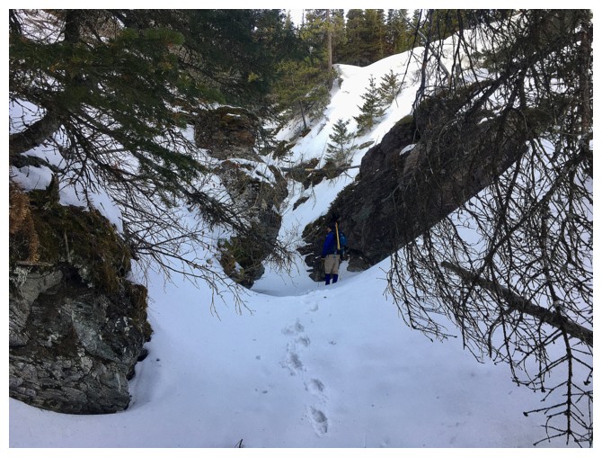
 The drainage started off well, but quickly
succumbed to the “that didn’t last long” theme of the day. We eventually
reached a significant drop-off in the creek and were forced onto the snowy,
bushy ridge. Travel here was perhaps the worst of the day. Even Brad found
going uphill at the smallest angle to be an exercise in futility. There really
was no choice but to descend back into the drainage and hope for easier travel
past the drop-off. Getting down was insanely steep. Once again Brad stepped up
and forged a feasible path down a narrow, icy gully (thank goodness for all the
branches on the side of the drainage providing excellent handholds).
The drainage started off well, but quickly
succumbed to the “that didn’t last long” theme of the day. We eventually
reached a significant drop-off in the creek and were forced onto the snowy,
bushy ridge. Travel here was perhaps the worst of the day. Even Brad found
going uphill at the smallest angle to be an exercise in futility. There really
was no choice but to descend back into the drainage and hope for easier travel
past the drop-off. Getting down was insanely steep. Once again Brad stepped up
and forged a feasible path down a narrow, icy gully (thank goodness for all the
branches on the side of the drainage providing excellent handholds).
The relief of being back on easy terrain may have lasted 50 m, if that! Another drop-off was encountered.
Fortunately, this one was quite small and would require only a short, easy
rappel off a nearby tree. By the time I had squirmed my way down the
aforementioned icy gully, Brad had already set up a rappel anchor. Thanks were owing
to Brad again at this point; not only for setting up the anchor but for
carrying a 60 m rope for the entire day and for providing each of us with a
harness at the beginning of the trip. It was actually kinda’ nice to use some
of the equipment we had hauled up and down the mountain.
Farther down the drainage a similar rappel
was required, but after that it was generally smooth sailing out of the same canyon/drainage
we started in about 11 hours earlier. The remainder of the trip involved only
mercifully easy hiking on the Yarrow Creek gas road and trail. We finished the trip tired, but immeasurably gratified.
A long and brilliant day of excitement, decision-making,
unexpected challenges, and adventure. And I couldn’t have asked for three
better humans to share the experience with – outstanding!
Click HERE to see Dave’s riveting
narrative.
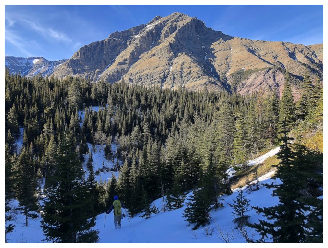
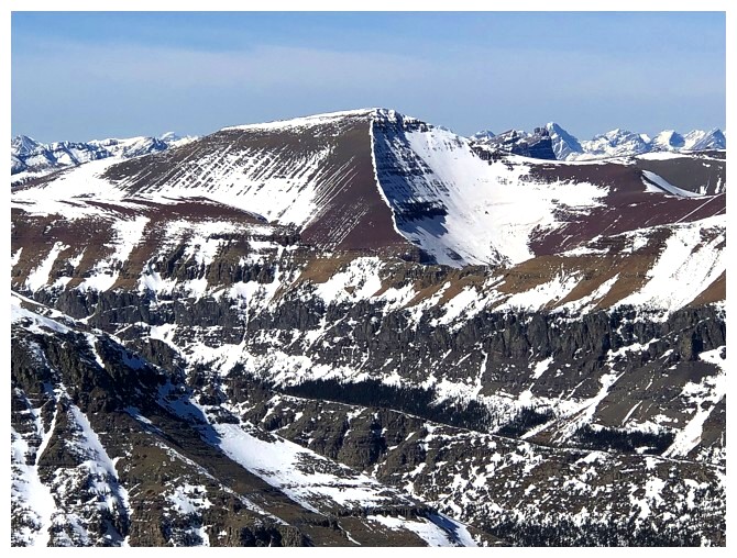
Mark leads the way. Mount Dungarvan at the left and Cloudy Ridge Junior at the right (photo by Dave).
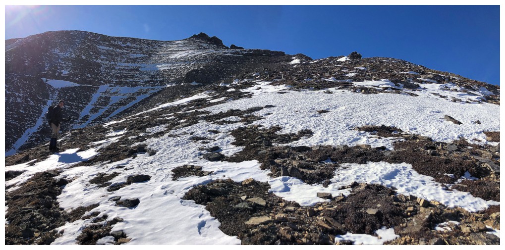
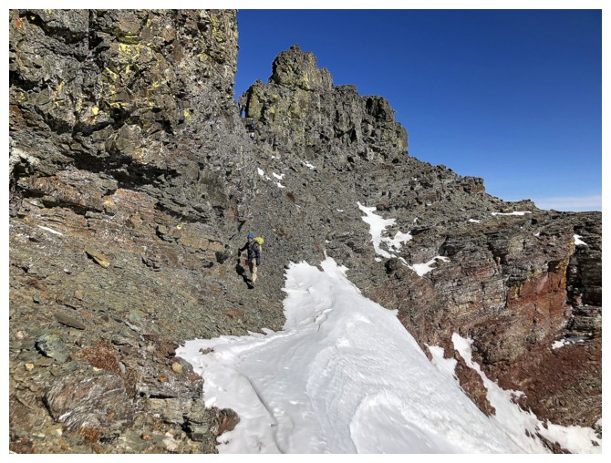
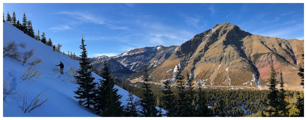
Looking up one of the numerous routes up Yarrow Ridge - this one is a personal favourite
Dave and Mark under the looming bulk of Junior
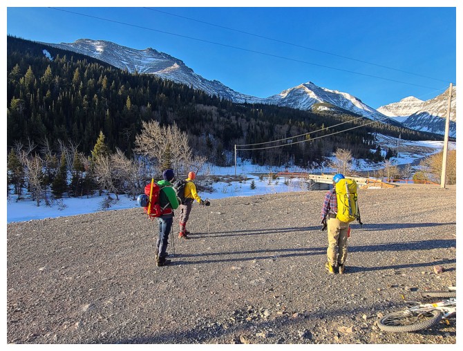
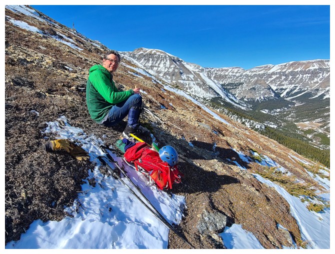
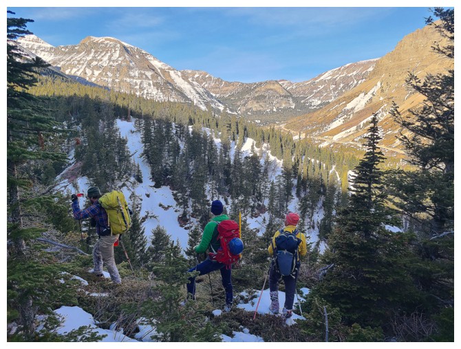
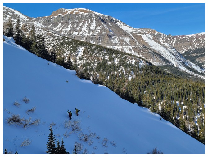
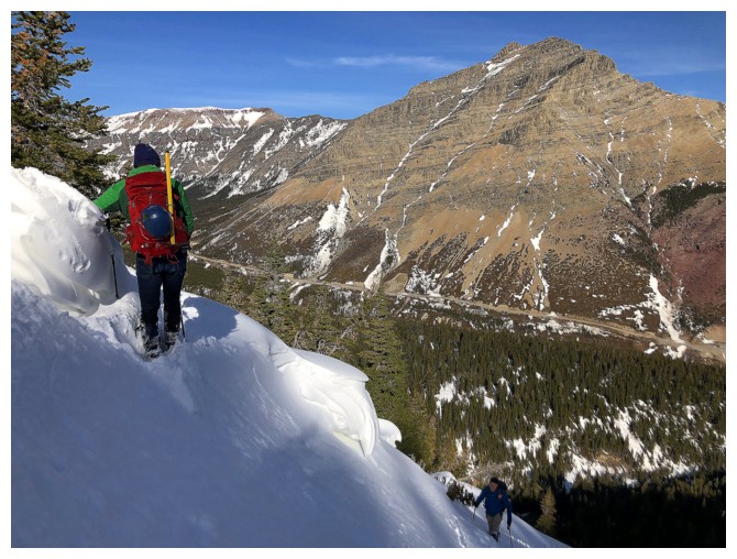
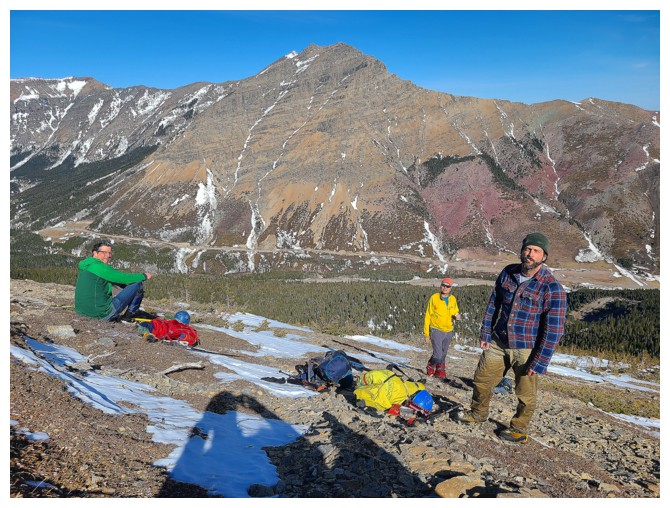
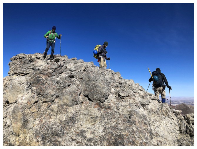
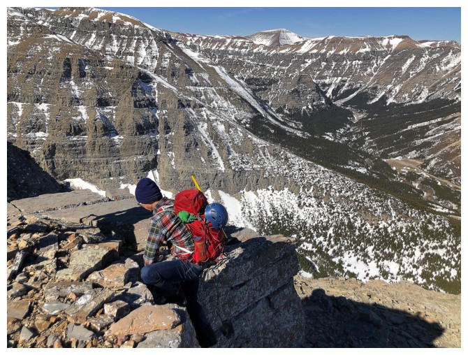
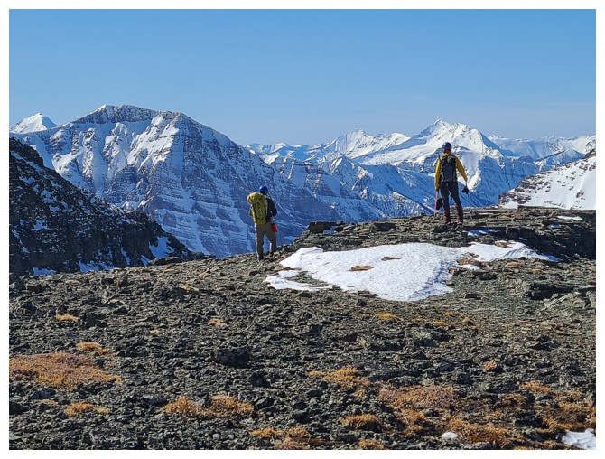
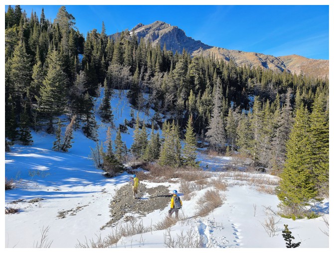
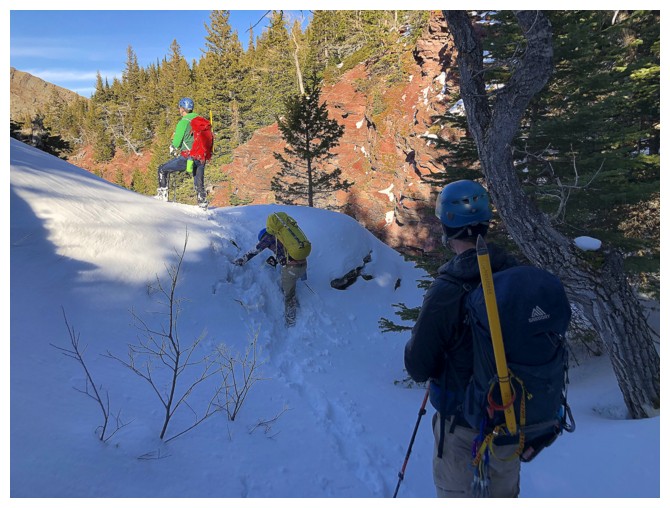
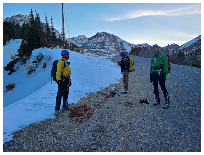
The troops discuss a plan of attack (photo by Dave)
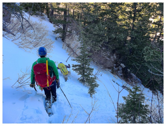
The snow was 100% supportive so we picked the drainage (photo by Dave)
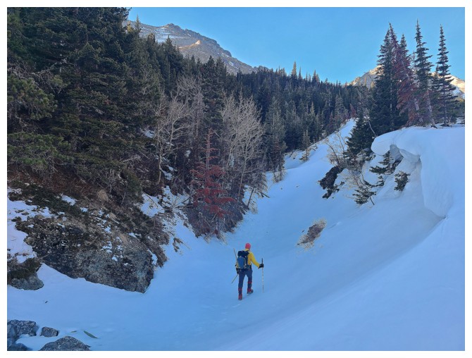
Dave prepares to enter the drainage
Mount Yarrow from inside the drainage
Brad enters the drainage
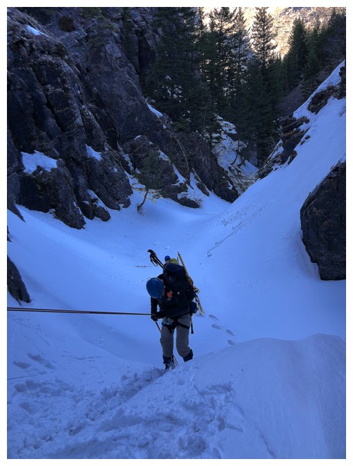
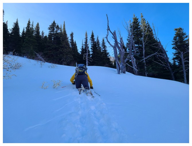
Dave takes the lead, but is about to break through the hard snow and dip one of his legs into the chilly water below
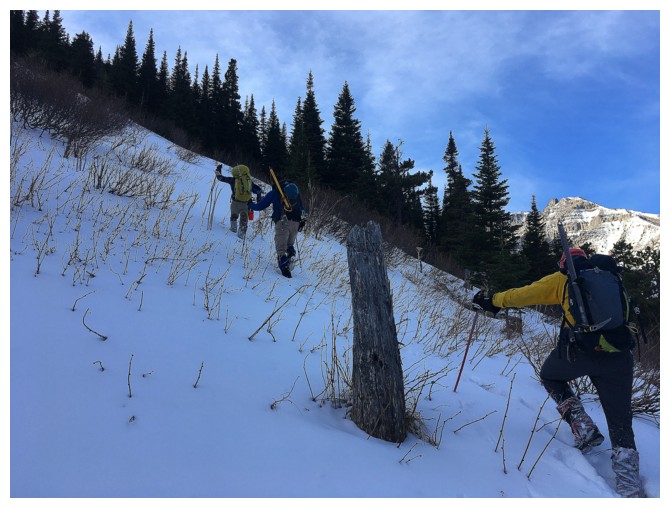
Just above the drainage, the terrain is bushy but no snow - not yet anyway! (photo by Dave)
Getting into some snow. We've certainly got the primary colours (plus) covered in our attire (photo by Dave).
A welcome but very short-lived break in the bush (photo by Dave)
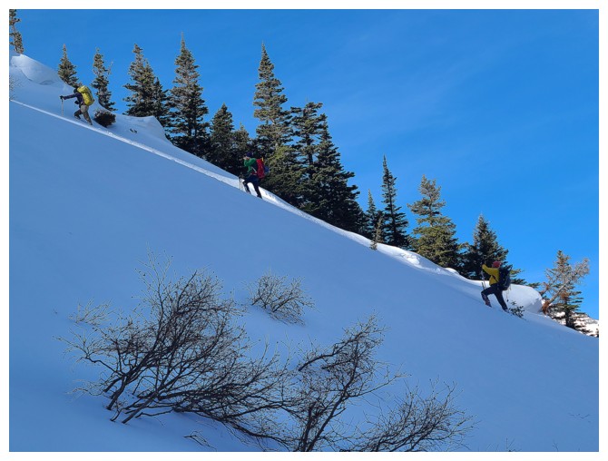
Things looked good for the odd short section (photo by Mark)
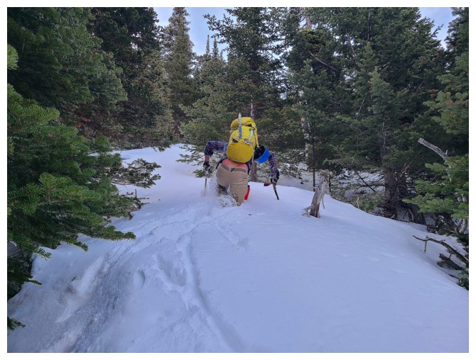
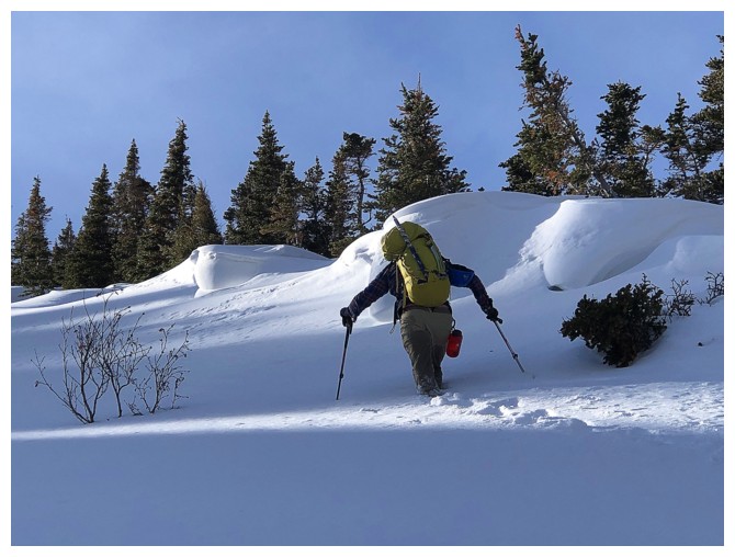
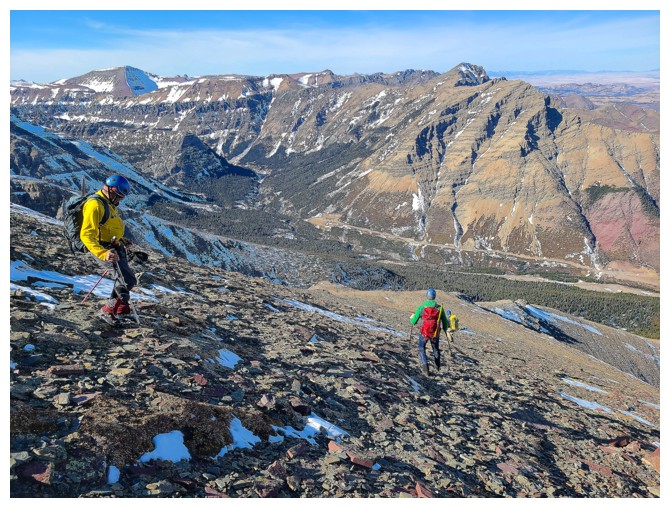
But most of the travel looked like this. The rabid gopher hard at work! (photo by Dave)
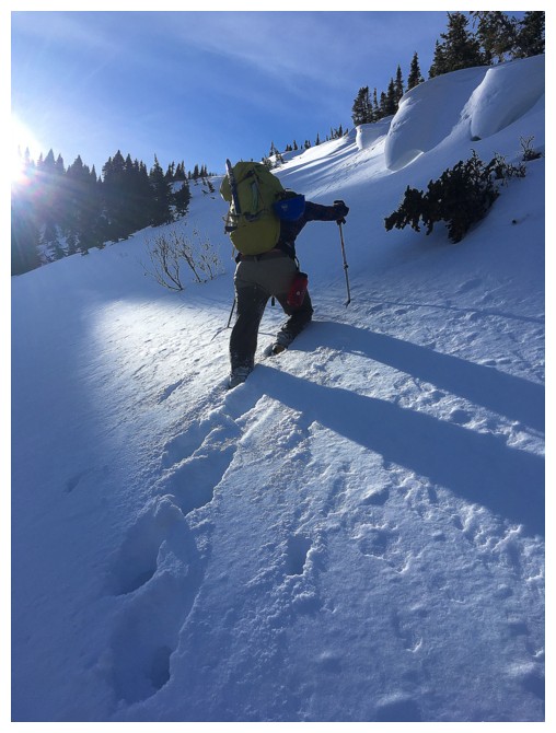
My turn to wallow in the snow (photo by Dave)
Crawling did have some minor success, but that too was short-lived (photo by Dave)
Mark seems happy - probably because he is not in waist-deep snow for the moment
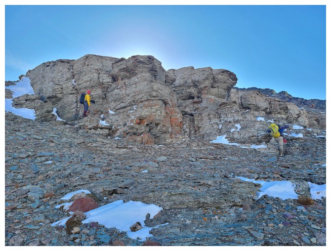
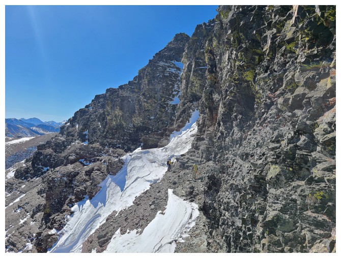
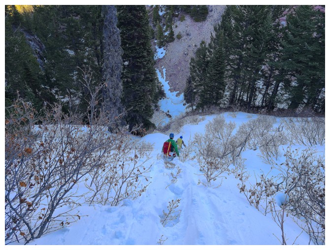
Approaching the big snow gully Brad led us across
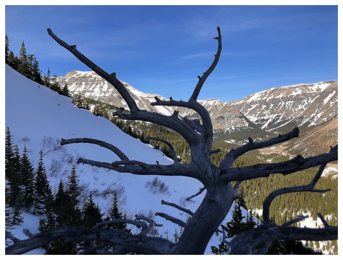
I say I love to photograph dead trees, but it's really just so I can catch my breath!
Brad leads the way across the gully
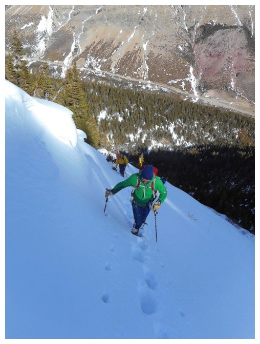
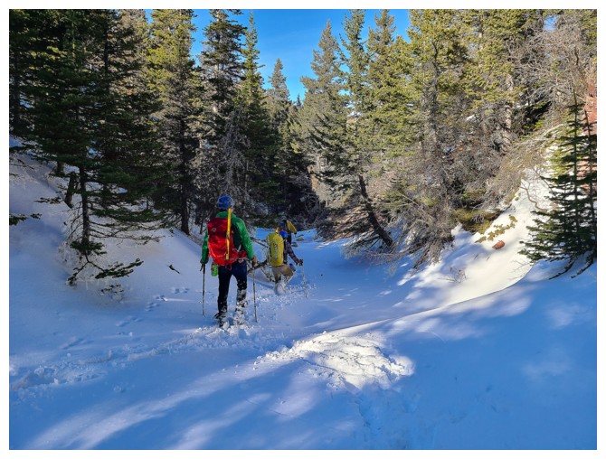
Gaining elevation on the other side (photo by Dave)
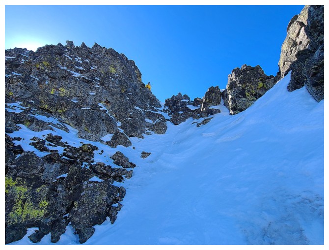
Steep and the snow is getting deeper (right photo by Brad)
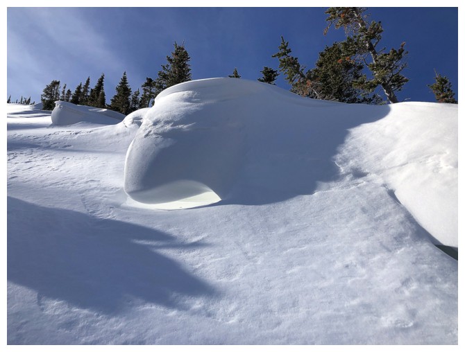
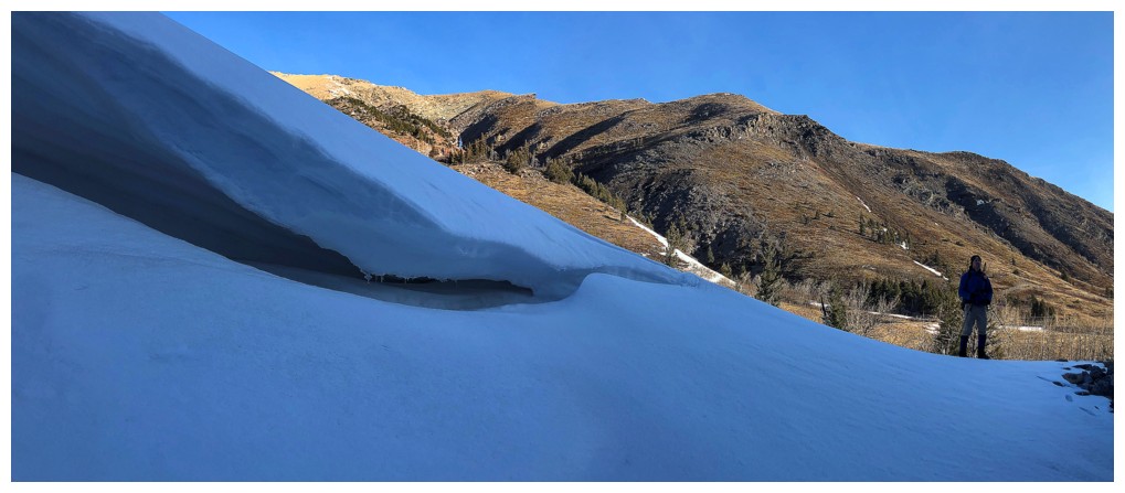
Cool snow formation
Mark leaves the gully when travel up becomes too difficult
Finally out of the snow (photo by Dave)
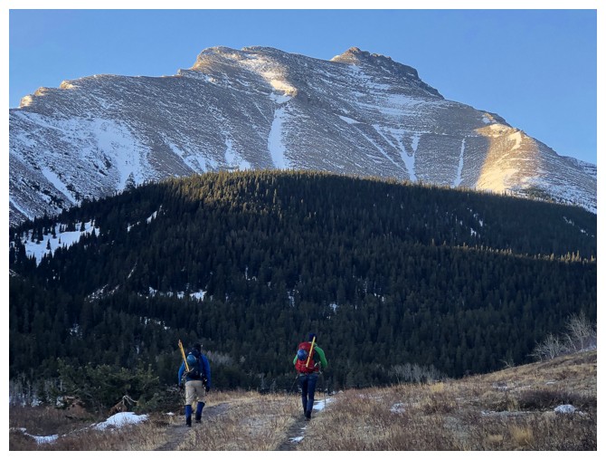
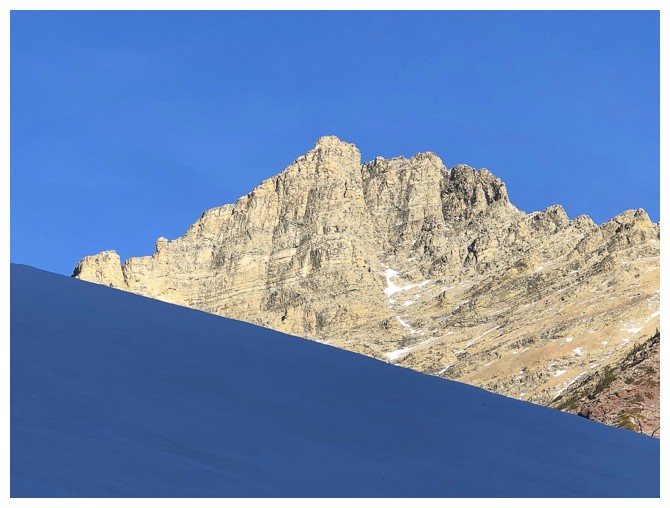
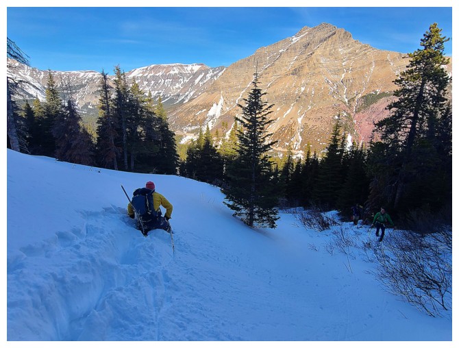
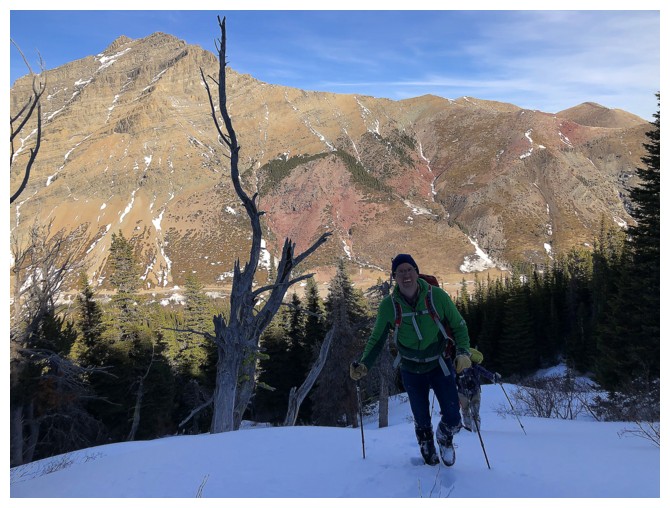
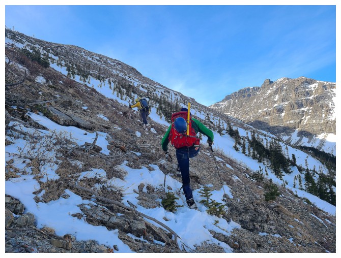
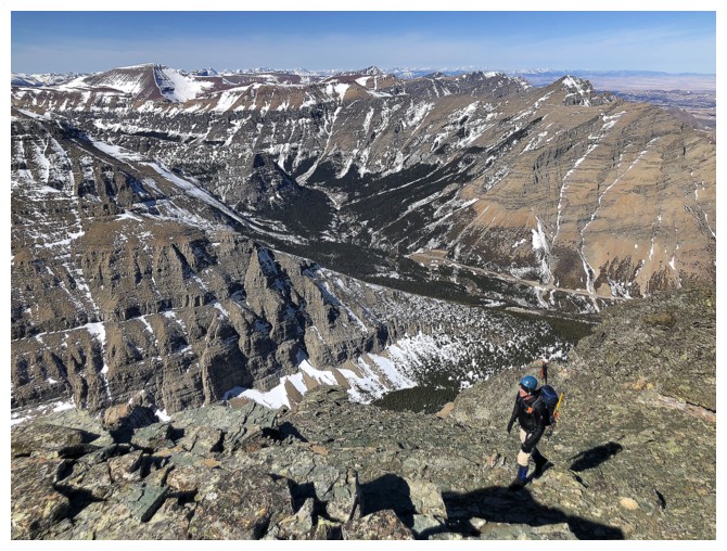
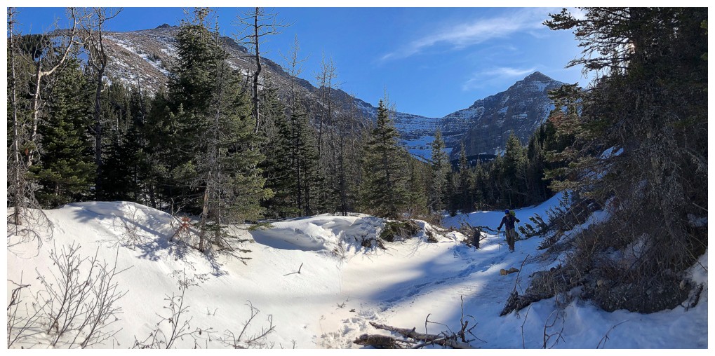
Brad and Dave hit the almost snow-free slopes. The peak behind is an outlier of Mount Glendowan and looks mighty tempting for a future trip.
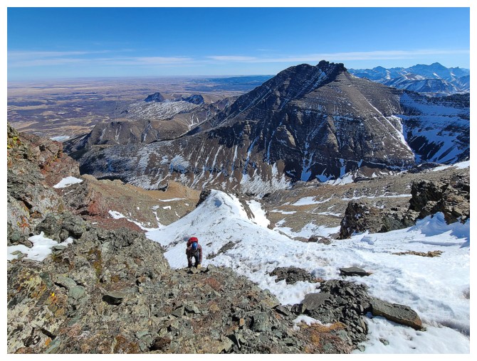
A
well-earned rest. At this point we are almost 3 hours into the trip,
but have only gained about 300 vertical metres (photo by Dave)
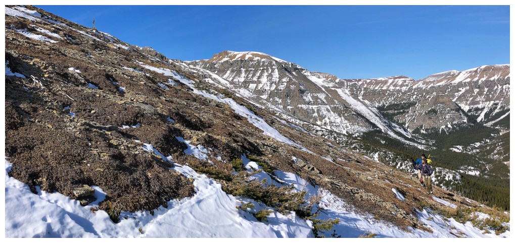
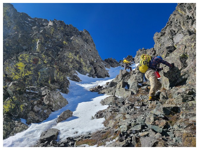
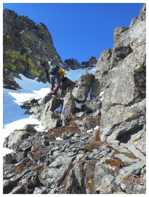
Dave, at the left, is ready to start the initial slog up towards the false summit, just left of centre
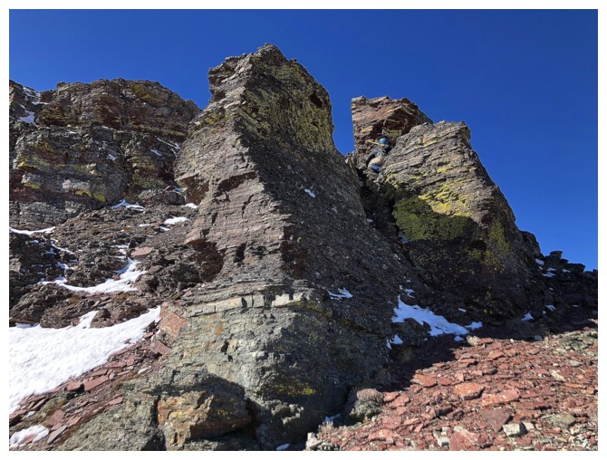
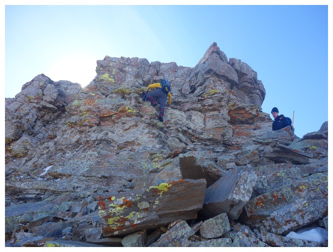
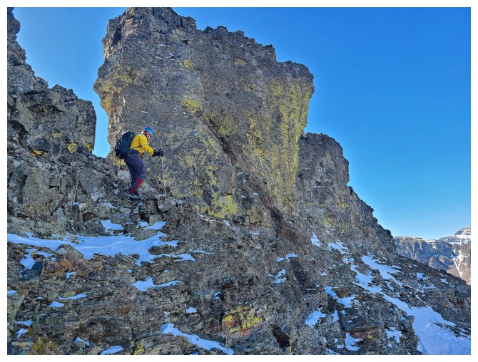
Very quickly, the slog is replaced with interesting scrambling up
interesting rock. Dave is having an intimate moment with this
"face-like" rock

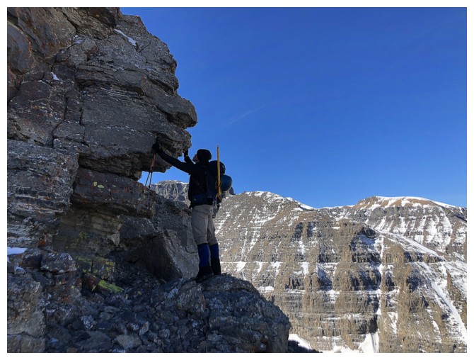
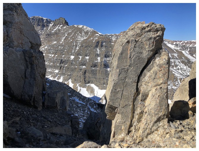
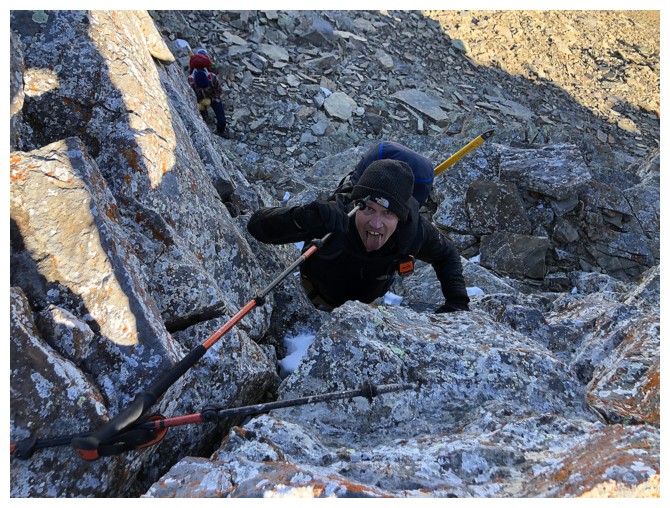
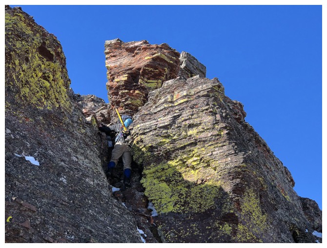
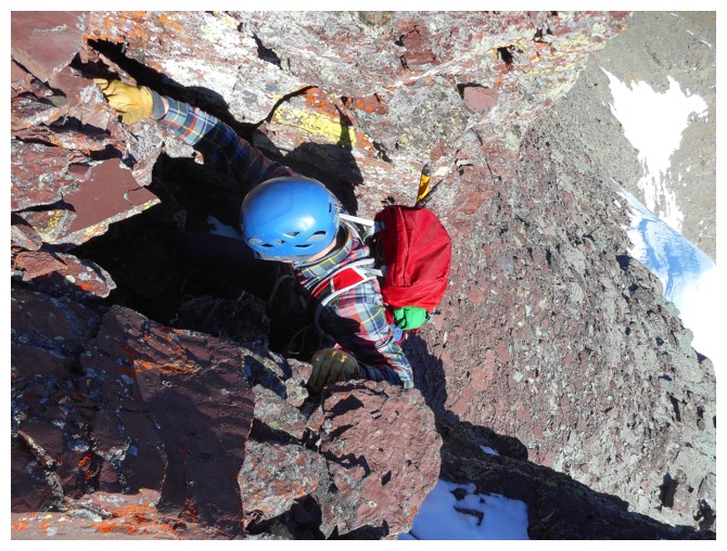
Dave found this very cool, narrow passageway through some rock (photo by Dave)
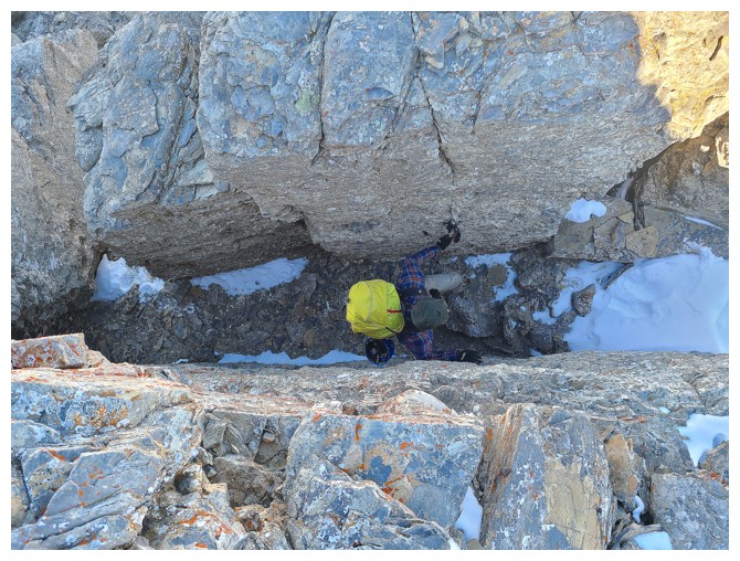
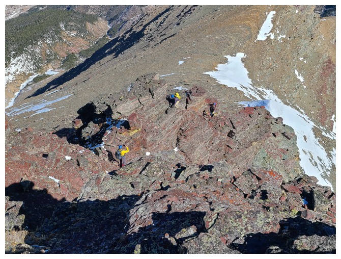
Birdseye view of Brad going through the passageway (photo by Dave)
Dave photobombs Brad in his shining moment of glory
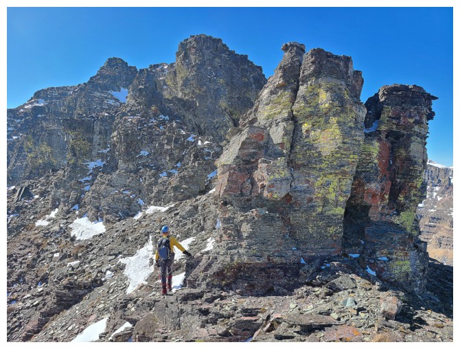
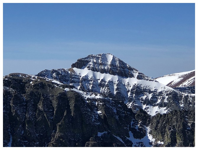
Brad and Cloudowan. Note the small frozen waterfall (potential ice climb!) at the left.
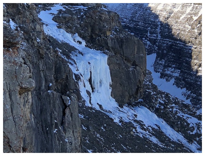
Close-up of the ice climb that no one in their right mind would try to climb, simply because of the horrendous access
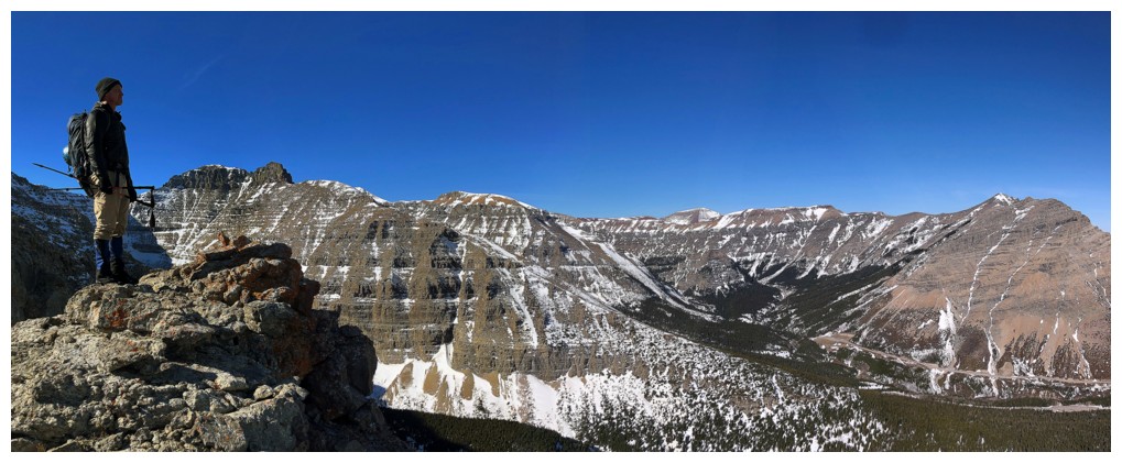
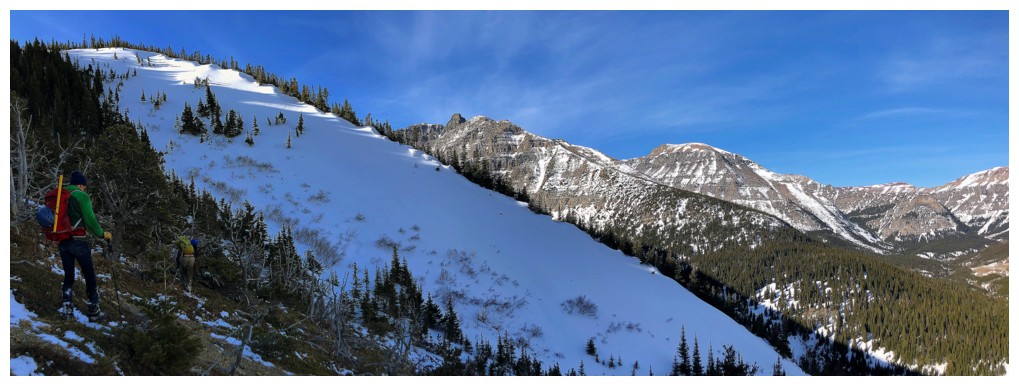
Dave surveys the area. The long and awesome ridge of Spionkop goes from right to left.
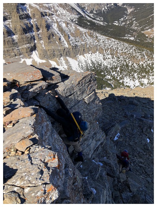
The troops descend the rock above the passageway
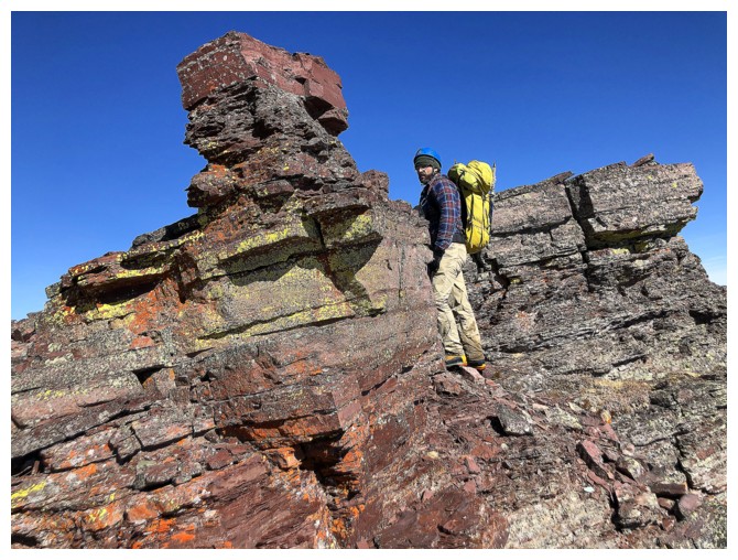
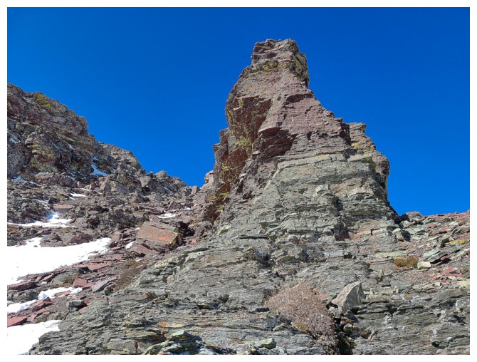
Lots more interesting rock to check out before we reach the interesting and COLOURFUL rock!
Easy route up around to the left, but there were tons of easy and fun scrambling options (photo by Dave)
Dave and Cloudowan
Brad takes up one of those scrambling options (photo by Dave)
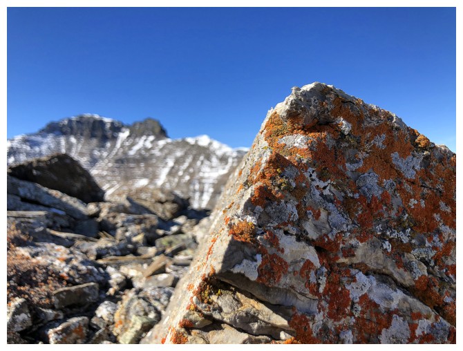
I'm reverting back to old habits, allowing myself to be seduced by lichen-covered rock
It's not much of a seduction - I'm putty in it's hands!
More decision-making, but the easy kind (photo by Dave)
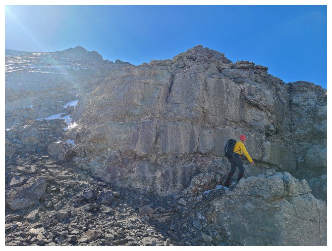
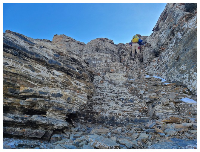
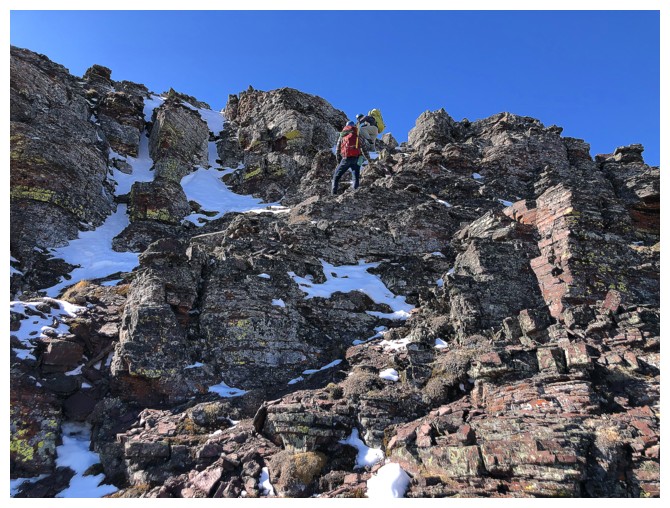
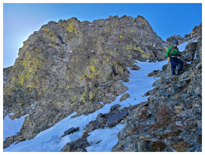
Heading up to a short, near-vertical step (photo by Mark)
Throwing my hiking poles up the step (photo by Dave)
Dave does the same (with love)
Dave ascends the step. Good foot- and handholds.
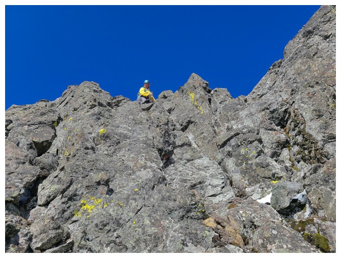
Mark demonstrates impeccable climbing form at the top of the step
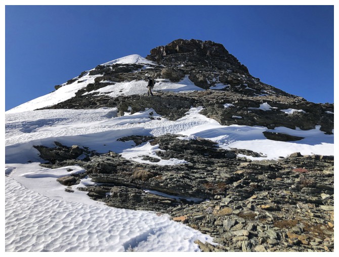
Dave continues to lead the way up to the false summit
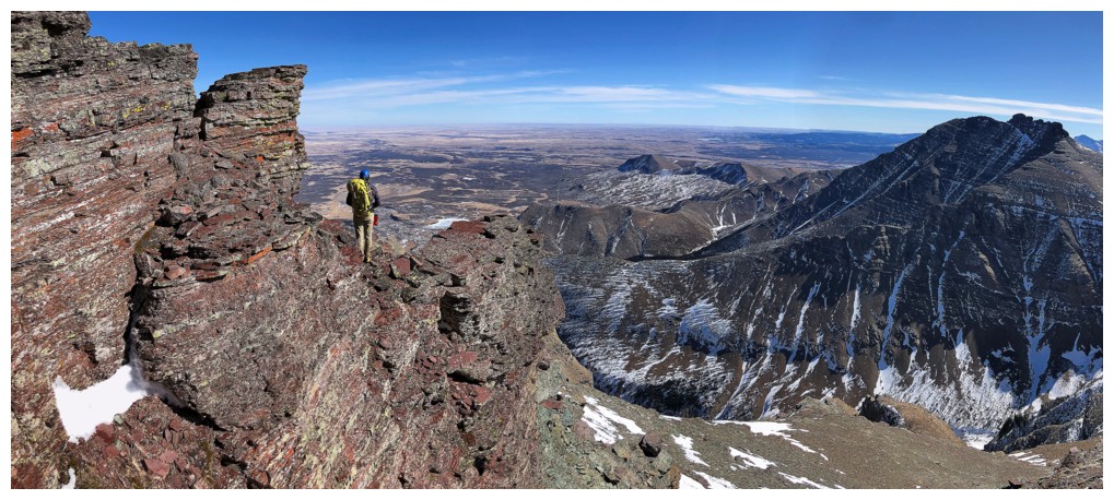
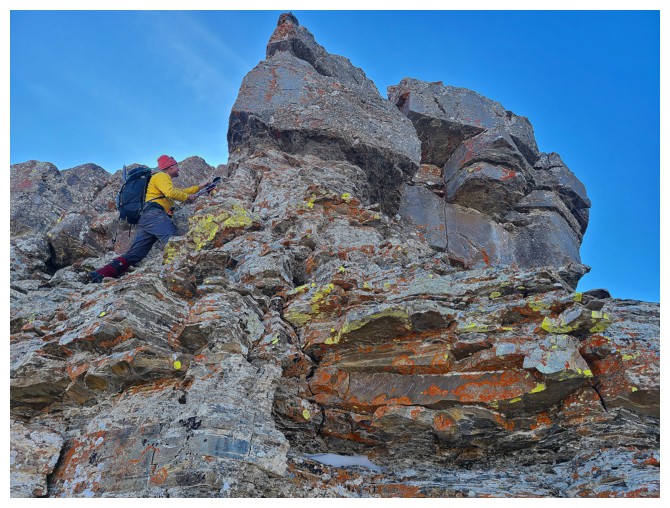
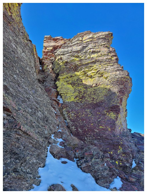
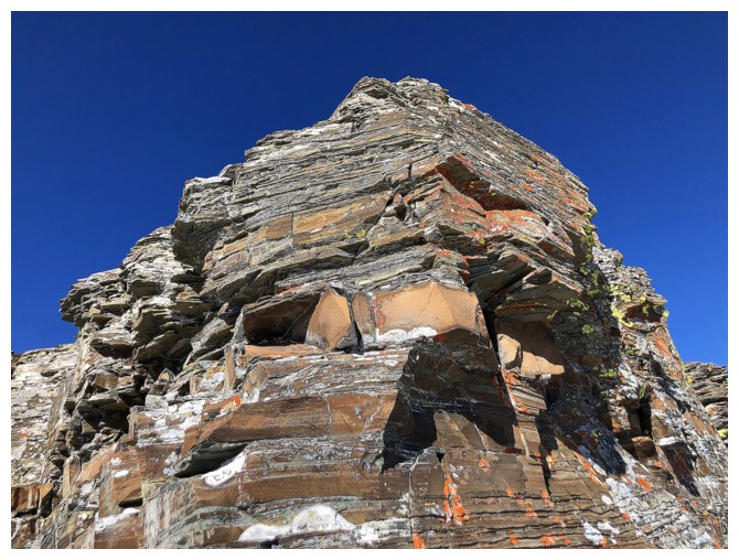
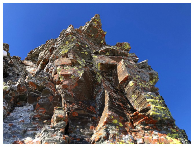
It's "interesting" AND "colourful" rock time!
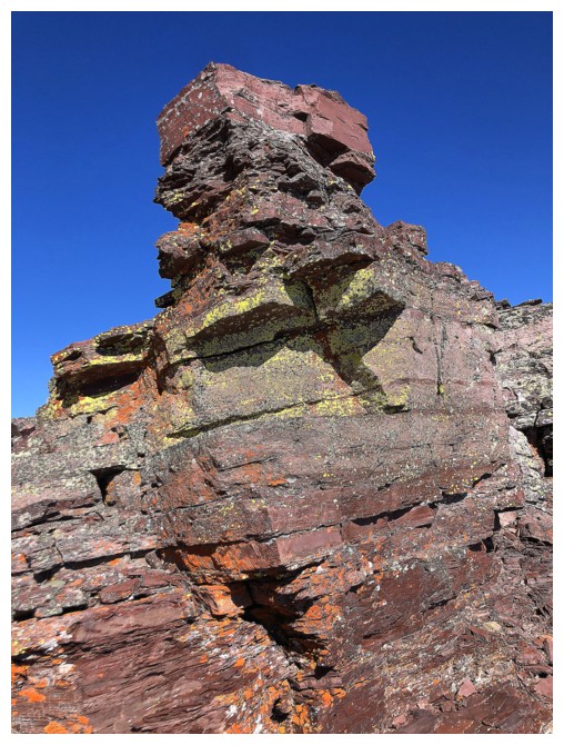
This stunning red argillite formation caught everyone's attention (photo by Dave)
So much so that Dave picked a steep line of ascent up it (photo by Dave)
There he goes
Success!
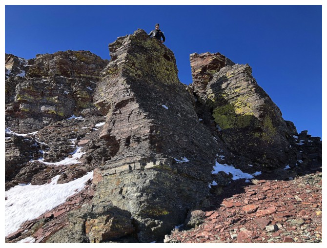
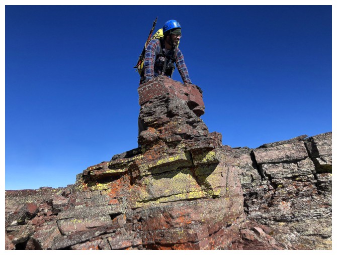
The massive false summit cairn awaits Dave at the top of the formation (photo by Dave)
I didn't ascend the step, victim of more gratuitous seduction by this beaut
Brad atop the step
Brad and Mark enjoy the awesome terrain
Definitely some stretchy, exposed moves needed to get up the step
Dave is high above, photographing me while I photograph Brad and Mark (photo by Dave)
 Mark tackles the challenging but super fun terrain (photo by Brad)
I asked Brad to climb this beautiful but precarious rock column for a
photo. Thankfully he had the sense not to go all the way to the top.
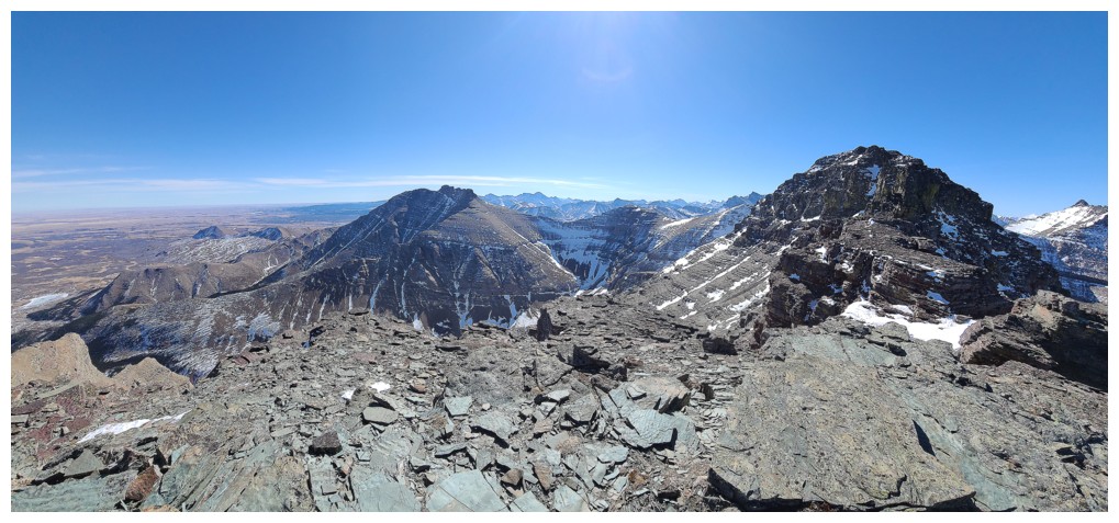
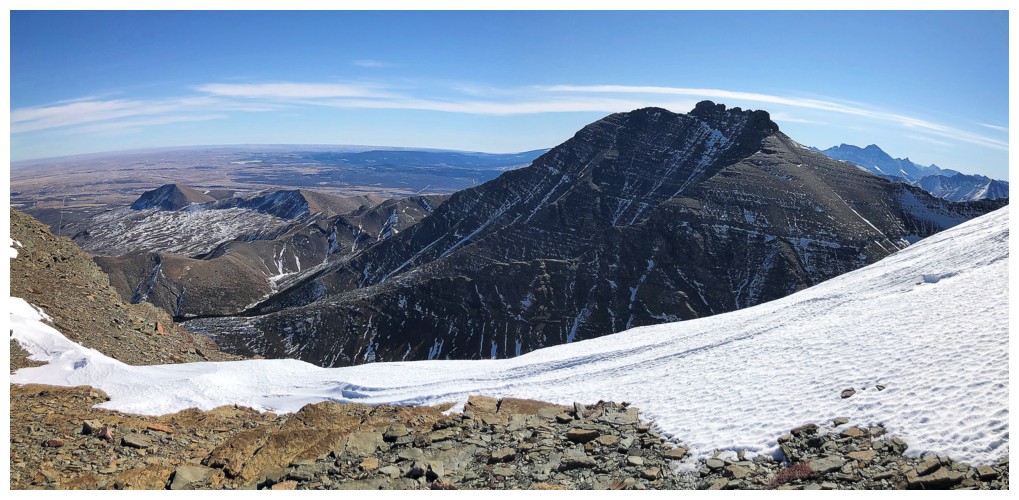
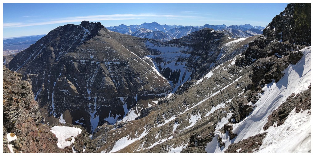
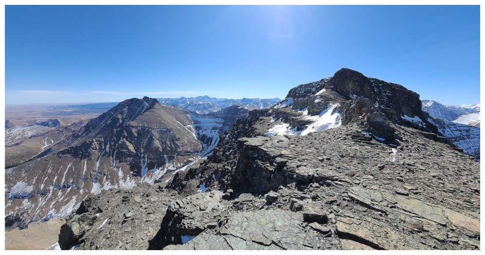
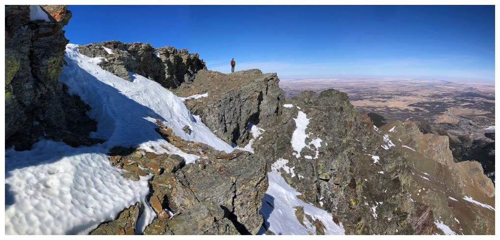
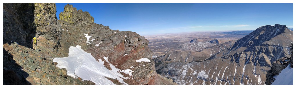
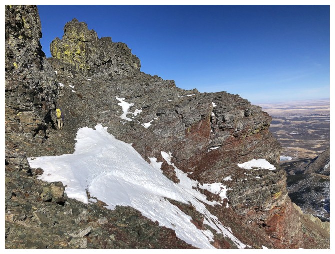
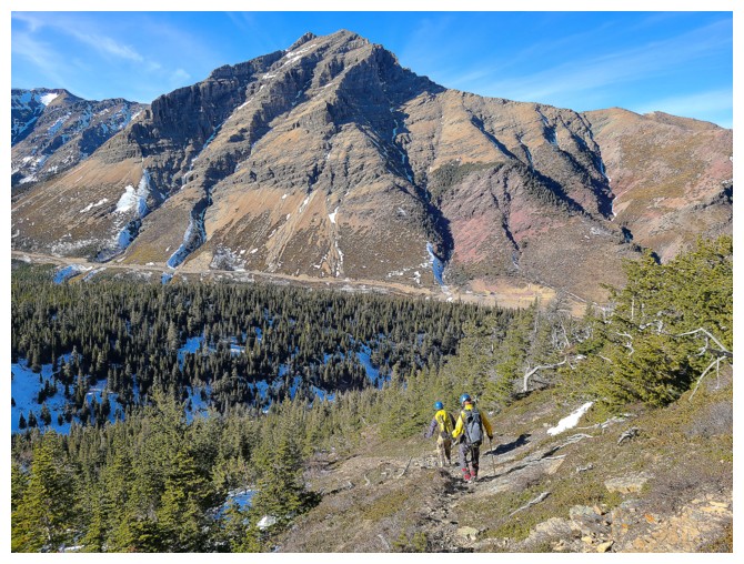
Awesome view from the false summit. Junior to the right and Mount Dungarvan at the left (photo by Dave).
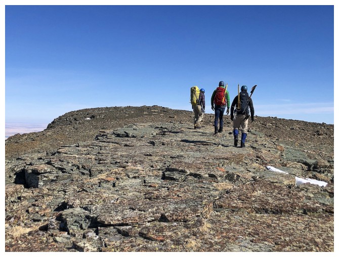
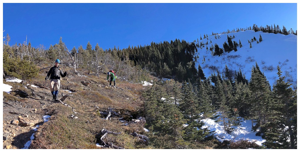
Mark, Brad, and I are still making our way up to the false summit
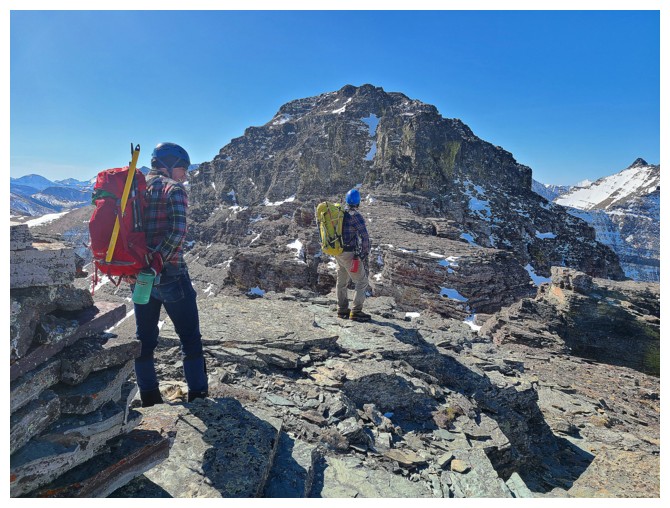
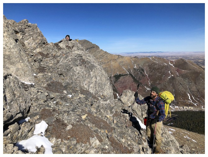
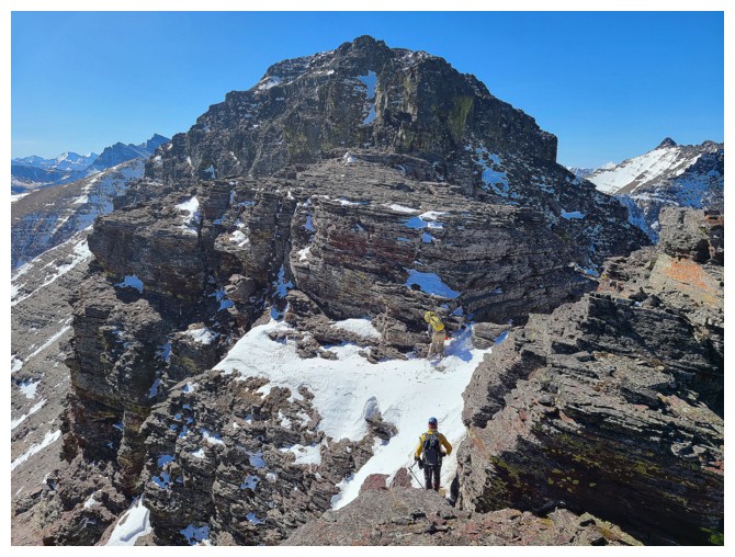
Mark
and Brad check out the route ahead. It looks daunting from the false
summit, but is easier than appearances dictate (photo by Dave).
Dave and Mark watch Brad and me trying to find a route up the first obstacle
Brad approaches a steep rock band (photo by Dave)
He couldn't find a route around it so we just went straight up it (photo by Mark)
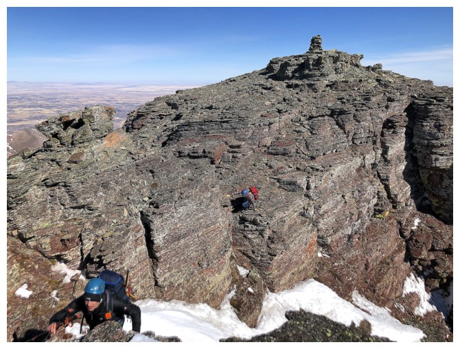
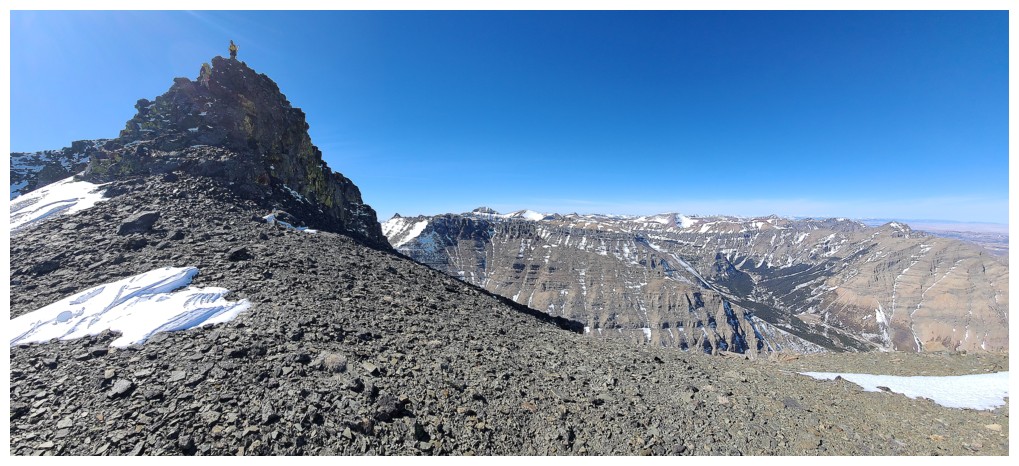
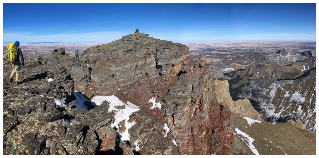
Dave and Mark follow. That false summit cairn, at the right, is huge!
Circumventing the next obstacle on the left (photo by Dave)
And this one on the right (photo by Dave)
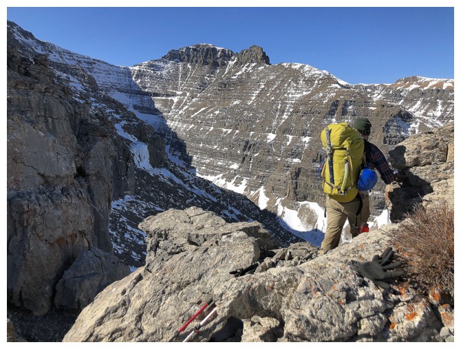
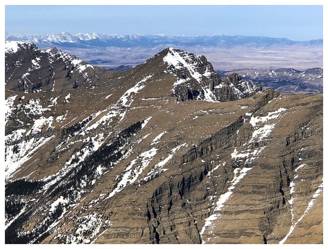
Dungarvan
not only looks great, but provides one of the most enjoyable (and
difficult) scrambling experiences in the park, via Lost Horse Creek and
the mountain's south ridge (photo by Dave)
Brad and Mark looking like serious mountaineers
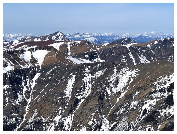
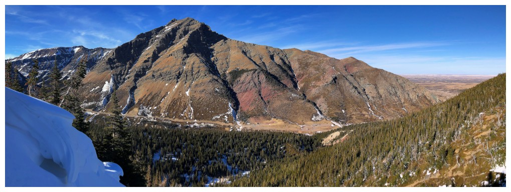
The peak to the right of Dungarvan (between that mountain and Cloudy Ridge Senior) is unofficially called "Dundy Peak" and is also a terrific trip
The biggest obstacle can be circumvented on the left side, even though the route is not obvious at first
Brad and I hike around the massive rock face, looking for a weakness (photo by Dave)
There's the weakness (photo by Dave)
Back atop the ridge (photo by Dave)
Mark ascends the weakness (photo by Dave)
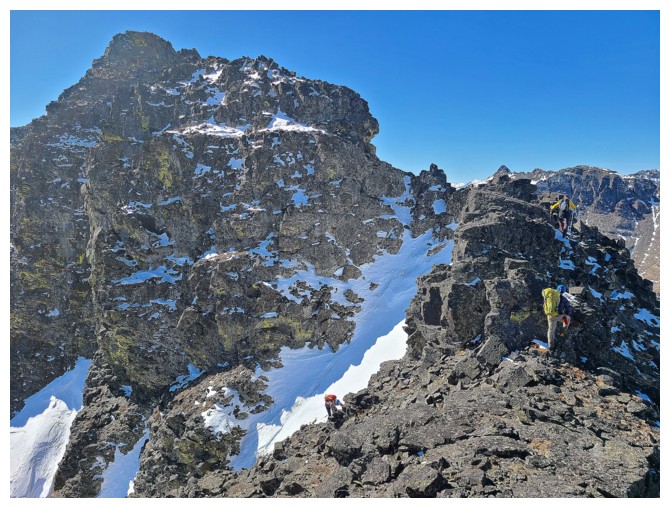
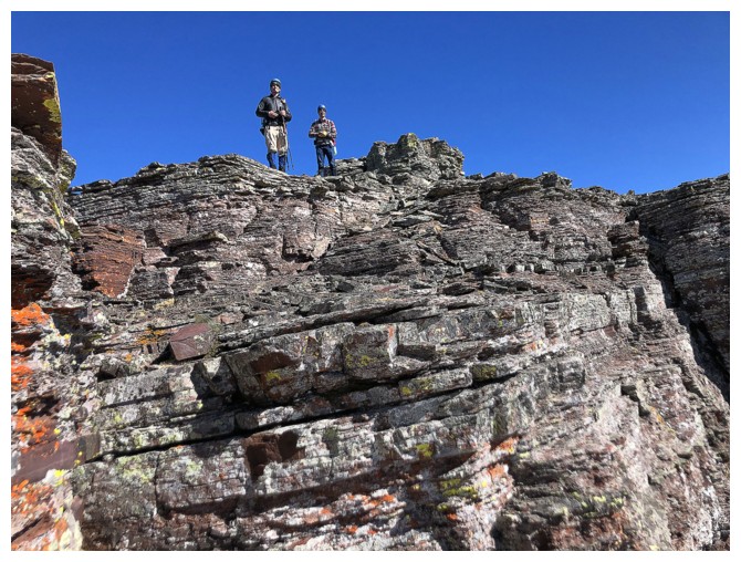
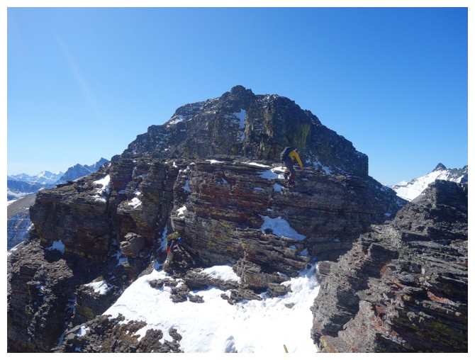
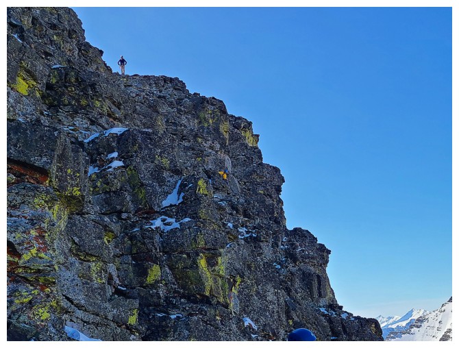
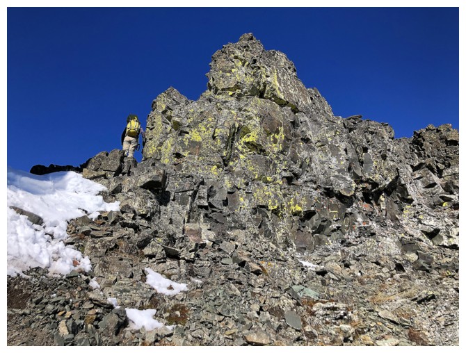
Continuing on the ridge to the next rock band
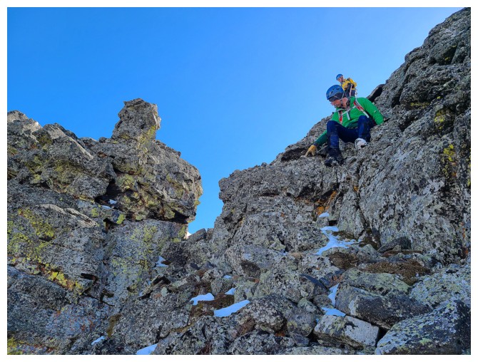
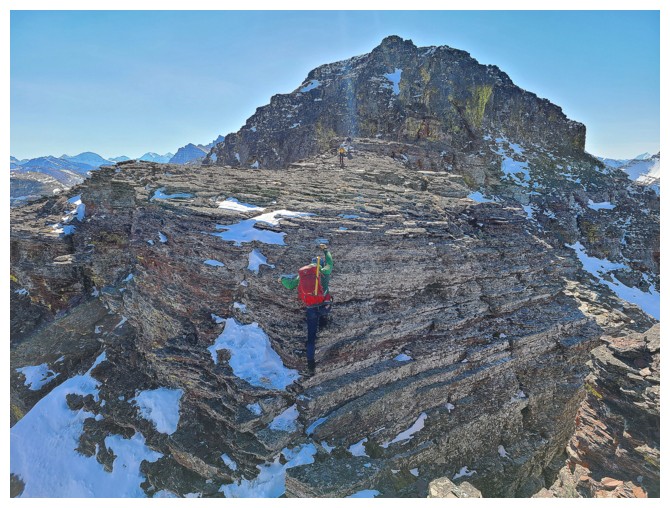
The crux of the summit ridge is getting up this rock band. Mostly
moderate scrambling with a few difficult moves, but lots of loose rock.
Descending it is more challenging than going up.
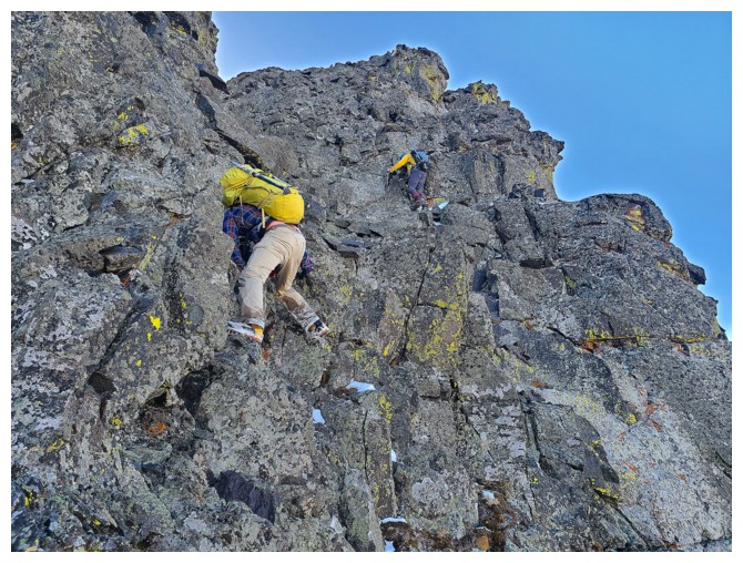
Dave and Mark wait patiently for Brad and me to ascend the step and get in a safe position (photo by Brad)
Dave is up
Still one more obstacle along the ridge before the summit (photo by Dave)
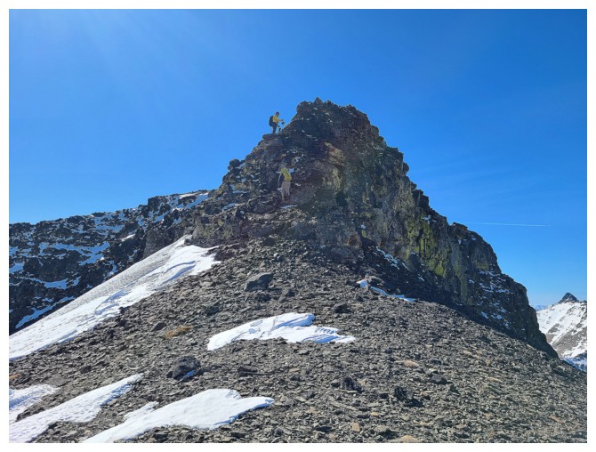
Heading up the final pitch
Once again, it looked challenging from afar, but was actually quite easy to ascend (photo by Mark)
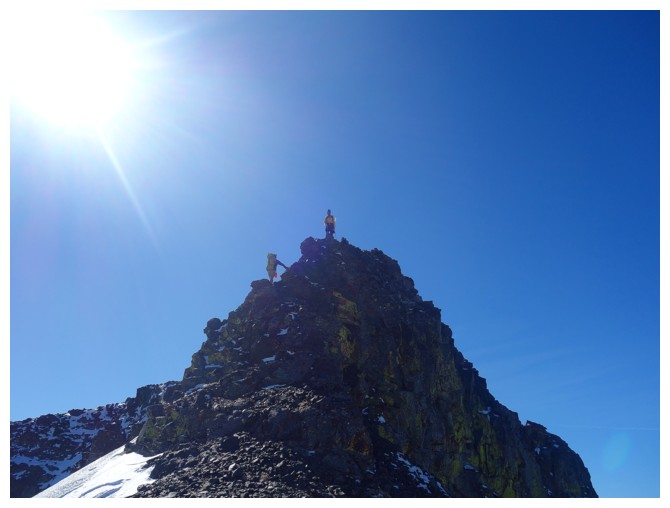
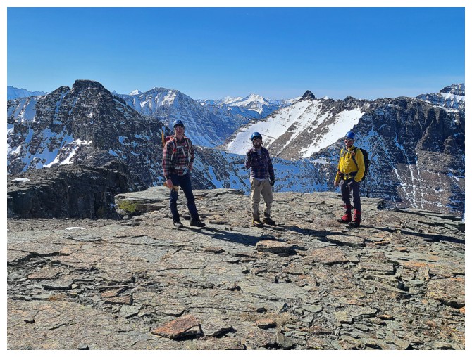
 Sweet summit success! (photo by Dave)
 Brad is giving Dave a friendly hand gesture - there's so much love in this group (photo by Dave)
 Summit of Glendowan
 Dave's huge summit smile is more than likely courtesy of Brad's friendly hand gesture
 Loaf Mountain
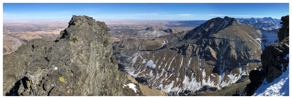
 Other Castle favourites (Victoria, Pincher Ridge, Drywood) and the snowy Flathead Range in the distance
 Mount Roche (Spread Eagle Mountain)
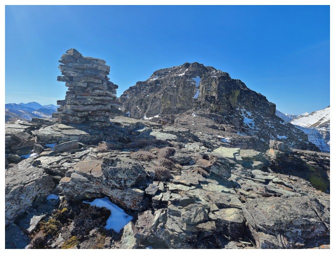
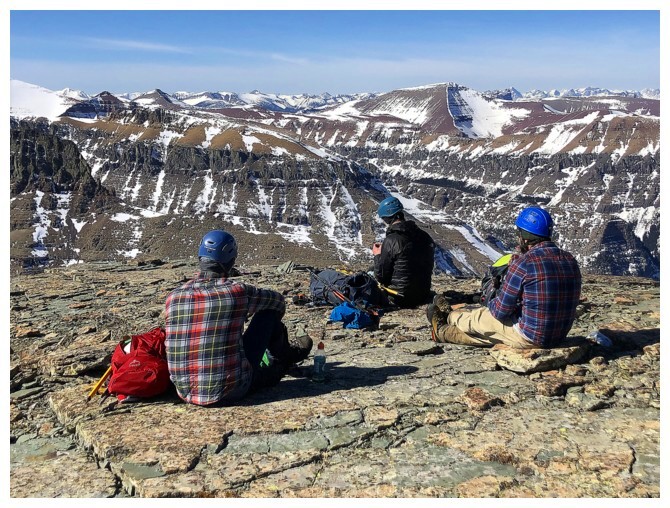
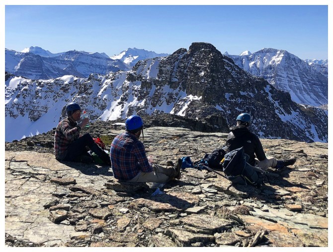 The Boys looking over to Cloudy Senior - not today
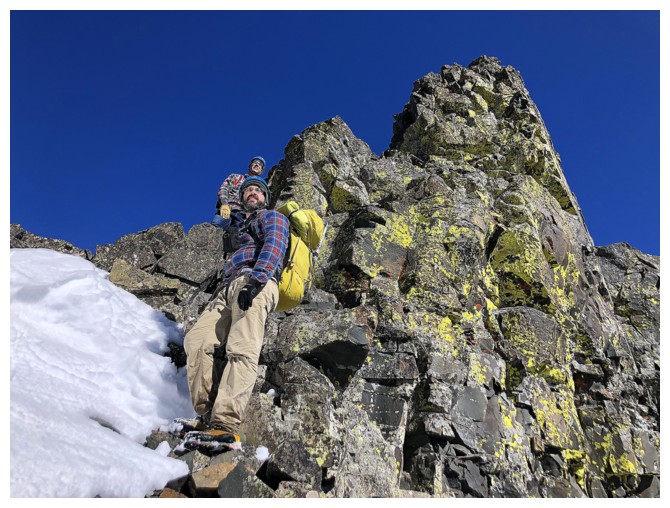
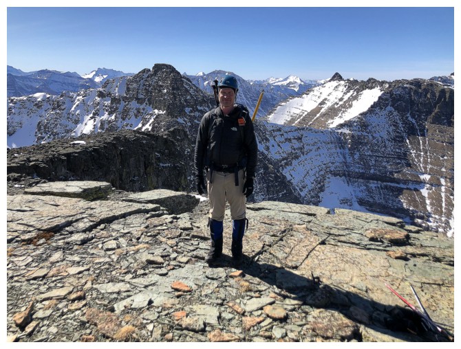
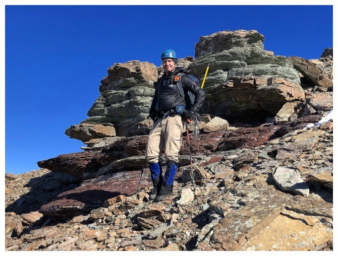
 Apparently blue is the colour choice for helmets. Mine was blue too.
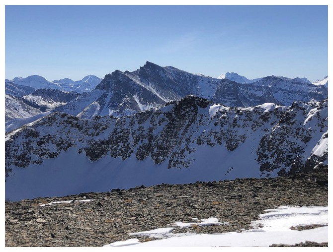
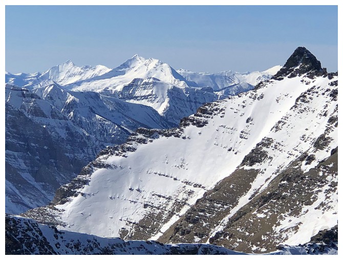 The beautiful and distinctive forms of two remote peaks: Miskwasini (far left) and Kenow. Cloudowan at the far right.
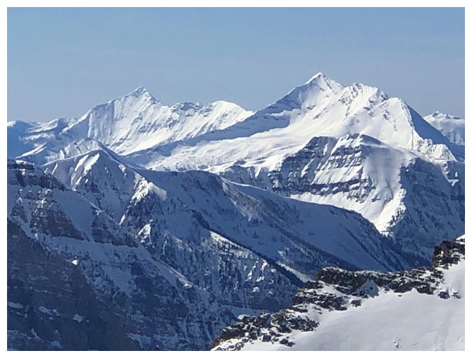 Close-up of the above (photo by Brad)
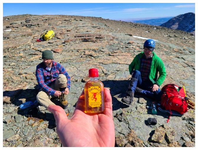 Read Dave's report to understand the significance of this! (photo by Dave)
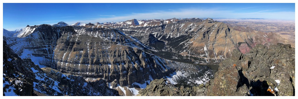
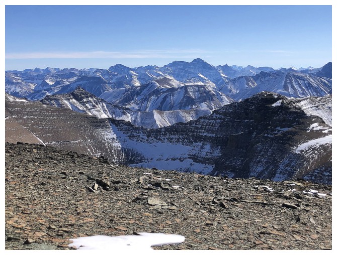 Lots of familiar
peaks to the south, including Glacier National Park's highest peak,
Mount Cleveland at 3194 m, just right of centre
Lots of familiar
peaks to the south, including Glacier National Park's highest peak,
Mount Cleveland at 3194 m, just right of centre
 Waterton's highest peak, Mount Blakiston at 2910 m
 Home time
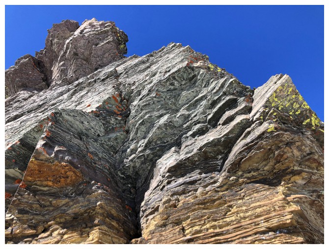
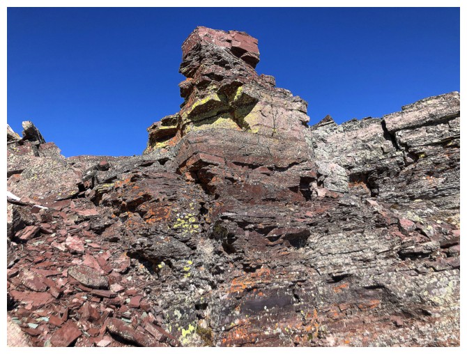
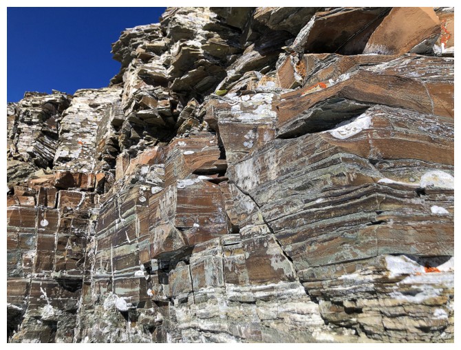
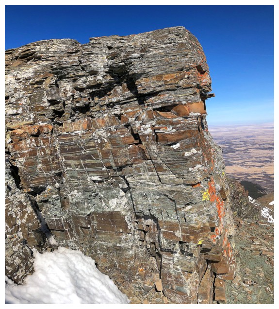 Stumbled upon this stunning rock wall on return
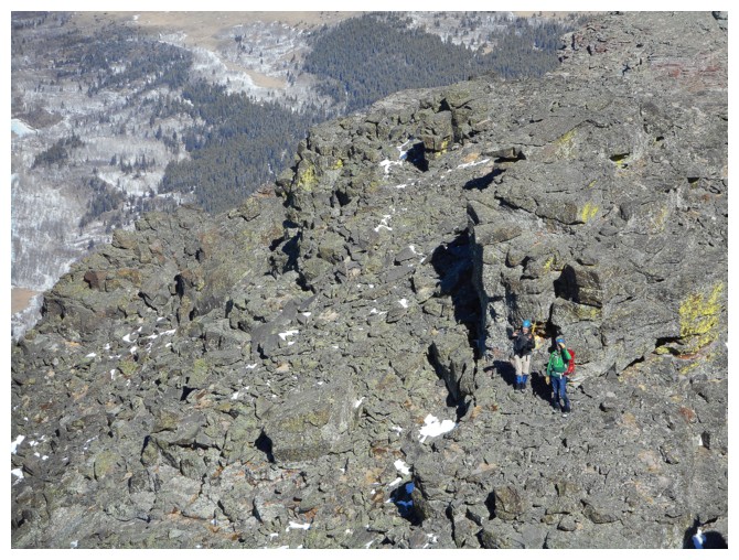
 The little detour took me to the other side of the ridge where I could see Mark making his way down
 Mark carefully downclimbs the crux rock band (photo by Dave)
 More great views from the ridge
 Mark is down the crux rock band, I'm a third of the way down and Brad is waiting at the top (photo by Dave)
 Same as above (photo by Dave)
 Easier downclimbing after the crux (photo by Brad)
 My turn to wait (photo by Dave)
Still enjoying outstanding views from various parts of the ridge
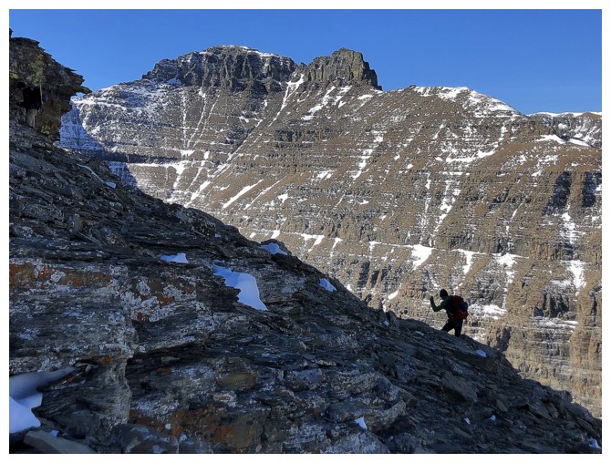
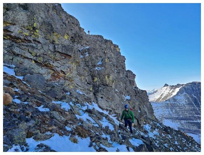
Mark carefully descends the loose terrain (photo by Dave)
Brad traverses familiar terrain
Same as above
And back up to the ridge
Almost back at the false summit and BIG cairn
More downclimbing for Mark (photo by Dave)
Took another minor detour to see this cool rock
Emerging from my detour (photo by Dave)
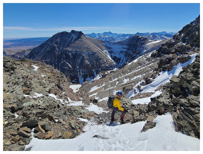
Heading down the main slope almost exactly the way we came up (photo by Dave)
Dave stops in front of a particularly striking rock band
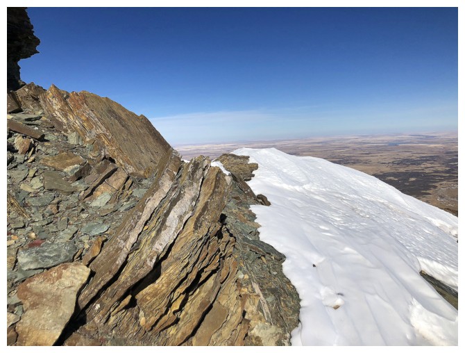
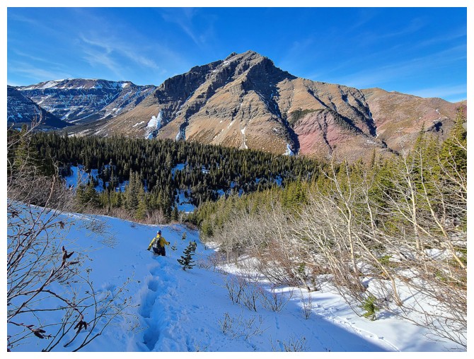
Looking down the downright nasty drainage I used for my first ascent of Cloudy Junior. This scene made me shudder, recalling that day!
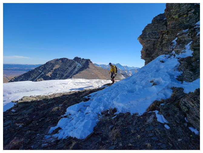
If nothing else, we get to stare at the aesthetic form of Mount Yarrow through much of the misery to come
Dave crosses the snow gully
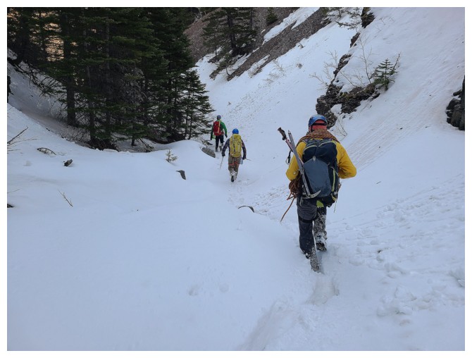
Brad and I head down the other side on a good trail (photo by Dave)
Dave and Mark follow
The snow gets deep again, but it's all downhill (photo by Dave)
Back in the main drainage and the moment of my grim realization (photo by Dave)
Dave joins us in the drainage
It started off well (photo by Dave)
Then things started to go south (even though we are traveling north) (photo by Dave)
Mark looks for a route to get around the huge drop-off in the drainage (unseen at the right)
Brad struggles through some of the worse trail-breaking of the day (photo by Dave)
No choice but to go down, back into the main drainage (photo by Dave)
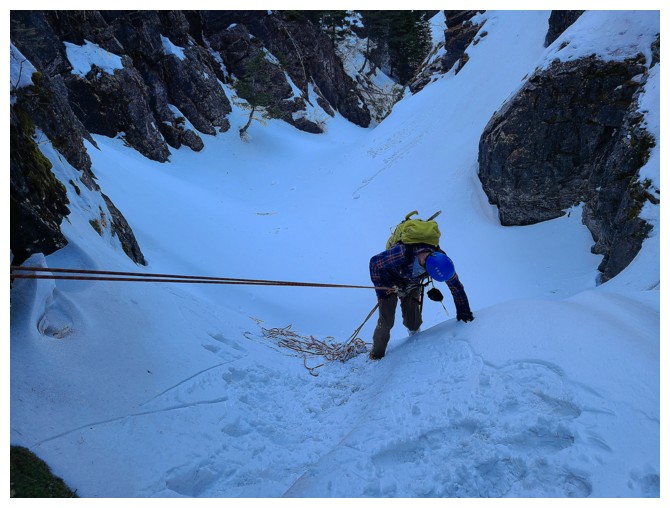
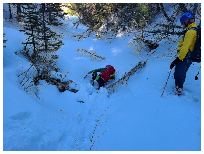
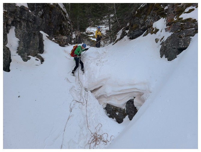
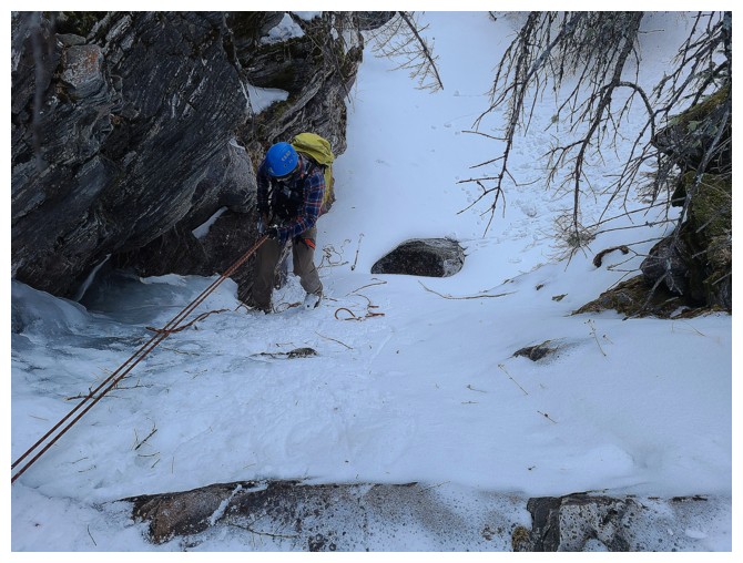
Back in the main drainage where Brad completes the first rappel (photo by Dave)
Mark raps (photo by Dave)
Round 2 of easy travel (photo by Dave)
Round 2 of rapping
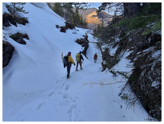
Finally passed all the tough stuff (photo by Dave)
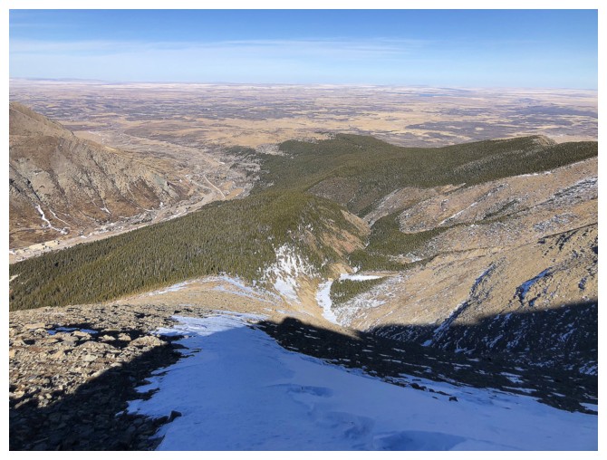
Huge relief to arrive back at the gas road (photo by Dave)
The
easy hike back was also a huge relief (except for the unavoidable
elevation gains on the Yarrow Creek trail - BOO!) (photo by Dave)
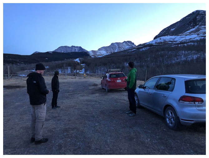
Good timing. Back at the start as the Sun sets. Totally awesome day!
The End
LOG