Cloudy
Ridge
– June 16, 2006
Mountain height:
2607 m
Elevation gain:
1100 m
Ascent time:
6:00
Descent time:
4:00
Scrambling with Mark.
Two of our most enjoyable ascents of 2005, were
We started from the
Though we were expecting high winds throughout (hence, our choice of a route
that would be going with the wind on ascent and against it on descent), the
dismally overcast skies and short, but violent periods of rain, snow and sleet,
were completely unexpected. By the time we started the actual ascent, we were
wearing our winter gloves and had on every layer of clothing we had brought
along. Looking behind us, the summits of Mounts Blakiston and Anderson were
shrouded in clouds and everything else to the west, shades of cloud white, gray
and black.
As stated, the south ridge of Cloudy Ridge had only a few minor hands-on
sections of scrambling, but the rock scenery, specifically the vertical south
face, was entertaining. The summit block (which we didn’t know was the actual
summit at the time) was very reminiscent of that of Dungarvan – a steep band
of black, lichen-covered rock atop a striking band of burgundy argillite.
Soon, we hit the first major highpoint of the ridge and a terrific view of the
mountain’s two summits. Here, we were surprised by two things: 1. the block we
had been looking at was the first summit; 2. although the topo map indicated the
second (most easterly) summit to be slightly higher, the closest (most westerly)
appeared to surpass the other in height. That was fine by us because the two
summits were separated by difficult terrain that clearly was not scrambling.
The traverse from the first highpoint to the summit was by far the most
enjoyable part of the day. The burgundy coloured ridge was lined with
interesting pinnacles and rock formations and although we continued to be
pounded by a fierce west wind, the sky above us started to clear. At one point,
we had to find shelter on the east side of the ridge, as a storm blew in and the
wind and blowing snow threatened to knock us off the ridge. The storm quickly
passed and on we went. Right before the summit, the ridge narrowed and
significant vertical walls of rock reared up before us. Fortunately, after a
little searching we found a good route around the summit block that led to
easier terrain. We set up a couple of quick belays here, as a little snow
remained on the east side of the mountain and a slip would have been very bad.
We reached the summit shortly after and in very good spirits, given that during
the ascent we had doubts on numerous occasions that we would make it to the top.
The summit itself was another pleasant surprise, for a day that had started off
a little on the rocky side. Firstly, although the wind was howling around us, on
the actual summit there was no wind to speak of – it was a most unusual
phenomena. Secondly, the summit itself was a flat and grassy plateau – great
for taking in the views and lounging around. Thirdly, the view was terrific and
lastly, it was clear that this was, in fact, the true summit of the mountain.
Even if it hadn’t been, this summit undoubtedly had a superior view to that of
its easterly neighbour.
The descent was very easy, save for yet another attempt at an alternate route to
avoid some of the bushwhacking and the tedious 150 m elevation gain. Once at the
bottom of the south ridge, we crossed over to the south side of the creek,
hoping for an easier route. The bushwhacking was actually worse here, and we
ended up having to regain a huge amount of elevation in to escape the deadfall.
In general, the alternate route was no better, but not much worse either.
Although was actual scrambling, was somewhat of a letdown, when compared to
Dungarvan and Glendowan, the overall trip was terrific.
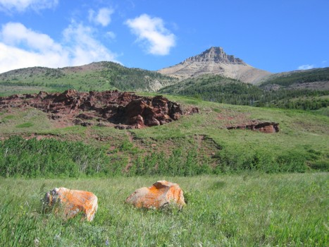
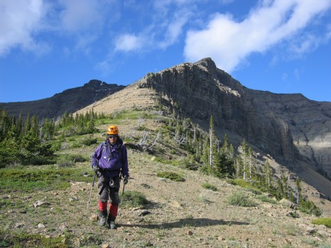
A quick look at Mount Galwey, on the way to the Red Rock canyon parking lot
On open slopes heading towards the south ridge; first highpoint is the point at the left
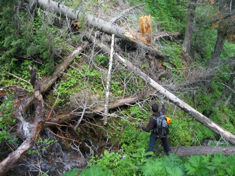
Negotiating our way around deadfall and over a stream, while losing about 150 m of elevation on ascent
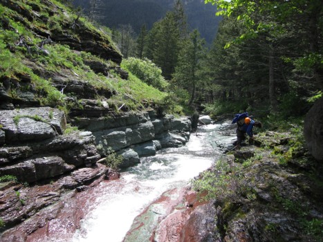
At the scenic stream
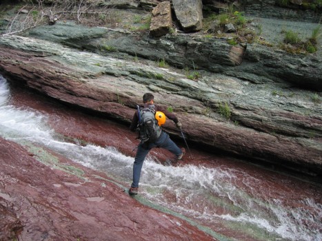
Crossing the stream
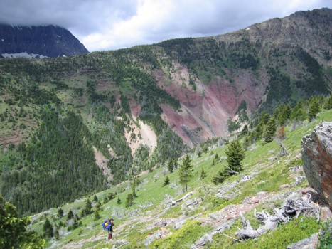
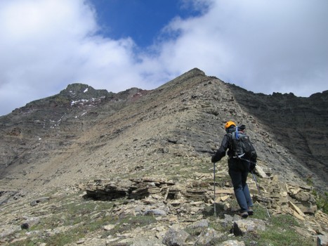
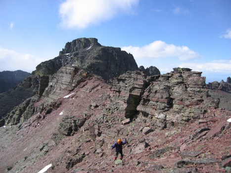
Mark slogs up the south ridge, after losing elevation from the ridge behind
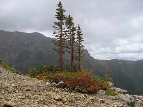
Trees
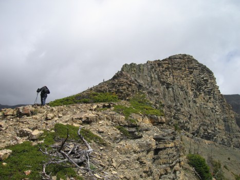
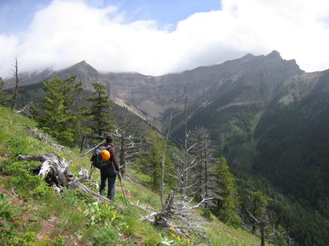
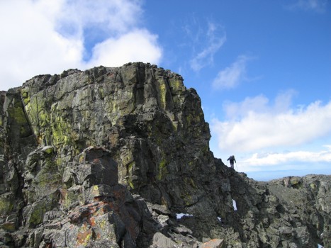
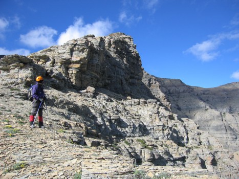
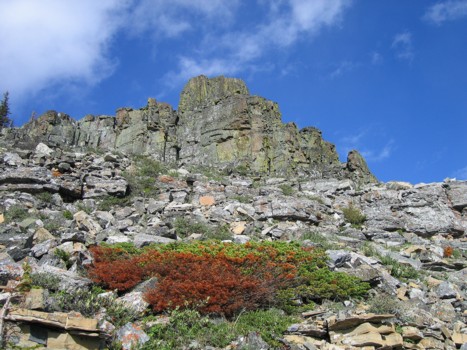
Above the treeline, looking at the steep south side of the ridge
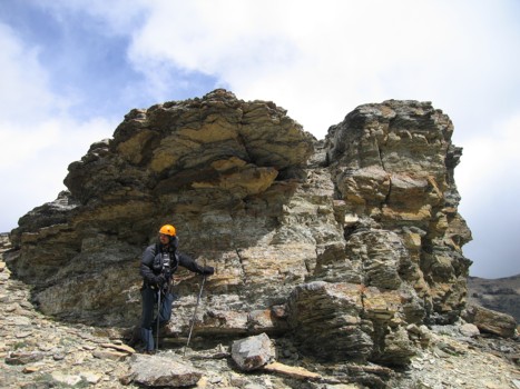
Interesting rock, but it was too windy to scramble up
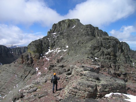
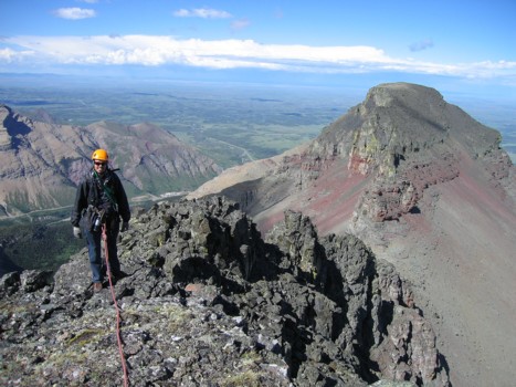
The sky clears a little; the1st highpoint just right of centre and the summit at the left
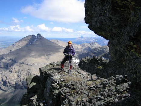
At the 1st highpoint, with the two summits of Cloudy Ridge
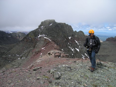
Me at the highpoint, with our objective behind
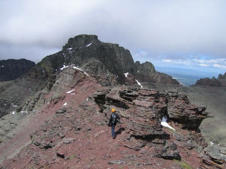
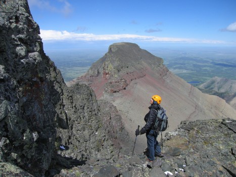
Starting the scenic traverse to the summit
The ridge
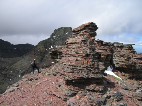
Interesting pinnacles on the ridge
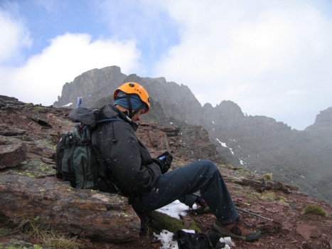
Checking the GPS, while taking shelter from a violent storm that was blowing in from the west
About halfway across the ridge
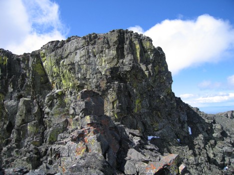
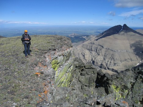
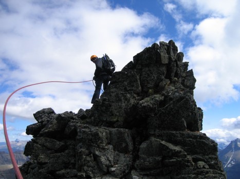
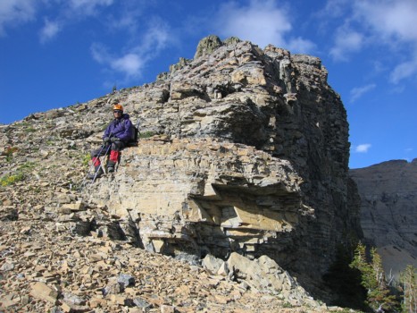
The summit block; the scramble route goes around the right side
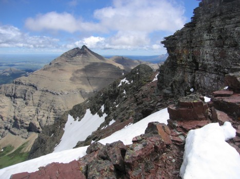
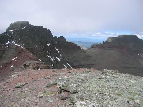
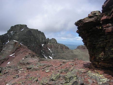
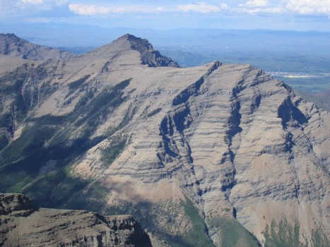
Looking back to Mount Dungarvan (just left of centre)
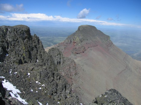
The east summit of Cloudy Ridge
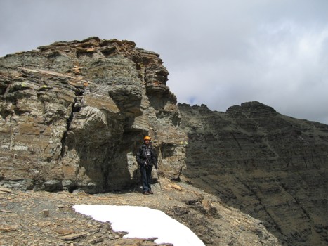
Searching for a route around the summit block
Mark traverses a wide ledge around the block
Checking out the east side of the block; no route up that way either!
At the summit, with Dungarvan to the right
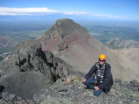
At the summit, with the east summit behind
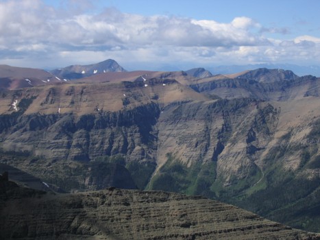
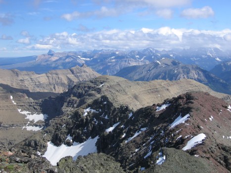
Looking north to the Castle area
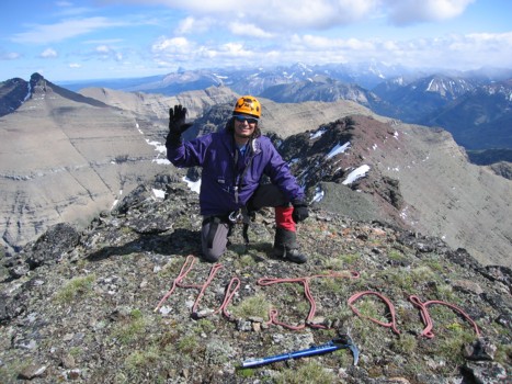
Saying "Hi" to a friend in England - Jan Ridgeway (the perfect surname for someone who loves the mountains); sorry Martin, we ran out of rope when we got to the "T" and didn't want to abbreviate your name to "Mart" (guess we should have brought 60 m of rope instead of 30!)
(obviously not Cloudy
Ridge!)
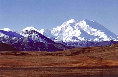
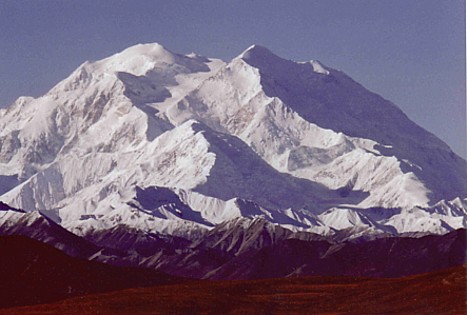
Jan took the amazing photos (above and below) of North America's highest
mountain, Mount McKinley (Denali)
The summit view south; Chief Mountain to the very distant left
Another view of the east peak of Cloudy Ridge
A good indication of the wind velocity on the ridge
Clearer skies as Mark heads back along the ridge
Looking back at the south face, on descent
More great colours on the way down
Mark rests before we head down to the creek for another 1.5 hours of evil bushwhacking
A last look at the south ridge and the summit block (left)
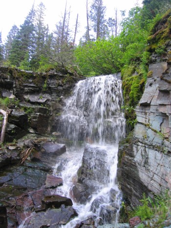
A waterfall