Mountain height: 2,863
m (9,393 ft)
Elevation gain:
1,250 m
Ascent time:
4:00
Descent time:
Solo scramble.
As
soon as I stopped sulking about the miserable weather, when a good weather day was once
again forecast, I quite enjoyed this scramble. I doubt that
The 12.3 km
bike approach took me an hour and 15 minutes. It might have taken a little less
had I realized before completing the entire approach that my back tire was half
flat. Thankfully, I brought the bike-pump to fix the situation for the return
trip. A steep hike through forested slopes took me to the open ridge, where the
ascent becomes a no-brainer. Through most of the ascent, the sky was completely
overcast and it rained steadily for a good hour. Thick, ominous clouds enveloped
everything to the west and I didn’t expect to see any good views at all. This was rather a shame, as Cougar Mountain is quite a shapely and interesting peak
and looks great when backdropped by a clear, blue sky (see Bob Spirko’s
webpage at: http://scrm.250free.com/CougarMtn/CougarMtn.html).
As I ascended
the ridge, I tackled some of the steeper terrain head-on and avoided other
sections, usually going to the left. If I had to do it again, it would tackle
them all head-on, just to provide some relief from the monotonous scree slog.
The sky eventually cleared to the east, revealing some surprisingly interesting
and scenic peaks, such as
By the time I
reached the false summit, cloud cover to the west had worsened and a wall of
dark, rain clouds threatened to blanket Cougar’s true summit, as well as all
the surrounding mountains. I was quite sure I would reach the summit in a
downpour and with extremely limited visibility. Certainly not for the first time
in my life, I was wrong, and although the sky to the west never cleared
completely, the approaching clouds seem to whiz by and dissipate as soon as they
hit the border between the mountains and the foothills.
It took me
about 45 minutes to get from the false summit to the true summit, and once
again, there were a few opportunities to tackle some steeper scrambling. At the
summit, I was assaulted by a viciously cold and strong wind and after taking the
compulsory pictures descended a little to take shelter behind a small rockband.
I decided to wait to see if there would be any clearing to the west and even
curled up to take a brief nap. Brief it was, as the temperature up there
couldn’t have been more than a few degrees above zero and I didn’t have a
very thick outer later. There was a little clearing, revealing the snowy east
faces of Mount Rae, Mist Mountain, Storm Mountain, Elpoca and the two summits of
Tombstone Mountain, but I could see more clouds behind and it became obvious
that this was as good as the view was going to get. The cloudy skies did,
however, help create a couple of stunning rainbows – one right in front of
The descent
was easy, but a little slow – with clear skies to the east I had to stop to
take all the photos I missed on the way up – aren’t digital cameras great!
There was also a beautiful array of colours at the treeline, with plants and
vegetation changing to stunning autumn reds and yellows. Unfortunately, the
clouds and accompanying rain were really coming in from the west now and I made
a beeline down the forested slopes and back to the trail, only minutes away from
my bike. With a fully inflated back tire and some long stretches of very gentle
downhill riding, the bike ride back was mercifully easy and at 40 minutes, took
almost half the time of the ride to the mountain.
I can’t say
I’ll be counting the days until I ascend this mountain again, but I’m sure
I’ll return someday, hopefully with better weather.
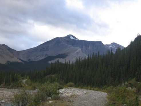
Cougar Mountain, as seen from the approach trail
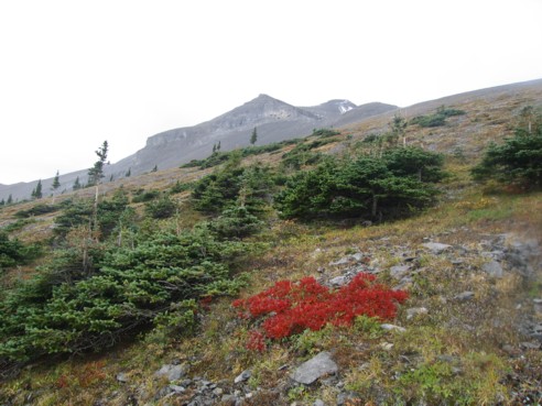
Interesting colours enroute to the ridge
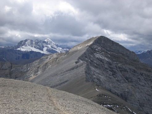
The true summit, as seen from the false summit; the snow covered peak to the left is Mount Rae (picture taken on descent)
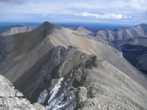
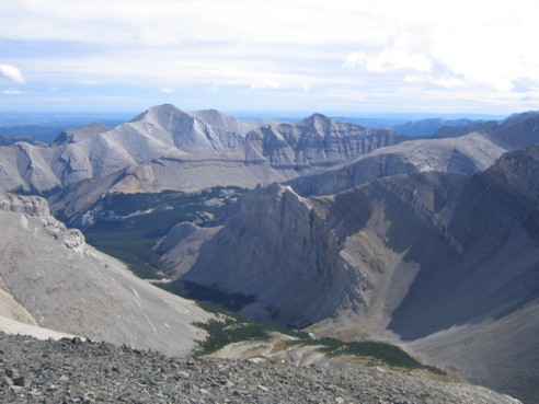
Looking back to the false summit from the true summit
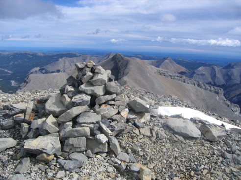
The summit cairn, with the false summit behind
The view to the southeast; the peak lefy of centre is Bluerock Mountain (I think?)
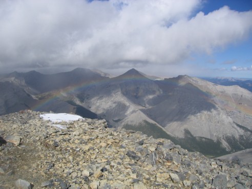
A rainbow in front of Banded Peak
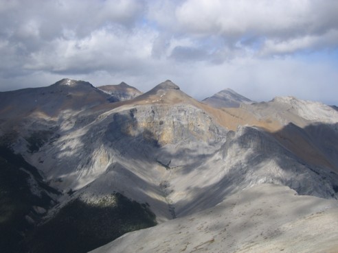
A better view of Banded Peak; Outlaw and Cornwall are to the left of Banded Peak and Glasgow is to the right
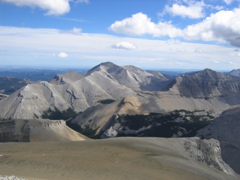
Another view of Bluerock Mountain (I think??)
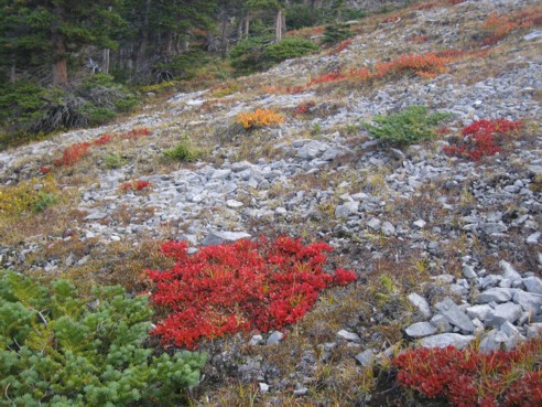
More interesting colours, seen on descent
HOME
SCRAMBLES
MOUNTAINEERING
OTHER
TRIPS
PHOTO
GALLERY
LOG
FAVOURITES
LINKS