Crypt Peak II
September 2, 2018
Mountain
height: 2610 m
Elevation gain: 1370m
Ascent
time: 6:10
Descent
time: 4:50
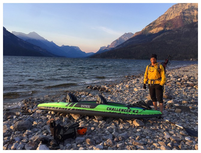
Scrambling
and kayaking with Mark.
A little
over a month and $130 later (the price of an inflatable 2-person kayak) we were
on our way to attempt Crypt Peak
once again. This was a very last minute
decision, as we were waiting for a windless, cloudless, smoke-free day
to make
the attempt. We didn’t get exactly that kind of the day, but we both
agree that the trip was definitely one of our "finest hours" (actually
about 12 of them!).
 Windless
– not even close! The only reason we needed a relatively windless day
was to
accommodate the crossing of Upper Waterton Lake in a kayak. It was
windy, but
we went anyway. To put the mildly, the crossing was harrowing at best
and
terrifying at worst! Fair sized waves threatened to capsize us on
numerous
occasions and halfway across the kayak was full of water. In a state of
mild panic we decided to head straight across the lake to the nearest
shore, as
opposed to going southeast to Crypt Landing. Thankfully we didn’t sink
or drown
– personally, I was never so happy to put my soaking wet feet on dry
ground!
Windless
– not even close! The only reason we needed a relatively windless day
was to
accommodate the crossing of Upper Waterton Lake in a kayak. It was
windy, but
we went anyway. To put the mildly, the crossing was harrowing at best
and
terrifying at worst! Fair sized waves threatened to capsize us on
numerous
occasions and halfway across the kayak was full of water. In a state of
mild panic we decided to head straight across the lake to the nearest
shore, as
opposed to going southeast to Crypt Landing. Thankfully we didn’t sink
or drown
– personally, I was never so happy to put my soaking wet feet on dry
ground!
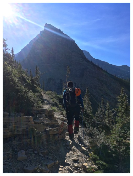
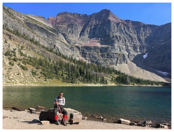
A 2 km
hike to Crypt Landing followed and then the additional 8.7 km to Crypt Lake. Throughout,
we enjoyed beautifully cloud- and smoke-free skies and hoped for no change.
That didn’t happen either.
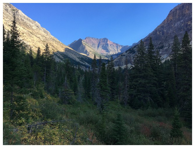
As we
headed up to the north ridge of the objective, clouds started to form all
around and the sky to the north turned to that nasty colour of forest fire
smoke haze. BOO!!! As always, when the weather goes down the toilet, so does my
motivation to continue. However, we had not braved (perhaps foolishly) the
precarious crossing of Upper Waterton Lake only to turn around an hour before
the summit and so onward and upward. And of course I was being super picky and
critical of the weather at this point, due to the fact that we had perfect
weather for our first attempt; in fact it could have been way worse.
However,
the most important factor that kept us moving was the stunning rock scenery
around us and that which we knew was to come. The red argillite summit block had
“wowed” us on attempt number 1 and we expected no less this time around. After
gaining the north ridge via a very interesting and challenging route, going
much farther north than attempt 1, we headed towards the summit block, hoping
its bark was worse than its bite.
 Not only
was the ascent considerably easier than we thought it would be, but the
argillite scenery was likewise considerably more stunning than predicted. It
was here that we were both very relieved to have kayaked across the lake,
thereby eliminating any sense of urgency to summit and return before the last
boat left Crypt Landing. We were able to take our time and enjoy some of the
best rock scenery we’ve ever seen. In fact we agreed that the Crypt Peak summit
block was our favourite of all time (so far).
Not only
was the ascent considerably easier than we thought it would be, but the
argillite scenery was likewise considerably more stunning than predicted. It
was here that we were both very relieved to have kayaked across the lake,
thereby eliminating any sense of urgency to summit and return before the last
boat left Crypt Landing. We were able to take our time and enjoy some of the
best rock scenery we’ve ever seen. In fact we agreed that the Crypt Peak summit
block was our favourite of all time (so far).
The next
pleasant surprise of the summit block was to pop over the ridge and arrive
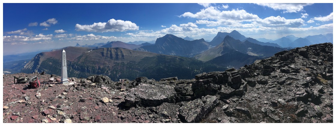
directly at the summit and a very cool boundary marker. The summit of Crypt
Peak sits exactly on the border between Canada and the United States.
And
finally, the clouds started to clear and, although the north remained a little
hazy, there was significant improvement from the morning. We stayed at the
summit for 50 minutes (yet another advantage of kayaking), enjoying a
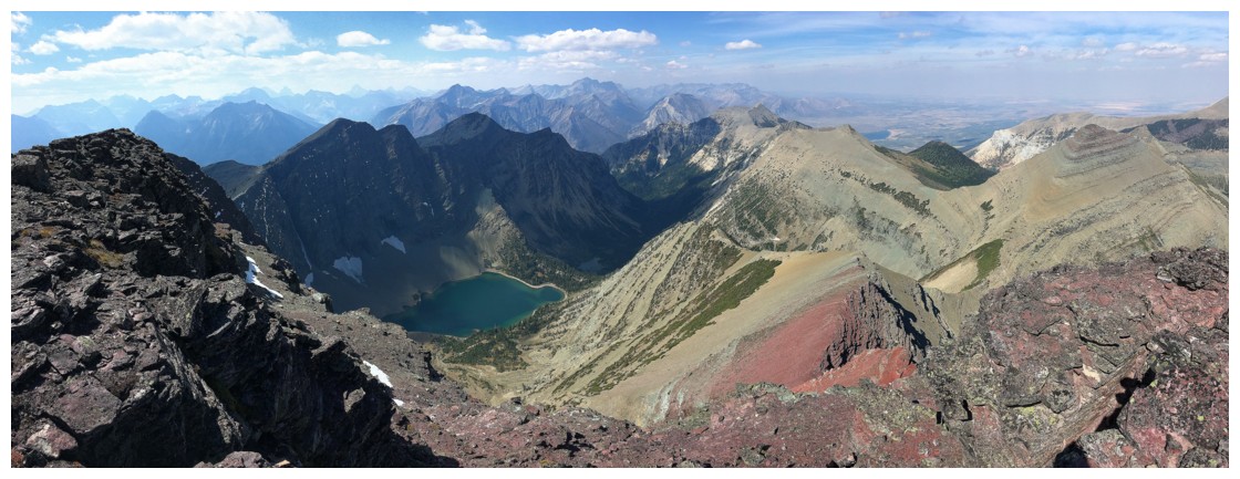
thoroughly engrossing panorama. Statuesque Mount Cleveland remained in
silhouette, because of the position of the Sun, but still captured much of our
attention; Crypt Lake far below the magically colourful slopes of Crypt Peak got
pretty much the rest of it.
Leaving
this awesome summit was difficult, but we had a long descent ahead and the
kayak ride back was an unknown, due to the potential of a repeat performance of
the morning adventure. Getting down the summit block to the ridge took as much
as ascending that same terrain; not because difficulties were encountered, but
simply because the red scenery was even more stunning than on ascent. The remainder
of the descent was less interrupted and mercifully the winds had subsided a
great deal during the day. Instead of paddling directly across the lake, we
followed the east shoreline of the lake in a north direction and then crossed
to the other side at the narrowest point. This time the wind at our
backs actually assisted our return trip.
Definitely
one of our best days ever in the mountains. From an adventure and scenery
perspective this trip is unbeatable – just go on a calm day!
All smiles as we prepare for the daring crossing!
The waves may not look too big, but they were big enough to toss us about a fair bit and almost capsize the kayak.
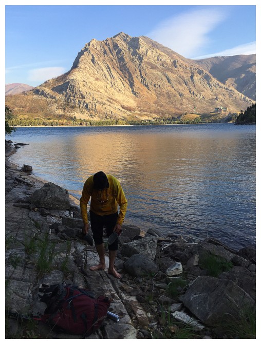
At the very least I had the sense to wear runners for the boat trip!
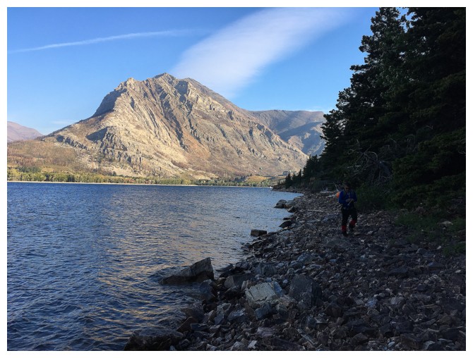
Hiking along the shoreline to Crypt Landing
Mount Crandell has changed considerably since the fires of 2017
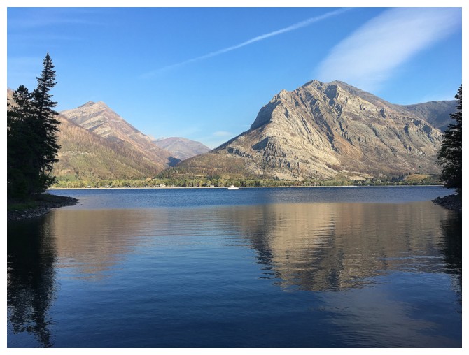
Mount Boswell looks terrific in the morning Sun
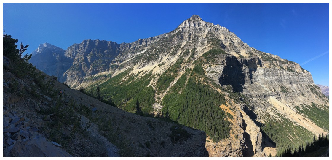
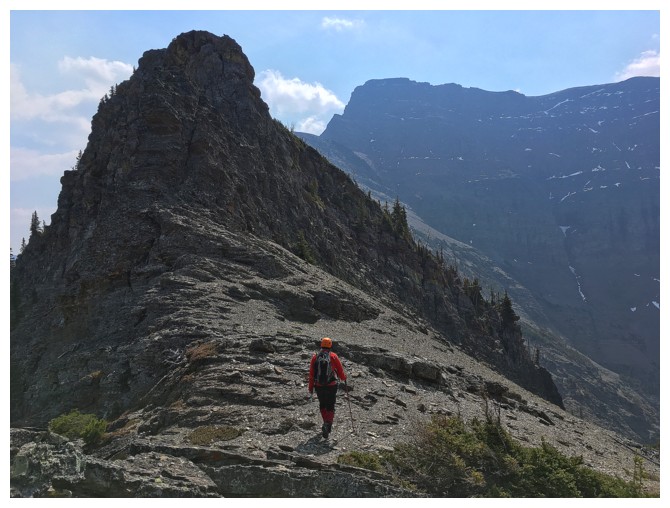
The northwest wing of Crypt Peak is straight ahead
Approaching the tunnel
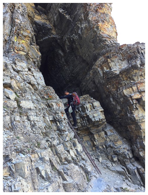
Heading into the tunnel
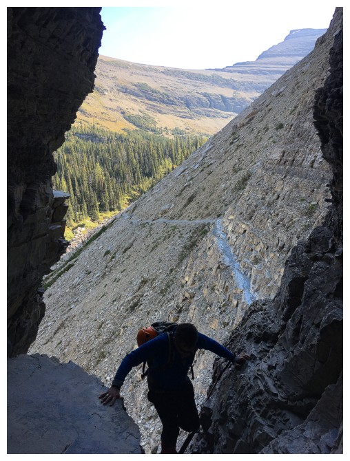 \
\
Mark joins me in the tunnel
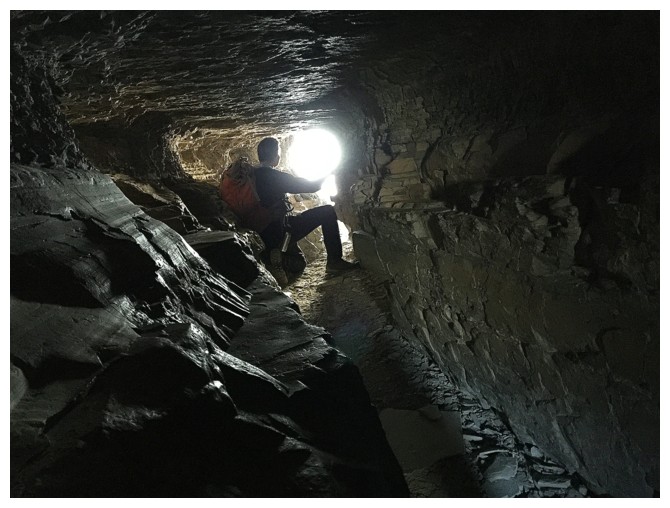
It's a tight fit in there
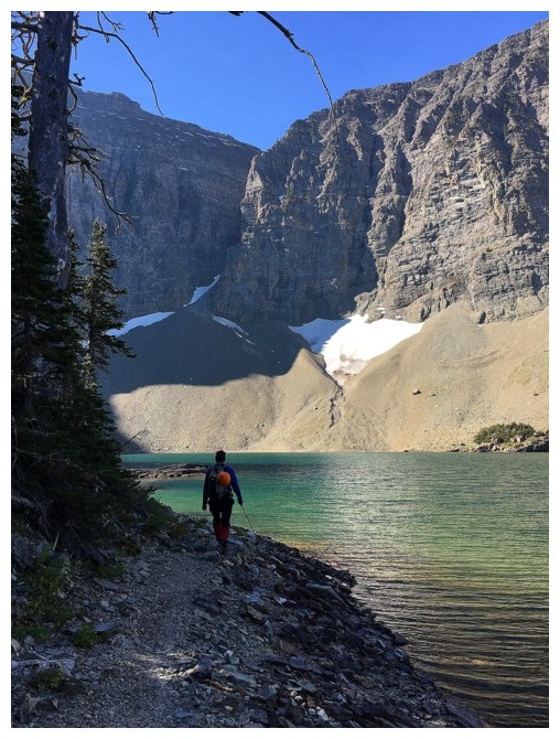
Hiking around Crypt Lake
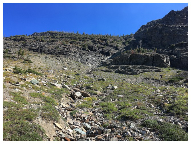
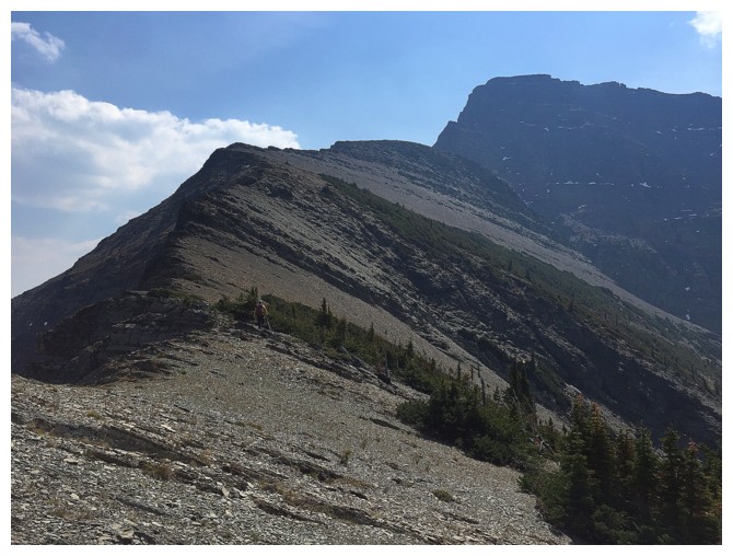
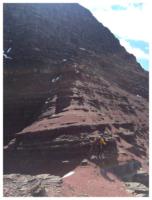
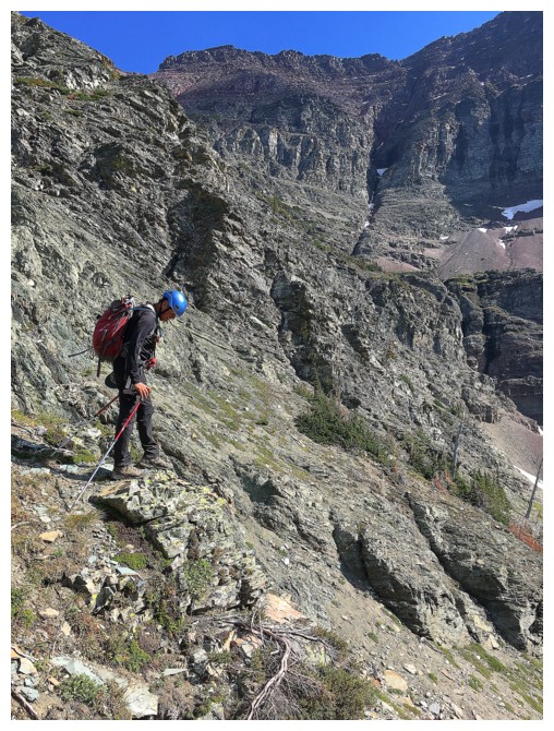
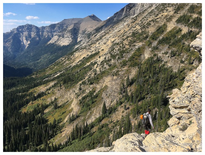
On our first attempt we followed the gully
that curves to the right. This time we went more left and ended up
doing some pretty serious scrambling.
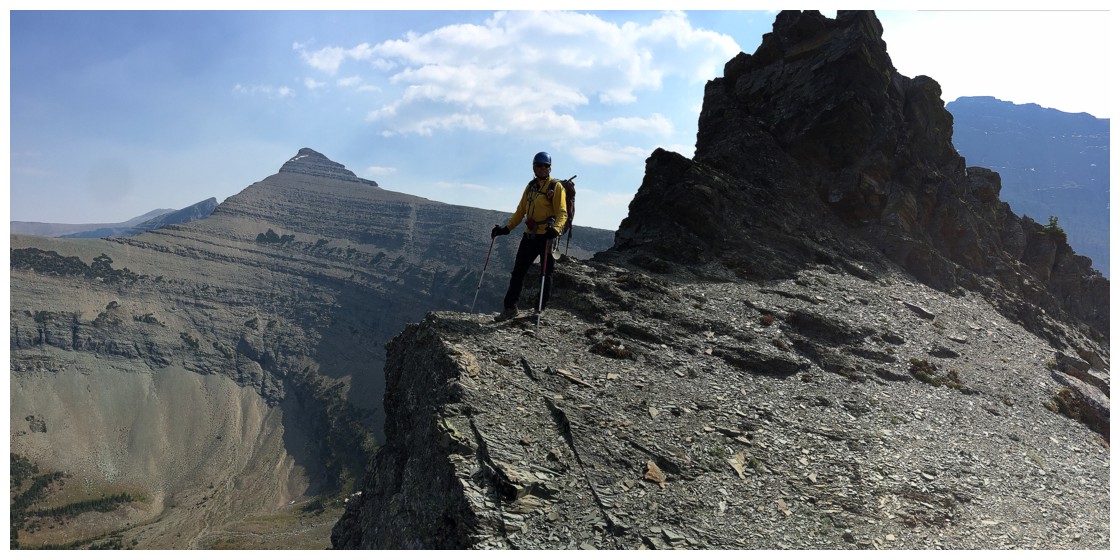
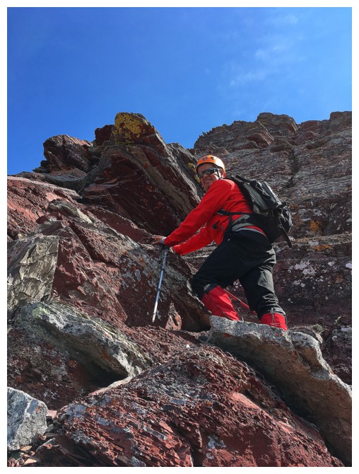
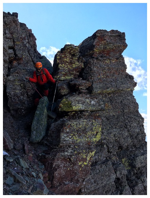
On the ridge with a cool obstacle behind to scale
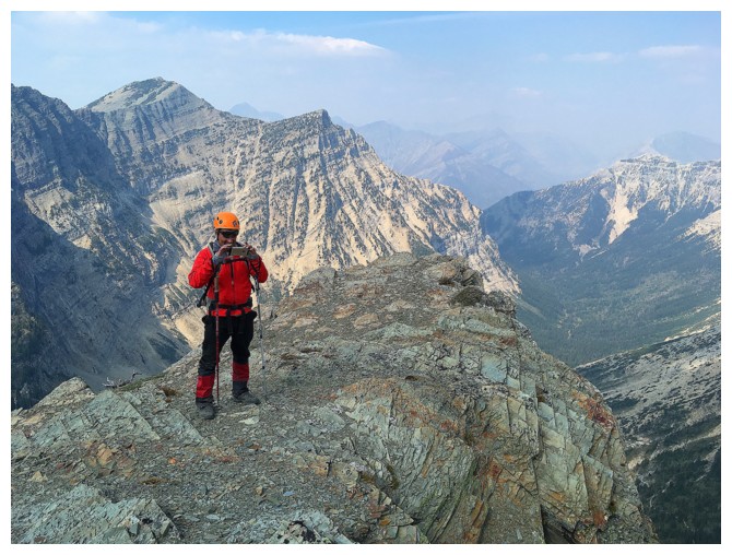
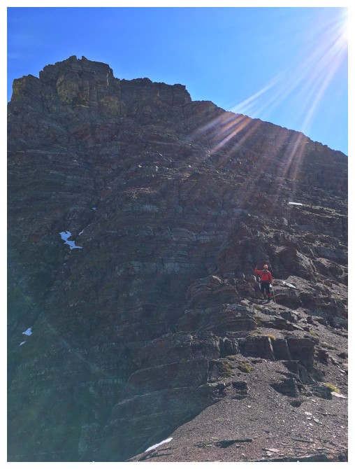
Clouds above us and very hazy to the north
Mark approaches the section of difficult scrambling
...and then leads the way up
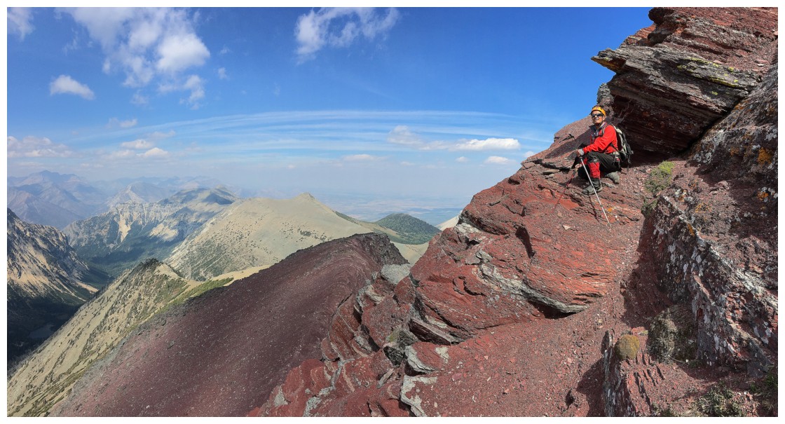
Easy ridgewalking to the summit block ahead
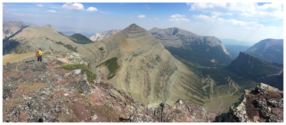
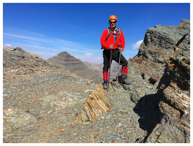
Vimy Peak (far, distant left), Arras Peak
(next one over), the highpoint of Vimy Ridge (the cool looking one) and
Sofa Mountain (behind)
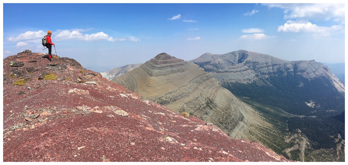
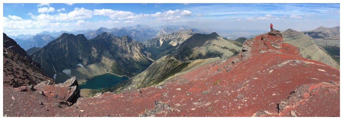
Throw in a little red argillite with Vimy and Sofa
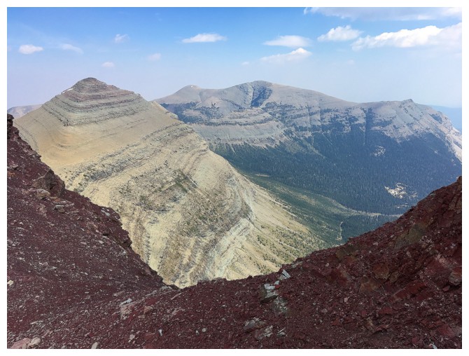
The argillite takes on a different hue when the Sun is blocked by clouds
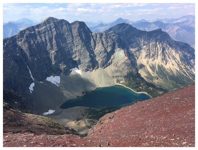
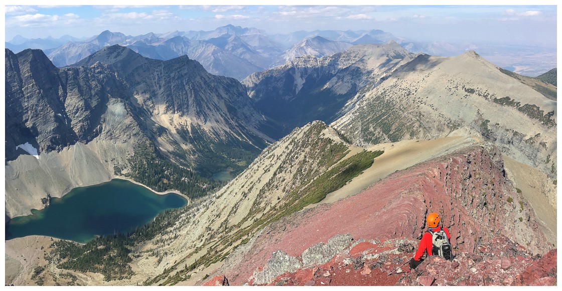
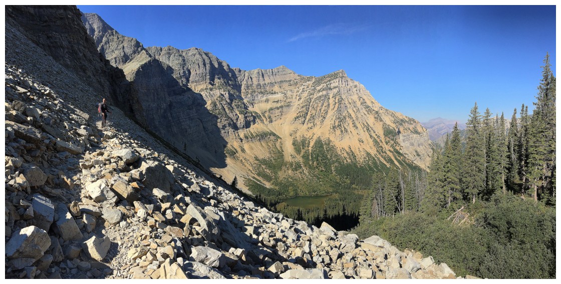
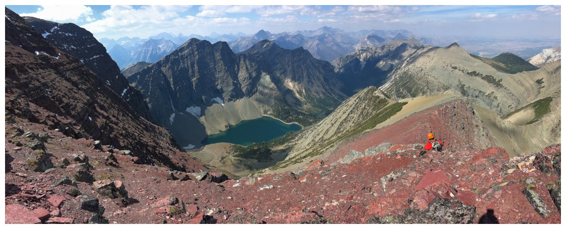
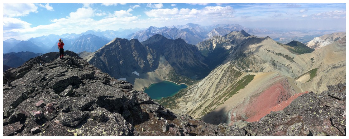
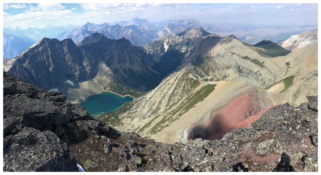
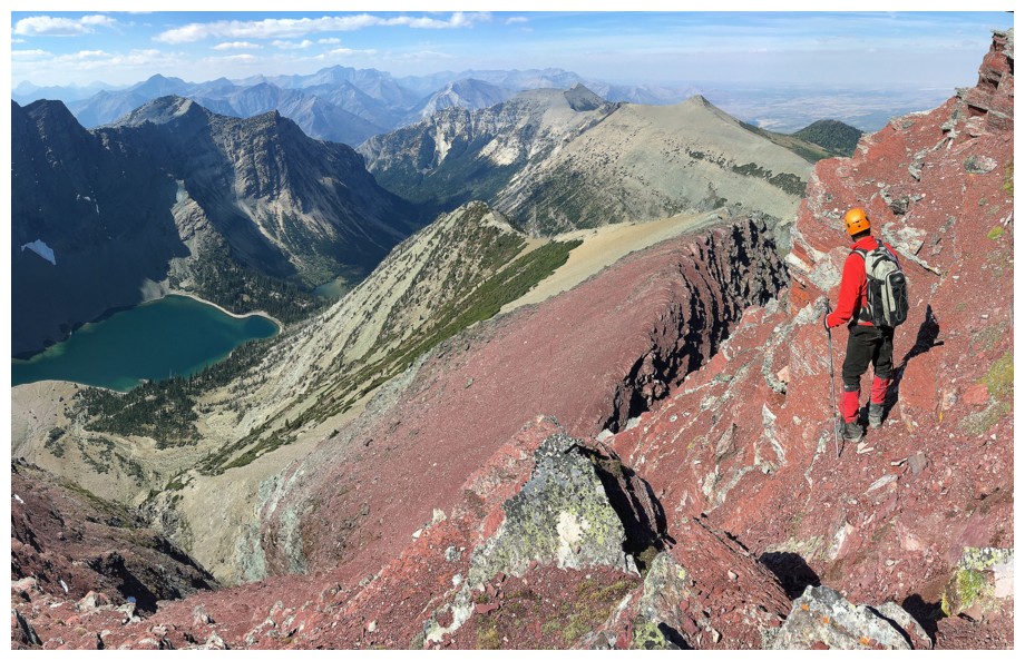
Crypt Lake far below
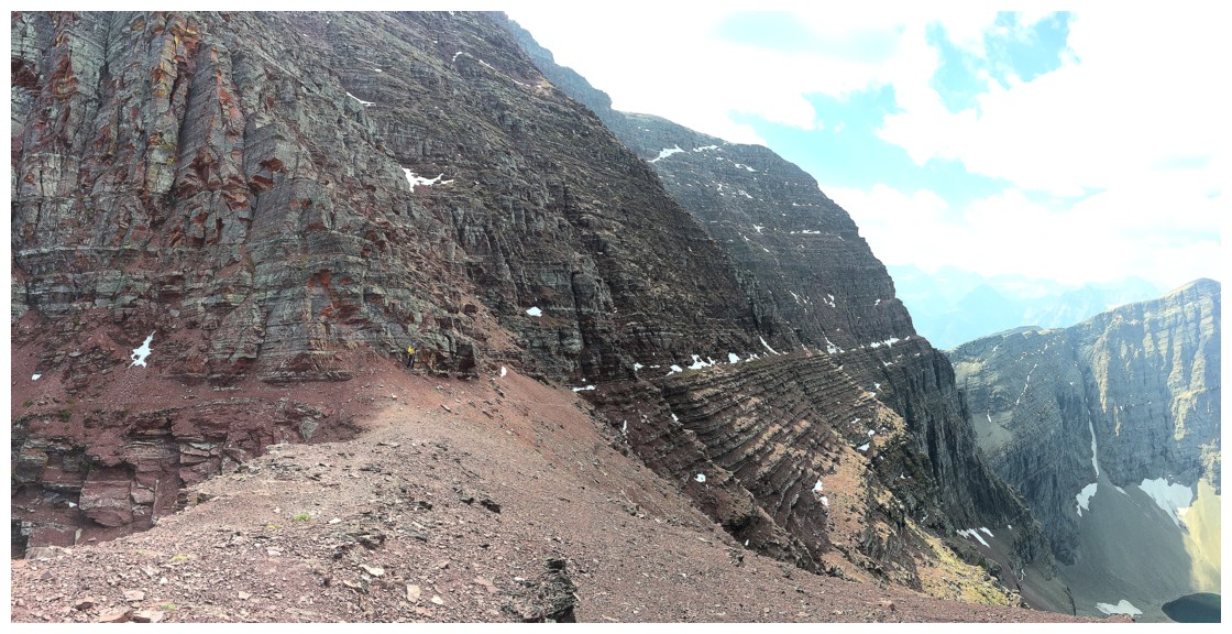
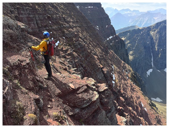
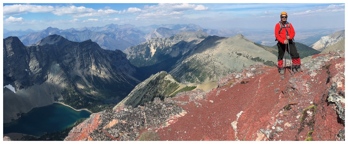
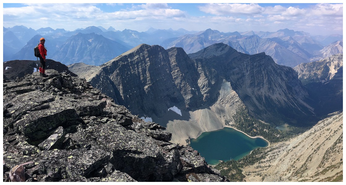
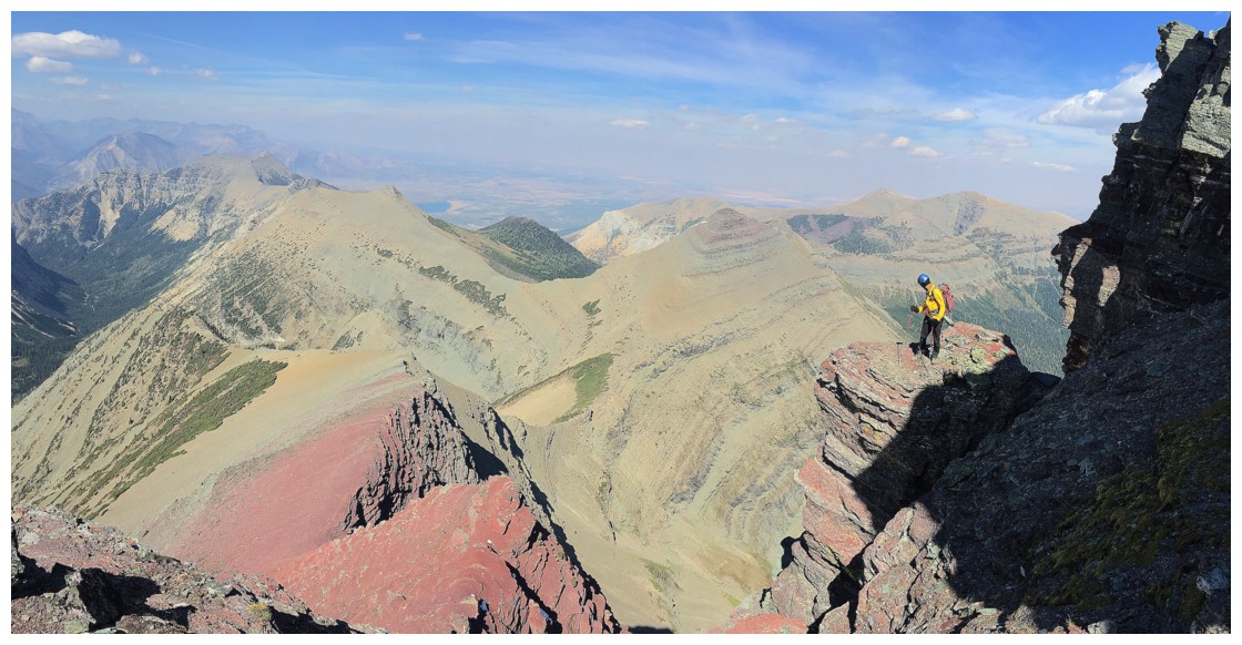
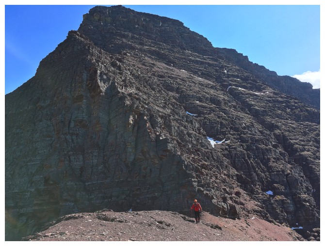
The impressive northwest face of Crypt. I'm standing at the base.
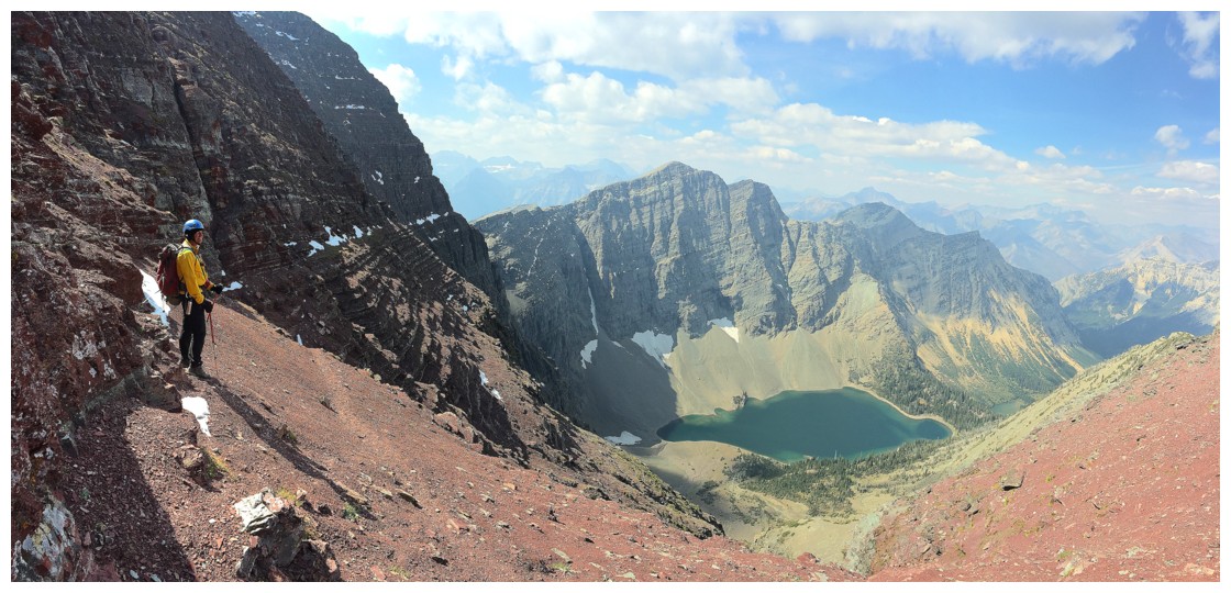
Even from the base of the summit block, the views are nothing to sneeze at
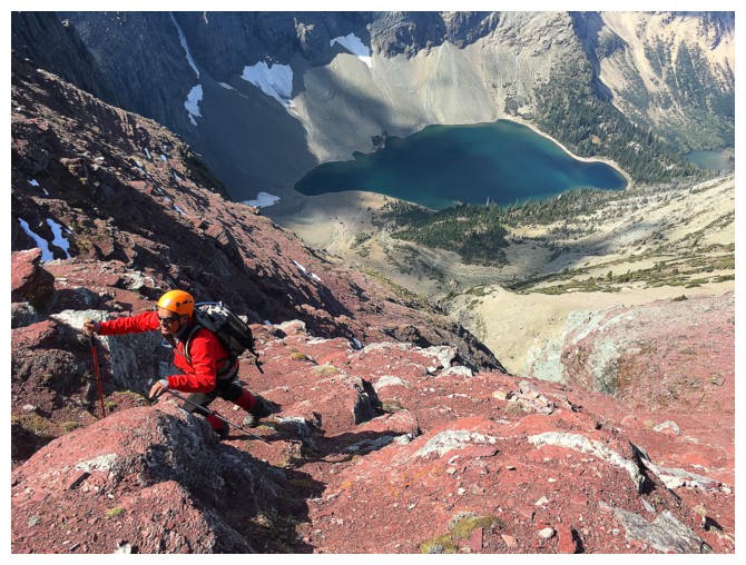
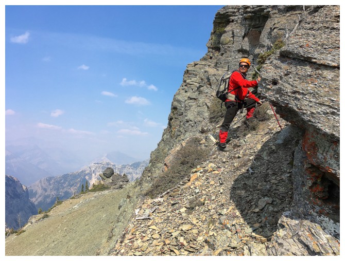
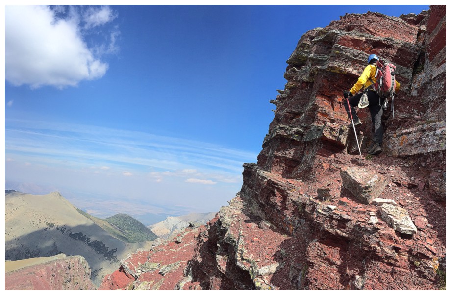
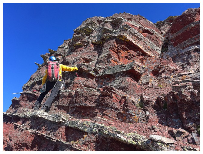
Up we go
Once again, hooray for the horizontally oriented rock of the southern Canadian Rockies
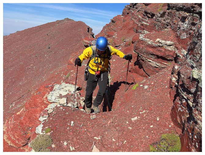
Happy to be ascending this awesome terrain
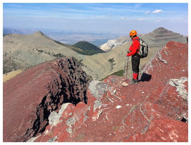
Lots of places to rest and enjoy the views
Looking for the easiest way up. It was not difficult!
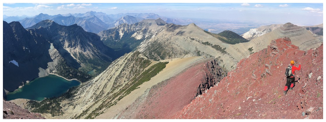
So much beautiful terrain to explore
...and so many colours!
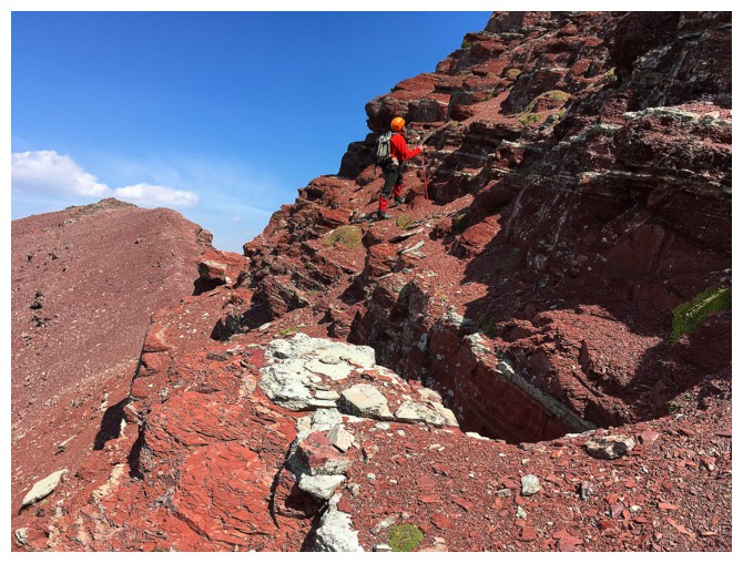
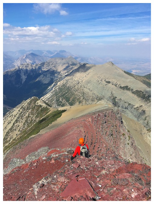
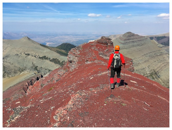
One of the highlights of the summit block is this little minor summit of bright red rock
Mark at the little summit
Continuing up to the next section. The ascent route goes up and to the left - it's far less steep than it appears.
Looking back at Mark at the little summit
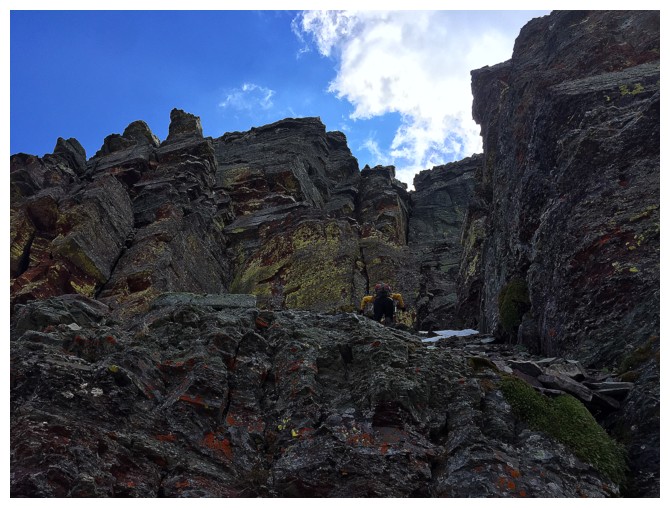
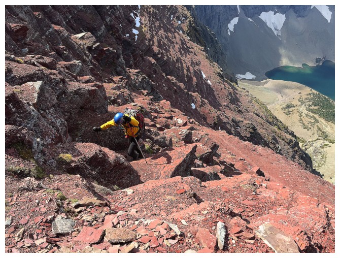
Fun and slightly exposed terrain near the summit
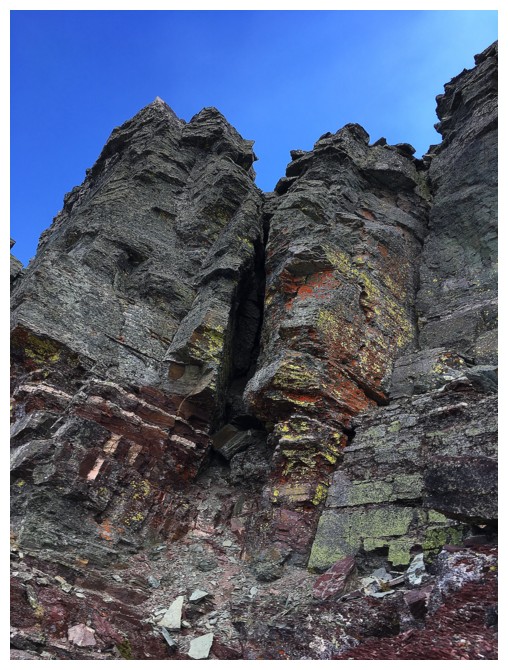
The summit is guarded by this rock band, but there is a weakness around the right side
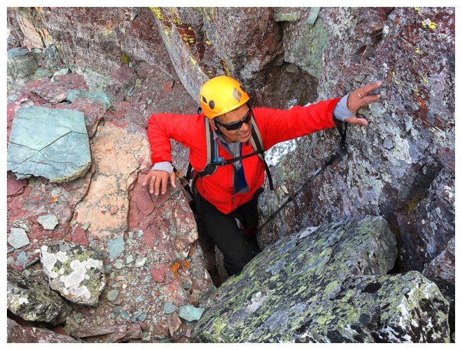
Mark scrambles up the weakness
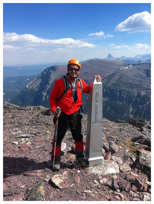
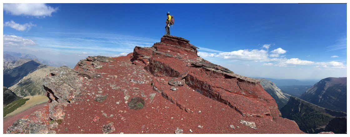
Triumph!!
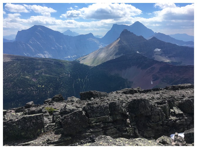
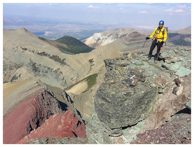
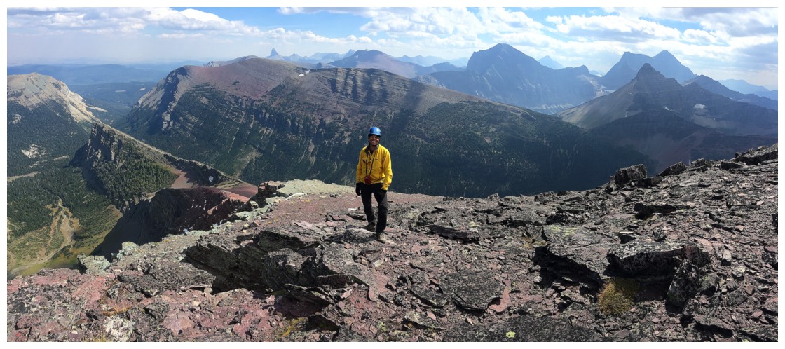
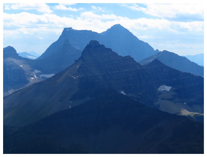
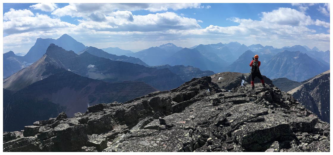
Kaina Mountain (left) and Mount Cleveland (distant right)
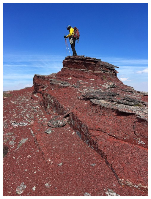
Lots of summit views to follow
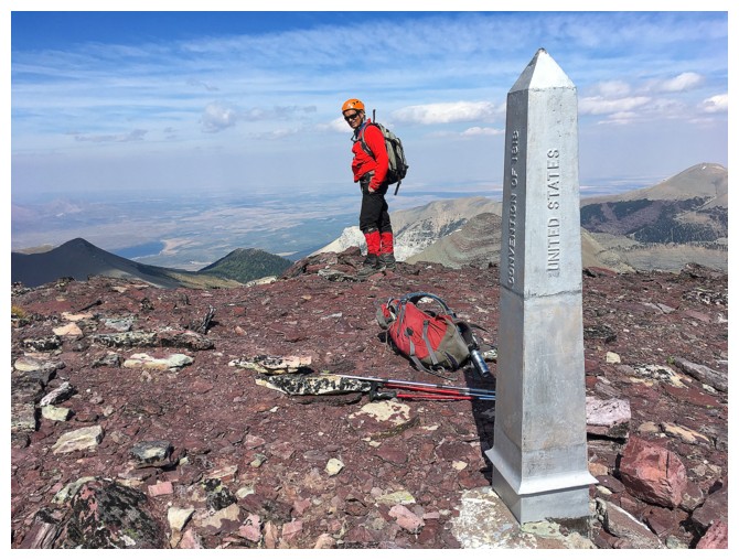
Subject in Canada; photographer in the U.S.
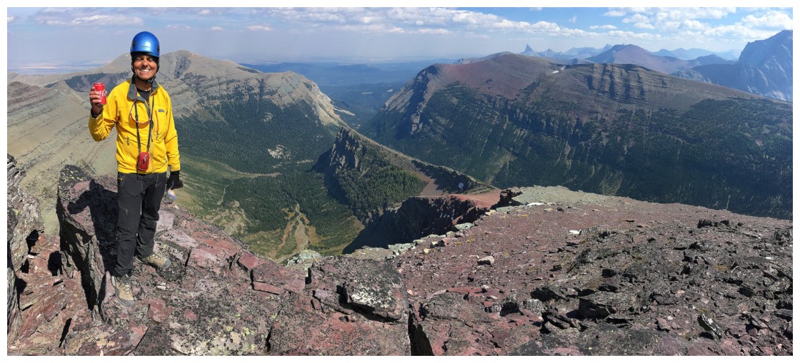
Still carting cans of pop up to the summits!
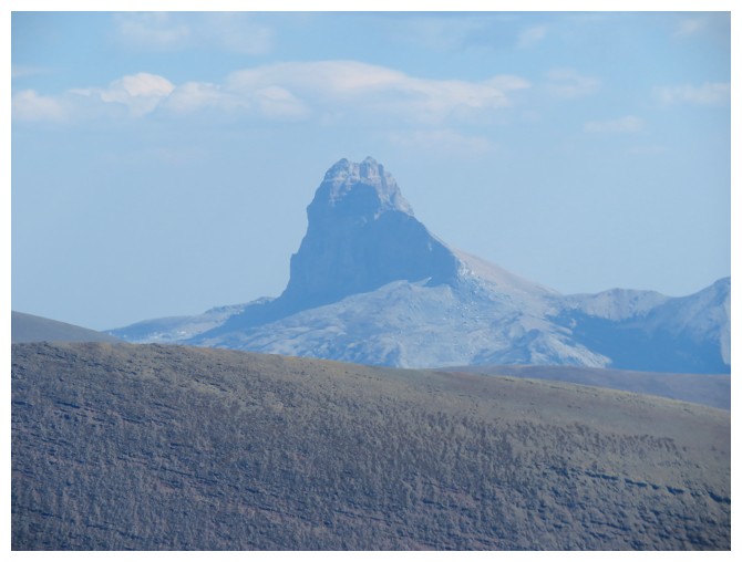
Chief Mountain
Miche Wabun Peak in front of Mount Cleveland
More exploration on descent
And interesting scrambling
Returning to the little summit
And checking out more cool rock scenery
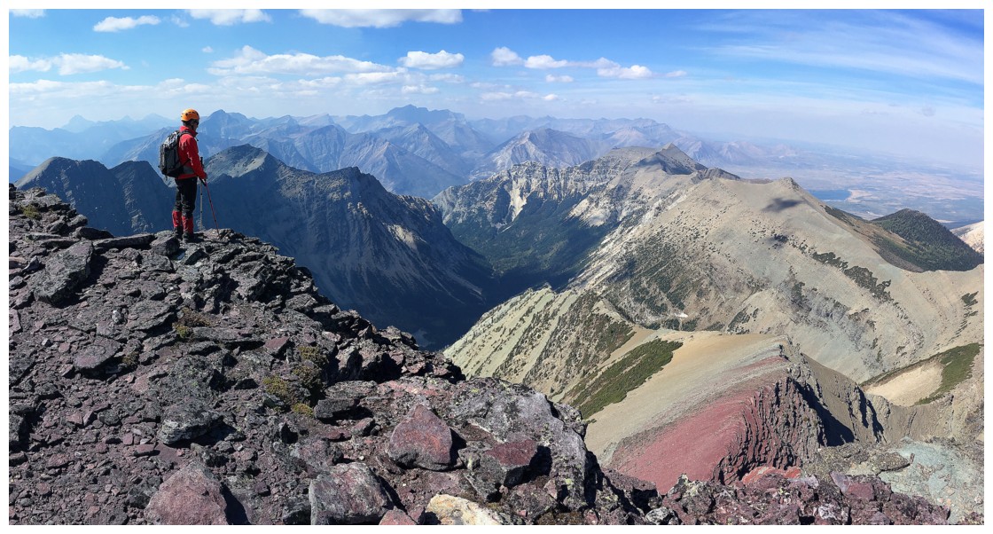
Still hazy to the north, but the clouds cleared and we were granted spectacular views of the mountain during the descent
Regrettably leaving the best summit block in town!
Red argillite is not the only colourful rock on this peak
Finding an easier way down to Crypt Lake
Back at Crypt Lake, with Crypt Peak behind. The summit is left of centre.
The chain section of the Crypt Lake Trail
A parting look at Crypt Peak from the Crypt Lake Trail
The End