Drywood Outlier
March 10,
2019
Mountain height: approximately
2075 m
Elevation gain: approximately 550 m
Roundtrip
time: 3:40
Solo snowshoe.
For Dave McMurray
I certainly missed having my Southern Alberta
Scrambling/Snowshoeing partner on this one. Not only because he is fantastic
company, a wealth of knowledge, classy as classy gets, and a snowshoe trail-breaking machine, but also
because he comes up with the best names for unnamed outliers – The
Muffin, The Croissant, Bakery
Peak, The Eaglet, Raptor Peak, to name
a few. As such, I’m content with calling this one Drywood outlier, until Dave
does the ascent and gives it a proper name! (I’ll gladly join you, Dave).
 Having recently enjoyed a string of ascents (see above)
of several northeast outliers of the eastern front mountains of Castle
Provincial Park (wanted to see how many “of”s I could fit in this sentence),
another outlier of Drywood Mountain seemed to be the next logical place to go.
On February 18, Dave had ascended a couple of outliers of Pincher Ridge, leaving only
Drywood and Yarrow to be explored, between the two of us. I chose to attempt a
minor outlier south of the other outliers reached while attempting and then ascending the
northeast ridge of Drywood Mountain.
Having recently enjoyed a string of ascents (see above)
of several northeast outliers of the eastern front mountains of Castle
Provincial Park (wanted to see how many “of”s I could fit in this sentence),
another outlier of Drywood Mountain seemed to be the next logical place to go.
On February 18, Dave had ascended a couple of outliers of Pincher Ridge, leaving only
Drywood and Yarrow to be explored, between the two of us. I chose to attempt a
minor outlier south of the other outliers reached while attempting and then ascending the
northeast ridge of Drywood Mountain.
 After a short and pleasant snow-free walk along
a gas road that dumped me right at the base of the objective, it was on with
the snowshoes. It took me only two steps to come to the realization that this
was going to be a physically strenuous ascent at best. The snow was very deep
and still sugary because of a bitterly cold February – not conducive to solo
snowshoeing. Thankfully, I eventually reached wind hammered snow that was much
easier to ascend; otherwise I would have turned around within the hour.
After a short and pleasant snow-free walk along
a gas road that dumped me right at the base of the objective, it was on with
the snowshoes. It took me only two steps to come to the realization that this
was going to be a physically strenuous ascent at best. The snow was very deep
and still sugary because of a bitterly cold February – not conducive to solo
snowshoeing. Thankfully, I eventually reached wind hammered snow that was much
easier to ascend; otherwise I would have turned around within the hour.
Although
I initially picked the line of least resistance, through a large stand of
trees, those tightly spaced trees provided nothing but resistance and I was
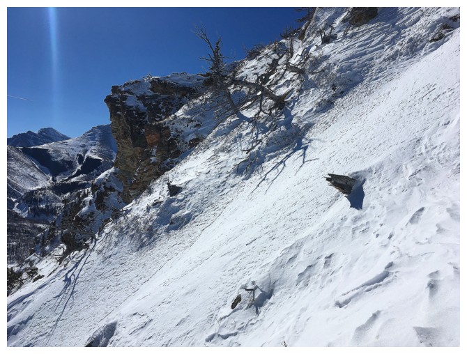
forced to go to the left, onto very steep but more open terrain. What followed
could hardly be called snowshoeing as I used trees, bushes, rocks and whatever
else was stable to pull myself up an increasingly steep gully.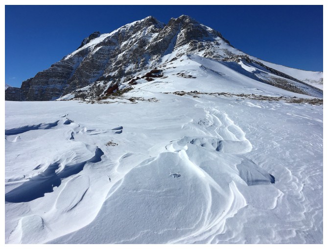 Nevertheless,
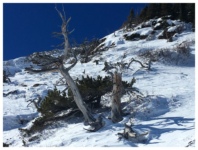
the ascent was fun and of course super scenic, featuring the usual suspects of
the Castle: vibrantly colorful rock, contorted dead trees, and wind sculpted
snow formations, all below a stunning blue sky. Atop the gully, easier terrain
lay ahead, and before long I was on the ridge and heading towards the summit.
Nevertheless,
the ascent was fun and of course super scenic, featuring the usual suspects of
the Castle: vibrantly colorful rock, contorted dead trees, and wind sculpted
snow formations, all below a stunning blue sky. Atop the gully, easier terrain
lay ahead, and before long I was on the ridge and heading towards the summit.
Up to
that point the temperature had been wonderfully mild. The starting air
temperature was only -4 degrees Celsius – that’s exactly 30 degrees warmer than
the previous week’s ascent to Surprise Pass! However, the wind was soon about
to change that. Once out of the wind sheltered east face of the outlier, the
air temperature plummeted to an alarmingly degree – a cold far more severe than
anything encountered on our -34 degree trip up to Surprise Pass. Of course, the
cumulative effects of the wind made for some outrageously cool snow scenery,
frozen fingers being a small price to pay for checking it out and snapping a few
photos.
I had
long decided that there was no way I was going down the mountain the same way I came up
it, so upon reaching the summit of the outlier (not really a summit, because of
its insignificant prominence), I simply continued along the ridge in hopes of
finding an easier route down. One quickly appeared between the summit of the
outlier and another highpoint I had visited on my two previous trips. Needless
to say, I had to visit this other highpoint once again. That visit was
extremely short-lived; the wind chill reaching new levels of severity. After
taking one single photo I was able to bomb down easy slopes to the drainage
between the highpoints, thankfully escaping the vicious wind. Except for some
mid-thigh deep postholing lower down, the drainage provided an easy and scenic
descent.
Great
trip, but I’ll be back on this one some time with Dave so we can give it a
proper name!
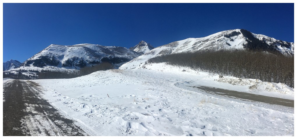
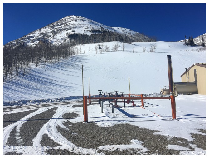
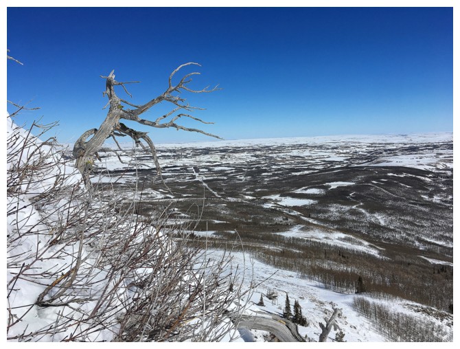
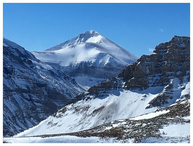
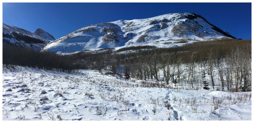
Hiking the gas road. The objective is at the far left and the route simply goes up the left skyline. Drywood Mountain in the centre.
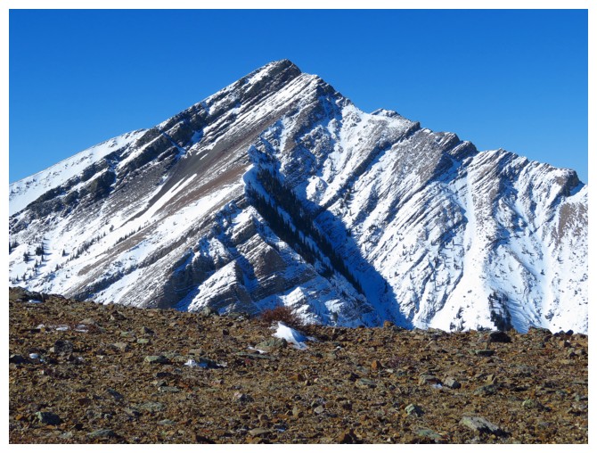
Closer look at some of the northeast ridge of Drywood
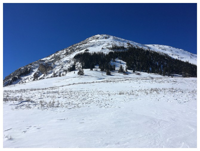
Looking up the route from the gas well; looks fairly easy from this vantage point
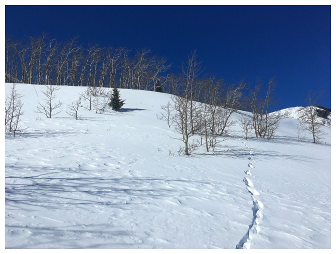
I followed these deer tracks for a short distance but was still post-holing;
guess the deer doesn't have a thing for DQ double cheeseburgers
Onto easy terrain, with less post-holing. The route I took goes around the left side of the trees
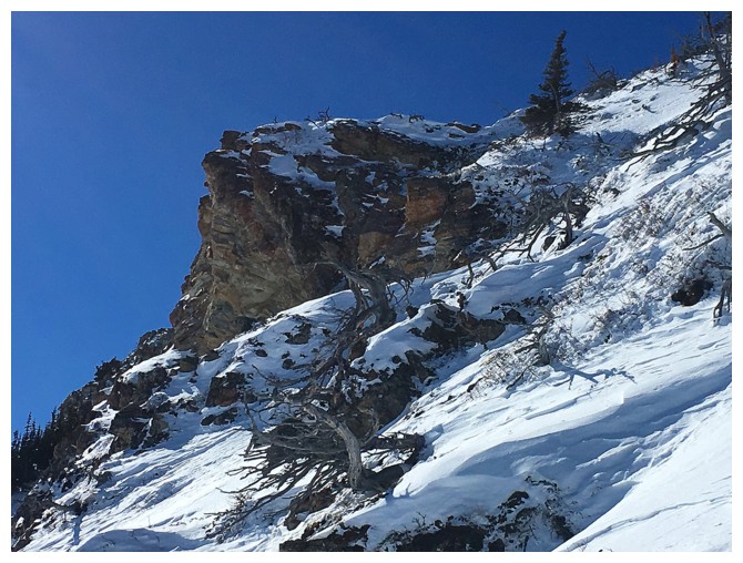
Yet another interesting rock band distracts me
Typical terrain on the lower slopes, but it's getting steeper
Passing the rock band; pretty sketchy terrain to get there so I decided against it
Went up the slope on the right
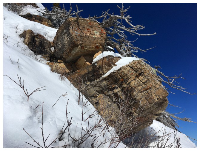
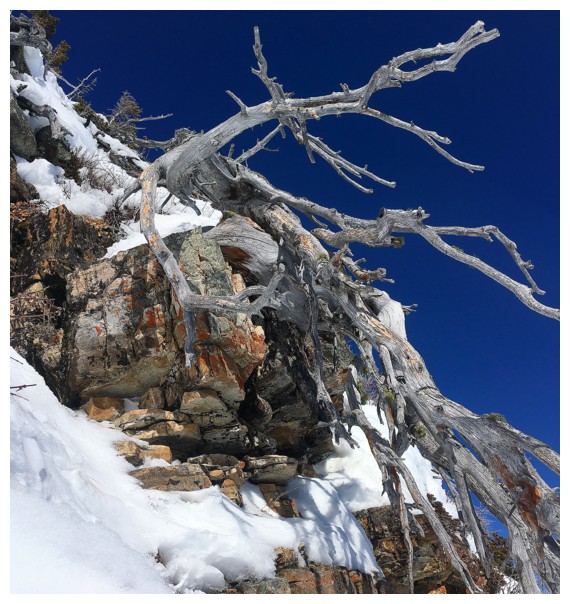
Some of the rock that available for hand-holds
And some of the dead trees that add to the scenery
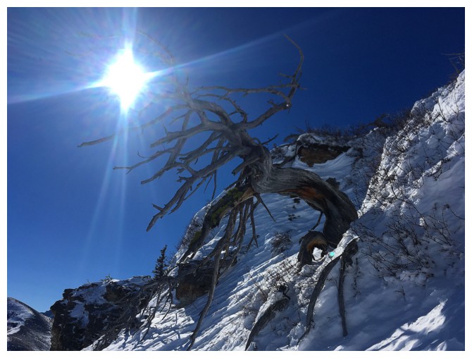
And that one!
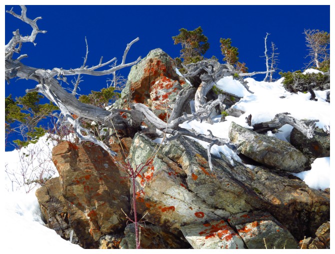
And throw in a little orange lichen
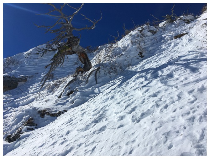
Another interesting tree and one of the highpoints of the northeast ridge
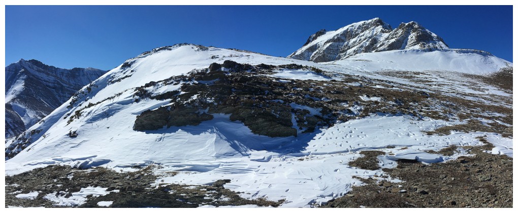
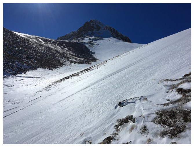
Much easier terrain to the summit
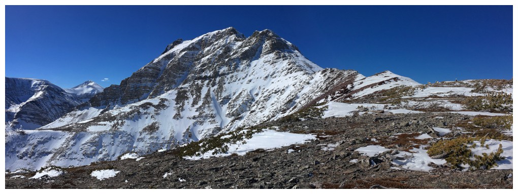
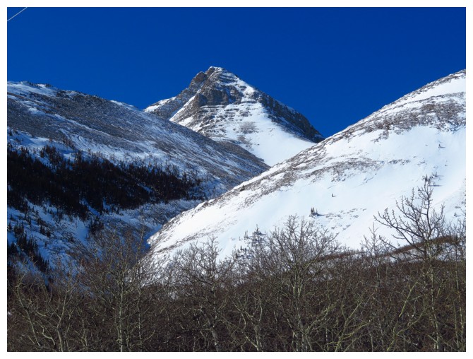
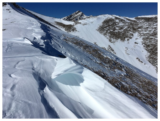
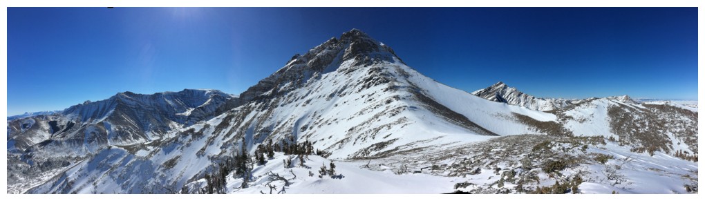
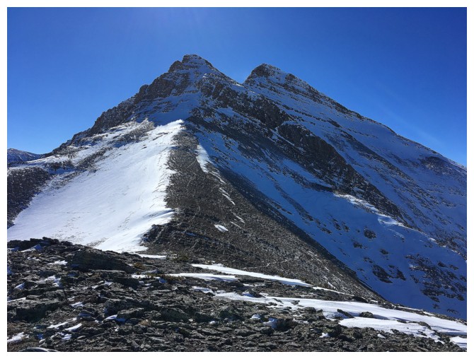
The summit block of Drywood Mountain peaks over the ridge
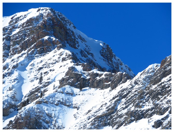
Close-up of the summit block. The "moderate" scramble route goes up the obvious snow gully,
just right of centre - but only when there's no snow!
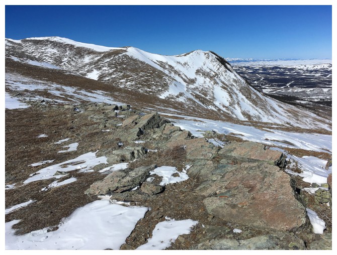
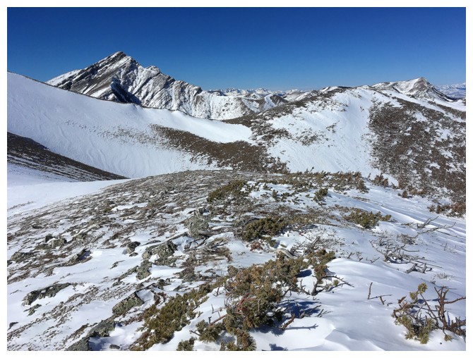
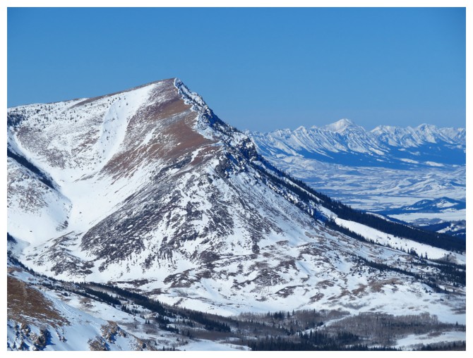
Looking over to the northeast ridge. I eventually reached the highpoint at the left.
Distinctive Loaf Mountain in the distance
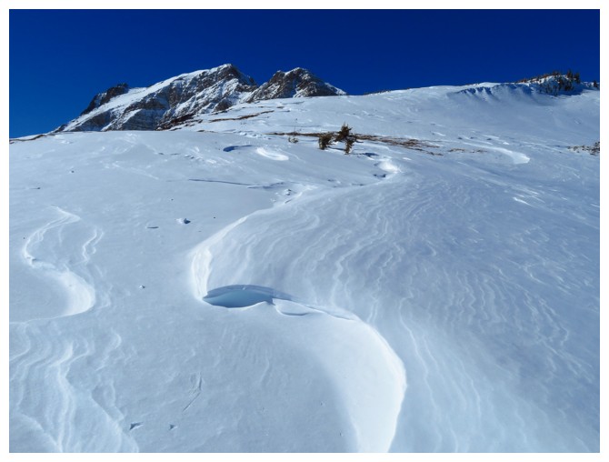
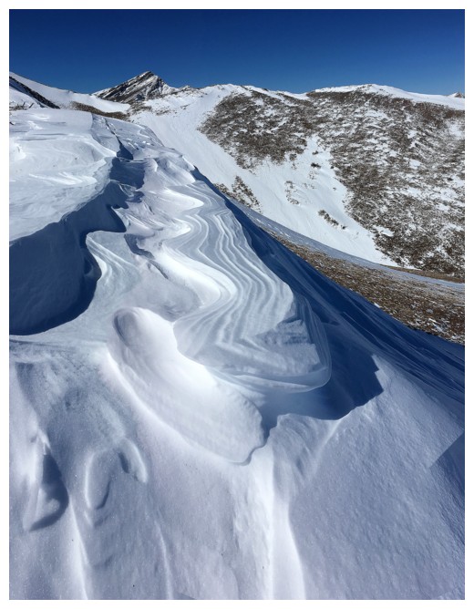
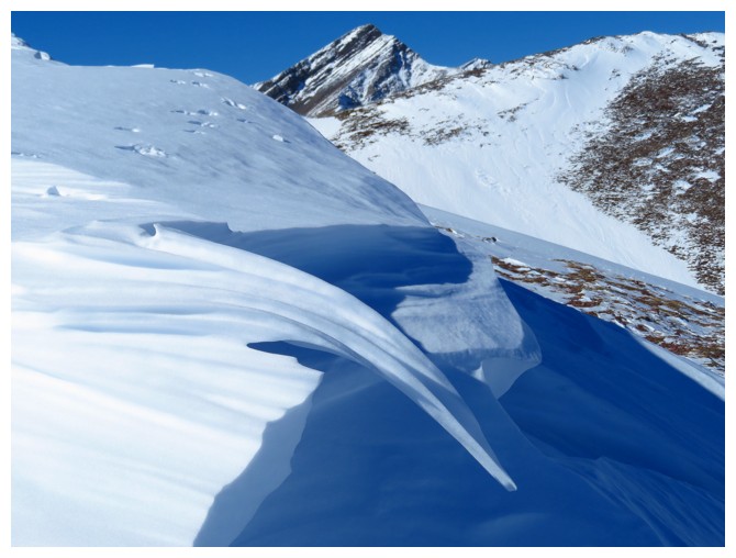
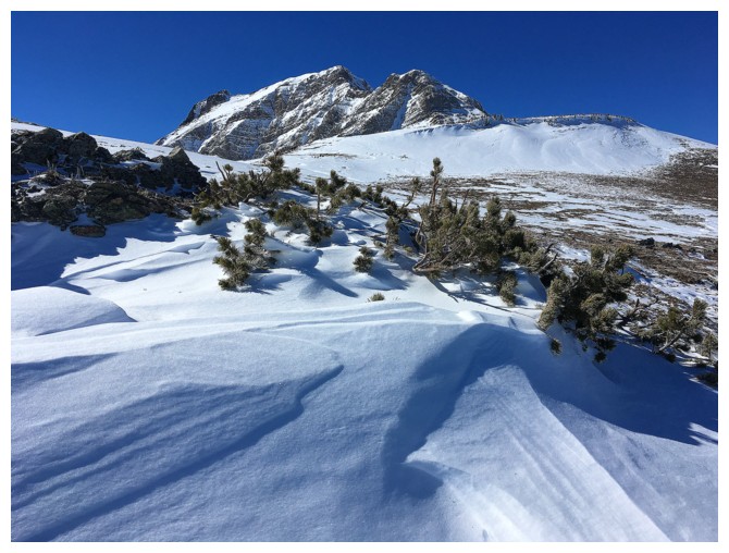
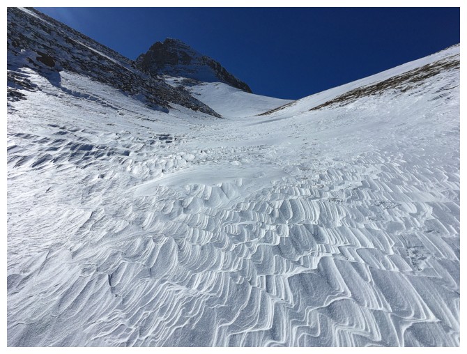
The start of some very cool wind sculpted snow
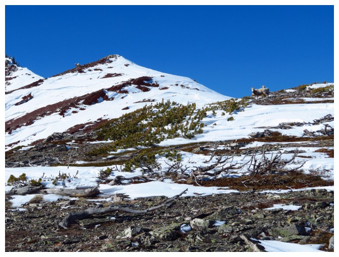
There's the summit and I have some company - or more accurately they have some company: me
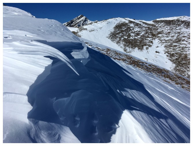
The southeast side of Drywood is quite spectacular
One of the coolest formations of snow
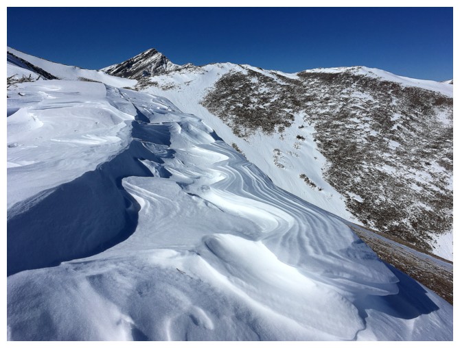
And another. That's the summit of Pincher Ridge in the centre
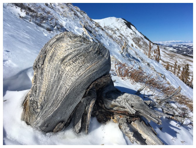
Definitely my favourite of the snow formations
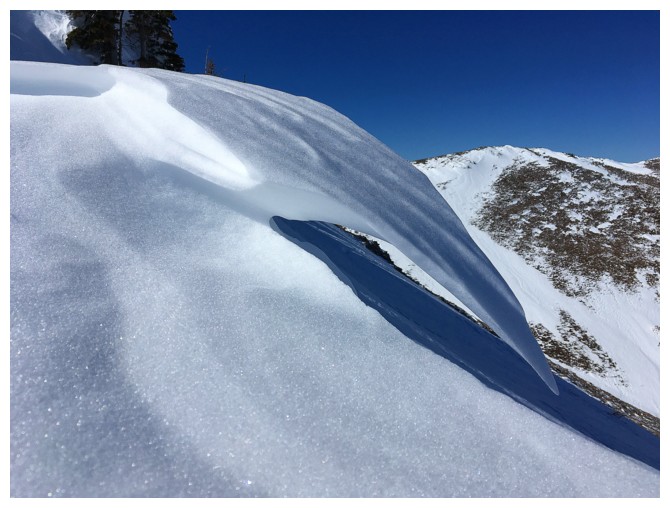
Close-up of my favourite
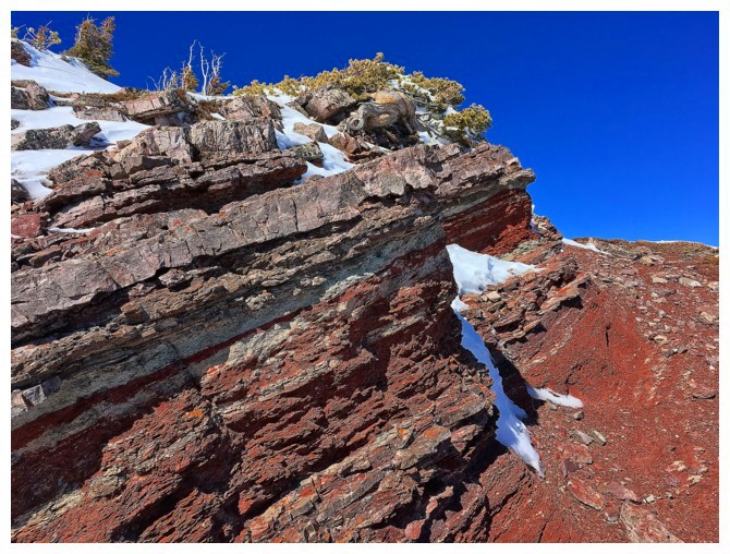
Most of the red argillite was snow covered, but the sections that were not were awesome!
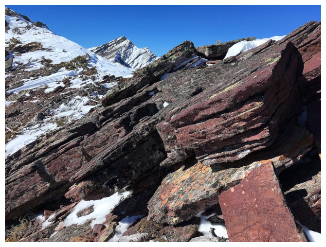
Burgandy argillite
Summit view
Heading over to one of the highpoints along the northeast ridge
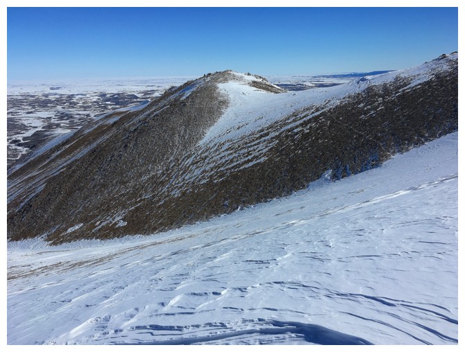
Looking back to Drywood Outlier
Closer look at the exciting northeast ridge of Pincher Ridge
Nearby Prairie Bluff and distant Centre Peak
More of Pincher Ridge, with two more of Dave's great names: "Cinch Hill" and "Bridle Peak"
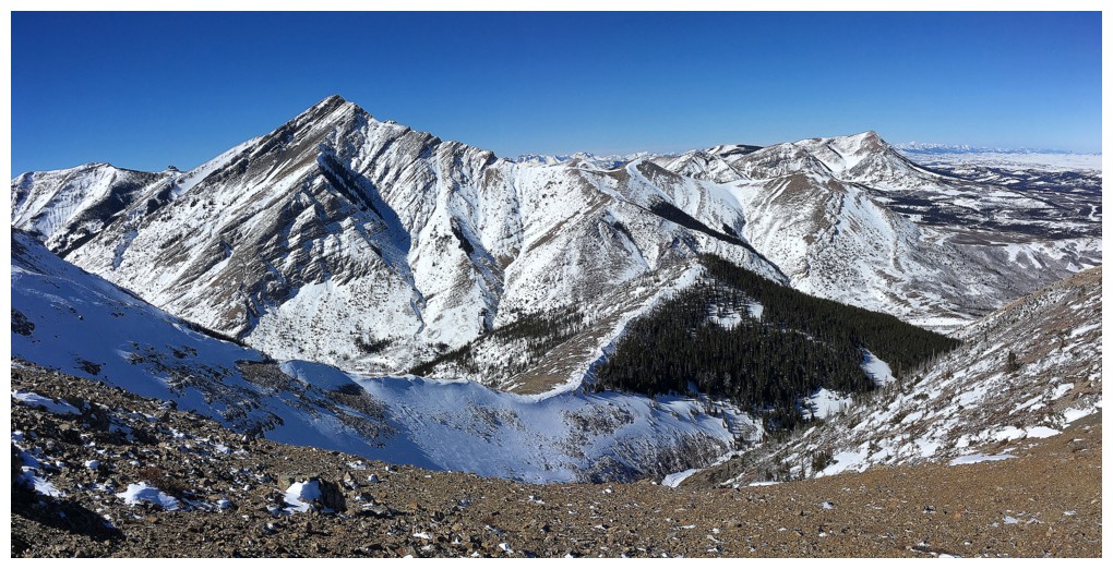
The route up the northeast side of Drywood
More great wind-blown snow in the escape drainage
Last look at some of the route. I descended the drainage at the left.
The End