Drywood Mountain
July 2, 2005
Mountain height: 2,514 m (8,246 ft); 2,475 m
according to my GPS
Elevation gain: 841 m to
true summit; approx 500 m to west summit
Ascent time: 3:55
Traverse time to west summit: 2:30
Descent time:
1:40
Scrambling with Mark.
The purpose of this trip was three-fold:
firstly, to introduce Mark to the wonderful scenery and colours of the Castle
Crown area; secondly, to achieve the summit of the mountain that Linda and I had
come so close to, last week; and thirdly to see if Mark and I could find a more
direct route to the summit, than the scenic but circuitous route chosen by
Linda and I.
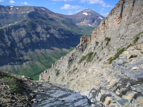
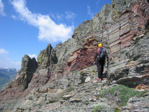
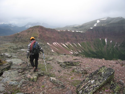
Parking just before the road narrows (to
avoid the “under-carriage scraping” events of last week), we hiked the trail
for about 200 m, before turning left towards the first obvious gully. Right
from the start, the moderate scrambling up the gully was fun and the
surrounding scenery stunning. We basically followed the water-worn gully as
much as possible, circumventing more difficult sections on the right side.
Ascending the gray, steppy rock was most enjoyable.
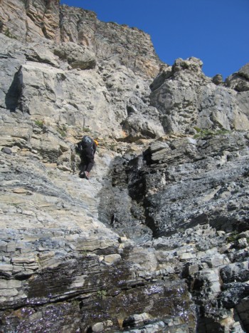
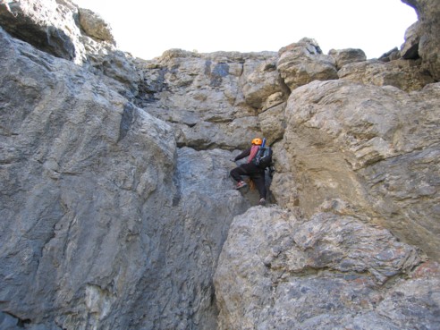
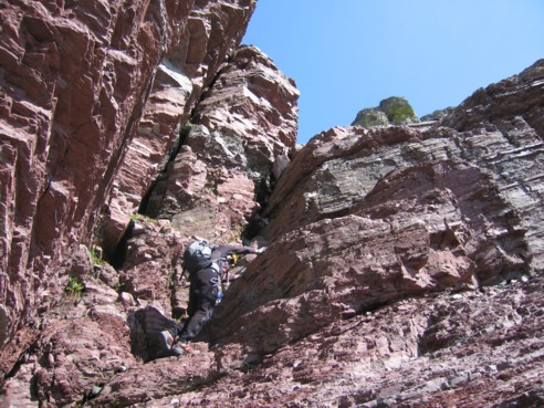
At one point, we arrived at a more
intimidating rockband, water streaming down the obvious weakness. We started
traversing right, along its base, to find another weakness. Eventually we found
one, but as I scrambled up the steep terrain, I became concerned I couldn’t
downclimb it. The rockstep was fairly exposed, after finding a safe place to
stand, I took out a rope, placed a cam and completed the short section with a
belay from below. Mark followed and at the top we did notice that we could have
easily got around the rockband on the left side. We then returned to the gully
and continued to ascend, enjoying the ever increasing variety of colours and
some phenomenal rock scenery.
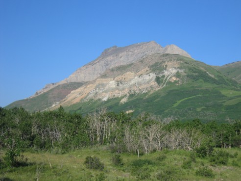
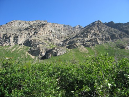
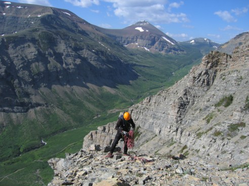
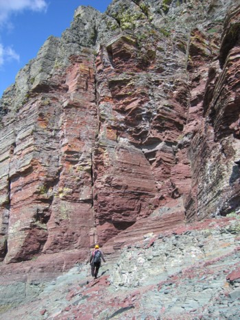
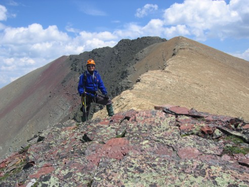
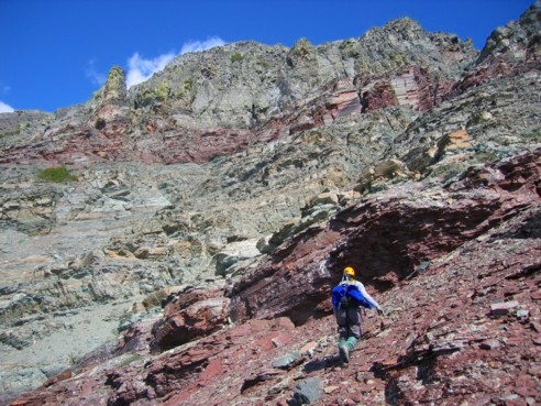
We knew the crux of this route would be
near the top, as the summit appeared to be guarded by huge walls of vertical
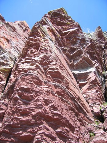
rock. Arriving at that summit block was one of the most visually spectacular
scenes we’ve been lucky enough to see in all our mountain trips. A striking
band of red argillite (actually more burgundy in appearance) dominated the
lower portion of the summit block and along with a few towering pinnacles and
other forms of lichen-covering gray and black rock (sorry for my geological
ignorance – the description “gray and black rock” is not going to be impressing
any geology professors at the University!), had us awe-struck for a good hour -
an hour, because that’s how long we spent, trying to find a weakness in the
band. We, again, traversed to the right, coming to within 140 vertical metres
of the summit, before arriving at a steep drop-off on the east side of the
mountain. When an easier route through the band didn’t reveal itself (probably
because there wasn’t one), we had to return to the gully and then continue
heading down and to the west, losing about 150 m of elevation. Although the
traverse around the east side did not yield any results, it was an amazing
visual diversion, and were I to ascend the mountain again, I would return to
this area, just to experience the fantastic scenery.
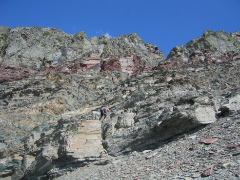
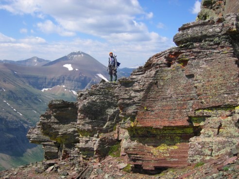
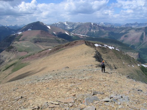
The left side did reveal as easier route
and we enjoyed some more moderate scrambling on beautifully solid, dark gray
rock (still not impressed?). The surprising appearance of some blue flagging
along the way attested to the fact that we were not the first to use this
route. We topped out on a light brown shale slope that I recognized immediately
as the one that Linda and I started up, but turned around on last week. The
final 150 or so vertical metres consisted of the short trudge up the shale
slope and then an enjoyable ridgewalk over lichen-covered boulders, with a
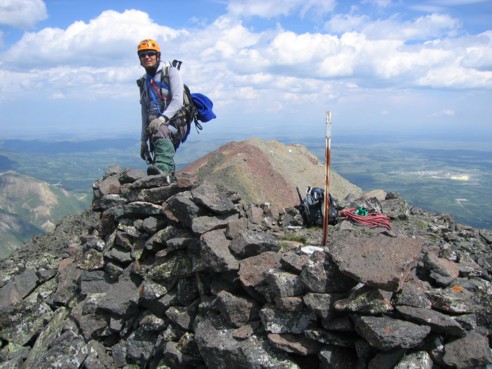
vertiginous drop on the south side of the mountain. A geological survey marker
and a welcome rock shelter marked the summit, that I was surprised to find
measured only 2,475 m on my GPS (the west summit having earned a superior
height of 2,490 m last week). The summit panorama was very pleasant, although
perhaps a little anti-climatic, given what we had seen on the way up.
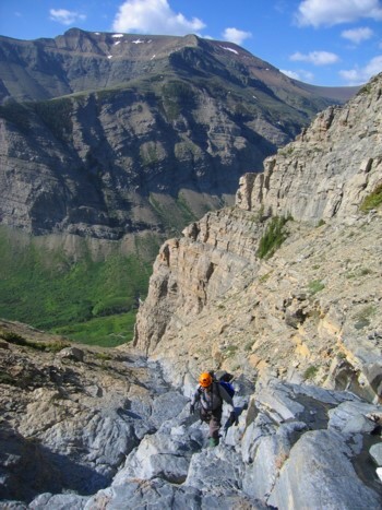
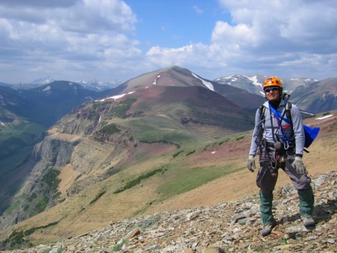
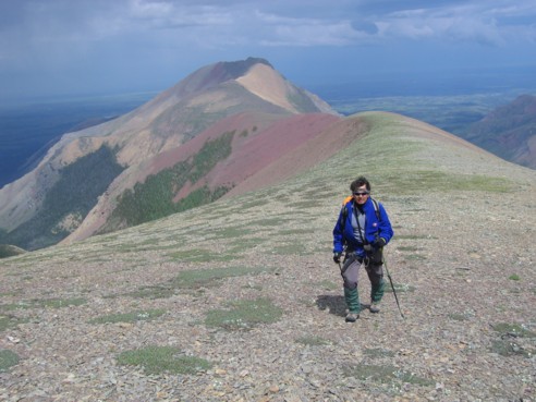
The weather had been great up to that
point, however, looking to the west, it was clear that bad stuff was on the way
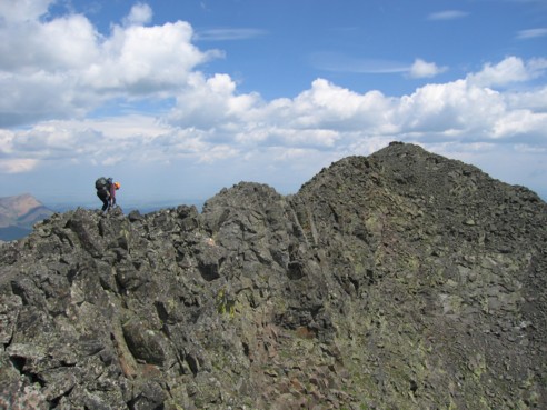
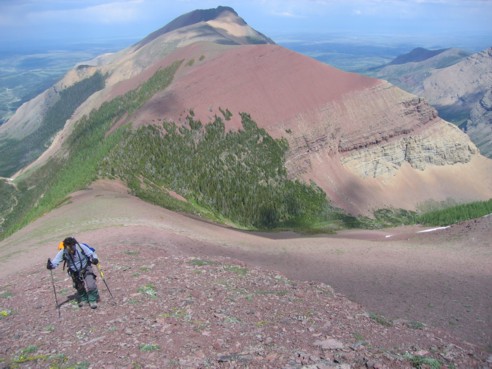
and we left the true (?) summit, with the hopes of traversing over to the west
summit before all hell broke loose. Just a long hike, with about 500 m of
elevation loss followed by the equivalent gain, the traverse was easy,
enjoyable, and scenic, though hampered a little by a fierce head wind and
deteriorating weather conditions. Also, we started to feel the strains of
having almost completed about 40 km of scrambling/hiking with approximately
3,200 metres of elevation gain, within the last 24 hours.
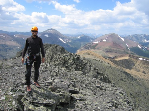
Five minutes short of the
west summit, we were pounded by a vicious hailstorm, and the sky turned black
all around. It quickly passed, but more dark clouds followed. I re-confirmed
that the west summit stood 2,490 m above sea level, before we continued heading
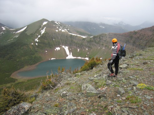
west, hoping to get a glimpse of Bovin Lake. To my surprise, the Drywood Ridge
did not descend all the way to the lake and, in fact, continued on, forming a
narrow-looking ridge well above the scenic lake. Had we more energy, time, and
better weather, a continuation would have been most intriguing. We didn’t have
any of the three, however, and so we turned south and bolted down easy scree
slopes to escape the second violent hailstorm that was now upon us. At the
bottom, a 5 km hike on an easy trail completed the loop. An absolutely amazing
day – there are few things more gratifying than finding your way up a mountain
via an unknown route; add to that the incredible scenery en route to the summit
and you have a combination that simply can’t be beat.