Mount
Mountain height: 2,614
m (8,574 ft)
Elevation gain: 1,157 m
Ascent time: 7:05
Descent time: 4.05
Awesome scrambling and a little mountaineering with Mark, Dan, and James.
When Dan was rudely awakened at
The plan was simple: the summit of
Fortunately, the situation was about to dramatically improve and after a steep hike to gain the treeline, we found ourselves at the start of a spectacular pinnacle-studded ridge. For the next several hours, we enjoyed some of the best hands-on and difficult scrambling we had ever encountered. Most of the rockbands and pinnacles appeared to be too steep to scramble up, however, James and Dan (followed by Mark and I) tackled every one head-on and we were all surprised to find great routes up each successive rockband. Although the rock was quite loose (typical of the Waterton area), its wonderful, horizontal bedding and step-like nature inspired confidence, even when the rock quality didn’t. As well, the view of the surrounding peaks continued to improve and impress as we made our way up the lengthy ridge.
About two-thirds of the way up, we did encounter a vertical rockband of limestone that was definitely not to be scrambled up (although I think James was eyeing it up!). We traversed left along its base and ascended through one of several weaknesses. Interestingly, we also ran into a set of very fresh set of bear tracks in the snow, and wondered what the heck a bear was doing at that elevation, well above the treeline. James suggested it may have been looking for a place to hibernate – regardless, our descent, later that day, was a most noisy one.
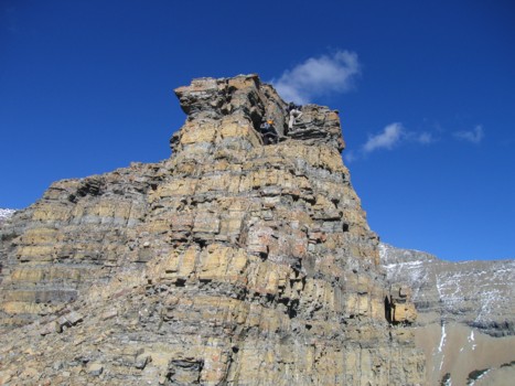
Above the rockband, a scree slope led easily to the stunning and somewhat daunting summit block: a lichen–covered band of vertical black rock, atop a distinctive band of red (actually more burgundy in colour) argillite – identical to that seen on two earlier ascents of this year: Mount Blakiston to the southwest and Drywood mountain, further north. The horizontally lain argillite band was easily ascended, however, the black band presented a formidable challenge. Dan tried an exposed gully, choked with snow, to the right of the summit block, but turned back because it was too dangerous. We then traversed along the base , again looking for a weakness. James apparently found one and started up while Dan, Mark, and I continued along the base. There were a couple of options, but all were very steep and rendered quite treacherous with snow and ice on the rock. Dan started up the easiest looking one, soon arriving at a section he thought might be impassable. He also announced to us that downclimbing his ascent route was not an option and so Mark and I went back to James’ ascent route, hoping that we could get to the summit and then traverse over to the top of Dan’s route just in case he needed a rope to get up.
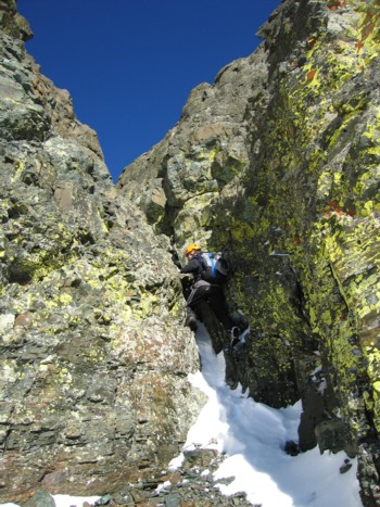
We were shocked to discover that the “James ascent
route”, stemming up a vertical chimney and then a short, but very exposed
climb up a rockface with few, if any, good holds, was far, far beyond
scrambling. I went up the chimney, but found the lack of holds and exposure on
the rockface to be too much. Luckily, James, who had already gone to the summit,
came back and belayed me and Mark up. We were both thoroughly impressed that
James had scrambled up this serious step without a rope or any form of
protection. Dan had also skillfully and cautiously made his way, over a narrow
and exposed ridge, to the summit and the four of us enjoyed a short, but
immensely satisfying rest at the top. Like
It was
An absolutely fantastic day of terrific scrambling, outstanding scenery, and a few thrills and chills. Happy Birthday Dan!
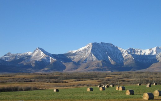
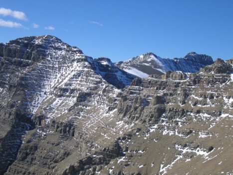
Mount Dungarvan (just right of centre), as seen from Highway 6. Mount Galwey is at the far left
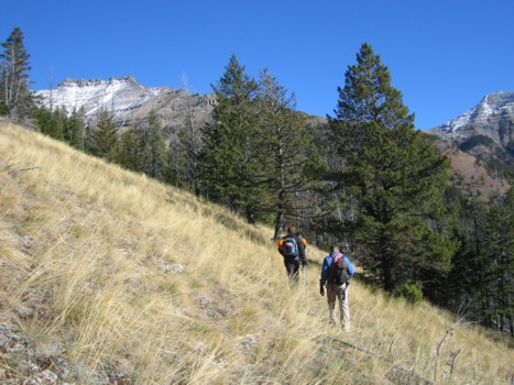
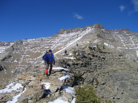
Dan and James on easier terrain, heading towards the south ridge; summit visible at the left
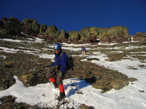
Approaching the treeline; the peak in the background is the northeast extension of Mount Galwey and is easily reached from that summit
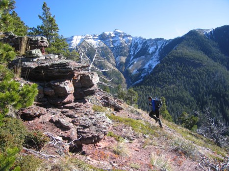
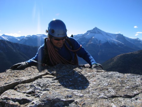
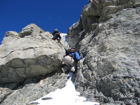
James starts the fun hands-on scrambling
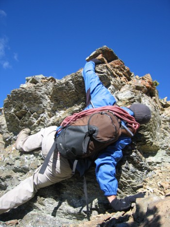
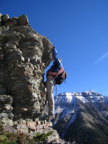
James experiencing some difficulty
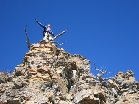
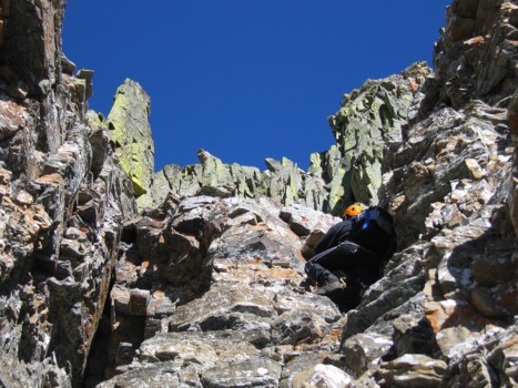
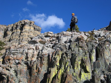
James atop a rockband
Dan scrambles up the same band
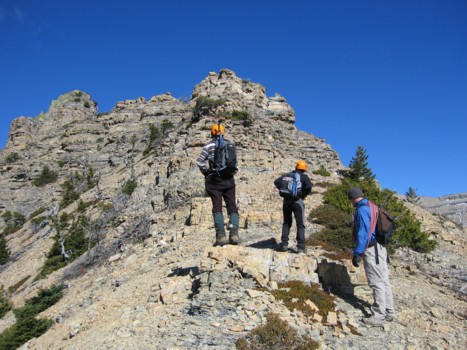
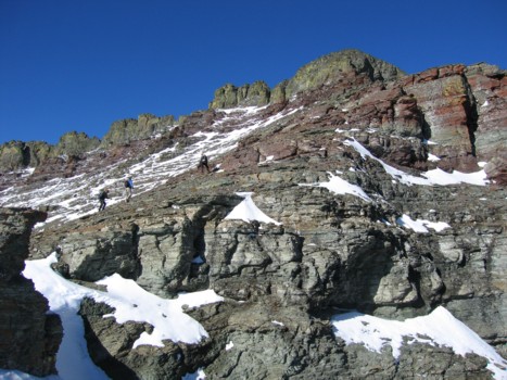
Me, Dan, and James checking out more interesting terrain on the south ridge
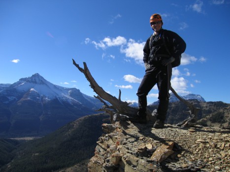
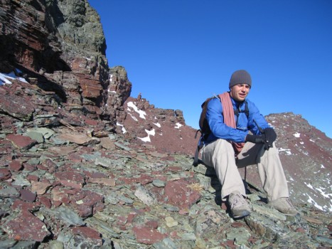
Dan, with Mount Blakiston to the left
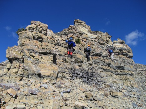
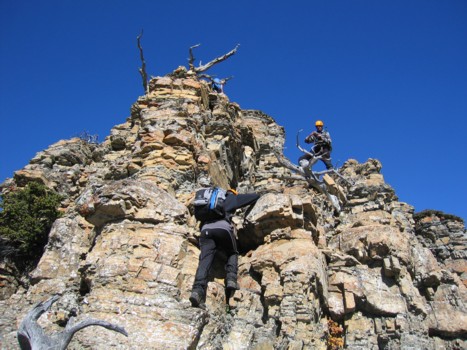
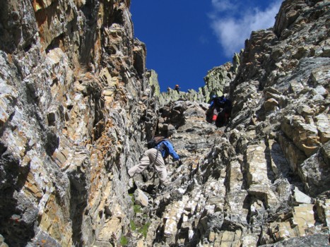
Mark, Dan, and James each pick a different route up a rockband
Same as above
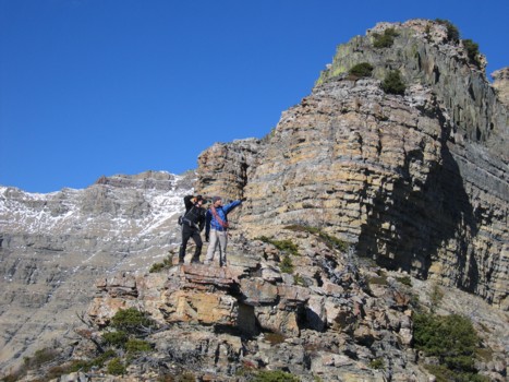
Posers, Dan and James stop before the next rockband
Mark comes up, with Blakiston behind
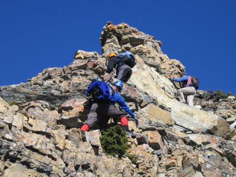
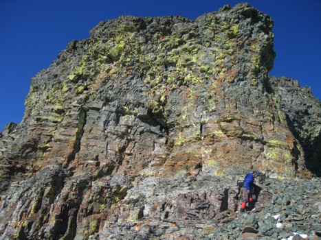
Dan leads the way through a magnificent rockband of amazing colour and rock
James and Mark follow up that band
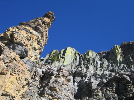
More cool rock
Atop the rockband
Dan and James prepare to ascend the rockband to the left (yeah.... they're pretty dramatic characters!)
Dan and James ascend the band
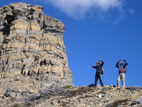
James and Dan listen to the roar of the crowd after their successful ascent
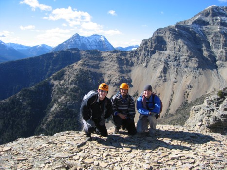
Dan, me, and James, with Mount Anderson behind
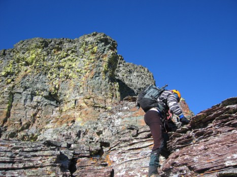
Daring James on more interesting rock
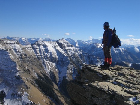
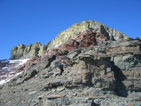
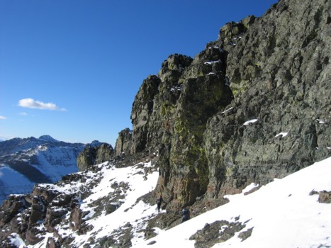
Further along the ridge, with the summit block ahead
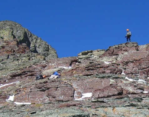
Dan sizes up the limestone band
Dan and James ascend through a weakness in the band
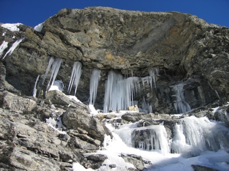
Winter scenery on the rockband
Getting close to the summit block
Dan and James collapse in a state of utter exhaustion just before the summit block (I, of course, had energy to spare!)
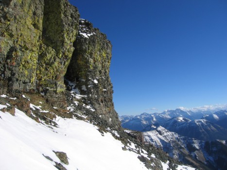
Looking towards the west ridge of Dungarvan and the continuation towards Cloudy Ridge and Mount Glendowan
Mark surveys gorgeous scenery to the southeast
The steroids finally kick in and James is back in action
Blah, blah, blah....
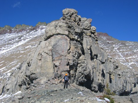
The summit block
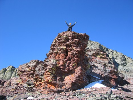
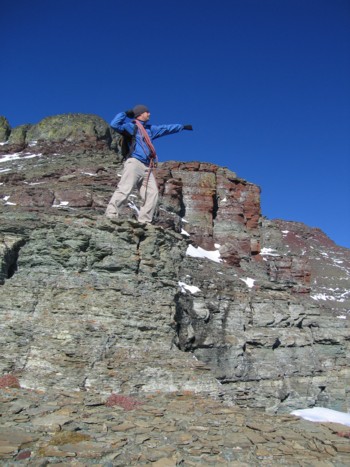
Dan atop a pinnacle of red argillite
More of the summit block
Looking southeast; Mount Cleveland to the right, Galwey and it's northeast extension in the foreground to the left
James contemplates his existence
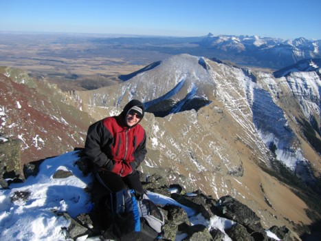
Mark and the summit block
Me and Dan traverse the base of the summit block
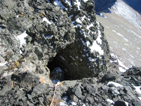
Looking back; the James ascent line goes into the cave and then up through the crack in the rock
Dan's ascent line
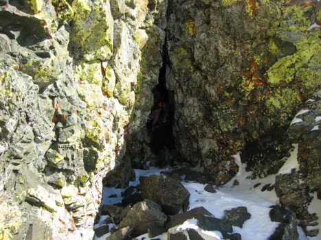
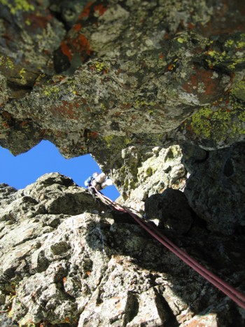
Me in the cave
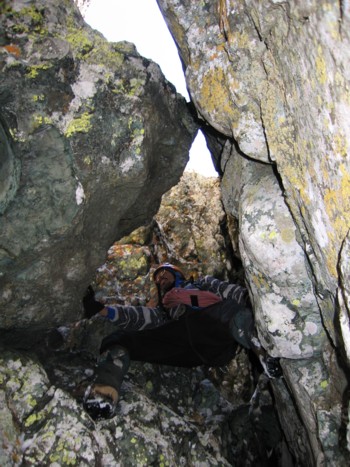
Stemming the chimney
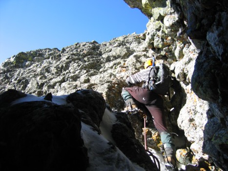
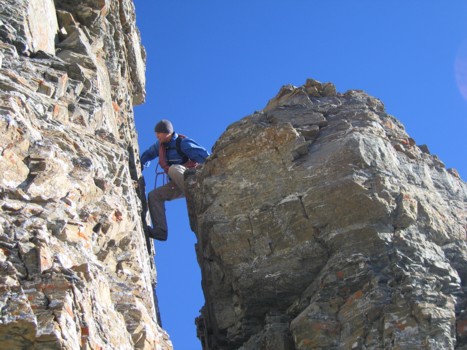
The exposed rockface
Looking down the crux step that James scrambled up
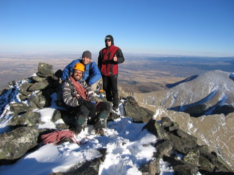
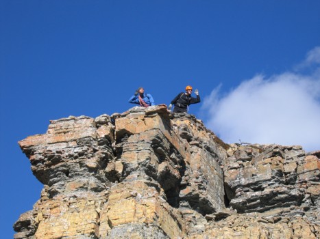
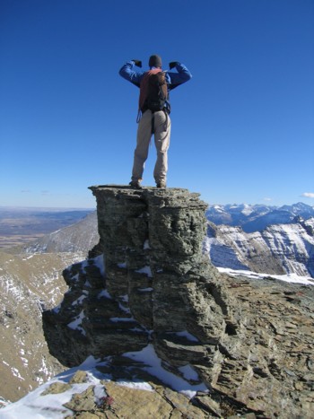
At the summit
The Birthday Boy
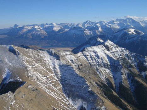
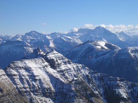
A magnificent summit view
James rappels down the chimney
Mark and James go down easy scree slopes, late in the day
HOME
SCRAMBLES
MOUNTAINEERING
OTHER
TRIPS
PHOTO
GALLERY
LOG
FAVOURITES
LINKS