Mount Edith Cavell II
August 2, 2023
Mountain height: 3363 m
Elevation gain: 1950
m
Round-trip time: 13 hours
Scrambling with
Matt Hobbs.
Way too much
time had passed since my last trip with Matt Hobbs – a “Shanks for Nothing”
romp up and down merciless Mount Shanks! So, when he suggested we take a run up
the pride of Jasper, Mount Edith Cavell, I was all in. 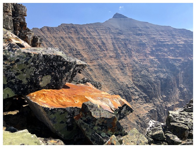 Since I climbed Cavell via
its famed east ridge in 2004, I suggested to Matt that we follow Mike
Mitchell’s route up to the ridge via the west side and then tag Mount Sorrow (a
minor summit at the north end of Edith Cavell) on the way up or down.
Since I climbed Cavell via
its famed east ridge in 2004, I suggested to Matt that we follow Mike
Mitchell’s route up to the ridge via the west side and then tag Mount Sorrow (a
minor summit at the north end of Edith Cavell) on the way up or down.
The crux of the trip was the logistics. I was unavailable on August 1 and Matt
wanted to be back in Calgary by late afternoon on August 3 to celebrate his 40th
birthday with his family. We therefore decided to leave Calgary early on August
2, do the trip that day, stay at the Cavell hostel for the night, and then
return to Calgary on the 3rd.
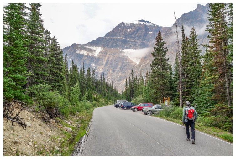
A groggy 3 am Calgary departure meant we were hiking the Astoria
River Trail by 8 am. 4 km later we hiked right by the Verdant Pass
trail, but quickly corrected our mistake. 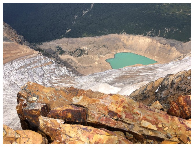 The only other time I hiked this
trail was by headlamp, 19 years earlier, and so it felt quite new. Throughout,
I was reminded of how much I enjoy hiking with Matt. His positive demeanor and sharp
wit keep me entertained when the scenery doesn’t!
The only other time I hiked this
trail was by headlamp, 19 years earlier, and so it felt quite new. Throughout,
I was reminded of how much I enjoy hiking with Matt. His positive demeanor and sharp
wit keep me entertained when the scenery doesn’t!
A big thank you
to Mike Mitchell (Giant’s Gate), at this point, as his GPS track took all the
guesswork out of our ascent route. After hiking the Verdant Pass Trail for a
few kilometres, we turned east, hiking up surprisingly stable slopes of
quartzite boulders. Had that lasted, we would have gained the ridge in no time
(relatively speaking of course). 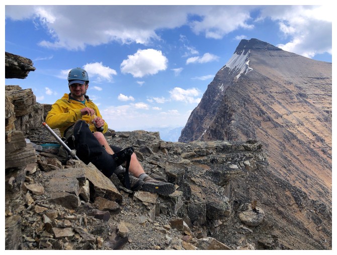 It
didn’t and we didn’t! Above the stable
slopes, lay seemingly endless, steeper slopes of unstable boulders. We
did
eventually reach the ridge, but after considerable time and effort -
and that effort pretty much did us in physically. Decision time: at
this
point, summitting both Edith Cavell and Sorrow was delusional at best
and choosing 3010 m Sorrow over 3363 m Edith Cavell would have been
questionable at best –
off to Edith! But not after a long break to recuperate.
It
didn’t and we didn’t! Above the stable
slopes, lay seemingly endless, steeper slopes of unstable boulders. We
did
eventually reach the ridge, but after considerable time and effort -
and that effort pretty much did us in physically. Decision time: at
this
point, summitting both Edith Cavell and Sorrow was delusional at best
and choosing 3010 m Sorrow over 3363 m Edith Cavell would have been
questionable at best –
off to Edith! But not after a long break to recuperate.
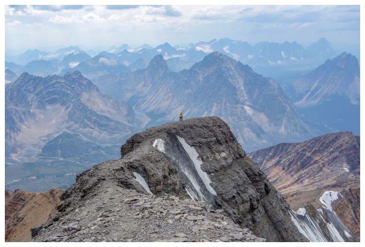
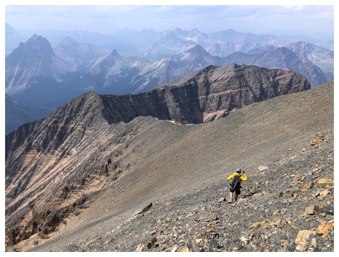
From the ridge,
the ascent of Edith Cavell went very well, requiring only a few steps of tricky
terrain. We reached the summit cairn in great spirits, only to be disillusioned
to see that the two summits to the east appeared to be slightly higher. While
our disillusionment was not an illusion, the higher summits were! They are both
lower. Nevertheless, we made the trip back and forth just to make sure. Of
course, I should have known this from my previous ascent, but the skies were
not the only thing that was hazy at that given moment!
Settling down
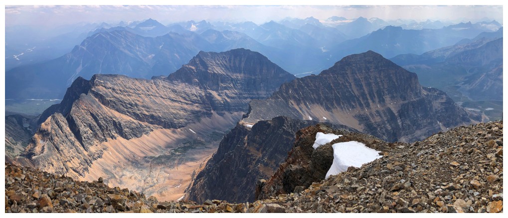
at the summit, it finally dawned on me how stunning this part of the Jasper National
Park is. 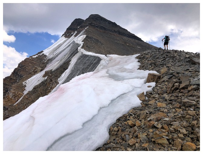 Though our view was mostly overcast and hazy from forest fire smoke, there
are stunning peaks in every direction, especially to the west. The geology of this
neck of the woods is vastly different from many areas farther south, glaciation
and erosion leaving behind many peaks that have a distinctive, craggy
appearance. Long before leaving the top, the gears in my head were already in
motion, planning a third ascent, but on a perfectly clear day.
Though our view was mostly overcast and hazy from forest fire smoke, there
are stunning peaks in every direction, especially to the west. The geology of this
neck of the woods is vastly different from many areas farther south, glaciation
and erosion leaving behind many peaks that have a distinctive, craggy
appearance. Long before leaving the top, the gears in my head were already in
motion, planning a third ascent, but on a perfectly clear day.
After a
wonderfully satisfying summit break, celebrating not only making the summit but
also Matt’s last day as a man in his thirties, we started down. The “normal” west
ridge descent route was agreed upon to get down. Other than a section of hideously
loose rubble, threatening to bring down the entire west face, this descent was
surprisingly pleasant, fun and easy. After the loose stuff, it’s an enjoyable
route-finding journey down small rock steps to the valley below. Even the slightly
uphill Astoria Trail didn’t packed the death-blow we were contemplating as we descended
it about 12 hours earlier.
Almost 13 hours
to the minute after leaving the hostel, we were back, enjoying a cool beer, courtesy
of Matt – that’s the other thing I love about Matt – he’s got his priorities in
the right order! The hostel stay was great and the following morning we were
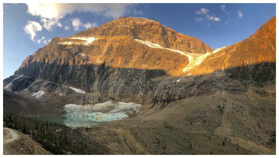
able to do the short but interesting hike to the Angel Glacier and Cavell Pond before the long
drive back to Calgary.
A fantastic return
to a fantastic mountain with a fantastic partner. Happy 40th Matt – enjoy
your forties – it’s a great decade of life!
Short hike from the hostel to the trailhead (photo by Matt)
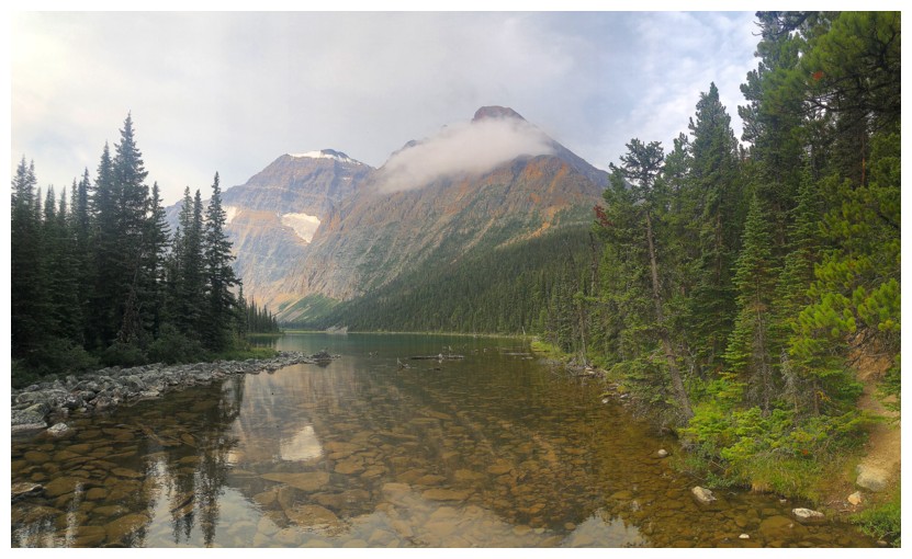
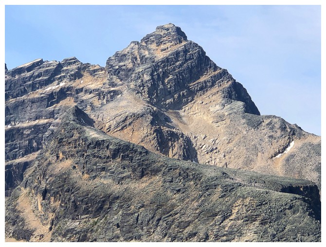
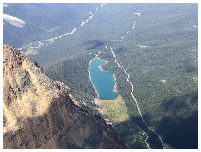
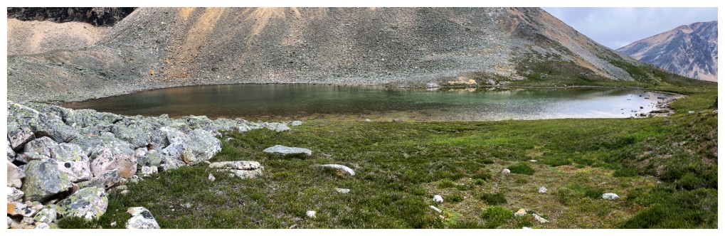
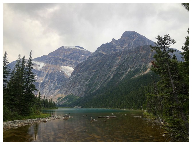
The Cavell Lake outlet, Mount Edith Cavell (left), and Mount Sorrow
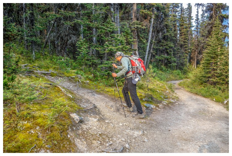
After hiking past the Verdant Pass Trail we rectified our error (photo by Matt)
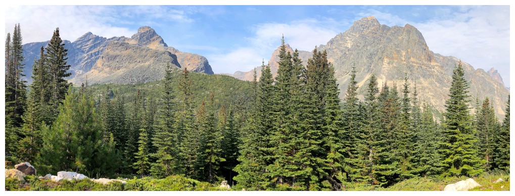
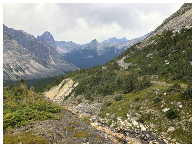
Chevron Mountain (left) and Throne Mountain are the first of innumerable beautiful mountains to make an appearance
Throne is a big sucker!
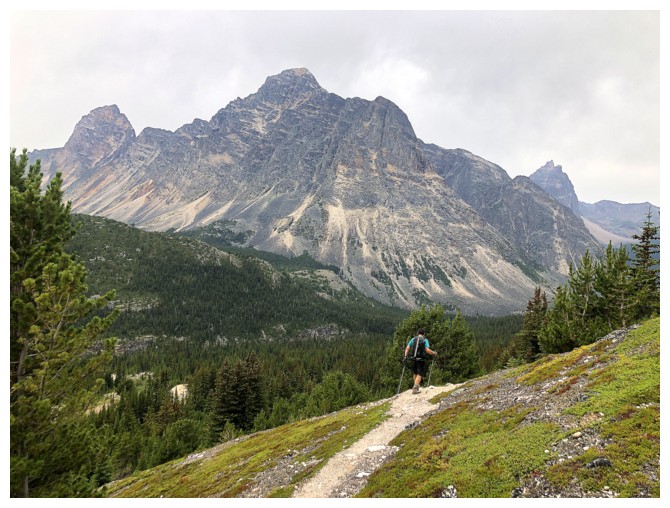
Looking up the first part of our ascent route
Matt is all smiles at the beginning - will it last?
Distant Mount Estella
Oldhorn Mountain looks very intimidating
The north peak of Chevron
Matt still enjoying stable terrain underfoot
The view to the west continues to improve and impress
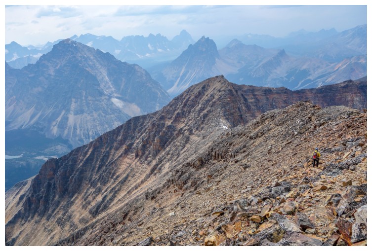
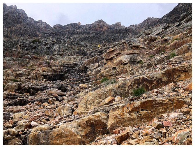
Spot Matt on the rubble
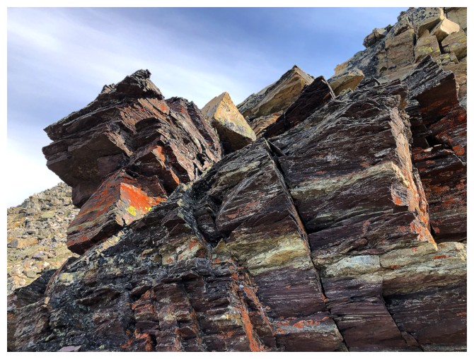
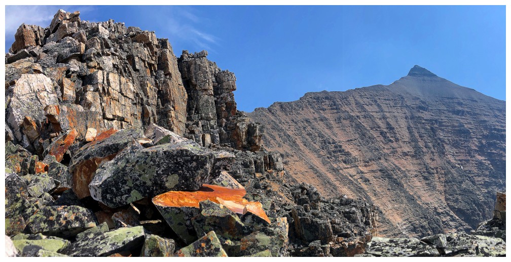
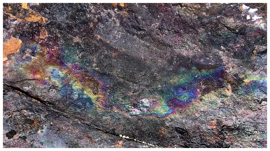
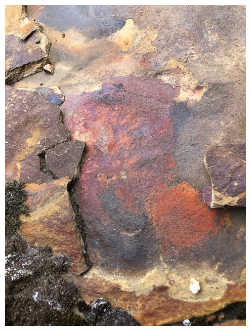
An isolated section of red, oxidized rock
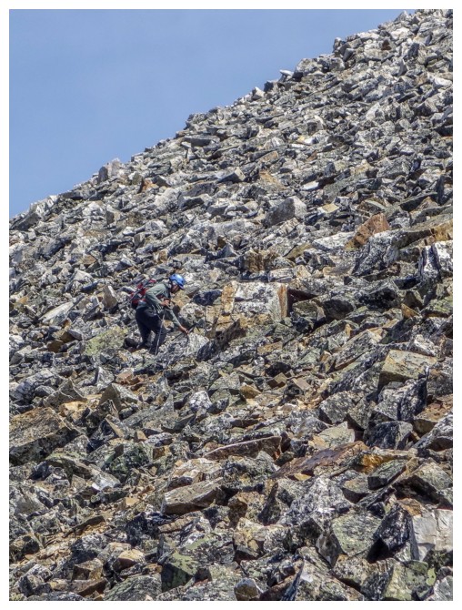
Spot Matt again - he's looking fairly small on the big terrain
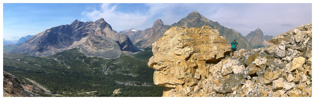
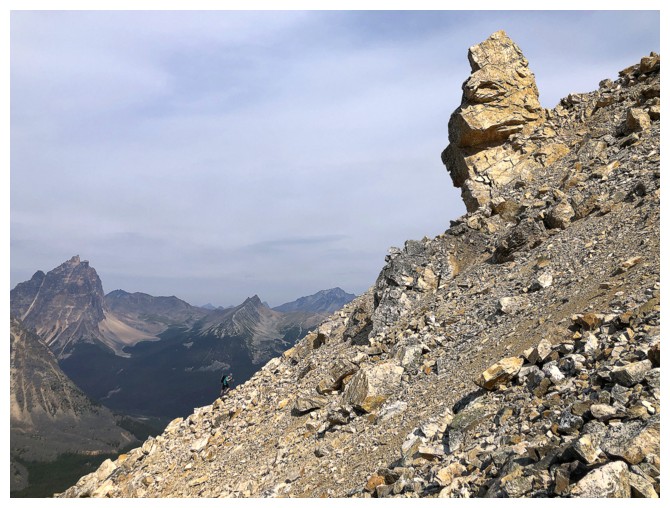
Cool rock formation at the right
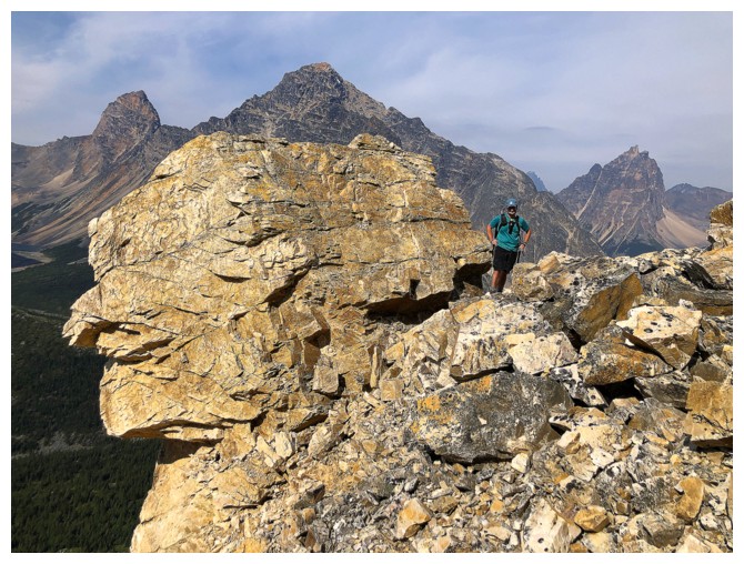
Matt and the cool rock
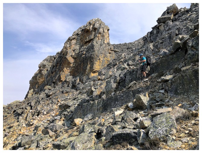
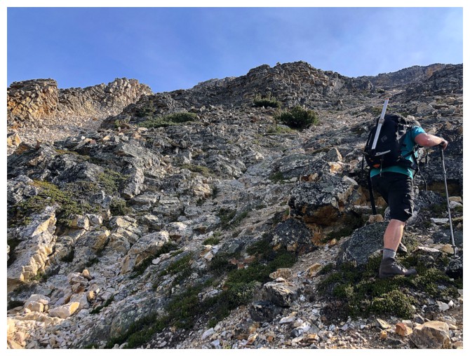
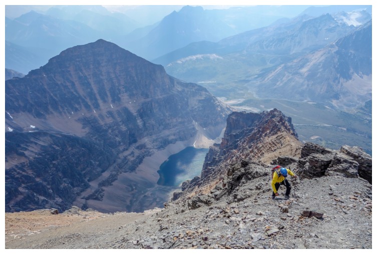
Matt makes his way up steeper and looser terrain
So do I (photo by Matt)
Another cool rock formation at the right
Same as above with me (photo by Matt)
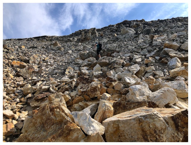
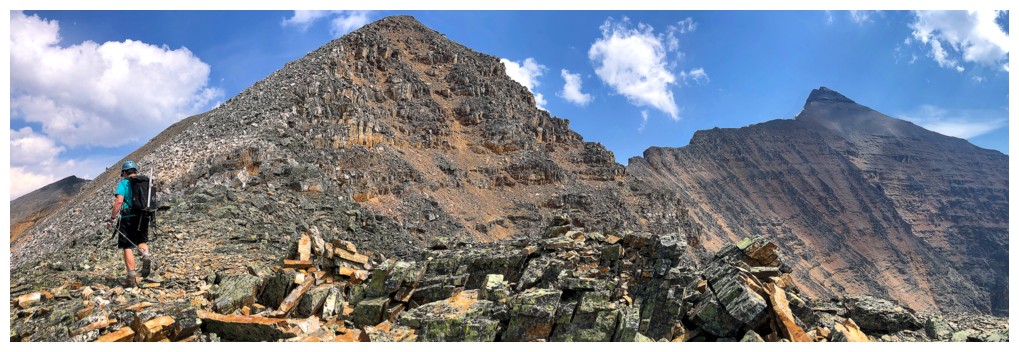
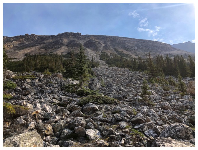
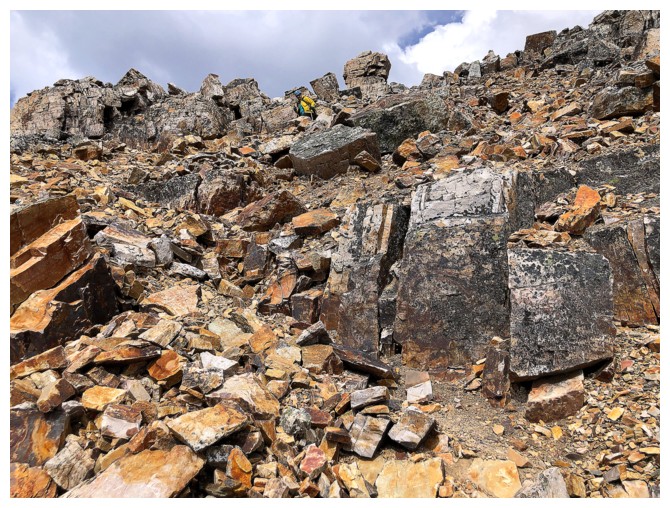
The middle section of the ascent route features unstable boulders and is much steeper than it appears
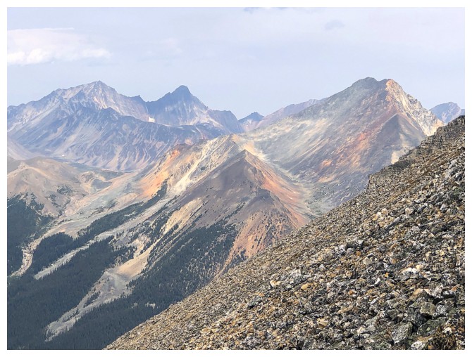
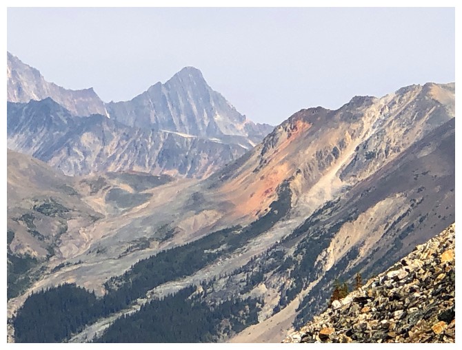
The view to the north includes several strips of strikingly colourful rock
The grade of the middle section - and like the Energizer Bunny, it keeps going and going and going....! (photo by Matt)
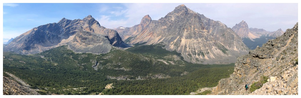
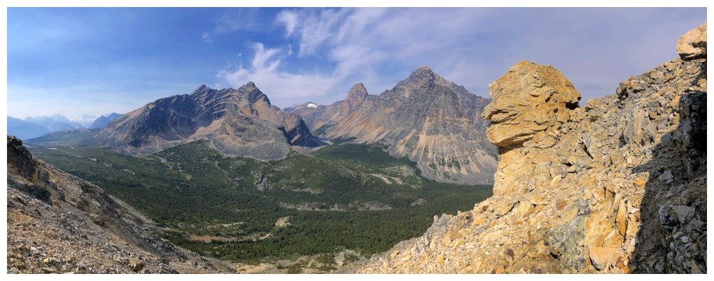
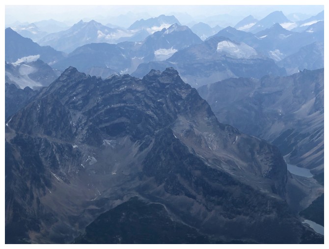
Chevron (left), Throne (right), and Campus Peak in the distant centre
At the end of the middle section and taking a well-deserved break to soak up the view
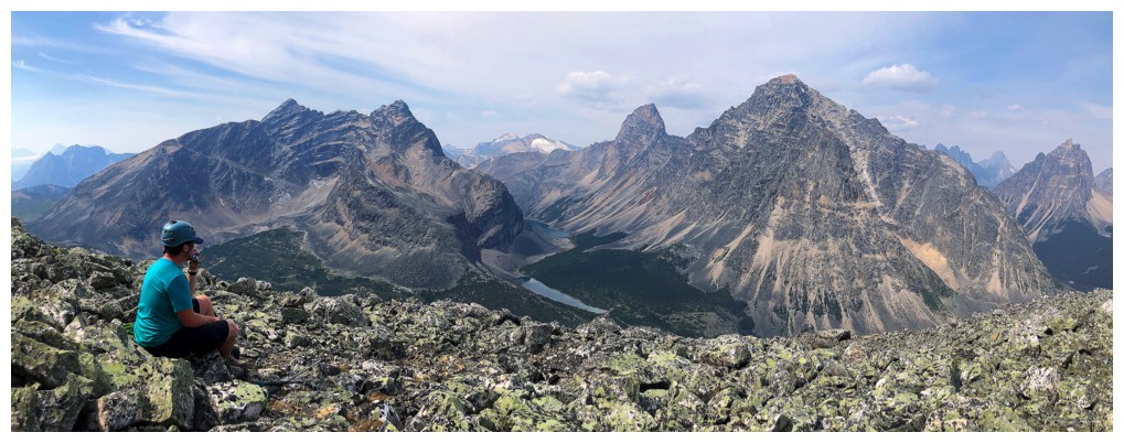
Arriving at the scenic viewpoint before the final section to the ridge. The summit of Edith Cavell at the right.
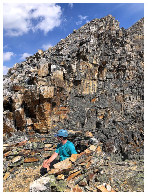
Someone has built a small rock shelter. Good place for another break (photo on the right by Matt).
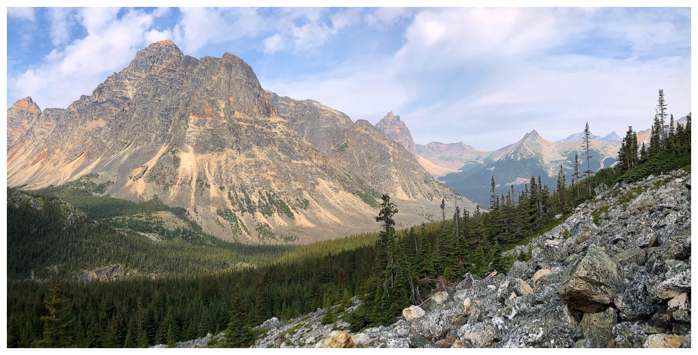
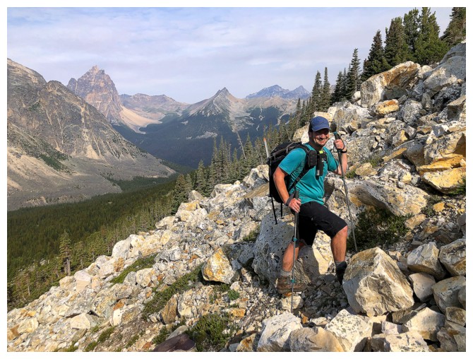
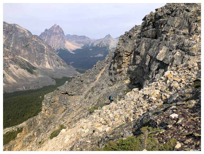
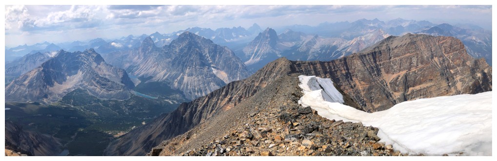
Reaching the ridge and there's Mount Sorrow
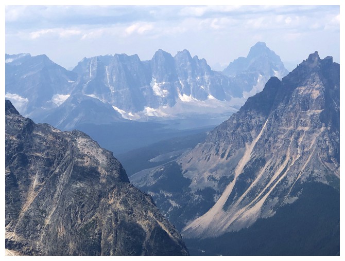
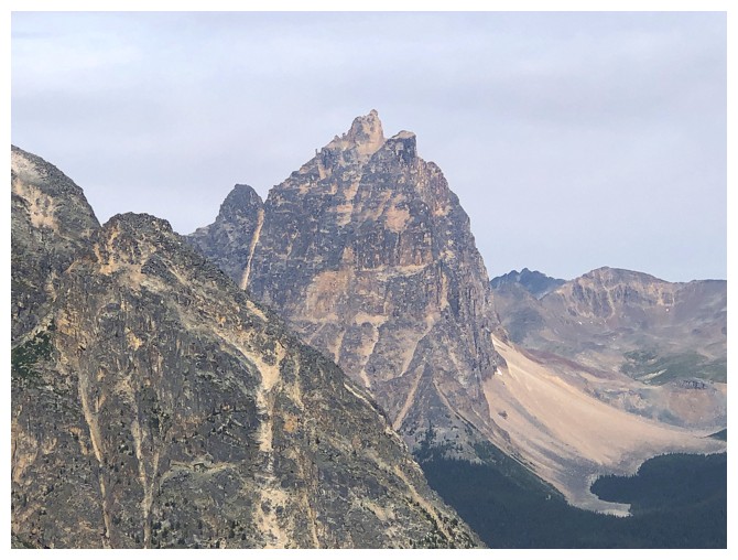
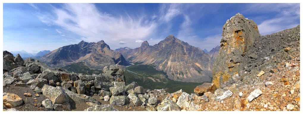
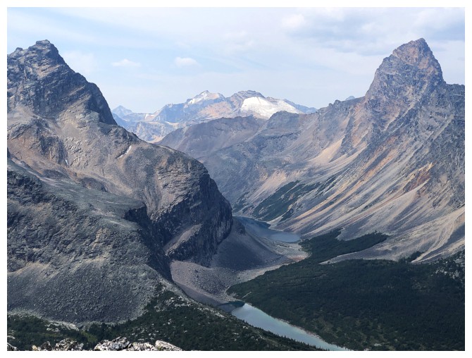
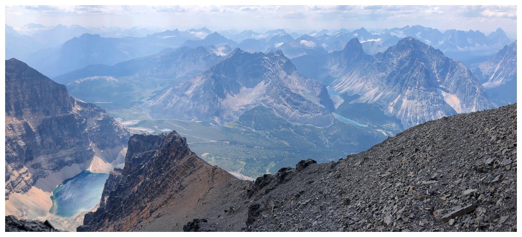
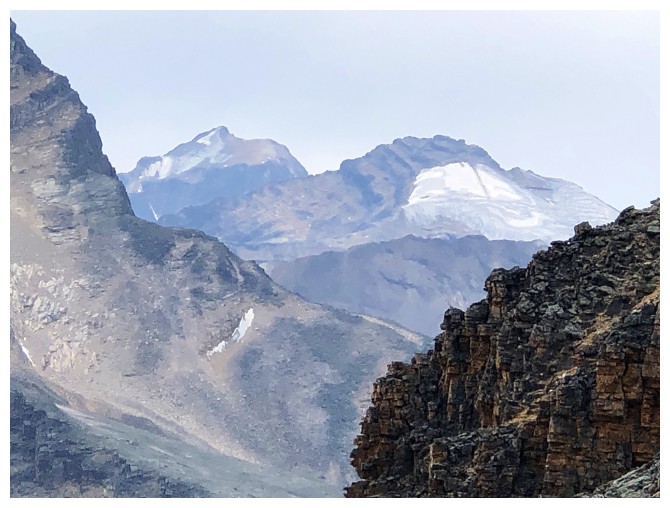
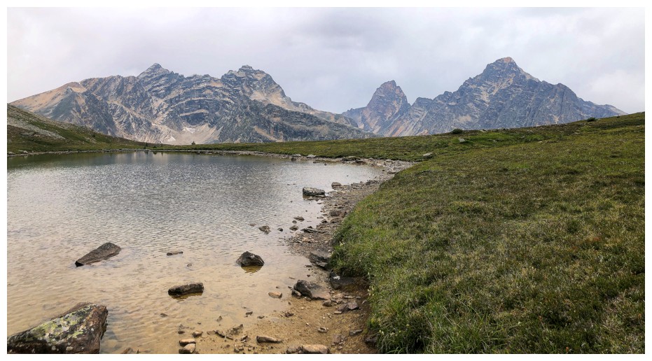
The famous Ramparts and Amethyst Lake
Even with the overcast skies, there's a killer view to the west
Checking out the remainder of the ascent to Edith Cavell (photo by Matt)
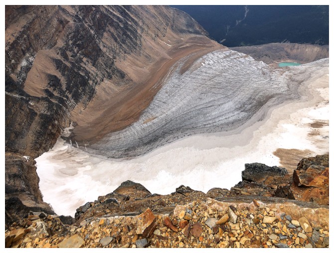
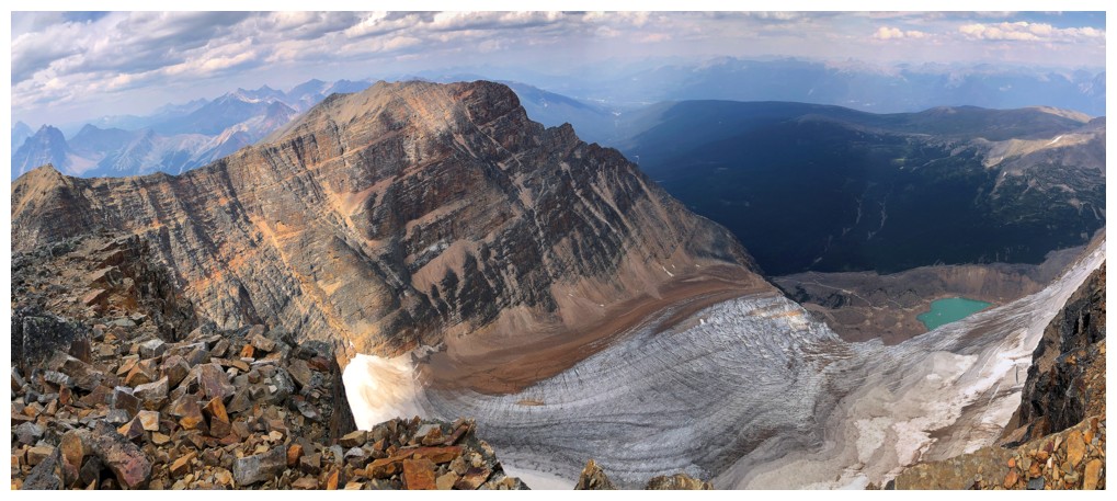
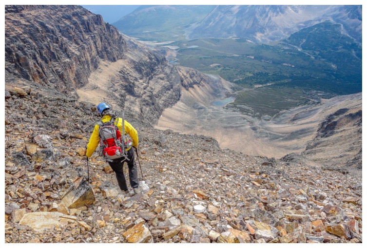
The Angel Glacier far below
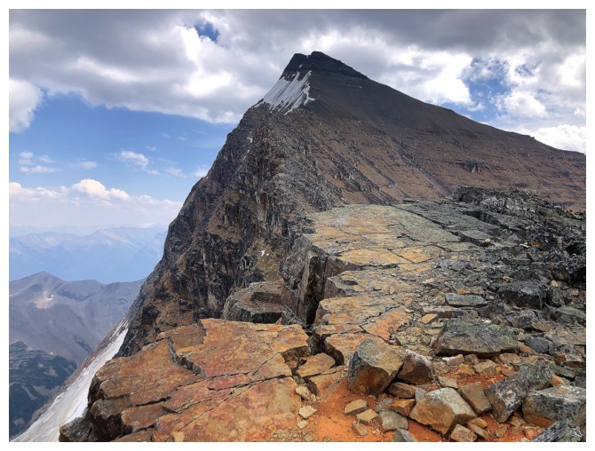
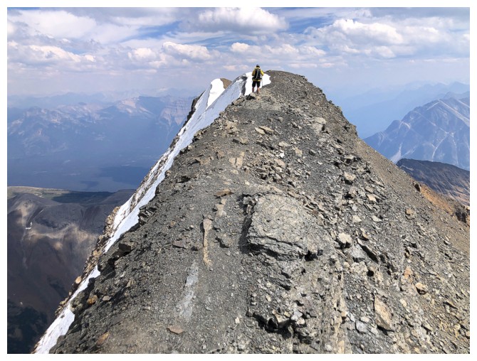
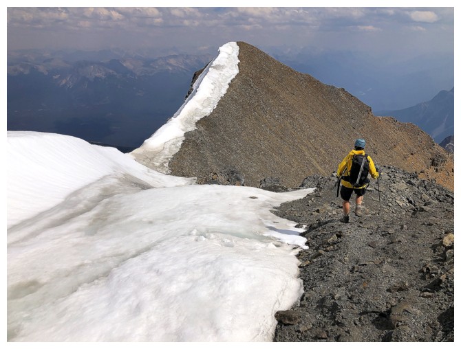
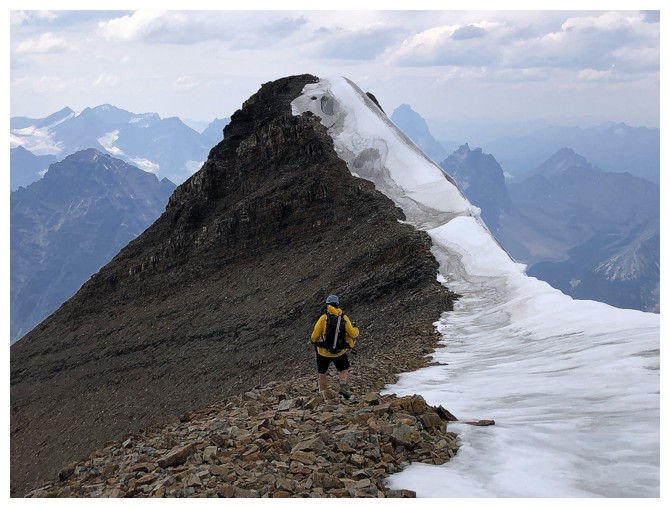
The west ridge has more bark and bite - it's an easy scramble
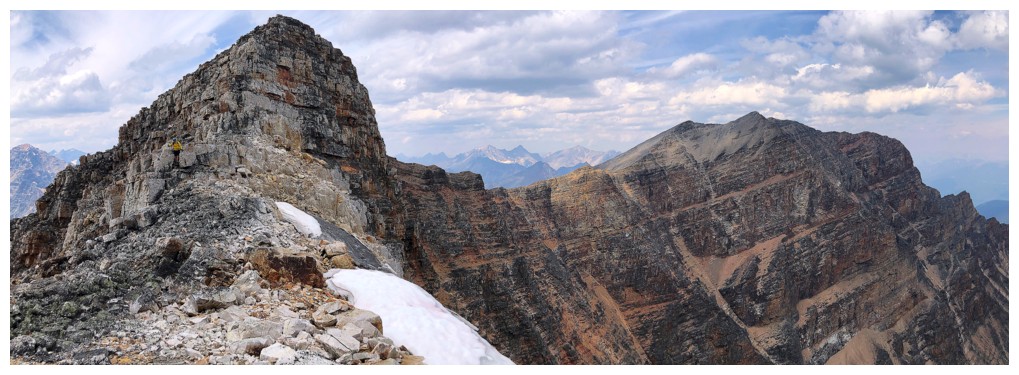
Looking back to the highpoint we reached and Mount Sorrow at the right
First glimpse of Cavell Pond
Matt leads the way
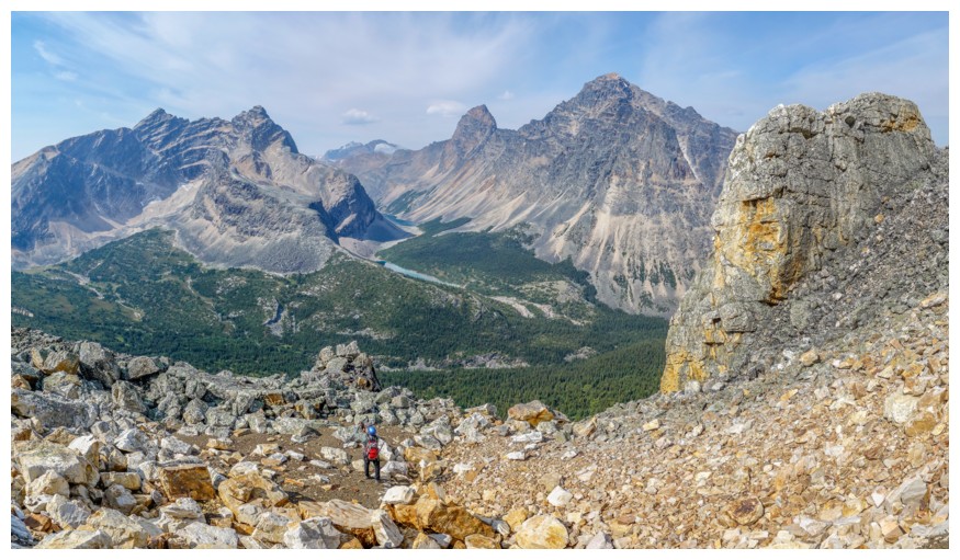
I'm still taken with the view to the west
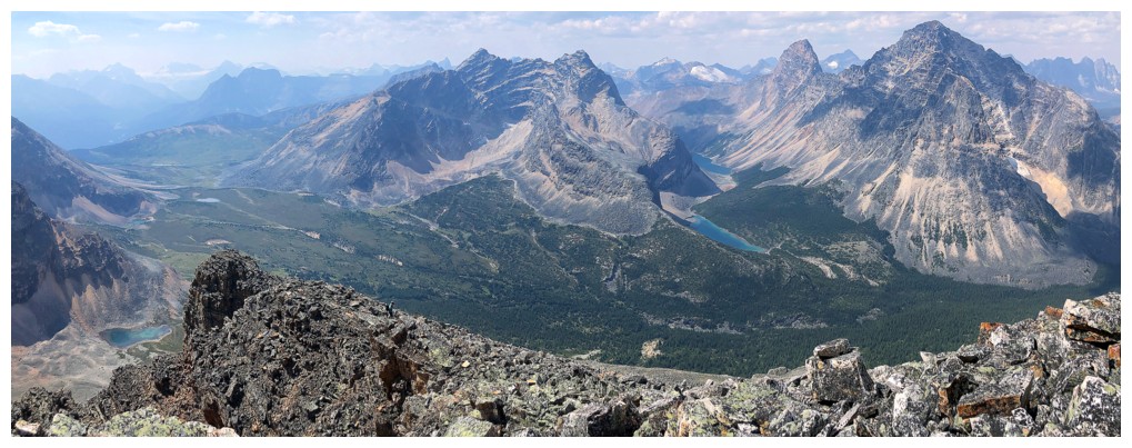
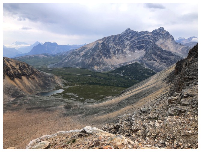
A significant but unnamed lake appears below a significant peak at the south end of Edith Cavell. Mike calls this Verdant Peak, while other sources identify Verdant Peak as the lower one behind and to the left.
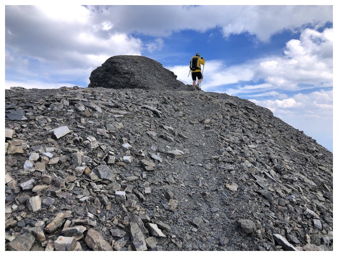
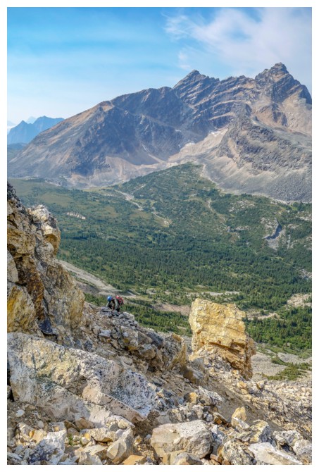
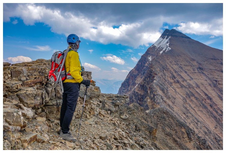
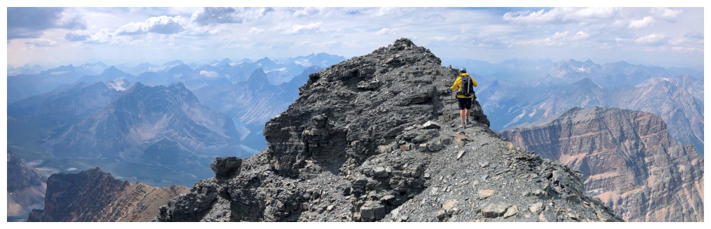
Final push to the summit
For me too (photo by Matt)
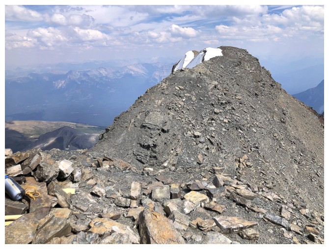
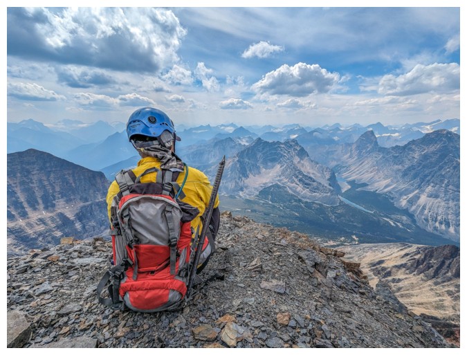
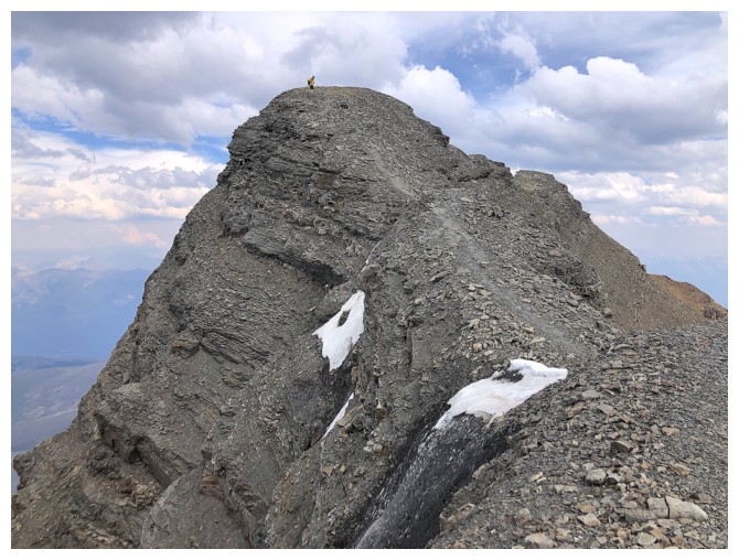
At the summit. The cairn and register should have been enough to
convince us this was the highest point, but those two farther points
definitely look higher from this angle - they are not!
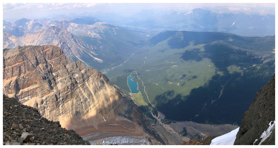
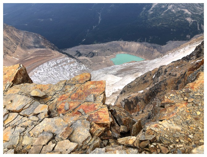
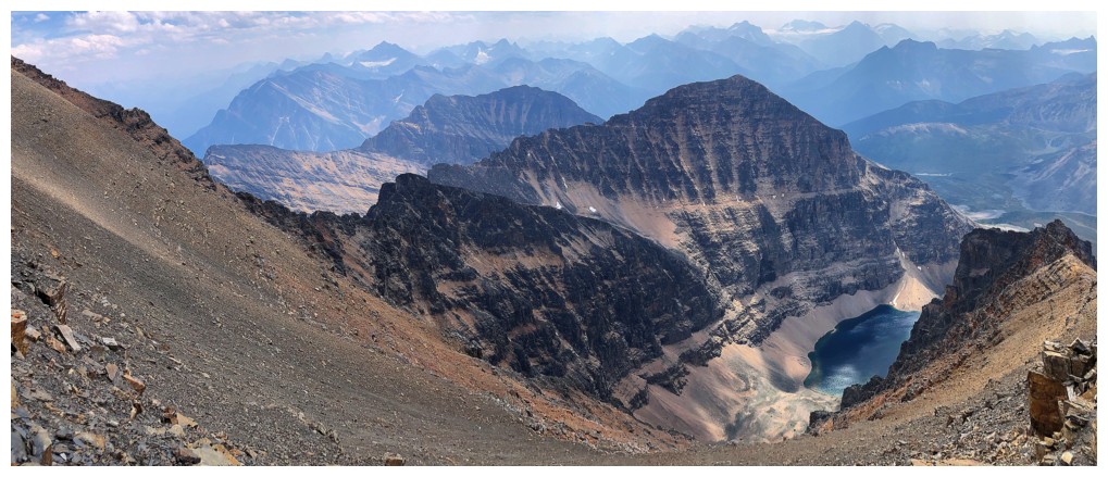
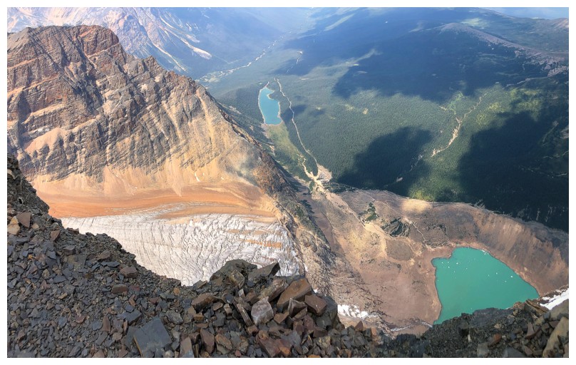
Cavell Lake and the northeast end of Mount Sorrow
Close-up
Looking down on Sorrow
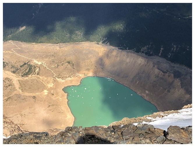
Cavell Pond
Matt approaches the first illusion
Now heading to the second illusion
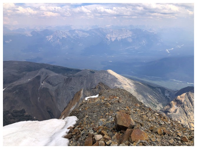
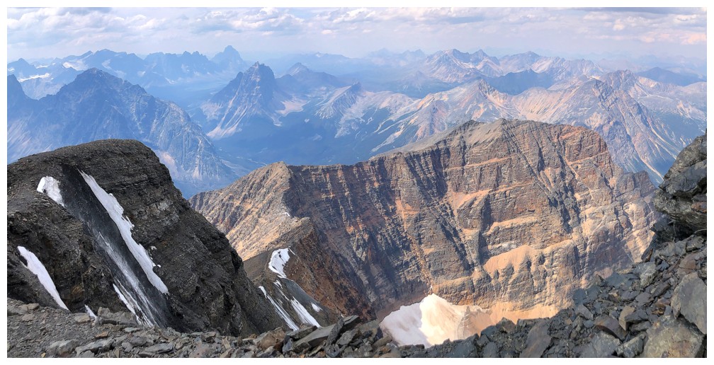
Slightly disappointing view down the east ridge. Very hazy to the east.
Another illusion: one is Verdant Peak, one is not - take your pick (peak)!
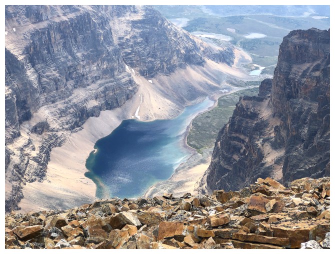
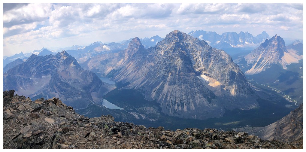
The unnamed lake is big and beautiful
Heading back to illusion 1
Approaching the true summit
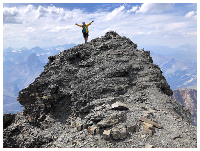
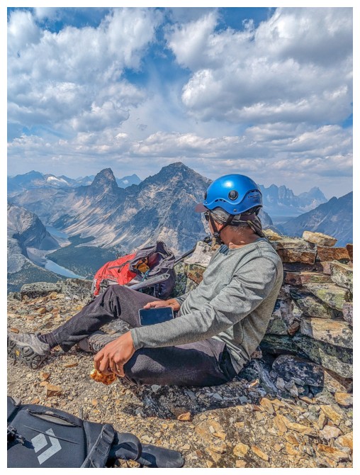
Great job Mr. 39 years, 364 days!
My age is a secret but Sammy Hagar has a classic 80's song about it! (photo by Matt)
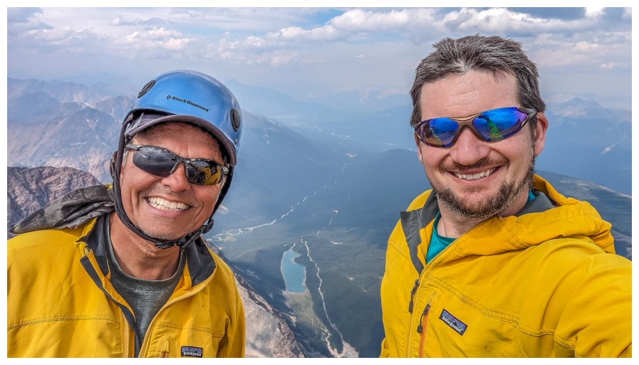
One happy old man and one happy not so old but getting there man at the top (photo by Matt)
Now we get to take all the summit photos!
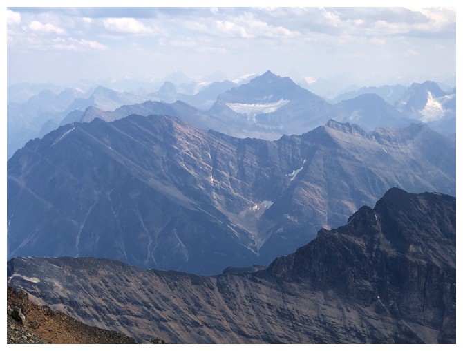
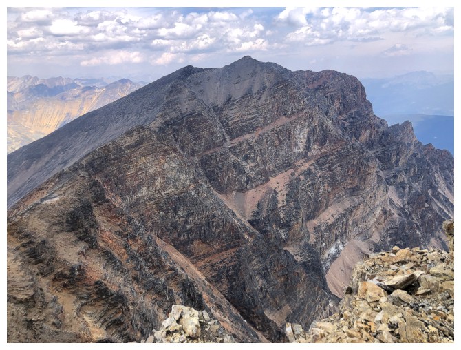
Mount Fryatt is the dominant peak to the south
Easy to see how Chevron Mountain got its name
Heading down (photo by Matt)
My view of Matt at the summit
Traversing back to the ridge
Descending the only tricky section (photo by Matt)
 Back to the ridge (photo by Matt)
Very interesting colours on this rock
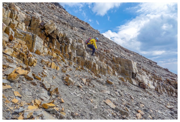
Starting
down the west face. The upper half of this route features tons of loose
rubble. I wouldn't want to be coming up at the same time people were
coming down (photo by Matt).
Matt carefully descends the loose crap
Another colourful rock
The lower half features terrific step-like rock that is a pleasure to descend
Another unnamed lake/tarn below
Campus Peak again
Approaching the tarn
At its shores
Heading back to the Verdant Pass Trail
Matt and Throne Mountain
Back near the start and an almost identical view to the one we saw 13 hours earlier
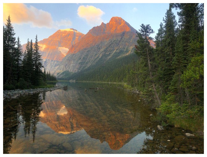
The same view the next morning
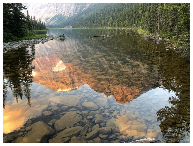
Reflection
Mount Edith Cavell and Cavell Pond
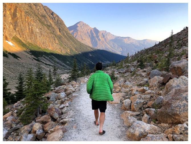
Exit Stage Centre! The pleasant morning hike was a fitting end to our trip
The End
LOG