August
26, 2011
Mountain
height: 2880 m
Elevation gain:
1540 m
Ascent time:
7:30
Descent
time:
3:35
Scrambling/climbing
with Raff.
The
last day of our two week scrambling trip and Raff and I wanted to try
something
in a totally different area. After packing up our tent from the bivy
site below
Mount Alcantara, at the western edge of the Rockies, we drove all the
way over
to the east side and parked at the trailhead for Elliot Peak, along the
David
Thompson Highway. Route information for Elliot is sparse, but we did
find a
trip report on Bivouac by Markus Kellerhals, describing a 35 degree
snow gully
to the summit. Without snow we expected the route to be a grunt, but
relatively
easy. Still, two pairs of rock shoes managed to make their way into our
respective
packs and later in the day we were both extremely relieved they did.
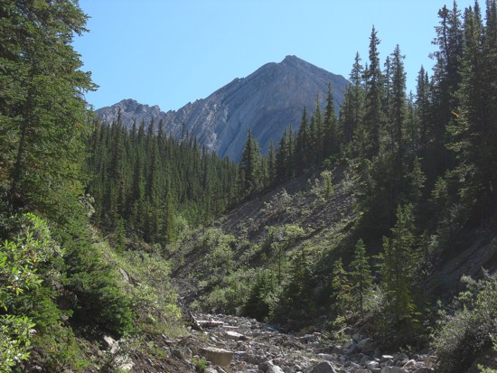
 After
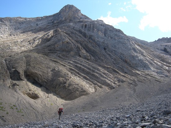
biking about 2 km to an unnamed drainage, we started a tedious and
tiresome,
bushwhacking slog alongside the creek. Thankfully the drainage
eventually
cleared and the remainder of the trek, into the bowl below the north
side of Elliot,
amounted to an enjoyable and easy boulder hop.
After
biking about 2 km to an unnamed drainage, we started a tedious and
tiresome,
bushwhacking slog alongside the creek. Thankfully the drainage
eventually
cleared and the remainder of the trek, into the bowl below the north
side of Elliot,
amounted to an enjoyable and easy boulder hop.
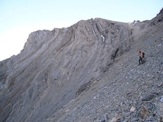
More
tedious slogging preceded an interesting search for the correct gully
up the
face – interesting in that there were so many potential gullies going
towards
the summit, it was next to impossible to ascertain the one outlined in
the route
description we had. Perhaps this was because Mr. Kellerhals and company
had
completed the ascent in spring, when the gully was snow filled and
therefore
more obvious.
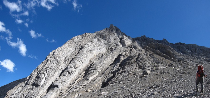
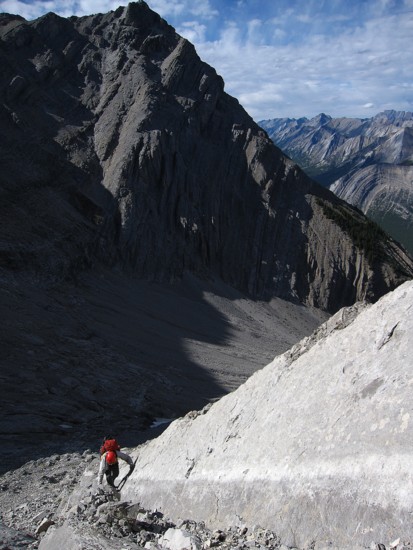
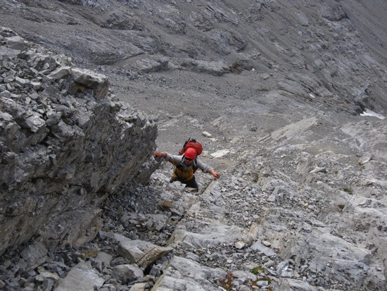
In
the interests of time, we just picked a line and started up. The slabby
terrain
on the lower slopes was gently angled and tons of fun to ascend.
However, it
soon steepened to the point where rock shoes were a far better option
to boots.
As well, route-finding became very important, some gullies leading to
seriously
steep terrain. We did have a rope and some gear, but opportunities for
placing
protection were for the most part non-existent on the down-sloping
slabs and so
we scrambled up without a rope.
Throughout
the increasingly difficult ascent we could plainly see a wide,
down-sloping
scree ramp that appeared to offer an easy route up. However, attempts
to
traverse over to the ramp were futile and so we continued up a
promising gully.
This was generally a good route, but soon became more serious when we
reached a
particularly steep step. 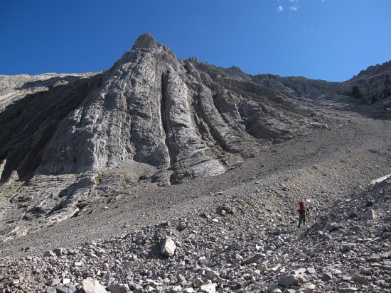 We pulled out the rope here, though in
retrospect it
was unnecessary. Above the step the angle eased up. More slogging
followed, and
then a couple of tricky moves up another short but steep step and we
were on
the ridge.
We pulled out the rope here, though in
retrospect it
was unnecessary. Above the step the angle eased up. More slogging
followed, and
then a couple of tricky moves up another short but steep step and we
were on
the ridge.
Time
was definitely becoming a concern at this point. Descending our ascent
route
would have been extremely slow and unnerving in multiple places.
Getting stuck
on the face in the dark was most unappealing and therefore we decided
we would attempt
the aforementioned wide scree ramp. Most of that route was clearly
visible,
though a cliffband lined the face below the ramp. Hopefully we would be
able to
find a weakness down the cliffband near the far end of the ramp.
The
remainder of the ascent amounted to a tedious rubble ascent as
described by
Kellerhals. I was already a little worried about getting down.
Unfortunately
that always takes away from enjoying the present moment and our short
summit
was not as gratifying as it should have been. Still, the summit view
was
excellent. The sun setting in the west detracted from views in that
direction, however
the peaks to the south and east looked great.
As
luck would have it the alternate descent route turned out to be
remarkably easy
(and remarkably ankle-jarring!). The cliffband that had caused us some
concern
eventually petered out to almost nothing. Descending it was little more
than
steep hiking – huge relief, as darkness arrived shortly after. Had we
descended
our ascent route, getting benighted on the mountain would have been a forgone
conclusion.
The
boulder hop down the creek was a little more interesting by headlamp,
as was
the GPS guided bush-bash back to the bikes. A slow, cautious bike ride
completed the day. Now at 11 in evening, we decided to camp for the
night and
drive home in the morning.
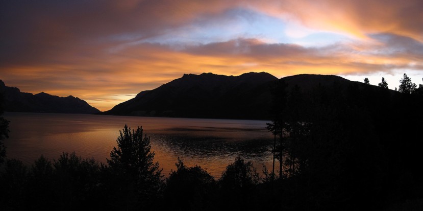
The
pleasant colours over Abraham Lake in the morning seemed to denote a
fitting
end to our very productive and breath-takingly scenic 11 day scrambling
romp.
Statistics for those 11 days were 10 summits, involving 13 355 m of
elevation
gain (43 804 feet), and 71 hours 35, minutes of hiking/scrambling. With
summits
in several distant quadrants of the Rockies, the southern-most being
Mount
Jackson in GNP, Montana, and the northern-most Elliot Peak along the
David
Thompson Highway, I can’t even begin to calculate the kilometres we put
on Raff’s
vehicle. A big thank-you to Raff not only for doing most of the
driving, but more
importantly for being a totally awesome scrambling partner.
Next
up – a well-deserved and extended rest!
 The first look at Elliot Peak
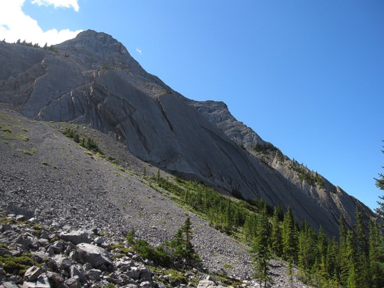
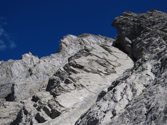
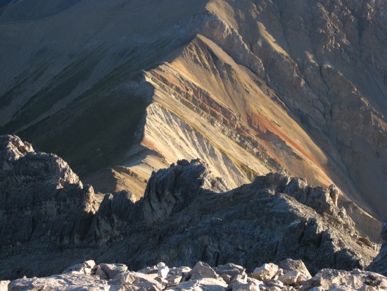
Cool slabs on the side of Sentinel Mountain
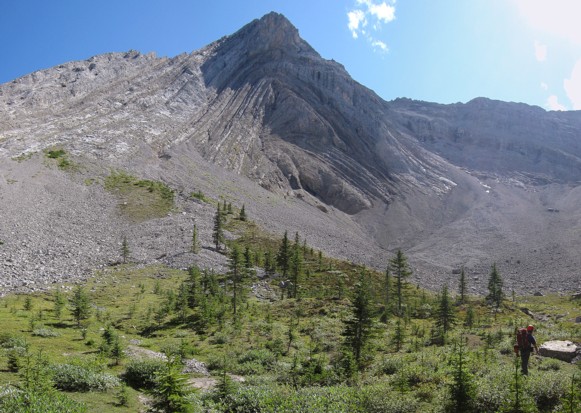
The north ridge of Elliot
The tedious slog to the ascent gullies
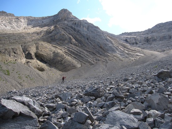
Same as above
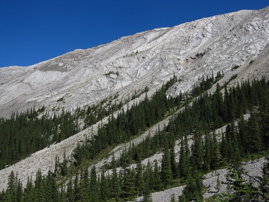
Raff approaches one of the numerous gullies that offers a potential way up
Typical slabby terrain on the lower slopes
Raff scrambles up the slabs
Same as above
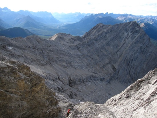
Same as above; the wide scree ramp is visible behind; ascending this ramp
would make the whole ascent an easy, but somewhat grueling scramble
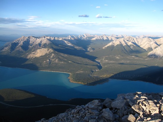
Abraham Lake
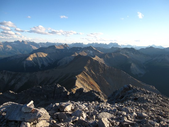
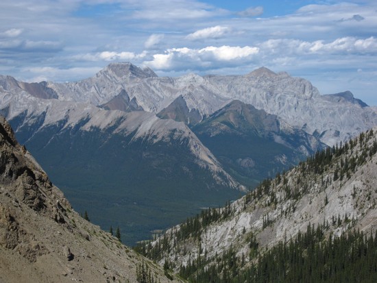
The view to the south; Mount Murchison is just visible at the distant right
A colourful col on the south ridge of Elliot
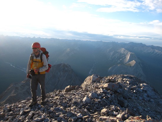
Raff enjoys the last Tangerine Fanta of our trip
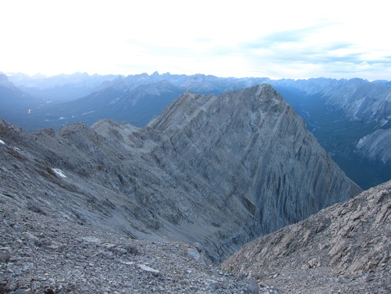
Looking down the descent route
Raff looks back up the descent route and the ascent route, basically up the centre of the face
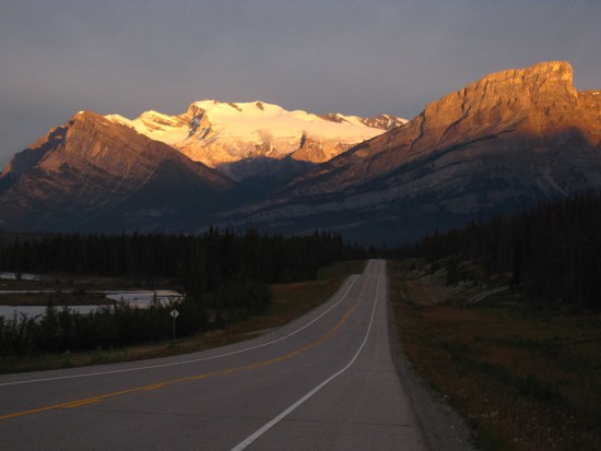
Mount Wilson gets some early morning sun
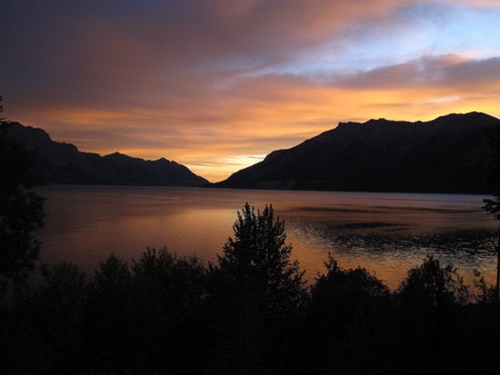
Sunrise on Abraham Lake