Mount Evan Thomas IV – October 14, 2007
Mountain height:
3090 m
Elevation gain:
1500 m
Ascent time: 6:15
Descent time:
3:40
Scrambling and a little mountaineering with Mark.
Ever since Kevin Barton and I reached the summit of Mount Evan-Thomas on our first trip together back of the summer of 2004, I’ve wanted to repeat the ascent with Mark. It’s a wonderful mountain with terrific scenery throughout and a phenomenal summit view.
Initially, Mark and I wanted to
use the same route Kevin and I had done via the west ridge. However, our recent
trip up
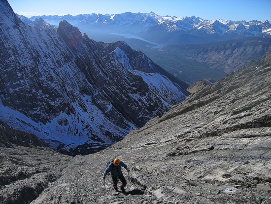
It took us two hours to reach
the ascent gully and another two to reach the ridge. The southwest ascent slopes
were relatively easy, but incredibly foreshortened. Fortunately, an amazing view
of
We topped out on the ridge right at the bottom of the second rappel, effectively bypassing anything that could be considered mountaineering or climbing. From this point to the summit, Kevin and I had enjoyed a simple and rope-free scramble to the summit. I thought Mark and I would do the same. Even with a fair amount of snow on the ridge, I didn’t think we’d have any problems. I was very wrong.
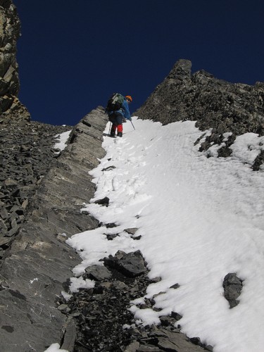
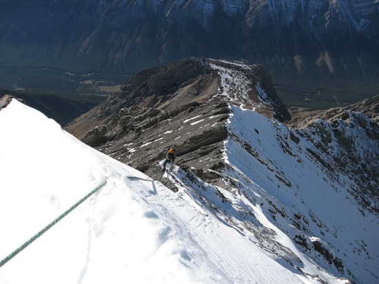
We roped up just to play it safe and it’s a good thing we did. The snow rendered the ridge a veritable death trap. Any slip down the snow-covered north slopes would have resulted in a serious involuntary glissade and probable death. The fall factor down the south side of the ridge was not much better. We progressed up the ridge very slowly. I was stunned at how difficult it was compared to the snow-free ascent in 2004. The snow was not consolidated where we really needed it to provide a measure of stability. Several times we considered turning around. The crux was a steep, heavily snow-covered section just before the terrain seemed to get easier. Mark led the step and I have to admit I was nervous just watching him go up it. I did have him on a solid belay, but if the snow gave way he still would have went for a ride before the rope caught him. We were both very relieved when he topped out above the step to a good belay position.
The remainder of the ascent was
considerably easier and much shorter than the view indicated. We arrived at the
summit exhausted, but very happy to have made it. The sky was clear, there was
very little wind, and all around were magnificent peaks – some plastered in
snow, some clear of snow, and some in between.
Our summit stay was pretty short due to the length of time the ascent had taken. We downclimbed the first section and then debated how to get down the crux. In the end we couldn’t justify taking the risk of downclimbing the unstable snow and decided to rappel. This took us past the most difficult section, but there were several more dicey ones to come. To avoid these, we took an alternate route to try to get around them. This route was okay, but still tricky in places. Eventually we were able to work our way back to the middle of the southwest slopes. At one point, the mountain released a frightening volley of huge rocks down the middle of the gully. The rocks came from the upper slopes and were bouncing down the slopes at incredible speeds by the time they went by us. We ran for cover to the sides of the gully and were quite lucky that one of them didn’t hit us. After that, Mark found a decent scree slope away from the centre gully and we made it down to the valley in good time.
Hiking out we saw another party
ahead of us. We caught up to them just before Highway 40 and to our surprise the
group turned out to be Raff, Renata, and three friends. They had just completed
an ascent of
Not the easy trip I was expecting, but an entertaining return to a magnificent mountain and in perfect weather conditions.
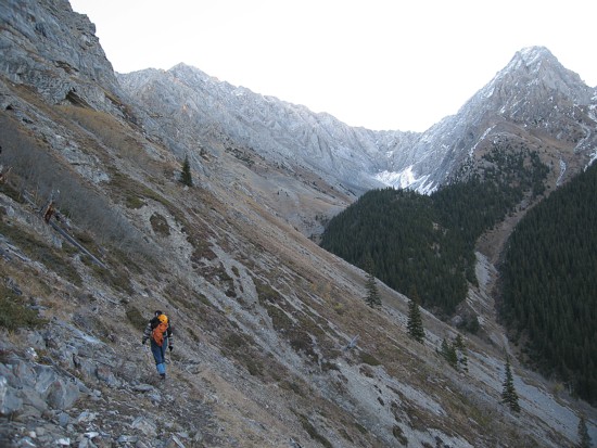
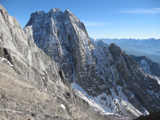
On the way to Evan-Thomas (left), with shapely Mount Packenham on the right
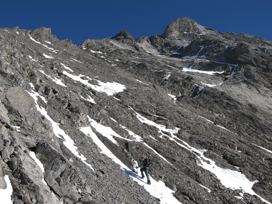
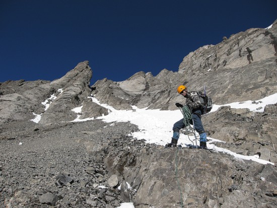
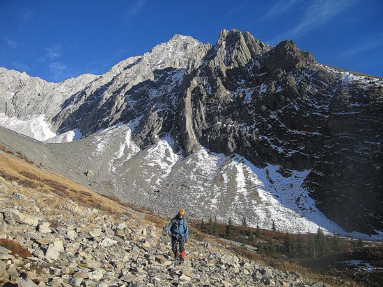
Mark takes a breather on the southwest ascent slopes
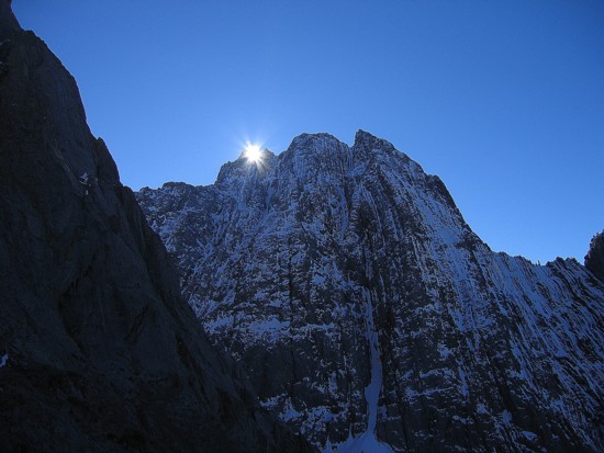
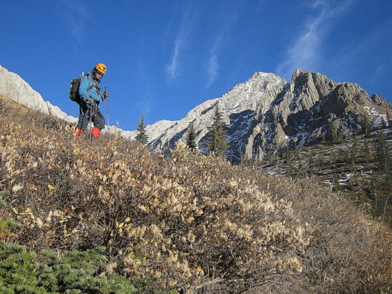
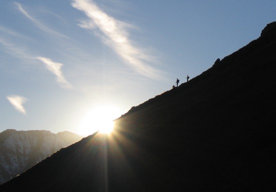
The sun pokes over Packenham
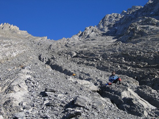
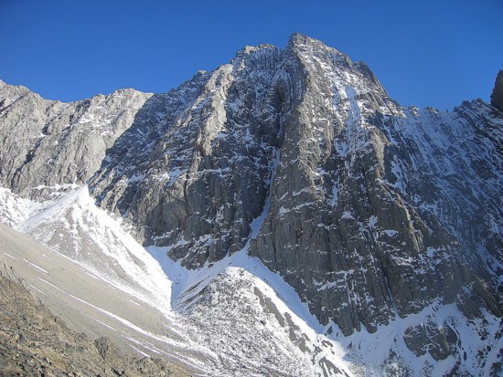
More of the ascent slopes, with the Kananaskis Lakes in the distance
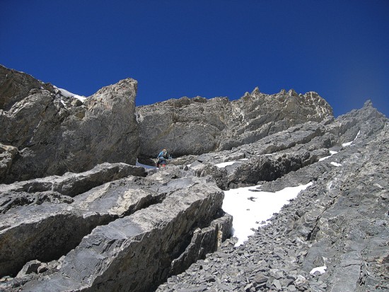
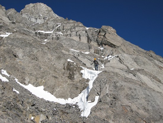
Approaching the ridge, with the summit block on the right
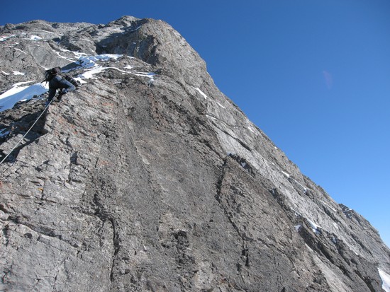
Mark ascends alongside an overhanging rib of rock
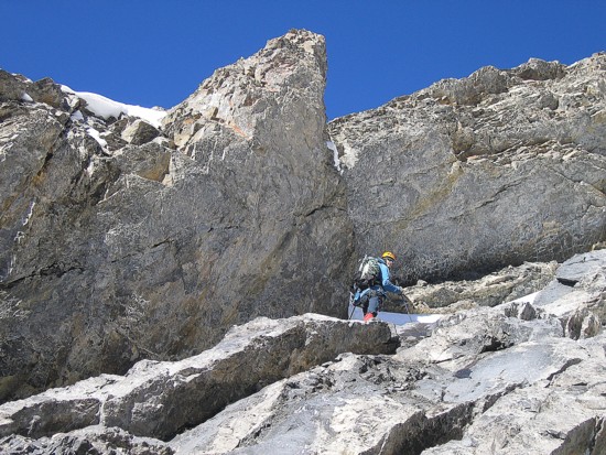
Same as above
Mark leads us up to the ridge
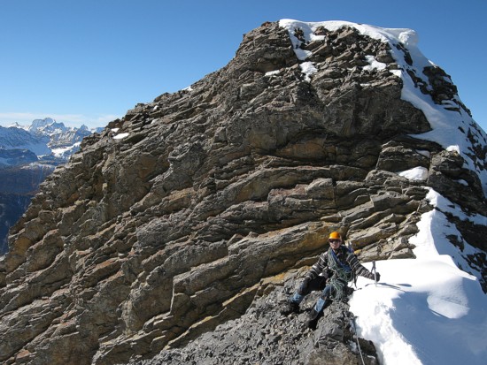
Mark on the ridge
Me on the ridge below the second rappel Kevin and I did; King George at the distant left
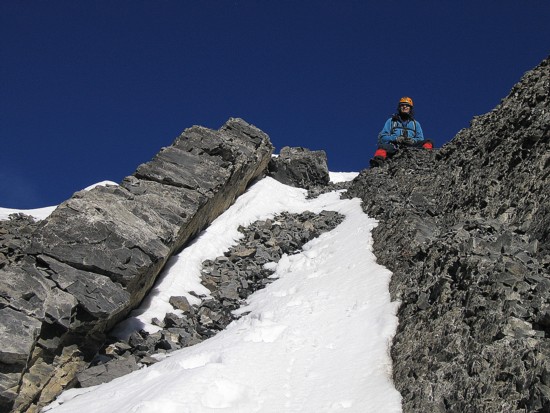
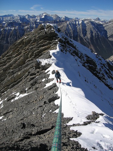
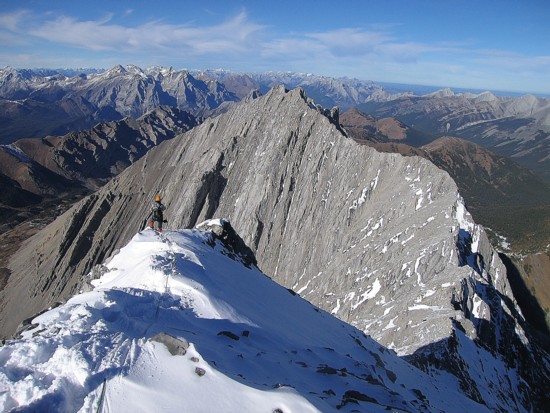
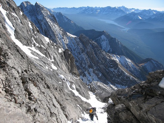
The traverse and ascent of the ridge begins
Same as above
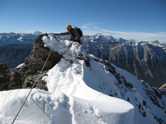
The snow was piled high on the sheltered north side of the ridge
Mark comes up the ridge
Tackling one of the steeper sections
Just below the crux pitch
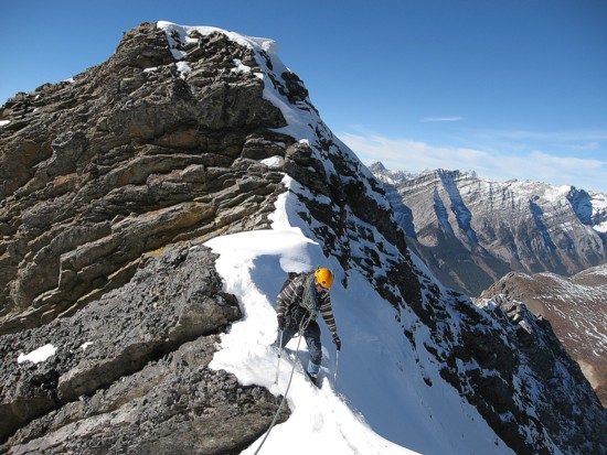
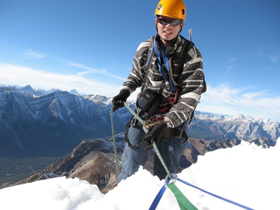
Mark prepares to belay me up the crux pitch
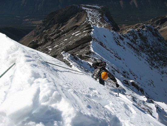
Making my way up the crux
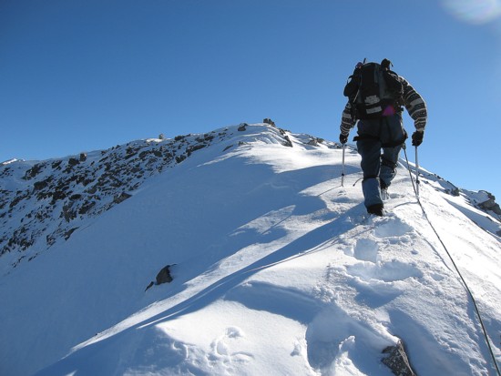
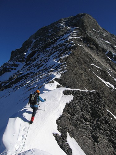
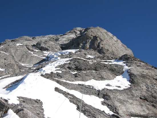
The final ridgewalk to the summit
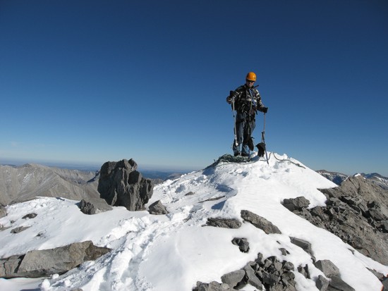
At the summit
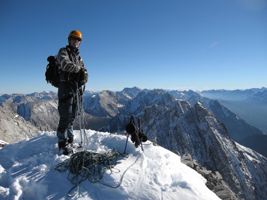
Same as above looking south
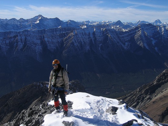
Mark at the summit
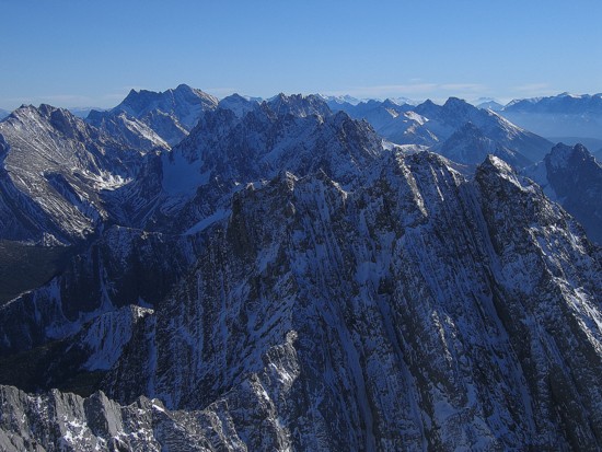
The serrated Opal Range to the south
Mark starts the descent; Mount Potts behind
Preparing to rappel
Descending a snow gully to avoid more difficult terrain
Back on the southwest slopes
Same as above
The north side of Packenham
Same as above
Hiking out

Mark stops to take one more look at beautiful Mount Packenham
More descent scenery
Two figures on the horizon as the sun disappears