 Solo scramble from hell.
Mountain height: 2905
m
Elevation gain: 1200
m
Ascent time: 6:45
Descent time: 6:15
Solo scramble from hell.
To make up for a disappointing (ie. non-existent) summit
view on
This is one trip I wouldn’t wish on my worst enemy (if I had
one!). I’ve always referred to mountains of the Continental Divide in Southern
Kananaskis as “piles of crap”, but
I was using Rick Collier’s Bivouac route description, but decided to change the approach a little by cycling up Lost Creek, instead of the Upper Cataract Creek trail. This would have been a brilliant idea had it not rained heavily during the night. The usually easy-to-travel logging road was a muddy mess. Within a hundred metres of passing the cattle fence, the gears and wheels of my bike were thoroughly jammed up with wet mud. I couldn’t even push the bike and had to abandon it by a tree. This meant I would be hiking the 5.7 km along Lost Creek instead of biking it. Not really a problem, just time-consuming, given the additional 4 km along the Great Divide Trail after that and the 7 km I had already biked.
One of the two saving graces of the trip was the beautiful
environs of Cataract Plateau – a large, open meadow below the east face of Farquhar.
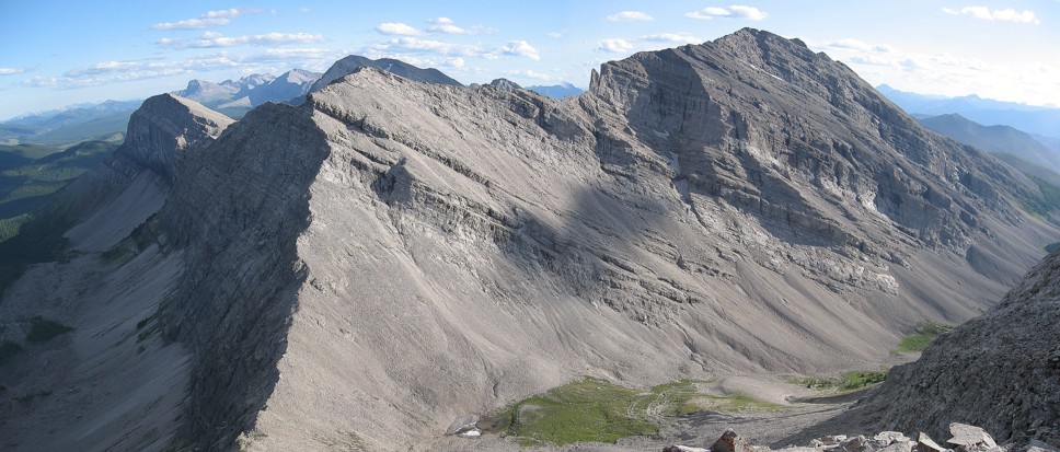
What followed was hardly a thing a beauty – several hours of slogging up some
of the worst rubble and scree imaginable. I tried to avoid the scree by staying
on the 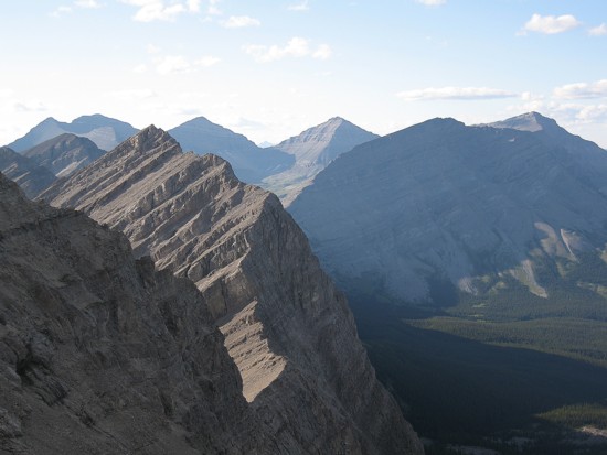
The ridgewalk to the summit didn’t fare much better either. There was some interesting scrambling, but the rock was horribly loose on a couple of exposed sections and therefore more unnerving than fun to ascend. The second saving grace of the ascent was the fine summit view, although even that, as mentioned by Mr. Collier, was marred by the unsightly mess left by Fording mining.
For descent, I decided to try an alternate route, descending south into the cirque between Farquhar and Pierce and then down the headwall between the Farquhar/Pierce col. I knew there was a route down as Mr. Collier had used this as an ascent route for Pierce. Descending the south scree slopes was as equally miserable as ascending those on the northeast side of the peak. You’d think that if a mountain was going to be a pile of crap, it would have some decent scree-surfing – not this pile of crap! It is 100% angle-twisting garbage.
I was able to downclimb about half of the headwall below the
Farquhar/Pierce col, but got cliffed out. This wasn’t a comfortable situation
to be in, having not ascended this way and so I returned to the col and then
slogged back up to the
Having got down the disgusting scree unscathed in approach shoes, I found it decidedly ironic I would later roll my ankle quite badly while hiking the easy Great Divide Trail. Overall, not a trip I’ll remember with the fondest of memories.
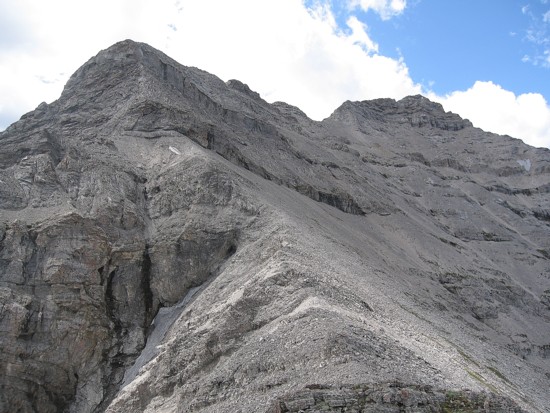
Mount Farquhar
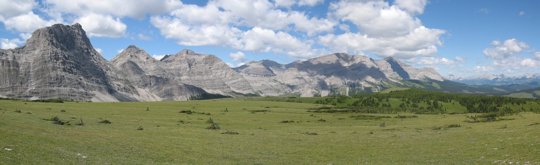
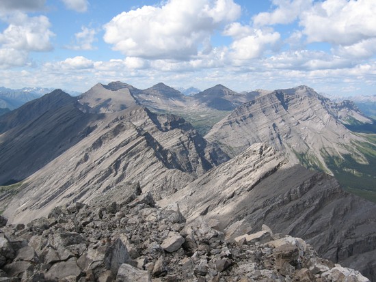
Looking northwest from Cataract Plateau; L to R: Unnamed, Holcroft, Scrimger, Etherington, Baril
Mount Pierce and the Farquhar/Pierce col; the headwall I failed to downclimb
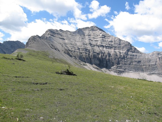
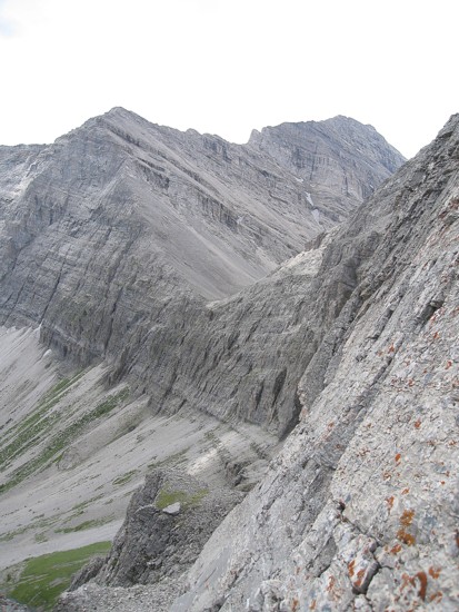
The northeast face of Farquhar
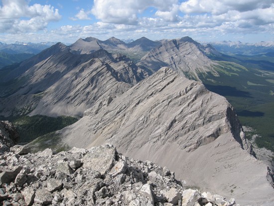
The summit view to the north; the Pyramidal-shaped peaks in the background are Courcelette, unnamed, and Cornwall
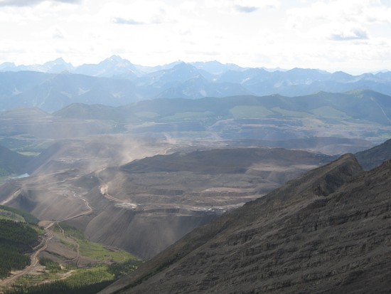
The Fording mine
Mount Pierce
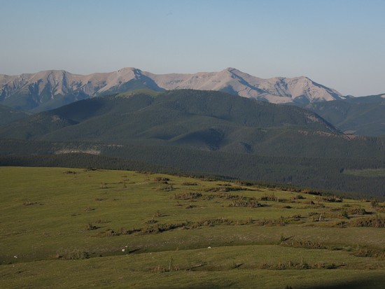
Cataract Plateau in the foreground and Mount Burke behind