Mountain height:
2,351 m (7,711 ft)
Elevation gain:
651 m
Ascent time:
4:20
Descent time:
2:20
Scrambling with Kevin.
Mount
Fortune
is one of those peaks that begs the question, “Why is this an official
summit?” Basically the southern tip of a large massif, with Mount
Turbulent
as a highpoint and several other subsidiary summits, Fortune hardly deserves
its own name. Nevertheless, official or not, the mountain offers an interesting
and relatively easy ascent and fabulous views of the Spray
Lakes
area.
This is also one of those mountains that I wouldn’t have
thought about ascending and so when Kevin suggested we attempt to ski up its
southwest slopes, I was more than eager. We started at the Mount
Shark
parking lot and after skiing aimlessly in circles for a while, around some of
the Mount Shark cross-country ski trails, Kevin found an easy route to the lake. Skiing across the lake was
quite an experience in itself. One would expect a frozen lake to be almost
completely flat, however, the southern end of the Spray Lake was more undulating
than anything, leaving Kevin and I somewhat baffled and a little unnerved in
some sections. At one point, we came across a wide and very long opening in the
ice and thought we might have to turn back. We were relived and mystified to
find that it was a stream, running north into the lake, and at this end, the
lake was obviously very shallow. Further on, we reached the end of a plateau
section and then had to descend about 2 metres onto more level terrain –
remember, this is all in the middle of a huge frozen lake!
As we approached the base of the mountain, it became
obvious that we would be doing the ascent on foot and that the southeast slopes
would grant a faster and safer route up. The steep, rocky, and heavily treed
terrain was simply not conducive to a ski ascent. Attaining the ridge proved to
be the crux of the ascent. The terrain was, at times, steep and covered in a
deep layer of fresh snow, with an old, hard layer underneath. Postholing in the
thigh-deep snow slowed travel considerably. Luckily for me, Kevin graciously
took on the role of trail-breaking, making my ascent considerably easier. Kevin
actually led almost the entire ascent at a very impressive break-neck speed,
while I sucked wind, some distance behind.
The weather had been absolutely bleak throughout the trip
(the epitome of “socked-in”) and continued to worsen as we gained the ridge
and started towards the summit. While we were teased with occasional views of
Mounts Turner and Morrison, everything to the south (Birdwood, Smuts, etc.) and
everything to the east (Sparrowhawk, Buller,
Engadine, etc.) was thoroughly blanketed in dark, low clouds. We were both certain there
would be no summit view to speak of. Thankfully, along the way, the scenery did
get interesting as we passed the odd group of trees, covered magnificently in
ice and fresh snow.
We got the view we expected at the summit (that is –
nothing!), however, as we took a GPS reading and studied the map, to confirm we
were at the summit, the sun miraculously broke through the clouds and a few of
the surrounding peaks started to emerge. Even in the partially sunny, but most
cloudy conditions, the panorama was stunning. The surrounding mountains were all
plastered in fresh snow, looking more like peaks from the
Himalayas
than the
Rockies. Mount
Buller
took on a very unique perspective and looked far more intimidating than it
really is. We stayed at the summit for 20 minutes enjoying the unexpected and
wonderful views and every second of the glorious break in the weather. Within
minutes of leaving the summit, the gray clouds returned and remained for the
entire descent. Our timing could not have been more perfect.
The descent was remarkably fast, easy, and fun. We could
almost run through our ascent tracks in the snow. Of course, skiing back across
the lake was no faster. An unexpectedly great day on a very insignificant
mountain – awesome choice, Kevin!
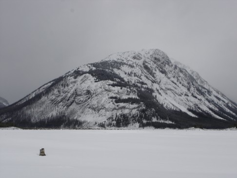
Mount Fortune, as
seen from the south end of Spray Lake (photo by Kevin)
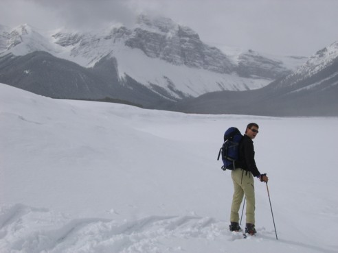
Kevin, skiing across the lake; "Why are we
going down...it's supposed to be a lake??"; Mount
Turner in the background
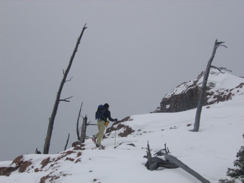
Kevin, breaking trail on the ridge
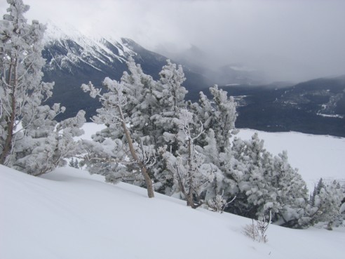
One of the many wonderful scenes of ice and snow-covered
trees
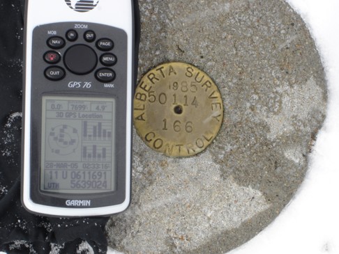
Kevin's GPS next to the Alberta Survey marker at
the summit (photo by Kevin)
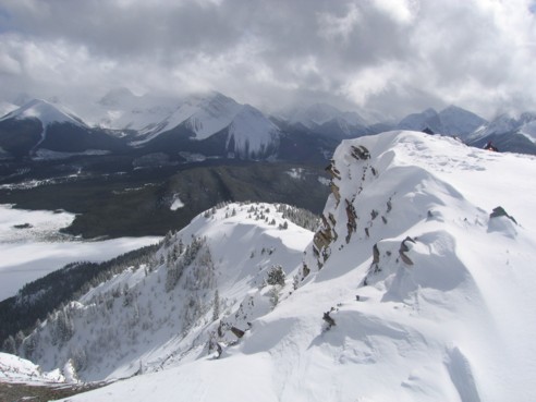
Looking back at the ascent route; Mount
Shark to the left
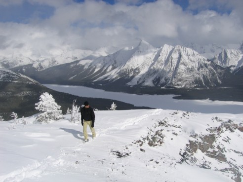
Kevin explores the summit, looking for an
alternate descent route
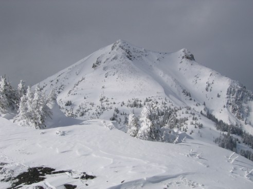
Two attainable higher points to the north; we
considered the trip, but decided there was too much snow to get up the final
steep section
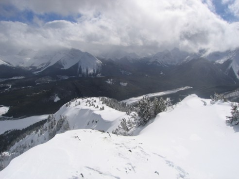
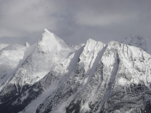
Another view of the summit and beyond
A unique view of Mount
Buller (photo by Kevin)
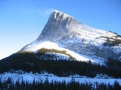
At the end of the day, the sky really cleared; Ha
Ling Peak, as seen from highway 742