August 4, 2008
Mountain height:
3234
m
Elevation gain:
1330
m
Ascent time:
7:50
Descent time:
5:10
Mountaineering with Mark.
 As the third highest mountain in
Kananaskis, exceeded in
elevation only by Joffre and Sir Douglas, you’d think Mount
French would
receive a great deal of attention. Aside from the obvious –
it’s falls short of
3353 metres (11,000 feet) – we found out why firsthand: the
big “E” – exposure!
I bet your average nudist colony sees less exposure than the south
ridge of
As the third highest mountain in
Kananaskis, exceeded in
elevation only by Joffre and Sir Douglas, you’d think Mount
French would
receive a great deal of attention. Aside from the obvious –
it’s falls short of
3353 metres (11,000 feet) – we found out why firsthand: the
big “E” – exposure!
I bet your average nudist colony sees less exposure than the south
ridge of
 Rod McAlister had completed a solo
ascent of French in
August of 2007 and recommended the route to us. Knowing Rod’s
amazing abilities
as a solo scrambler, we chose to take a rope and some protection and
treat the
climb as a mountaineering trip.
Rod McAlister had completed a solo
ascent of French in
August of 2007 and recommended the route to us. Knowing Rod’s
amazing abilities
as a solo scrambler, we chose to take a rope and some protection and
treat the
climb as a mountaineering trip.
It took us a surprisingly long four
hours to reach the Haig
Glacier. We had taken the same amount of time on snowshoes, earlier
this year
on an ascent of
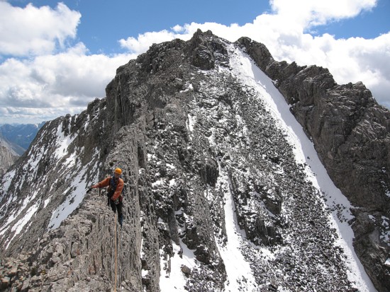
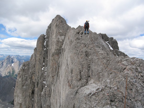
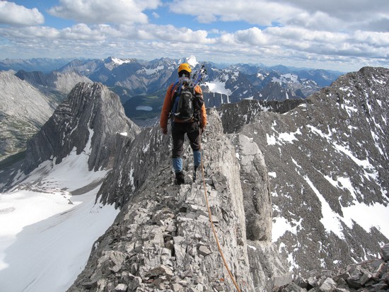
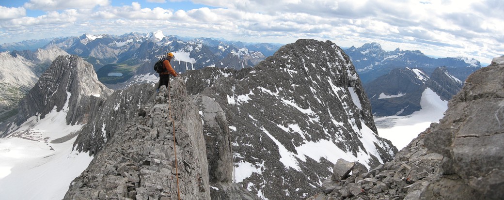
The ridge was a different story. A little scree might actually have been nice - anything to account for the fact that in place of tedious scree there was nothing but air. The ridge wasn’t too bad at first, but shortly before the summit we arrived at one of the most daunting mountains scenes we’ve seen in a while. The ridge narrowed to about 30-40 centimetres (12-16 inches for the imperialists), with an enormous vertical slab on the west side and a severe drop on the east. Though not technical, we roped up and set up the belays as best we could, even though a slip off either side would result in a significant pendulum fall. Thankfully, this section was only about 35 metres in length.
Everything after that was
child’s play, relatively speaking
and we arrived at the summit, quite happy with ourselves. Even though
the
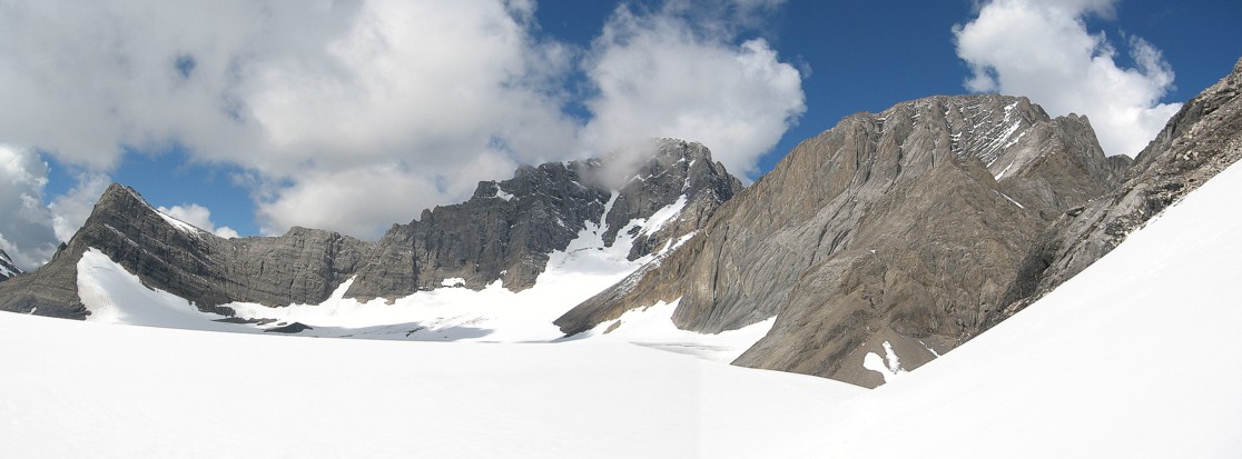
weather was not fully cooperating the summit panorama was absolutely
stunning –
definitely in the top 5 of all-time. It was unbelievable how many peaks
were
visible. I especially enjoyed the slabby west face of
We expected to take almost as much time going back across the narrow ridge and so we left the summit at 4:30 pm. Going back across the crux section was a little harder than going up it and we took all the time needed. The remainder of the descent was so easy compared to what had preceded, it was almost criminal! Having said that, the trail along French Creek was about 5 km longer than I would have liked and both Mark and I were happy that we wouldn’t have much need to hike that trail again.
Overall, a thoroughly satisfying day on a magnificent and unjustly neglected mountain.
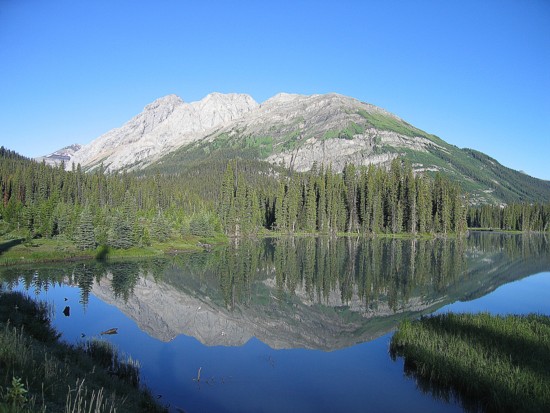
Birdwood and Commonwealth reflected in Mud Lake
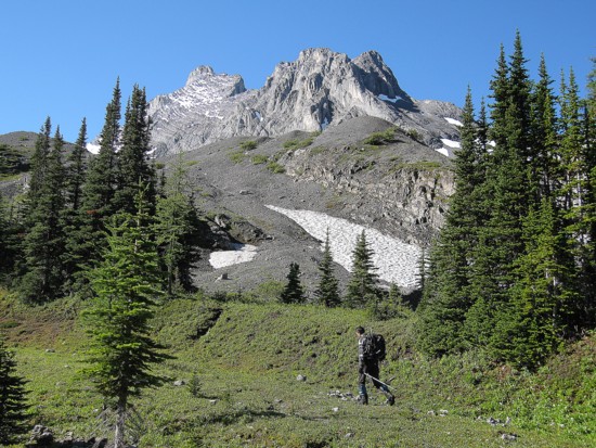
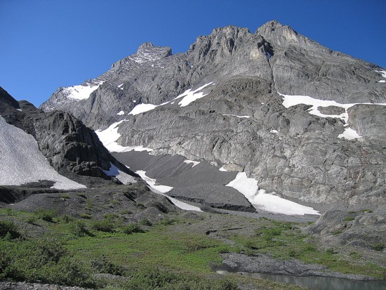
Approaching the moraine of French Glacier; the northeast face of Mount Robertson shown here
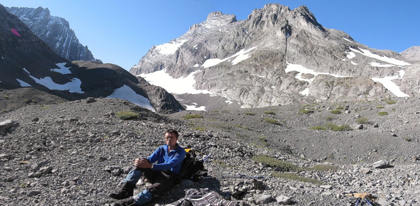
Stuffing my face with food before tramping up the glacier
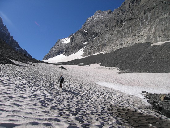
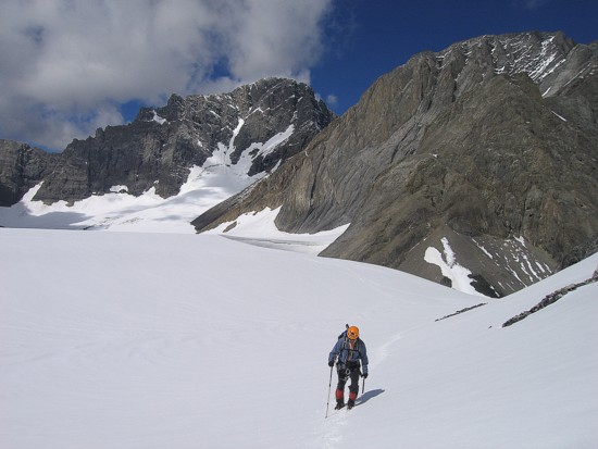
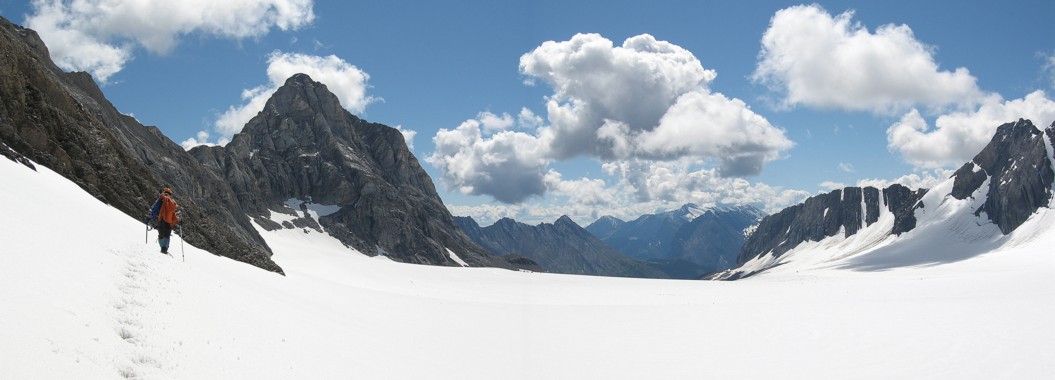
Mark leads us up the glacier
I follow
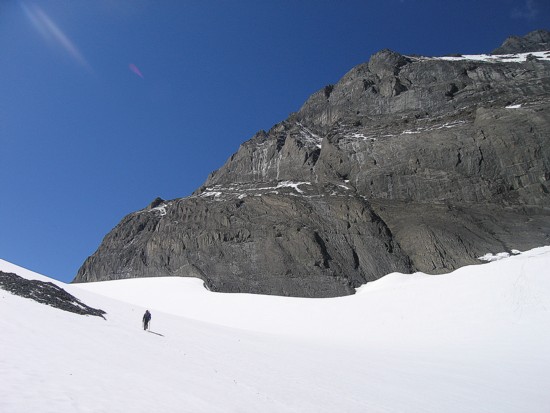
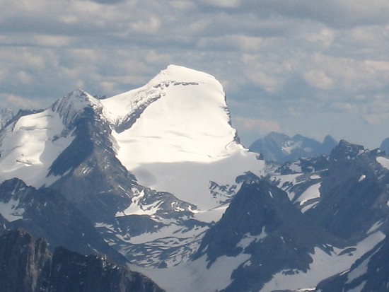
Mount Robertson again
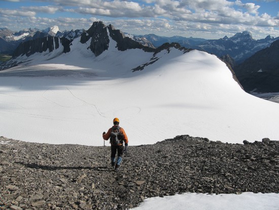
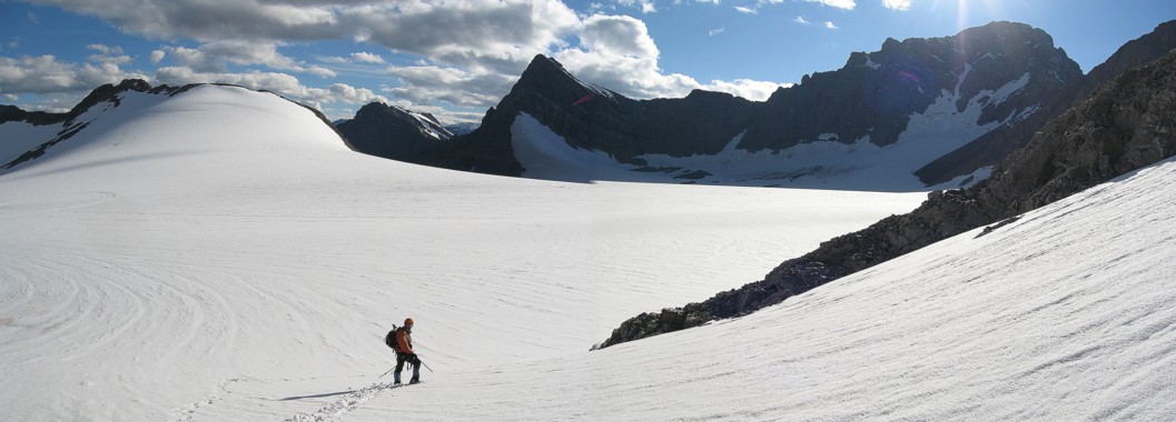
On the Haig Glacier with Munro, Sir Douglas, and Robertson
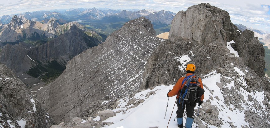
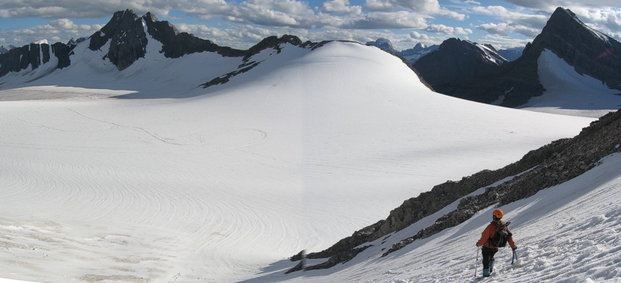
Heading around to the southwest side of French, Jellicoe at the left
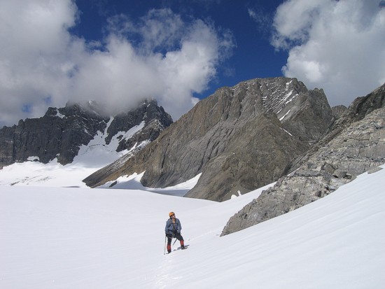
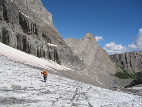
Mark looks up the ascent slope
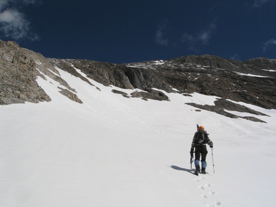
Heading up that slope
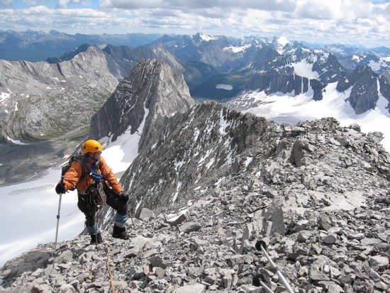
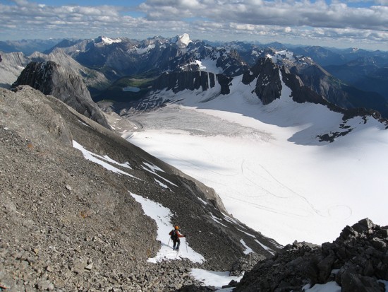
Mark comes up the slope, with the Haig Icefield stretched out below
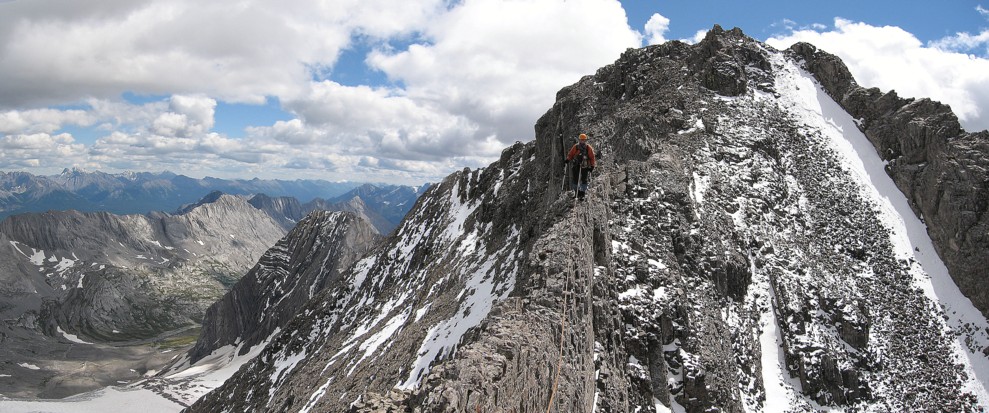
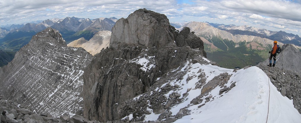
On a narrow section of the ridge (but not the most narrow)

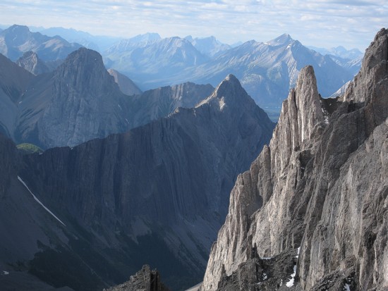
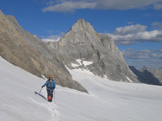
The beautiful west face of Smith-Dorrien
Looking south
The ridge starts to narrow again
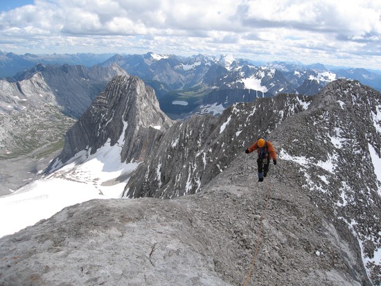
Then it widens considerably
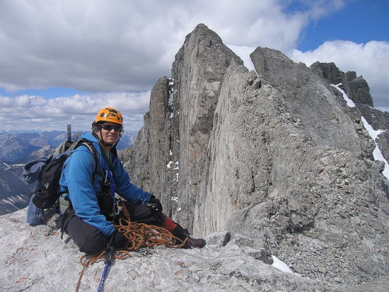
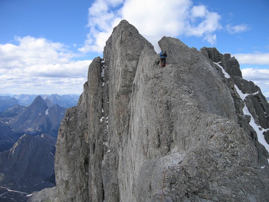
Mark tries to looks happy as we arrive at the crux (I felt naueous!)
Inspecting the crux
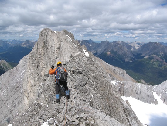
Past the crux (thank the Good Lord) and heading to the summit
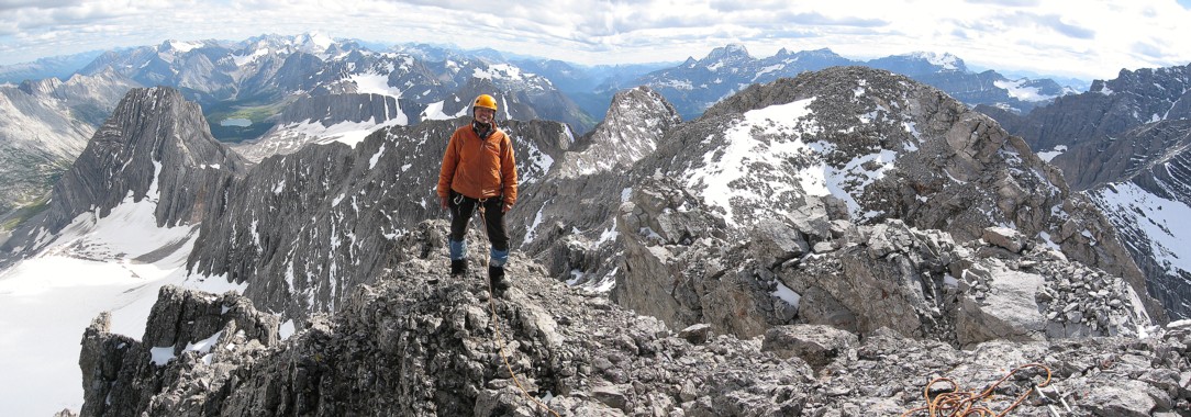
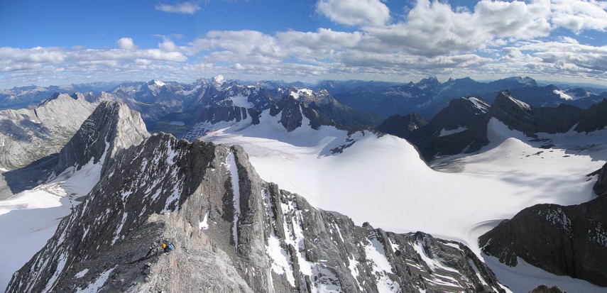
At the summit looking south
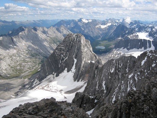
Mount Jellicoe in the centre
Looking north; the peak in the sunlight, at the right is Prairie Lookout (only 40 m lower than French)
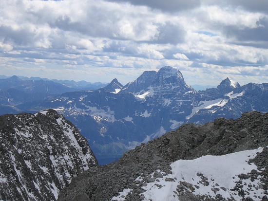
South again; Joffre obviously dominates the view
Especially now
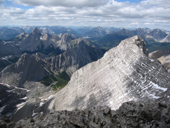
King George; Prince Albert is hiding in front of George, Princess Mary is the pointed peak to the left,
with Prince George in front of her; Prince Edward is at the right (that's a lot of British royalty!)

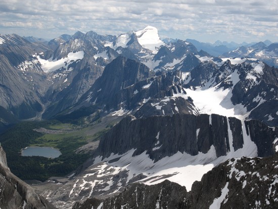
Assiniboine at the distant left; Birdwood at the right
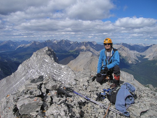
Mark at the summit
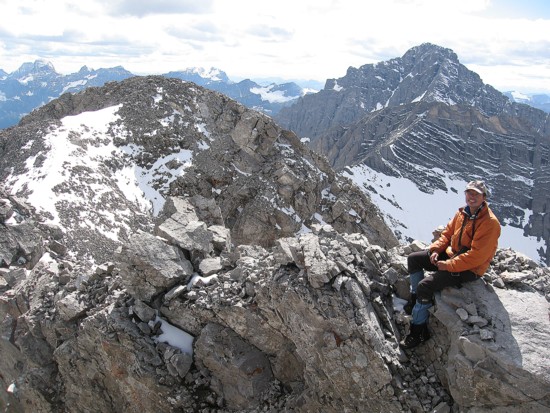
Another summit photo, but I'm wearing my Rams cap in anticipation of the upcoming NFL season
(highly unlikely the Rams will win the Superbowl, but after last year's 3-13 record, they can't be much worse!)
Preparing to go back over the crux
Stopping halfway over; there was a nice ledge to walk along at this point
Mark removes a sling before he descends the last part of the crux
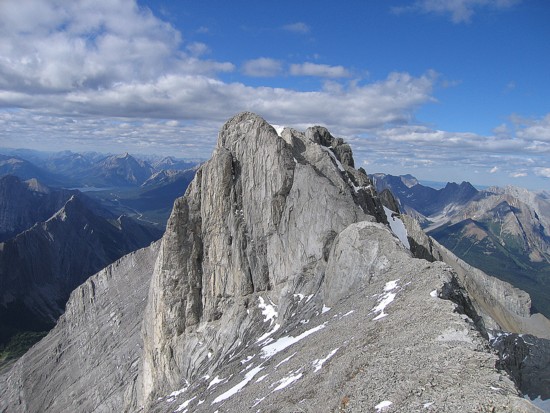
Looking back at the summit block
Jellicoe again
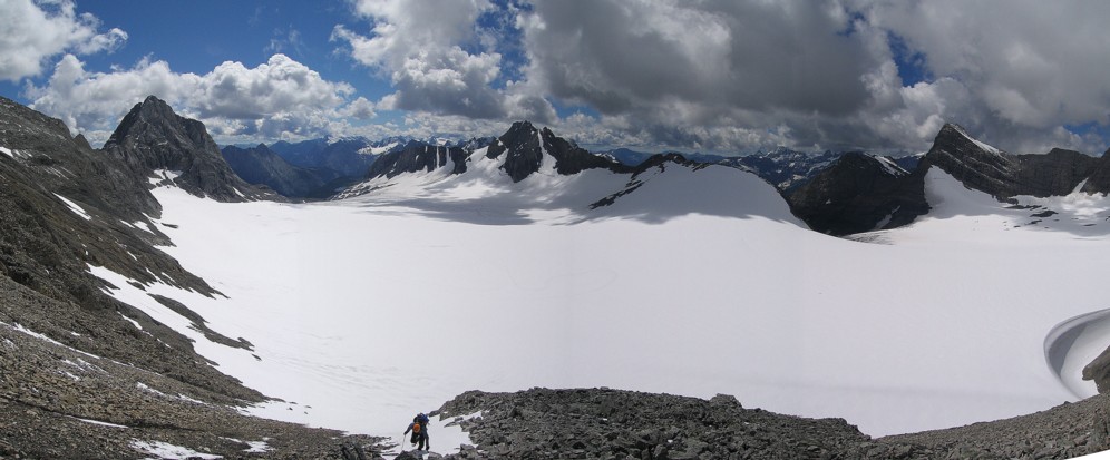
Descending the scree was very fast and you get a great view of the Haig Glacier along the way
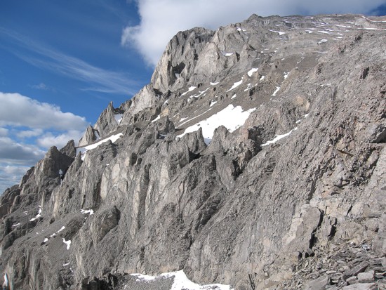
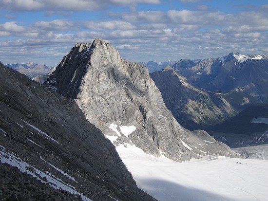
The southeast face of French
One of innumerable pinnacles on the face; Commonwealth (left) and Burstall (just right of centre)
More of the descent
A scene you never get tired of
Same as above
Same as above