Gibbon West
September 30, 2022
Mountain height: 2900 m
Elevation gain: approximately
1600 m
Ascent time: 4:30
Descent time: 3:10
Solo scramble.
A very rewarding ascent of Gibbon Pass
Peak in the summer of 2018 provided plenty of motivation to return to this
amazing area, preferably with clear skies and perhaps even during larch season.
I was lucky to get 1.5 out of 2 on this mostly beautiful late September day!
 While ascending Gibbon Pass Peak in 2018,
I had noticed a small outlier of Storm Mountain on the other side of the pass
that appeared to have a straightforward ascent route via its southeast side. To
my surprise a route up the outlier appeared in David Jones’ Rockies Central.
John Martin had ascended the 5.5 northeast arete to the summit in 2006. Finding
that to be a little too intimidating for me as a solo scrambler, I hoped the
route I spotted would yield with significantly greater ease.
While ascending Gibbon Pass Peak in 2018,
I had noticed a small outlier of Storm Mountain on the other side of the pass
that appeared to have a straightforward ascent route via its southeast side. To
my surprise a route up the outlier appeared in David Jones’ Rockies Central.
John Martin had ascended the 5.5 northeast arete to the summit in 2006. Finding
that to be a little too intimidating for me as a solo scrambler, I hoped the
route I spotted would yield with significantly greater ease.
First things first, however – getting
to Gibbon Pass. I decided that a time and energy efficient approach, would have
to supersede a longer but far more scenic one. Hence instead of the lengthy up
and down, but intensely scenic hike via Arnica and Twin Lakes, I would try a
route via Redearth Creek. This worked remarkably well: a 30-minute bike ride,
followed by 1.5 hours of easy hiking up to a point near Gibbon Pass. And Gibbon
Pass in larch season, on a clear day did not disappoint in any way. The pass
must have one of the largest concentrations of larches in the Canadian Rockies
– it’s almost overwhelming!
Just before reaching the pass, I veered
off to the west towards the southeast side of the objective (Gibbon West seems
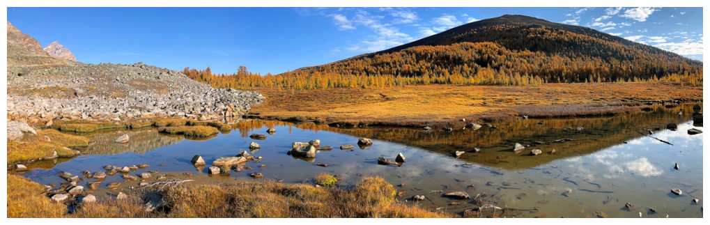
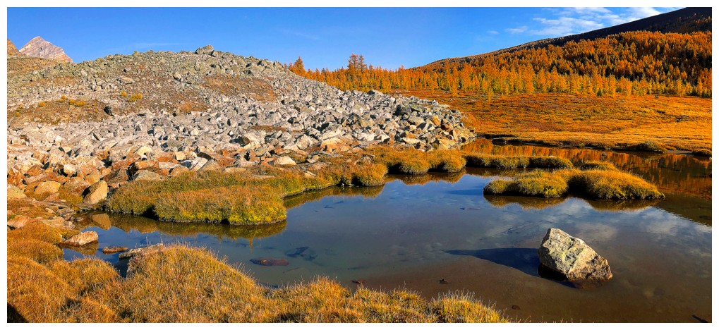
fitting for an unofficial name), fortuitously running into a beautiful, shallow tarn along the way. The
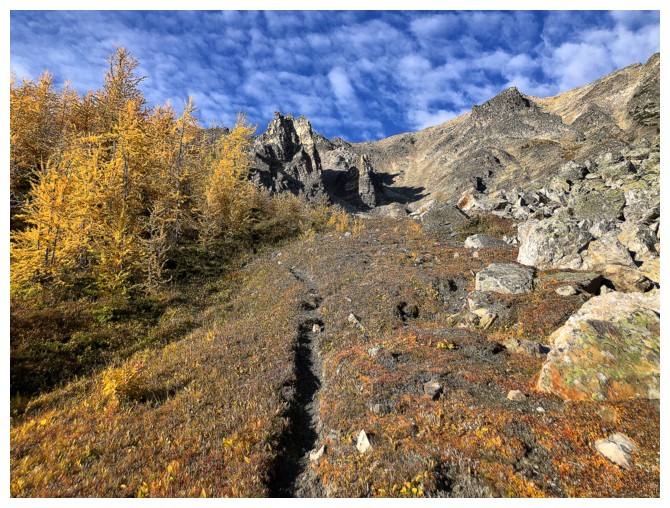
first part of the ascent went with predictable ease. Exponentially improving views
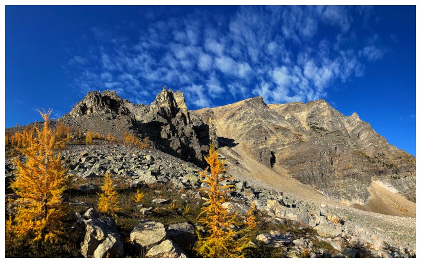
throughout and several run-ins with awesome quartzite rock would slow my progress a little. However, the ridge leading
to the summit looked to be far more challenging than I thought it would be and
so I traversed over to the southwest side of the peak. Nothing more than a
labourious rubble slog, the new route did provide the easiest (though not
terribly aesthetic) access to the summit. 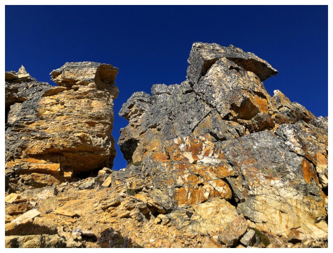 Unfortunately, the weather had broken
down in the meantime, detracting a little from what would have been a stunning
summit panorama.
Unfortunately, the weather had broken
down in the meantime, detracting a little from what would have been a stunning
summit panorama.
Part of me was hoping that the
connecting ridge between Gibbon West and the higher unnamed summit to the north
(also ascended by the incomparable John Martin, but 32 years before Gibbon West and
also described in the Jones’ book) would go as a scramble. However, by the time I
reached the summit of West, a bigger part of me hoped the route would not – and
it didn’t, a huge, near vertical wall appearing to block progress. I was
surprised at this point to see that I probably could have stayed on the
southeast ridge on ascent, circumventing the difficulties on the right side of
the ridge. I did start down this route but changed my mind a short ways down
and returned to the summit. My preference, at this point of the day, was to explore the west side of West and
hopefully get some decent views of the turquoise waters of Shadow Lake.
The descent was generally easy, but I
did make my second route-finding error of the day. In retrospect, I should have
made my way down in a southwest direction to the far west end of Shadow Lake. Regrettably,
I was to discover that my Gem-Trek map was enjoying the warmth and comfort of
the front seat of my car, some 13 km away, instead of the bumpy, jarring ride in my backpack. Several
hours later a look at the map revealed a good trail along the north side of the
lake. Instead, trying to avoid a possible bushwhacking nightmare, I took a more
southerly route that involved a long stint of travel through steep forest. The
bushwhacking was never hideous but there was lots of weaving in and out and
going left and right instead of down. Eventually, I did intersect a very
pronounced and well-maintained trail that led back to the Shadow Lake Lodge. Easy
hiking and even easier biking and the trip was done.
Awesome day of new terrain and new
adventures. Hopefully, I’ll be back someday to see that west end of Shadow
Lake.
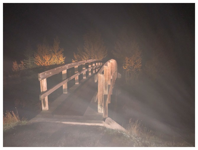
The
bridge over Cascade Pond. I sometimes stop here to gear up so that I
can start quickly when arriving at the trailhead.
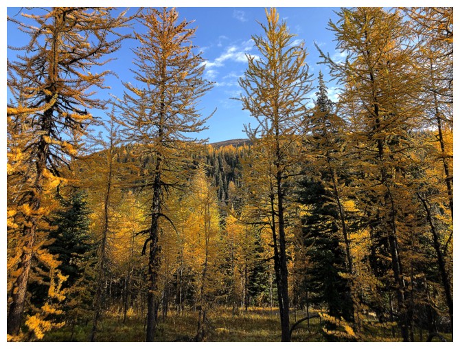
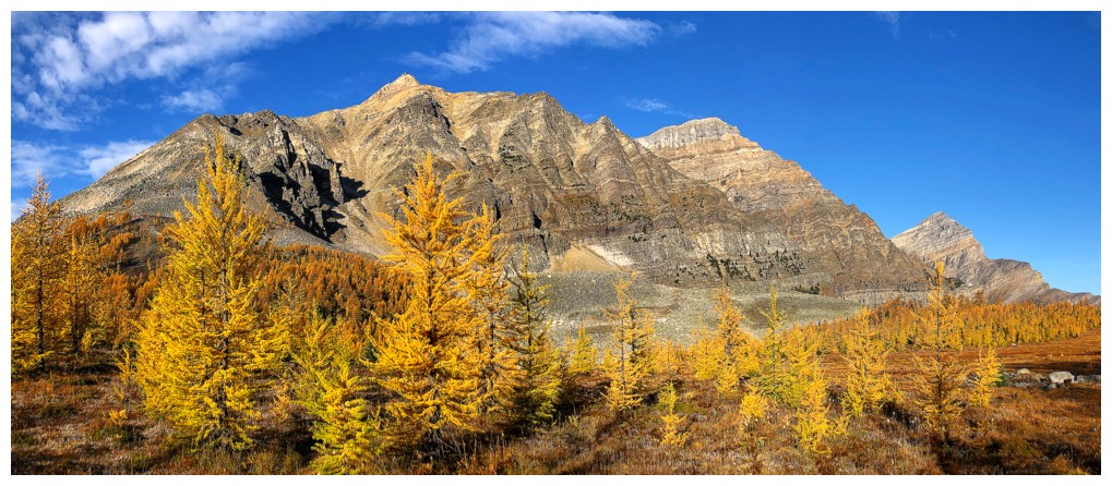
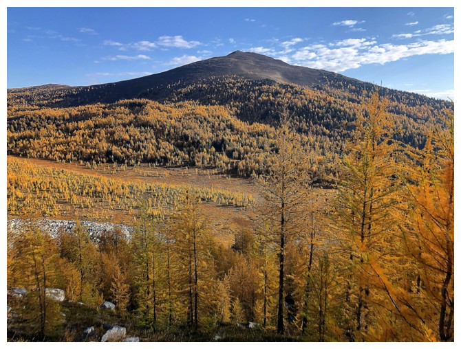
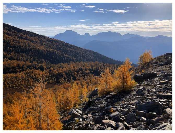
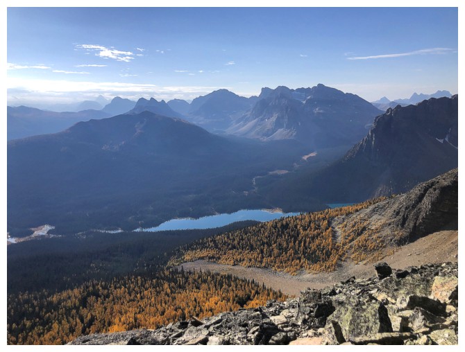
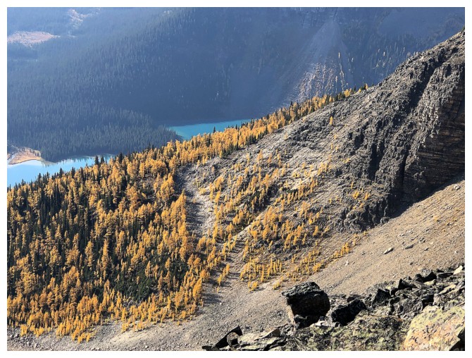
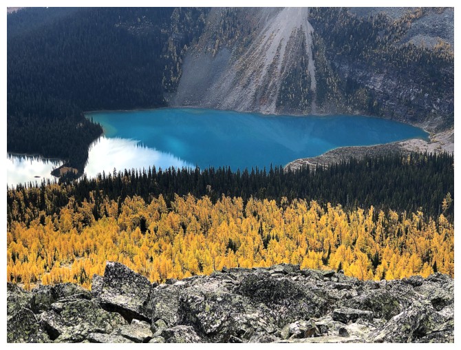
Several hours later I get my first view of the larches near Gibbon Pass.
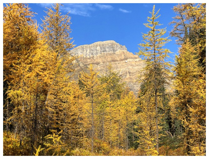
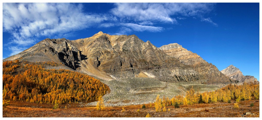
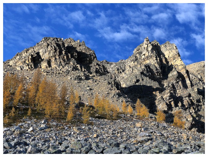
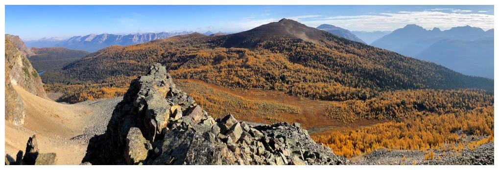
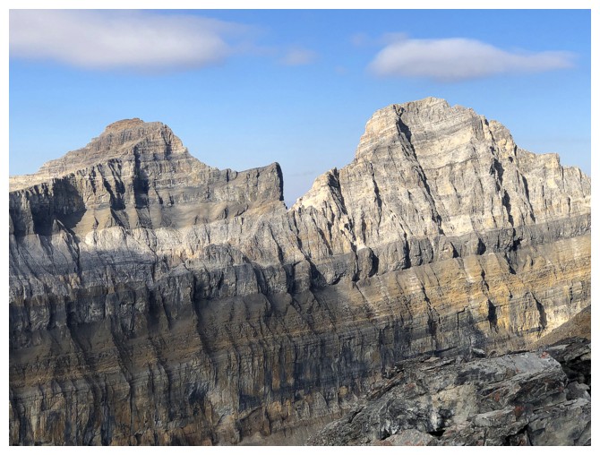
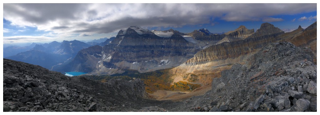
The unnamed peak north of Gibbon West appears through the yellow trees

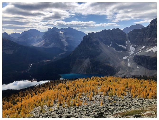
Unnamed in the centre and Gibbon West near the left
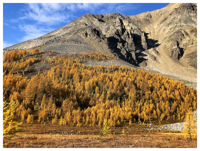
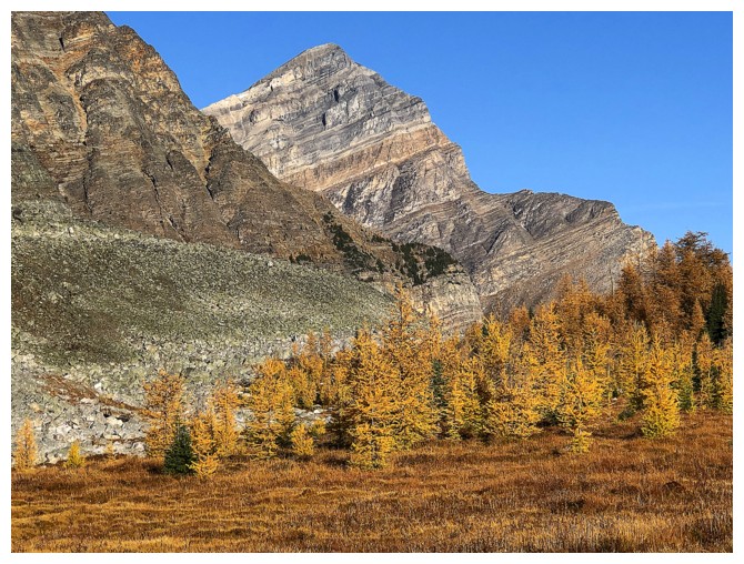
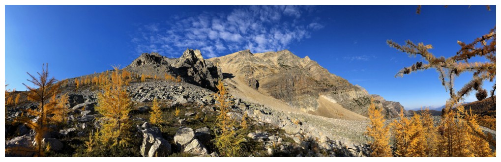
Closer look at the objective (centre)
Not so close-up
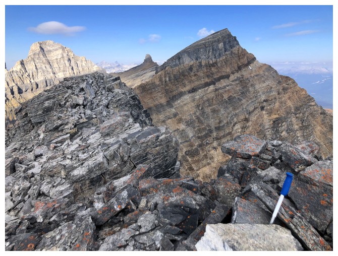
Storm Mountain
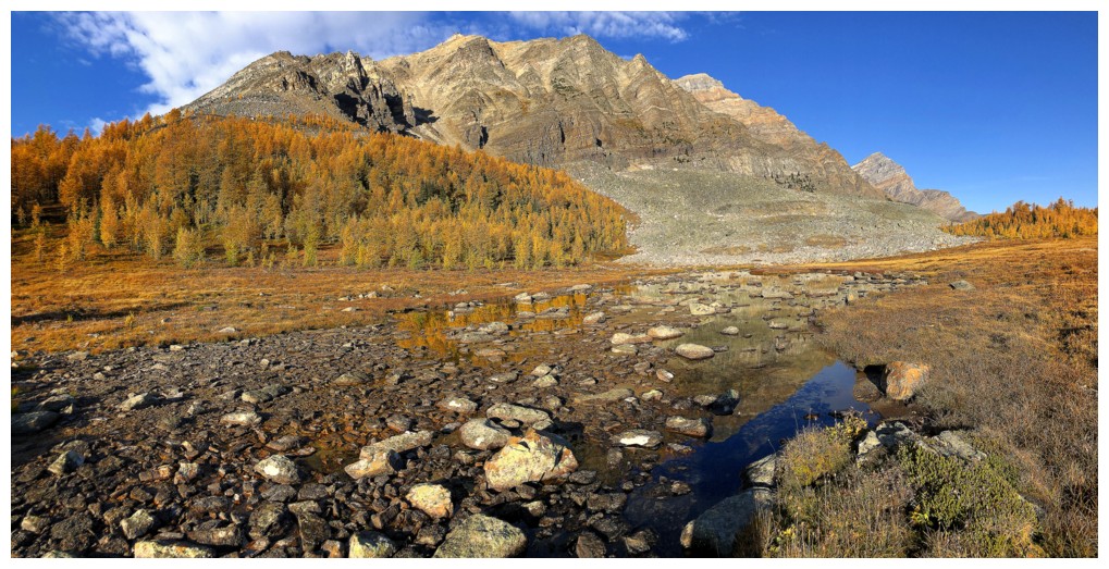
At the shallow tarn
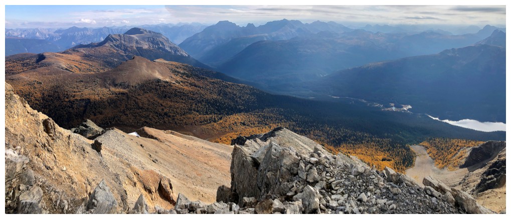
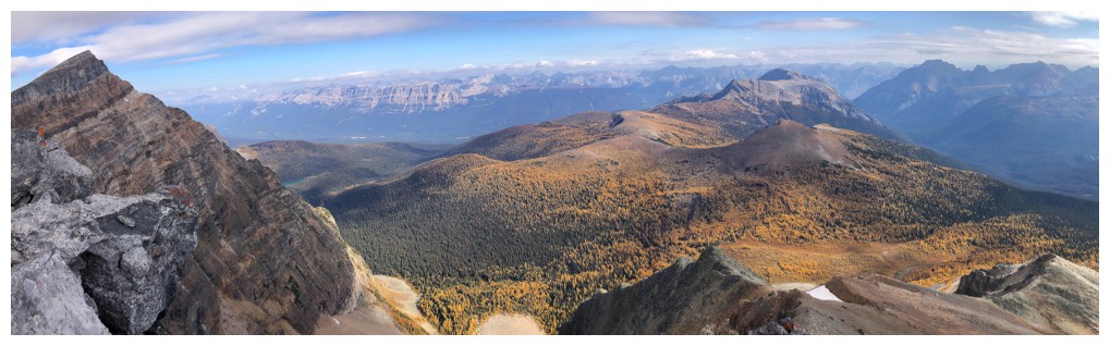
Gibbon Pass Peak to the east
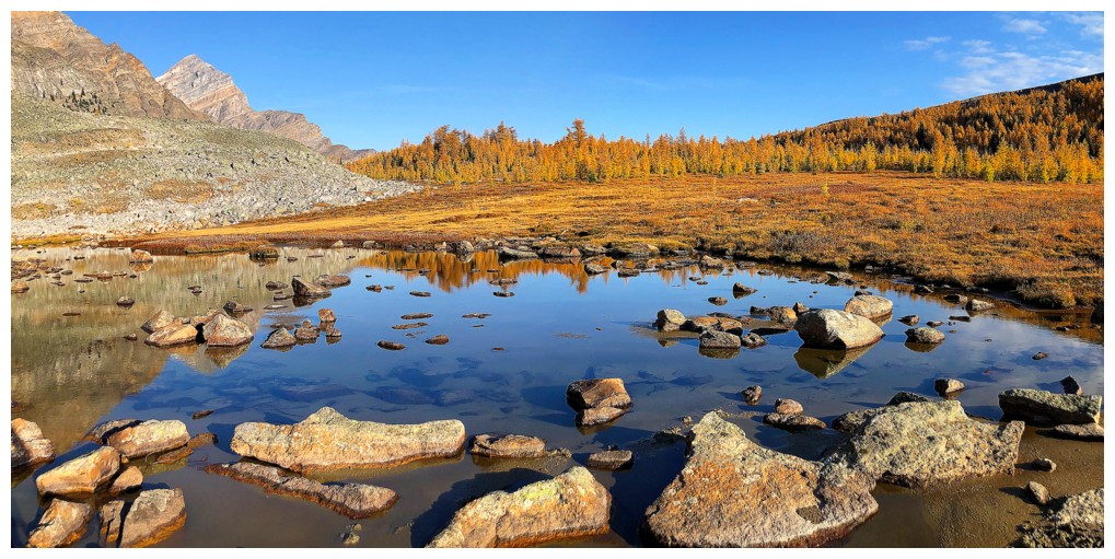
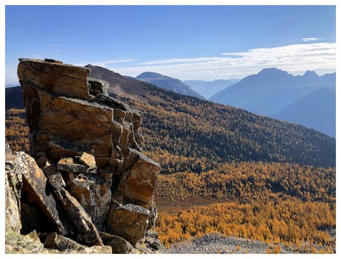
Great fall colours
Heading up - clearly the wildlife loves this mountain!
Nothing like a few random larches to spruce up the scenery!
I did consider going straight up the scree gully at the
left but decided against it, for the possibility of better views on the
ridge
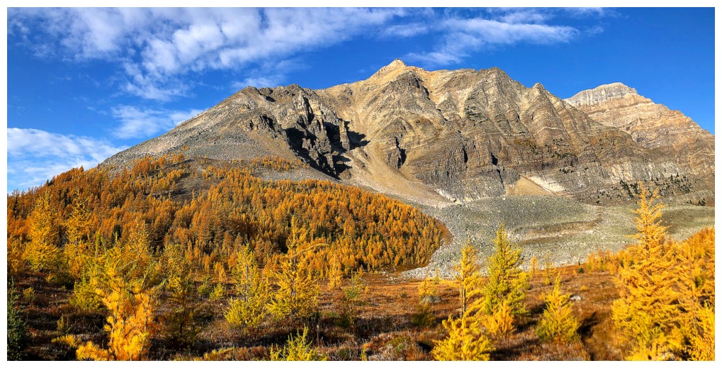
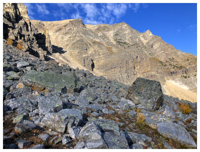
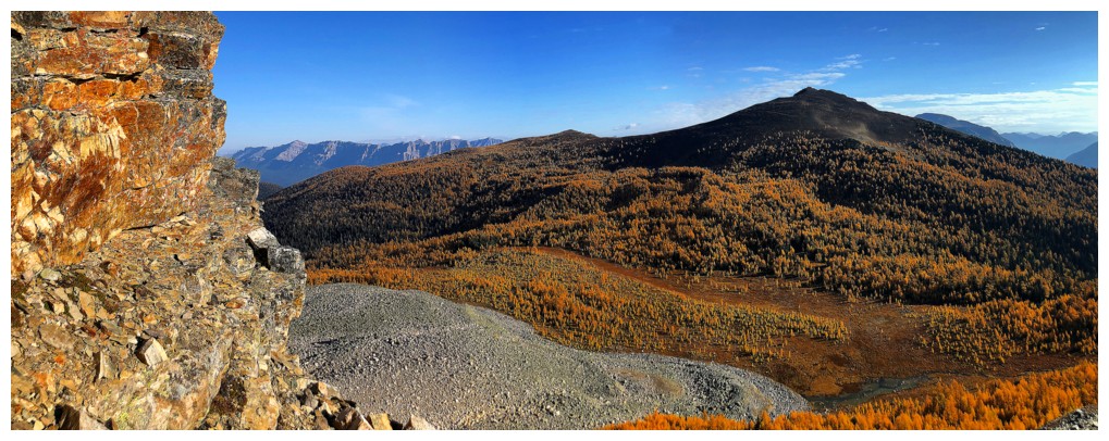
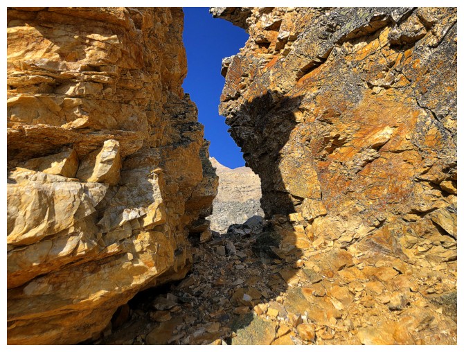
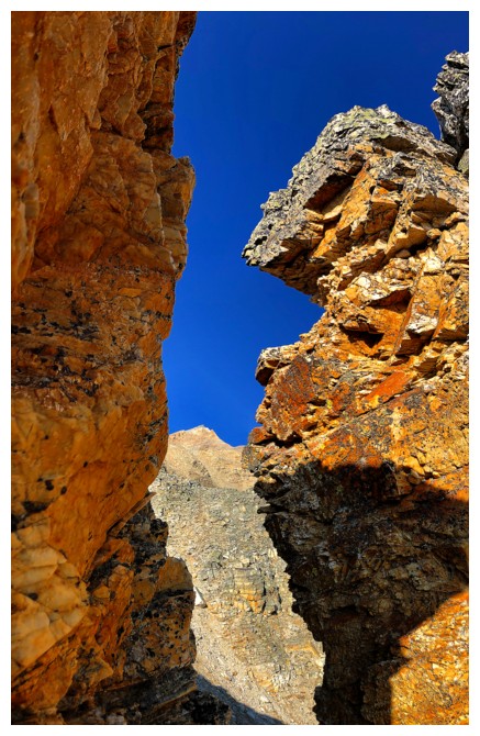
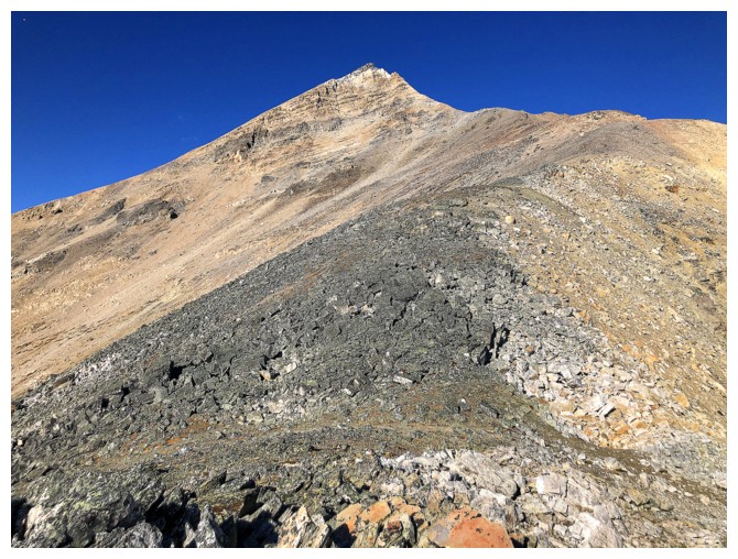
The southeast side is home to numerous rock pillars of solid quartzite
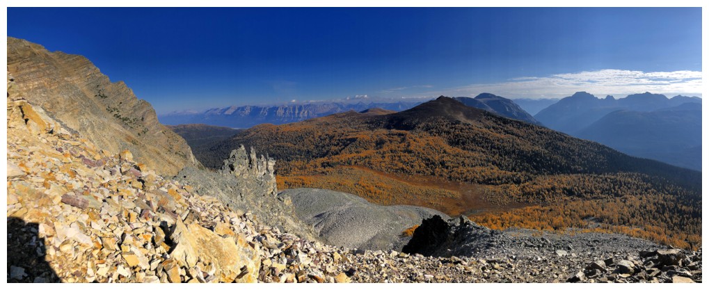
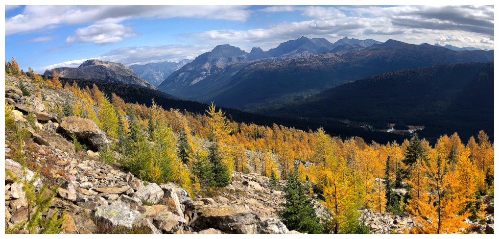
Looking back to Gibbon Pass Peak and the glut of larches
The view to the southeast includes Pilot Mountain and Mount Brett
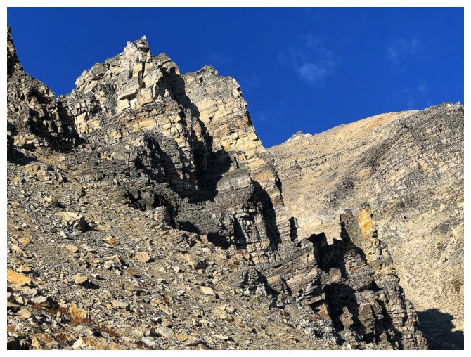
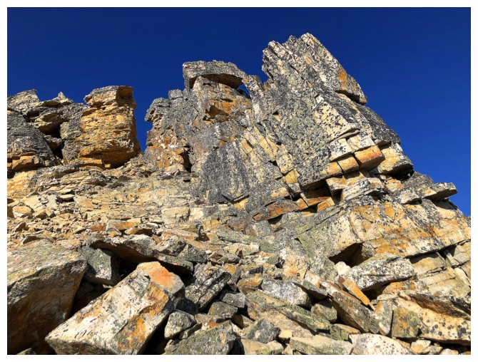
Some of those quartzite pillars
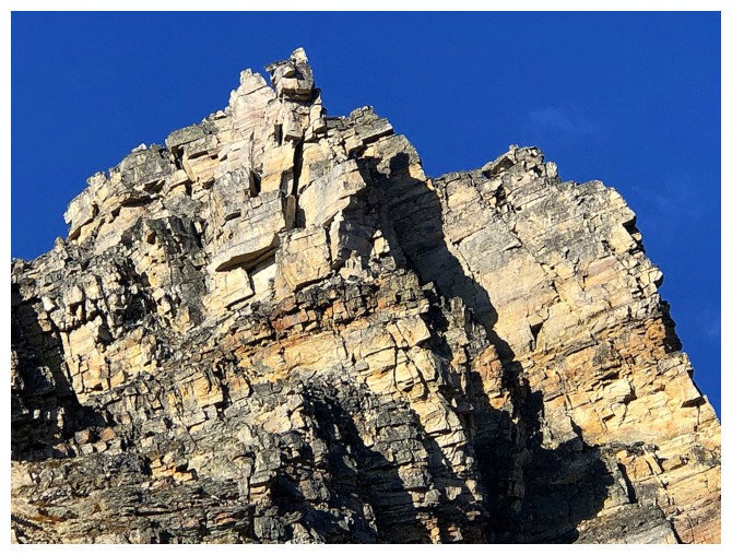
Close-up
If you are going to be rubble, be quartzite rubble!
Yellow larches and quartzite - a pretty good combination
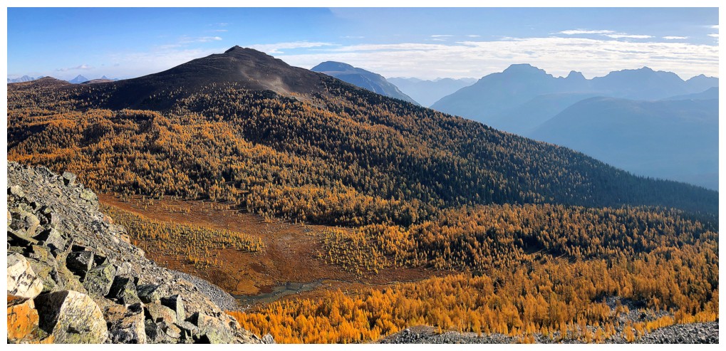
Even without the quartzite the view is nothing to sneeze at
Back to those pillars
Back to the larches
Blah, blah blah.....
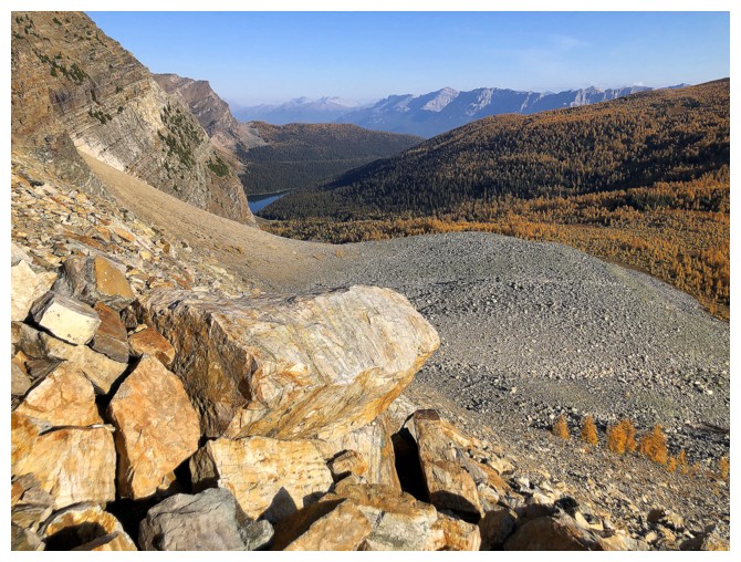
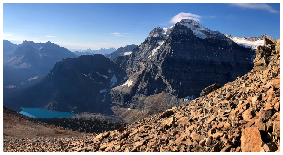
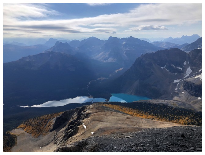
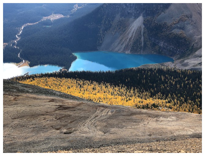
Shadow
Lake. Unfortunately, this viewpoint from the north, with the Sun in its
present position, does not do justice to the vibrant turquoise colour
of the water
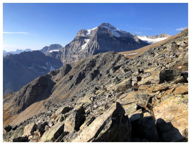
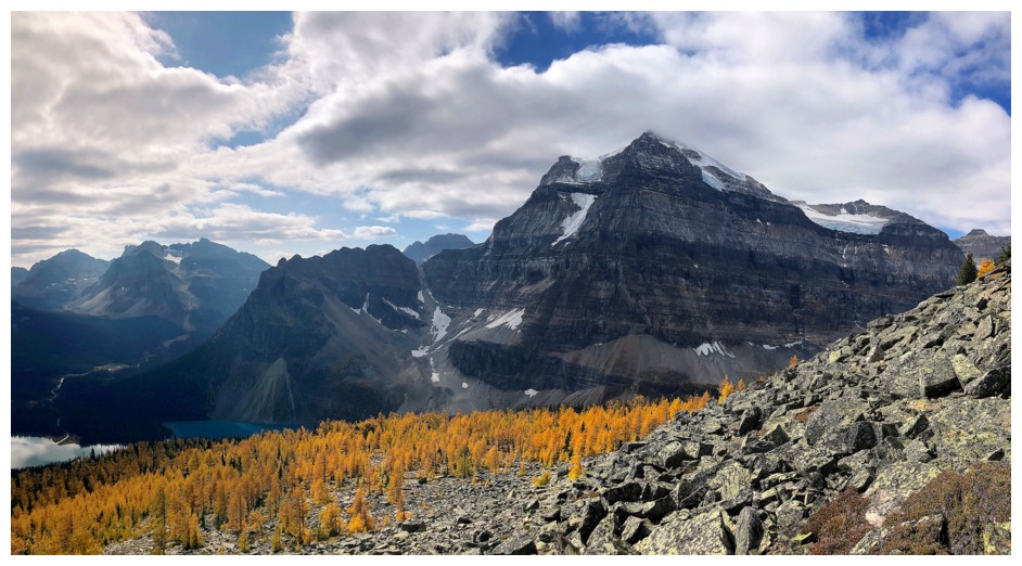
First view of Mount Ball
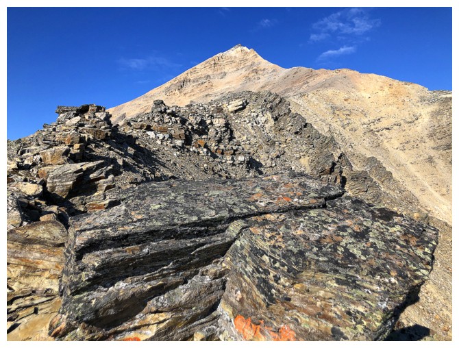
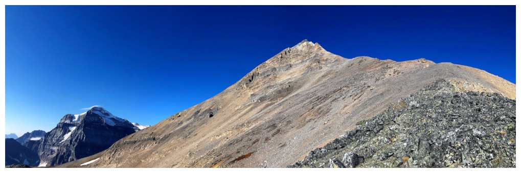
There's the summit but it still a fair distance away
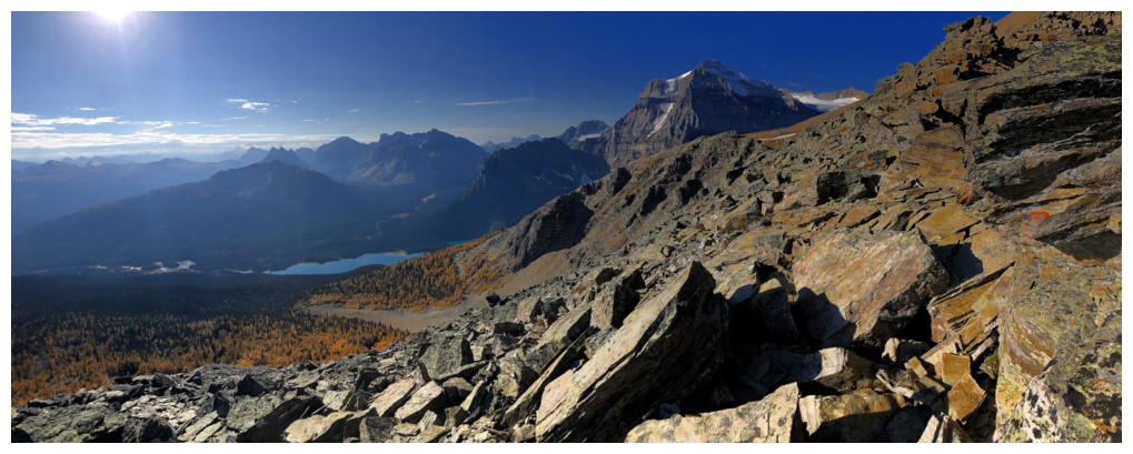
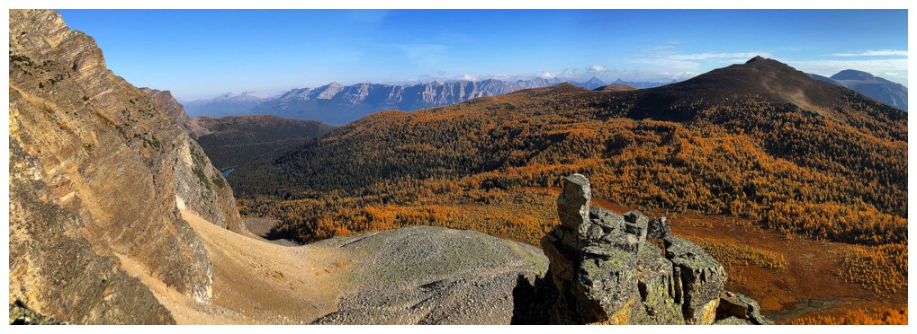
Lots of rubble but great views to the southwest
Tons of larches around Shadow Lake too
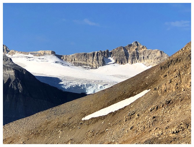
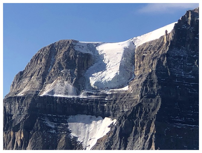
Some of the glacier on the northeast side of Ball
From
this angle the summit block looked relatively easy, but the angle
reared up when getting closer and I traversed over to the ridge at the
left
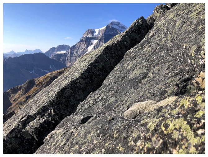
Steep, lichen-covered rock and Ball
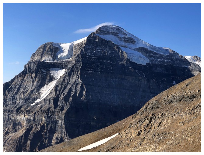
Closer look at super cool Mount Ball
The hanging glacier on Ball's east face
The route ahead. I haven't traversed over to the southwest ridge yet.
The traverse is complete and Ball is even more captivating
Copper Mountain at the left
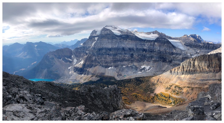
Looking down to Shadow Lake and the route I would eventually use to for descent
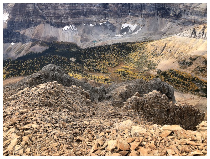
The Unnamed I don't want to get to anymore (not on this trip, at least)
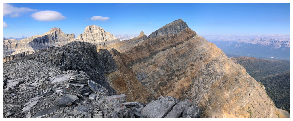
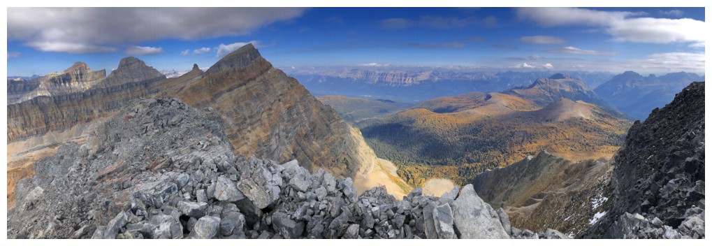
At
the summit. Three of the four peaks to the north are described in
Jones' book. Left to right: Unnamed (3087 m), Shadow Mountain (3060 m),
and Unnamed (3021 m). The little point in the distant centre is
identified as Storm South Ridge.
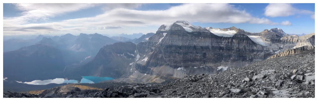
View towards Ball and company and Shadow Lake
Half a hiking pole marks the top
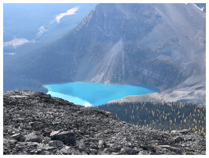
Shadow Lake looking more turquoisey
Unnamed (3087 m) and Shadow Mountain. By their descriptions, neither sounds easy.
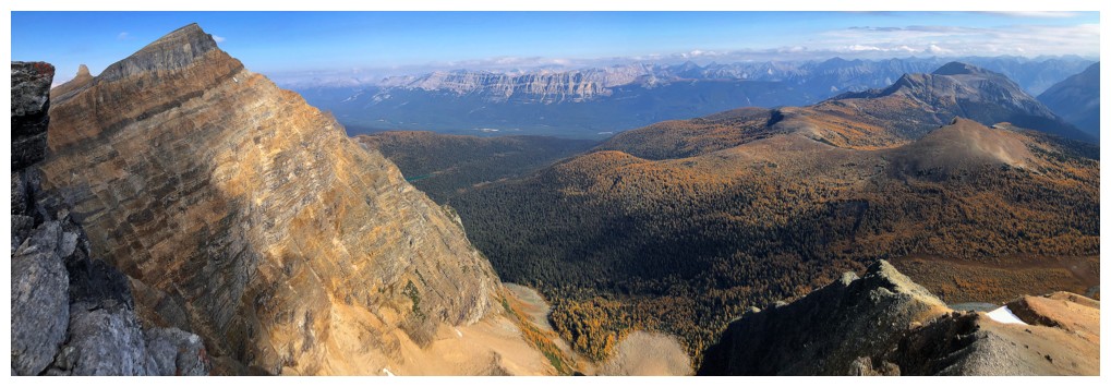
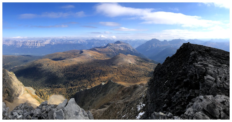
More summit views
Descending the south ridge
I should have went down somewhere around here and followed the drainage down to the northwest end of Shadow Lake
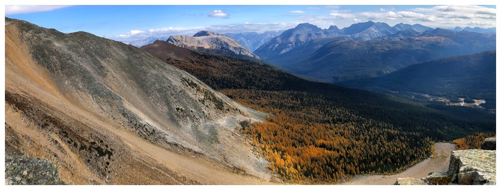
However staying on the ridge yielded terrific, larch-filled views
Last look at Ball before I descend into the forest
Last of the larch views
The End
LOG