Mount Glendowan
October
23, 2005
Mountain height: 2,677 m (8,781 ft)
Elevation gain: 1,175 m
Ascent time: 5:05
Descent time: 4:50
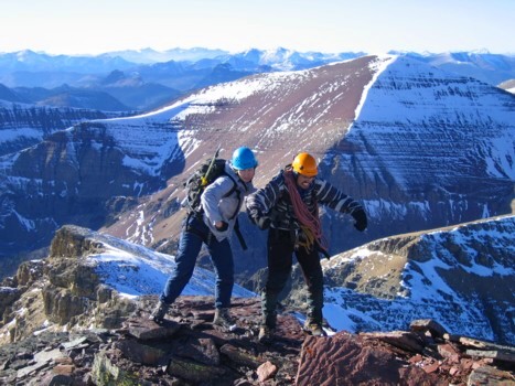
Scrambling with Mark and Jodi.
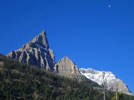
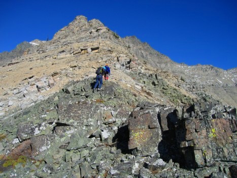
We were hoping that the south ridge of
Mount Glendowan would provide the same great hands-on scrambling and
outstanding scenery its neighbour, Dungarvan had done for us two weeks
earlier…and it did. Not surprisingly, the ascents and geology of the two mountains
(both via their south ridges) are remarkably similar – definitely brothers if
not twins.
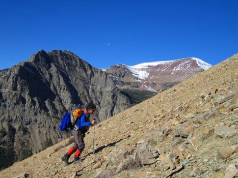
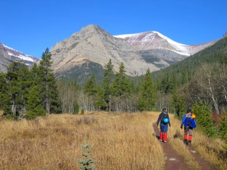
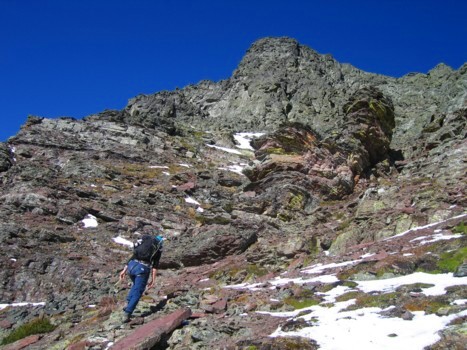
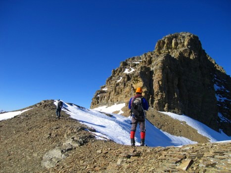
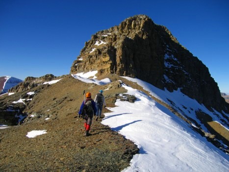
The good stuff was preceded by a 2 km hike
along Snowshoe Trail and then an hour of sometimes tedious bushwhacking and
climbing over deadfall. Once above the treeline, it was Déjà vu for the next
three hours, as we scrambled up numerous pinnacles and rockbands lining the
south ridge. Though not quite as stunning and demanding as Dungarvan, the
ascent was, nevertheless, thoroughly enjoyable.
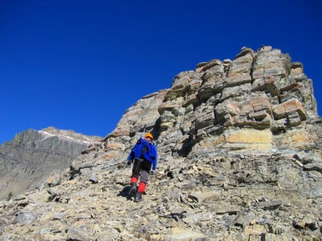
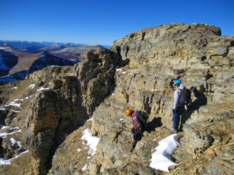
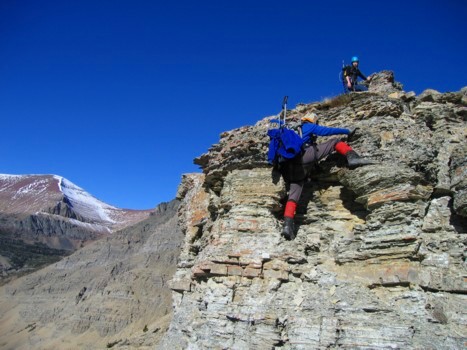 Higher up, we had to circumvent some of the
rockbands, on the left side, as time was becoming a concern. Mark and I were
also quite tired (the residual effects of the previous evening’s Judas Priest
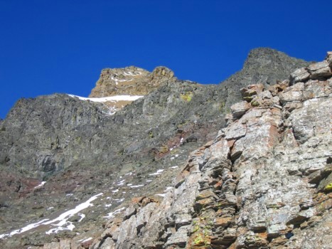
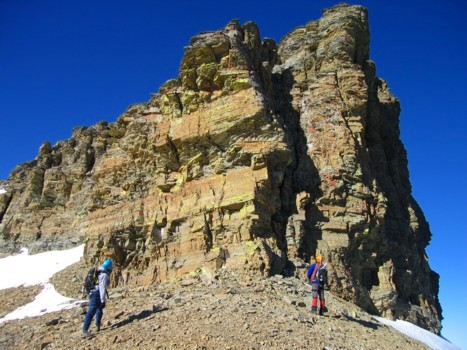
concert) and opted for the quickest route towards the summit block. The upper section of the mountain was
characterized by the same band of black, lichen-covered rock, atop a band of
burgundy argillite, as was Dungarvan – the only differences being that on
Glendowan the black band was more broken and less steep and atop that, was an
additional band of light brown shale (accounting for the slightly higher
elevation of Glendowan than his little brother).
Higher up, we had to circumvent some of the
rockbands, on the left side, as time was becoming a concern. Mark and I were
also quite tired (the residual effects of the previous evening’s Judas Priest
concert) and opted for the quickest route towards the summit block. The upper section of the mountain was
characterized by the same band of black, lichen-covered rock, atop a band of
burgundy argillite, as was Dungarvan – the only differences being that on
Glendowan the black band was more broken and less steep and atop that, was an
additional band of light brown shale (accounting for the slightly higher
elevation of Glendowan than his little brother).
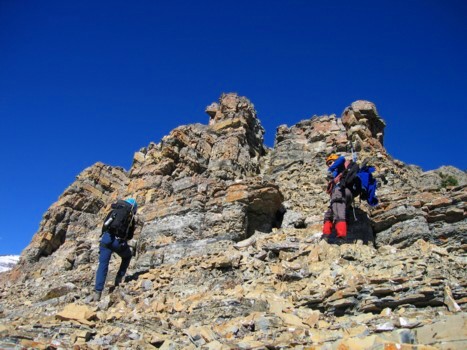
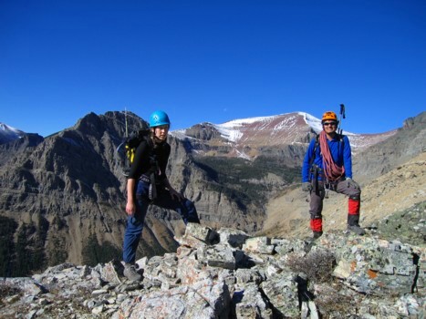
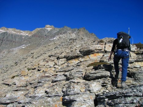
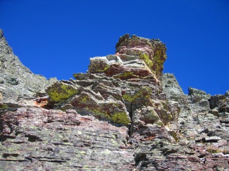
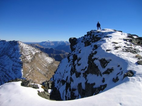
 Where the black band of Dungarvan was a
significant challenge that required a rappel to get down, Glendowan involved only
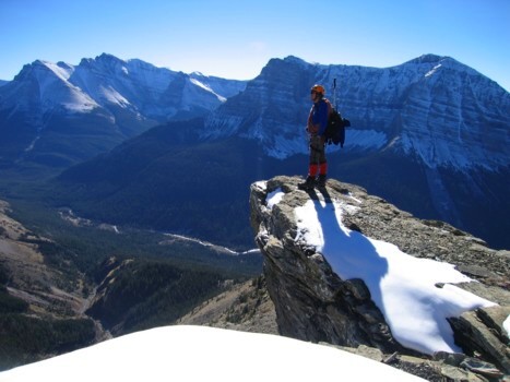
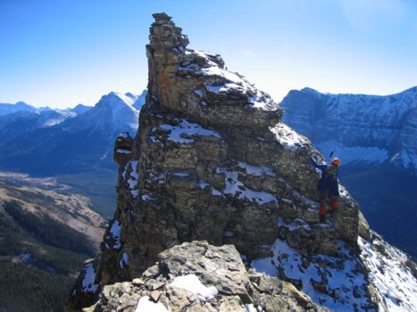
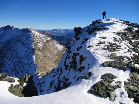
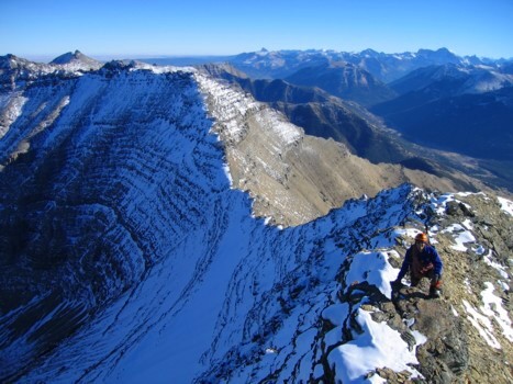
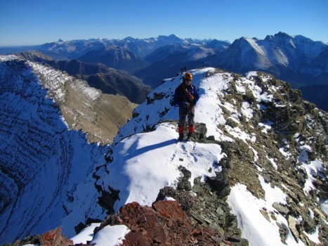
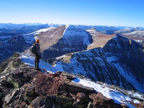
moderate scrambling. Regaining the ridge above revealed not only the stunning
and imposing-looking, shale summit block, but a fantastic view of the long
ridge towards Dungarvan and other shapely Waterton peaks. Although the east
wall of the summit block would have required a significant compliment of
climbing gear to ascend, the south side granted easy access to the summit via a
weakness in the band. A scree slope followed and then a short and pleasant
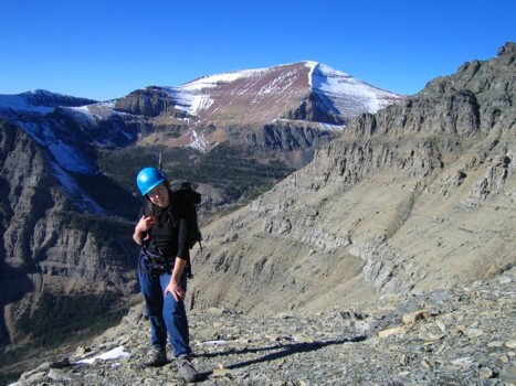
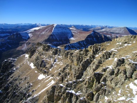
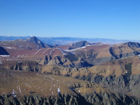
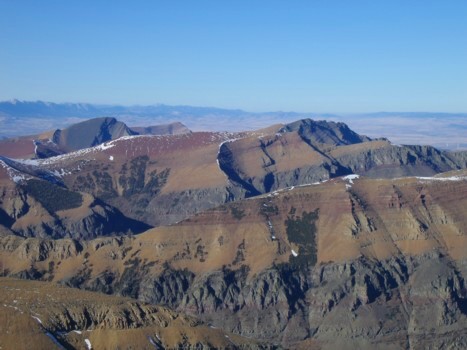
traverse led us easily to the summit. The summit panorama was outstanding in
every direction, but I found the view towards the Castle Crown area especially
breath-taking – the distinctively coloured layers of rock and beautiful
contours of the mountains were absolutely unique – there is nowhere else on the
Canadian Rockies where such a variety of amazing colours of rock exist.
Where the black band of Dungarvan was a
significant challenge that required a rappel to get down, Glendowan involved only
moderate scrambling. Regaining the ridge above revealed not only the stunning
and imposing-looking, shale summit block, but a fantastic view of the long
ridge towards Dungarvan and other shapely Waterton peaks. Although the east
wall of the summit block would have required a significant compliment of
climbing gear to ascend, the south side granted easy access to the summit via a
weakness in the band. A scree slope followed and then a short and pleasant
traverse led us easily to the summit. The summit panorama was outstanding in
every direction, but I found the view towards the Castle Crown area especially
breath-taking – the distinctively coloured layers of rock and beautiful
contours of the mountains were absolutely unique – there is nowhere else on the
Canadian Rockies where such a variety of amazing colours of rock exist.
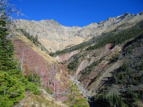
Although it was extremely tempting to
investigate an alternate descent route by heading west along the undulating
ridge towards Newman
Peak, we opted to play it
safe and return the same way – more or less. Unfortunately, we should have
picked “more” than “less”. Again, comparing the trip to Dungarvan, it appeared
that an easier descent route existed right down the center of the south side
gully. At first, this theory held true and at the bottom of the gully we came
across some outstanding waterfall and rock scenery. Everything after that was
sheer hell, as we were forced to side slope steep terrain covered in horrendous
deadfall. Of course, it was dark by then and so the miserable 2 hour stint was
done by headlamp. Add to that the fact that I somehow lost Mark’s camera (with
all the good ascent photos) somewhere along the way, and I, for one, was a
little cranky by the time we returned to the car.
Except for the miserable final couple of hours
and the lost camera, a thoroughly enjoyable and satisfying ascent – definitely
worth a repeat visit.
Epilogue: We stayed
at Pincher Creek overnight, and returned to see if by some miracle we could
find the camera. Six hours the searching turned up nothing, however, we were
able to see the fantastic waterfall and creek scenery in much better light.