Mountain height:
approx. 2,550 m (7,380 ft)
Elevation gain:
approx. 700 m
Ascent time:
5:15
Descent time:
2:20
Scrambling
with Mark.
How many
days ‘till Christmas? It can’t be soon enough. We’ve asked for a GPS from
our exceedingly generous parents and today was yet another shining example of
why Mark and I shouldn’t be allowed to leave the house without one. Basically, we
started the trip on-route, decided we were off-route, even though we were
actually still on-route, tried to get back on-route, but, of course, we were
already on-route and so we were now off-route, realized we were off-route, but
knew where we were and so changed our destination, thought we were on-route for
the new destination, but were actually on-route for the old destination and
off-route for the new destination, made it to a minor summit, where we realized
we were on the wrong mountain! Got that! Let me explain…….
Our goal
was Mount James Walker. Its strategic location right in-between the
We started
up but drainage, but found travel to be tedious and uncertain due to the thin
layer of ice over the running water below. Cutting up rubble slopes and
rockbands to the left, in order to gain the ridge, seemed like a good idea. It
wasn’t! It was an absolute nightmare that we were both lucky to walk away from
unscathed and still breathing. The terrain was far steeper than it appeared and
was covered in a light layer of fresh snow, making the footing unreliable and
treacherous. Add to that, the worst possible rock imaginable (extremely loose
shale) and you have an accident waiting to happen. I led the ascent and before I
knew it, I had ascended terrain I could not downclimb. I had no choice but to
continue up. I climbed very slowly and cautiously, but huge handholds would
crumble when I touched them and there were at least five moves whose outcome was
a 50/50 proposition – the foot holds and you’re safe; it slips on the snow
or the rock gives way and it’s a brutal fall to the bottom, resulting in
severe injury or death.
I
eventually made it to the group of trees, where I traversed along a steep
rockband by holding on to the branches of the trees. From there, I was able to
get out about 30 m of rope, setup an anchor around a tree, and throw the rope
down to Mark, who like me had gone up what he couldn’t get down.
Unfortunately, the rope became stuck between some rocks and I had to rappel down
to dislodge it. Rope in hand, Mark slowly made his way up to safety. At the top
we both collapsed in exhaustion, disillusionment, and relief.
The ascent of this seemingly straightforward slope took us over an hour
and we only gained about 60 m of elevation.
Reaching
the summit of
Shortly
before reaching the highpoint, another mountain appeared to the north that
looked exactly like
The summit
view was great. Snow-covered Mounts Chester, Birdwood, and Smuts, were stunning.
Unfortunately, a solitary group of clouds hovered over
A very bizarre day, but rewarding day: from our severe routefinding woes, to a nightmarish hour on a treacherously steep slope, to a pleasant ridgewalk and a magnificent summit view.
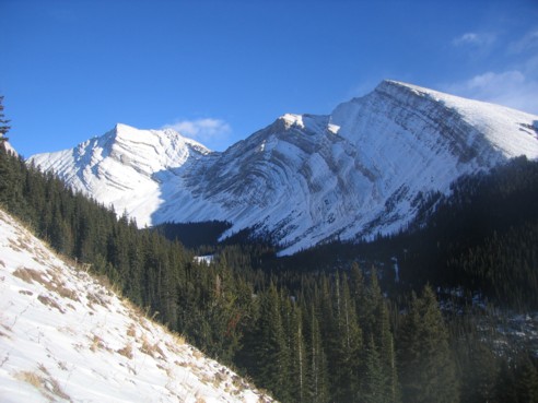
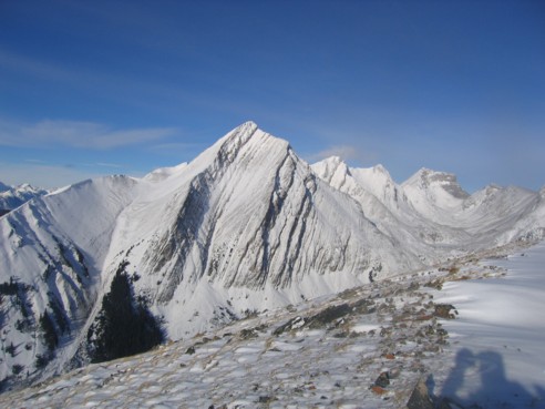
Looking west at Mount Murray
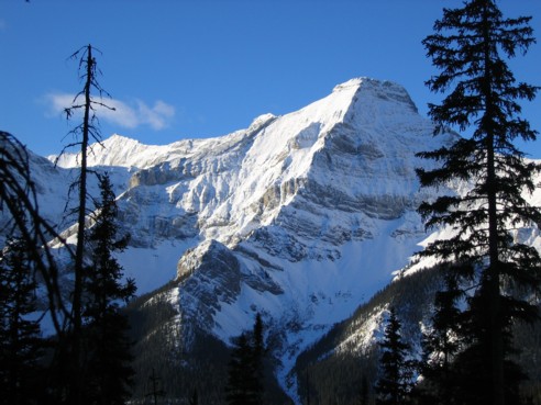
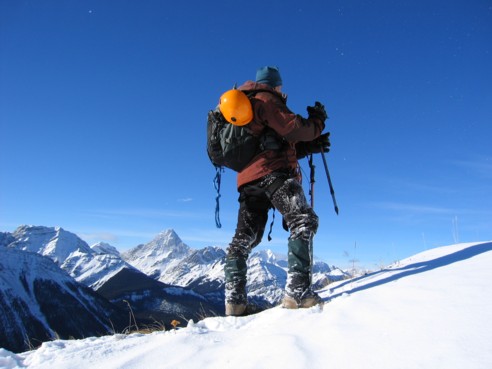
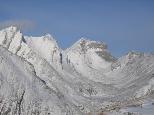
Making our way up to the ridge after a harrowing hour on a dangerous slope; at this time we thought the peak in the background was Mount Chester
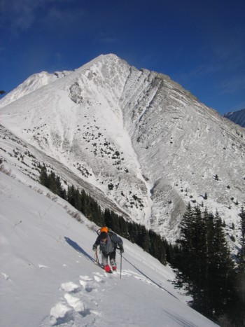
Almost at the ridge
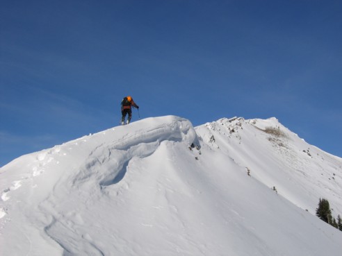
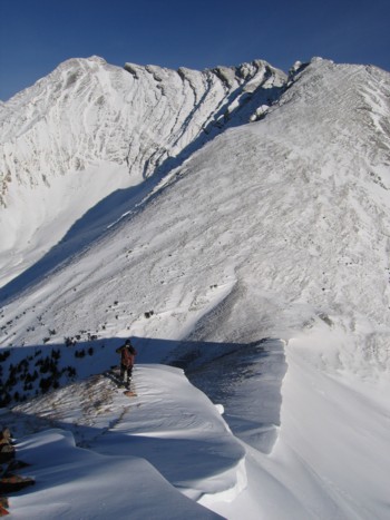
On the ridge of GR232272; the summit is at the right
Again, on the ridge; the prominent peak to the left is Mount Birdwood
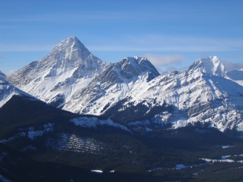
From left to right: Mount Birdwood, Pig's Tail, Commonwealth Peak, and Mount Smuts at the far right
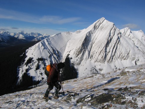
Almost at the summit, with picturesque Mount Chester behind
A summit view of Mount Chester, the Headwall Lakes Valley, and The Fortress at the far end of the valley
A closer look at The Fortress (centre)
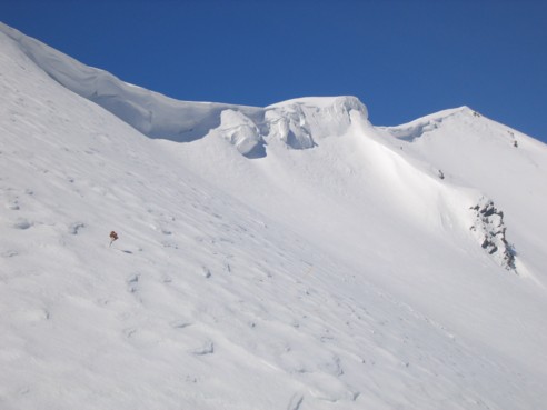
Looking down to the col and ascent slope east of GR232272
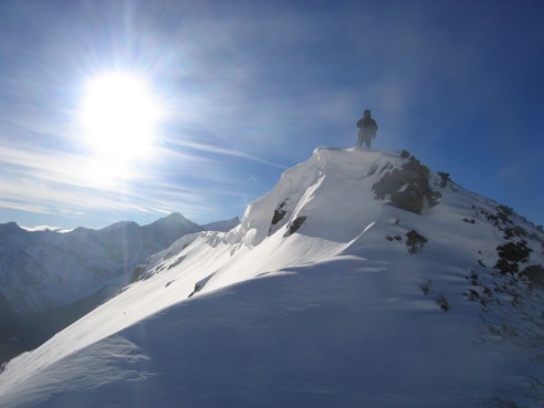
Mark at the summit