Unnamed
summit at GR338442 (north
of Mount McDougall) –
Mountain height: 2,283 m (7,488 ft)
Elevation gain: 838
m
Ascent time:
4:05
Descent time: 3:00
Solo scramble.
An ascent to the summit at GR338442 won’t give you an official peak, or even the second or third or fourth highest point in the Mount McDougall range. It will, however, give you plenty of breath-taking views of some magnificent rock scenery, further enhanced by doing the trip on a clear day and preferably when some snow remains on the mountain.
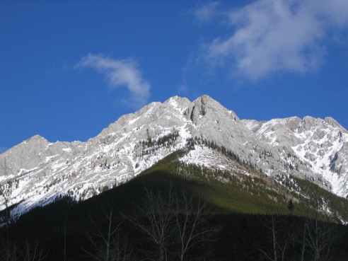
I spotted this summit driving
home from
Approaching the summit, I suddenly came to a steeper section that, when snow-free, would have presented few problems. The remaining snow, however, made things a little more tricky. A slip would result in an involuntary glissade that wouldn’t kill you, but at least give you a rough ride onto snow-free scree and rubble below. I spent over an hour here, trying one route after another. Actually, the snow wasn’t the biggest problem: a small rock band guarded the upper slopes and although it was only a couple of moves to ascend it, the very small holds would make the descent considerably more tricky – fine when you’re with someone…very different when alone. Add to that, the fact that if you did slip, you would fall onto the snow and then start an unwanted glissade.
Just about ready to give up, I moved far to the left where the rockband was the least high. The advantage of this route was that a large, nearby tree could provide some help on descent…the disadvantage, a short, but steep snow slope leading to a small drop-off – again, not enough to kill you, but everything’s a whole different ball-game when help is kilometres away. I ascended the step and quickly scrambled up to easier terrain. Immediately, I knew the descent of this section would be slow and handled with extreme caution.
I arrived at the summit, a little disappointed, but certainly not surprised, that although my summit was the one I was aiming for, it was not the highpoint indicated on the map. That one was about half a kilometre further east and unattainable without ropes and rock gear (and a climbing partner, for that matter). To make up for that fact, I was rewarded with a brilliant summit view – Inflexible, James Walker, The Fortress, Allan, Collembola, Wind, Lougheed, and fantastic views of Kidd, Bogart, Ribbon Peak, and Sparrowhawk. Again, however, the scenery on the mountain itself stole the show.
My summit stay was very short. I wanted to get down the difficult section so I could breathe a little easier. I took out a 10 m rope and attached two slings to it, just in case. Upon approaching the downclimb, I took one quick look at it, veered off, and headed straight for the tree. From there, I put a sling around it and started down very slowly. I couldn’t use this as a rappel system, as the rope and slings were too short to make it to the bottom (the tree was about 5 m left of where I had ascended). Instead, it was set-up to backup a fall. Thankfully, the system was long enough for me to traverse the slopes to the safer point where I went up the rock step. I made it down and took a deep breathe of relief.
While I was quite proud of myself for setting up a safety system, what followed was sheer stupidity….I pulled the wrong end of the rope! Remember, I had attached two longs slings to the rope, to increase its length. Instead of pulling on the slings to retrieve the rope, I pulled on the rope and so, of course, the knot that attached the slings to the rope got caught in the sling around the tree. For 20 odd minutes, I tried frantically and in futility to shake the rope loose, but to no avail. My choices, at this point, were to abandon the system, leaving a 5 m rope, three slings, and two carabiners dangling from a tree, or go up again and do it correctly. I choose the latter. Having made a seemingly safe path from the tree to the lowpoint, I felt a little more confident about negotiating the terrain. It was, in fact, easy and I got everything back except for the sling around the tree (an expected causality).
Once passed that section, the remainder of the descent was absolutely fantastic. The sky to the east and south had completely cleared making the incredible rock scenery even more stunning. With the snow and the odd evergreen on the slopes, it was visual heaven. What this needed was a decent photographer and, unfortunately, he (my brother, Mark) was stuck at work. I did the best I could, but historically my results have invariably paled in comparison to Mark’s. I also took this opportunity to explore as much of the mountain as I could. It was truly one of the most enjoyable hours I’ve ever spent on a mountain, and it was very difficult to leave. A most rewarding and interesting day and irrefutable proof that just because it isn’t named on a map doesn’t mean to say it’s not worth going up.
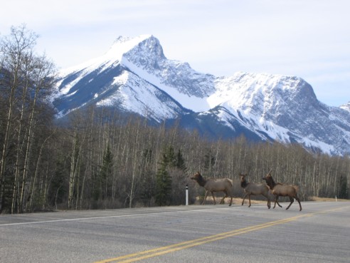
Wildlife crossing the road; behind is The Wedge and the ridge I tried to get to from Limestone Mountain
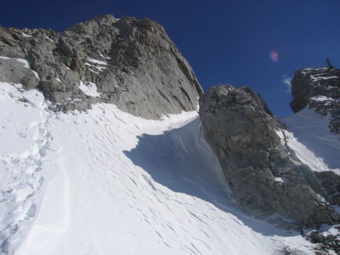
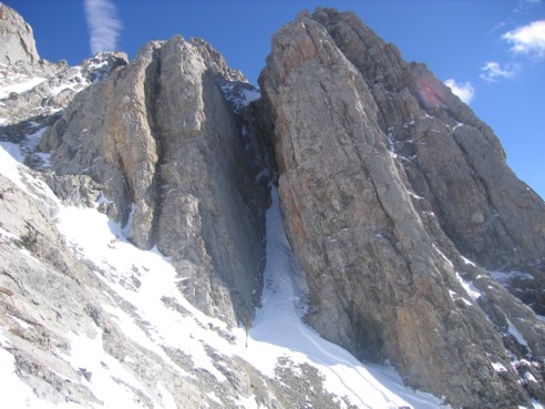
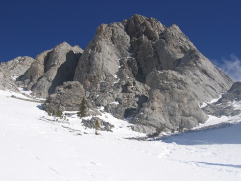
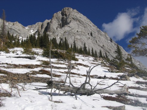
GR338442; the ascent route goes right up the center, where the snow is (photo taken on descent)
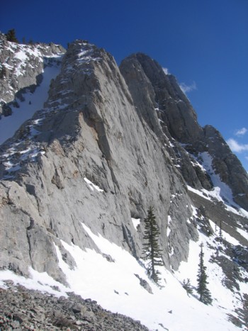
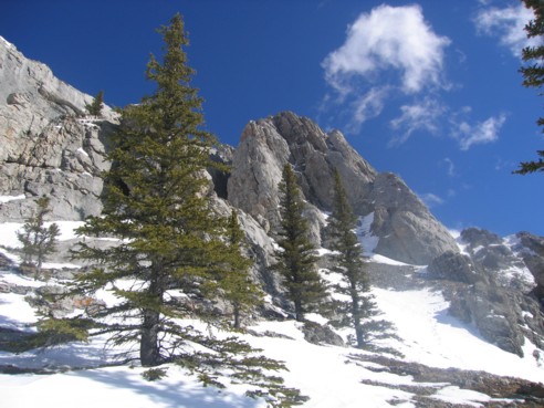
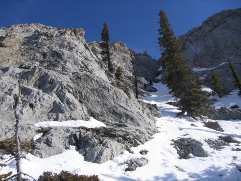
Impressive towering walls as you break the treeline (photo taken on descent)
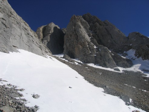
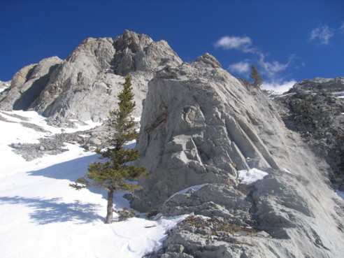
The first route I tried to take
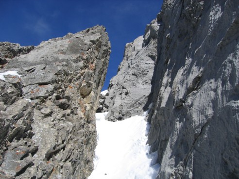
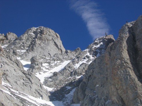
I barely squeezed through this gap, scrambled up rock to the right, and then had to turn around, as there was a significant drop-off
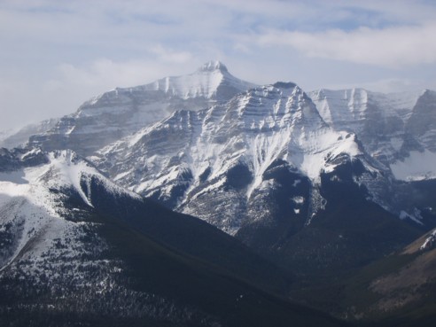
Mount Bogart and Ribbon Peak
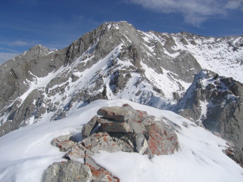
At the summit, looking to the higher point to the east
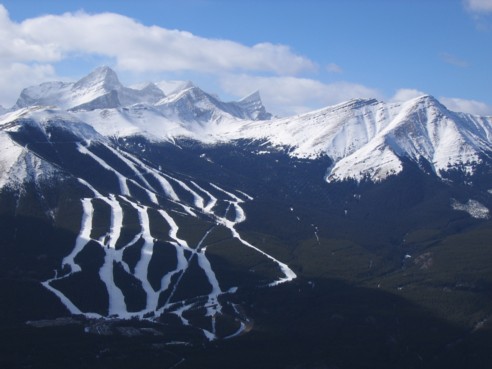
The view to the west; Mount Lougheed, Allan, Collembola, and the Nakiska Ski Hill
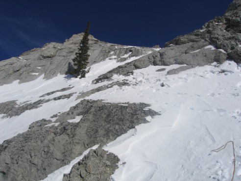
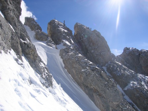
This the difficult section; it is steeper than it appears; I used the tree at the left to set-up a safety system; notice the multiple sets of tracks, where I tried to find different ways up
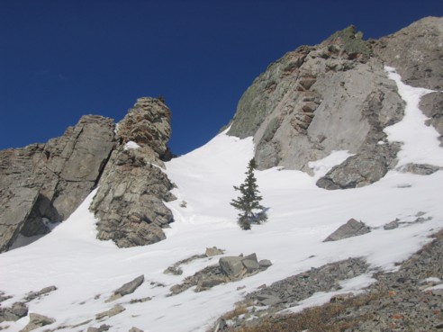
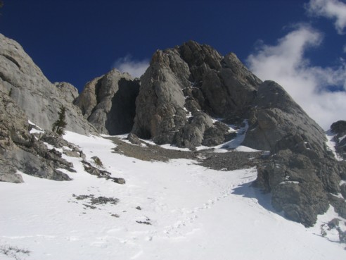
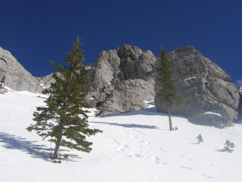
The remainder of the photos are scenes from the descent (no descriptions):