Guinn’s
Pass and Peak at GR237374
April 10, 2004
Guinn’s Pass height: 2,405
m (7,888 ft.)
GR237374 height: 2,606
m (9,548 ft.)
Elevation gain:
845
m to Guinn’s Pass; additional 180 m to GR237374
Ascent time to Guinn’s Pass: 2:40
Ascent time to GR237374: approx.
20-30 minutes
Descent time:
2:10
Round-trip distance: approx.
18.8 km
Solo
hiking and snowshoeing. I probably could have picked a more scenic trip, given
the great weather forecast in just about every area, and as I was making my way
along mundane Galatea Trail, I began to regret my choice of Guinn’s Pass.
However, once at the pass, I was rewarded with some pretty terrific, wintery
views and it turned out to be a good choice after all. The almost kilometre long glissade
on decent, didn’t hurt matters either.
As
stated, the 4.5 km trek along Galatea Creek offered only a few moments of
interest, including some good views of South Kidd, and debris from a rather
large avalanche, going right across the trail. Upon reaching the Guinn’s Pass
trail I put on my snowshoes, as the snow was still very deep and there was no
evidence that anyone had been up to the Pass recently. After a short hike
around a wide turn, the Pass and its long ascent slope came into view. The
ascent gully was obviously still covered in deep snow, but ascending it was
relatively easy with snowshoes, although long and tiring. About halfway up, the
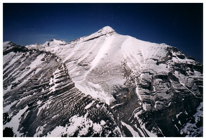
view really started to improve, when The Fortress, Mount Galatea,
and the striking unnamed peak to the west of the Pass became visible.
At
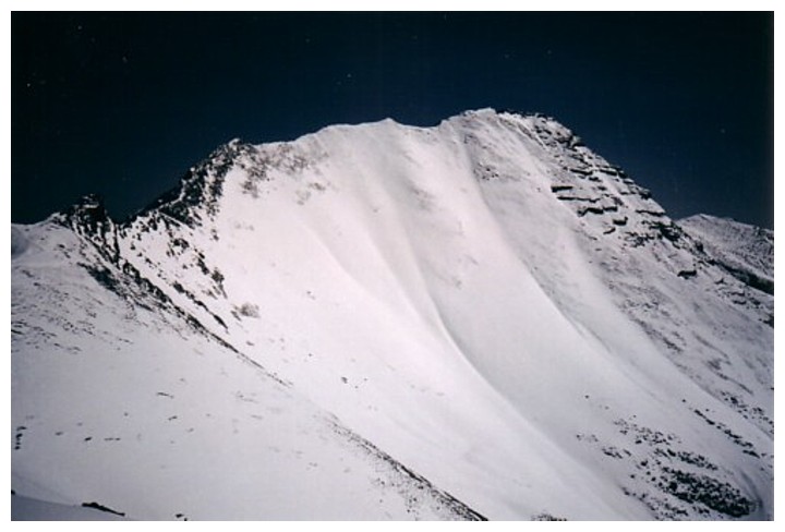
the Pass, the view was great. Most impressive was the snow-covered southwest
aspect of Mount Bogart – showing the entire scramble
route and the long 11 km approach. The summit at GR237374 was only about 20-30
minutes away and was worth the extra effort to get there. The view at the
summit was slightly better than that of the Pass. Commonwealth Peak,
Pig’s Tail, and Mount
Birdwood could now be
seen through the gap in-between The Fortress and Galatea and the summit and
ascent route of South Kidd were clearly visible. Also, of note in the panorama
were the Wedge, the spiky points of the Opal Range,
and Fisher Peak. I contemplated continuing on to
the summit of South Kidd (for about 2 seconds!), but lacked the energy and
motivation.
For a
very rapid descent, the best way to go is back to the Pass and then glissade
down the entire ascent slope. I chose to take a more direct route, descending
scree slopes towards a lower point of the ascent gully. In retrospect,
returning to the Pass would have been easier, however, a large herd of bighorn
sheep with their young were now blocking the route and I didn’t want to disturb
them. When I finally got back to the gully to do the lengthy glissade, I realized
I had left my most important piece of equipment in the car…..my Crazy Carpet!
Fortunately, the terrain was steep enough for me to glissade down for a good
kilometre, before the heat of the sun had softened the snow enough to stop the
glissade. With my Crazy Carpet, I could have continued down to the bottom in no
time. The remainder of the trip was uneventful.
Overall, the fantastic weather and surprisingly good scenery (only when you are almost to the Pass,
however!) rendered this a most enjoyable trip.
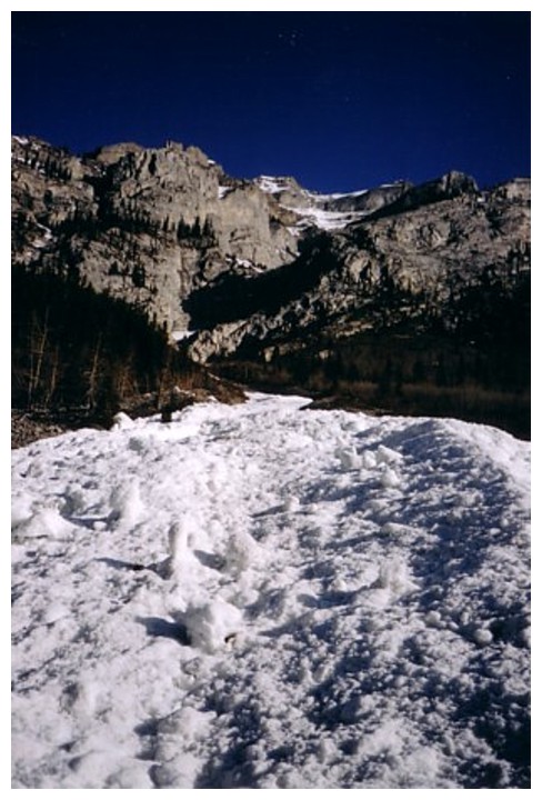
Avalanche debris off Mount Kidd South
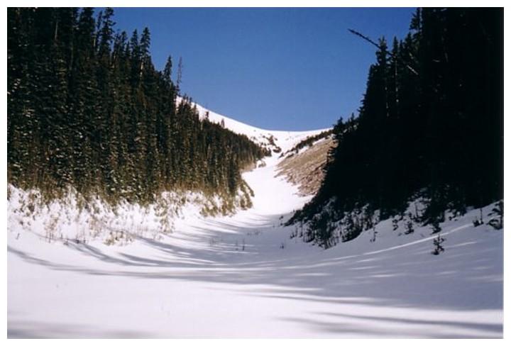
Looking up the ascent gully
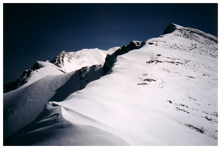
At Guinn's Pass, looking up to the GR
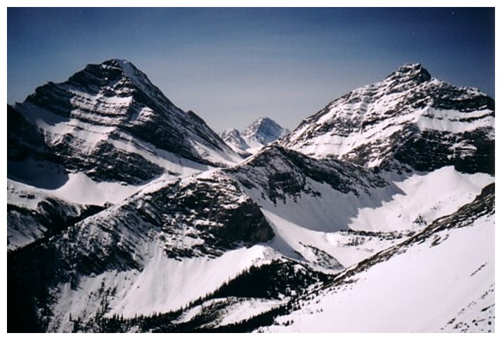
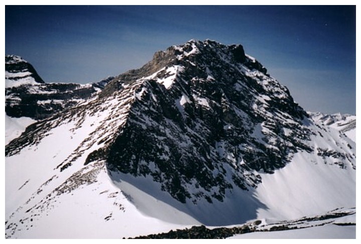
Mount Galatea (left) and The Tower (right). Between them sit Commonwealth Peak and Mount Birdwood.
Mount Bogart
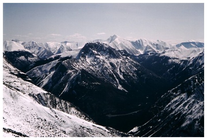
View to the east

The Fortress and Gusty to the left of Galatea
Unnamed peak to the west of Guinn's Pass
Mount Kidd South