Mount Henkel
Mountain height: 2673 m
Elevation gain: 1150 m
Ascent time: 4:30
Descent time: 2:30
Scrambling with Mark.
 Mum always taught us that laziness never
pays off. This trip proved that there are exceptions to that rule. Flipping
through Gordon Edwards A Climber’s Guide
to Glacier National Park, on day 2 of our second trip to GNP, a
particularly phrase caught my eye: “one and half miles to the summit”. After
whipping out my 8 trillion computations per second Super Computer to find out
what the heck one and a half miles was, I was pleasantly surprised to find out
it converted to a mere 2.4 km (odd that a British person has no concept of what
a mile is!). That was music to our ears and so we set off on this short and
probably mundane scramble.
Mum always taught us that laziness never
pays off. This trip proved that there are exceptions to that rule. Flipping
through Gordon Edwards A Climber’s Guide
to Glacier National Park, on day 2 of our second trip to GNP, a
particularly phrase caught my eye: “one and half miles to the summit”. After
whipping out my 8 trillion computations per second Super Computer to find out
what the heck one and a half miles was, I was pleasantly surprised to find out
it converted to a mere 2.4 km (odd that a British person has no concept of what
a mile is!). That was music to our ears and so we set off on this short and
probably mundane scramble.
 Mundane-----my butt!!!! This scramble
quickly joined the elite group of our top 5 favourite scrambles of all time. It
was one mind-boggling scene after another; enough colours to make a clown
jealous, tons of fun hands-on scrambling, and views that were second-to none.
Mundane-----my butt!!!! This scramble
quickly joined the elite group of our top 5 favourite scrambles of all time. It
was one mind-boggling scene after another; enough colours to make a clown
jealous, tons of fun hands-on scrambling, and views that were second-to none.
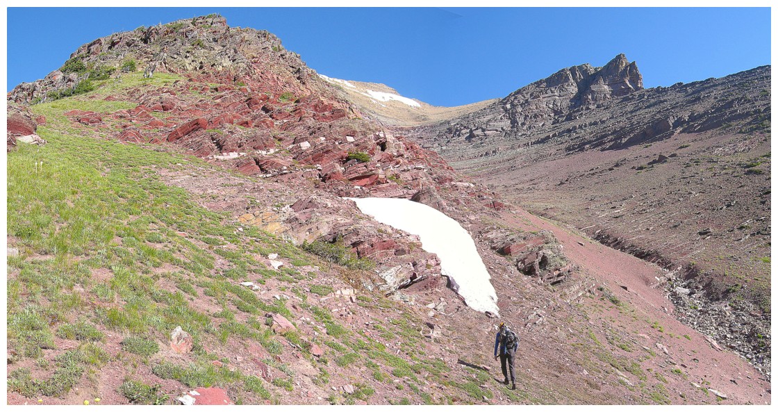
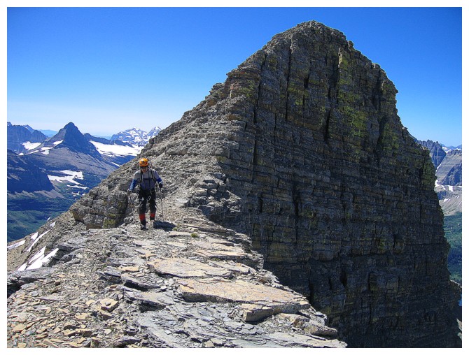
We started off following the suggested
route in the book, but deviated when the drainage we were ascending alongside
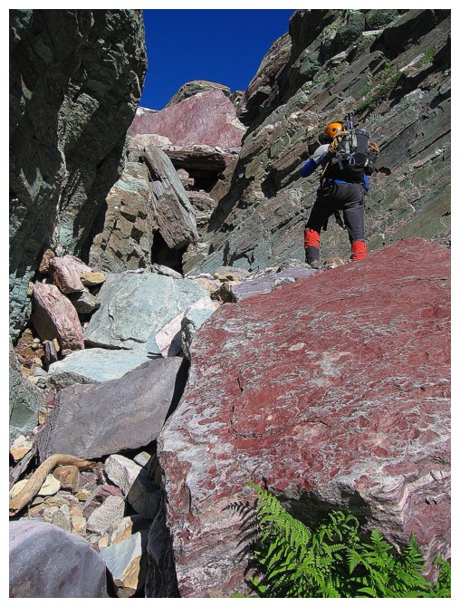
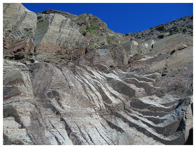
caught our eyes. We went into the drainage to find an astonishing array of
colourful rock. Higher up, we stayed in the drainage, when the trail took
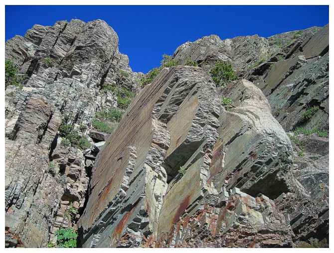
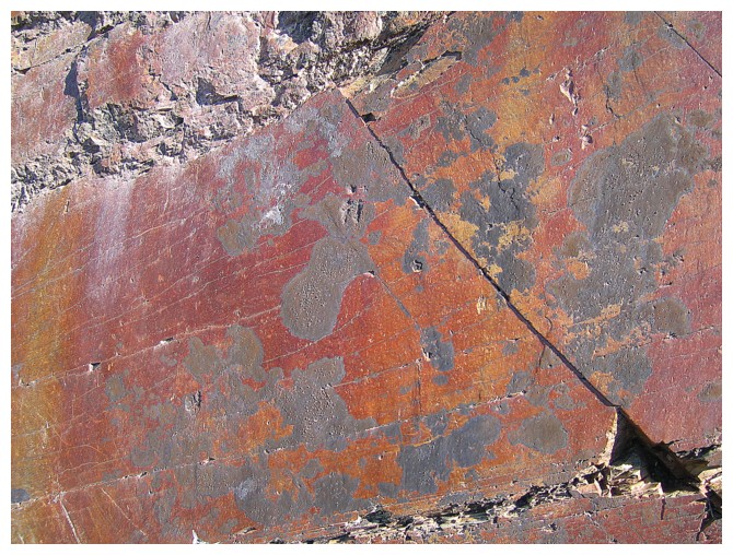
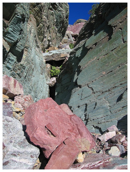
another route. The drainage was filled with huge chockstones of red and green
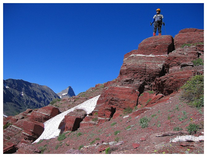
argillite. The scrambling here was most unique and enjoyable.
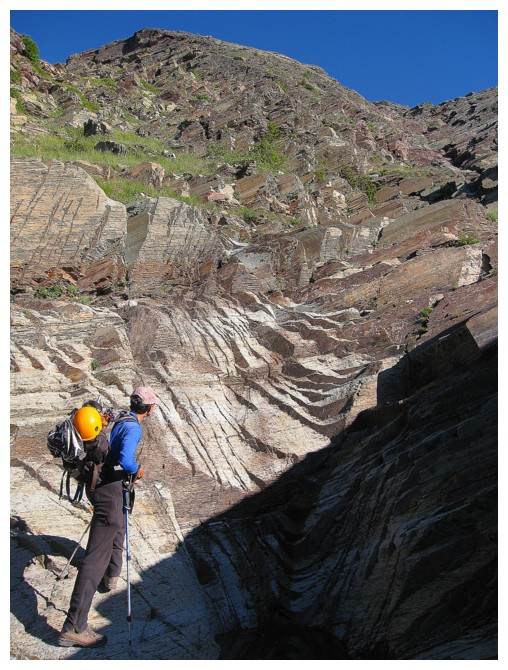
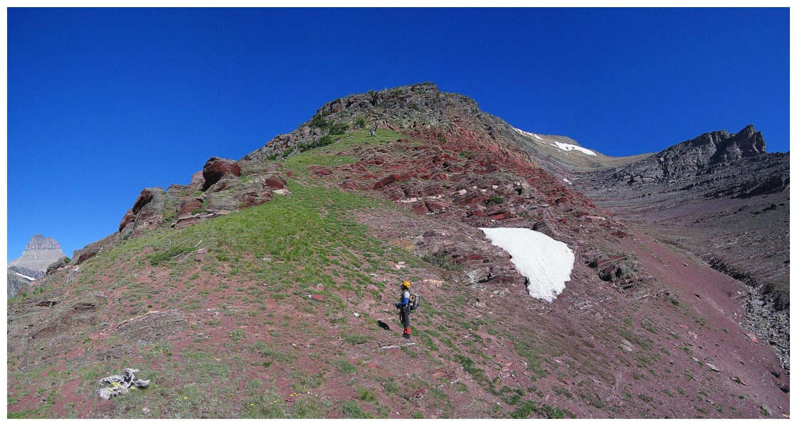
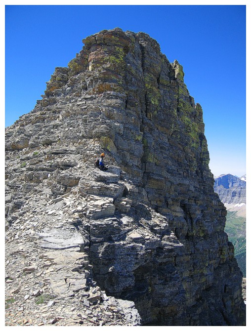
 At the top of the gully, the suggested
route went up the centre, between two ridges, to the summit. However, the lure
of the west ridge was too much for us and so we decided to go that way. We had
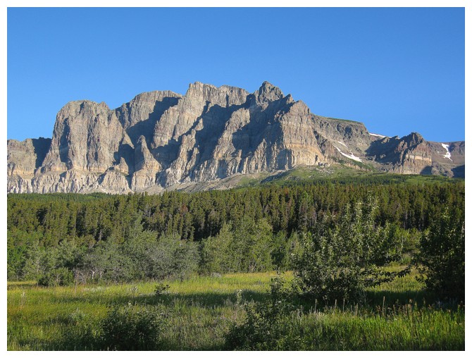
already seen some unbelievable views of stunning Mount Wilbur
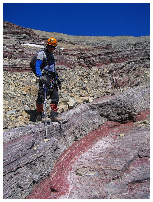
and hoped for more on the ridge – we were not disappointed. As well, the
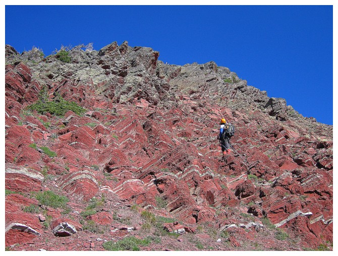
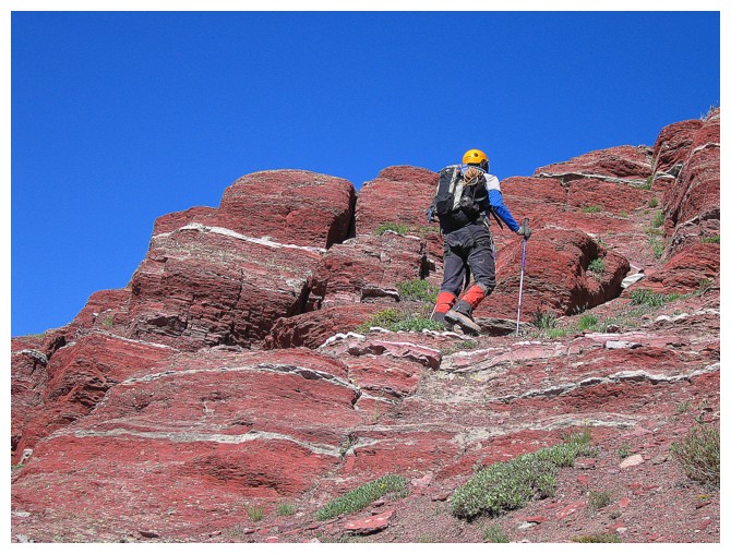
initial section was a paradise of bright red argillite rock formations. The
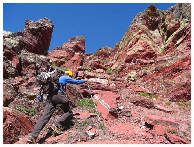
remainder of the ridge was a combination of fun route-finding, yet more
phenomenal views, and a healthy dose of hands-on stuff.
At the top of the gully, the suggested
route went up the centre, between two ridges, to the summit. However, the lure
of the west ridge was too much for us and so we decided to go that way. We had
already seen some unbelievable views of stunning Mount Wilbur
and hoped for more on the ridge – we were not disappointed. As well, the
initial section was a paradise of bright red argillite rock formations. The
remainder of the ridge was a combination of fun route-finding, yet more
phenomenal views, and a healthy dose of hands-on stuff.
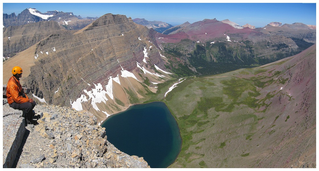
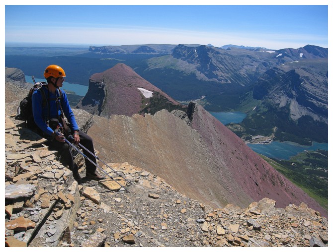
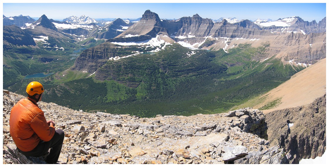
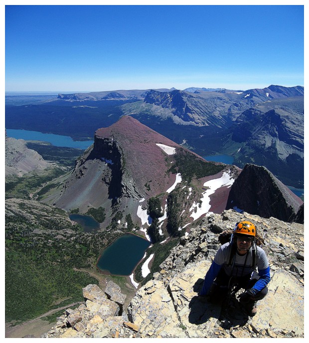
After all this amazing scenery and
scrambling, was the summit view going to be a let-down?? Not bloody likely!! It
was hands-down one of the best summit panoramas we’d ever seen. This is taking
into account that we could only identify a handful of peaks, the area being
completely new to us. I remedied that shortcoming by pouring over the excellent
National Geographic topo map of the area for about 20 minutes. Highlights of
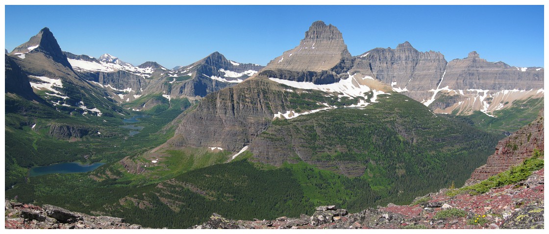
the view were….well, pretty much everything, but Mount Wilbur was about as
beautiful and striking as any mountain gets; and Grinnell Point, Iceberg Peak,
Mount Merritt, Mount Gould, the three peaks we summitted the day before, Allen
Mountain, Apikuni Mountain, Yellow Mountain, Altyn Peak and Chief Mountain
weren’t bad either! Throw in a handful of gorgeous lakes just to drive home the
point and total satisfaction is a forgone conclusion.
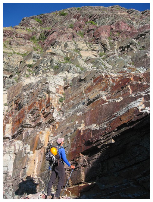
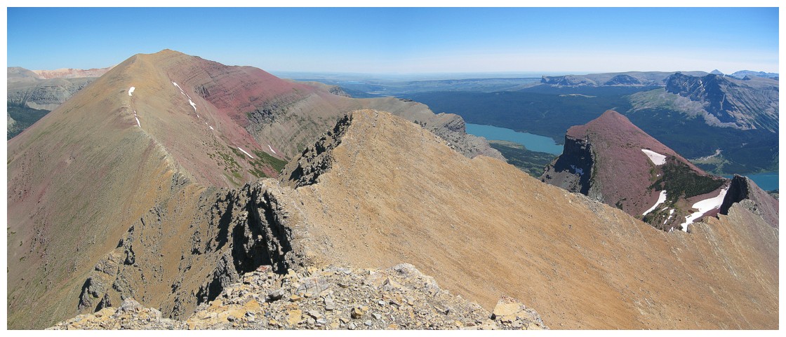
The descent was as
equally gratifying as the trip up. We followed Edward’s alternate descent
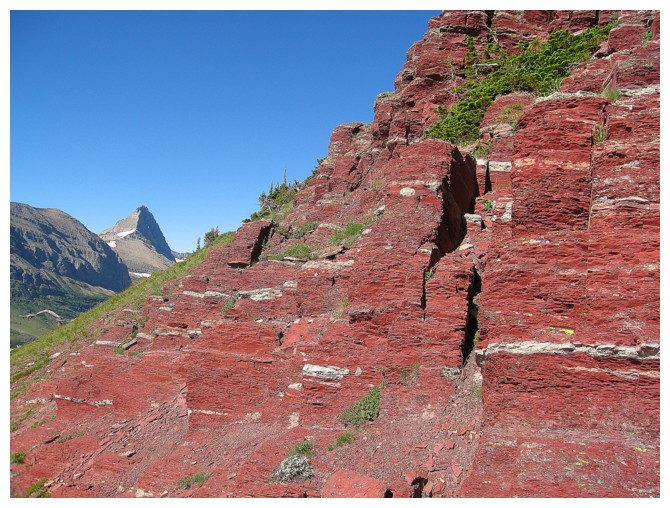
route, going down the centre of the peaks. The rock was again amazing – the
classic bands of alternating red and green argillite with a few surprise layers
in between. The only thing now needed to make this a perfect day was ice cream
waiting at the bottom….and there was! A gift store at the parking area provided
refreshing soft ice cream to end an unbelievable day.
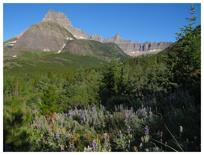
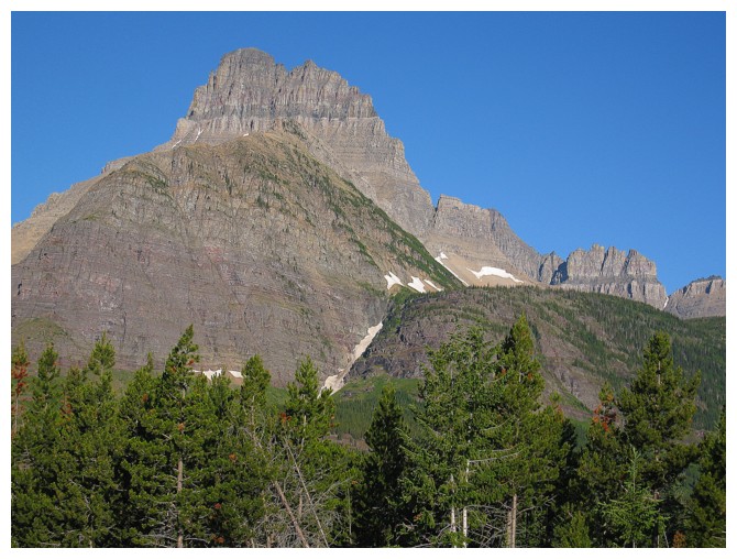
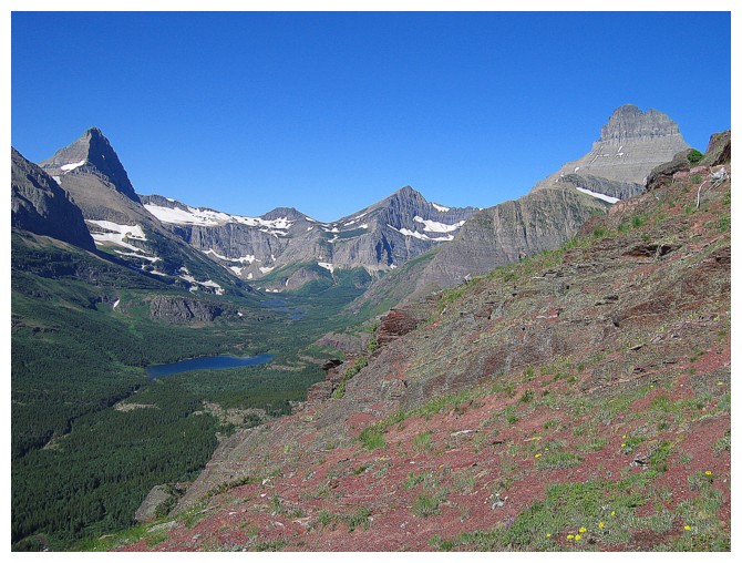
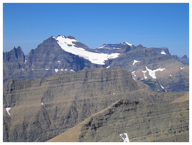
Impressive scenery on the drive in
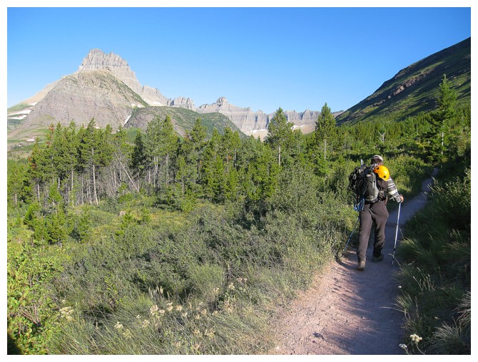
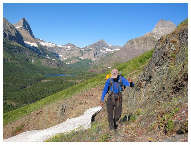
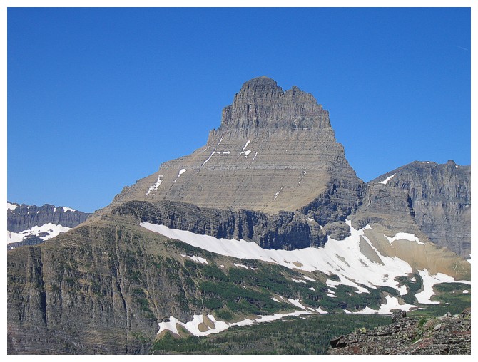
Hiking the trail to the ascent gully. Mount Wilbur makes its first of many, many, many appearances
There's another already!
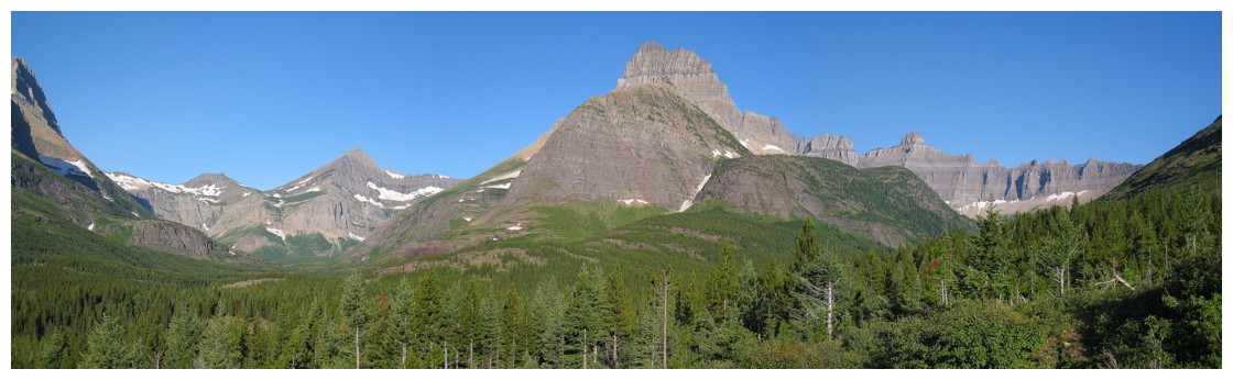
And another! The peak to the left is Swiftcurrent Mountain
Iceberg Peak and the B-7 Pillar join Wilbur in the view
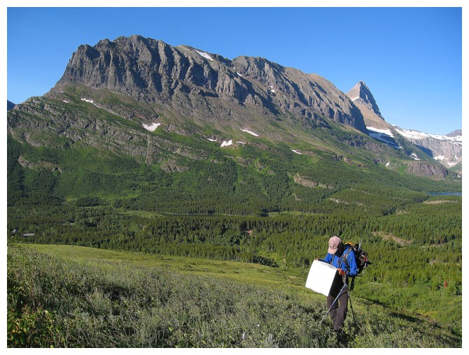
Making sure we are on the right mountain!
The pointed peak at the left is Grinnell Point
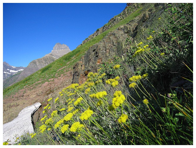
Flowers make everything look good
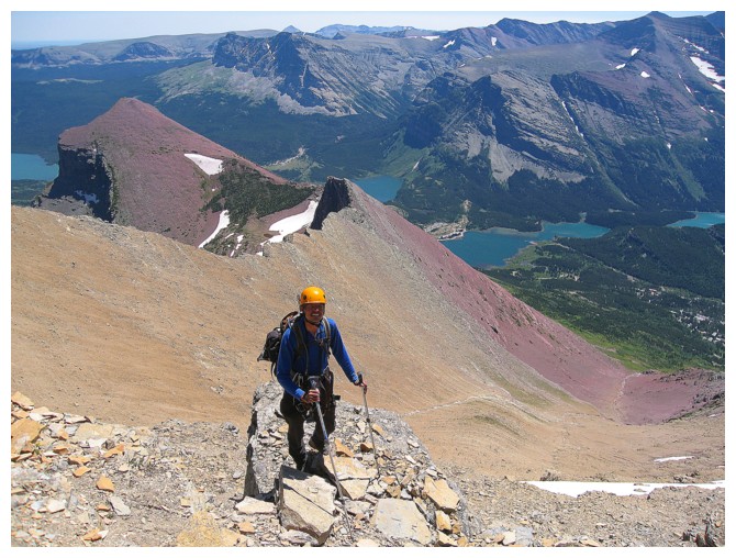
Mark and Grinnell Point
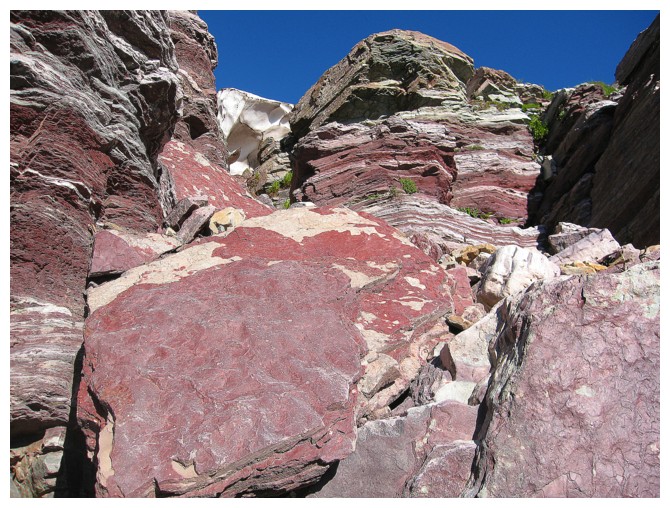
Super cool rock
Oxygen - not only for breathing!
Couldn't get enough of the amazing rock
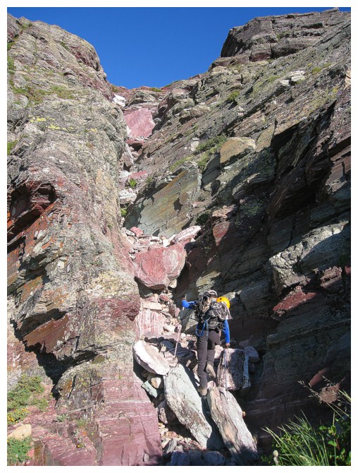
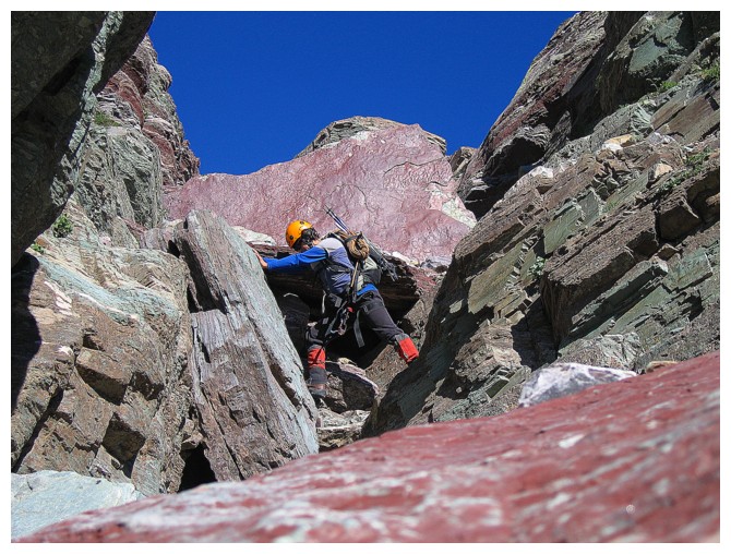
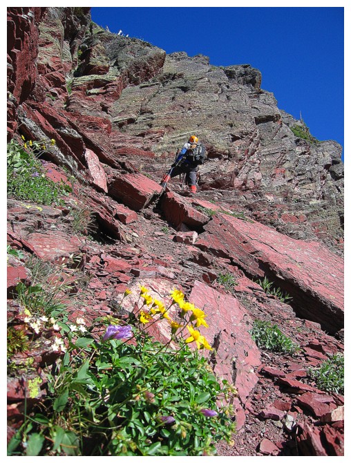
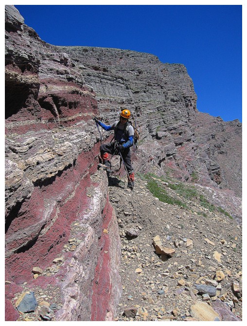
Starting up the chockstone gully
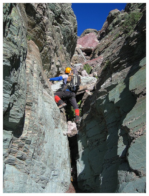
Mark takes the lead
Climbing over the major chockstone in the gully
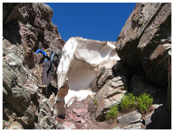
Snow at the top of the gully provides a little challenge
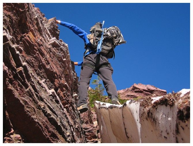
Luckily the snow was more ice than snow
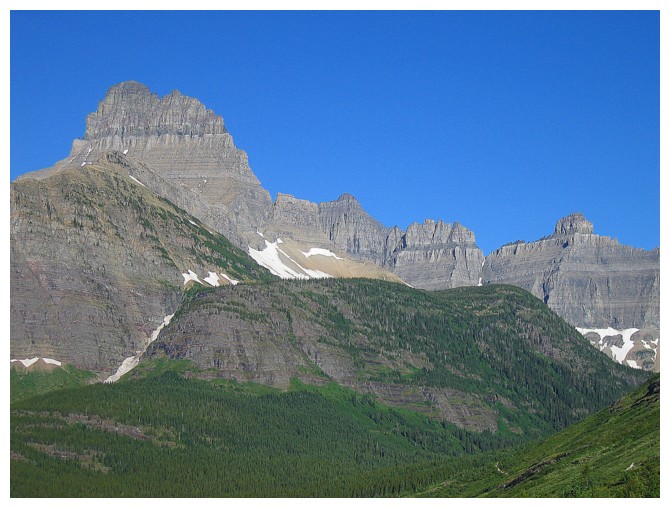
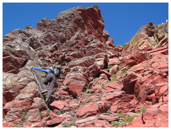
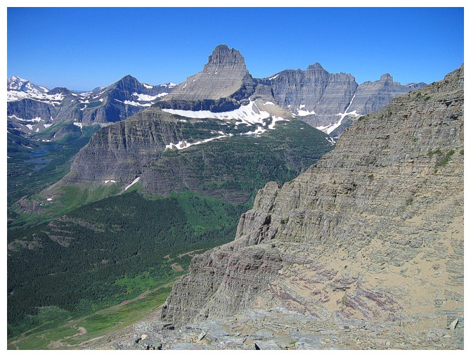
Atop the gully, the magnificent middle section of the mountain is revealed
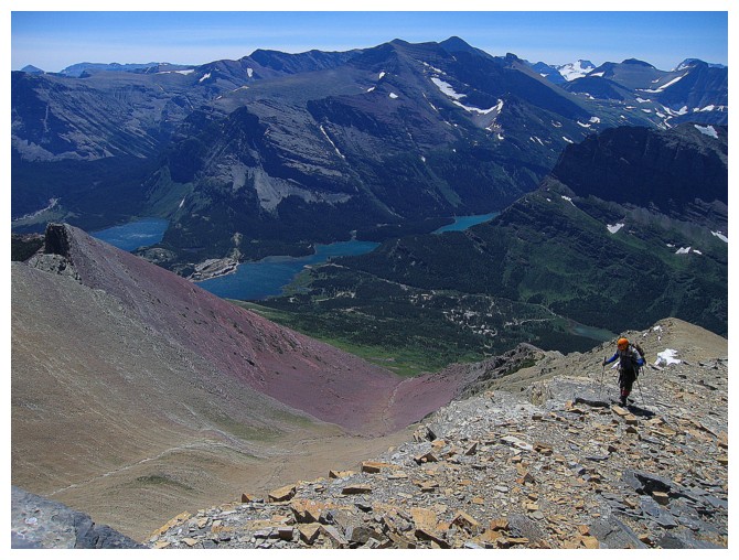
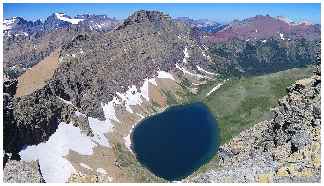
A few lakes start to appear in the valley to the west
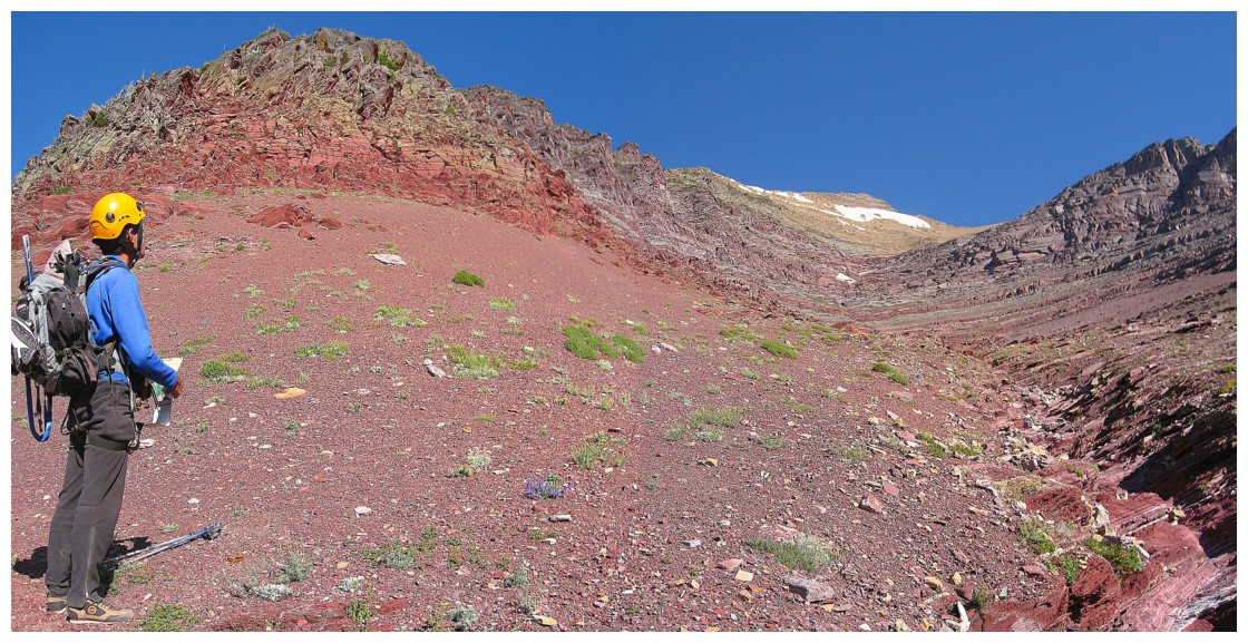
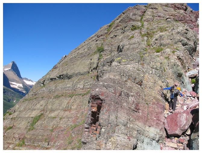
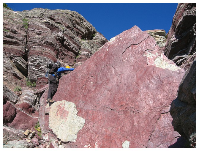
Red argillite heaven is coming up!
And a few lakes appear to the southeast
Getting closer
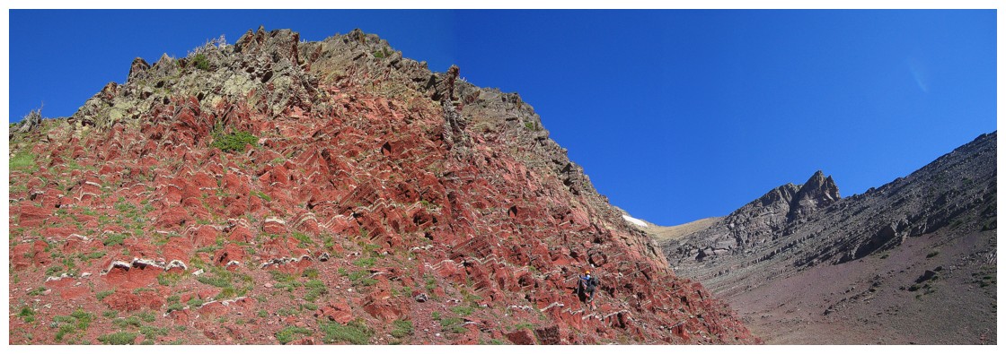
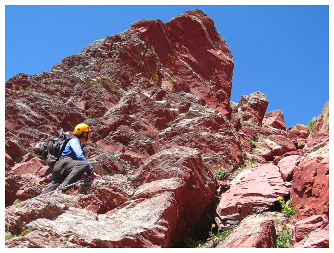
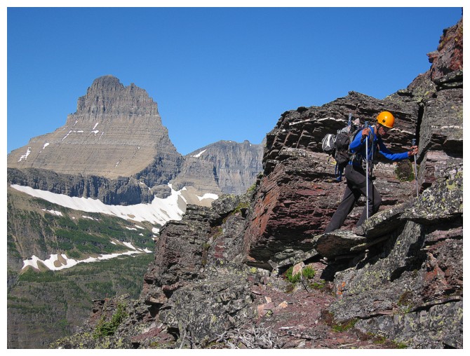
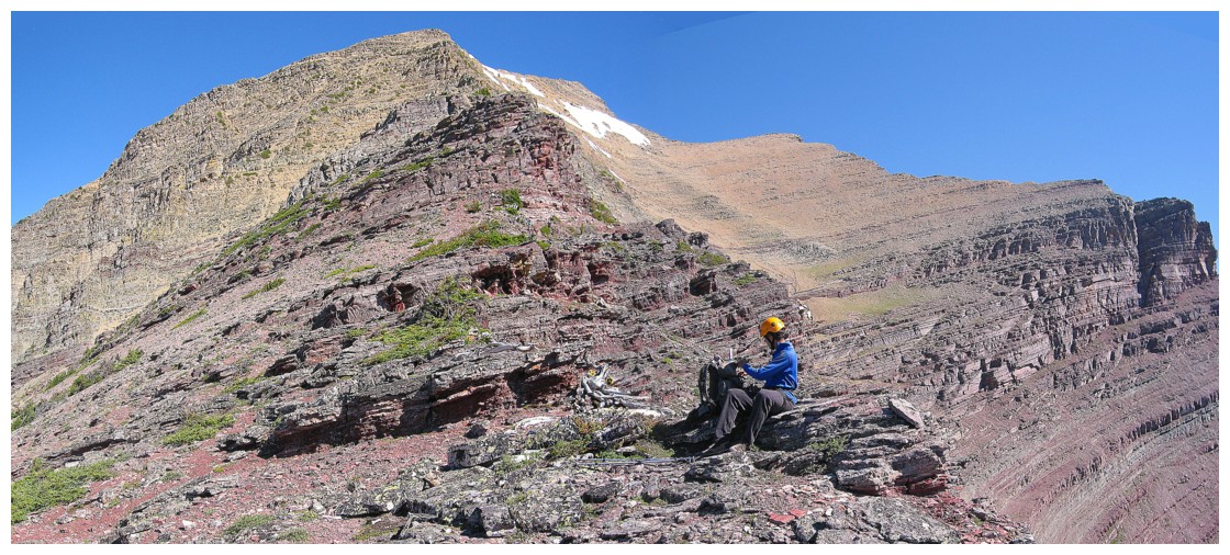
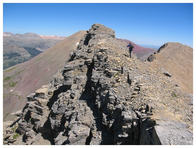
Mark starts up the argillite rockbands
ROYGBIV!?! (grade 4 science?)
Ridiculously cool rock!
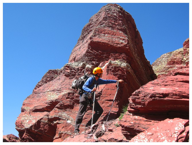
And then a ridiculously cool view of a ridiculously perfect mountain
Looking back. The descent route goes right down the middle.
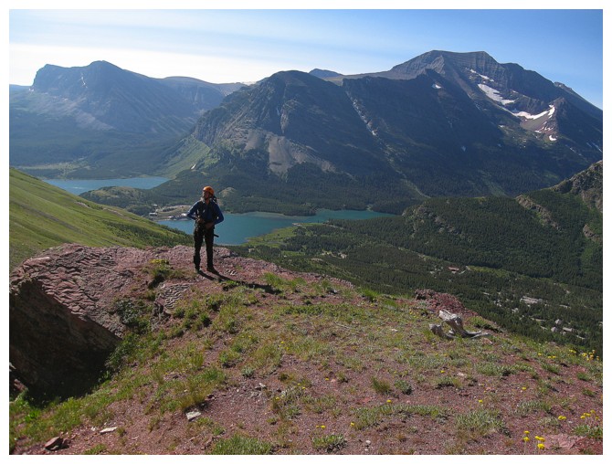
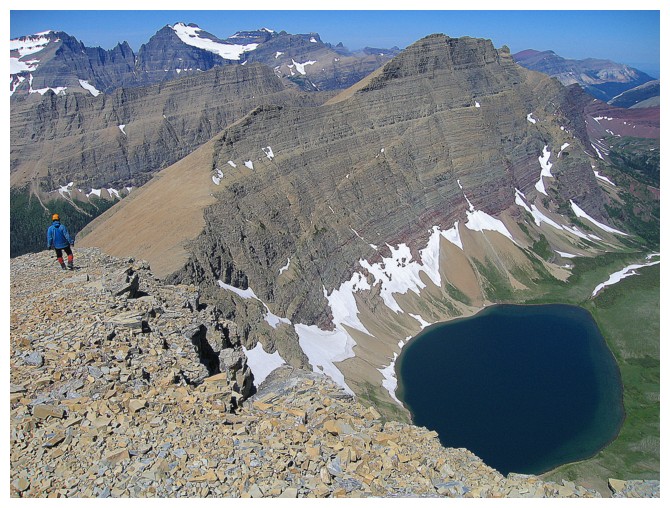
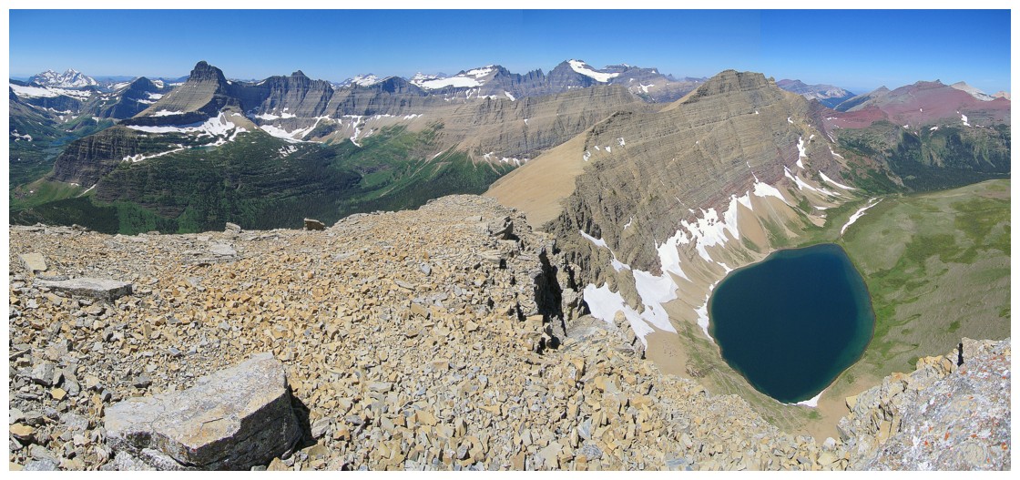
Easily one of the best views we've ever seen. Mountains, lakes, forests, glaciers - Henkel has it all!
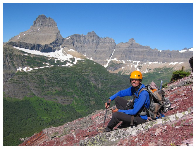
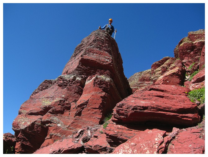
Someone is quite happy
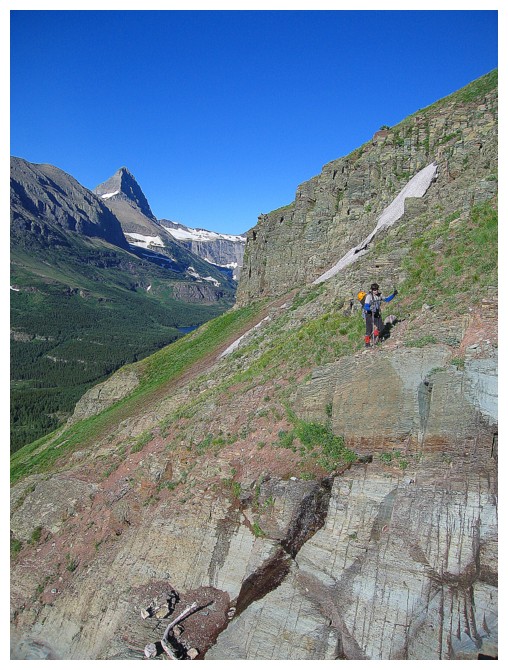
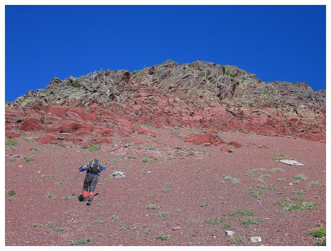
The upper section of the ascent
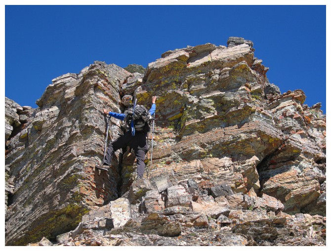
Good scrambling
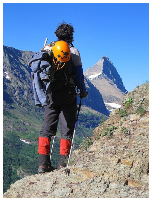
What is he looking at?
That!
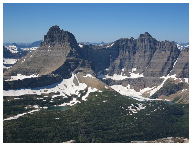
The colourful mountains to the north include Seward Mountain, Gable Mountain, parts of Yellow Mountain and Chief Mountain
Kennedy Lake, Crowfeet Mountain, and the the view of Mount Merritt are a couple of the wonderful surprises at the summit
Summit view to the west
Looking over to Apikuni Mountain (left) and Altyn Peak (low red peak near the right side).
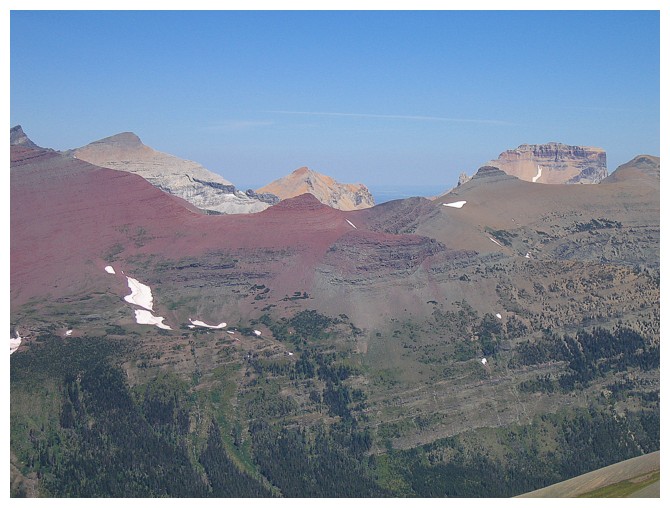
Both can be completed in a day and offer some of the best scenery in the park (in my opinion)
Unreal view
Mount Merritt is easily (?) achieved in 58 wonderful kilometers of hiking, scrambling and mountaineering.
This elusive summit is one of the crowning achievements of mountain ascents in Glacier National Park, Montana.
Unreal view, the sequel
Unreal view in the opposte direction, as we head down
Traversing over to the descent route
The big lake below is Natahki Lake and it's spectacular!
The steep face of Henkel's north side
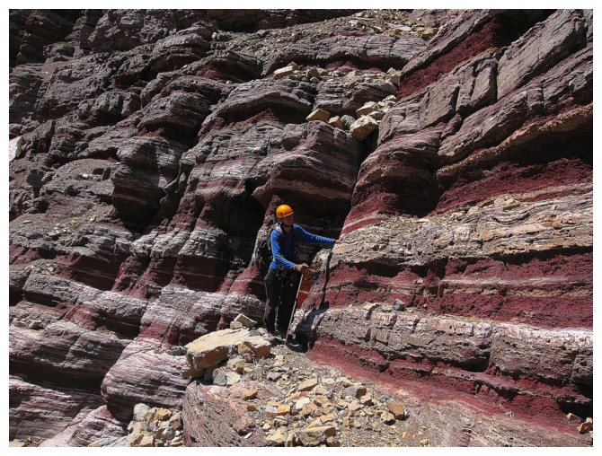
The alternate descent features more great rock scenery
Mark has a touching moment with the rock before we finish the descent
The End