Mountain height: 2,685 m
(8,807 ft)
Elevation gain:
1,226 m
Ascent time:
6:25
Descent time:
Scrambling and mountaineering with Mark.
I think I need to introduce an “Ordeals” section to my website - we seem to have enough of them to warrant it. Though not as unnerving as our involuntary glissade down Mount Kidd, or our two nightmarish descents on Narao Peak last year, the day’s ascent of Holy Cross Mountain did have a couple of thrills and chills that we laughed about on the drive home, but were no laughing matter at the time.
We brought along a fairly full compliment of gear for the winter ascent – snowshoes, avalanche equipment, crampons, ice axes, rope, harnesses etc. We didn’t use the snowshoes, but I’m definitely glad we took the remaining items.
The trip started with an easy and pleasant hike along Gunnery Creek Trail. Upon reaching the base of the mountain we decided to ascend the north-east ridge and save the easier centre gully (the shaft of the cross) for descent. Gaining the ridge was a little more difficult than we thought it would be. The west wind picked up considerably as we gained elevation and, in the conjuction with the hardened snow, required us to take out the crampons and ice axes. We eventually came to a very scenic rockband and ascended through a weakness on the right side.
Finally on the ridge, we were assaulted by the full brunt of the wind. It was absolutely vicious and on two occasions I was knocked to the ground. Nevertheless, we continued the ascent along the interesting ridge, even though the gusting head-wind made travel very slow and exhausting.
Just before the summit ridge, things got interesting. Here, we had three route options: 1. continue up the northeast ridge to gain the lower summit and then traverse to the true summit; 2. traverse to the center of the gully, gain the ridge up steep snow slopes and again traverse to the summit; 3. traverse more steep snow slopes to the southeast ridge and gain the summit from there. Option 1 seemed to be the most obvious, however, we were unsure of how wide the connecting ridge was and, given that we knew we would again be brutalized by the wind as soon as we made it to the ridge, we chose to forgo this route. The same concern was true of Option 2 and that one also involved a very steep, but short climb to gain the ridge. And so option 3 it was. The traverse started off okay, but soon we were on pretty steep terrain covered by a very inconsistent and “iffy” snowpack – at times the snow was hard and easily traversed with crampons and ice axe; at other times, it was deep powder, with very little stability. Here, an ice axe self-belay was completely useless.
About halfway across, the instability of the snowpack had us concerned enough to change plans. Since the ridge was quite close we started up a steep slope towards it. Again, the snow was terrible to ascend and even roped up, I found the short ascent somewhat unnerving. A few metres before the ridge, the grade increased to an alarming degree. Retreating appeared to present more danger than the ascent and so I just went for it. Luckily, the snow held and I crawled onto the ridge and belayed Mark up.
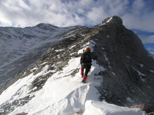
Unfortunately, our troubles weren’t over. As expected, once on the ridge, the wind was ferocious - far worse than anything we’d experienced up to that point. The ridge was also quite narrow with drop-offs on both sides and corniced snow on the east side. On a calm day the snow would have presented little problem and the traverse to the summit would have probably been straightforward and perhaps pleasantly exhilarating. With the wind, it was “gripping” to say the least. Ascending the ridge standing upright would have been suicidal and so we basically crawled along the snowy ridge, grabbing every solid rock-hold we could. Once, I turned around to see Mark straddling the ridge on his belly holding on some rocks for dear life (as I said, we laughed about it on the way home, but not at the time).
We really didn’t have much of a choice but to complete the ascent, as there was no way we were going the descend the route we came up. Getting to the summit and descending the southeast ridge was our only option and once we started, there was no turning back. Thankfully, the ridge was not too long, and shortly, we were on summit (although it seemed to take forever).
After breathing several sighs of relief (and getting my heart started again!), we took a few pictures and immediately started down. The descent route was an unknown and we couldn’t see much of it from the summit. Although easier than our ascent route, the southeast ridge was still fairly steep and again, the snow stability was very questionable. Belaying each other off slings around the very few available rocks, we headed straight for the right side where the wind had blown much of the slope clear. Once there, the most dangerous section was behind us and we moved into the centre gully to complete the descent. The final 1.5 hours along the Gunnery Creek Trail was done by headlamp and in relative silence, as we were both physically and mentally exhausted.
Yet another great day in the mountains!! I sincerely, doubt we’ll be trying to duplicate this winter ascent in our lifetimes (although, in the spring a more stable snowpack would make for a great ascent), but as they say, “no harm….no foul”.
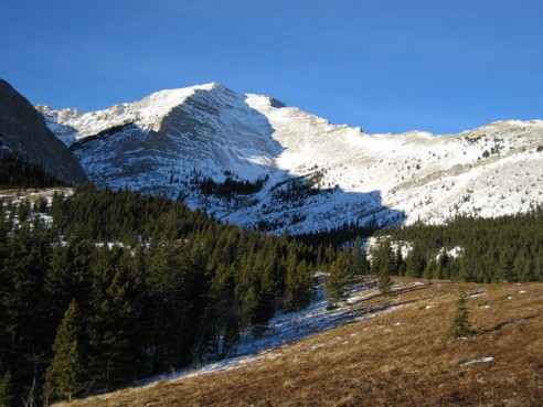
Holy Cross Mountain; the ascent route we took follows the right skyline
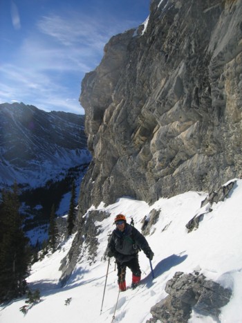
At the first rockband
Traversing slopes beneath the rockband towards a weakness (near the centre of the photo)
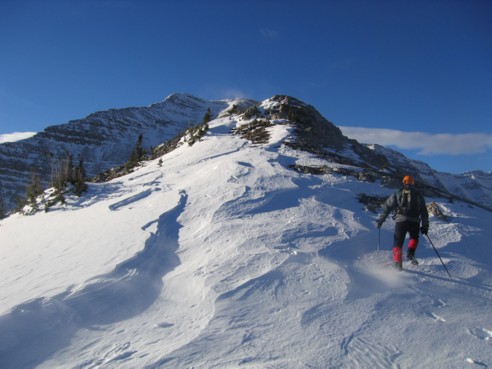
On the northeast ridge; the summit can be seen just left of centre
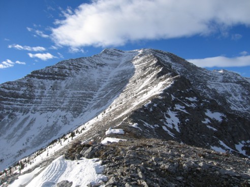
Further up the ridge, with the interesting and enjoyable northeast ridge before us
More interesting ridge scenery
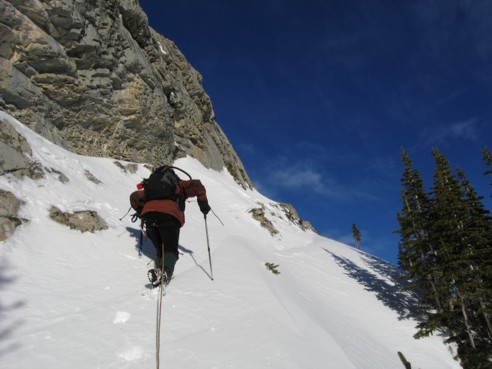
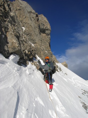
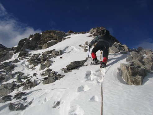
Onto steeper slopes
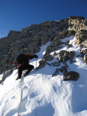
We traversed around this rockband instead of tackling it head-on; the strong wind made it too dangerous
More great terrain.......
And more....
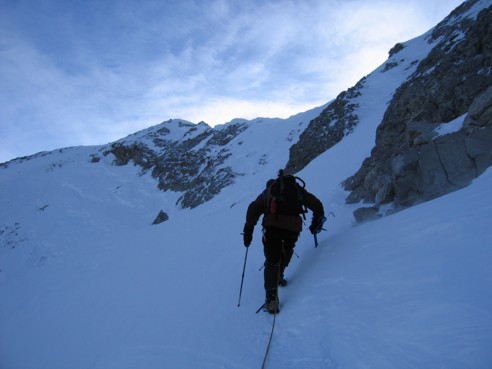
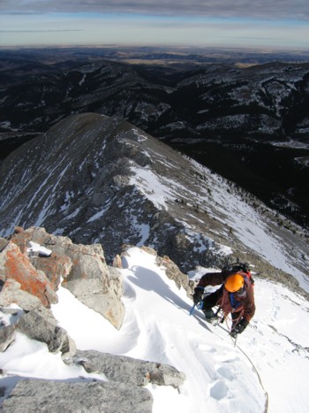
Approaching the summit (left of centre); this is where we had our three options; the slope ahead is steeper than it looks and has avalanche potential; we intended to traverse all the way to the left, but made it into the middle and then ascended a very steep slope to gain the ridge near the middle of the picture
On the ridge, with the summit behind
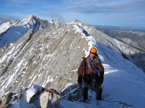
On the ridge, but looking to the north; the prominent peak to the left is Mount Head
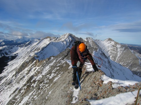
Negotiating the narrow ridge; the position of the rope around my shoulder indicates how strong the wind was
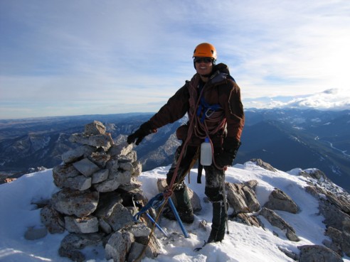
At the summit cairn
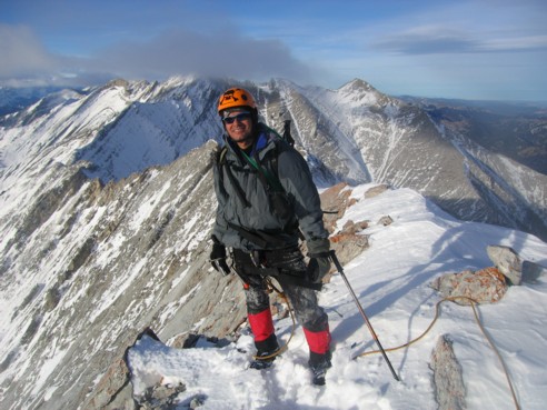
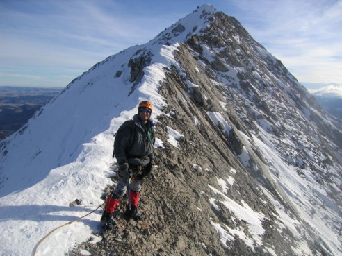
Mark at the top