Iceberg Peak
September 16, 2023
Mountain heights: 2788 m, 2694 m
Total elevation gain: approximately 1700 m
Ascent time: 5:45
Traverse time to
South: 1:25
Descent time: 4:25
Scrambling with
Raff.
There are
outstanding summit panoramas and then there are OUTSTANDING SUMMIT PANORAMAS!!
The view from Iceberg Peak definitely belongs in the latter category.
Mark and I had
attempted Iceberg Peak in 2014 via the famous Iceberg Notch route.
After gaining the notch we bailed on the summit attempt due to poor weather and
instead went to nearby Ahern Peak – in retrospect a very good decision. That
route starts at Many Glaciers and approaches the summit of Iceberg from the
east and the north. 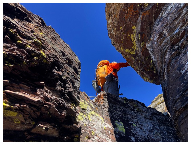 A less technical route from the St. Mary’s side,
approaching the summit from the south and west, is well described by both J. Gordon
Edwards and Blake Passmore and that is the one Raff and I chose.
A less technical route from the St. Mary’s side,
approaching the summit from the south and west, is well described by both J. Gordon
Edwards and Blake Passmore and that is the one Raff and I chose.
To bypass the
crux of the trip – finding a parking spot along the Going-To-The-Sun Road – we
camped the night before at the St. Mary’s KOA. Even so, at 7 am we snagged one
of the last remaining spots at The Loop trailhead. Although this starting point
adds 700 m of elevation gain to the trip, as opposed to the Logan Pass
trailhead, it also reduces the total horizontal distance by 11.6 km. 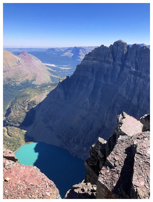 We figured
that waning energy levels at the end of the trip would favour an all-downhill
return from the common point shared by both routes, instead of a long up and
down traverse back to Logan Pass.
We figured
that waning energy levels at the end of the trip would favour an all-downhill
return from the common point shared by both routes, instead of a long up and
down traverse back to Logan Pass.
The extra 700 m
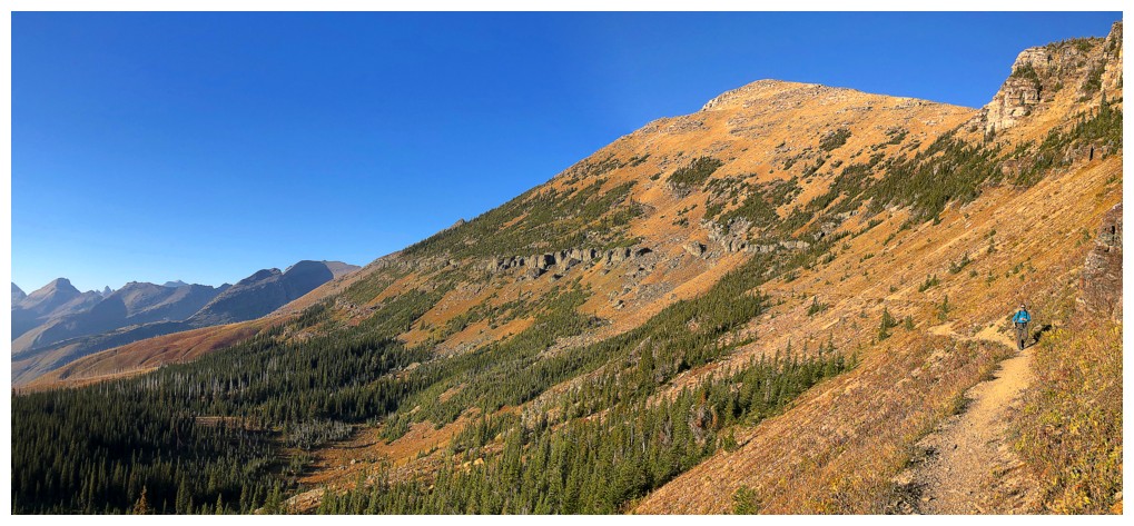
of elevation was gained easily on the gently graded Granite Park Trail. Turning
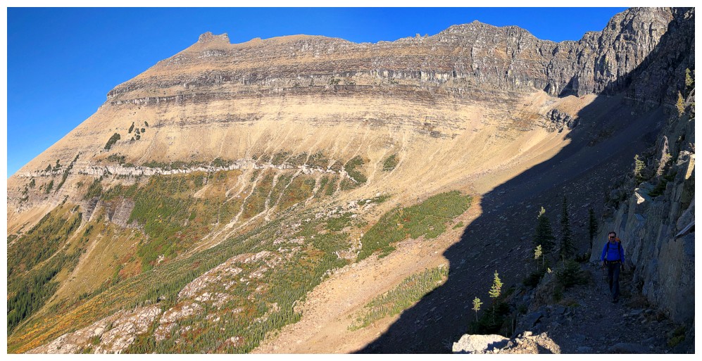
onto the Highline Trail we then hiked several kilometres across the west side
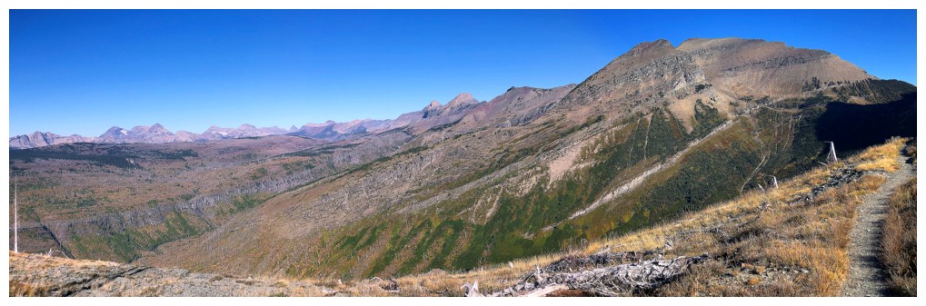
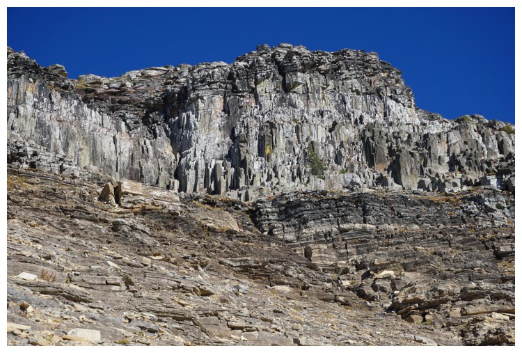
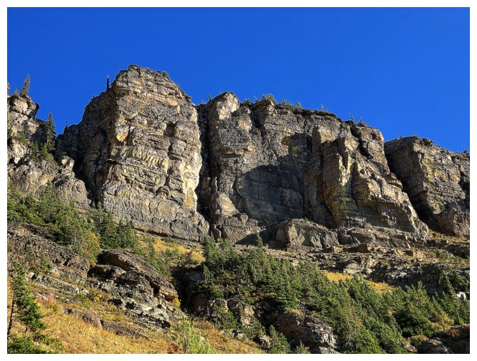
of the huge and seriously impressive massif that joins Swiftcurrent Pass to
Ptarmigan tunnel. This wall of rock (The Ptarmigan Wall at the north) is
basically a continuation of The (razor-thin) Garden Wall and boasts some of the
most awe-inspiring rock scenery you may ever see.
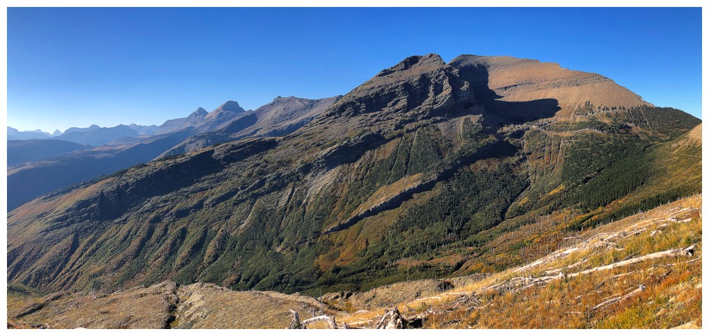
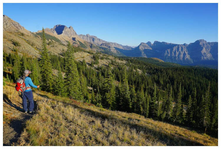
Views
throughout the approach were quite unique. Much of the northwest section of the
park was visible, but separated from our present position by a huge, green
valley. We could also see well into Waterton, mounts Blakiston, Rowe, and even Festubert
immediately catching our eyes. It was really neat to see the southeast sides of
mounts Kintla and Kinnerly, two peaks that I often fawn over from the northeast
on the Canadian side of the border.
The only section of concern during the approach was going
to be the infamous Ahern Drift – a north-facing section of the trail that is often
covered in a steep, icy layer of snow and notorious for stopping hikers without
crampons and an ice axe dead in their tracks. To our utter surprise there was
not a flake of snow on the trail where the drift usually resides. 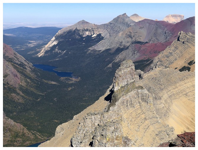 This was
great news for the day, but like the relatively recent appearance of a huge
lake north of Northpost Spire, another reminder that permanent snow and glaciers
in this part of the world are disappearing at an alarming rate. Apparently, the
park had blasted a path through the drift earlier in the summer, but we were at
minimum expecting to see some debris from the blast.
This was
great news for the day, but like the relatively recent appearance of a huge
lake north of Northpost Spire, another reminder that permanent snow and glaciers
in this part of the world are disappearing at an alarming rate. Apparently, the
park had blasted a path through the drift earlier in the summer, but we were at
minimum expecting to see some debris from the blast.
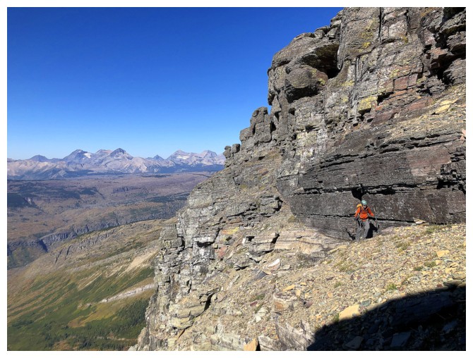
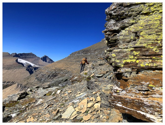
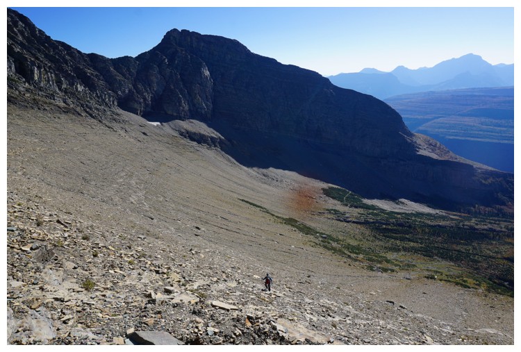
Soon after passing the non-existent Drift, we started up
the southwest slopes of Iceberg Peak. While generally straightforward, the
ascent was noticeably lacking in the aesthetic qualities of the Iceberg Notch
route. There were definitely some interesting sections, just few and far
between. Having said that, the west route is a great way to ascend Iceberg
without venturing into 4th and 5th class terrain.
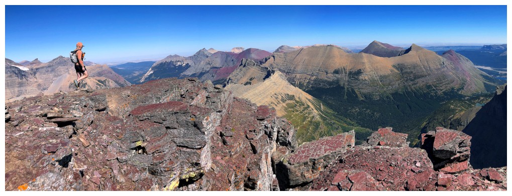
Up to that point the views had
been great but were about to get crazy! Waiting for us patiently at the ridge
was an outrageously cool view of Mount Wilbur’s northwest face and Iceberg
Peak’s southeast face with Iceberg Lake between them. And that was but a small
taste!
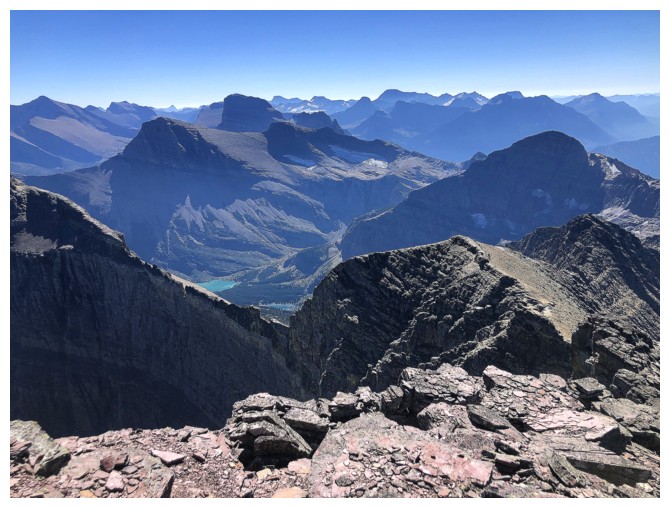
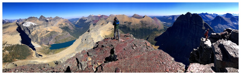
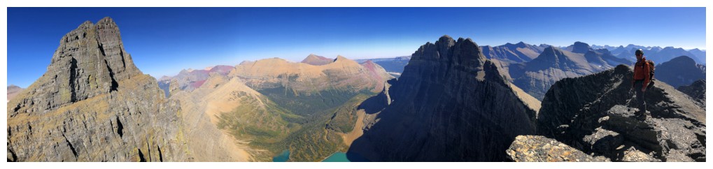
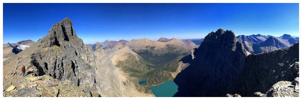
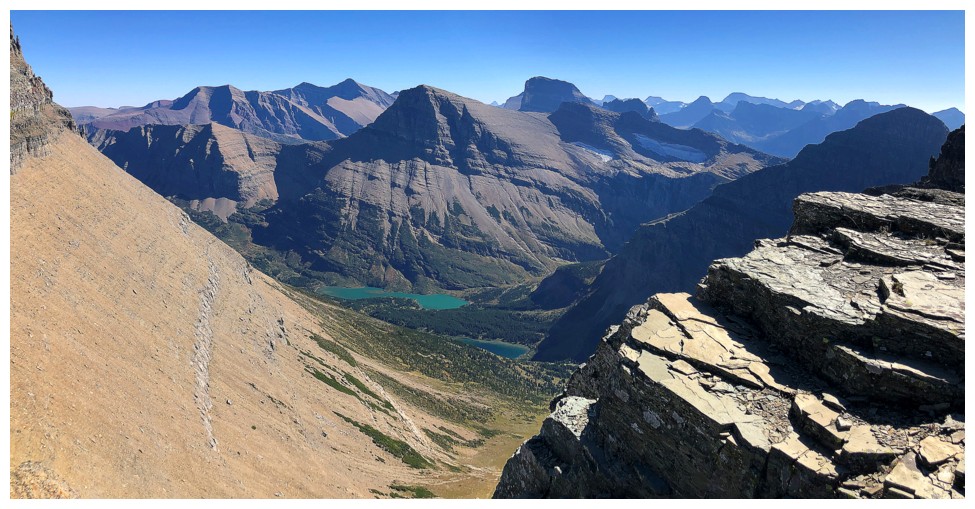
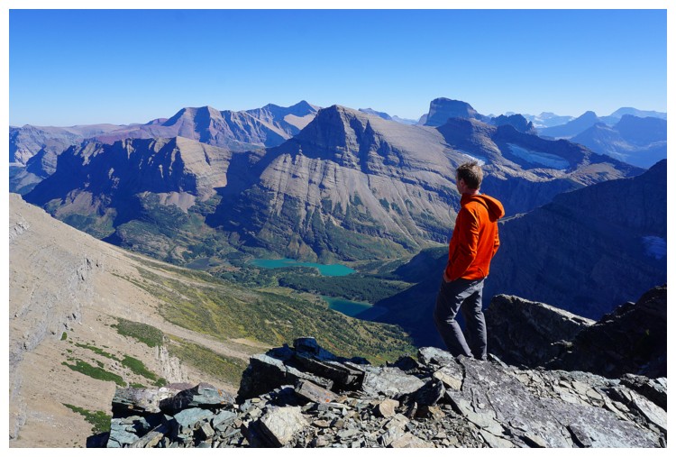
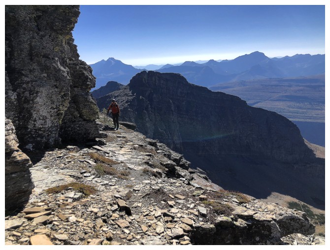
The panorama waiting at the summit
was simply incomparable! Under clear skies, a sea of striking peaks in a
multitude of different colours, and several stunning lakes conspired to render
the view one of the finest I’ve ever seen. A rousing round of “oohs”, “aahs”,
and “Holy mackerels” ensued ("mackerel" is the PG version!). I could say there was a "plethora"
of excited utterances but there were exactly as many as required – “neither more, nor less” (two of my favourite movies ever).
Soon after we arrived, two
trail runners joined us at the top, both also blown away by the view. 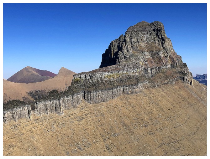 They
had come up from the Many Glaciers side via Swiftcurrent Pass, in a remarkable
time of 5.25 hours. Like
Grinnell, a few weeks earlier, we shared our ascent stories and recommended
descent routes. After
they left, we stayed at the top an additional 30 minutes before deciding we
wanted more. South Iceberg Peak was only about 0.5 km away and was also advertised
to have an amazing view.
They
had come up from the Many Glaciers side via Swiftcurrent Pass, in a remarkable
time of 5.25 hours. Like
Grinnell, a few weeks earlier, we shared our ascent stories and recommended
descent routes. After
they left, we stayed at the top an additional 30 minutes before deciding we
wanted more. South Iceberg Peak was only about 0.5 km away and was also advertised
to have an amazing view.
Getting over to South required
far more time, effort, and route-finding than expected, until we realized we
had gone over the summit and then to the next highpoint. The views from that
highpoint were great, but definitely inferior to those from Iceberg. South
Iceberg had the second-best views of the day. Again, Mount Wilbur provided most
of the visual entertainment, its west side equally impressive as the north,
east, and south – Wilbur really is a mountain of a near perfect aesthetic
beauty.
Although an alternate descent
route from the next highpoint (GR966090) appeared to be feasible, the path over
there didn’t look like a pushover. We decided to play it safe and return the
same way we came up. Back on the main trail, a long and somewhat foot-numbing hike
out ensued, tempered greatly by the wonderful scenery on the west side of the
massif, now illuminated by the Sun’s rays. (Almost) sheer relief hit when we
reached the aforementioned key junction. Had we picked the Logan Pass route, we
would have been confronted with 12.2 km of up and down hiking to finish the
trip. Instead, only 6.4 km of all downhill hiking was required. The remainder
of relief set in as we arrived back at The Loop trailhead, just as darkness fell.
An incredible day of jaw-dropping
views and mountain scenery. A return trip to this amazing viewpoint is already
in the works for next year. This time (hopefully with the old bro’) we would
ascend via the Iceberg Notch, go up and over Iceberg and South Iceberg, and
return via Swiftcurrent Pass, with the possibility of also throwing in
Swiftcurrent Mountain – guaranteed to be the trip of a lifetime!
 Raff on the Granite Park Trail
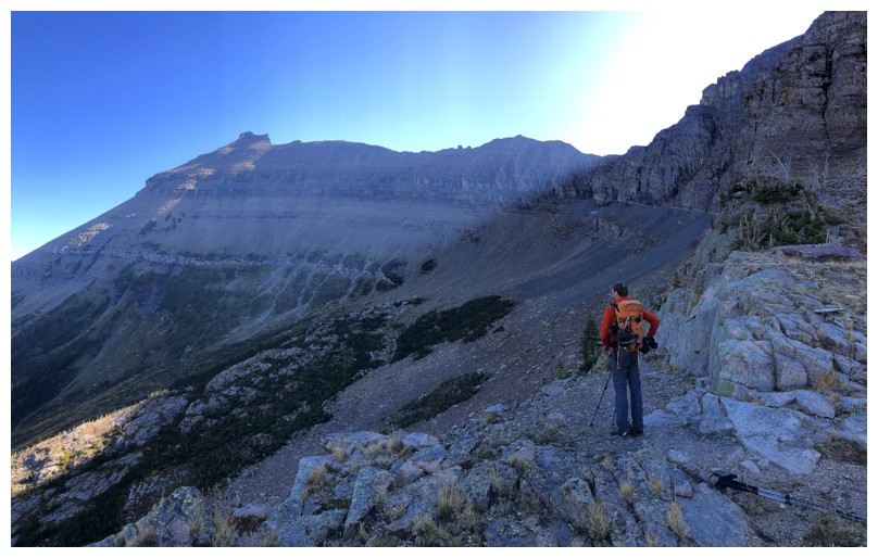
Heavens Peak looks like a very cool ascent
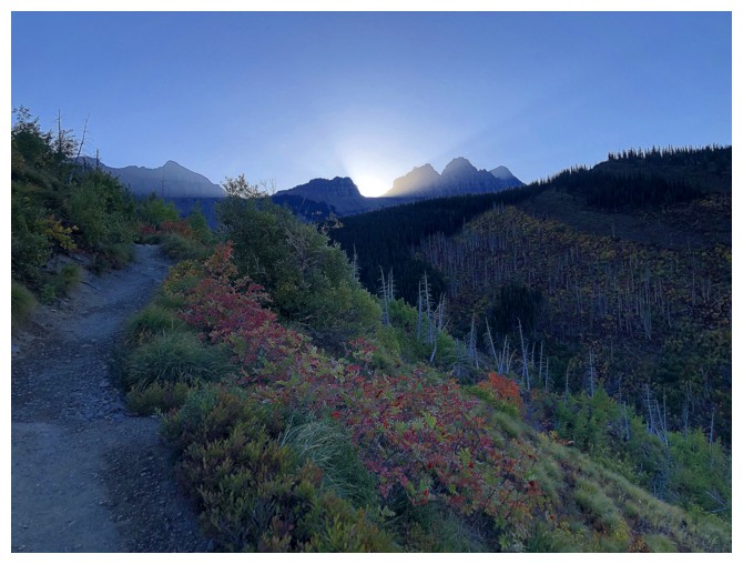
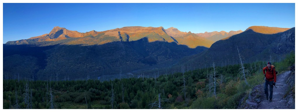
The Sun is about to break the horizon, but we would do most of the ascent in shade

There's the Sun and Raff
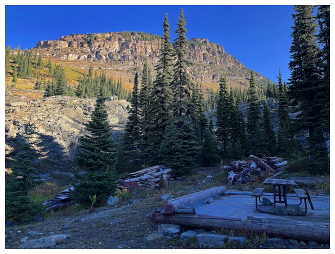
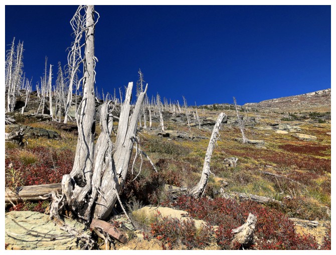
Just past the Granite Park campground sit the remnants of something
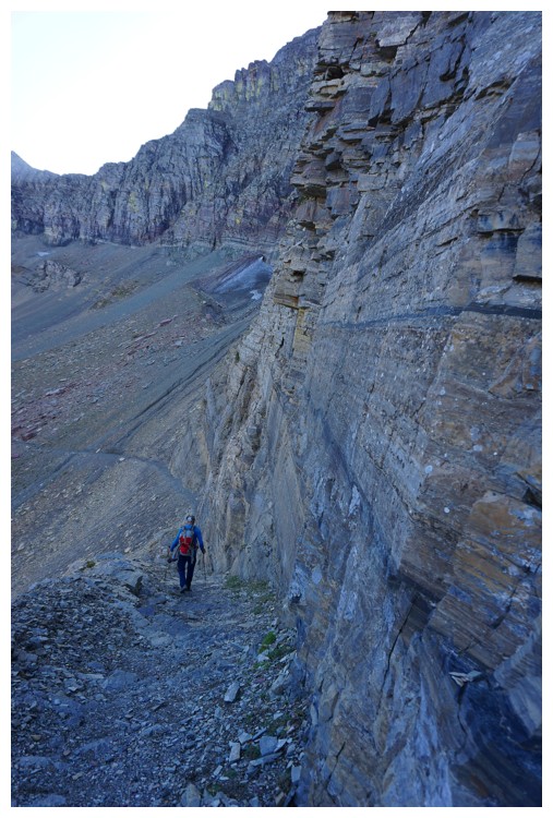
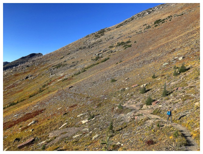
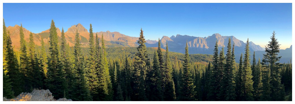
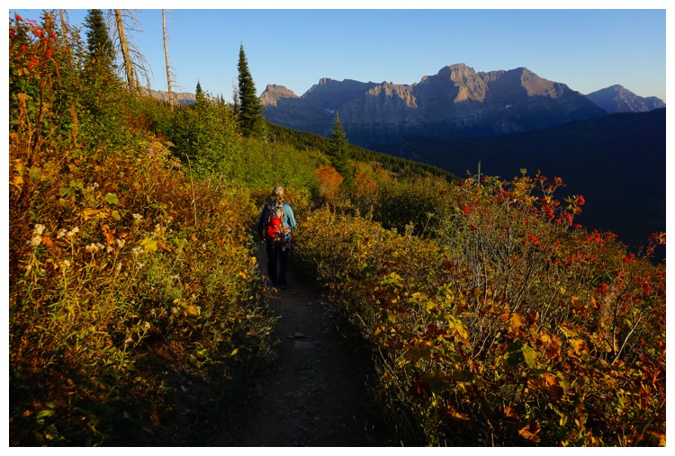
On the Highline Trail and ready to traverse a big distance across the west sides of Swiftcurrent Mountain and Iceberg Peak
One of the few times we were hiking in the Sun
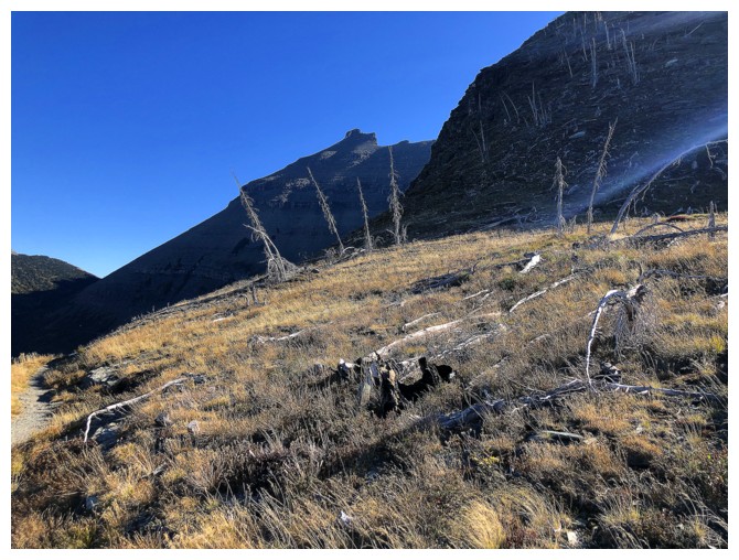
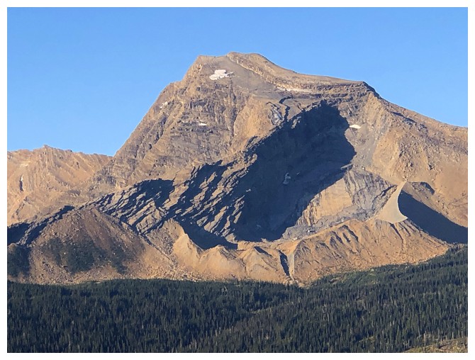
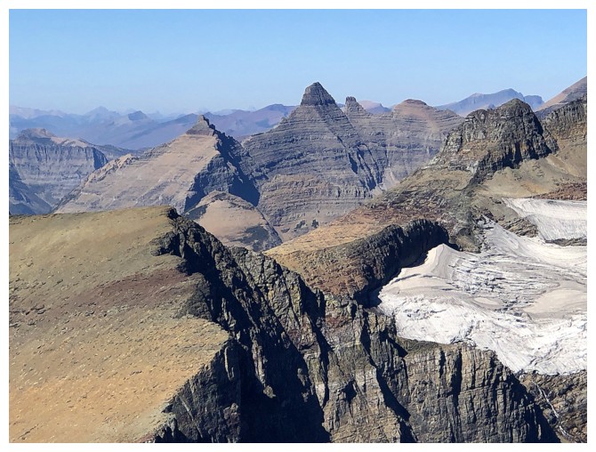
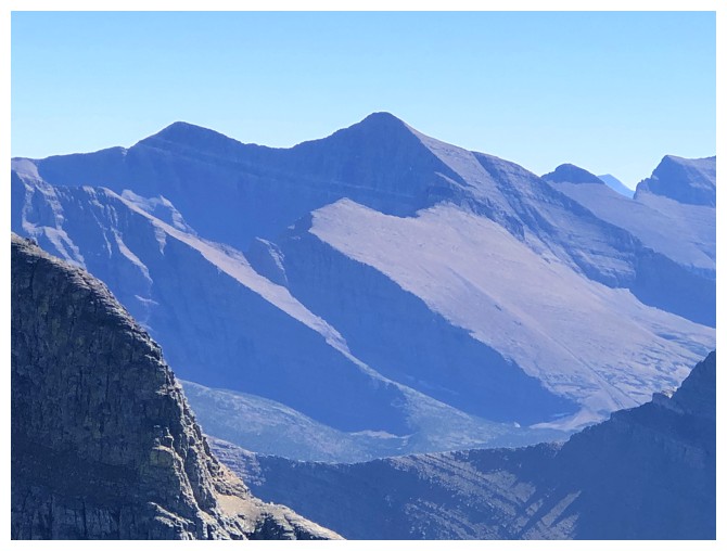
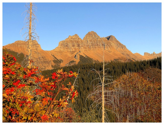
First look at the Iceberg Peak
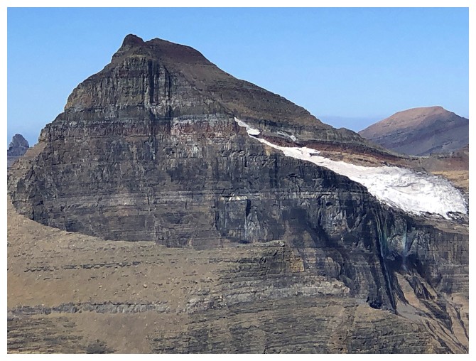
And also of Ahern Peak
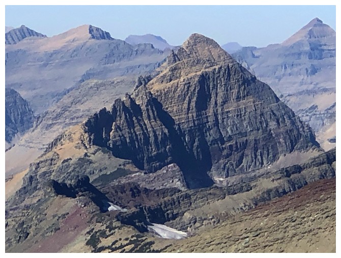
A better view of Iceberg, as we approach the Ahern Drift
Except there is no Drift
An easy hike down the snow-less path (photo by Raff)
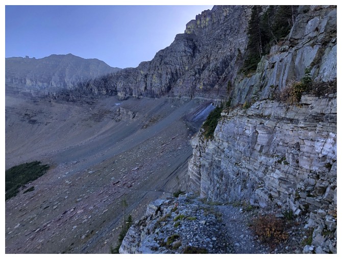
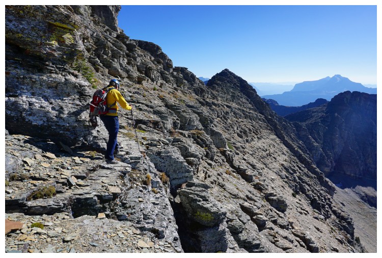
The
path around the cliffband at the left is an amazing example of a goat
trail turned into a human trail (or maybe humans just made it!)
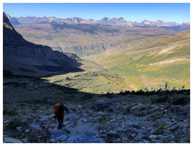
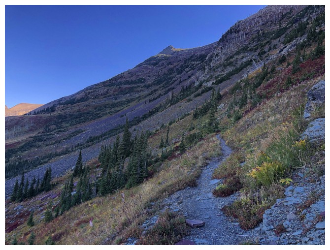
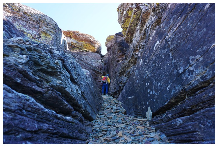
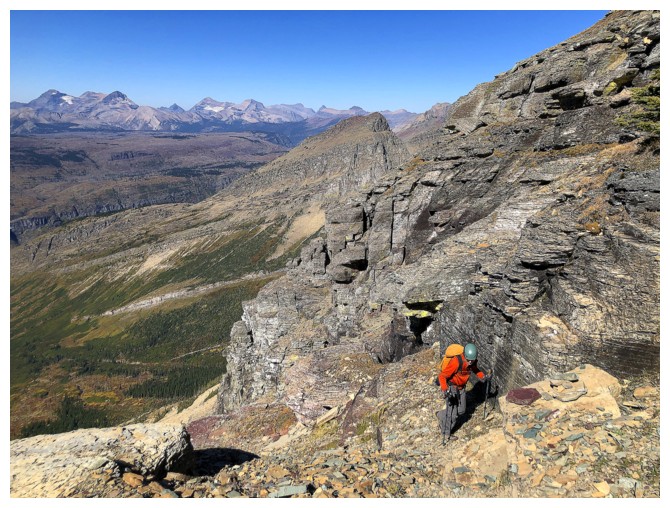
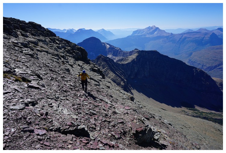
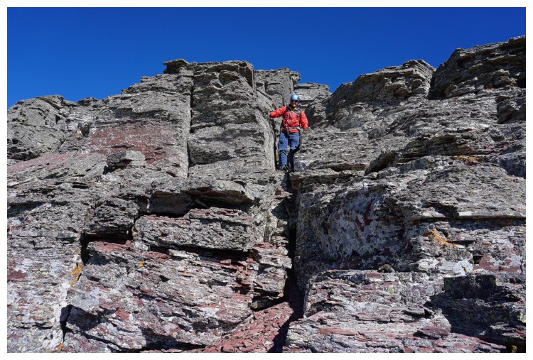
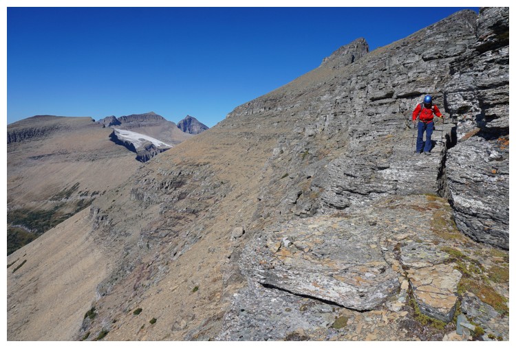
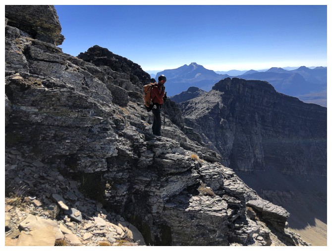
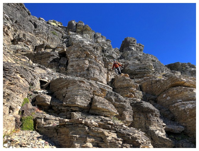
Raff on the lower slopes of Iceberg
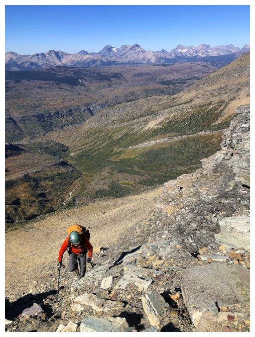
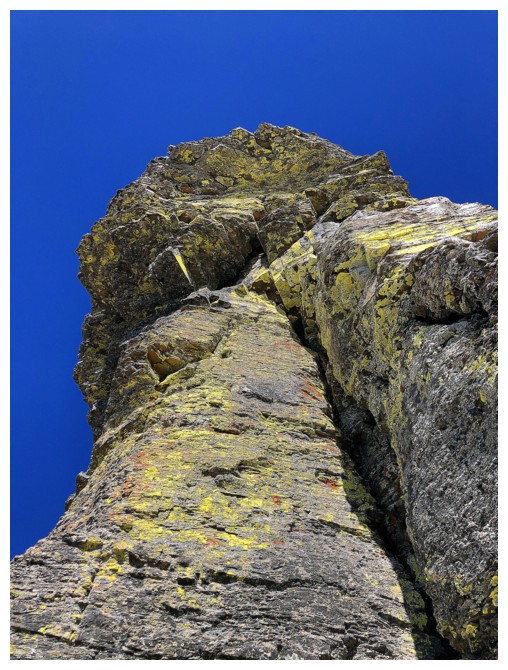
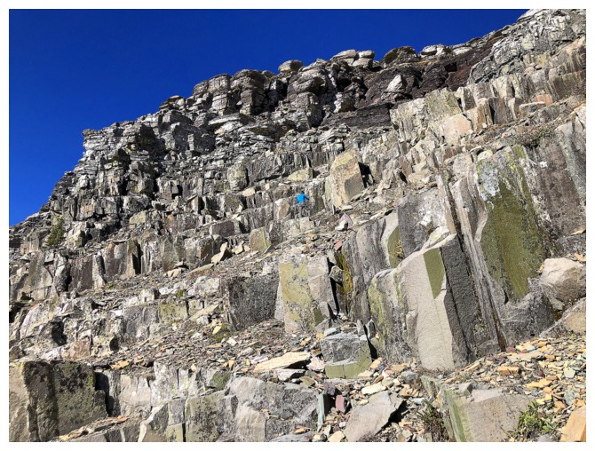
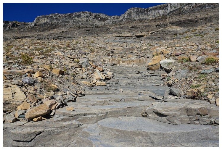
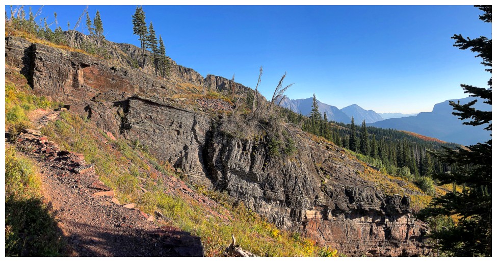
Approaching the rock bands that make up the middle section of the ascent
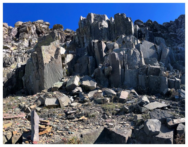
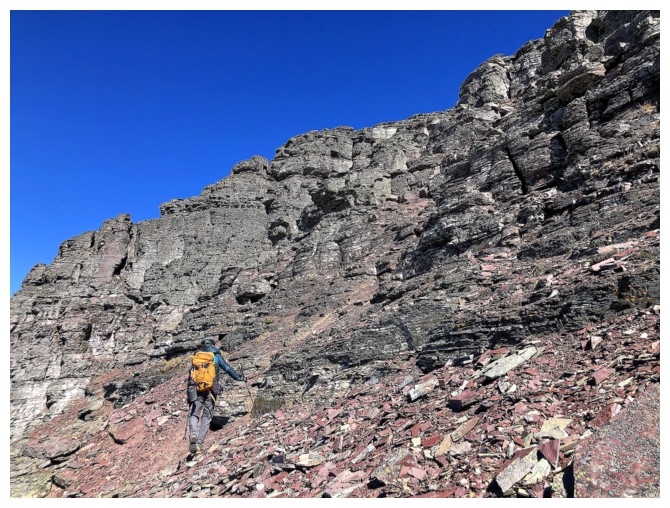
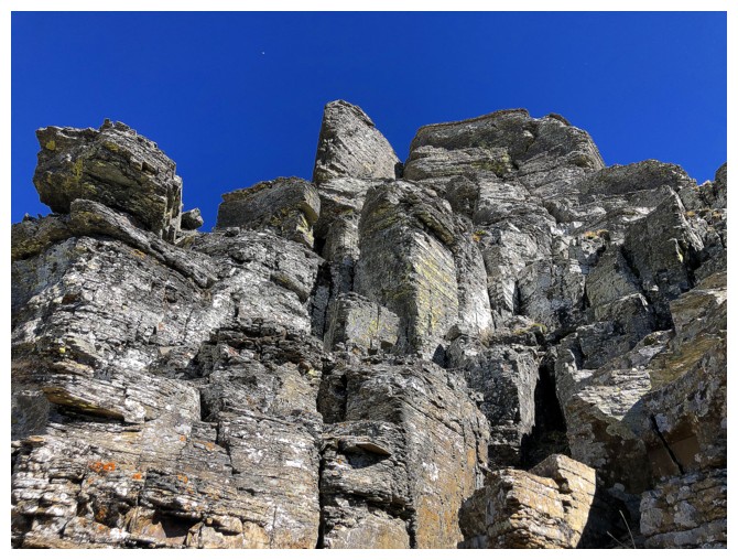
The scree and rubble give way to solid rock
Working our way up through the cool rock (photo by Raff)
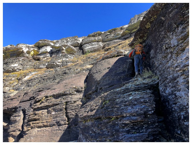
The next section provided a good route-finding challenge
Hit a dead end here (photo by Raff)
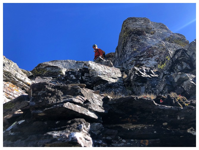
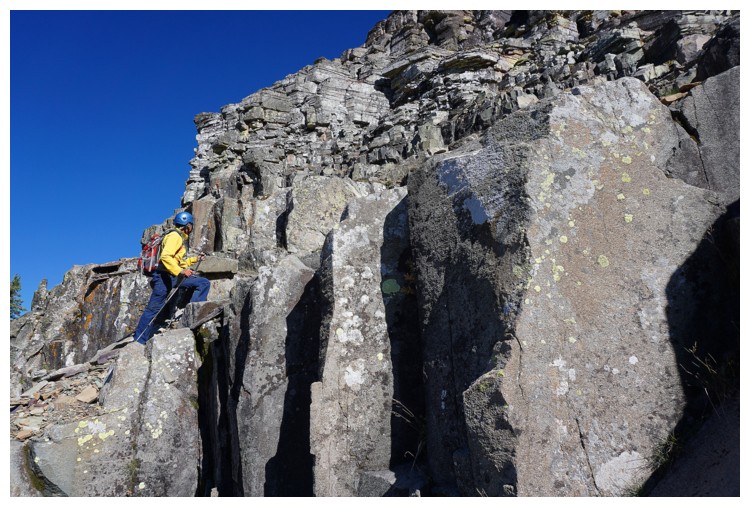
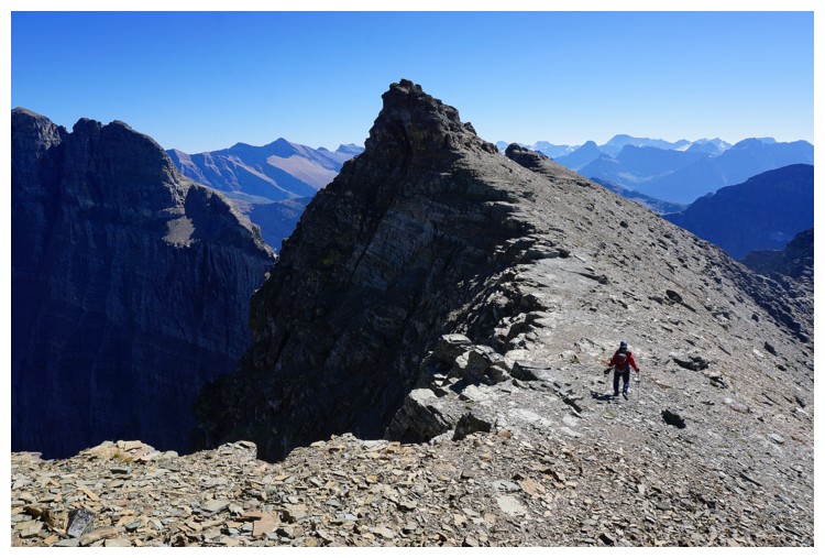
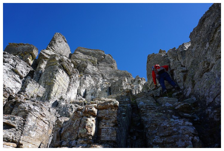
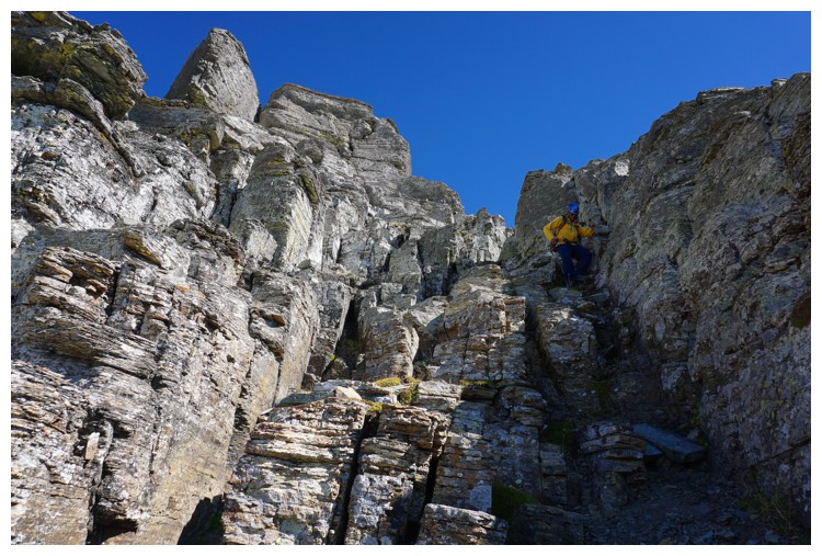
Raff led the way, finding good scramble routes up each rock band
He's up one
And another
Almost at the ridge
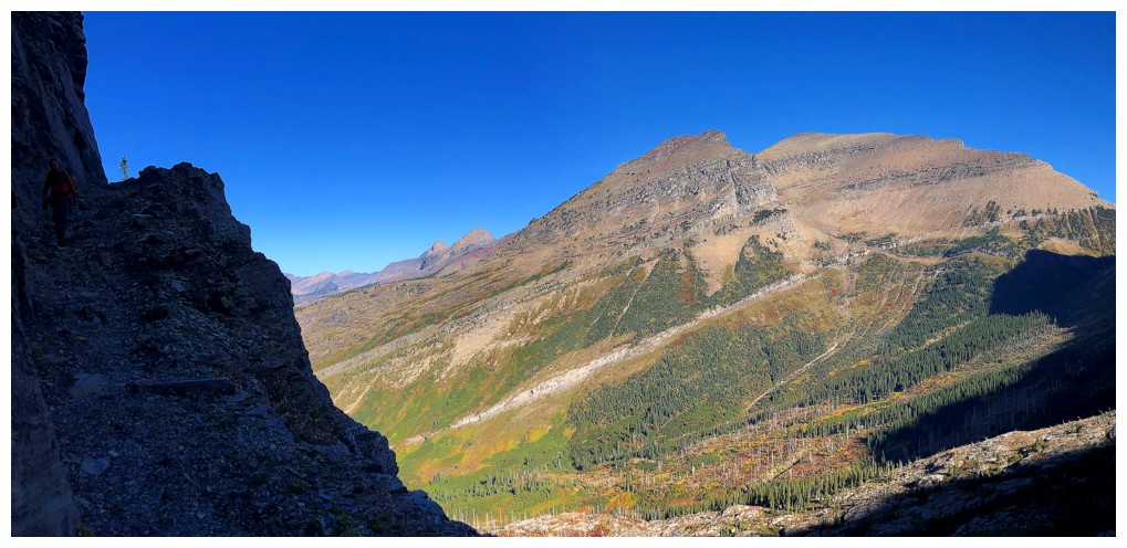
Great views to the west
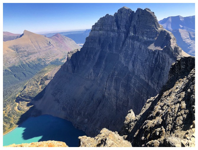
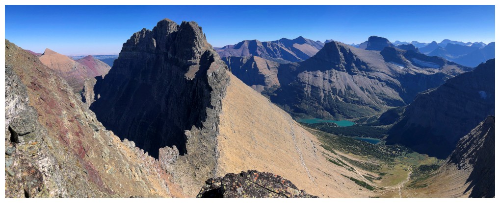
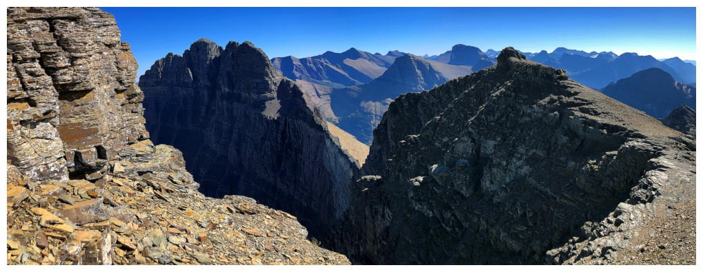
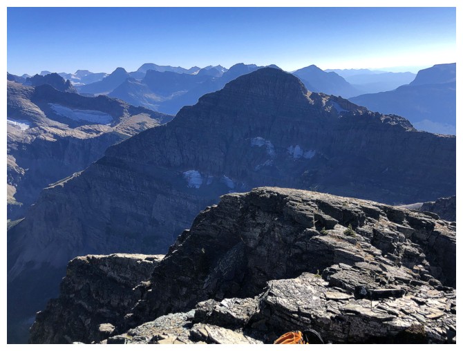
Stunning view of Mount Wilbur upon reaching the ridge
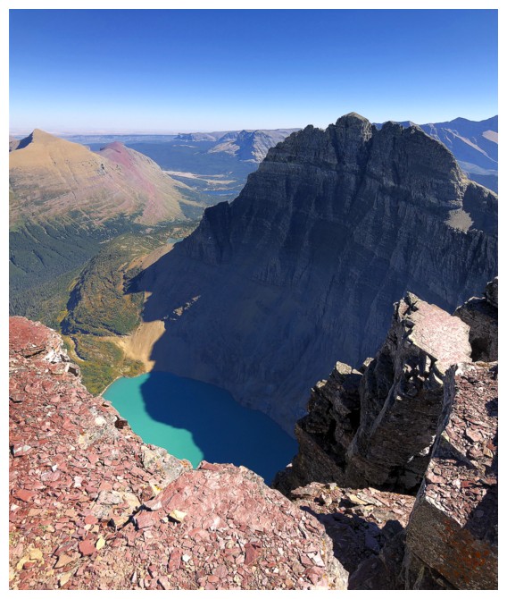
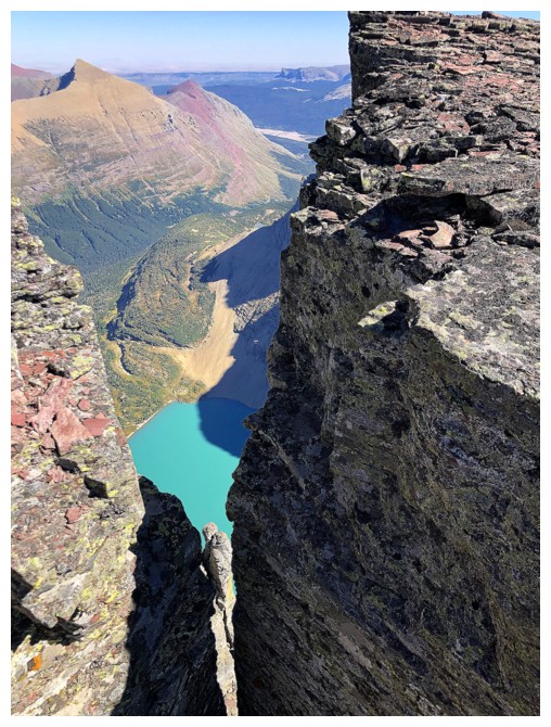
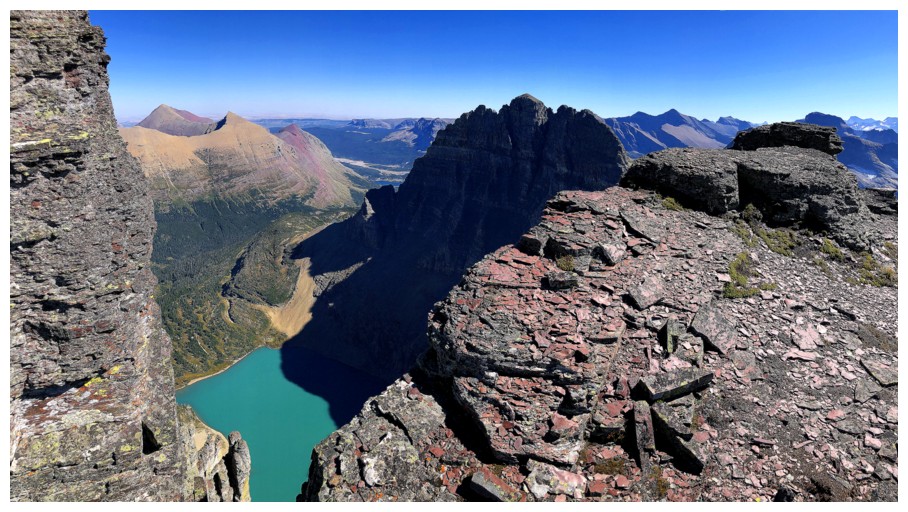
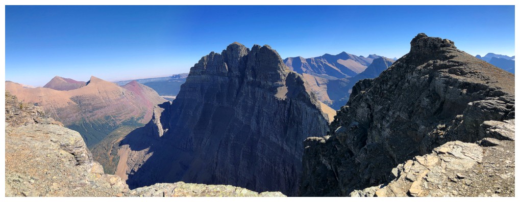
Add Iceberg Peak (left) and Iceberg Lake
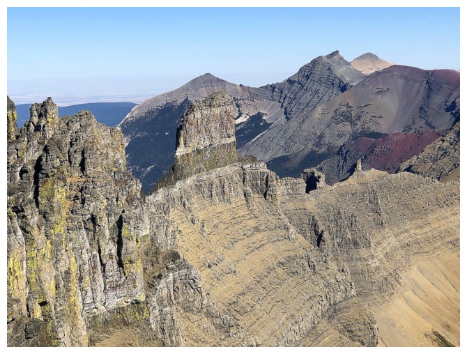
The distinctive B-7 Pillar north of Iceberg
Close-up
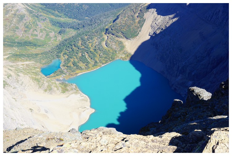
Too bad some of the lake is in shade
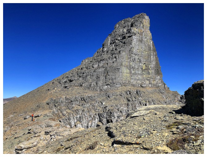
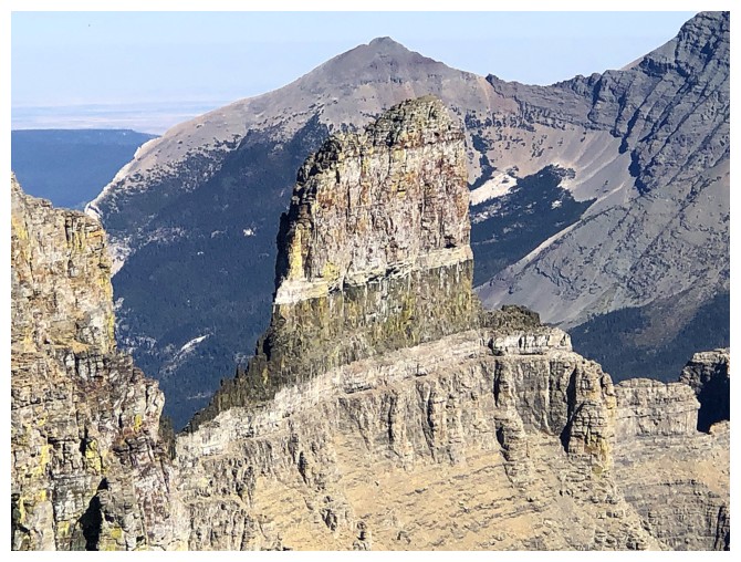
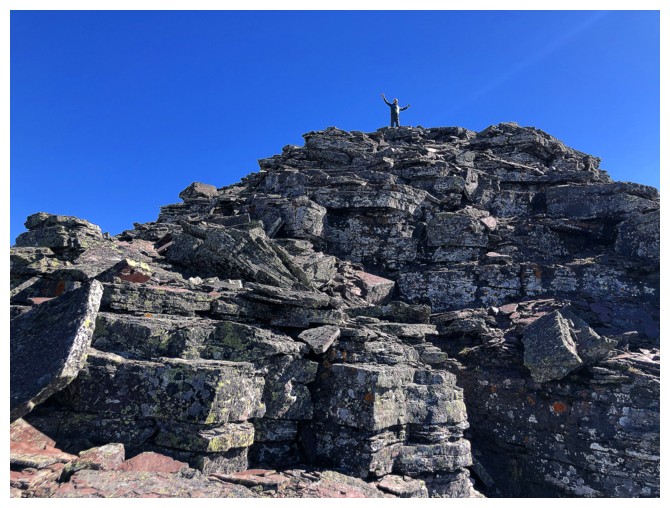
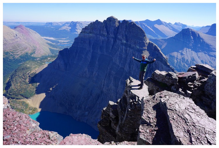
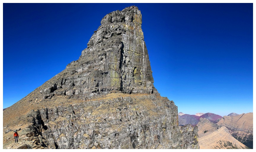
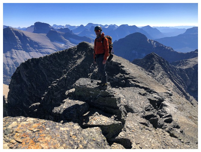
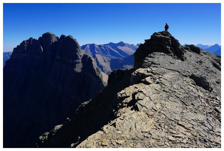
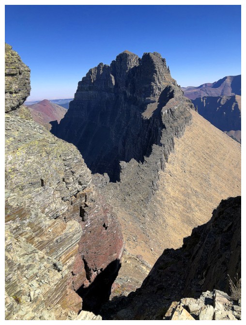
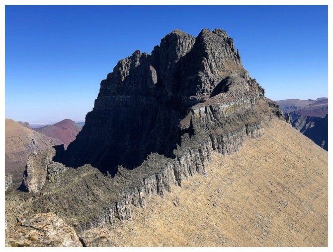
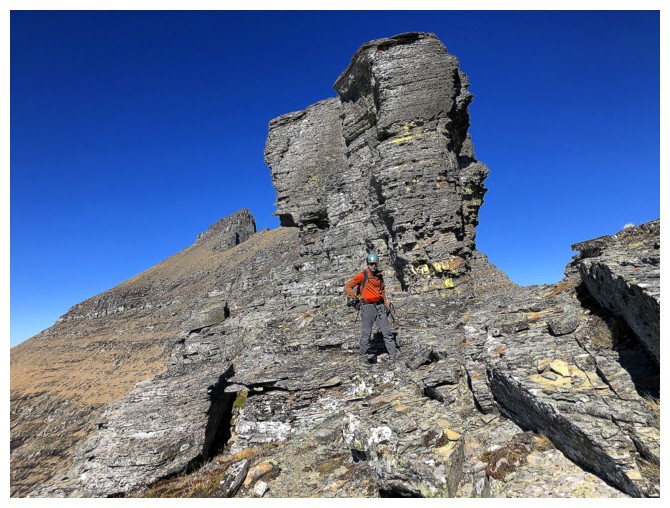
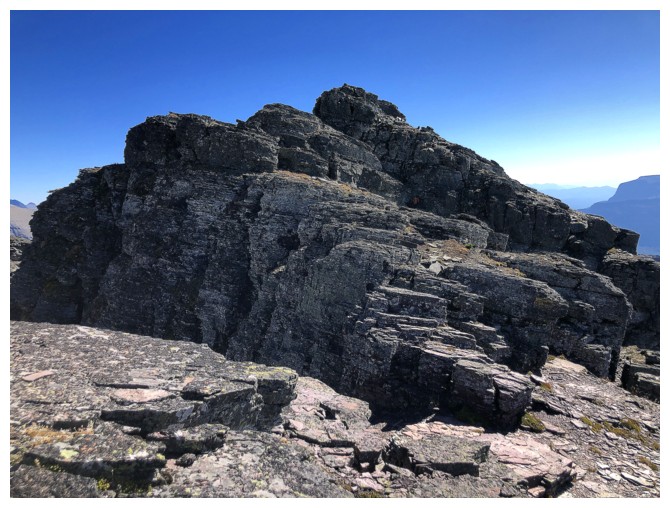
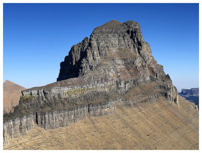
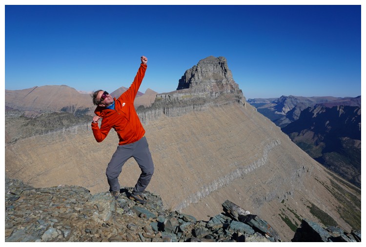
The impressive summit block of Iceberg. Raff at the left to give it some scale.
Catching up with Raff (photo by Raff)
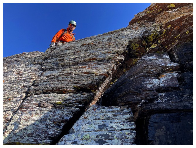
The route up is straightforward
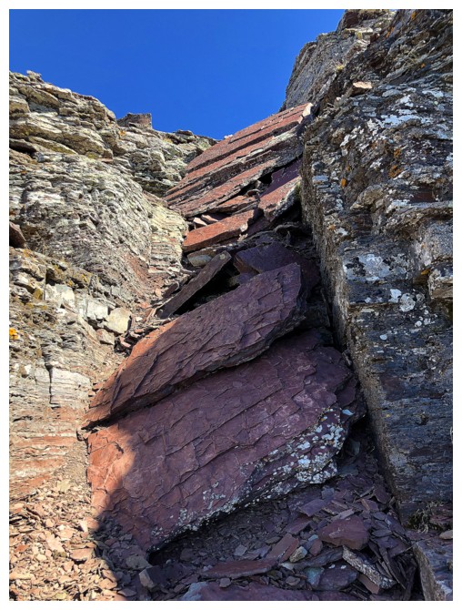
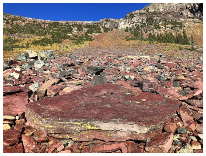
And has some great red argillite!
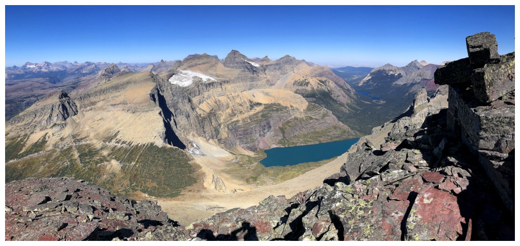
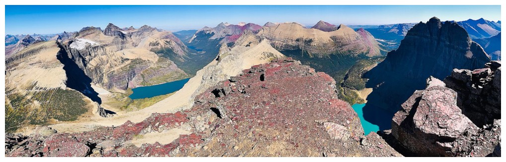
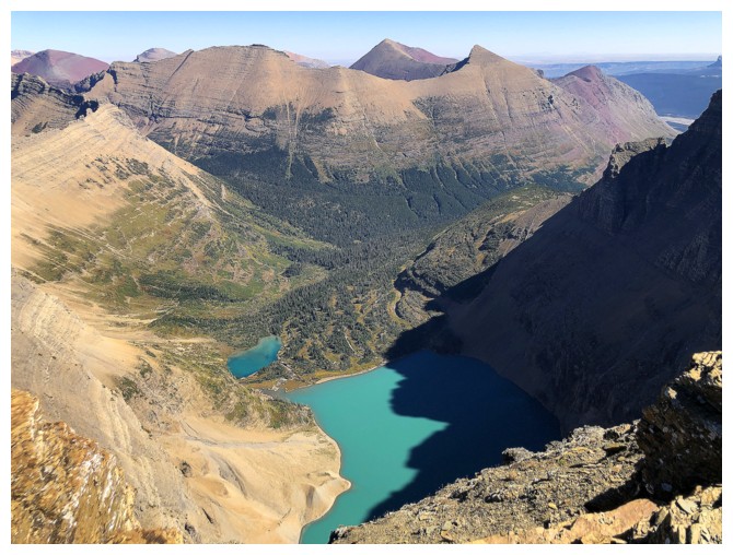
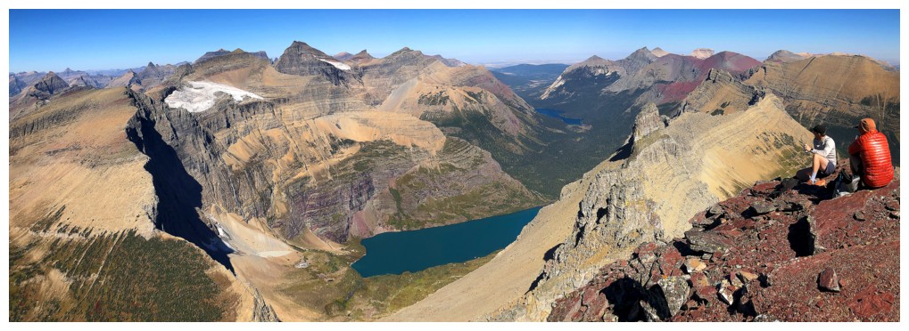
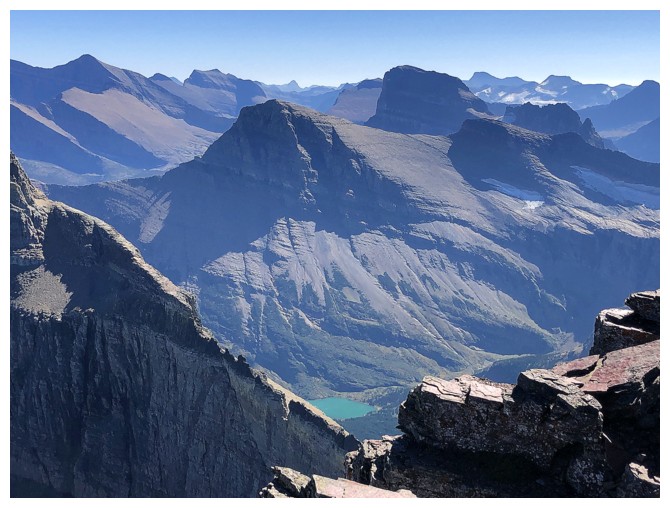
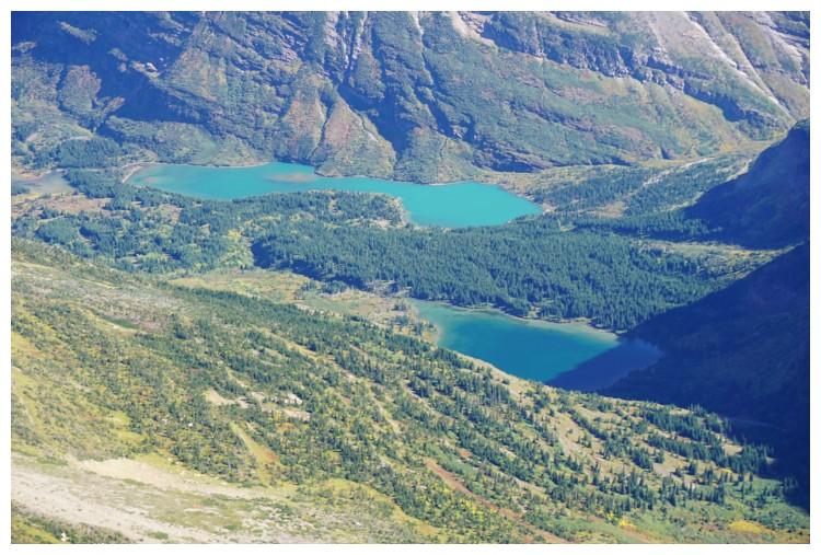
The view upon reaching the ridge. Helen Lake is stunning.
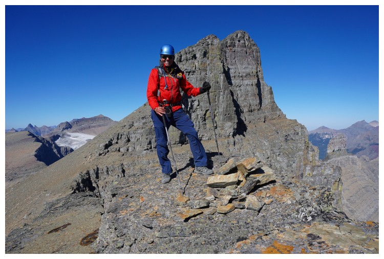
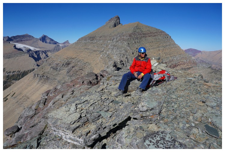
Raff is already at the top
Raff's view of me making the final ascent steps (photo by Raff)
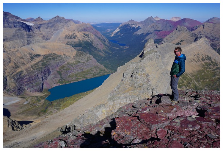
Raff and Helen Lake
Raff, Iceberg Lake, and mountains of the Many Glaciers area
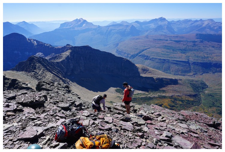
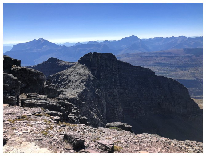
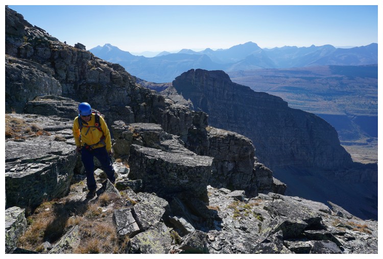
The view to the south
Our two fellow scramblers join us at the top
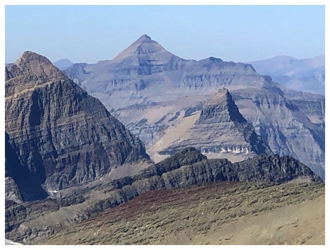
Mount Cleveland behind Ipasha
Mount Merrit
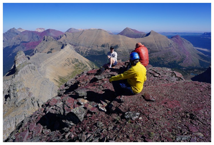
Everyone is enjoying this summit (photo by Raff)
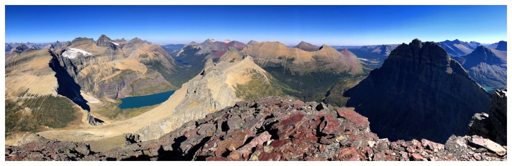
The variety of colours is staggering
View to the north
There are many beautiful peaks to the northwest, but I don't know many of them
Same as above
I think that's Cathedral Peak
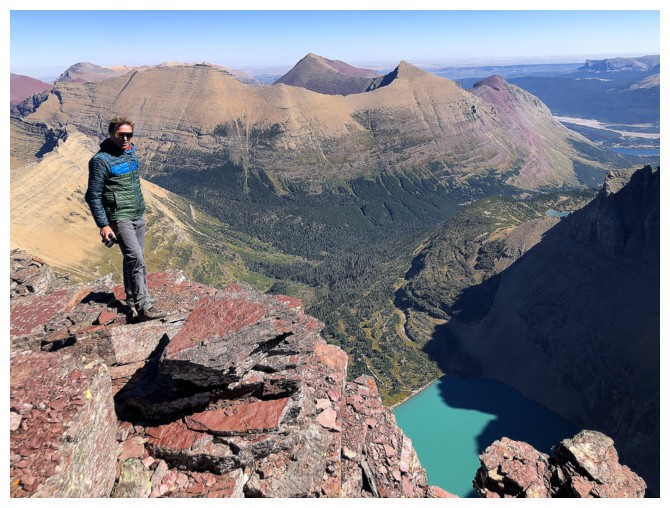
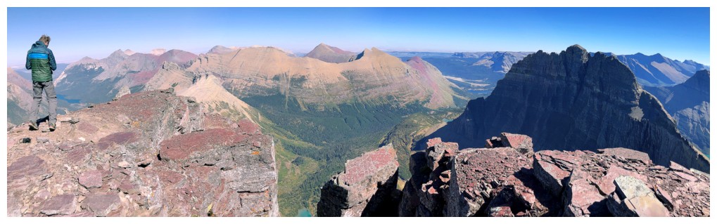
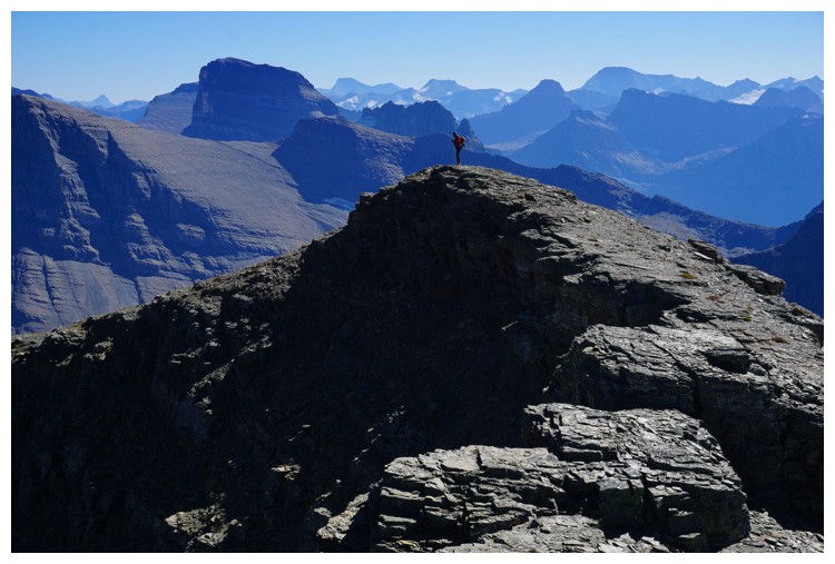
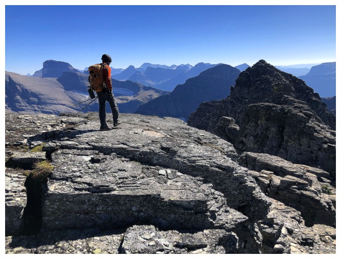
Back to the unreal view to the east. Raff at the summit and one of the other scramblers near the right
Our fellow scrambler has found a neat little perch
Same view without humans
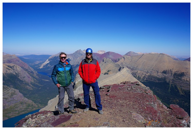
One of our fellow scramblers was gracious enough to take a summit photo of me and Raff (photo by nice guy)
Mount Grinnell in the centre - a super worthwhile objective
Same as above with Wilbur
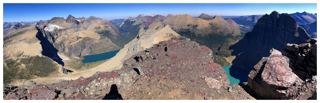
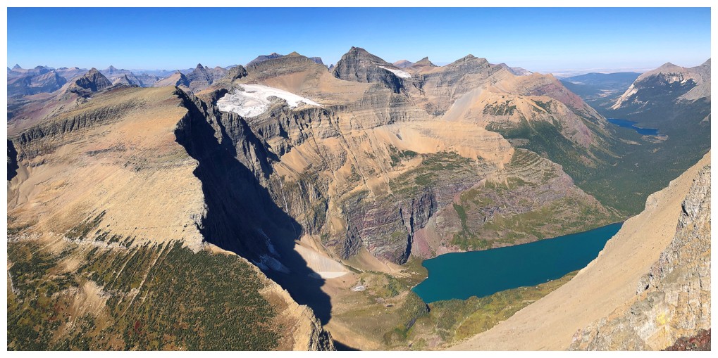
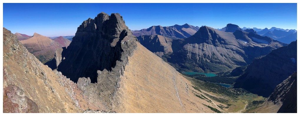
Managed to get a pano with both Helen Lake and Iceberg Lake
The two nice guys start their descent (photo by Raff)

Closer look at the reds and yellows to the northeast
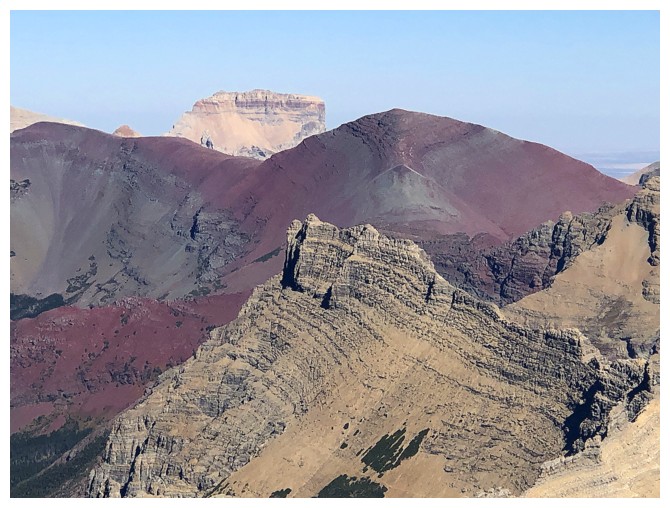
Chief Mountain and Seward Mountain (the red one)
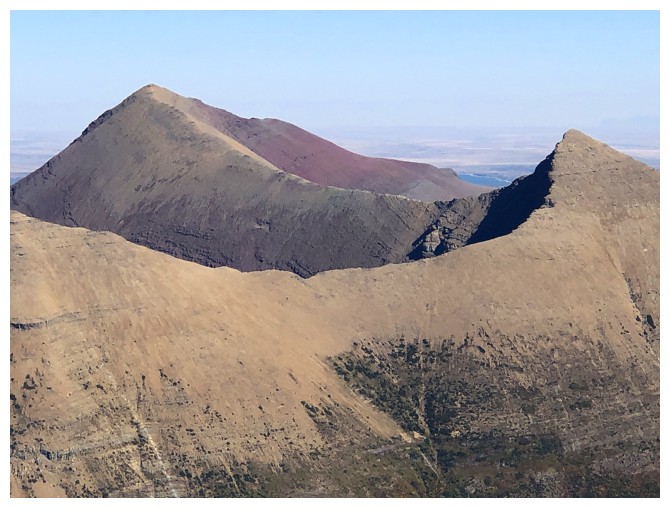
Apikuni (left) and Henkel
Siyeh (centre) and Cracker (left)
Wilbur and Iceberg Lake are going to get lots more love
Raff's turn on the perch
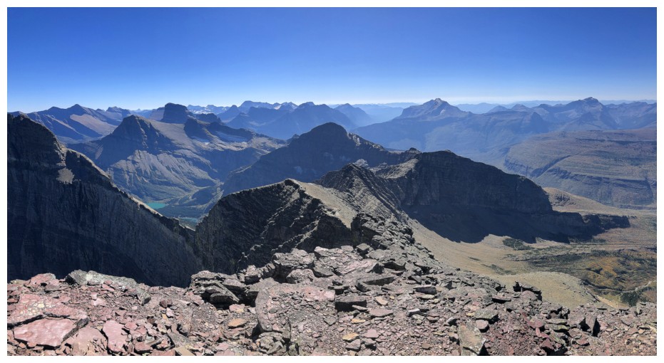
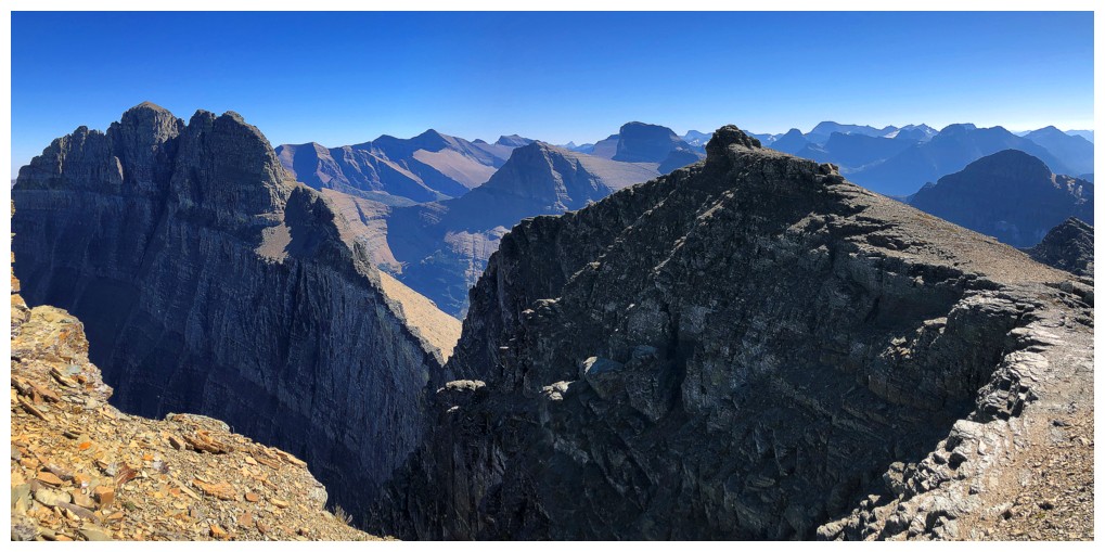
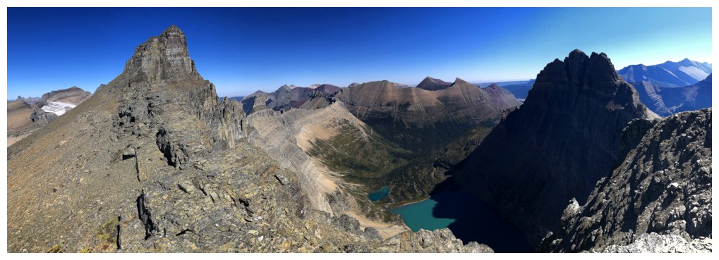
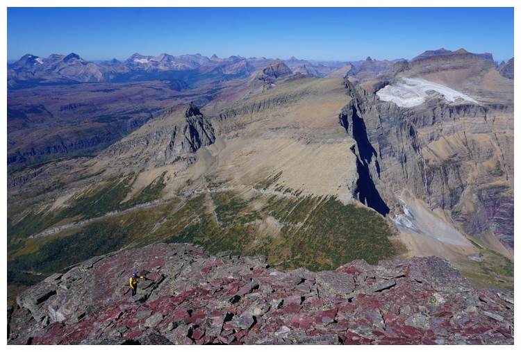
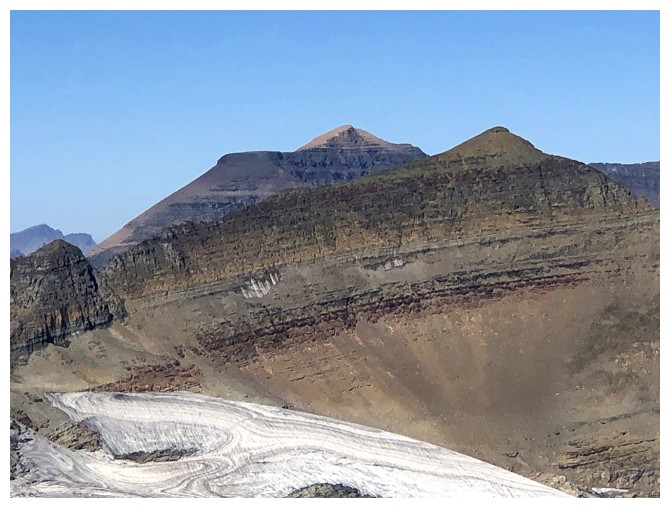
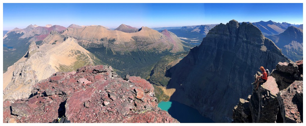
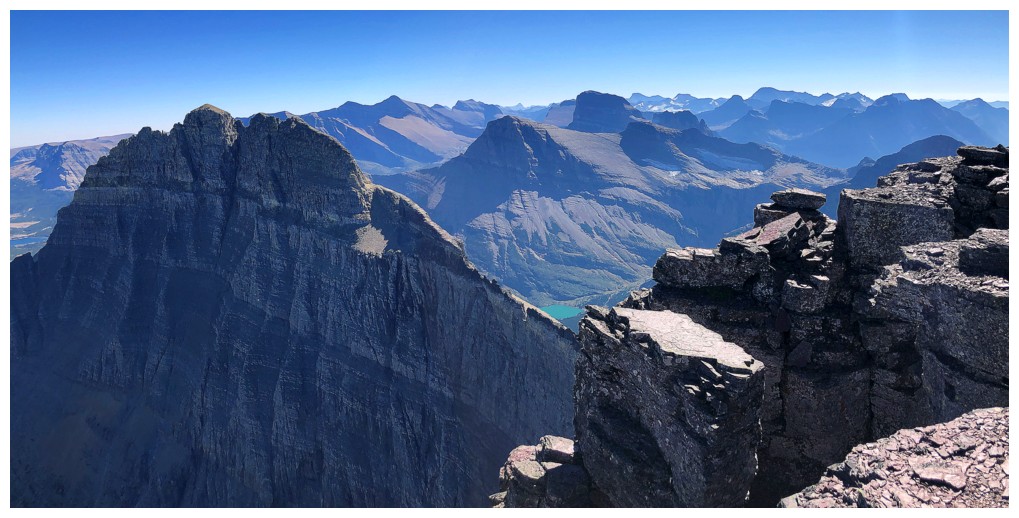
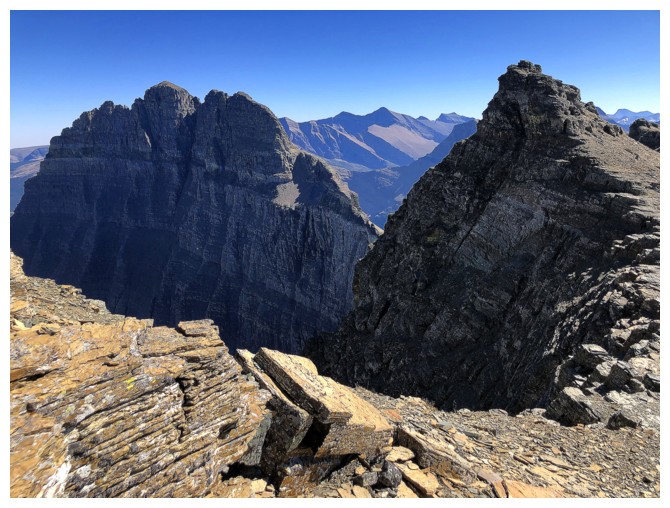
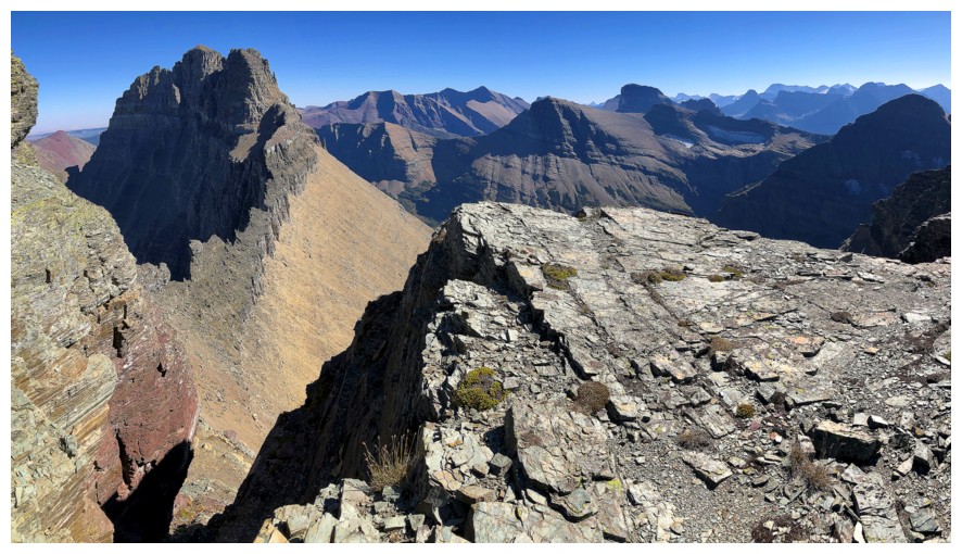
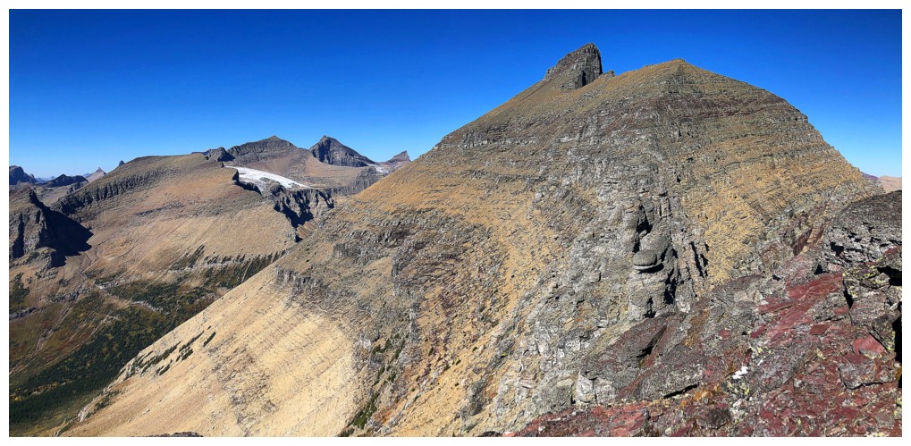
View south towards South Iceberg Peak and Swiftcurrent Mountain
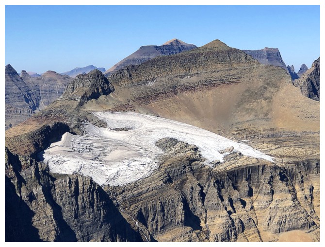
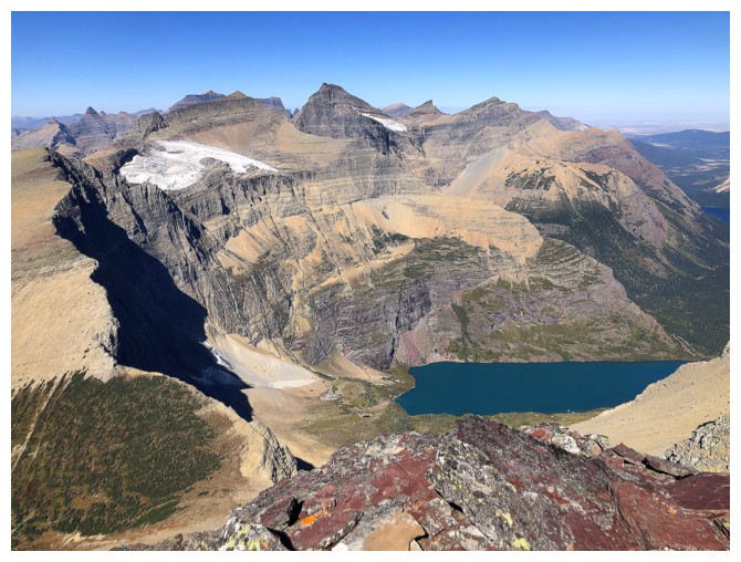
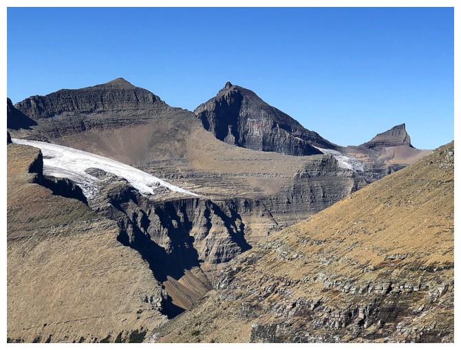
The Ahern Glacier below Ipasha Peak
One more summit pano with Raff
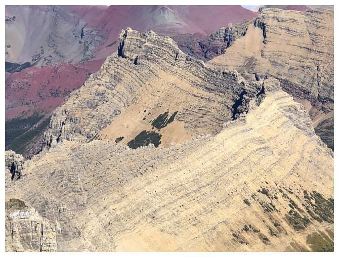
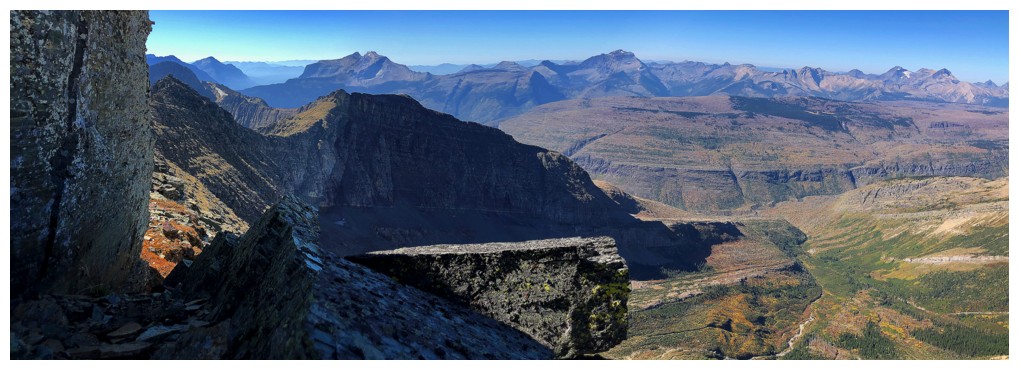
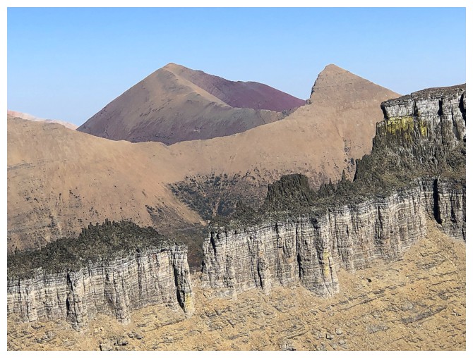
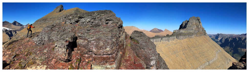
The Ptarmigan Wall is stunning and scary as h#$@ looking!
Last look north before we head south to South Iceberg
Heading down (photo by Raff)
Took any chance we could get to see the lake while traversing to South
Same as above
Wilbur and South Iceberg
Super easy travel to South Iceberg (photo by Raff)
Iceberg's southeast face is almost vertical
At the summit of South Iceberg, although we didn't know it at the time (photo by Raff)
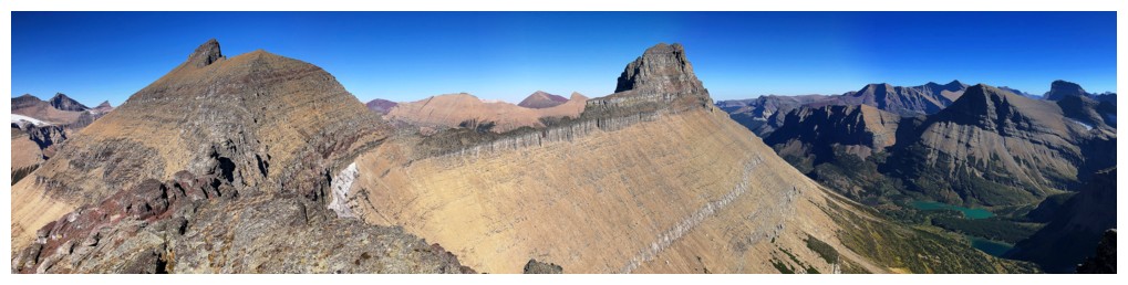
South Iceberg Peak pano
Raff at the top
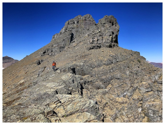
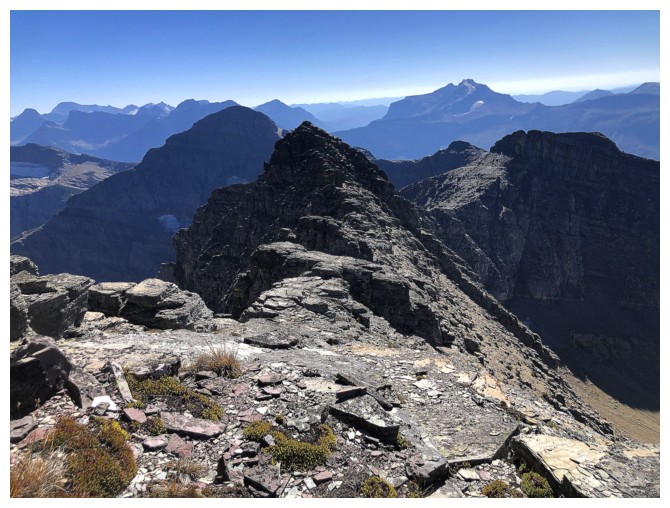
Continuing along the ridge towards the next summit. Iceberg and South Iceberg are visible here.
Many more panos to come
And a few more views of the lakes below. They disappeared from view shortly after leaving South Iceberg (photo by Raff).
Another highpoint and Wilbur
Same as above
Atop that one (photo by Raff)
And another (photo by Raff)
Just when you thought Wilbur couldn't be more impressive, you see the mountain's west side
Same as above
No more Iceberg Lake, but at least distant Bullhead Lake, below Mount Grinnell, is visible
The peak ahead is the one we thought was South Iceberg
Getting over to it required lots of route-finding and traversing below the ridge (photo by Raff)
At least Wilbur is keeping us entertained
As is the view to the southeast
On the ridge
...below the ridge
Looking up at the heavily pinnacled ridge
Scrambling back up to the ridge (photo by Raff)
And finally back on the ridge to complete the ascent
The last section still requires some judicious route-finding
At the summit of our last highpoint of the day (photo by Raff)
Terrific view to the south
Close-ups of Bullhead Lake (top) and Windmaker Lake (photo by Raff)
We couldn't see an obvious route up the rock band that guards the summit of the next highpoint
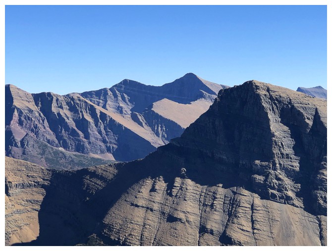
Looking back to South Iceberg and Iceberg
Pano from the highpoint
Close-up of you know who
Apikuni and Henkel again, but the small section of Wilbur's west ridge in front is even more fascinating
One of Raff's many classic summit poses!
Cracker (left), Siyeh (centre), and Grinnell (foreground right)
Ipasha, Merrit, and Natoas Peak
Swiftcurrent Mountain
Time to go home
Back below the ridge (photo by Raff)
Descending that step (photo by Raff)
Some back and forth to get lower (photo by Raff)
Instead of the "yo-yo" ups and downs, we decided to traverse more directly to the descent line
No trip is complete without a lichen photo
Nice, big ledge to traverse
And then some more challenging terrain
Raff in the middle of the diorite band
Back onto the scree slopes (photo by Raff)
Looking back to the diorite (photo by Raff)
A few water-worn gullies helped on descent (photo by Raff)
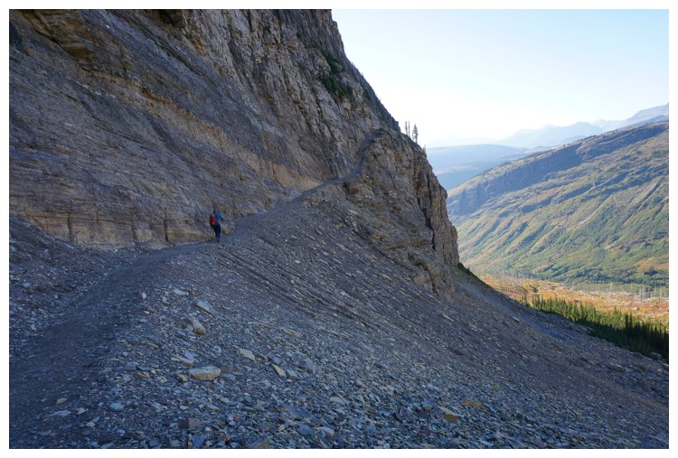
Back on the trail where the Ahern Drift should be (photo by Raff)
Raff on the cool trail that wraps around the cliff-face and our last look at Iceberg Peak and the route up
Ahern Peak again
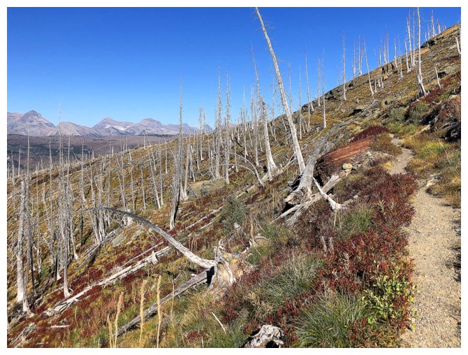
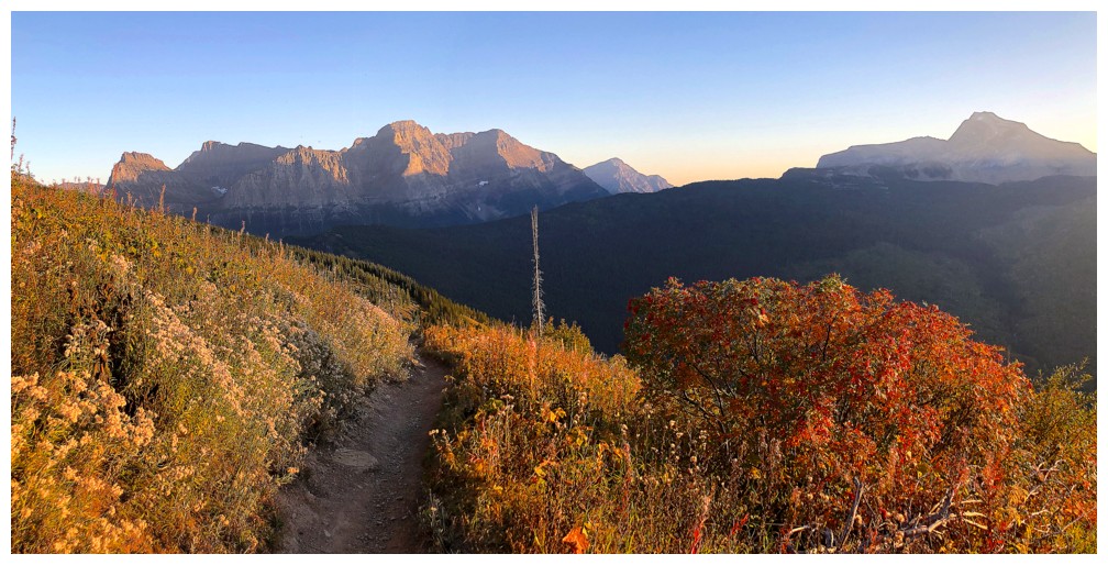
Wonderful fall colours are going to be the theme of the hike back to the start
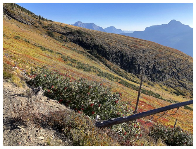
Same as above
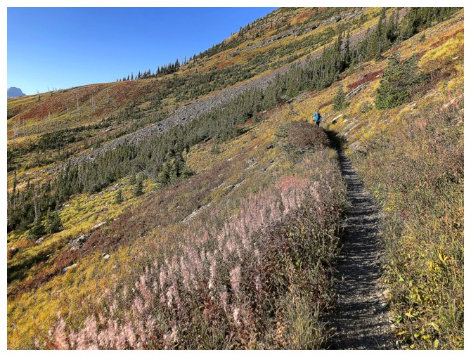
Raff gingerly hikes the Highline Trail
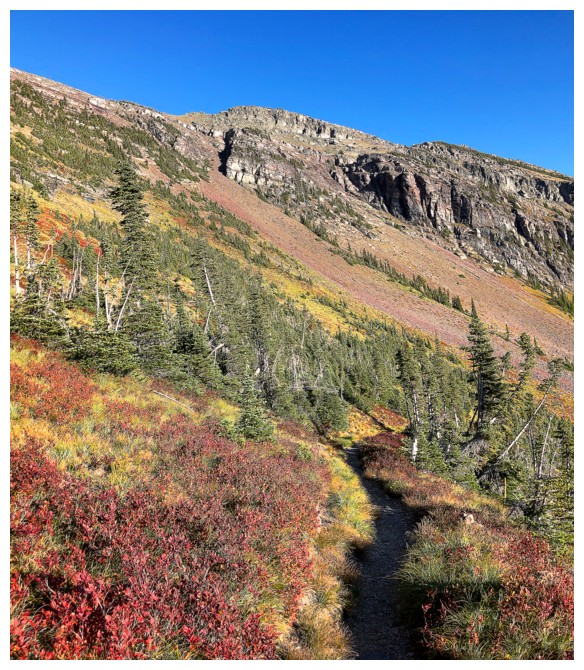
Back to the fall colours
Of course, red argillite adds colour to any scene!
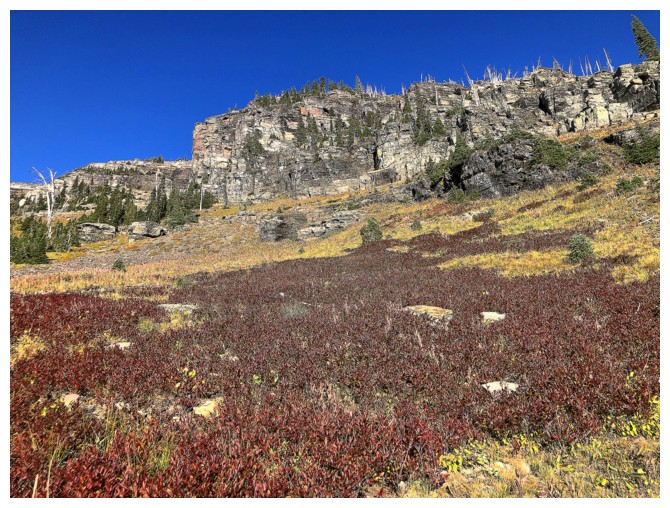
As does the burgundy/red foliage
It's a long hike back!
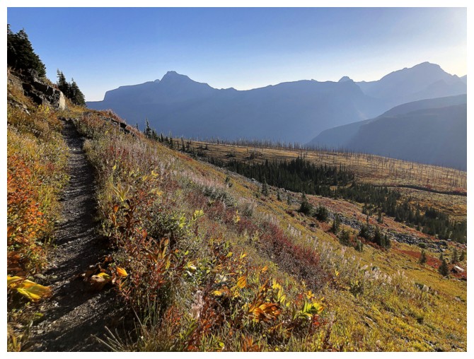
And the Sun is sinking
Cool rock scenery abounds
Same as above
Raff again is the star of the trail!
Stopping once in a while to take in the views (photo by Raff)
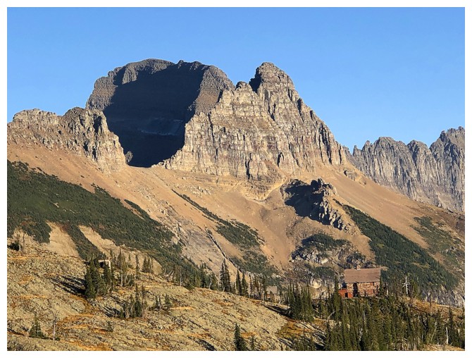
The Granite Park Chalet is dwarfed by Mount Gould and sections of The Garden Wall
Pano
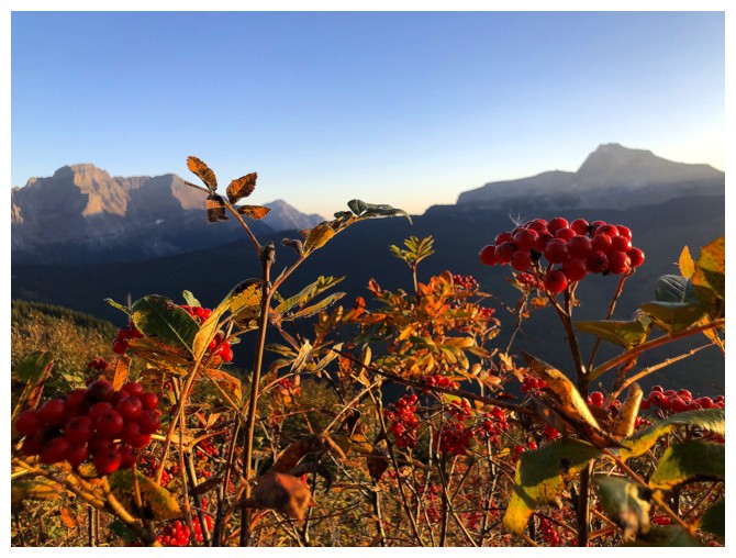
Argillite and the foliage aren't the only red things to see
So many wonderful scenes as the days winds to its end
Downhill and colourful - not a bad way to finish a long day (photo by Raff)
Another cool scene
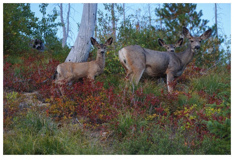
Hello deer..... (photo by Raff)
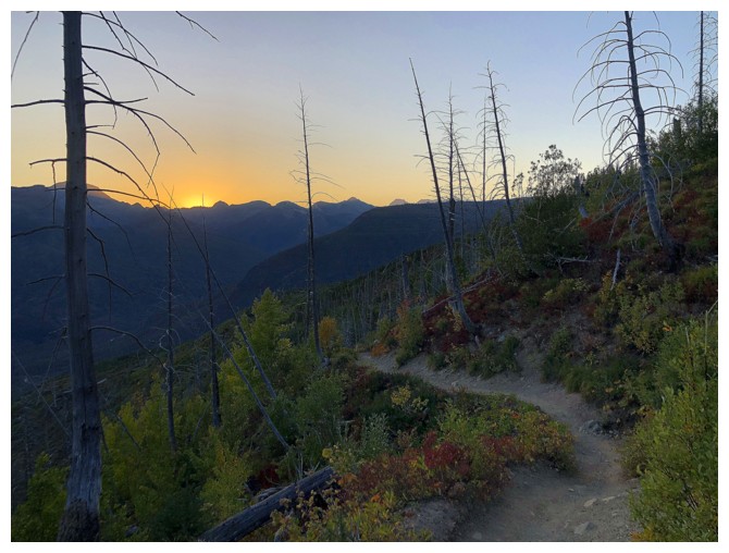
.....bye-bye Sun
The End
LOG