Isolated
Peak - September 27,
2003
Mountain height: 2,845 m (9,332 ft)
Elevation gain: 1,400 m
Ascent time: 6:30
Descent
time: 3:50
Scrambling
with Mark.
An epic, to say the least.
The
day started out as a planned attempt of Mount Carnarvon, however, a good layer
of fresh snow on the mountain made success unlikely and so we decided to give
Isolated Peak (that we unexpectedly spotted from the Trans Canada) a shot. With
a 10:45 am start, running
out of daylight was definitely a concern and so we left at a quick pace and
maintained it throughout the long 10 km approach trail.
We
reached the end of the trail in about 2 hours and continued up towards the
summit of Whaleback
Mountain. The surrounding
area was magnificent – Mounts Niles, Daly, and Balfour, pointed Mount des
Poilus, the glaciated Wapta Icefield, and of course the famous President and
Vice-President. The great view only got better as we reached Whaleback’s summit
(definitely a long and grueling scramble in itself). Now almost four hours into
the trip, we got our first glimpse of Isolated Peak.
The mountain’s step-like, pyramidal shape, in contrast to the surrounding
snow-fields and glaciers was spectacular.
Another
hour of enjoyable ridge-walking along Whaleback
Mountain (with an unfortunate, but
necessary elevation loss of about 200 vertical metres) took us down to the base
of Isolated Peak. Already we had done a solid 14 km
of hiking and scrambling, with about 1000 metres of elevation gain, and we were
just stepping onto the actual mountain. At this point, time was definitely an
issue. We agreed that regardless of how close to the summit we were, 4:45 pm would be our turn-around time.
The
scenery around the west side of the mountain was very nice, especially the
glacier and snow field leading up to Mount
McArthur. Unforunately, we had some route-finding problems upon starting up the steep
slopes of the ascent gully. First we tried to traverse atop of a wide ledge. It
quickly led to a dead-end. Next, we attempted a very steep and icy gully to the
right. Meltwater was pouring down the rock, however, and that route also proved
unsafe. Finally, we tried traversing below the ledge, where we found the
suggested route. By this time, out turn-around time had passed, but we decided
that we would go for 10 more minutes. The terrain here was very steep, covered
in snow, and running water covered the rocks we had to ascend. Going up wasn’t
too bad, however, coming down would be a little risky - one slip and it would
be Yamnuska II all over again!
With
the steep section over, it looked like the summit was only about 5 minutes away
and so we hurried up as fast as our exhausted bodies would take us. Of course,
it was a false summit and the next one again looked to be close. Another false
summit, but at this point we knew we had to be close and given the extreme
effort required to make it this far, there was no way that we were going to
give up, regardless of the lateness of the day. Thankfully, the next apparent
summit was actually the true summit and we both let out a shout of victory.
The summit panorama was magnificent – snowfields,
glaciers, meadows and valleys, and of course numerous stunning, shapely peaks.
We left the summit at 5:30 pm
– 45 minutes passed the turn-around time and 2 hours away from sunset.
Obviously we would be doing at least a couple of hours without daylight and so
we chose to descend via the Stanley Mitchell Hut, where we could find a decent
trail to follow. This descent route was a welcome alternative, as going back
the way we came would have entailed climbing all the way back up to the summit
of Whaleback Mountain – a most unfavourable
proposition given our fatigued state and limited time. With our headlamps, we
spent the last two hours in darkness and made it back to the car at 9:30 pm – a fairly respectable
descent time of 3 hours, 50 minutes. We were both absolutely exhausted and I
had to pull over to rest four times during the drive home, but overall, a fantastic
and extremely memorable day.
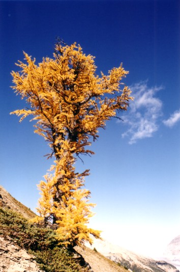
It's larch season
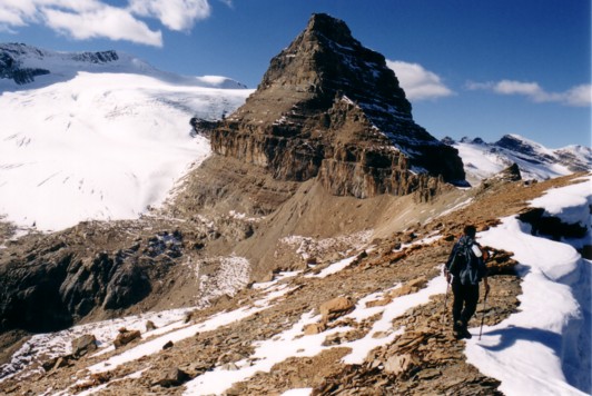
The objective finally in sight
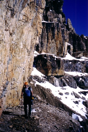
Trying to find the correct ascent route
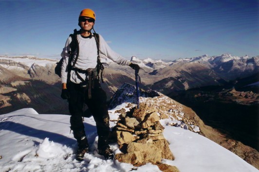
Enjoying the summit