August 16, 2010
Mountain heights:
James: 2857 m
Amphitheater:
2648 m
Little Amp:
2616 m
Total elevation gain: approx.
2000 m
Ascent time to James: 4:50
Traverse time to Amphitheater: 1:45
Traverse time to Little Amp: 1:20
Descent time: 2:55
Solo scramble.
95% hiking, 5% death-defying scrambling
It was time to explore another area
of
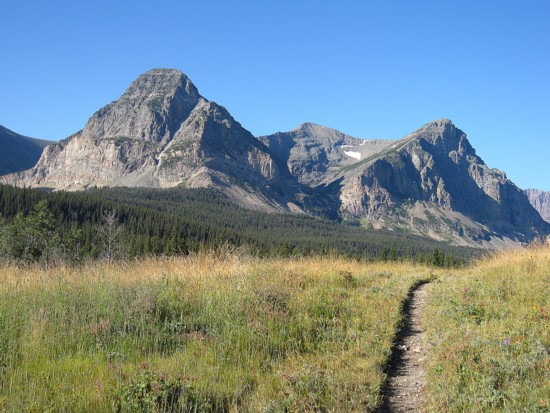
There are several day trips from the
Cut Bank Campground,
and with a great weather forecast I had my eye on the highest peak
–
The first half of the hike to 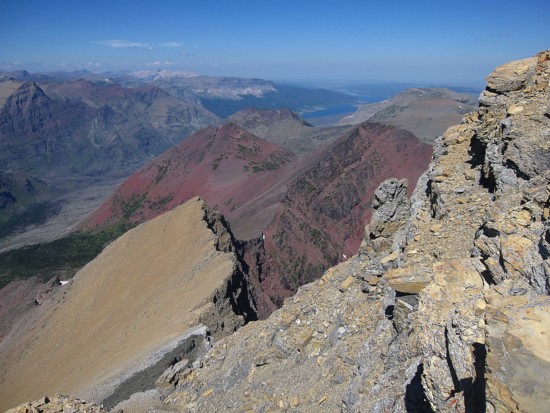 The
Triple Divide
Trail seems to be another wonderful example of a humanized goat trail.
It rises
effortlessly up the side of the mountain, cutting through rock-bands
like a ninja
cuts through bad guys with poor fighting skills. Of the multiple
highlights of the trip, this was the first one. The scenery went from
decent to
outstanding within minutes and improved continually throughout the
ascent.
The
Triple Divide
Trail seems to be another wonderful example of a humanized goat trail.
It rises
effortlessly up the side of the mountain, cutting through rock-bands
like a ninja
cuts through bad guys with poor fighting skills. Of the multiple
highlights of the trip, this was the first one. The scenery went from
decent to
outstanding within minutes and improved continually throughout the
ascent.
About three hours into the trip I
arrived at
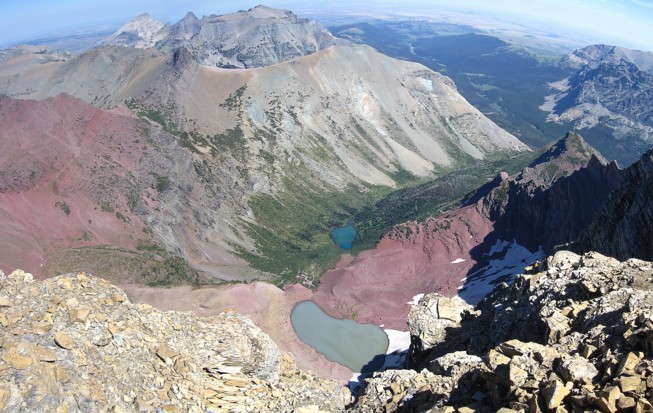
Thank goodness for the awesome views and a cool breeze, because the actual ascent was a labourious, two hour slog. As expected the summit panorama was spell-binding. I was surprised at how many peaks I could now identify and how that adds immeasurably to your enjoyment of a particular view. Two gray, glacial lakes flowing down to a greener lake below the northeast face of James were also a pleasant surprise.
 And there ends the predictable
portion of the trip. The next
four or so hours were filled with uncertainty, anticipation, and a
little
anxiety. Fortunately, the joyous moments along the way far outweighed
the
uneasy feeling of not knowing what’s around every corner (and
there were many,
many corners to negotiate on this part of the trip!).
And there ends the predictable
portion of the trip. The next
four or so hours were filled with uncertainty, anticipation, and a
little
anxiety. Fortunately, the joyous moments along the way far outweighed
the
uneasy feeling of not knowing what’s around every corner (and
there were many,
many corners to negotiate on this part of the trip!).
Actually the first part of the journey north to Amphitheater went surprisingly well. I lost elevation down a scree gully and then traversed back to the north ridge of James, across tedious, but colourful slopes of rubble. Continuing down the ridge there appeared to be many cliffs below. However, each time I thought I was about to get cliffed-out, a reasonable route down would appear. Down at the col, the ascent to the summit, up lichen-covered slabs of red argillite, looked easy and it was. At an elevation 200 m inferior to that of James, the summit panorama was not as good, but “not as good” as “spell-binding” is still pretty darn respectable!
At this point, I knew I could complete the loop route by doing saintgrizzly’s route in reverse. The bad news was that the route description was sitting in my car, not in my hand. From the summit of Amphitheater an unnamed peak of comparable height interrupted the ridge heading back to the trail. I couldn’t remember if the saintgrizzly route included this peak, but I decided I would take a look at it anyway.
Getting down to the col was
relatively easy, with few route-finding
issues. I then started up the unnamed peak, which I will call
“Little Amp Peak”, due
to the fact that “Amphitheater” is such a hard word
of type over and over
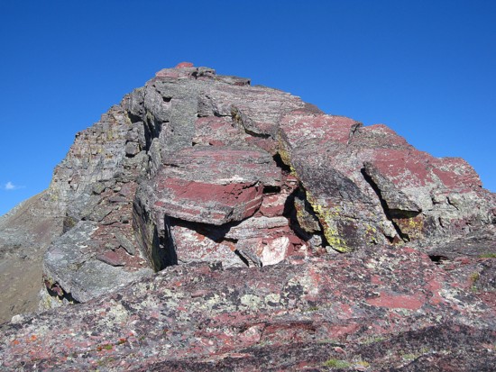
again. Little Amp is comprised of huge slabs and blocks of argillite.
Some of
them are stacked neatly atop another and some have been shifted by
glaciation
or other geological phenomena. Lower down the slabs were very easy to
walk up.
Gaining elevation, the terrain became a little more serious, requiring
lots of
route-finding and difficult, but fun scrambling. 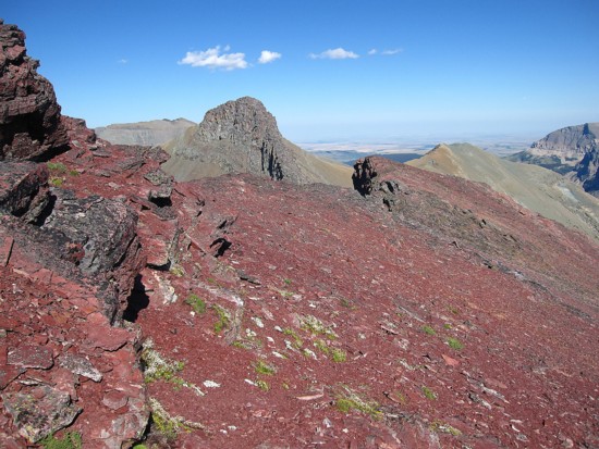 I was careful to not
upclimb
anything I couldn’t downclimb, in the unsavoury event I would
have to backtrack.
I was careful to not
upclimb
anything I couldn’t downclimb, in the unsavoury event I would
have to backtrack.
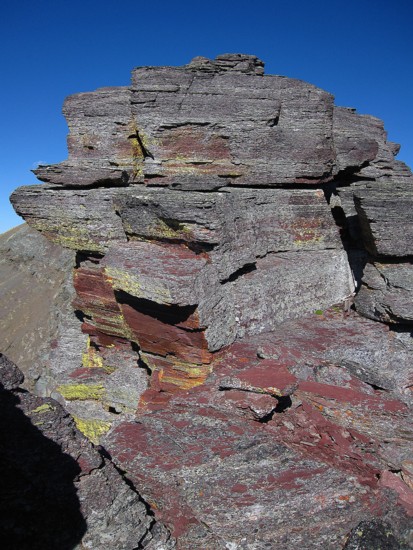
The “more serious” soon turned into very serious. Route-finding became a big challenge, the terrain was increasingly exposed on both sides and I was now upclimbing rock that would be at the high end of my downclimbing ability. With another person around, it wouldn’t have been an issue, but solo scrambling puts you in a completely different head space. Slipping and breaking your ankle when you are alone in a fairly remote and unknown area could have the same consequences and plummeting down a 200 m drop – ie. death! Nevertheless, this part of the trip was by far the most interesting and fascinating, as I went from one side of the ridge to the other, then right up the centre. And truth be told, the scrambling was never “death-defying”, but I bet that statement at the beginning got a few people to read through at the least to this point!
My only concern upon reaching the summit was finding an easy route down the other side of the peak. The space between the contour lines of the map seemed to indicate the strong possibility of such a route and there was in fact one. Whew! Returning the way I came would not have been impossible, but very slow and cautious. Plus, I then would have had to traverse below the peak all the way back to the ridge that was presently only a five minute descent away.
I suspected that the summit view from Little Amp might have been slightly better than that from Amphitheater. Unfortunately the Sun was in the most unfavourable position to make a judgment. This is why the entire trip would have best been done in reverse.
After the mercifully easy descent back down to the ridge, I followed it to the highpoint at the far east end. With creeks that both led to the main trail on either side of the ridge I was now confronted with day’s last decision – right or left? I vaguely recalled that the described route when left, however, I chose right for two reasons: 1. it appeared to be a straightforward scree descent to treeline; 2. my four litres of liquid was rapidly being consumed and there was a good water source below.
The descent generally went very well, though my physical condition was starting to deteriorate, due to the length of the trip, the rather high total elevation gain, and the day’s heat. After a stint of bushwhacking, the main trail was more than a welcome sight.
An excellent day of hiking and a little difficult (but not death-defying) scrambling. Like Altyn, my thanks go out to saintgrizzly for his terrific trip report and also to the late and great J. Gordon Edwards – his guidebook is truly a work of art!
Bad Marriage Mountain (you gotta' love some of the mountain names in GNP!)
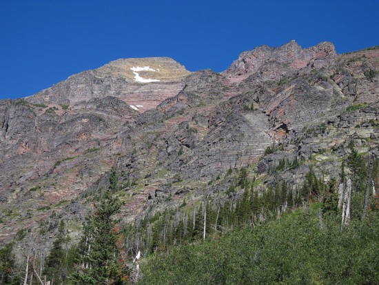
The south side of Mount James
Razoredge Mountain above Medicine Grizzly Lake
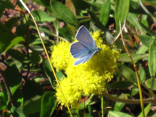
Blue butterfly on yellow flower; it's going to be a great year for the St. Louis Rams
(they only have to win 2 games to DOUBLE their productivity - the optimistic spin on being 1-15 in 2009)
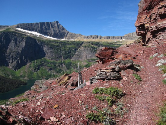
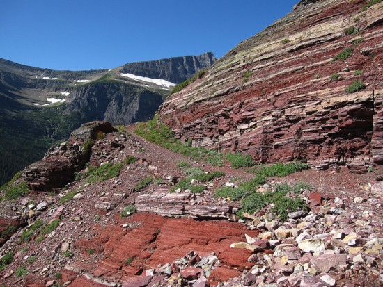
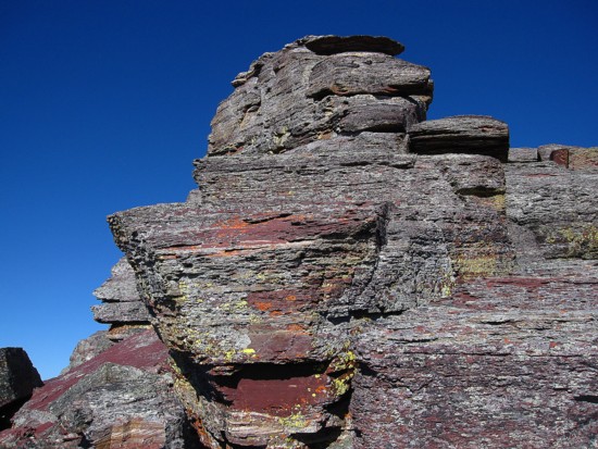
The only thing better than the Yellow Brick Road is a Red Argillite Trail (or RAT for short)
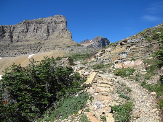
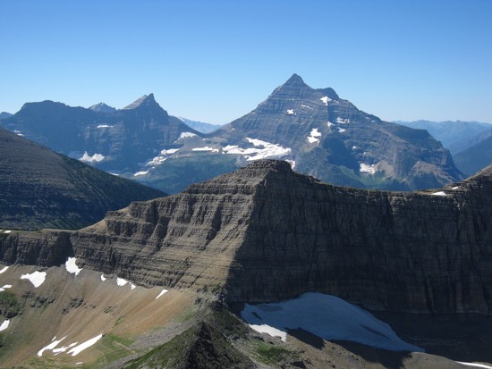
Triple Divide Peak looms over Triple Divide Pass
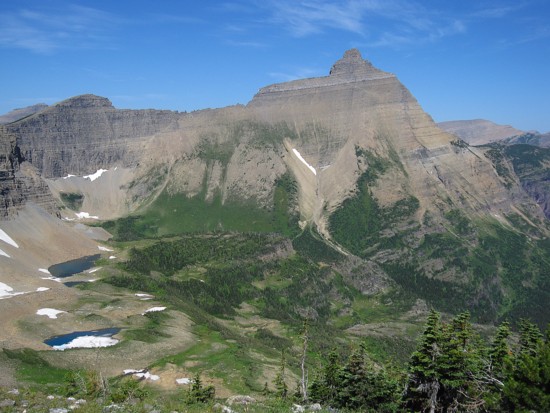
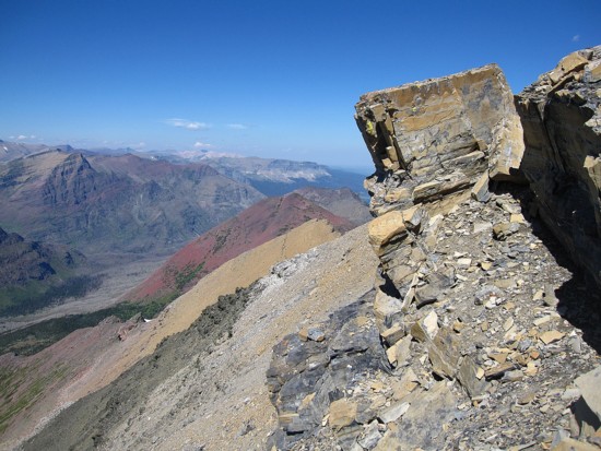
Looking at the route to the summit of James (far right) from the pass
Split Mountain
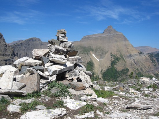
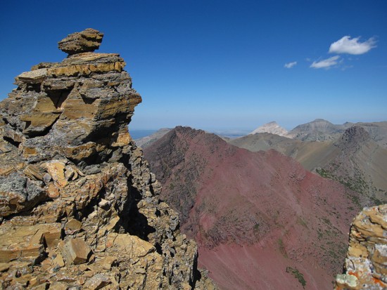
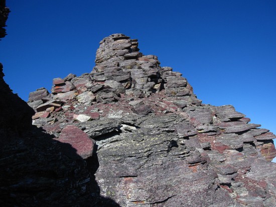
The cairn at the pass loosely mimics the profile of Split Mountain
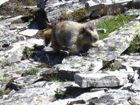
Marmot
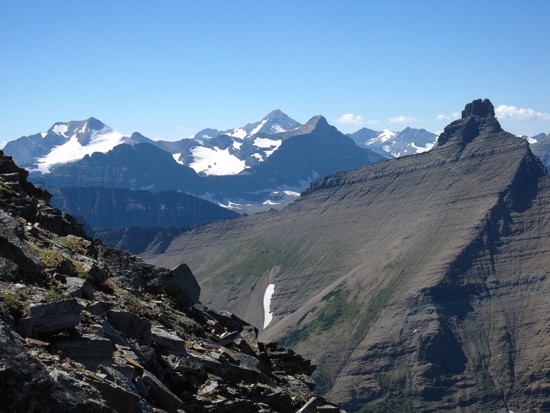
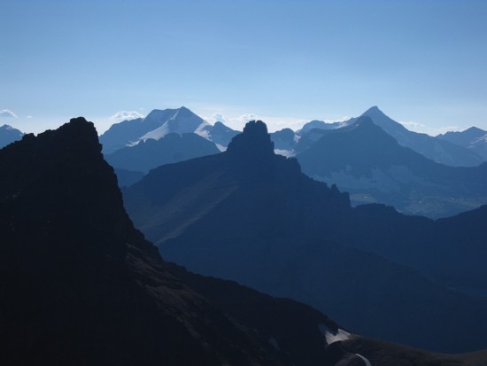
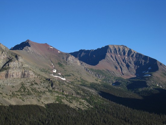
Mount Pinchot (left), Mount Stimson (right) and lowly Triple Divide Peak (forefront)
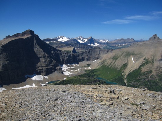
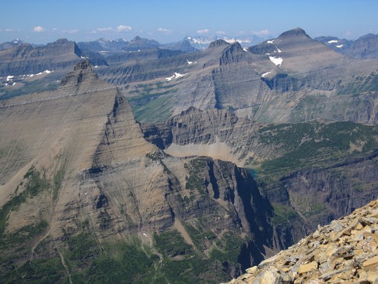
Norris Mountain (left), Blackfoot, Jackson, Logan (distant centre), and Split (far right)

A closer look at Blackfoot, Jackson, and Logan
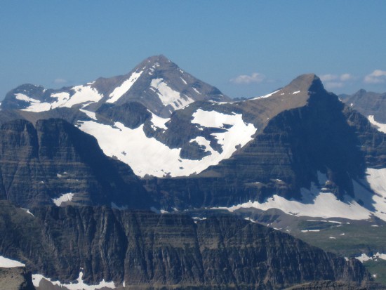
An even closer look at Jackson and Logan
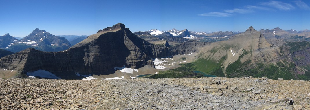
All of the above mountains!
Looking north to the traverse slopes to Amphitheater, the red hump is Medicine Owl Peak
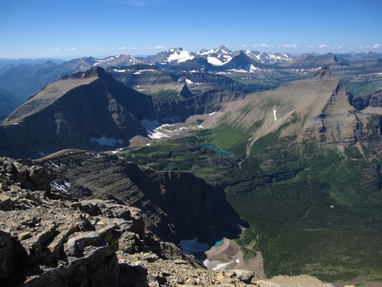
The partial view to the northwest; Little Chief Mountain at the far right
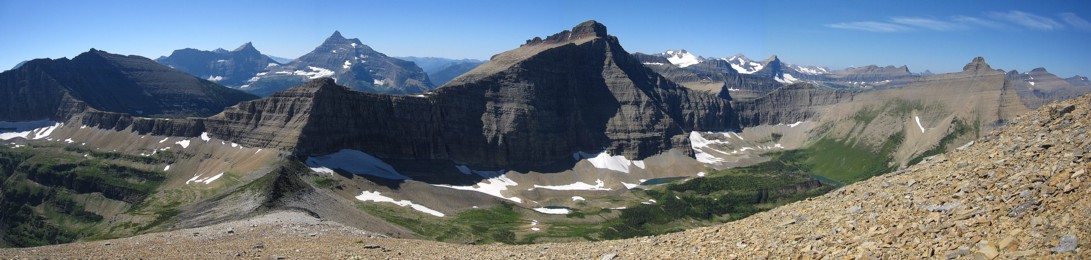
The summit view to the southwest, west, and northwest
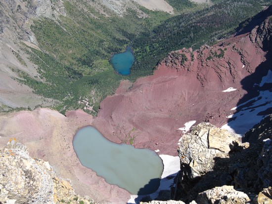
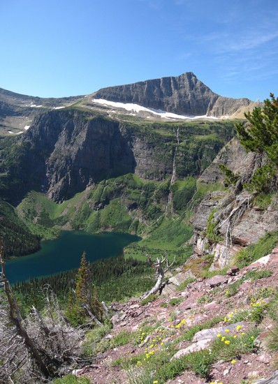
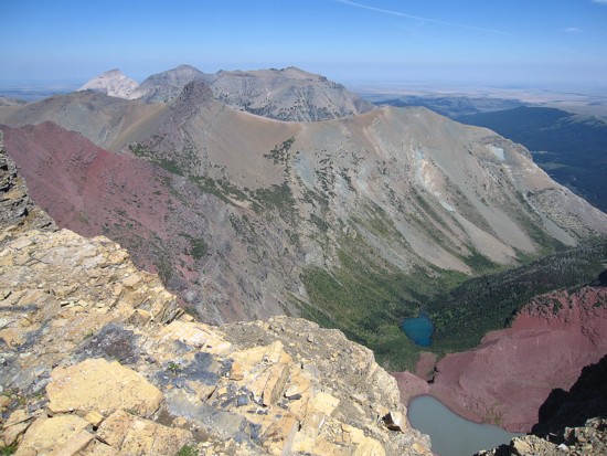
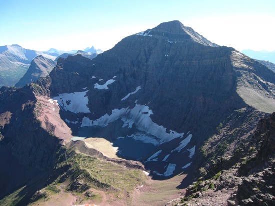
Two of the three lakes below James' northeast face
Same as above; Little Amp Peak is slightly darker protrusion near the upper left
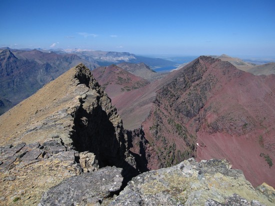
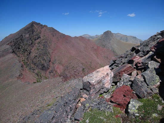
Looking north across the route to Amphitheater (red peak on the right)
Another view to the west; small lakes kept popping up so I had to take more photos
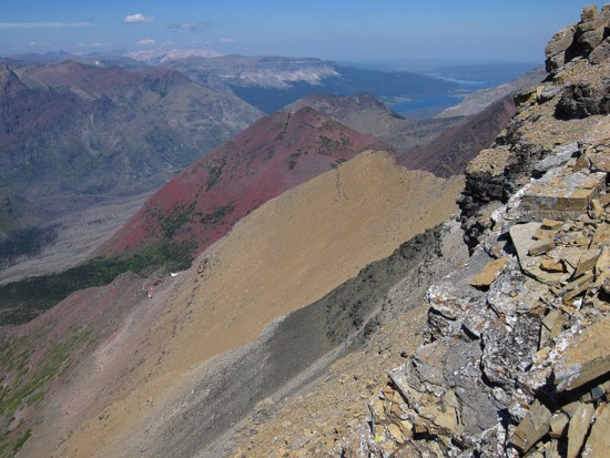
The colourful rubble slopes I had to traverse
More colourful views on the way to Amphitheater; Divide Mountain is the light coloured peak at the top left
Same as above
More of the same mountains, but there were so captivating
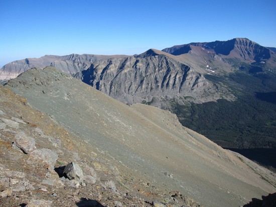
Almost at the James/Amphitheater col; Amphitheater at the left and Little Amp to the right
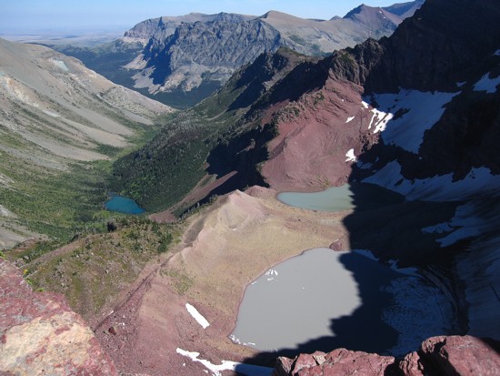
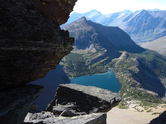
All three of the lakes
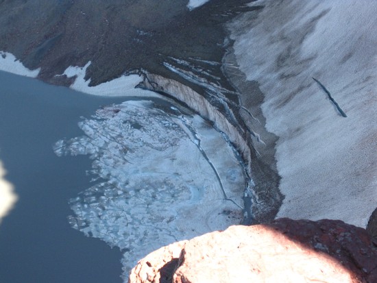
The last gasp for this glacier; more than likely it won't survive the decade
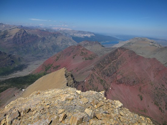
The view to the southeast
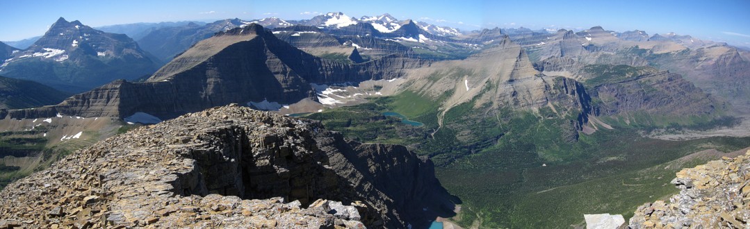
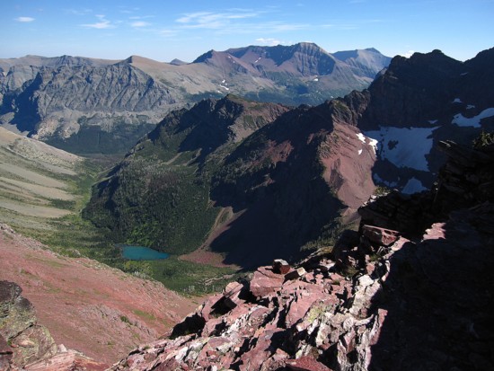
Looking back to James
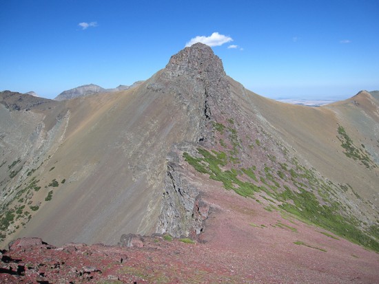
Looking forward to Little Amp (left) and the ridge back to the trail;
I went to the highpoint at the right and then descended scree slopes seen at the right
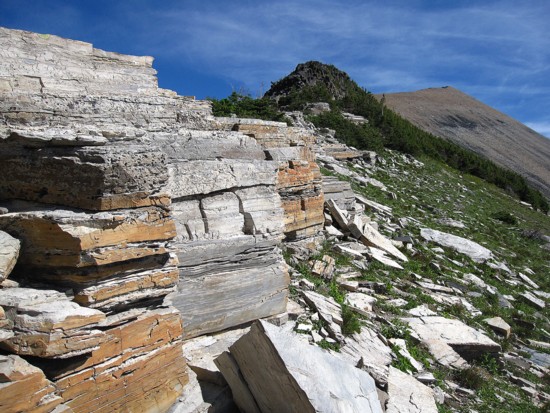
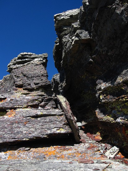
At the Amphitheater/Little Amp col; followed a very big RAT to get there
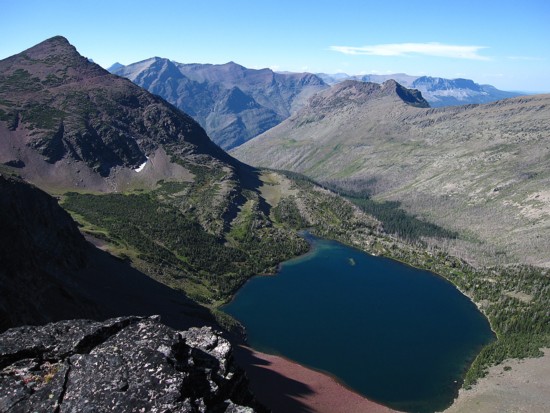
Another lake! Medicine Owl Lake
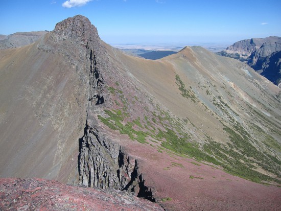
Typical terrain on the lower ridge of Little Amp
Typical terrain on the middle ridge of Little Amp
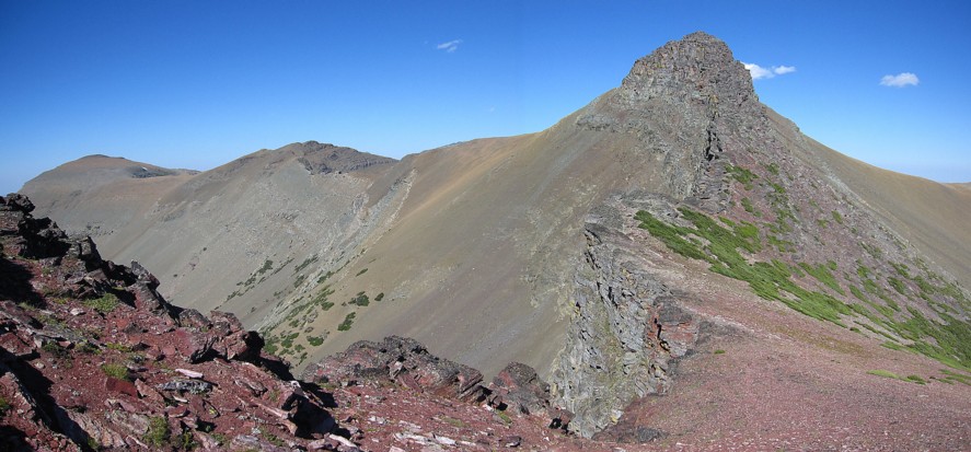
Interesting terrain to negotiate
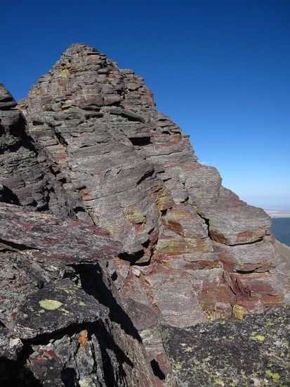
Approaching the summit
Owl Medicine Lake again
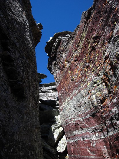
One of the cruxes; the gap was to narrow to ascend with a backpack on so I had to pass it up first
Almost there
The split in Split Mountain is now visible
The scree slopes I descended
Eagle Plume Mountain (left) and Red Mountain (right)