The Wall of Jericho
(attempt for me, success
for Doug)
August 11, 2023
Mountain height: 2848 m (my summit at the northeast end of The Wall)
Elevation gain: approximately
1950 m for me, much more for Doug
Round-trip time: 15:30
Scrambling with
Doug.
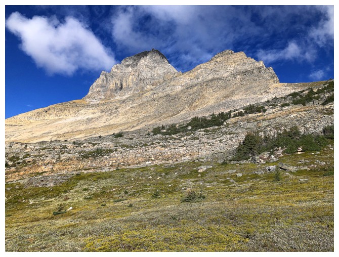
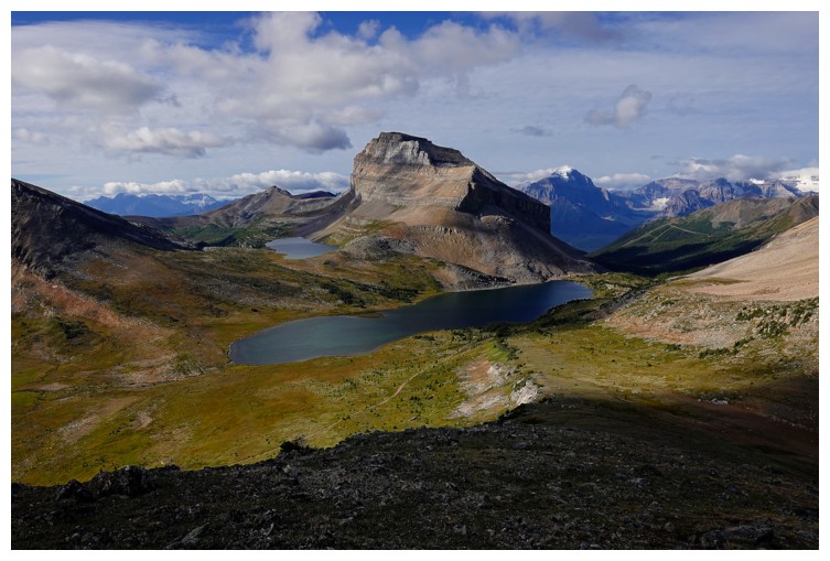
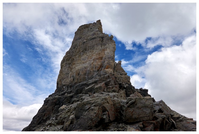
The Wall of
Jericho is one of the most visually captivating and unique mountains in the
Canadian Rockies, standing as a huge, narrow, and castellated fin of rock above
the  stunning Skoki Lakes (Zigadenus and Myosotis). The two summits (SW and NE)
appear impenetrable from all sides by non-technical means. Rick Collier and
J.A. Owens had muscled their way up to the SW summit, a
very exposed 5.8 climbing route with significant challenges. However, there was
very little (if any) information about the NE summit, until Erik Nilsson posted
a non-technical route on the Scrambling in the Canadian Rockies Facebook page.
stunning Skoki Lakes (Zigadenus and Myosotis). The two summits (SW and NE)
appear impenetrable from all sides by non-technical means. Rick Collier and
J.A. Owens had muscled their way up to the SW summit, a
very exposed 5.8 climbing route with significant challenges. However, there was
very little (if any) information about the NE summit, until Erik Nilsson posted
a non-technical route on the Scrambling in the Canadian Rockies Facebook page.
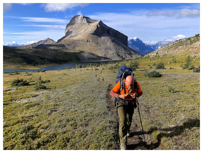
Intrigued by
the possibility of reaching the summit of this beast of a mountain, Doug and I
set forth to give it a go. After biking the road and hiking to Packer’s Pass,
Doug took a run up Packer’s Pass Peak – a lowly but more than worthwhile
objective, boasting a summit view typical of far loftier peaks. 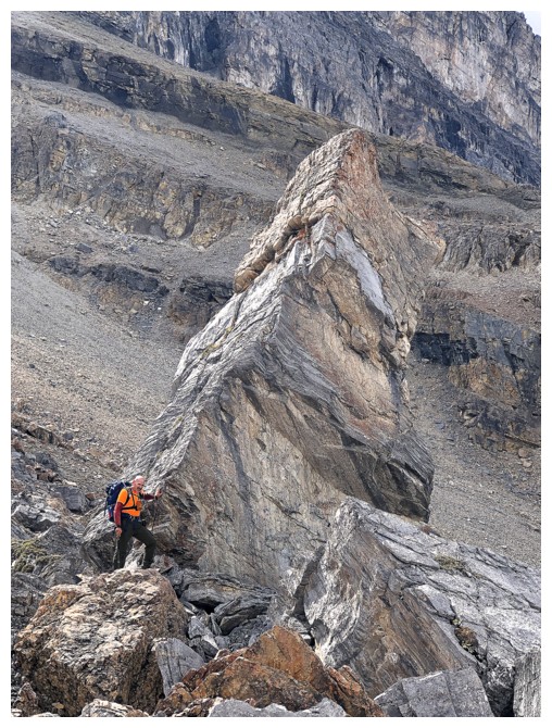 I agreed to
meet Doug on the northwest ridge of the peak and started traversing that way. I
had visited the summit of Packer’s about a year earlier and wanted to save energy.
I agreed to
meet Doug on the northwest ridge of the peak and started traversing that way. I
had visited the summit of Packer’s about a year earlier and wanted to save energy.
Doug thoroughly
enjoyed Packer’s and after reuniting on the ridge we continued down to the
lakes, around the east end of Jericho and then up to a point close to Merlin
Lake, where we could begin the ascent of Jericho.
Almost right
off the bat we could tell this was going to be a challenging ascent. The
terrain was loose, rubbly, unstable, and steeper than it looked. Still, Doug
led the way, expertly picking the easiest line over the unpleasantries
underfoot. Eventually we arrived at the weakness that leads up the upper ramp
and the summit block. Doug went first and it didn’t look easy – loose rock, atop
hard steep dirt with lots of rockfall. He got by the tricky section, announcing
the next part looked easier, but I was already in retreat mode. This terrain was at
the high end of my comfortable level, and I suspected it would get worse before
it got better. I told Doug I was not going up and would wait for him at the bottom
of the slope I was presently on. We wished each other well and off we went.
I tried to find
a spot down below where I could monitor Doug’s progress, but to no avail. For
quite a while he was nowhere to be seen. Then I saw and heard him, right by the
summit block. This was great news and I hollered back so he knew I had heard
him. Given the amount of time required for Doug to summit and then return, I
decided to run up to the highpoint of the Jericho ridge at the far northeast
end. The ascent appeared to be straightforward, and the summit would probably
grant me a pretty decent view. Also, I was sure I could be back to the waiting
spot before Doug returned.
Two errors on
my part were made here: 1. I severely underestimated how much time it would
take me to ascend the route; 2. I assumed that Doug could hear me when I was hollering
back at him.
Reaching the summit took twice as long as predicted, due to the incredibly
tedious terrain (the views were fantastic, mind you). And perhaps because of Doug’s
high position compared to mine and the physics of sound, I could hear him but
he could not hear me. 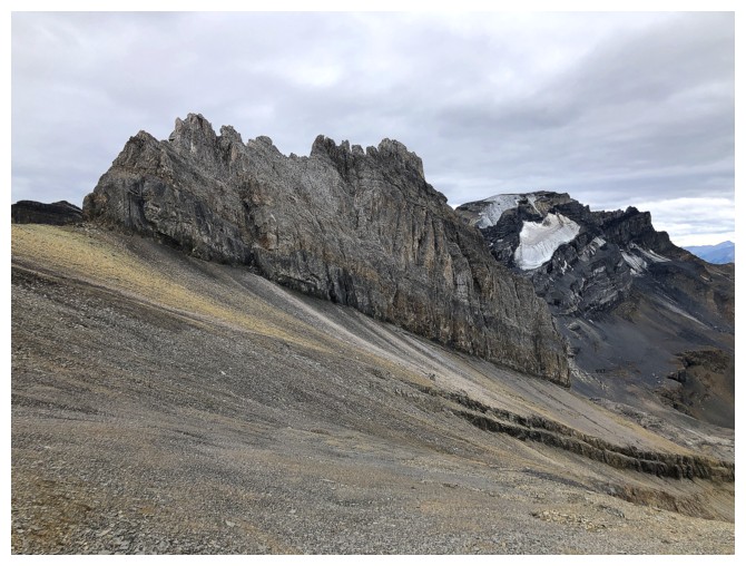 As such, whenever I heard him yell, I would yell back assuming
he would know I was somewhere close by, if not at the meeting place. By the time
Doug had descended most of his route neither of us could hear each other at all.
Doug assumed I had started the return trip to the parking lot and he started
doing the same, somewhat perplexed in my decision to leave without him. As luck
would have it our respective descent routes met up not too far from the meeting
place. Phew! In retrospect, we should have formulated a contingency plan in
case I decided to explore – definitely an unforced error on my part!
As such, whenever I heard him yell, I would yell back assuming
he would know I was somewhere close by, if not at the meeting place. By the time
Doug had descended most of his route neither of us could hear each other at all.
Doug assumed I had started the return trip to the parking lot and he started
doing the same, somewhat perplexed in my decision to leave without him. As luck
would have it our respective descent routes met up not too far from the meeting
place. Phew! In retrospect, we should have formulated a contingency plan in
case I decided to explore – definitely an unforced error on my part!
Once reunited,
the remainder of the return trip went well, and we were able to share our
respective ascent stories – Doug’s was far more interesting and intense than
mine! I was exhausted by the time we reached Deception Pass, but Doug seemed to
be ready to run a marathon! Doug’s boundless energy is equaled only by his amazing
scrambling prowess. We arrived back
at the parking lot around 10 pm.
As always it was a joy to spend the day with
Doug – an individual whose humility and positive energy are wonderful sources
of inspiration for me. I would have liked to get to the summit of Jericho, but
it was not meant to be. I have never regretted a decision to “turn tail and run”
and this day was no exception. A huge congratulations to Doug for achieving the
summit of this rarely ascended mountain and also a thank you to Erik for his
invaluable route information.
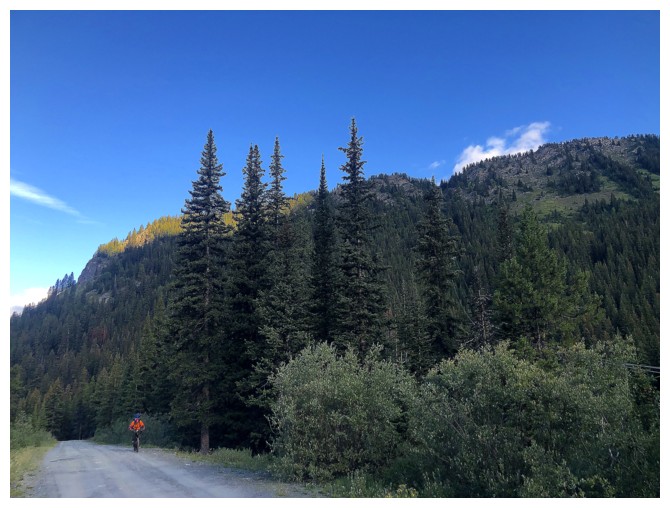
Doug bikes the approach
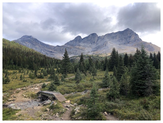
The obligatory photo of the first good view of Richardson, Pika, and Ptarmigan
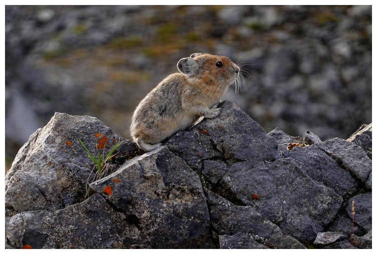
Speaking of Pikas - Doug gets a great shot of this little guy (photo by Doug)
Pointing out the route Mark and I took up Ptarmigan in 2022 (photo by Doug)
The obligatory shot of Ptarmigan Lake
Heading up to Packer's Pass (photo by Doug)
Good view of Ptarmigan Lake, Heather Ridge (just left of centre), and Redoubt Mountain
The southeast side of Ptarmigan always commands some attention
Doug powers up the trail
Almost at the pass. Packer's Pass Peak in front.
Doug's view of the Ptarmigan Lake, Redoubt Lake, and Redoubt Mountain from the southwest ridge of Packer's (photo by Doug)
My view of Doug's as he ascends the ridge
Close-up (with some light refraction)
Doug's summit view to the east (photo by Doug)
Doug's summit view to the west (photo by Doug)
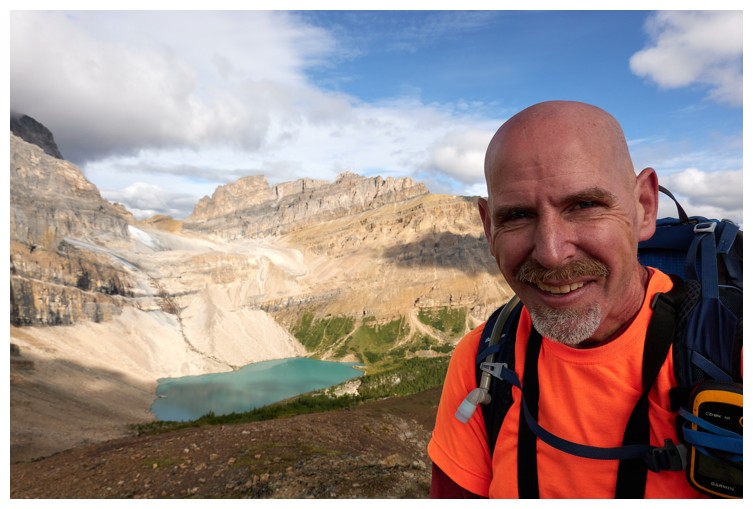
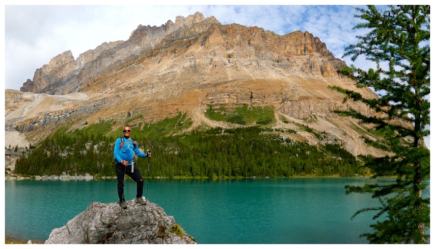
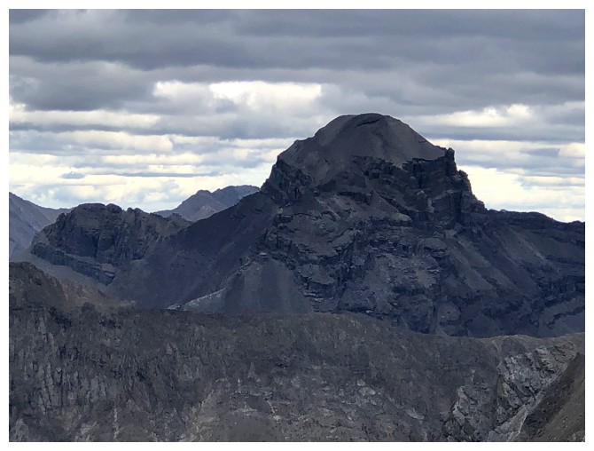
Doug's summit selfie, with The Wall of Jericho in full view (photo by Doug)
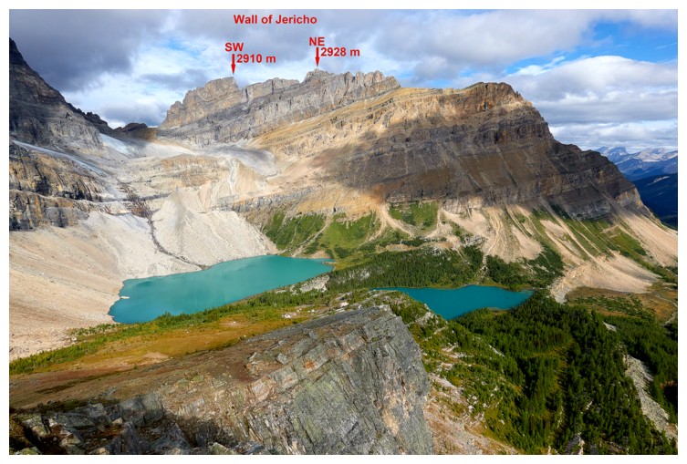
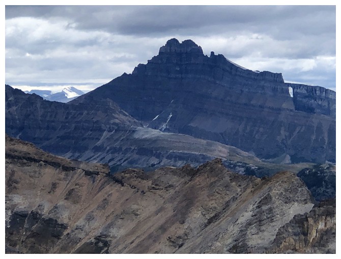
Doug identifies the two summits of The Wall (photo by Doug)
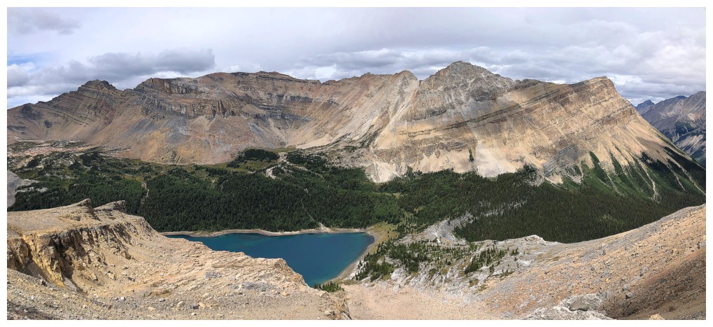
My view of the area from the northwest ridge
Ptarmigan's east face
There's Doug
He makes his way down the ridge
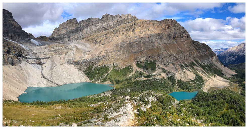
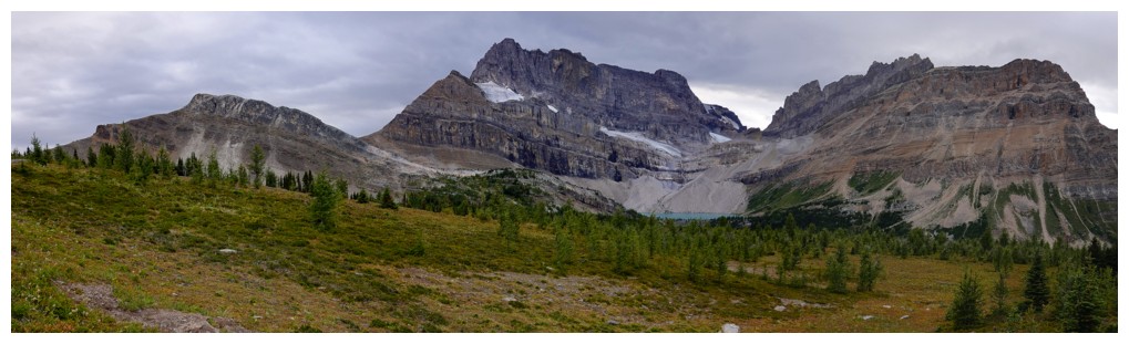
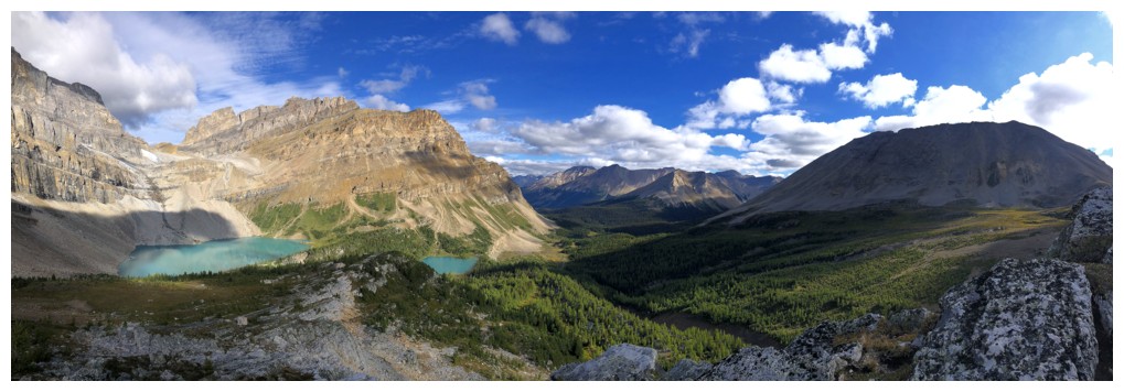
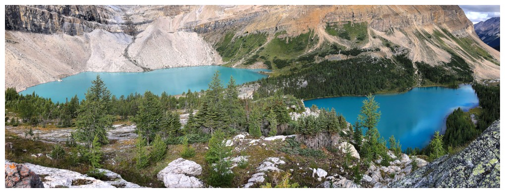
The Wall and the Skoki Lakes (Zigadenus left and Myosotis right) are spectacular from this ridge (photo by Doug)
Close-up of Myosotis (photo by Doug)
The terrain underfoot is very nice; a sharp contrast to what's ahead! (photo by Doug)
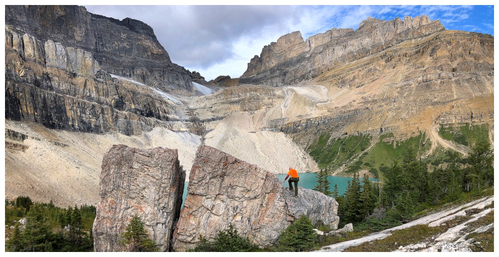
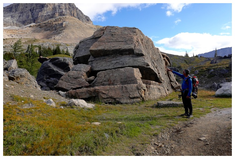
Doug spots a massive boulder that's been cleaved in two and it must be climbed!
"Mind the gap" Doug!
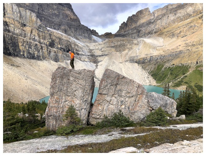
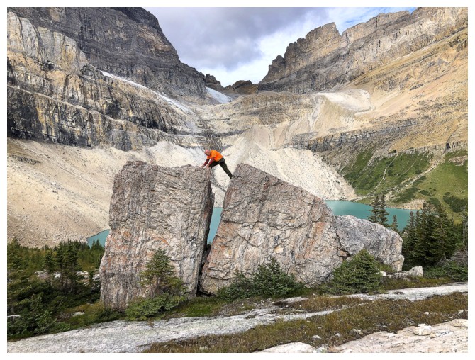
Success!
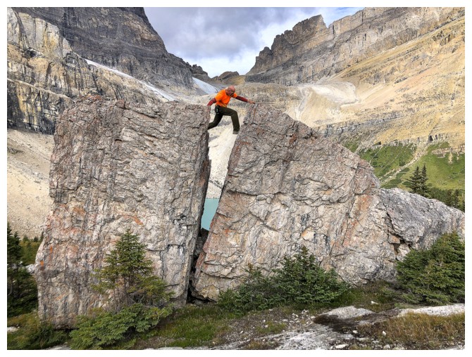
Doug looks like Samson here, pushing the two boulders apart
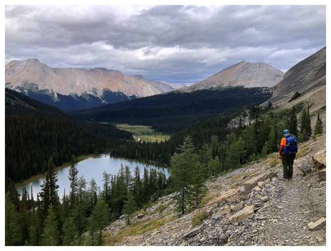
Continuing down to the lakes
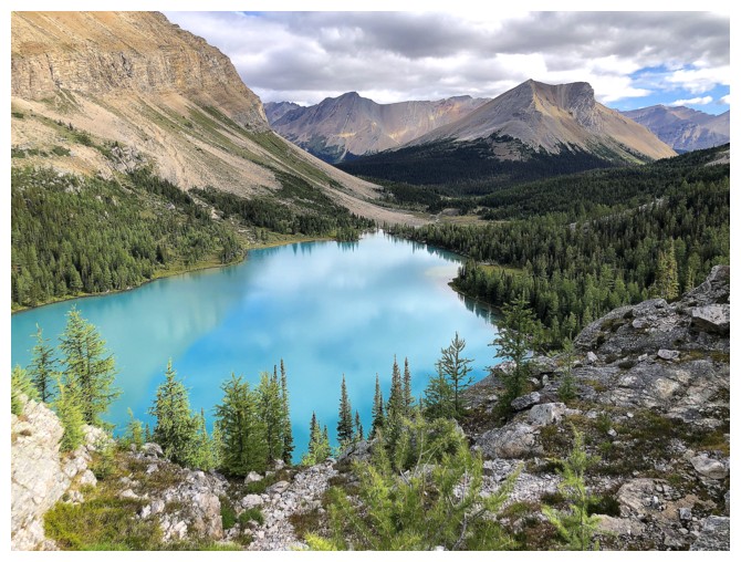
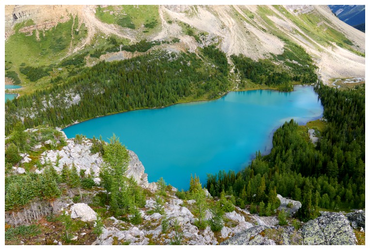
Myosotis, with Skoki Mountain in the background
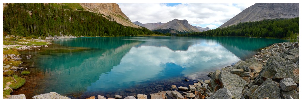
At the shores of Myosotis (photo by Doug)
My turn to climb a boulder (though it was hardly a metre tall!) (photo by Doug)

Disappearing into the cool, passage that grants easy access to the valley below Myosotis Lake (photo by Doug)
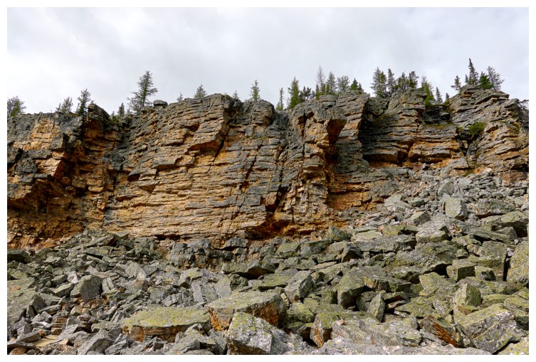
Hard to believe the passage goes right through this rock band (photo by Doug)
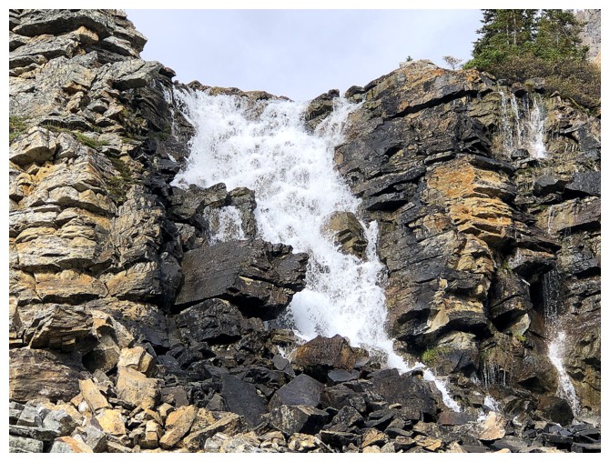
The waterfall that drains Myosotis
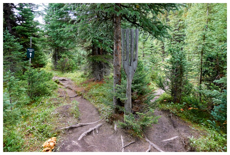
The Fork (photo by Doug)
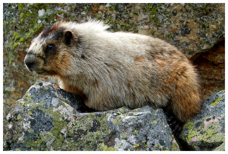
This marmot was not shy at all (photo by Doug)
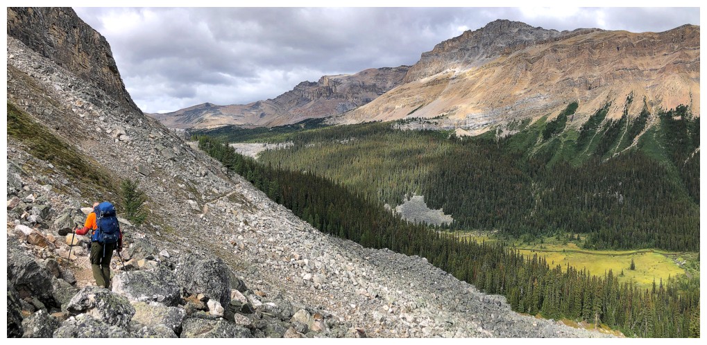
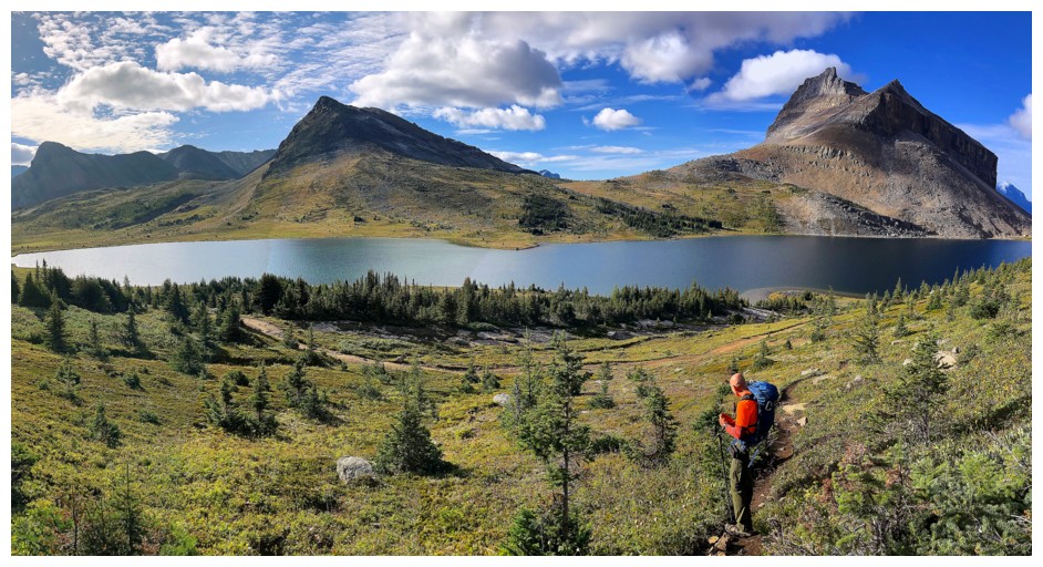
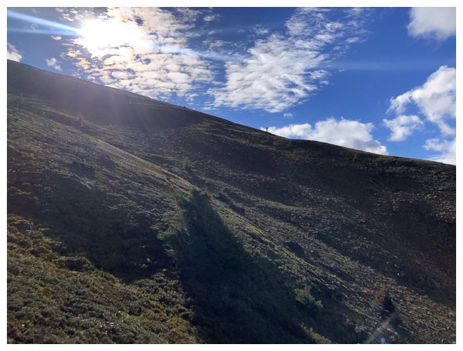
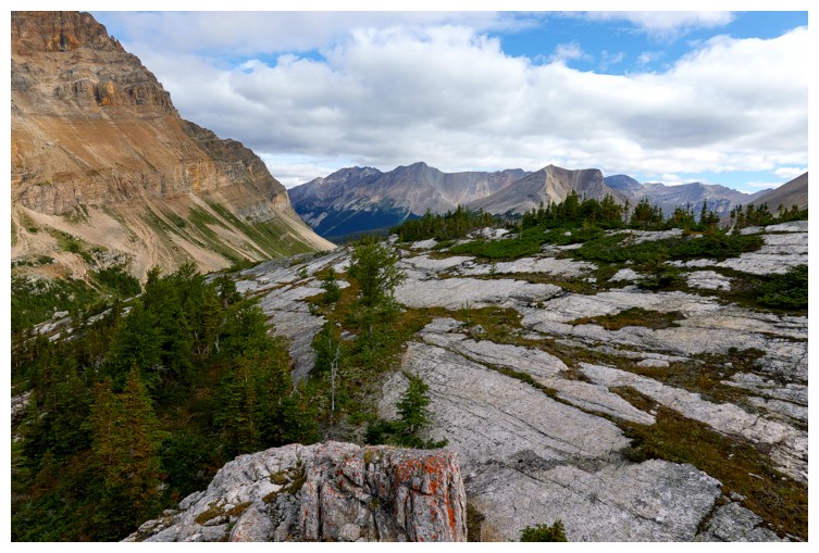
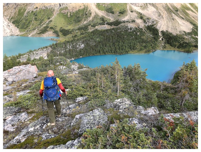
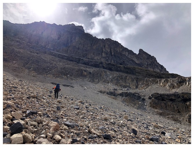
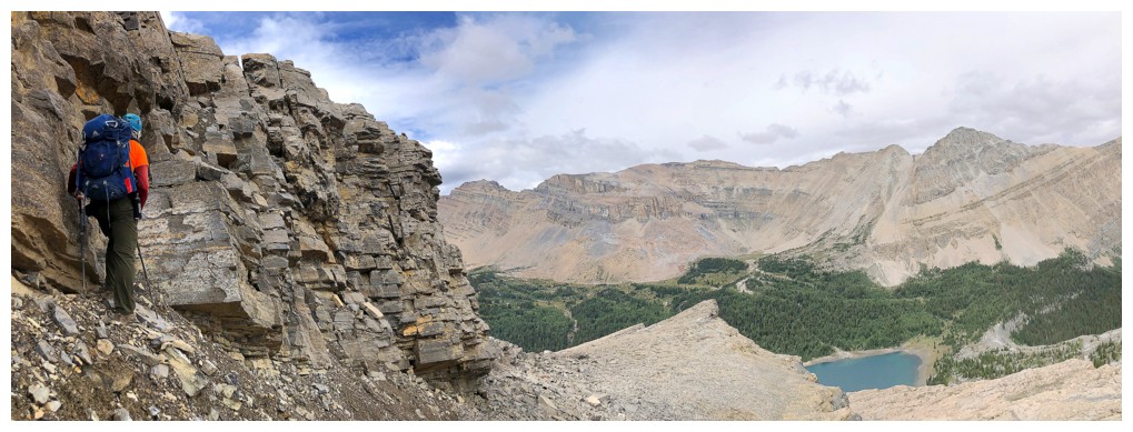
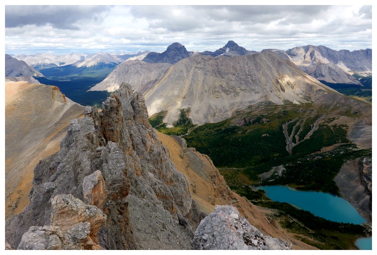
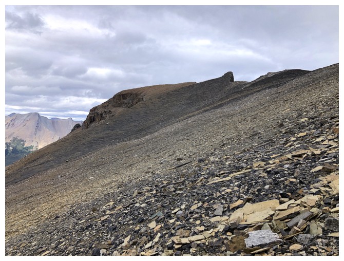
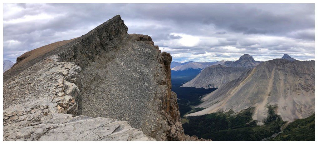
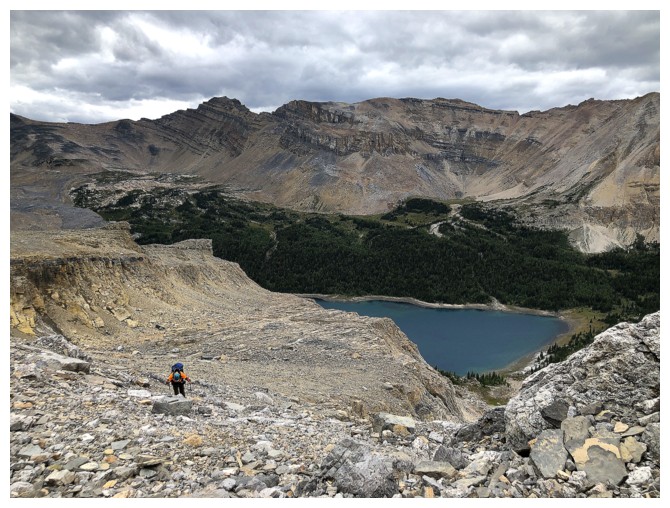
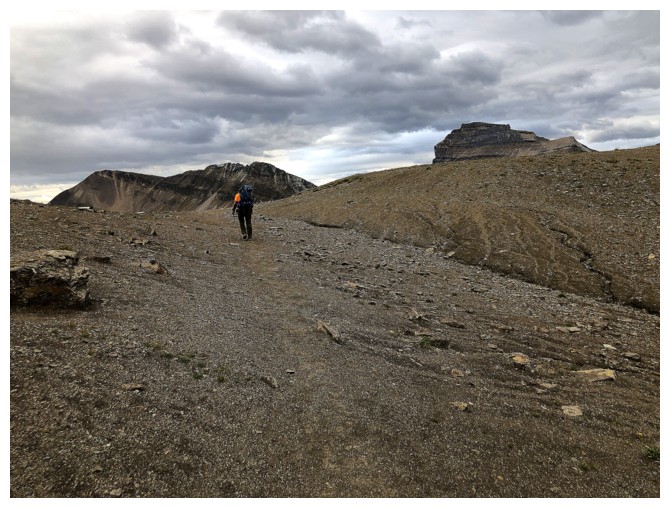
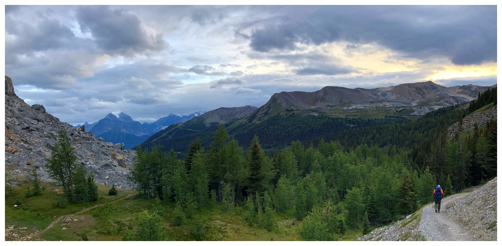
The long traverse across the north east side of Jericho
Castilleja Lake below the massive Merlin Peak massif
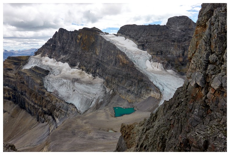
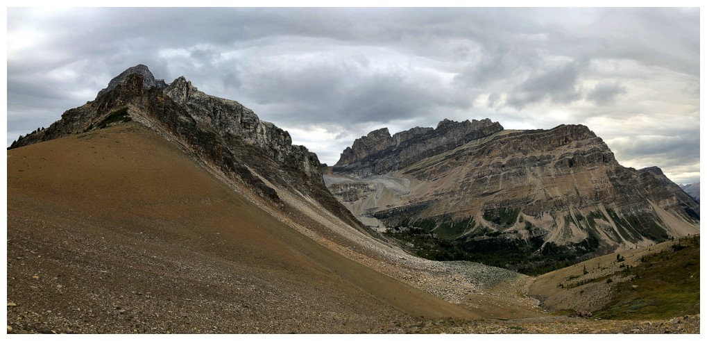
Above the headwall, Jericho, Richardson, Merlin Lake, and Merlin Peak makes their appearances (photo by Doug)
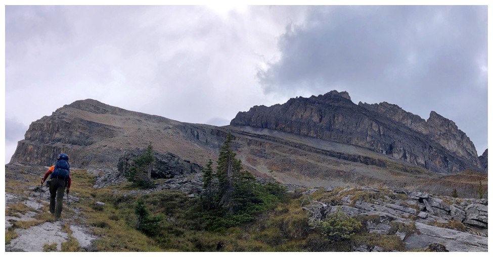
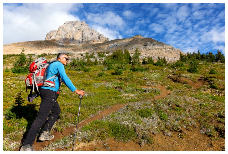
Doug starts the long journey to the base of the route up Jericho
Doug approaches a significant and striking boulder; musta' bin one helluva crash-boom-bang when that came down!
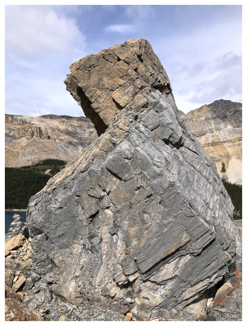
The boulder from a different angle
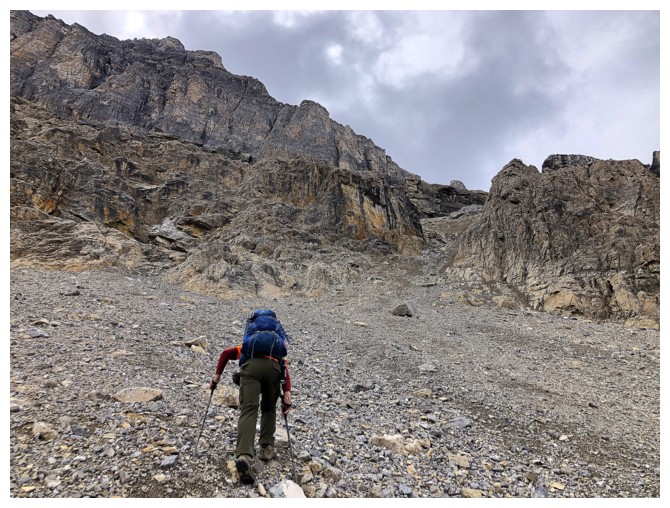
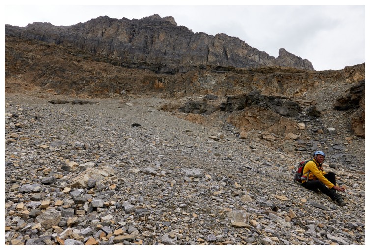
Typical terrain en route to the base of the scramble (photo by Doug)
Same as above (photo by Doug)
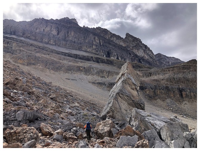
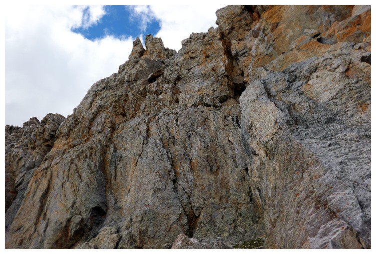
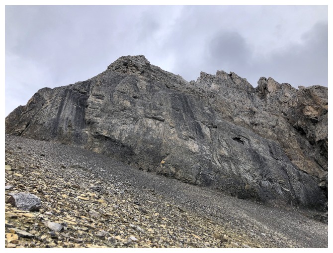
Doug heads for a weakness in the first rock band that lines to north face
There it is
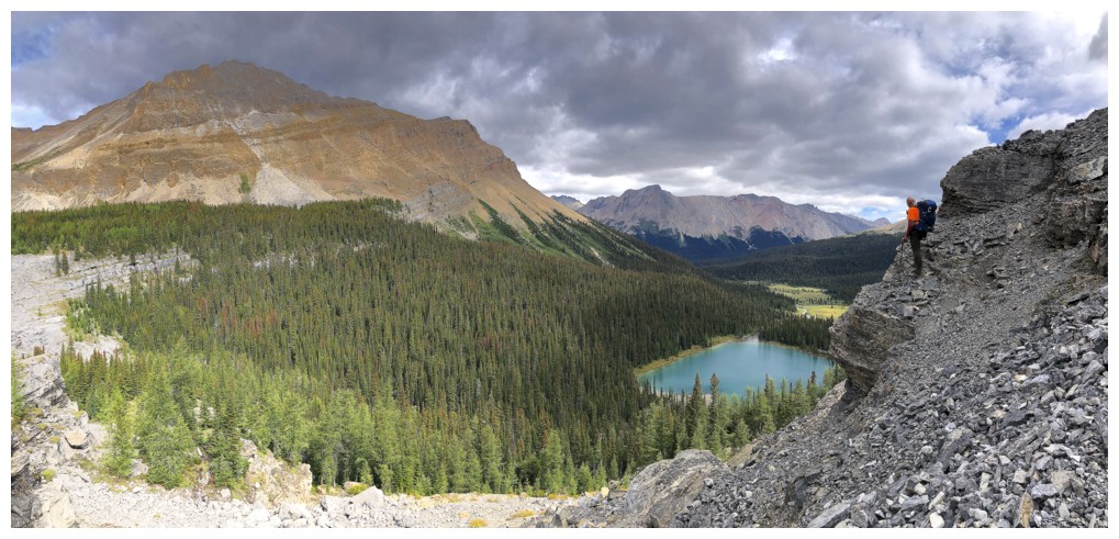
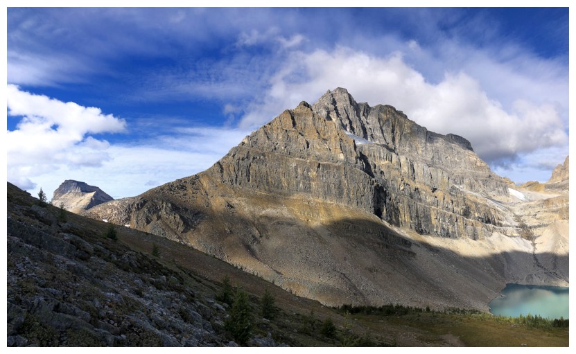
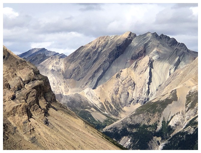
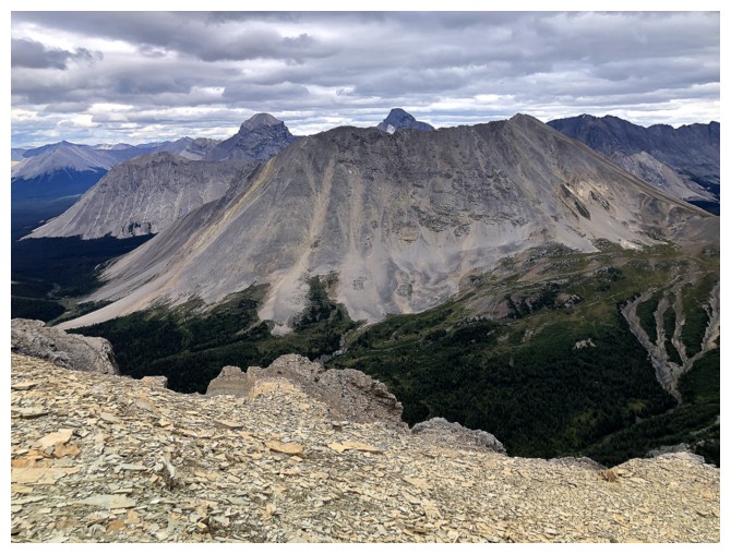
Views of the Merlin Lake area improve dramatically. The highest point seen is Merlin Peak at the far left.
Traversing to get around the next rock band
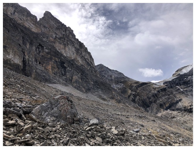
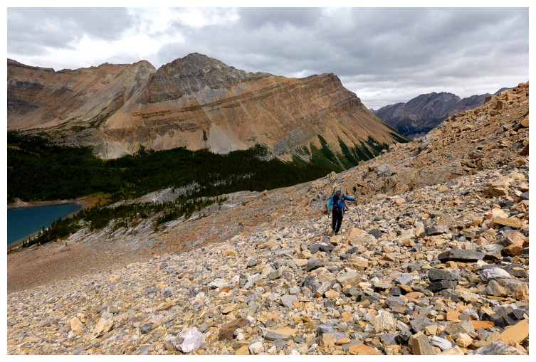
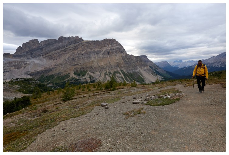
The route ahead is straightforward but on gnarly terrain
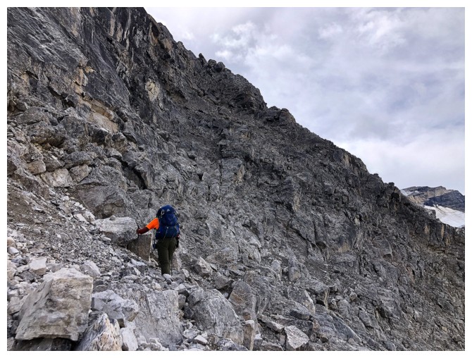
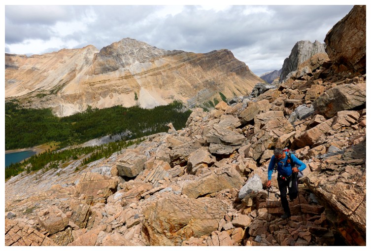
Doug approaches the tricky section to get to the ramp
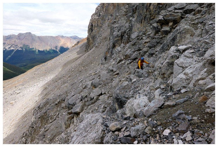
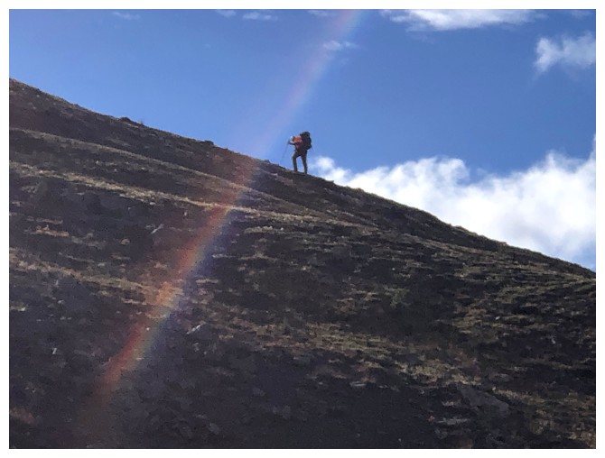
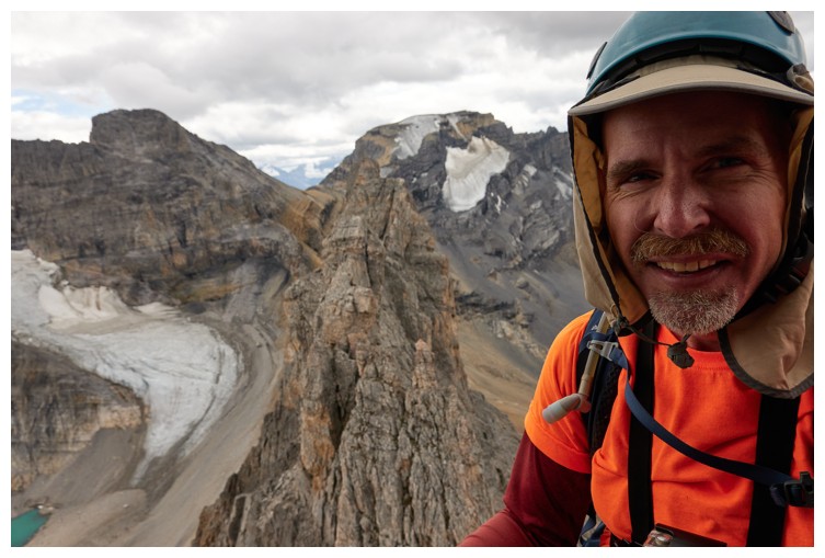
I follow, with an increased level fear! (photo by Doug)
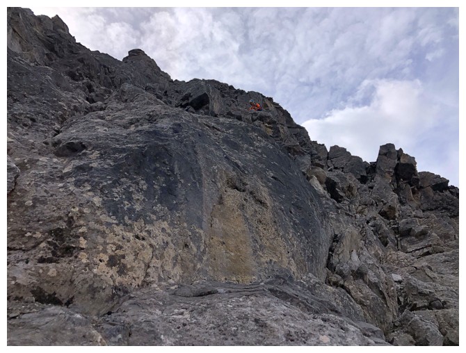
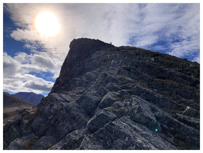
The last I would see of Doug for a while
Doug's journey to the summit of The Wall of Jericho (all photos by Doug)
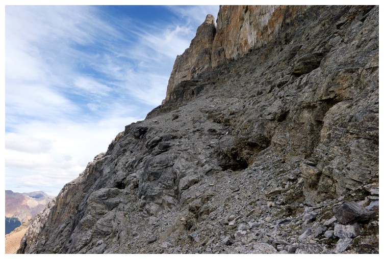
The upper ramp
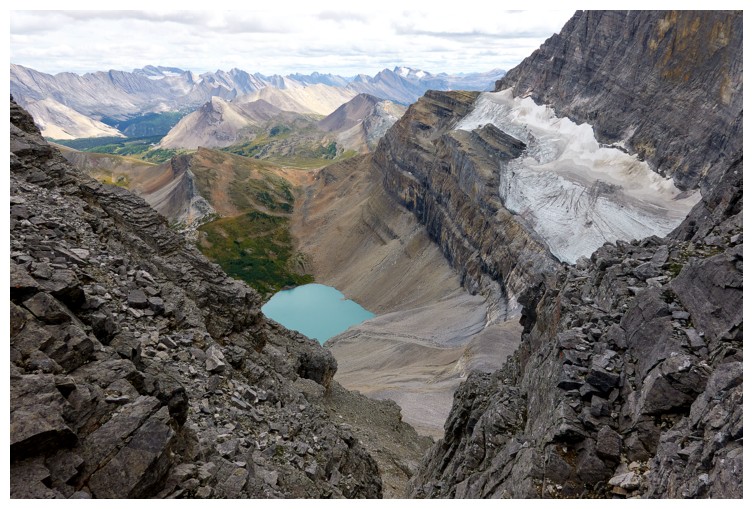
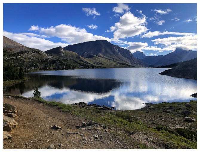
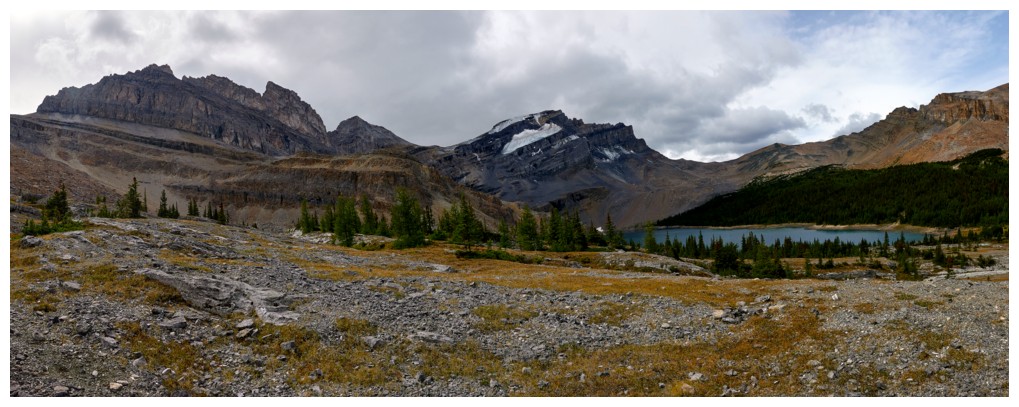
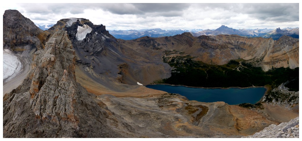
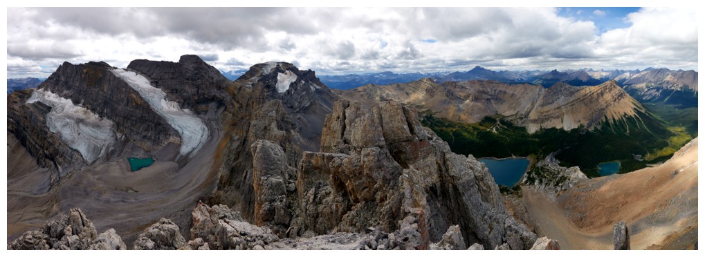
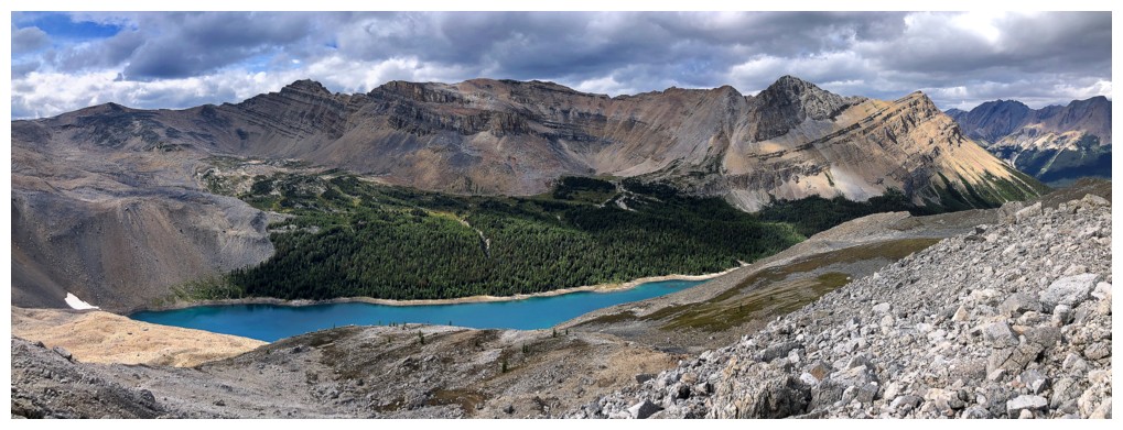
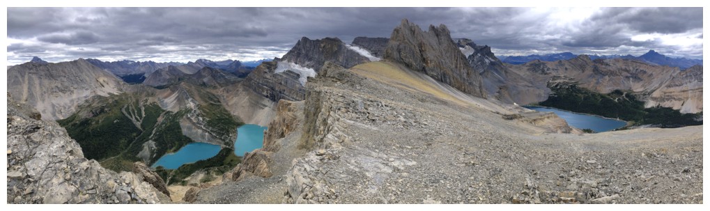
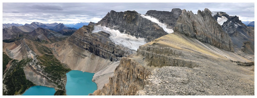
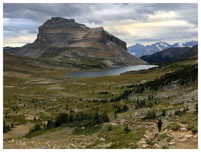
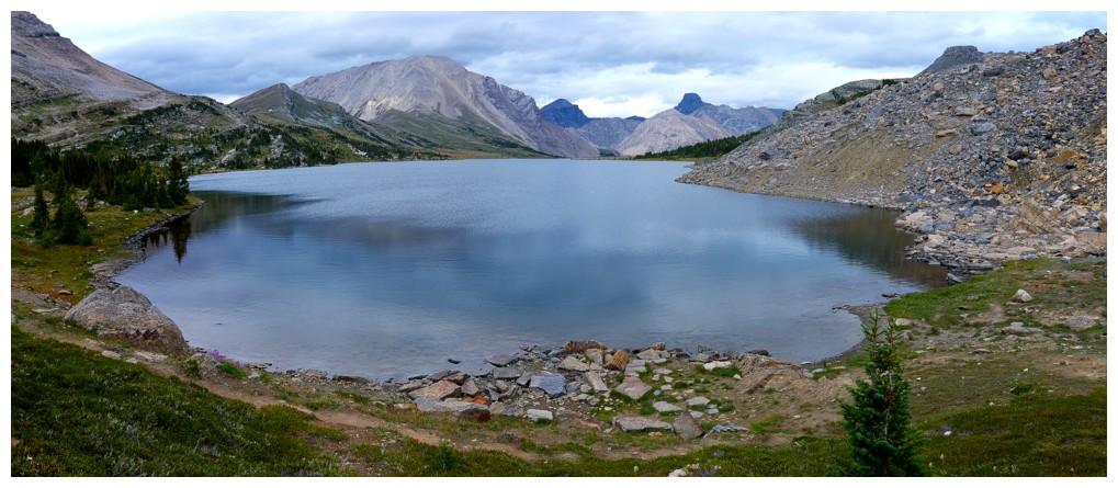
Zigadenus Lake
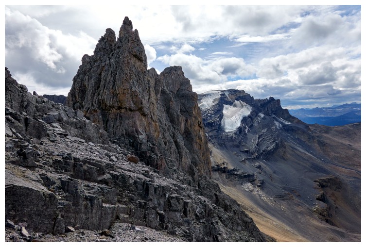
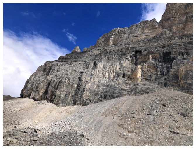
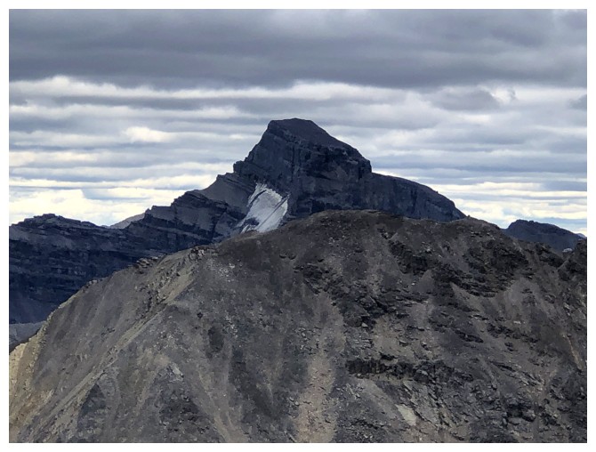
The daunting summit block. Doug tried the southeast side first.
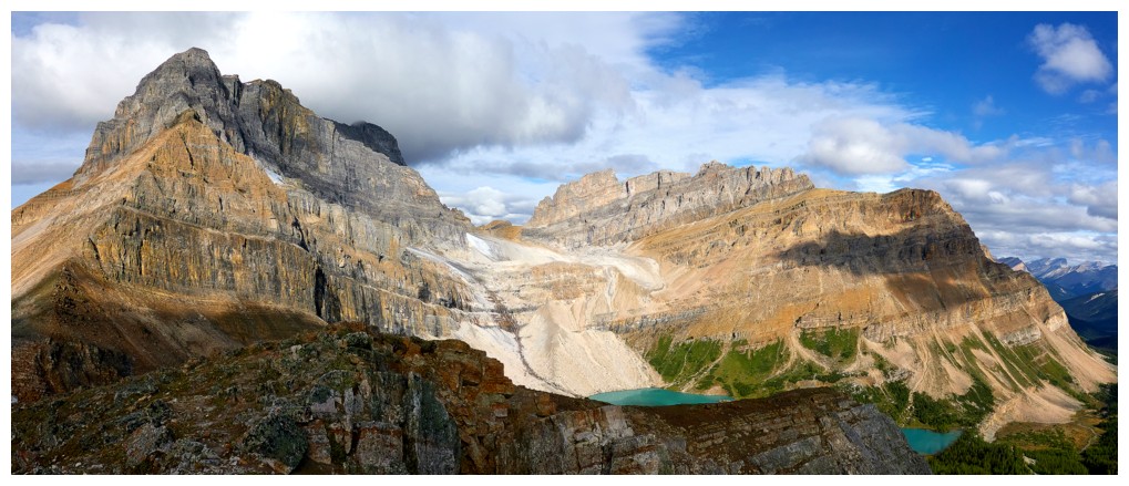
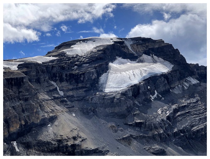
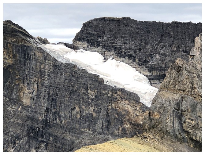
The glaciers of Ptarmigan Peak
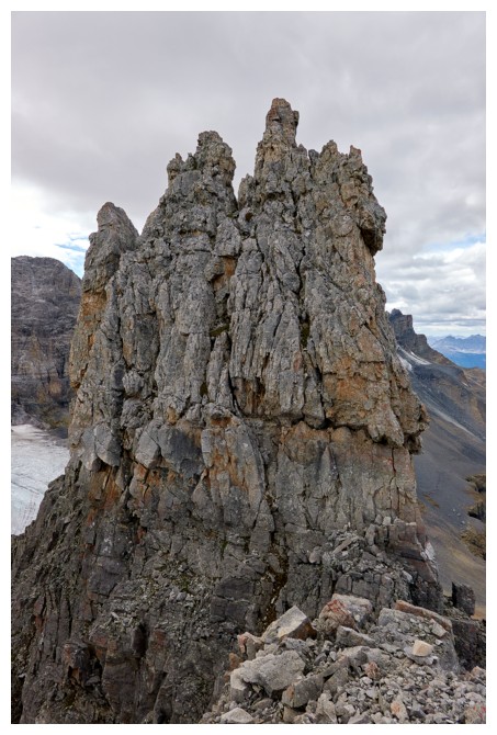
Scary looking things on the southeast ridge!
And the scary looking terrain of the summit block - not scrambling!
Doug did make significant progress on the southeast side before backing down
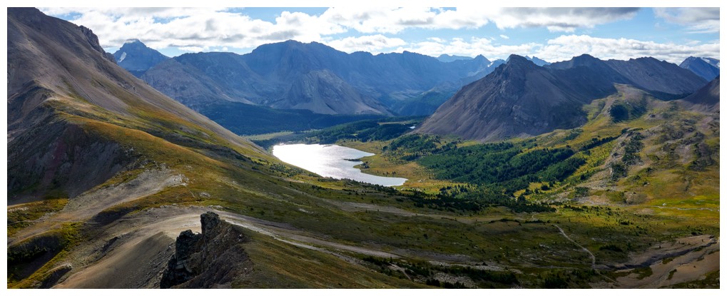
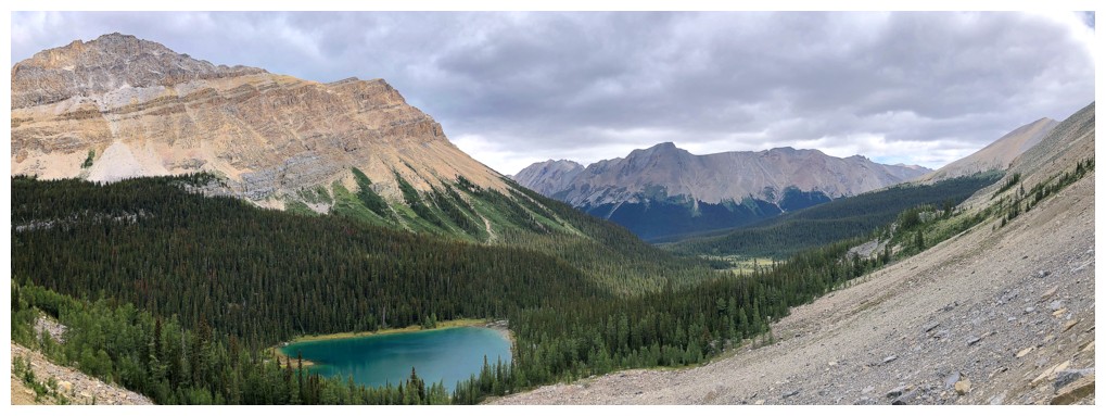
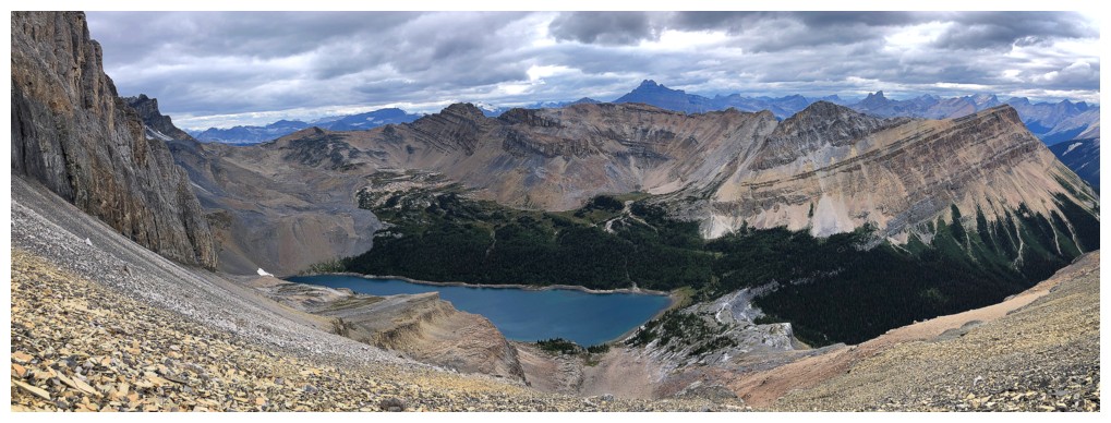
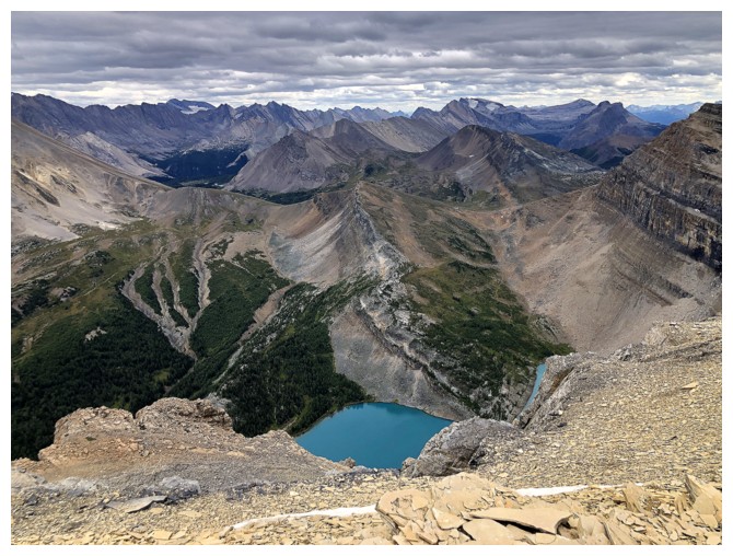
Fantastic views of Merlin Lake
Selfie from the end of progress on the southeast side
Great view of the Skoki Lakes; Packer's Pass Peak looks insignificant from here.
 Success!! After backing down Doug found the easiest route on the northwest side of the summit block.
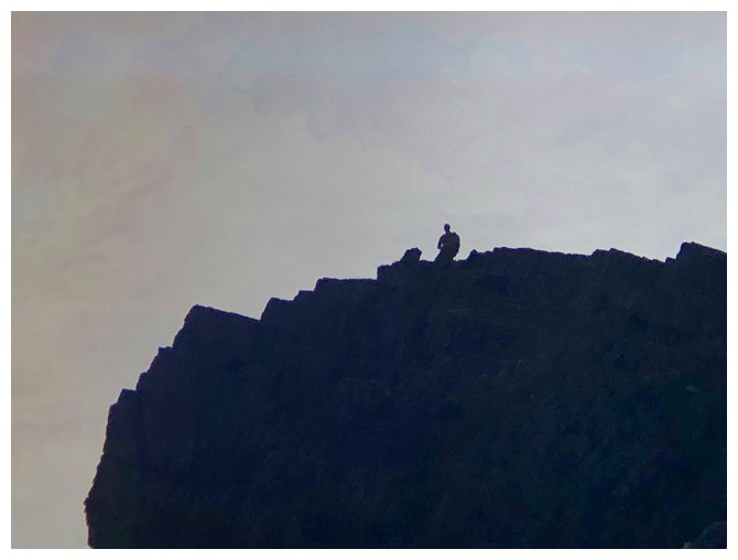
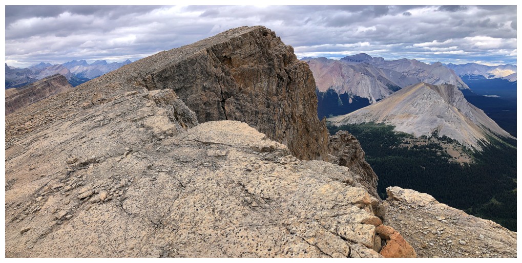
The dramatic view to the east includes the less than dramatic highpoint I reached near the centre
Great pano southwest, west, and northwest
Same to the east
Myosotis Lake looks great from here
Heading down
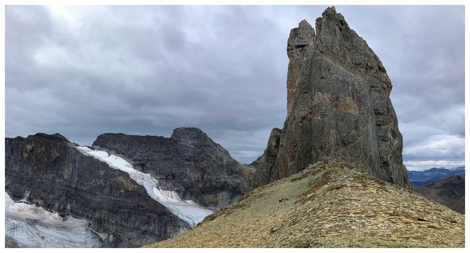
My journey to the summit of the northeast end of the Wall, that I'm going to call, "The Broken Fence of Jericho"
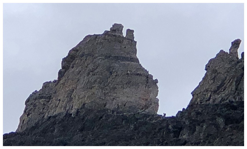
There's Doug, dwarfed by the awesome block of Jericho's highest point
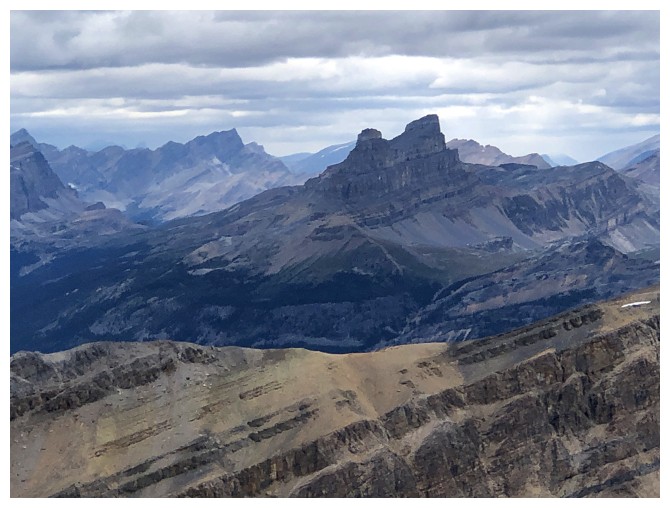
Cool peak to the northeast - not sure what it is
The glaciated east side of Mount Richardson
View of the valley below from my waiting spot
The clouds lifted briefly to reveal the some of the route up Jericho
Taking one of innumerable breaks to catch my breath while grinding my way up the tedious slopes
After
an inordinate amount of time ascending and side-sloping steep, unstable
scree, the terrain became a little more friendly (but barely!)
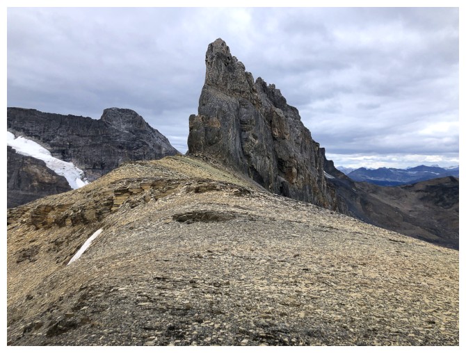
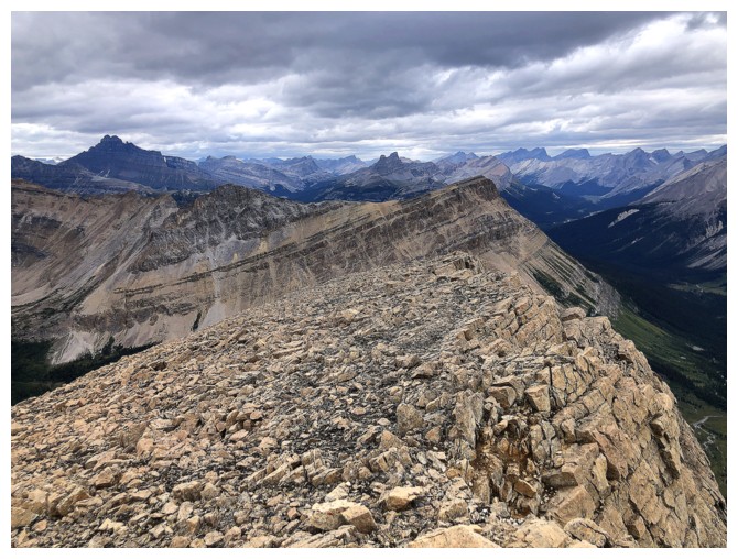
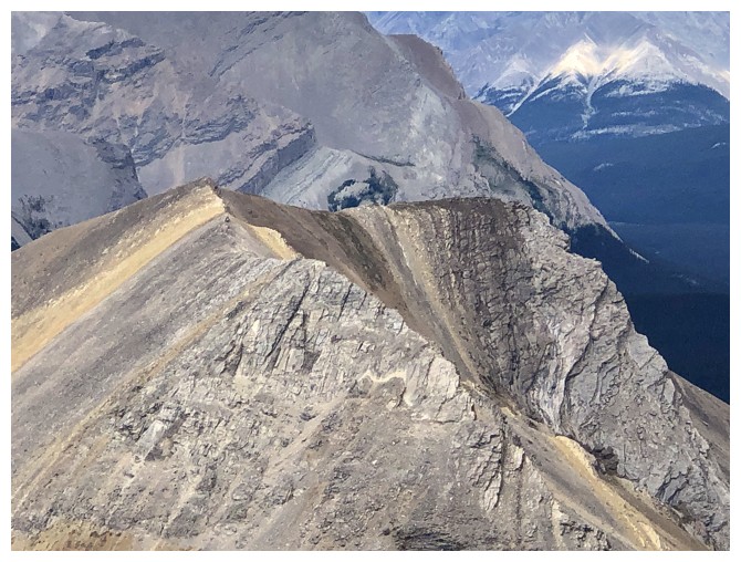
The east ridge of Jericho looks challenging from here but gets even more dramatic upon reaching the ridge
Fossil Mountain to the east
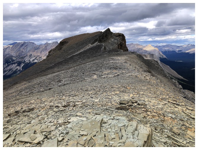
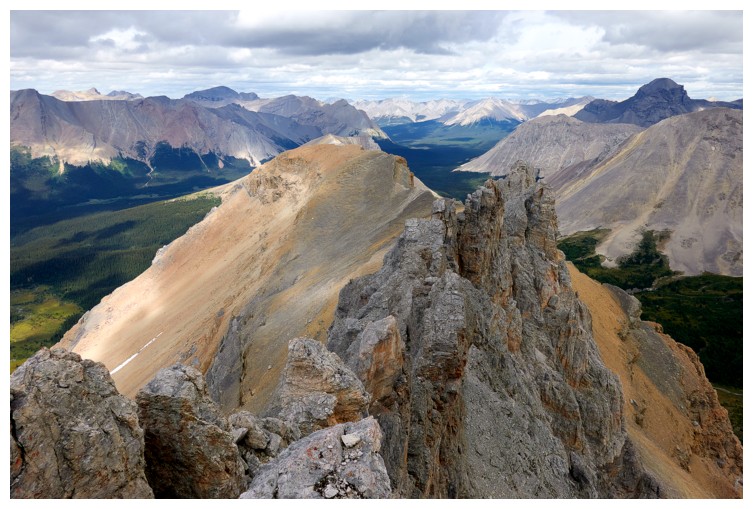
On the ridge with the summit ahead
There's the dramatic view!
Glimpse of Myosotis Lake
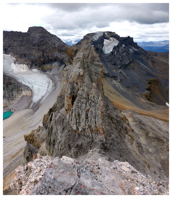
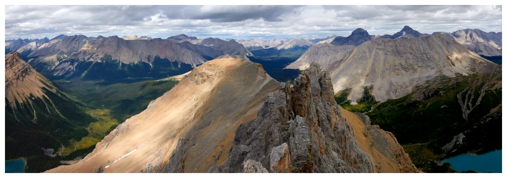
Back to dramatic
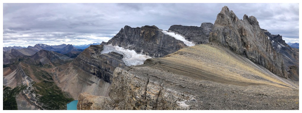
Dramatic and a little glimpse of Zigadenus Lake
Easy terrain to the false summit
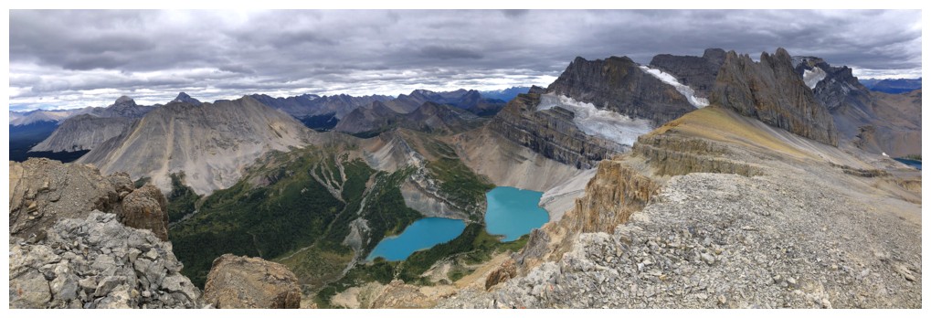
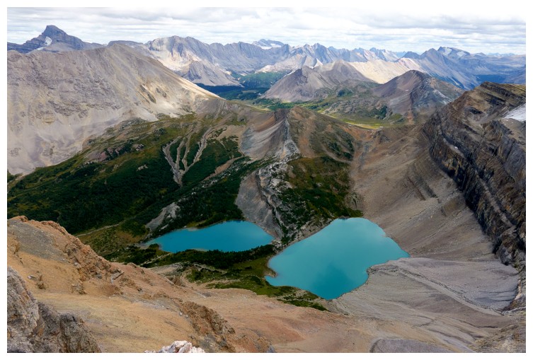
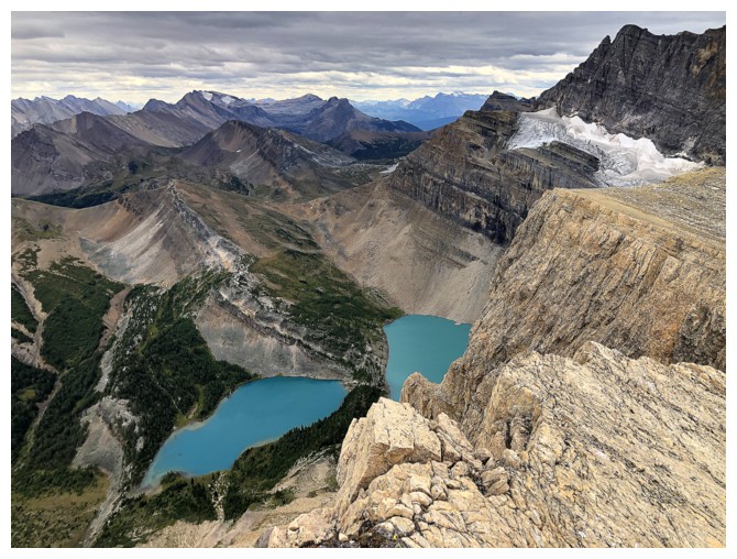
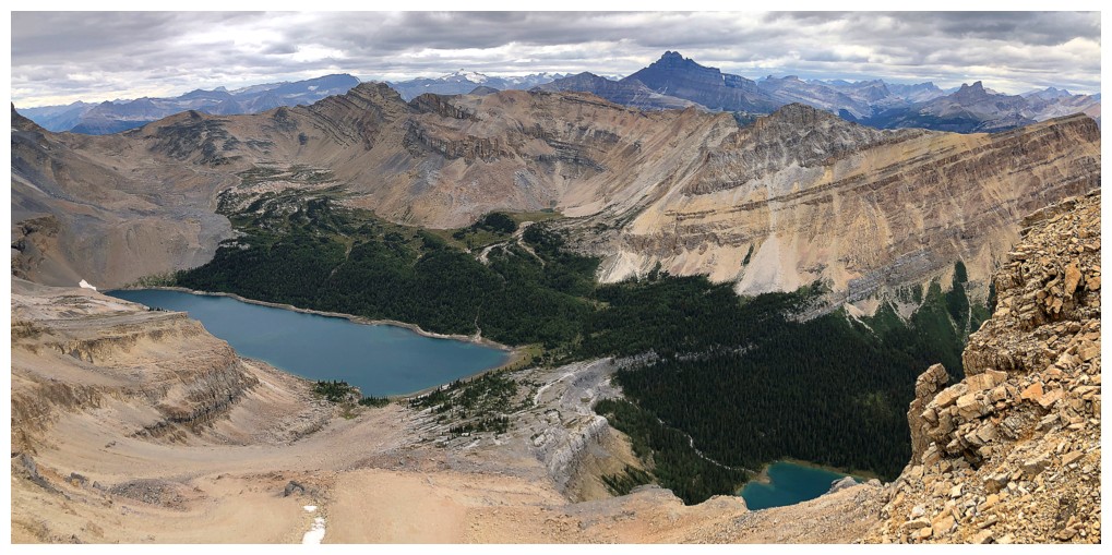
The Skoki Lakes at the left, Merlin Lake at the right, and a whole lotta' scariness in between!
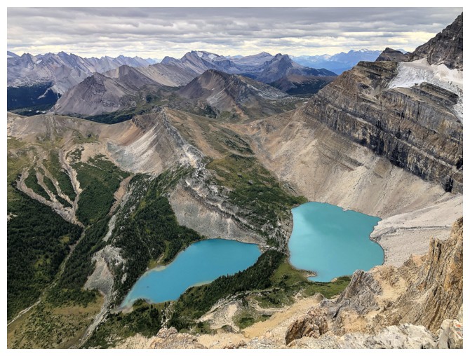
Full view of the Skoki Lakes
True summit ahead
Last look at the lakes
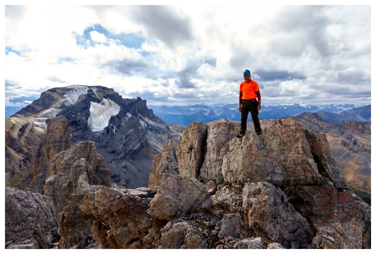
Summit. There was a small cairn nearby.
Jericho and Richardson
Mount Balfour
Mount Hector
Molar Mountain
Looking down on the summit of Skoki Mountain
Mount Douglas
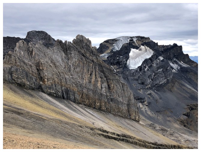
Mount St. Bride - now that's a scary mountain - the easiest route is a 5.10b climb
Part of the Ptarmigan Glacier
Views on descent
Doug!!! "Reunited and it feels so good"
Emptying my shoes of rock after a blissful reunion with Doug (photo by Doug)
Back above Castilleja Lake
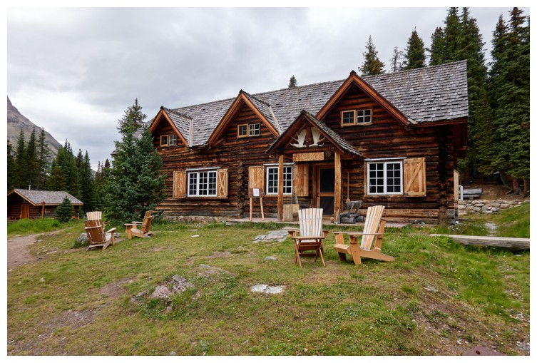
Skoki Lodge (photo by Doug)
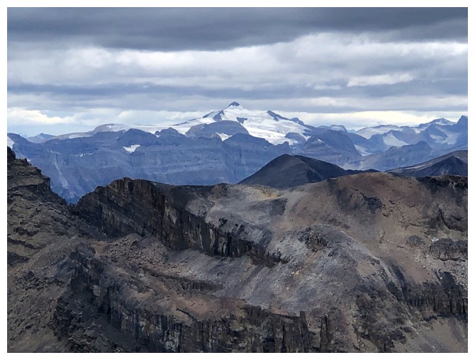
Packer's Pass Peak (blended into Ptarmaigan Peak), Ptarmigan Peak, and The Wall of Jericho
Doug takes the last fews steps to Deception Pass
Same for me (photo by Doug)
Descending from Deception Pass
Back at the west side of Ptarmigan Lake (photo by Doug)
Nothing but merciful downhill hiking and biking from here
The End
LOG