Mountain height:
2701 m
Elevation gain:
1100 m
Ascent time:
4:45
Descent time: 4:10
Scrambling with Kevin.
Though the summit of Junction Mountain can be
reached from the west, via Junction Creek, the north ridge appeared to offer a
little more interest, in that you would be able to gain elevation quickly and at
least get some decent views while negotiating the long ridge to the summit.
After fording both the
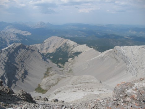
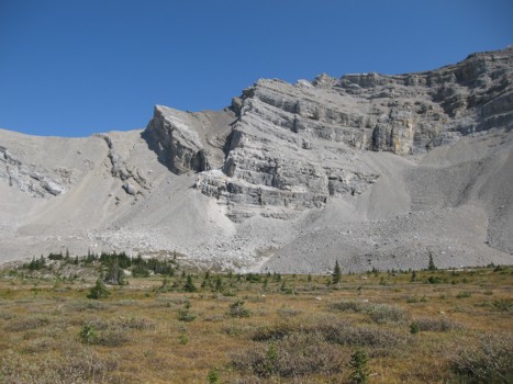
A lengthy, but very easy ridgewalk followed. Eventually we arrived at a much
more serious rock band that straddled the ridge and from a distance, appeared to
prevent access to the summit ridge. Up close, however, several potential routes
were revealed. Kevin and I went separate ways at this point. I took the high
road, in the form of an ascending scree ledge, in the hopes I could regain the
ridge just past the rockband. Kevin took a route lower on the mountain, where it
appeared he could gain a col east of the summit ridge and then ascend to the
ridge.
My route started well, but soon the ledge narrowed to the point where the
exposure on one side was a serious concern. I backed up a little and then headed
directly to the ridge up steeper, but more solid terrain. This worked well, and
very soon I was on the ridge. Kevin’s route didn’t turn out so well. The
scree on steep slabs was not conducive to a fun ascent and he decided to turn
around and check out the other side of the rockband. Meanwhile, I continued
along a very enjoyable ridge of hiking intermixed with moderate scrambling to
the summit.
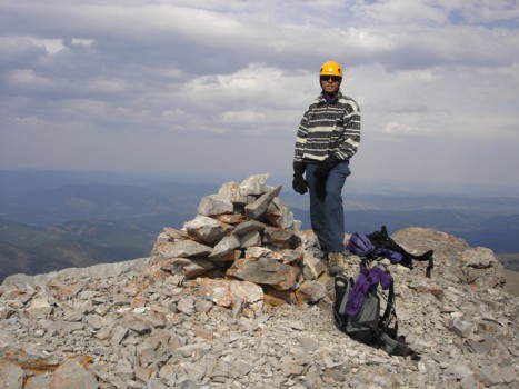
Kevin did manage to find a route around the rockband, but it was more circuitous
and thus he arrived at the summit much later. Fortunately, by that time, the
thick haze and clouds had time to dissipate a little and we enjoyed a pretty
decent summit view, highlighted by many of the distinctive, but unnamed peaks of
the
Returning the same way we came would have been
relatively straightforward, however, I really wanted to see the waterfalls just
off Junction Creek, as described in Daffern’s second volume of her Kananaskis
Country Trail Guide. This involved descending southwest into a beautiful cirque
below
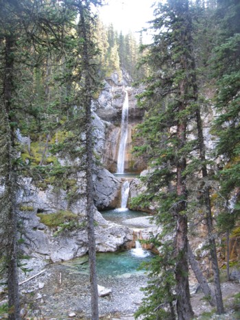
We accidentally passed the turn-off to the falls, but when we realized our mistake, I went back a short distance to see them. Not surprisingly, they were absolutely beautiful and well-worth the added time and distance. The remaining 7 km hike back to the car was long, but easy. Overall, the trip was a pleasant combination of hiking, ridgewalking, and scrambling, and boasted a wonderful variety of scenery and terrain.
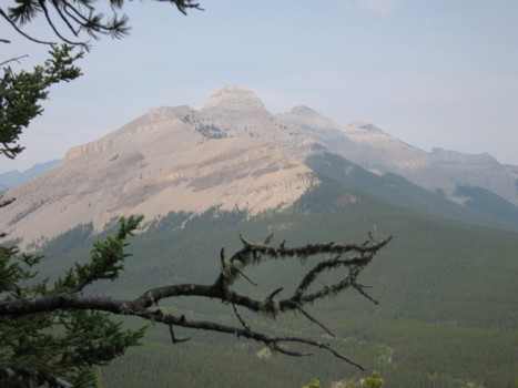
A hazy view of the east ridge of Mount Burns
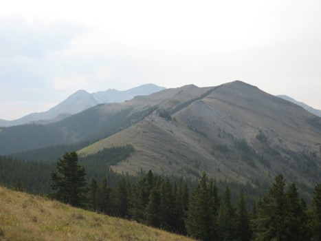
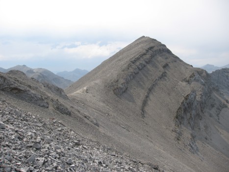
The long north ridge of Junction Mountain; summit in the distant centre
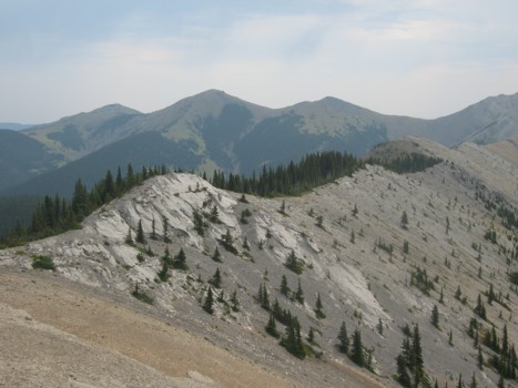
More of the ridge
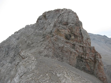
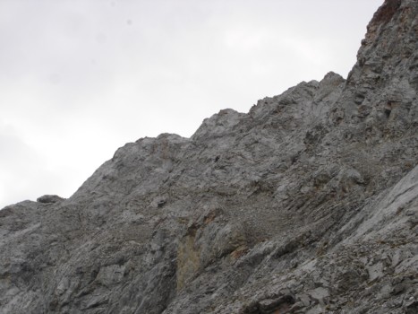
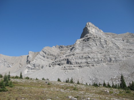
The crux; ascent route goes up the left side
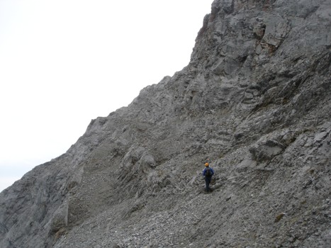
Heading towards the crux
Me ascending the crux (the little black dot in the middle)
The summit
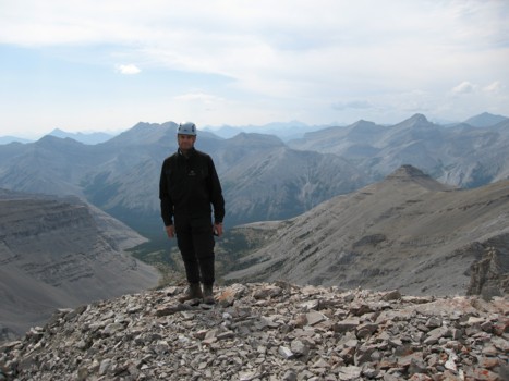
A summit view to the west
Looking to the north
Kevin at the summit
Me at the summit
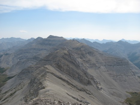
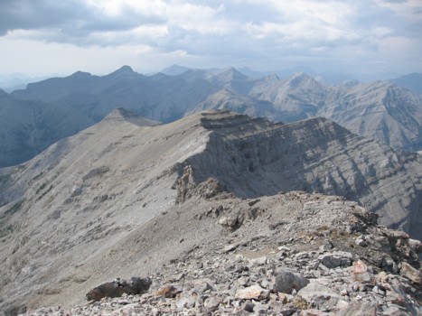
The south ridge and Mount Pyriform
The southwest descent route
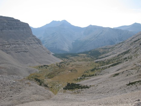
The haze and clouds finally dissipate, as we reach the meadows below Junction
Same as above
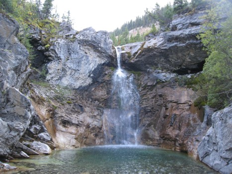
The first of many beautiful waterfalls along Junction Creek
Approaching the 3 tiered falls off Junction Creek
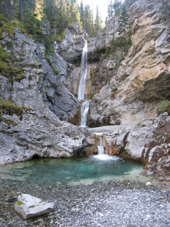
A closer look at the spectacular falls