Kent
Ridge (south) and Mount
Kent
–
Mountain height: 2,635
m (8,643 ft)
Elevation gain:
835 m
Ascent time:
5:50
Descent time:
2:30
Scrambling with Mark.
We quickly abandoned a planned attempt at Mount Black
Prince, when we arrived in the mountains to find several feet of new snow and
questionable weather conditions – overcast and snowing hard. After wasting
about an hour and a half, driving up and down Highway 40 trying to decide what
to do, we finally settled on Kent
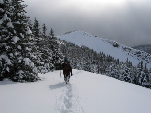
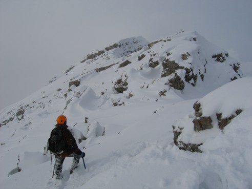
We parked along Highway 742, several kilometres south of the Black Prince parking lot and headed up one of the several creeks flowing down from the mountain. Initially, the snow was not a problem, however, higher up it was knee to mid-thigh deep and our pace slowed down considerably. Snowshoes would not have helped, as the snow was very light and powdery. The map cleared showed that the treeline was very low on the slope and so we became a little concerned as to our location when an hour up, we were still in the trees. Eventually, we did gain the ridge, where the trees, for the most part disappeared and we even got a few clear breaks.
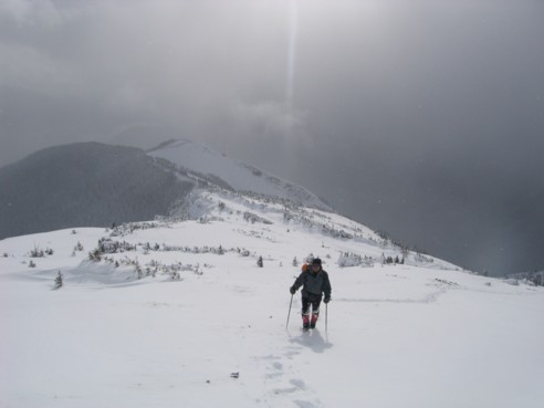
Walking the ridge was very pleasant. The views of the
Although the summit of Mount Kent wasn’t our initial objective, upon reaching the second highpoint, it came into view, and we simply had to continue. This required losing a fair amount of elevation and traversing below several cliff bands on dicey terrain. As long as the snow was deep, we felt quite secure, however, at times, only a thin layer covered steep, slabby terrain and a slip might have been serious. Time was also becoming a concern. Our slow ascent meant that we would have to find a more direct return route to the road, down one of numerous snow gullies, followed by a long hike back to the car.
At one point, we decided to play it safe and bail on the summit attempt. We started down steep slopes towards the road and it was then that nature played its usual evil trick on us and the sky cleared above the summit. It was easy to jam-out in miserable weather conditions, but blue sky is like The Apple in The Garden of Eden for us – the ultimate temptation. And that, I’ve decided, is our Achilles Heel: for Mark and I, the mountains are all about the breath-taking scenery and the magnificent views from the summit – as long as there’s a great view at the top, we’ll endure any scree slog, no matter how boring and unchallenging it may be (of course, with in addition of snow, today’s trip was neither).
We turned around and back up we went. It was a good
decision, and after about 30 minutes of carefully ascending the snow-covered
terrain, we were well rewarded with more great ridge scenery. Another 10 minutes
and we finally made a summit – I say “a” summit because even after close
scrutiny of the map, I can’t say whether this summit was the true summit.
There was definitely a point that was a little higher, further to the north,
but, oddly, the true summit of Mount Kent is much lower than several other points on
The descent was a little hairy at first. We went straight down from the highpoint, heading towards an obvious drainage. The slope was steep and once again, we relied on deep snow to keep us from sliding (falling) down the slabby terrain. Eventually, we got to the treeline, where the grade was much easier and safer. The snow-covered slopes and trees against the deep blue sky reminded us of why we so much enjoy winter trips. Once in the drainage, a seemingly endless slog alongside a creek brought us out to the road, where the car sat several kilometers away. I was pretty bagged at this point and mercifully, a group of skiers offered me a lift. We were only about 1 kilometre away from the car, at that point, but the ride was, nevertheless, greatly appreciated. Overall, a grueling, but very rewarding day out – it’s good to see the friendly face of winter again.
On the ridge, looking south
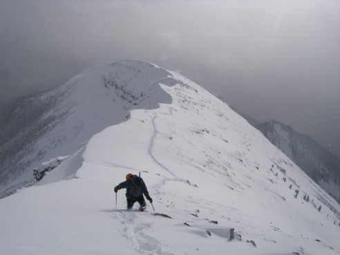
Mark, heading up to the first highpoint
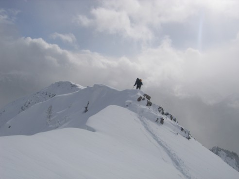
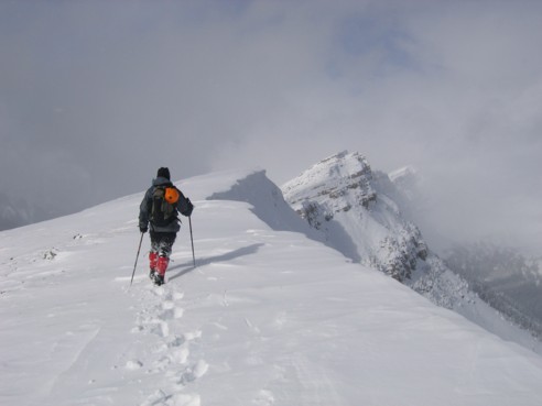
Negotiating the snow-covered and corniced ridge
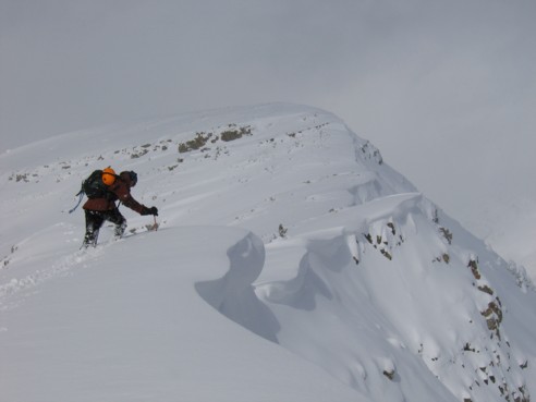
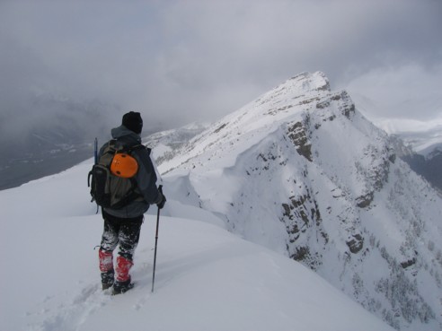
Trying to find out where the cornice begins; the second highpoint in the centre
Mark, wading through deep snow
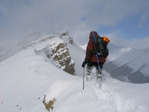
Looking towards the summit, just right of centre
A closer look at the summit and the intervening ridge
More of the ridge
Almost there. The summit we achieved is the point to the right; the highpoint at the centre is slightly higher
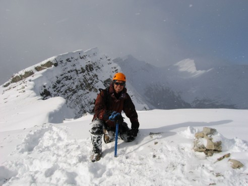
The sun finally comes out at the summit cairn; the peak, lit up by the sun, far in the distance, at the right, is Mount Inflexible; the little white specks in the picture are snow flakes (obviously!)
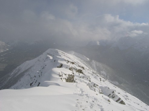
From the summit, looking back down the ridge
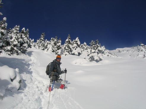
Trees, snow, blue sky, and Mark, as seen on descent