Mount
Mountain height:
2635 m
Elevation gain: 950 m
Ascent time:
3:30
Descent time:
2:45
Scrambling with Dan and Brad.
Almost two years ago to the day (Oct. 23, 2004), Mark and I ascended the south end of Kent Ridge in very snowy conditions, and then made our way north to what we thought was the true summit of Mount Kent. Since I really couldn’t think of anything else to do, this appeared to be a good opportunity to confirm that we really did summit the rather nondescript looking mountain. I was more than happy to have Dan and his brother-in-law, Brad (on his first scramble), along for the trip.
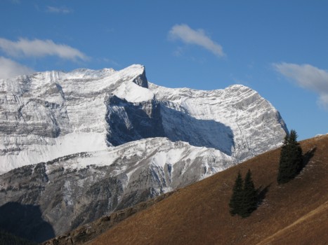
The three of us agreed to attempt a direct route to the summit, via one of numerous drainages running down the west face of the mountain. The route Mark and I had completed, while enjoyable, was also very long and we thought a steeper and more direct route might offer some decent hands-on scrambling. The route was terrific right from the start, as we ascended the drainage, enjoying some easy slab scrambling along the way. The entire valley was shrouded in thick clouds, but higher up, we turned around to see that we were actually rising above the low-lying clouds and suddenly a stunning view of snow-plastered Mount Black Prince filled the western panorama. The view to the west continued to improve exponentially, as we gained elevation and the forecast of snow flurries never did materialize. All three of us were ecstatic at the unexpected great scenery.
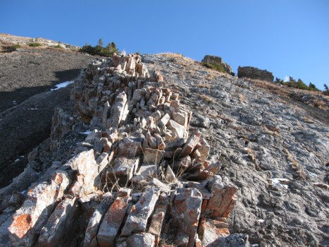
Soon, the drainage forked and though there appeared to be easier routes up to the left or right, Dan suggested we go straight up the middle. Great decision, Dan! The moderate scrambling here, up grippy slabs, was fantastic. Higher up, the terrain became steeper and the slabs, not so grippy. Dan took an interesting detour up and alongside an impressive outcrop of rock and had to jump down a small rockband, when his route became too dangerous.
At one point, a group of four mountain goats released a huge volley of rocks down the gully we were ascending. Luckily all three of us were at either side of the gully, at that point. We continued up, sometimes on the slabs and sometimes alongside them. Soon, the slabs gave way to scree, but the ridge was only a short distance away.
While the view to the west had been fantastic throughout
the ascent, we didn’t see anything to the east until we reached the ridge.
That view was equally spectacular, with the entire
From the ridge, the summit was only a few minutes away and
we plodded up to it in great spirits. Looking south along the ridge, we could
see that the point Mark and I reached two years ago was only a few hundred
metres away, but it was not the true summit. A relaxing and thoroughly enjoyable
summit stay amid superb surroundings followed. Unfortunately, a rather ominous
and obstinate cloud blocked the sun for our stay, but we were just happy that it
wasn’t overcast and snowing. Though dwarfed by nearby
Brad did remarkably well for his ascent. Some of the terrain was fairly steep and he didn’t have any problems on a few sections of mildly exposed slab scrambling. As well, he persisted to the summit even when he became tired (I certainly remember how I felt physically after my first scramble – it’s a miracle I went back for more!). Dan was all energy throughout the ascent and took other routes several times to seek out more challenging terrain.
For descent, we avoided the slabs by traversing around them on grassy slopes to the south. Getting back down to the drainage was tedious at times, but never difficult and hiking back down the drainage was again enjoyable and scenic. A terrific ascent with terrific company.
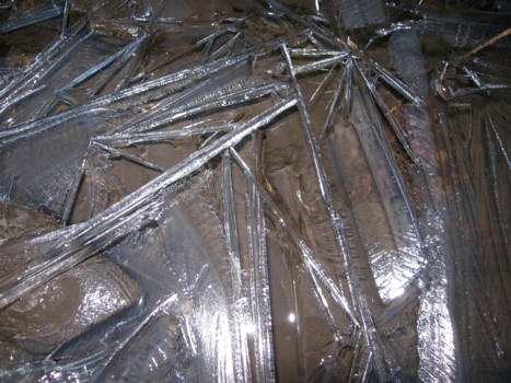
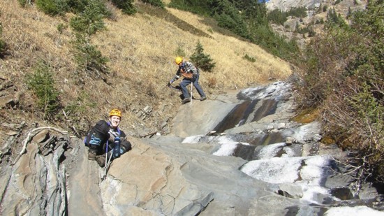
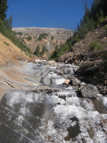
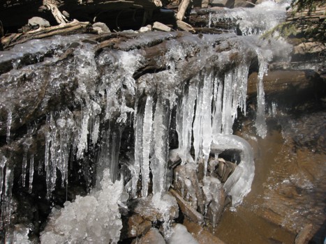
Ice in the drainage
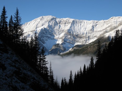
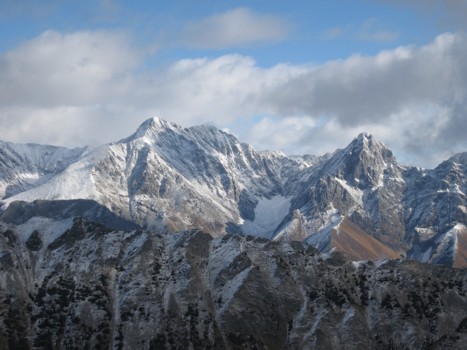
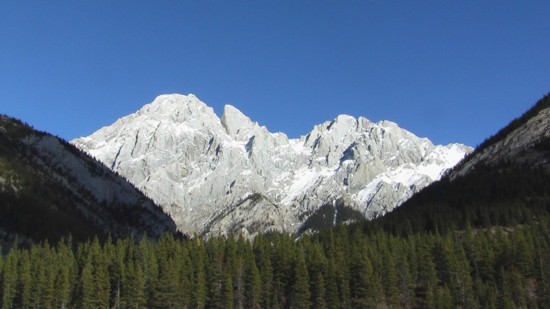
A first look at Mount Black Prince
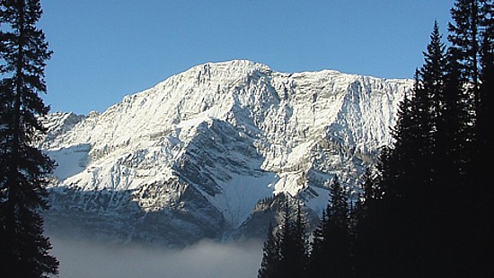
Another look at Black Prince (photo by Brad)
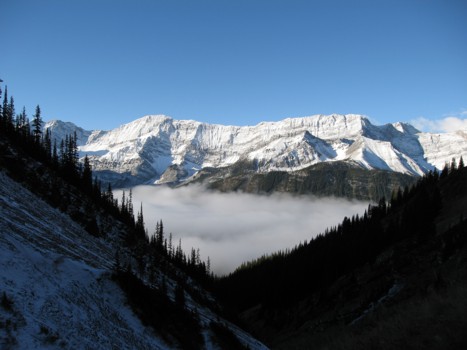
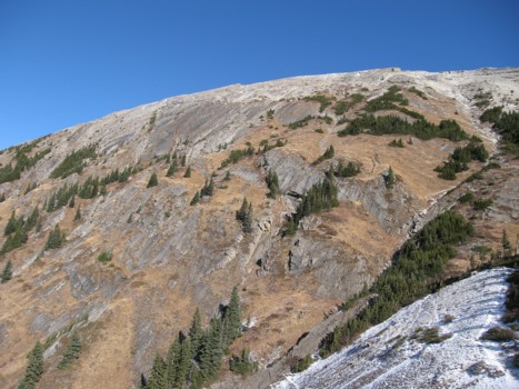
Higher up
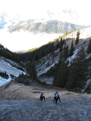
Dan and Brad start up the first slab
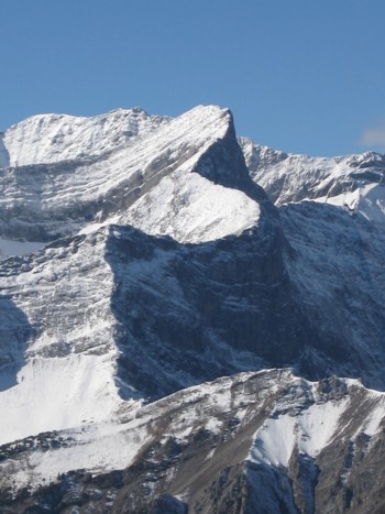
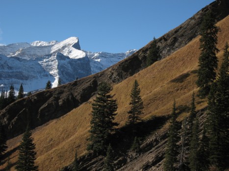
Mount French (behind) and Smith-Dorrien
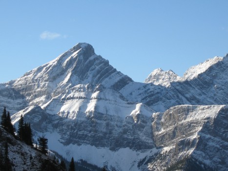
Mount Warspite
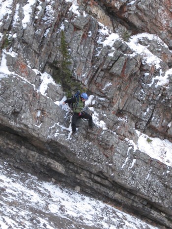
Dan (little black dot in the centre of the photo), tackles a steep outcrop of rock
Dan prepares to jump down a rockband to easier terrain
More slabs
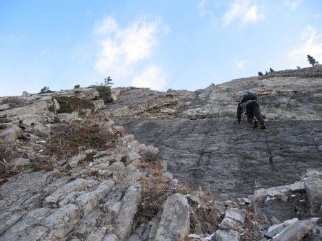
Dan tackles another slab
Even more slabs higher up
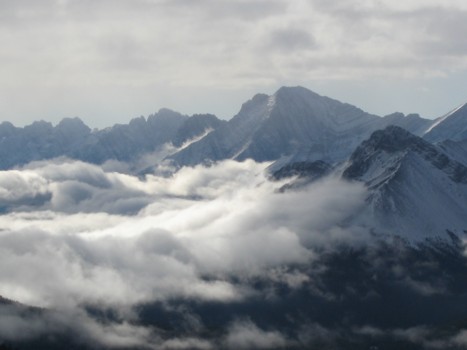
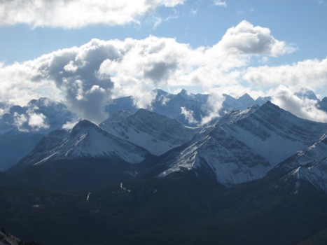
The low clouds start to dissipate around the Kananaskis Lakes area
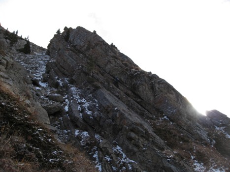
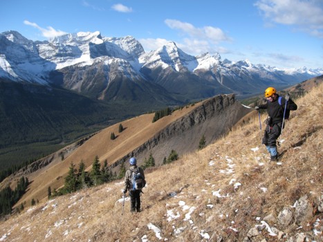
Approaching the ridge
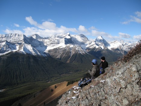
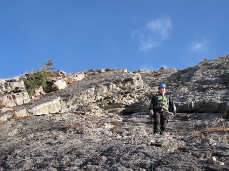
Dan and Brad take a well-deserved rest before the ridge
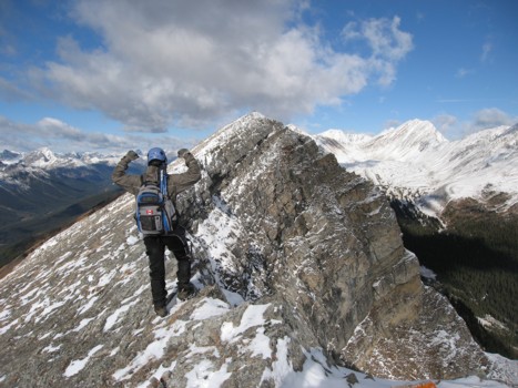
Dan on the ridge, with the summit a short distance ahead
Mount Evan Thomas (left) and Packenham (right)
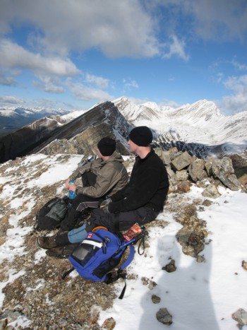
Dan and Brad at the summit
Looking southwest
Looking north along the ridge; Mount Inflexible to the right
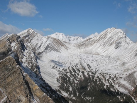
The contours of Mount Smith-Dorrien
Descending grassy slopes
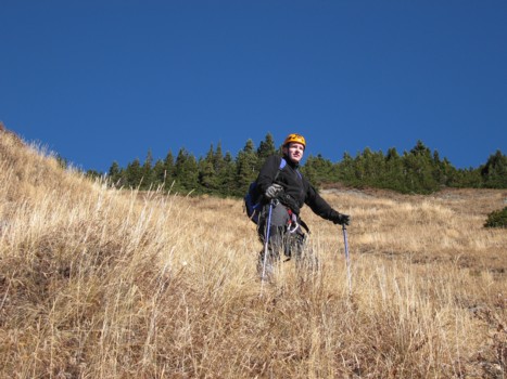
Brad, looking very GQ
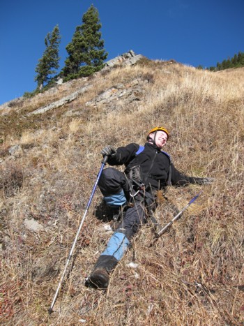
Brad, looking not so GQ, after he had a little fall
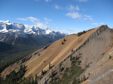
Looking back at the ascent slopes
The contrast of clear slopes and snowy slopes
Sane as above, with Smith-Dorrien
Brad and me descending the drainage (photo by Dan)
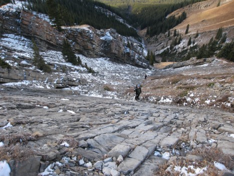
Looking up the drainage at the ascent slopes
More drainage scenery
Mount Blane (photo by Dan)