April 8, 2017
Mountain
height: 2477 m
Elevation gain: 1035 m
Roundtrip time:
10:45
Scrambling
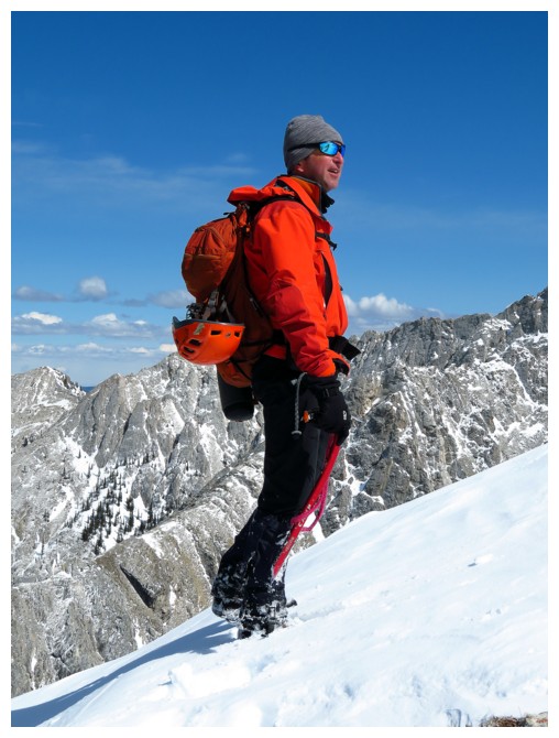
with Raff, Scott, Alison, Cody and Keith.
After a
breath-taking and incredibly rewarding trip up Lakeview Ridge and
Rogan Peak a week earlier, with Scott, Brad and Leon, this trip was
guaranteed to be anti-climactic – so I thought!
 Unofficial Lightning
Peak lies south of Thunder Mountain and north of Centre Peak. Bob
Spirko
pioneered the route up this significant peak.
Surprisingly, it is the second highest point along the incredible 30
km length of the Centre Peak massif, exceeding both Thunder Mountain
and Caldron Peak in height (the other official peaks on the massif).
Unofficial Lightning
Peak lies south of Thunder Mountain and north of Centre Peak. Bob
Spirko
pioneered the route up this significant peak.
Surprisingly, it is the second highest point along the incredible 30
km length of the Centre Peak massif, exceeding both Thunder Mountain
and Caldron Peak in height (the other official peaks on the massif).
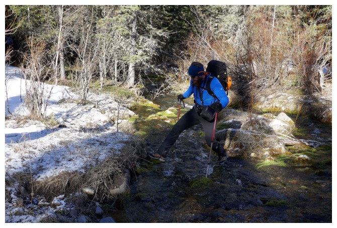
Joining
me were my old friend Raff, newer friends Alison and Scott and brand
new friends Cody and Keith. The six of us (and good thing we were a
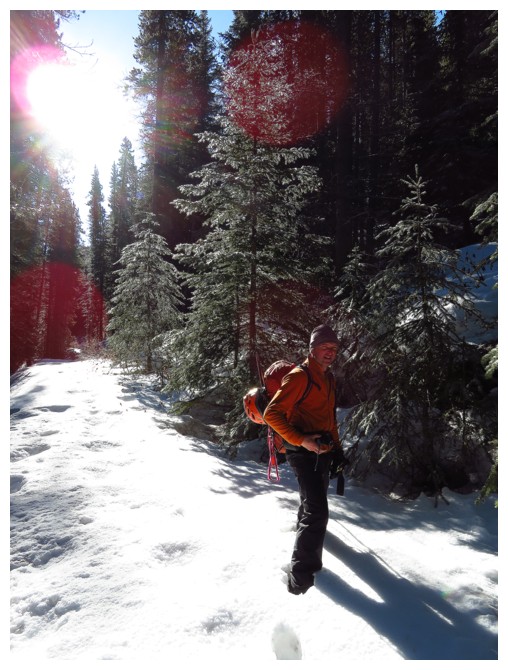
large group) left the parking area at 9:10 am, walking the very icy
approach trail – in normal weather years, I'm sure this trail would
be completely snow-free by April. Turning onto a side trail after
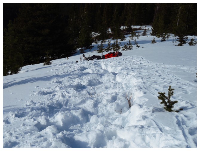
crossing Pocket Creek, we would quickly encounter deep snow and what
was to become the theme of the day – post-holing of Biblical
proportions! (hence the need for a big group).
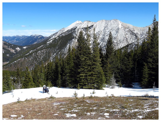
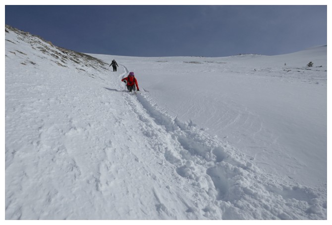
For a front range peak
in April, the depth of the snow was shocking. Fortunately, we were
able to take turns and persist through what seemed like endless
kilometres of waist-deep snow, but in fact was only about 2 km! On
several occasions we resorted to crawling across the snow, with
varying degrees of success. Nevertheless, even with the tribulations
of the initial ascent slopes, all were in great spirits and motivated
to continue on.
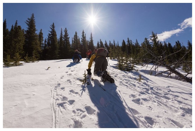
 Once out
of the trees, the ascent took a very favorable turn for the better.
Although the west side of the mountain was still plastered in snow,
the depth was that snow was far more manageable to negotiate through
and contributed to not only making the ascent easier, but also
incredibly scenic. We slogged our way up the the first summit,
enjoying some fierce cornice scenery and later a group of sheep
crossing the dangerous looking upper slopes. As well, the predicted
“iffy” weather never materialized and we continued up, under
beautifully blue skies.
Once out
of the trees, the ascent took a very favorable turn for the better.
Although the west side of the mountain was still plastered in snow,
the depth was that snow was far more manageable to negotiate through
and contributed to not only making the ascent easier, but also
incredibly scenic. We slogged our way up the the first summit,
enjoying some fierce cornice scenery and later a group of sheep
crossing the dangerous looking upper slopes. As well, the predicted
“iffy” weather never materialized and we continued up, under
beautifully blue skies.
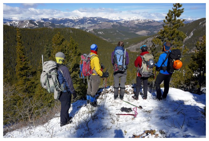
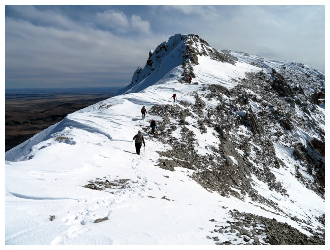
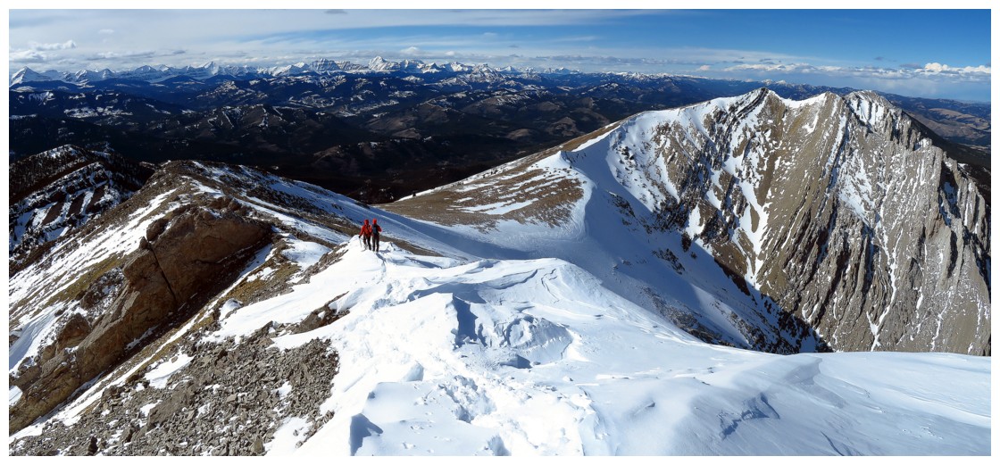
From the
first summit, the true summit of Lightning was quite distant, however
the trip there looked really cool – the steep, snow covered, east
face of the massif appearing somewhat Himalayan, just like Rogan
Peak, a week earlier! And indeed, the traverse
was as cool as it looked and more!
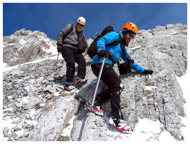
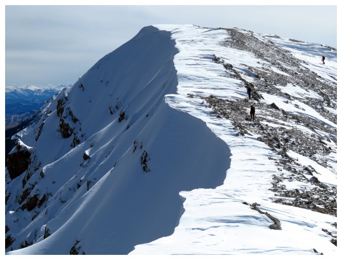
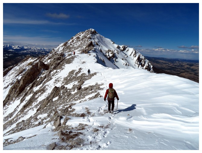 After
dropping down to a low col, we geared up (crampons or micro-pikes and
ice axes) and followed the super interesting ridge towards the
summit. The first section was the most “spicy” – a slip down
the east side would have been intense, given the snow conditions.
Fortunately, this section was straightforward and terrifically
photogenic. We stopped frequently to capture the magic! The next
section could easily be scrambled but there was a bypass route on the
west side.
After
dropping down to a low col, we geared up (crampons or micro-pikes and
ice axes) and followed the super interesting ridge towards the
summit. The first section was the most “spicy” – a slip down
the east side would have been intense, given the snow conditions.
Fortunately, this section was straightforward and terrifically
photogenic. We stopped frequently to capture the magic! The next
section could easily be scrambled but there was a bypass route on the
west side.
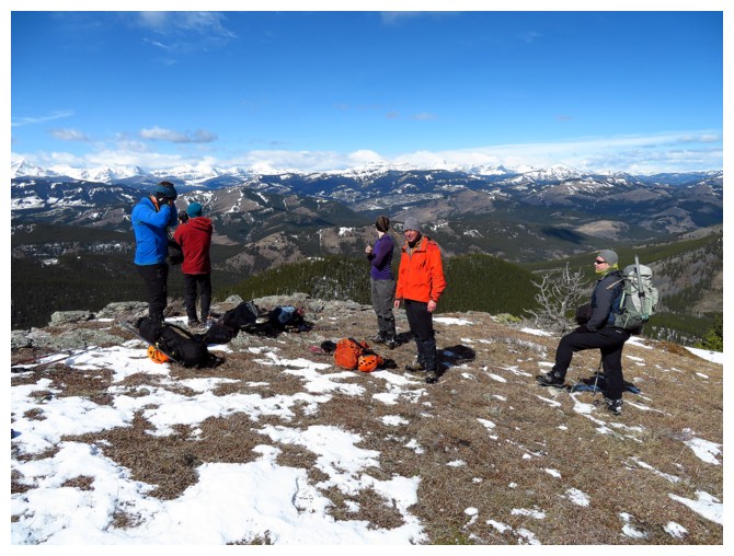
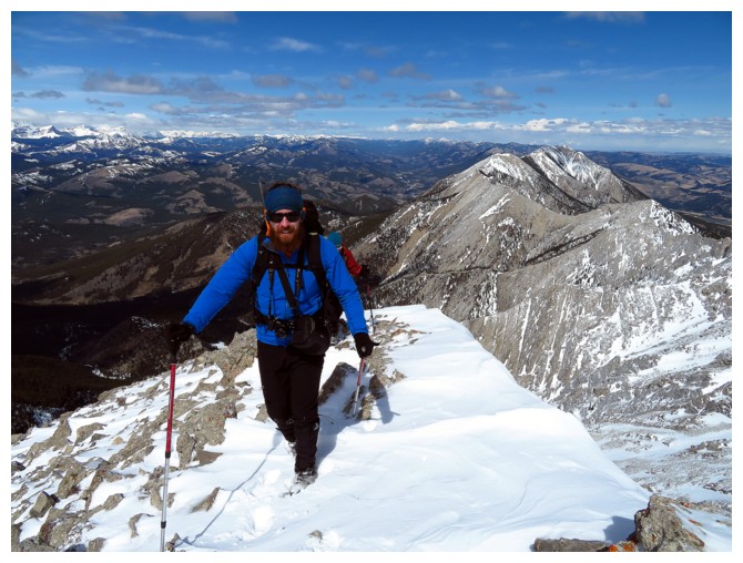
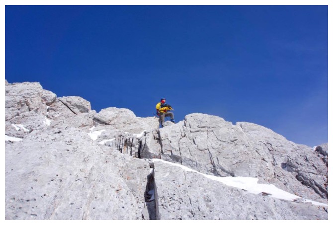
6
hours and 20 minutes after leaving the parking lot, one by one, we
arrived at the summit. Our entire group seemed pretty thrilled to
have achieved this summit, in fairly challenging conditions.
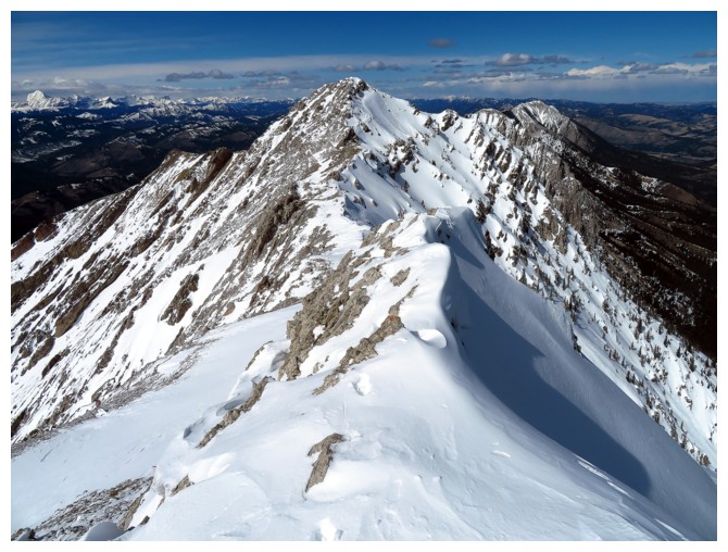
Although
years earlier I had visited the summit of Centre Peak, the highest
peak on the massif, I found the summit view from Lightning Peak to be
far more enthralling (perhaps in part, due to the fact that Mark and
I had been brutalized by the wind on the summit of Centre and
therefore didn't stay long to take in the view). From both peaks, you
can see from Chief Mountain and Mount Cleveland in Glacier National
Park, Montana, across Waterton, The Castle, Crowsnest and well into
Kananaskis. And of course the prairies to the east - a unique and magnificent panorama.
Although
long (exactly 4 hours, as Keith predicted), the descent was
excellent, with another round of photo opps on the amazing ridge, a
section of almost (!) glissadable snow, and general ease of travel
through the tough sections we had encountered on ascent. Along the
way, Raff patented a new “rolling” descent technique, whereby he
actually rolled down a small section of the mountain – very
impressive!
The
day ended with a well-deserved stop in Longview, for salty food and
beer (coffee for me, as I was driving and exhausted from the trip).
Another unexpectedly outstanding day in the Rockies and some new
friends – awesome!
 Scott leaps across Pocket Creek (photo by Raff)
Raff breaks trail to reach the ascent slopes

Still on a good trail before the intense post-holing begins! (photo by Raff)
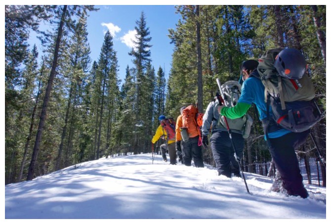
Here we go! The snow wasn't too deep here but became increasingly deep and unsupportive (photo by Scott)
Stopping to take in the view to the northwest (photo by Raff)
And then we crawl! (photo by Cody)
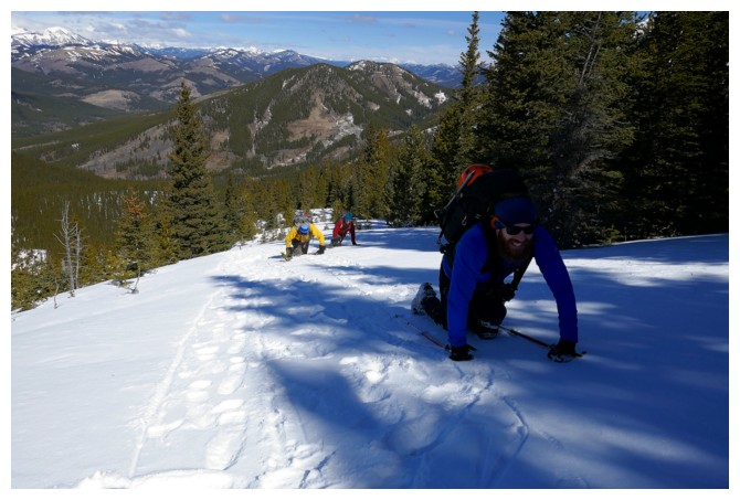
Better keep a positive attitude when you have to resort to this mode of travel! (photo by Raff)
Keith crawls through the final section of deep snow
Finally onto drier terrain
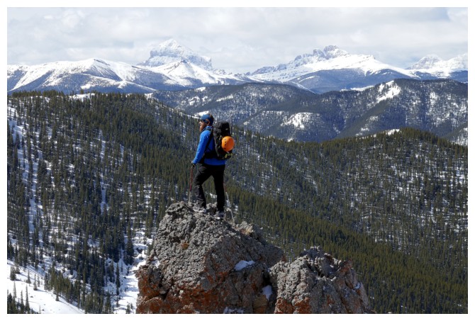
Adventurous
Scott detours onto a very cool pinnacle of rock. Crowsnest Mountain and
The Seven Sisters in the distance (photo by Raff)
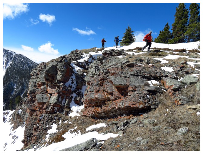
More interesting terrain
Cody checks out the cool rock (photo by Raff)
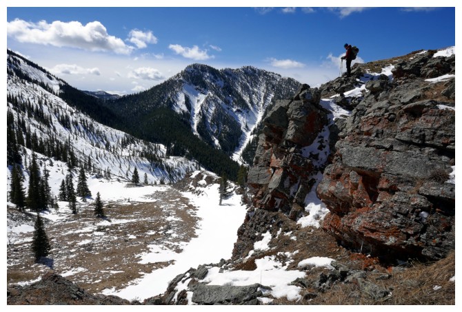
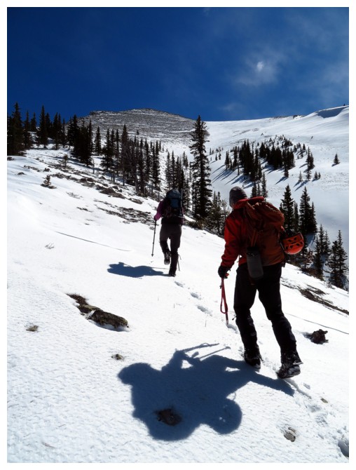
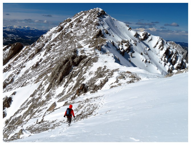
Time to check out the main ascent slope to the ridge (photo by Raff)
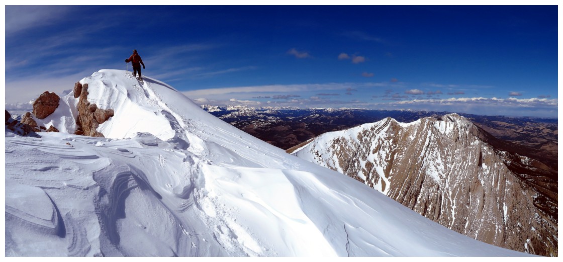
Our route went up the left skyline
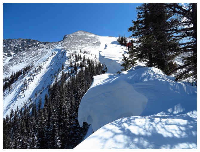
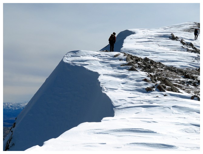
Pretty big cornices for this time of the year
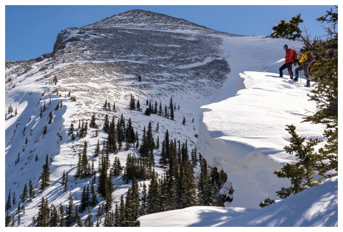
Raff and I check out the cornice (photo by Cody)
Scott, Cody and Raff are enjoying it so far
A small rock step to descend (photo by Alison)
Alison and Raff heading up
GQ Raff
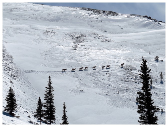
A group of sheep crossing a steep snow slope
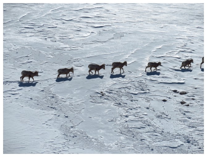
Close-up
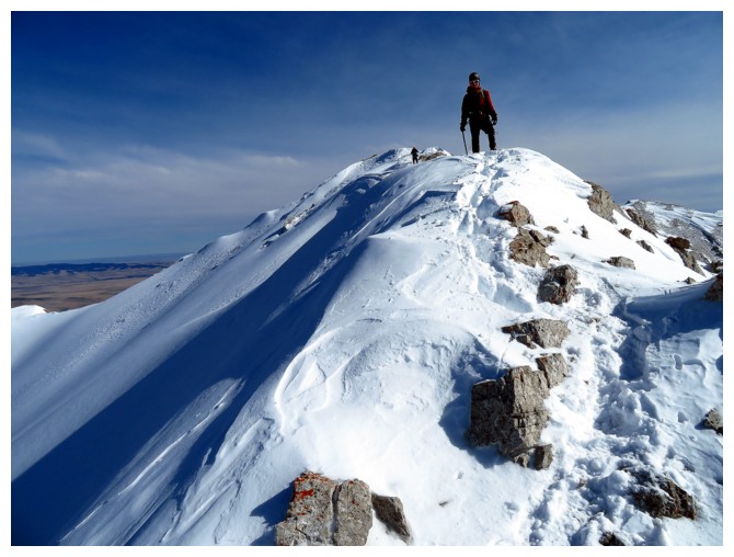
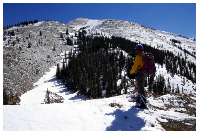
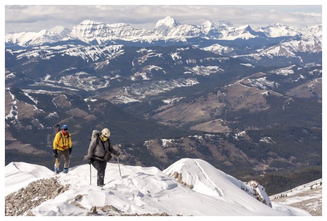
Scott arrives at the first summit. Thunder Mountain in the background
Alison descending from the first summit
Looking back at the first summit
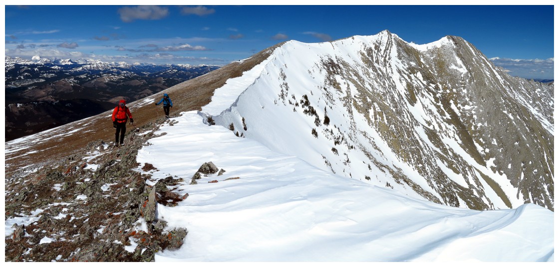
Looking forward to the next section of the ridge (photo by Alison)
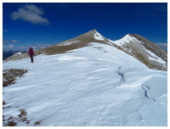
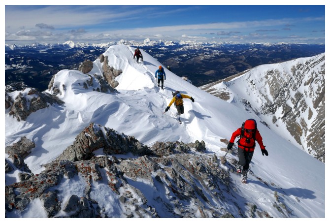
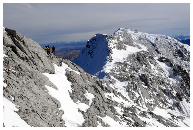
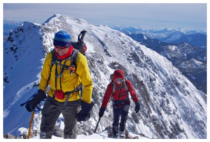
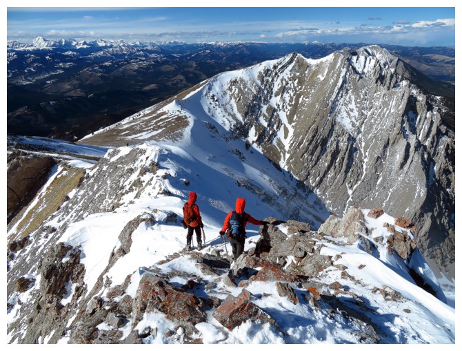
Heading up to more challenging terrain
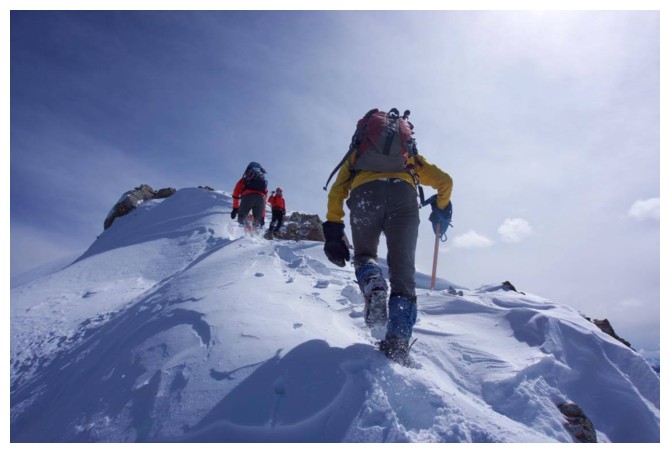
The snow made this section super scencic
Same as above (photo by Raff)
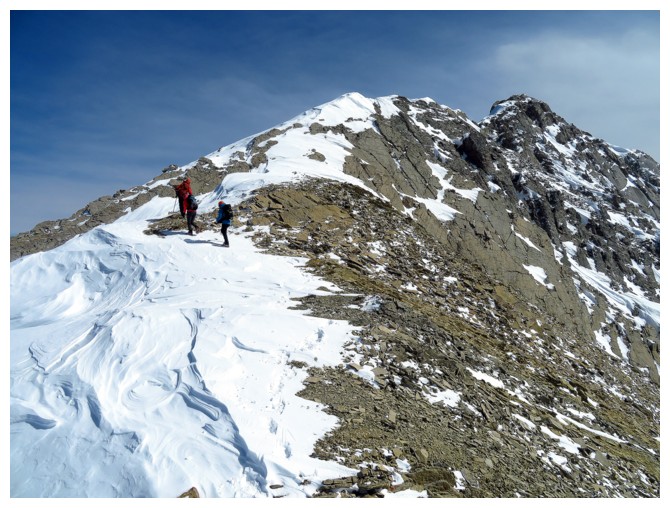
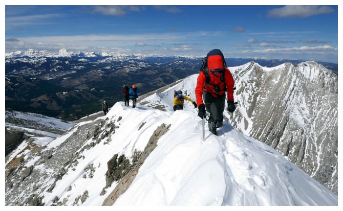
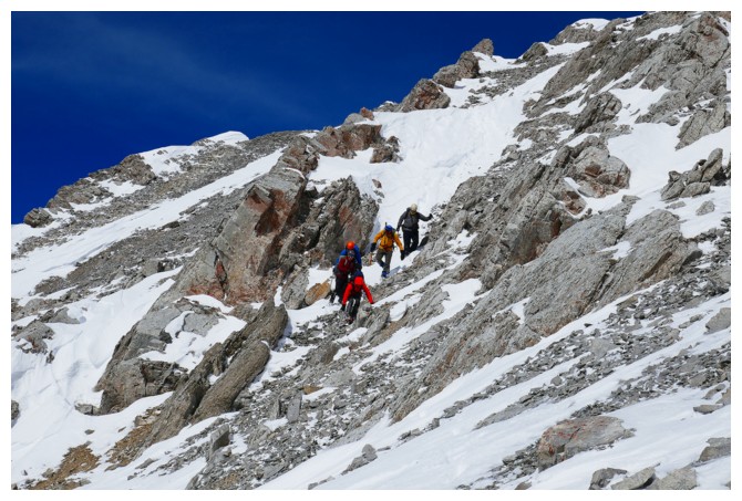
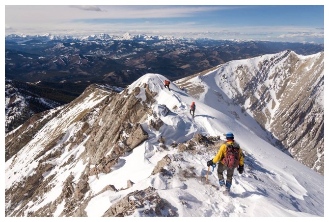
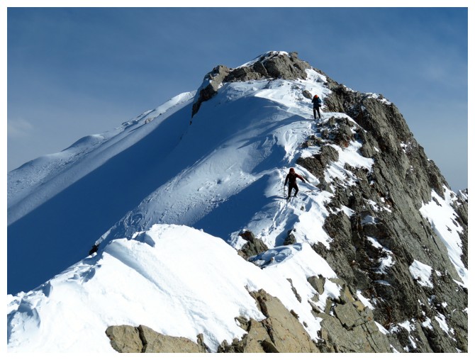
Cody descends one of my favourite sections of the mountain
Keith does the same
Four of us on that section (photo by Raff)
The view of Tornado Mountain (centre) was great (photo by Cody)
The colourful group descends (photo by Raff)
Same as above (photo by Raff)
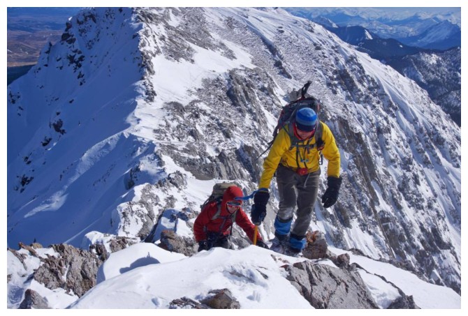
Careful foot placements
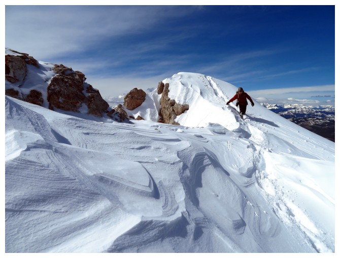
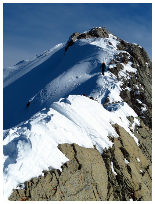
The next section of the ridge can be bypassed on the right side
Or you can stay on the ridge throughout (photo by Scott)
Looking back at the ridge. Bypass route is down to the left
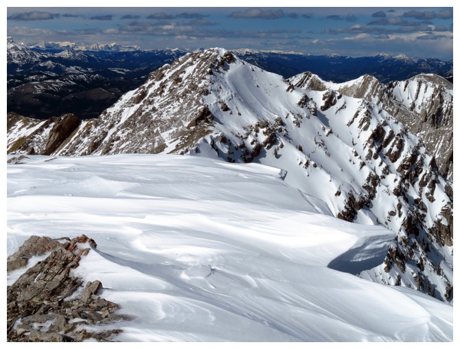
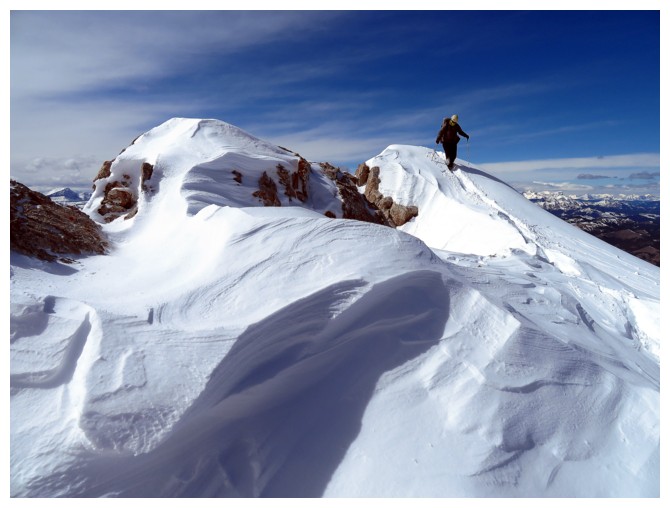
Still some big cornices remaining
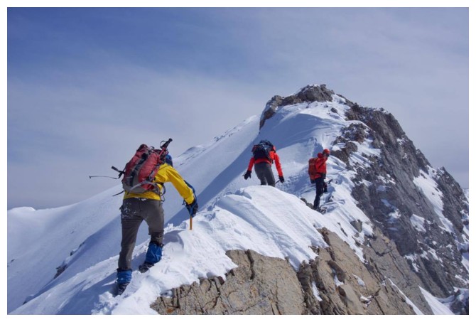
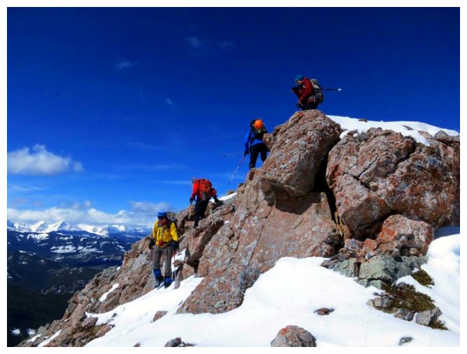
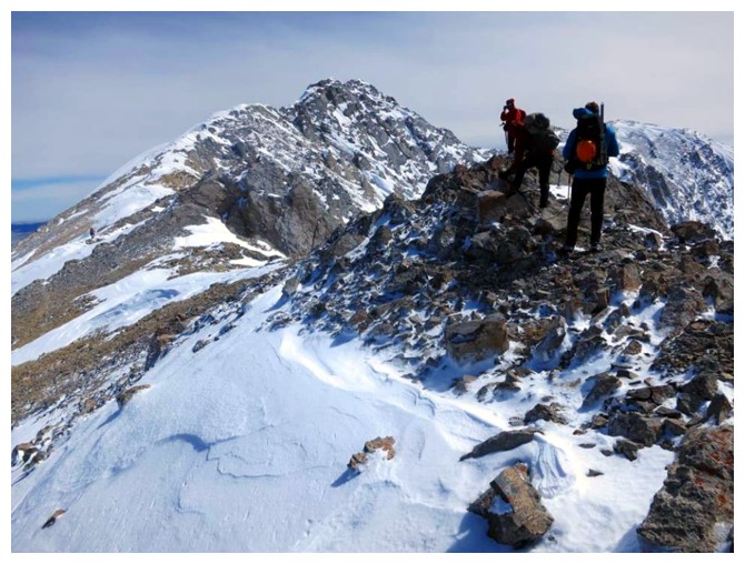
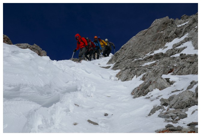
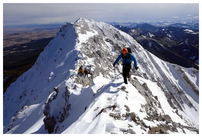
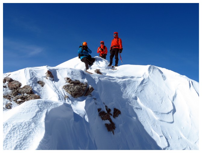
Three of our group approach the summit
Same as above
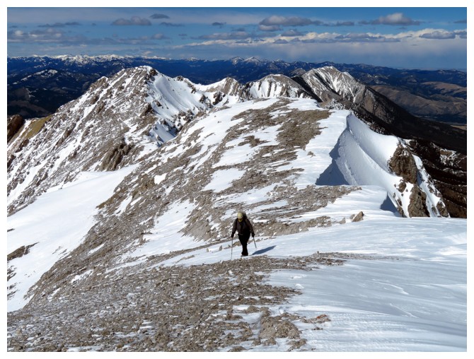
Keith completes the last section
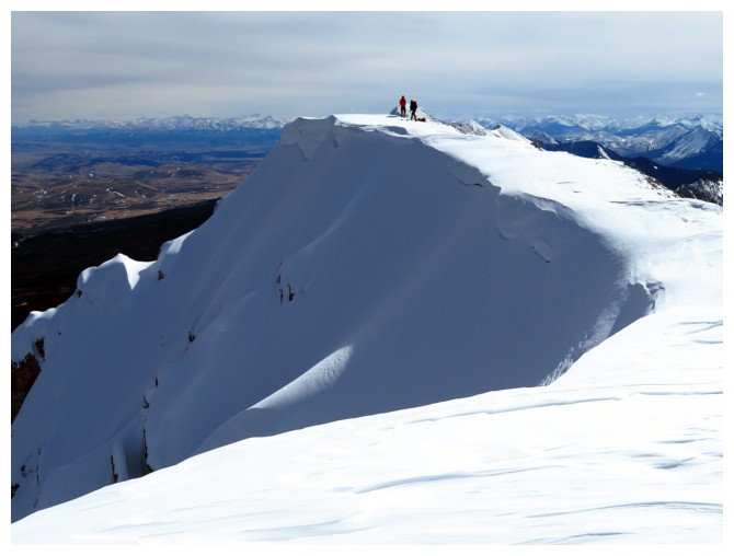
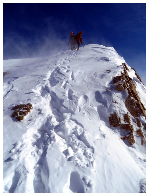
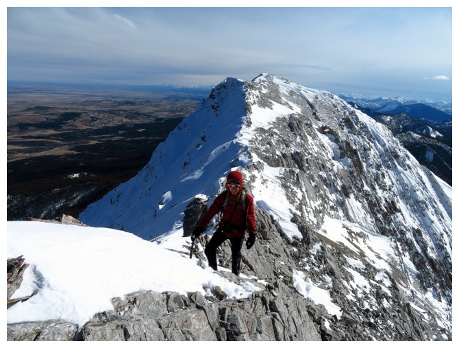
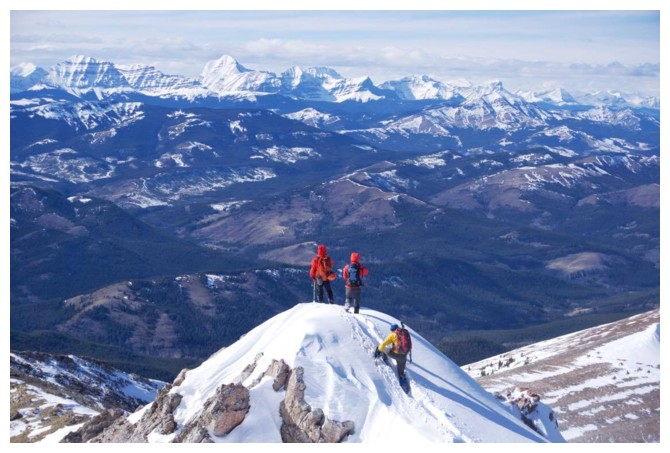
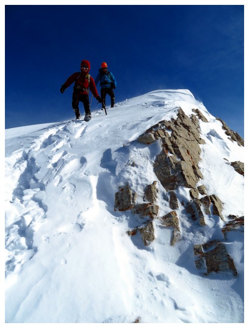
Two at the summit. The drop down the east face is terrific
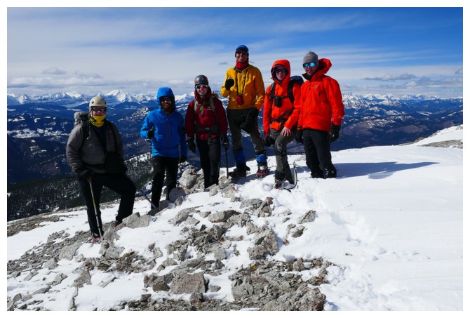
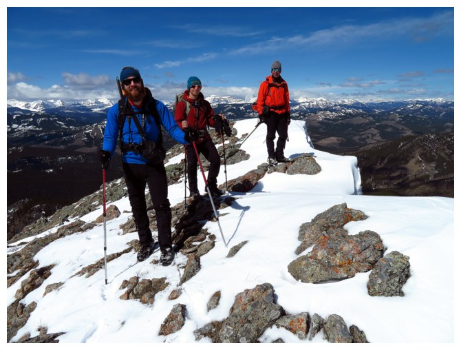
Keith, Scott, Cody, Andrew, Alison, and Raff - a happy group of six at the summit (photo by Raff)
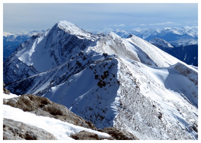
The view south. Centre Peak at the left
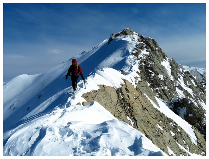
Scott heading back
Alison heading back
On the return trip a few of us took a sightly different route, sticking more to the ridge (photo by Raff)
Cody on that route
Scott back on the ridge
No place we'd rather be!
Scott, Alison, and Raff wait for us at a highpoint
Approaching that cool section on the ridge (photo by Cody)
Enjoying the view again (photo by Scott)
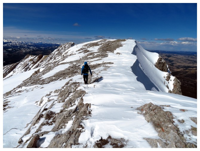
Descending the ridge was as fun and scenic as ascending it
Cody and Scott descending one of the steeper sections
Same as above
All done?
.... not quite!
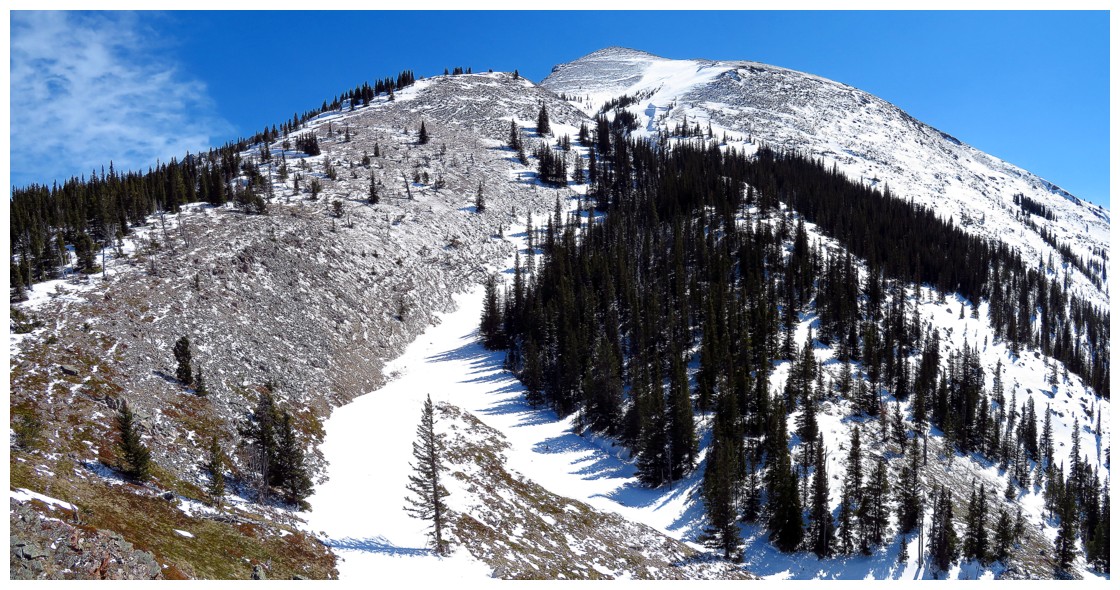
One more comprehensive look at this beautiful mountain
Alison glissades down the mountain, with little success
Raff rolls down the mountain, with surprising success!