GR308352
(ridge west of The Wedge)
–
Mountain height:
2,419 m (8,157 ft)
Elevation gain:
830 m
Ascent time to GR308353:
Roundtrip time to GR308352:
Descent time from GR308353:
Mountaineering with Mark.
The closure of Highway 742 (Smith-Dorrien highway), due to heavy rains, thwarted our plans to make an attempt of Mount Lougheed and so we returned to Limestone Mountain and The Wedge, to see to we could further the progress made last week on the ridge between the two mountains. There was also some talk of finding an easy climbing/difficult scrambling route up west side of The Wedge, but first we would have to gain the small summit block beneath the mountain.
To achieve the upper section
the of ridge as quickly as possible, we used last week’s descent route – a
tedious slog up mixed terrain of grass, rubble, scree, and slabs. The scenery
was, nevertheless, decent, with impressive views of the west face of The Wedge.
Higher up, we became somewhat concerned about the amount of new snow on the
mountain. We expected to be in for some fairly exposed scrambling and snow and
wet rock was the last thing we needed. The dropping temperature also put a
damper on our chances of making it much further than I had done previously. By
the time we reached the ridge, we were wearing toques, 3 layers of clothing, and
winter gloves.
It took us just over 2.5 hours to reach last week’s highpoint where, after a
brief rest, we started up the steeper terrain towards the summit plateau below
The Wedge. The fresh snow was an issue, right off the bat. Though, the terrain
was not terribly steep at the beginning, and a slip would have been unlikely,
the exposure on the right was enough to keep us on our toes and go one at the
time with a belay. We bypassed the route I chose last week, in favour of a less
direct but also less steep route around the right side of the summit block.
Further compounding increasing anxiety about the route, we were struck by the
incredible looseness and instability of the rock. Regardless of how “bomber”
it looked and/or felt, every handhold and foothold had to be double and triple
checked. We made very slow, but consistent progress, traversing back and forth
across and up the summit block, until we finally reached what could be called
the summit ridge. I was already a little unnerved about descending what we
had just come up, but the summit ridge took that to a whole new level. It was
very narrow, very loose, and severely exposed on both sides. With a good belay,
I was able to ascent a short rockstep that I hoped would take us easily to the
summit plateau, in front of The Wedge. Unfortunately, I reached the top to
discover that to get to the plateau, not more than 20 m away, would require an
exposed downclimb (or perhaps rappel), another short, but quite steep upclimb,
and then another short downclimb right before the summit. I was fairly confident
that with a belay, I could get over to the summit, however, getting back via the
same route appeared to be far more problematic. I sat there for about 10 minutes
trying to look for a solution, but nothing came to me.
At this point, numerous factors suggested a retreat was in order: 1. a thin
layer of wet, slippery snow on the route; 2. the uncertainty of the descent
route; 3. I was climbing with my winter gloves on; 4. but most of all, the
looseness and unreliability of the rock – very simply, it was hard to trust
anything when setting by belays/rappels. After a few minutes of waffling back
and forth, we chose to retreat, with the intention of trying again in better
conditions and with more climbing gear. I spent much of the descent wondering if
we should have gone for it, but after much discussion we both agreed that
“chickening out” was the right decision.
Descending the tricky terrain
of the summit block was actually far easier than we expected. With dry
conditions it would have been very easy. We used our ascent route for the
remainder of the descent, choosing to re-ascend a small portion of
We came up a little short of the summit, but both decided it a successful day
– after all, we’re still around to try again some day.
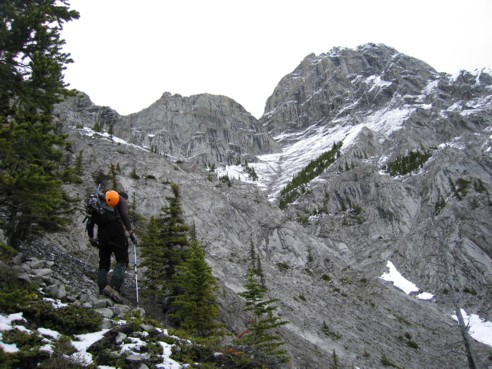
The lower of ascent slopes; The Wedge is at the right and the point we were aiming for is the summit block left of The Wedge; we made it to the highpoint at the far left of the block, but couldn't make it onto the summit plateau
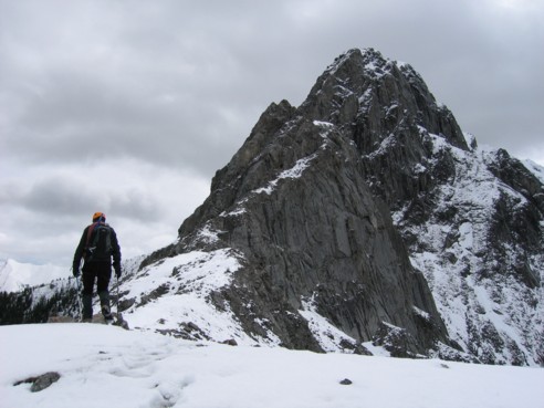
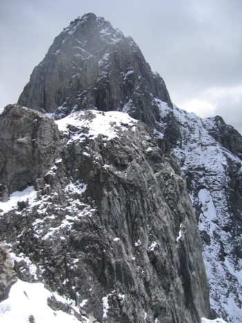
On the ridge again, looking up at our ascent route and The Wedge behind
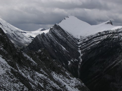
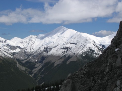
The north end of Opal Ridge (right) and Grizzly Peak in the distance (left of Opal)
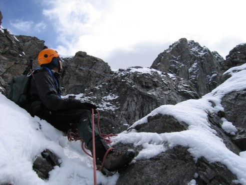
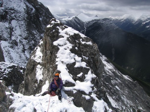
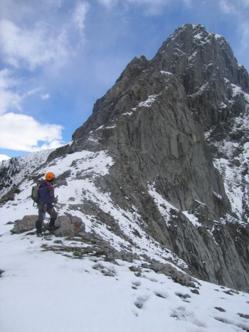
Sitting at a notch to survey the route ahead
Mark belays me up the next section from the notch
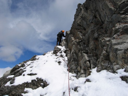
Though a slip here would have been unlikely, we felt it would be prudent to set up a belay
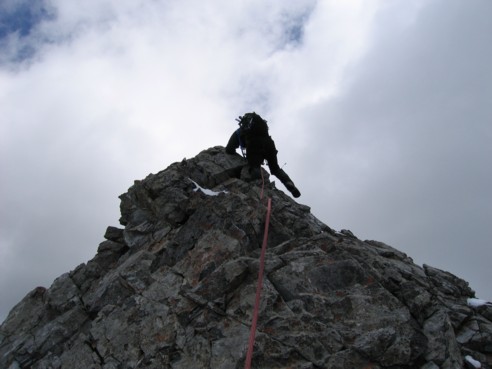
Scrambling up the final section before we hit the impasse
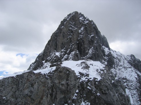
Looking over to the summit plateau and the imposing summit block of The Wedge, from our highpoint
Another look at The Wedge and the vertical walls around it
The unnamed ridge, south of Mount McDougall, that I failed to reach earlier this year
Looking back at our ascent route