Loaf Mountain
attempt –
Mountain height: 2,639 m (8,656 ft)
Elevation gain: 1,120 m (turned around after 740 m)
Roundtrip time: 6:25
Scrambling with Linda, Bob, and Dinah.
Although this trip easily cracked the top 5 of “Crumbiest
Weather Days”, all was saved by the good company and pleasant scenery. After
trying to hook up for a trip with Bob and Dinah for over a year, I finally had
the pleasure of meeting them, and along with Linda, we started up the Spionkop
Creek Trail towards oddly named
The weather was rather inclement from the start and steadily deteriorated throughout the trip. Unfortunately, we were also victims of outdated information, regarding the start of the trail, which now begins behind a locked gate. This added about 4.7 km of easy trail hiking to the trip (a perfect trail for a bike approach). Given that the surrounding mountains were engulfed by thick, low-lying clouds, the scenery was still surprisingly interesting and would have been tremendously colourful and vibrant on a clear day. Several beautiful waterfalls along the way, added immensely to the hike.
As we slowly gained elevation, we suddenly found that we were no longer below the clouds, but in them, and visibility was dramatically reduced. I was going to say that our destination disappeared in the clouds, but in truth, we didn’t actually see the main mass of the mountain at all throughout the entire day, due to the weather. Our initial plan was to hike around to the west side of the mountain and then ascend west slopes, however, deep snow covered the treed slopes around its base and so we had little option, but to try what was available on the east side. With the limited visibility, this was a “shot in the dark” at best, however, expectations of making the summit were pretty low at this point, and the attempt became more of an exercise in route-finding in low visibility and seeing how far we would persist in the worsening weather conditions.
The first scree slope was easily ascended and an occasional clearing revealed some splendid rock scenery. From there, we started up steeper snow slopes, looking for a weakness in the rockband that was only slightly visible, a little higher up. This was where the visibility really took a turn for the worse and even though I was barely 50 m in front of the rest of group, I could hardly see them. We continued step-kicking up the snow-covered slopes until we came to another rockband. The terrain was starting to get fairly steep, at this point, and our situation was made all the more eerie by the fact that we could see nothing of the slope below us except a wall of dense fog. Add to that constant rainfall and you have less than desirable ascent conditions.
We all made it to the rockband and I went in search of the route to circumvent it. I found one that looked quite feasible….that is, on a warm, sunny day, and minus the dense fog, constant rain, and unstable snowpack. Turning around here was an easy decision for us all - dicey conditions, no summit view, and no guarantee that we would be able to get anywhere near the summit – it was a “no-brainer”.
The descent was easy, although again, the uncertainty of what was below caused by the thick fog, made each of us a little more cautious than we would have been with clear skies. For the remainder of the trip, we were pounded by a very steady rain and ended up soaked through to the skin (of course, coming from rainy
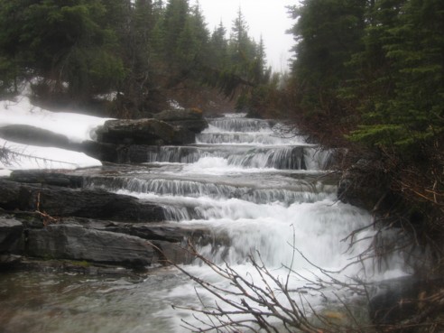
One of several scenic waterfalls seen en route
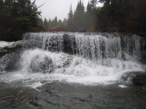
Another waterfall
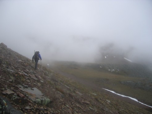
Bob disappearing into the fog
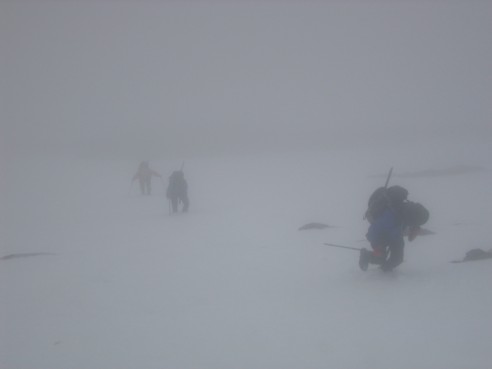
Bob, Dinah, and Linda ascend through the thick fog; this level of visibility was typical of that for most of the ascent