Loaf
Mountain height:
2639 m
Total Elevation gain (both trips): 1950
m
Roundtrip time (both trips):
approx 11 hours
Solo scramble.
What’s with the weird title?? The reason I listed this as a failed attempt, followed by a successful attempt is basically because I tried the east end of the mountain, getting to within 200 vertical metres of the summit, hit an impasse, went back down to the car, and then summitted from a different route. It kinda felt like doing two different mountains on the same day, even though they were one in the same.
My initial plan was to bike to
It’s too bad that this route didn’t go, because the scrambling all the way to the ridge was very enjoyable. From there, I started towards the pinnacles and reached a cairn in short order. As expected, the pinnacles were narrow, steep, and with significant exposure on both sides. I scrambled very slowly and carefully down into a notch and then up the other side, careful not to upclimb anything I couldn’t downclimb. Though only a few moves, this last upclimb was definitely at the upper limit of what I could downclimb. I arrived at the top to the very disconcerting sight of a tattered rappel cord – pretty much the last thing you want to see when you’re solo scrambling. I continued on for a couple of steps, but the terrain ahead obviously required climbing gear and a climbing partner. There was no hesitation and I turned around.
Once back onto safer terrain, I tried to circumvent the pinnacles on the south side of the mountain. A route was visible, but it would have required a huge elevation loss, and wasn’t worth the effort. I retreated back to the ridge and then back to my car via an alternate descent route (interesting, but much longer).
At 2:45 pm, my choices now were to call it a day or try the
original plan. I chose the latter, but even that was a bust. Biking the
Once on the ridge, the slog to the summit was very easy and
highlighted by increasingly amazing views of the mountain itself. Basically
the entire ridge is a huge rounded heap of red argillite rock. As I gained
elevation, the ridge behind me took on the look of the big, fat, red snake. As
well, the red rock on Loaf’s northerly neighbour,
The summit view was fantastic. Drywood, Pincher Ridge, and
the full length of Spionkop Ridge were especially stunning. For descent, it was
finally time to use the route I had planned on since the beginning of the day.
The easy west slopes were a treat to descend and arriving at the col, I decided
to gain the next highpoint south along the ridge to get a look at
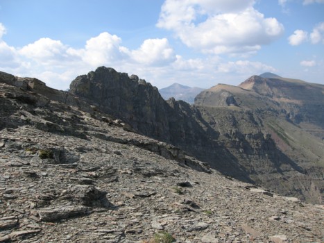
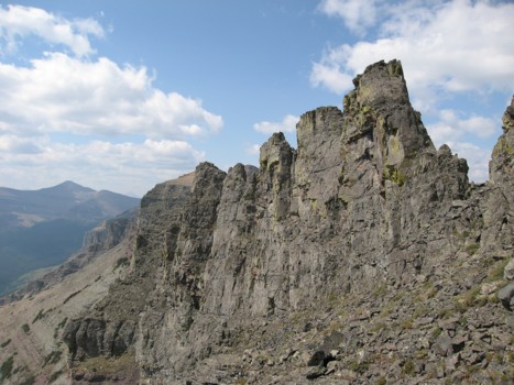
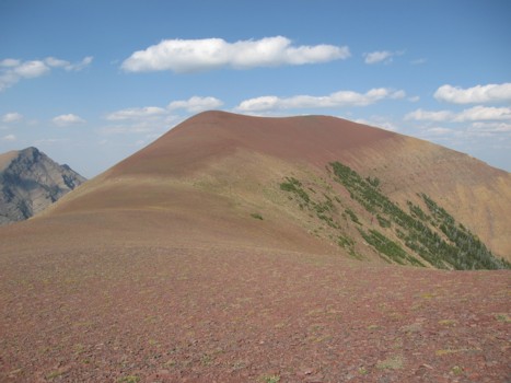
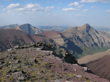
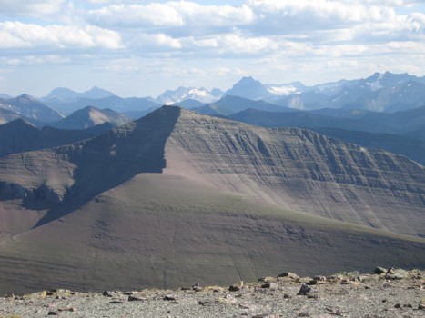
Gaining the east ridge, with the pinnacles ahead; the lengthy ridge of Loaf to the right and the summit is the highest point peaking over at the distant right
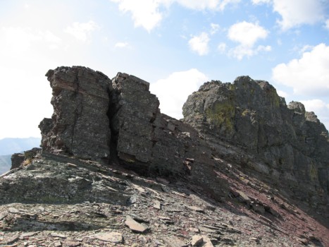
Approaching the pinnacles (right)
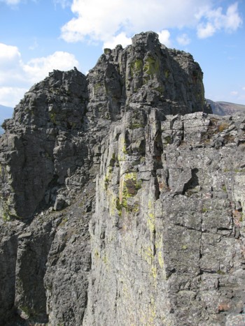
At the pinnacles; I made it to the small V-shaped notch left of centre; that's where I found the rappel cord
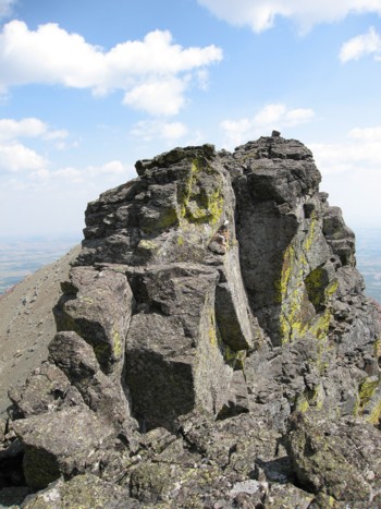
Looking back at the small section of the pinnacles I was able to traverse
The pinnacles from the south side of the mountain
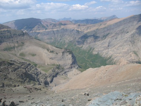
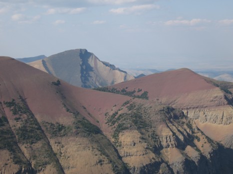
Back on the east ridge, looking down at the alternate descent route I took; Drywood Mountain behind
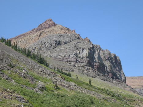
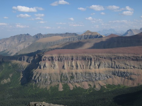
One of many colourful sections of Drywood Mountain from the Bovin Trail
Same as above
On the ridge of Loaf, looking east
Pincher Ridge peaks over Drywood Mountain
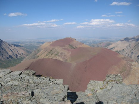
At the summit looking down the length of the mountain
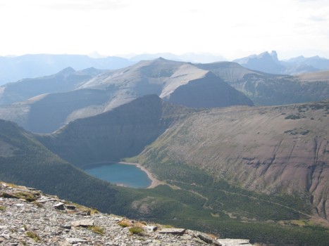
Bovin Lake, Victoria Ridge (centre), and the unique form of Castle Peak at the distant right
Pincher and Drywood from the summit
Spionkop Ridge (foreground), Glendowan (just right of centre)
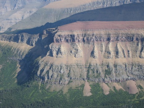
Spionkop Ridge looking very Grand Canyonish
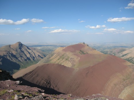
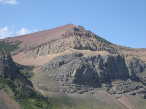
Drywood (left) and Loaf
Looking south to Spionkop Ridge