GR468932 (one of two highpoints in between Loomis and Odlum):
Mountain height:
2,544 (8,344 ft)
Elevation gain:
780 m
Ascent time:
6:15
Descent time
4:55
Scrambling with Mark.
By a long country kilometre, our best failure to date.
Our objective was either
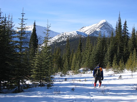
I severely underestimated the time and energy required to negotiate Odlum Creek Trail. An hour into the snowy hike, we had hiked a mere 1.5 km, instead of the 4 km I had set as a goal. We were able to make up a little time on the straight cutline heading towards Odlum Pond, however, the deep snow made travel slow and strenuous – hard to believe we had actually brought our bikes along us, in hopes of cycling the trail – yet another egregious???? error on my part.
In Gillean Daffern’s Kananaskis Country Trail Guide, Vol. 2, the author warns of the tedious and unscenic nature of the Odlum Creek Tail, and Gillean couldn’t be more right. The lacks of views and interesting scenery were especially frustrating, given the clear skies above us. 3.5 hours into the trip, we were finally at a point where we could start the ascent. I had spent most of those 3 and a half hours cursing myself for picking such an unrealistic objective and wasting a great weather day, hiking along a boring cutline, surrounded by view-blocking trees. As we made our way towards a col between Loomis and one of the two highpoints between Loomis and Odlum, the views did improve (east towards the Highwood Range), however, pessimism about reaching the summit of either peak, set in and we downgraded our objective to the highpoint immediately north of Loomis. At least we would get to see what was on the other side of the Continental Divide.
Again, ascending the snow-covered terrain was energy-draining and time-consuming. The snow, that had been ankle to mid-calf deep on the trail, was knee to mid-thigh deep on the ascent slope below the col. Higher up, the snow also became hard and icy and the grade of the slope increased significantly, and so out came the crampons, ice axes, harnesses, and a short rope.
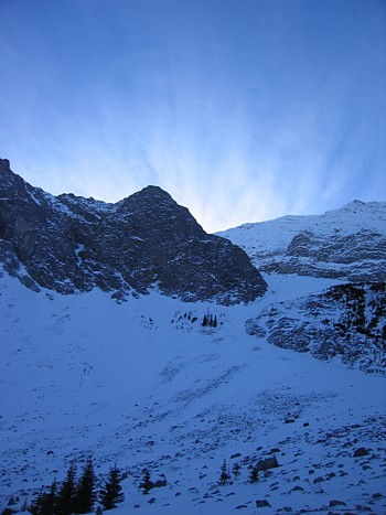
Approaching the col, we were
now hit with the dismal realization that the upper 50 or so metres were near
vertical and beyond our capabilities. We decided to veer to the right and try to
gain the
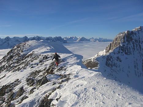
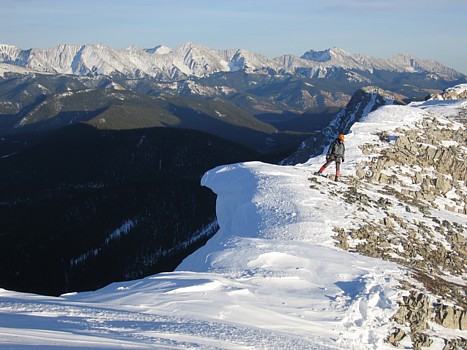
Gaining the ridge and the ridge
itself were definitely the crux of the trip. The grade was quite steep in places
and the footings in the snow, precarious at times. Without crampons, we would
have had to retreat. About 5 minutes from the top, we looked over to the west,
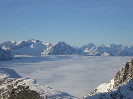
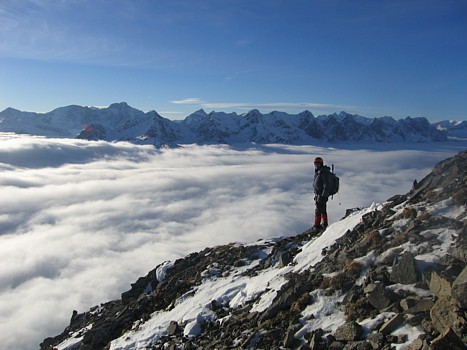
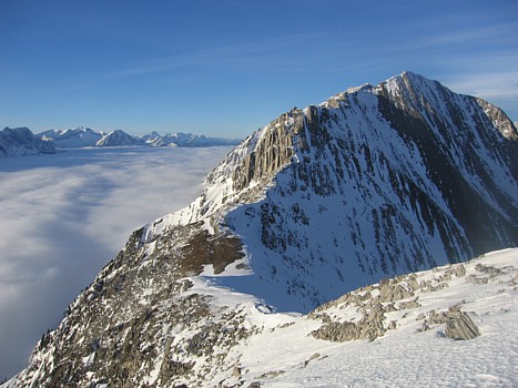
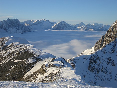
between a gap in the two highpoints, and noticed something a little unusual:
there appeared to be an enormous glacier separating the Continental Divide
mountains with those immediately to the west. Of course, no such glacier exists.
It took me a minute to realize that valley, between the two mountain ranges, was
draped with a tremendous blanket of low-lying clouds. This seemed to motivate us
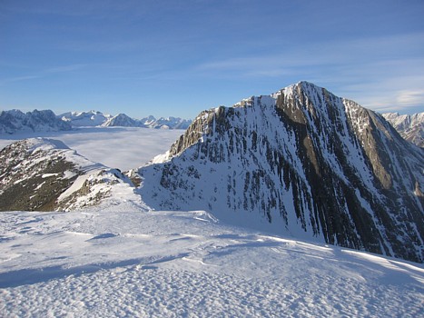
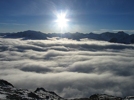
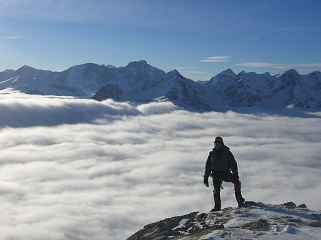
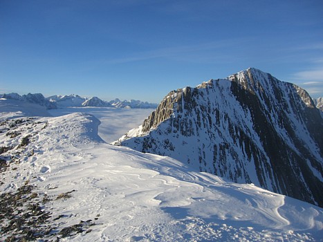
considerably and we scrambled to the top, to an absolutely spell-binding view of
clouds and innumerable peaks, protruding from the blanket of white. The cloud
lay about 100 vertical metres below us and extended up and down the valley, as
far as one could see. Looking down on it was reminiscent of being in an
aeroplane at 20,000 feet or something that you might expect to see while
ascending an 11,000er. We certainly didn’t expect to see a meteorological
phenomenon of this magnitude at a lowly elevation of 2,544 metres (8,344 feet).
The experience was every bit the equal of the stunning view of Mount Assiniboine,
seen from our ascent of
We stayed at the top for a
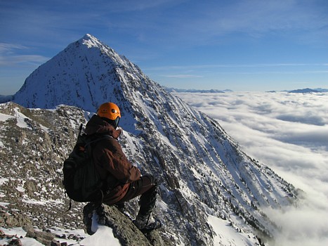
solid hour, marveling in this most unique panorama. The views of Loomis to the
south and the second highpoint, connecting to Odlum, were also spectacular, as
was the
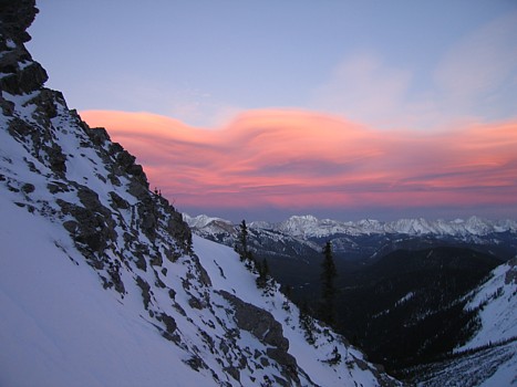
Just when we thought we had seen the most breath-taking panoramas of our 4-year mountain history, another suddenly appeared. In the waning daylight, the sky to the east slowly changed to some wicked shades of pink and orange, as the light of the setting sun reflected off large bands of cirrus clouds. Mark commented that it looked like a scene from Mars, not Earth. The remainder of the descent was long, but simple mindless walking, as we followed our tracks in the snow all the way back to the car.
By far, one of the most
visually incredible and rewarding days we’ve encountered.
One of the few open areas along Odlum Creek Trail; Mount Loomis at the left; the southerly outlier of Odlum at the right
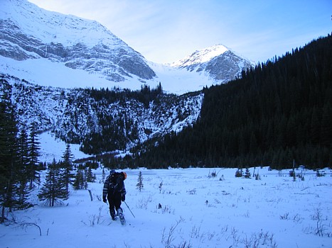
Arriving at Odlum Pond; Loomis at the left, GR468932 right of centre
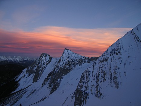
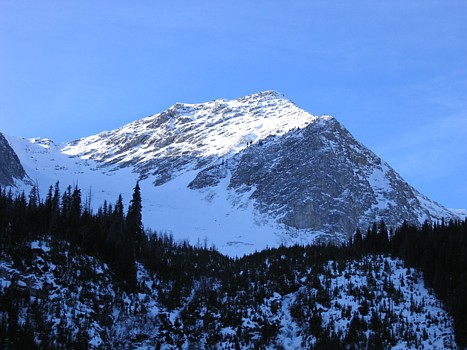
An outlier of Loomis
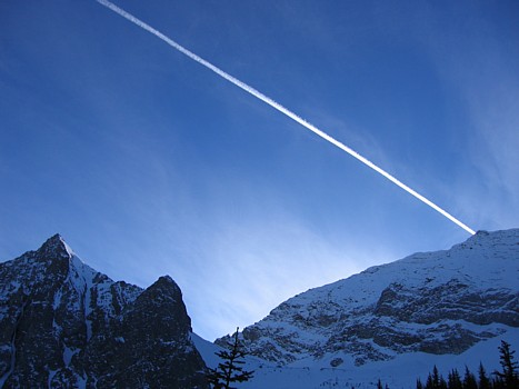
The exhaust of the plane, pointing right at the summit of Loomis, is brightened by the sun;
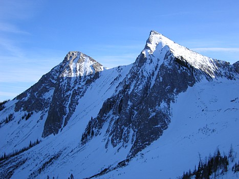
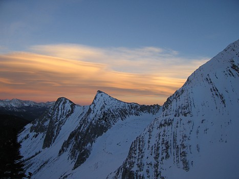
Two outliers of Loomis
GR468932
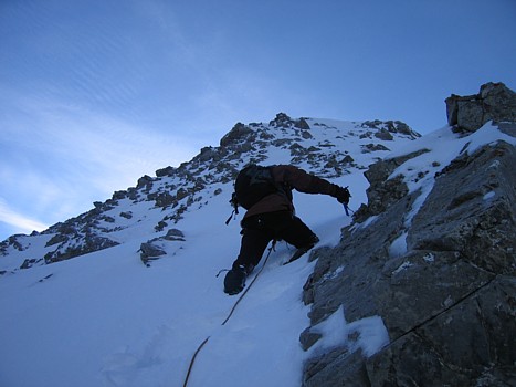
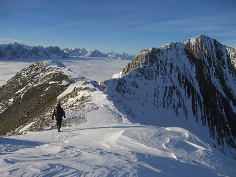
Ascending terrain on the east ridge of GR468932
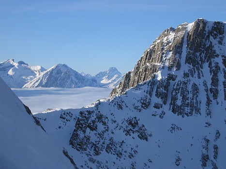
Our first look over to the west side of the Continental Divide; the blanket of white looked liked a glacier
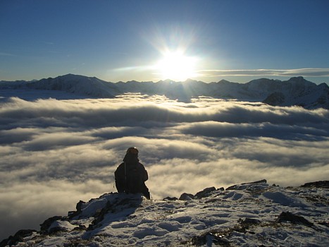
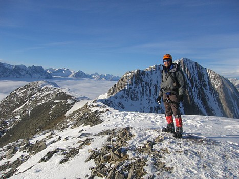
At the summit of GR468932; the outlier of Odlum at the right
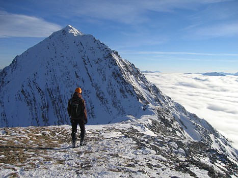
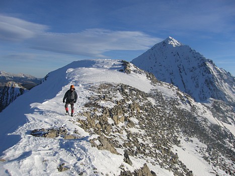
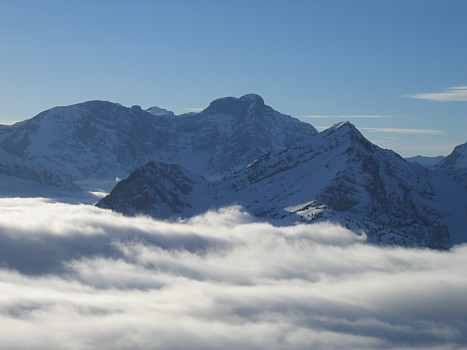
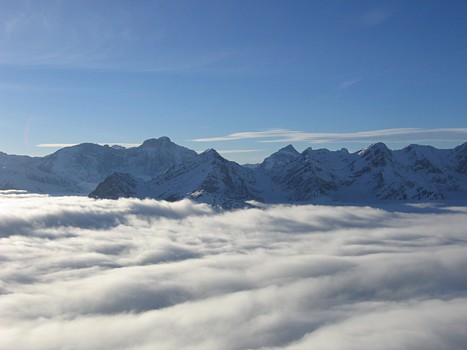
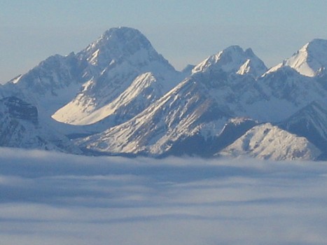
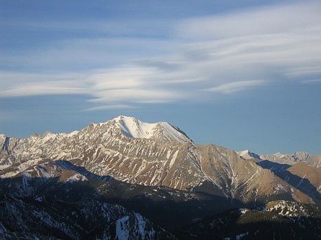
Mount Loomis
Loomis towers over the low cloud covered
The "Sun" series:
Other random scenes:
Mount Abruzzi
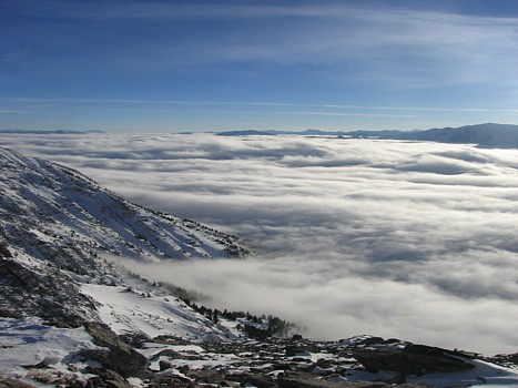
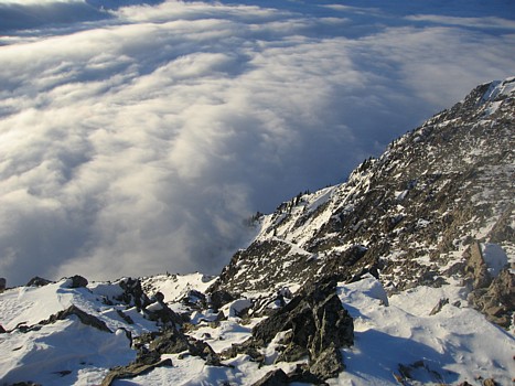
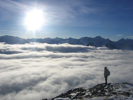
Looking down the west slopes of Loomis at the sea of cloud
Mount Sir Douglas (left)
Mist Mountain and some of the clouds that resulted in the photos below
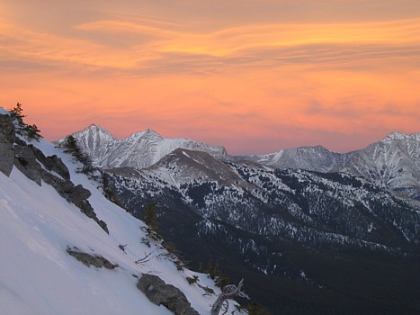
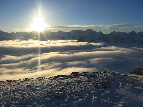
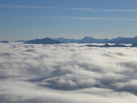
A last look at the spectacular scenery to the northwest
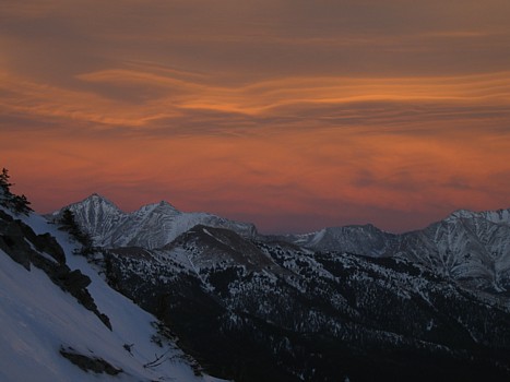
The "Evening Sky" series