Mountain height:
2822 m
Elevation gain:
approx. 1400 m
Ascent time:
8:05
Descent time:
3:05
Scrambling with Mark.
We failed to summit
It took us 1.75 hours to negotiate the first 8 km of Loomis
Creek Trail on bike, and we were both more than happy to ditch the two wheelers,
in favour of our preferred mode of transportation – two legs! Getting to
Initially, we wanted to see if we could gain the col between two unnamed outliers south of Loomis, then summit the north one and continue on to Loomis. From the lake, the terrain looked to be too steep and so instead we decided to pick our up to the ridge north of the lake, with the intention of descending to the valley directly below Loomis and attempting an ascent from there. There also appeared to be some interesting rock formations along the way and so this seemed like a decent idea.
The formations and pinnacles were spectacular and did not disappoint. By the time we made it to the ridge, another potential route became visible – right up the ridge to the summit of the outlier. There were several significant and vertical rockbands along the way that would obviously need to be circumvented. When comparing the scree slog route directly to the summit and this new route, we chose the latter, knowing full well that if we failed, we wouldn’t have the time or energy to return and take the easy route up.
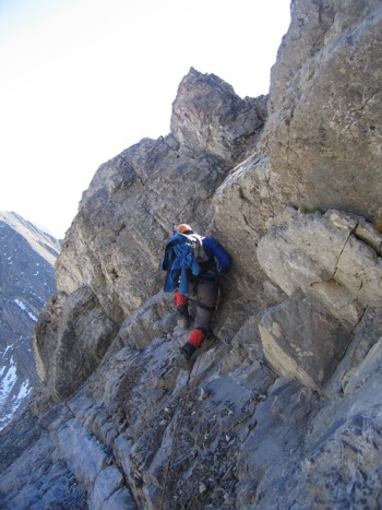
Almost right away, we reached a vertical rockband and had to lose elevation to get around it. Mark took the lead, at this point, and he, in fact, led the entire ascent. The scrambling was fun and the route-finding quite challenging. Several sections were steep, exposed and the rock hideously loose. I was very impressed to watch Mark scramble up terrain, definitely right on the borderline between difficult scrambling and technical climbing.
After several hours of meandering up and down, back and forth across the southeast face of the outlier, we finally reached the summit. At 2743 m, the outlier sported a pretty decent view. Getting to the summit of Loomis was easier than expected: a scenic ridge descent of 200 vertical metres followed by an equally interesting slog of about 250 vertical metres to the top. At a little over 8 hours, it was a much longer ascent than we anticipated, but often that makes the summit that much sweeter, especially when taking an unknown route.
It was too late in the day and we were too tired to return
all the way to
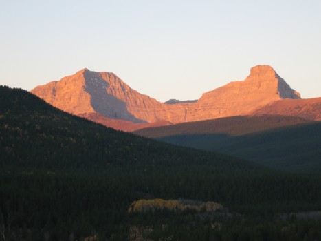
Strachan (left) and Muir in the morning light
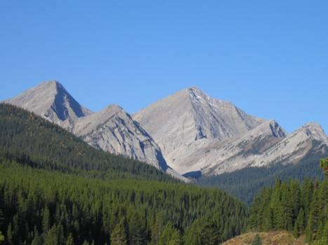
Mount Loomis (just right of centre) and the southern outlier to its left
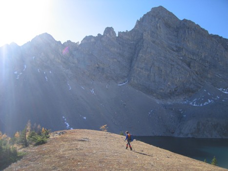
Approaching Loomis Lake, with the southern outlier in the background
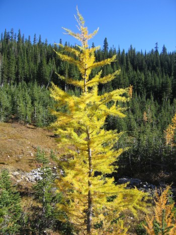
A larch
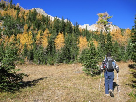
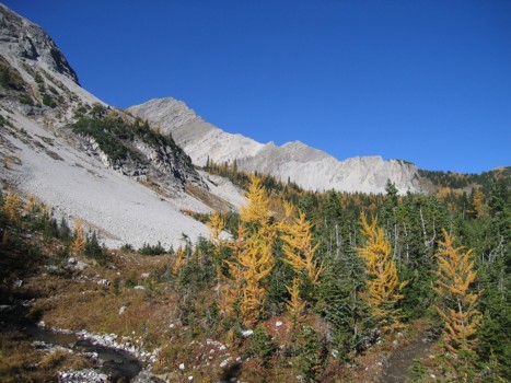
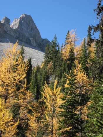
More colourful scenery
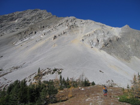
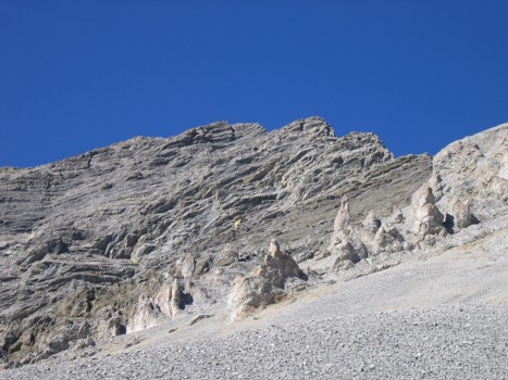
Part of the unnamed peak south of Loomis Lake
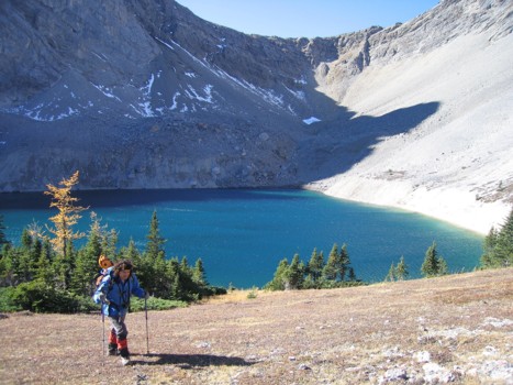
Mark arrives at Loomis Lake
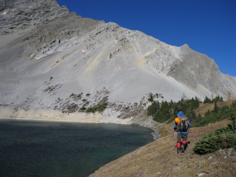
More of the lake and the southeast face of the outlier
Initially, we wanted to ascend to the col behind the lake
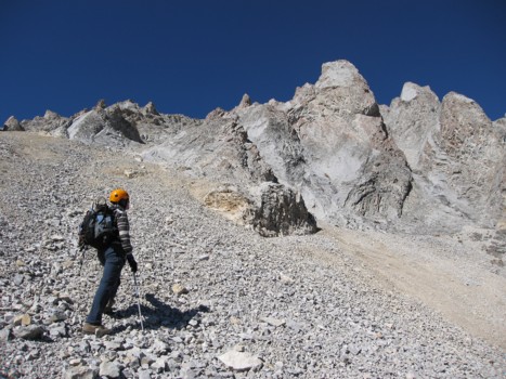
Mark starts towards the outlier
The lower slopes of the outlier
Looking back to yet another outlier of Loomis
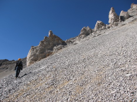
Approaching the pinnacles
Same as above
Same as above
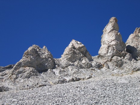
A closer look at some of the pinnacles
The most interesting and unique of the rock formations
Exploring the rock
Looking back towards the rock formations, Loomis Lake and Mount Bishop (centre)
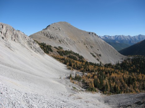
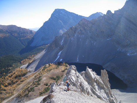
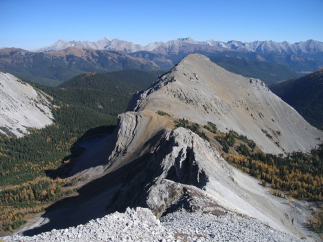
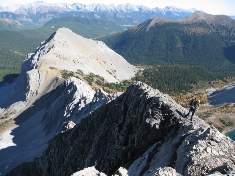
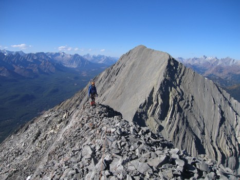
On the ridge of the outlier, looking at the summit of Loomis; the easy ascent/descent route descends to the valley below and then goes up the scree at the far left
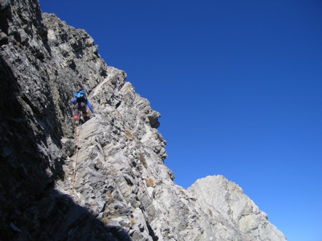
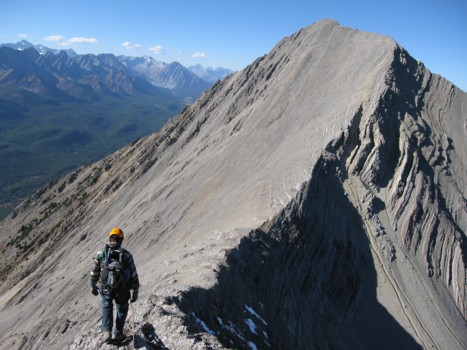
Looking back along the ridge
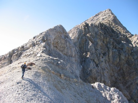
Looking forward on the ridge
Mark starts the scrambling on the southeast face
Bishop and Loomis Lake again
More of the ridge
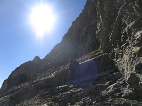
More of the southeast face
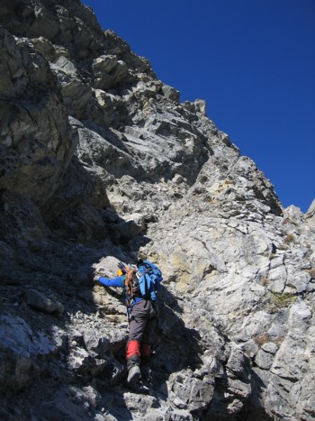
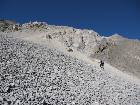
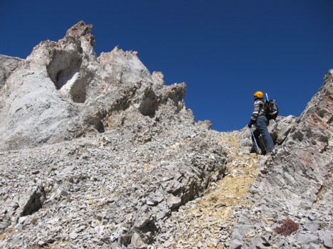
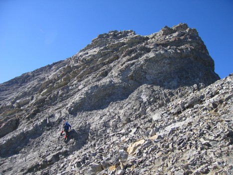
Mark tackles more steep terrain
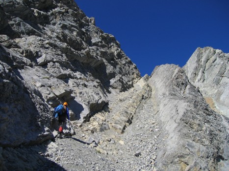
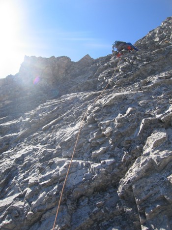
Lots of route finding on the route
And lots of steep terrain
Same as above
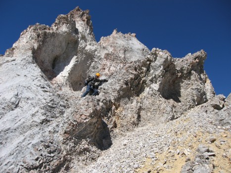
Mark leads the crux step
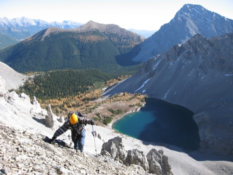
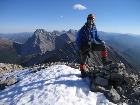
Me, with Bishop behind; contrary to appearance Bishop is actually about 100 vertical metres higher than the point I'm standing
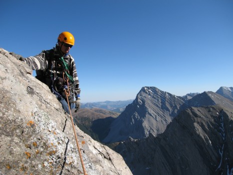
Mark at the summit of the outlier, with Loomis behind
Starting down to the col
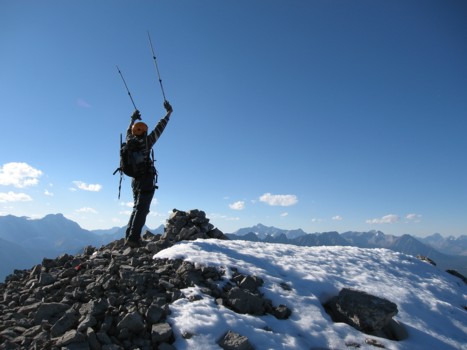
Finally at the summit of Loomis
Same as above, looking north to Odlum, Storelk, etc.
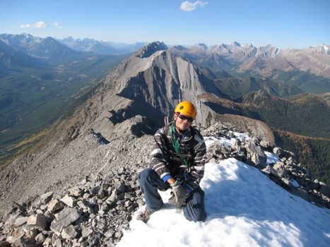
Mark at the summit
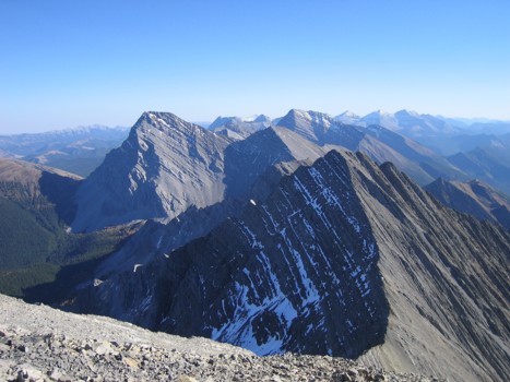
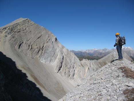
Looking south to Bishop, McPhail, etc.
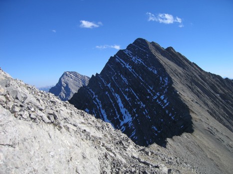
The outlier and beautifully curved connecting ridge