Mount Lougheed II – July
31, 2008
Mountain height:
3107
m
Elevation gain:
1400
m
Ascent time:
4:40
Descent time:
2:50
 Scrambling with Calvin.
Though I try to avoid repeating
mountain trips to the same
summit (okay…just forget I’ve done the various
summits of Mount Baldy
fourteen times!), Cal and I had been trying to hook up for a trip for
some time
and when he suggested an alternate route to the true summit of Mount
Lougheed,
I couldn’t resist. My first ascent of Lougheed was an amazing
experience with
Kevin Barton in the summer of 2006. I recall the summit view being one
of the
best panoramas in the area and hoped a repeat visit would be just as
satisfying
as the first trip.
The new route, suggested by a friend
and also outlined by
Rick Collier on Bivouac and on Willis Tsai's website,
involved ascending the valley alongside Spencer Creek and
then going up a
scree slope more or less directly to the true summit. Although devoid
of any
hands-on scrambling, this turned out to be a great route, with enough
fantastic
scenery to keep your attention off the lengthy scree slopes and on the
great
views.
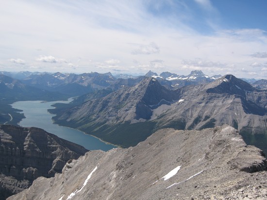
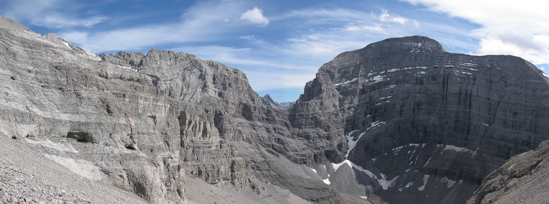
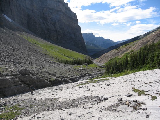
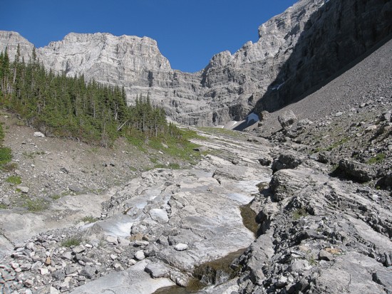
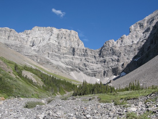
 First, we hiked the well-worn trail above Spencer Creek to treeline. The environs of Spencer
Creek have
to be some of the most beautiful
in the Canadian Rockies – grassy meadows, the water-carved
creek, the immense
walls of MountSparrowhawk’s
north face and the complex maze of rock that makes up Mount
Lougheed
– the hike into this valley
alone is well worth a trip to the Rockies.
First, we hiked the well-worn trail above Spencer Creek to treeline. The environs of Spencer
Creek have
to be some of the most beautiful
in the Canadian Rockies – grassy meadows, the water-carved
creek, the immense
walls of MountSparrowhawk’s
north face and the complex maze of rock that makes up Mount
Lougheed
– the hike into this valley
alone is well worth a trip to the Rockies.
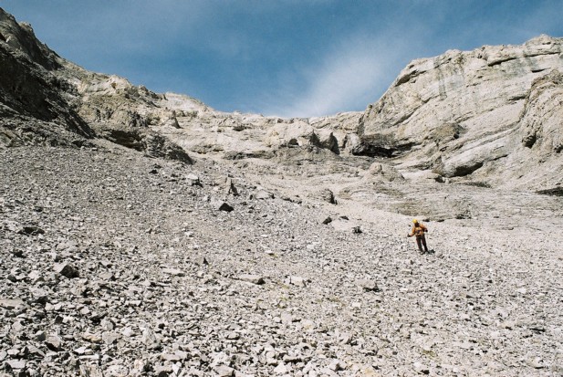
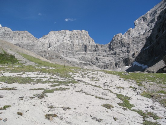
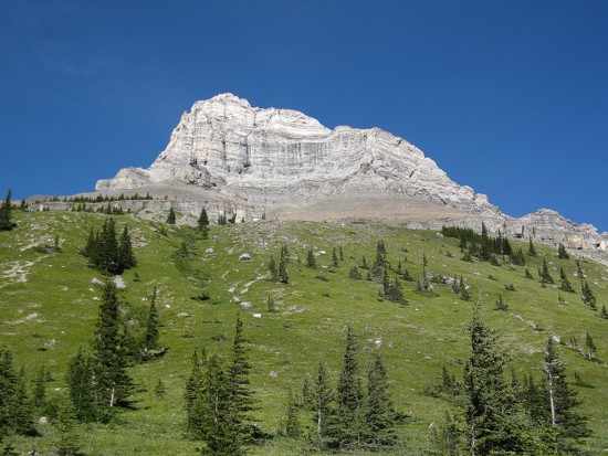
Leaving the creek, Cal
led the way up slopes of grass and scree between the steep walls of the
ridges
that make up the second peak. The relative ease of the ascent surprised
us
both. The scree was not at tedious as it looked and the route-finding
was interesting
and enjoyable. Though the upper slopes seemed to be guarded by
impenetrable
walls, there was an easy weakness to sneak up. We then side-sloped to
the most
easterly of the two south ridges of Lougheed’s 2nd
peak, and tramped
up easily to the false summit, several hundred metres west of the true
summit.
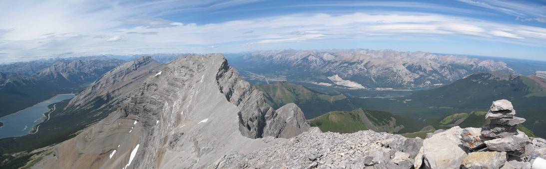
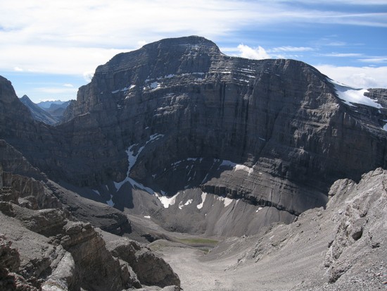
Good thing that we arrived at this summit, as it provides unique views
not
granted by the true summit. 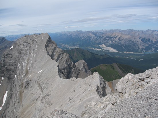 We reached the true summit shortly after in
great
spirits. The summit panorama was every bit as amazing as I remembered
it to be
– definitely a “must see” view. Cal
was even more excited to be on the summit of this magnificent mountain
as I
was. We both enjoyed a lengthy summit stay.
We reached the true summit shortly after in
great
spirits. The summit panorama was every bit as amazing as I remembered
it to be
– definitely a “must see” view. Cal
was even more excited to be on the summit of this magnificent mountain
as I
was. We both enjoyed a lengthy summit stay.
We chose to descend the same way as
opposed to continuing
south to peak 3. This was a very fast route and Cal showed his
skill at scree-surfing,
leaving me in the proverbial and literal dust. An excellent trip with
excellent
company. Every bit as enjoyable as my first ascent with Kevin.
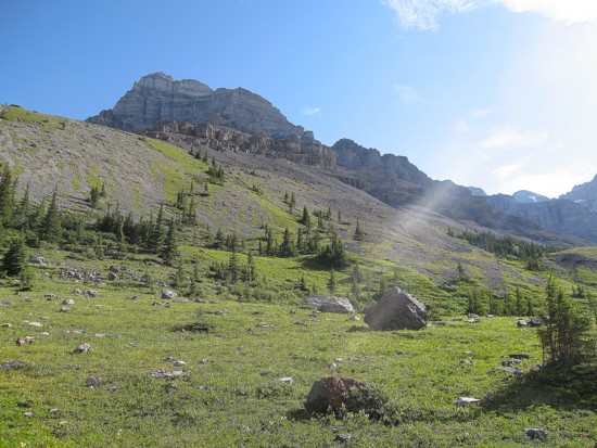
The Spencer Creek environs, with part of the second peak
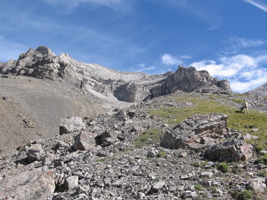
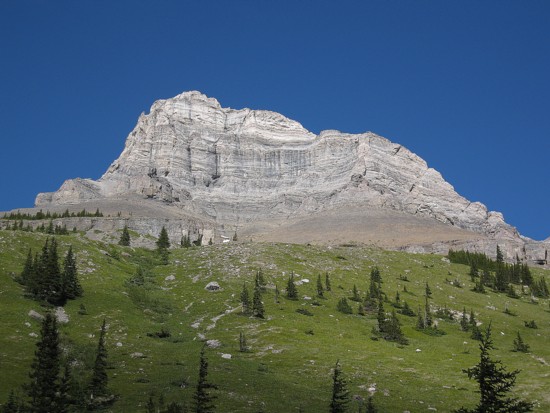
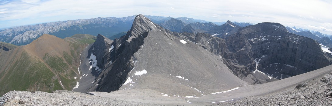
The ascent route goes basically up the middle and then over to the right
Cal leads us up
Looking behind at the north face of Sparrowhawk
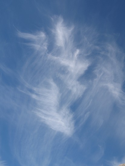
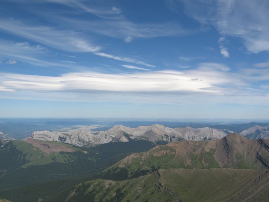
Cool clouds
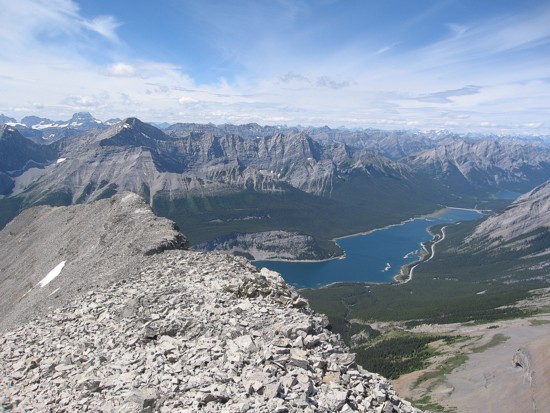
From the west summit, looking northwest; Old Goat Mountain to the left
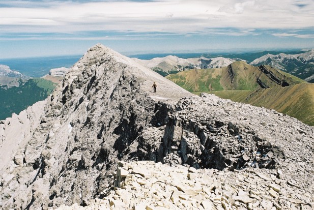
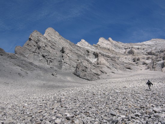
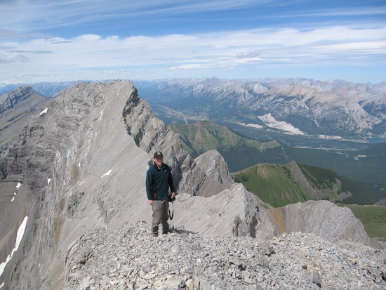
Me, heading to the true summit (photo by Calvin)
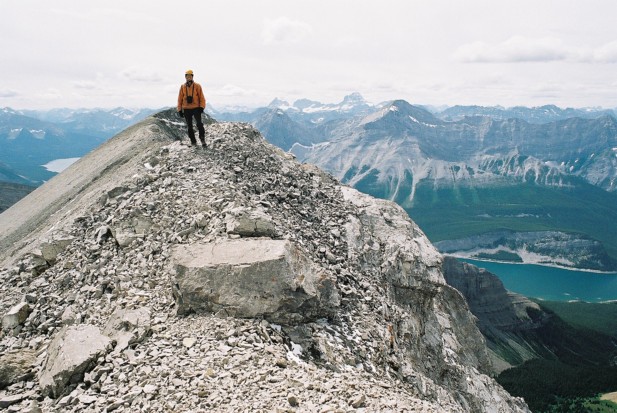
Calvin at the west summit; Assiniboine at the distant right
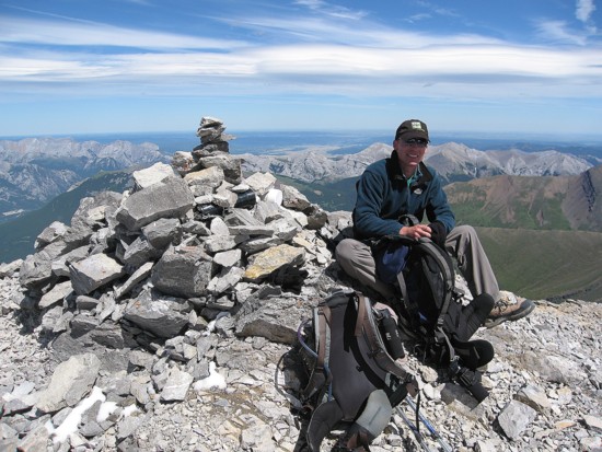
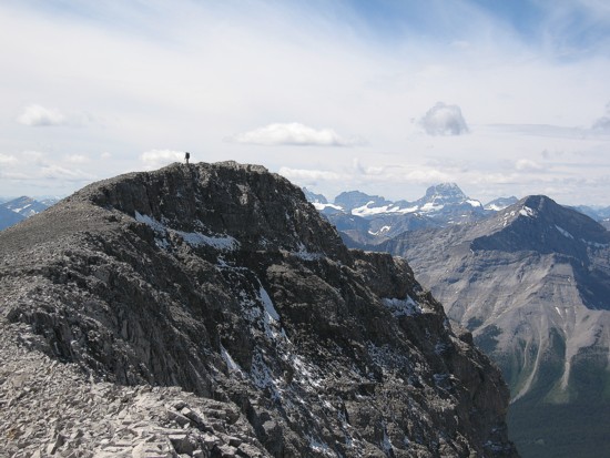
Cal at the summit
Me at the summit (photo by Calvin)
The striking profile of Wind Mountain
An unusual cloud above the McGillivray/Skogan/Lorette range
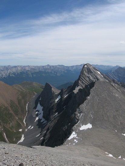
Cal again, with thre first peak behind him
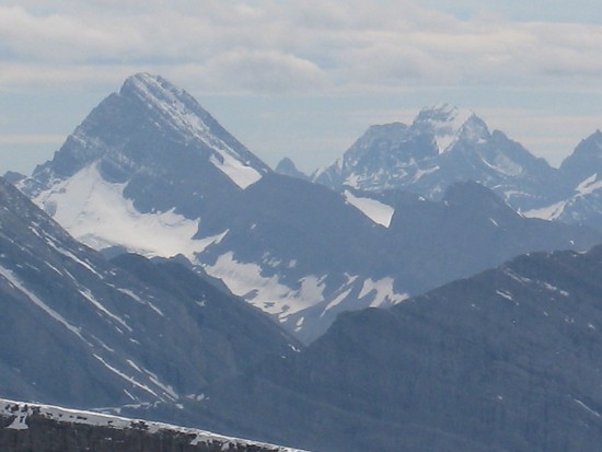
Sir Douglas and King George
Mount Allan (far left), Wind, and Sparrowhawk
On descent (photo by Calvin)
Another view of Sparrowhawk
Cal heads to the Spencer Creek drainage
Looking back at Wind Mountain
Same as above
One more of the same thing; it's just that outstanding of an area!
Looking back to the 2nd peak of Lougheed
LOG