July 25, 2009
 Mountain height: 3082
m
Mountain height: 3082
m
Elevation gain: 1350
m
Ascent time: 7:10
Descent time: 5:40
Mountaineering with Ferenc.
Originally I was planning a solo attempt, but was lucky enough to get Ferenc as a partner for the day. Good thing too - no way in heck I would have reached the summit without his lead mountaineering skills!
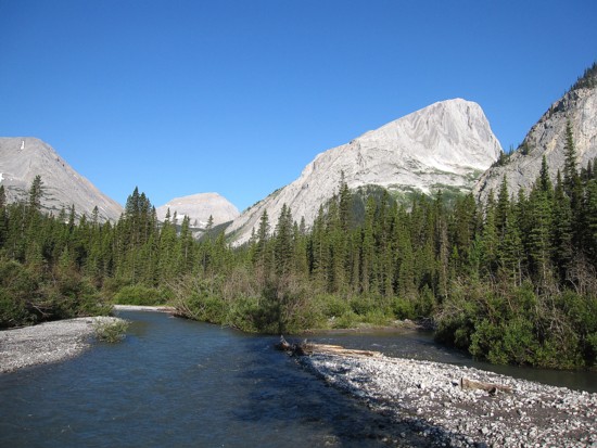
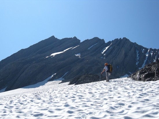
 After a 4 km bike and an additional 4 km of hiking, we
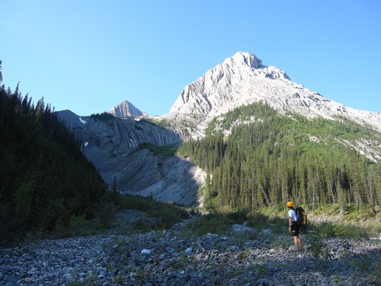
started up the drainage north of the summit, quickly reaching a headwall that
was not supposed to be there (according to the topo, anyway). Not a big deal –
the headwall is easily circumvented on either side – we chose the right. Above
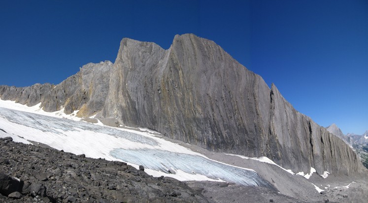
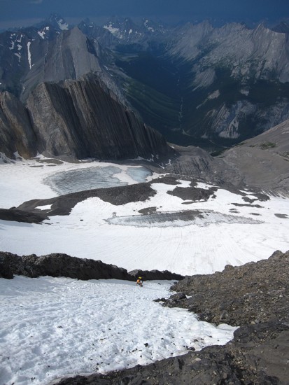
the headwall, the scenery was terrific: a barren, glacial cirque surrounded by
steep, impressive walls of rock, and the remnants of the Lyautey Glacier, all
behind a beautiful, blue sky.
After a 4 km bike and an additional 4 km of hiking, we
started up the drainage north of the summit, quickly reaching a headwall that
was not supposed to be there (according to the topo, anyway). Not a big deal –
the headwall is easily circumvented on either side – we chose the right. Above
the headwall, the scenery was terrific: a barren, glacial cirque surrounded by
steep, impressive walls of rock, and the remnants of the Lyautey Glacier, all
behind a beautiful, blue sky.
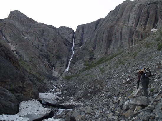
Things got interesting thereafter.
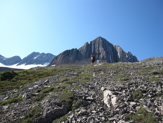
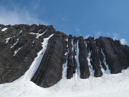
Arriving at a point where the summit peak was now visible, it was difficult to discern where the actual summit was. The topo indicated the right side, but visually the left side appeared to be of far greater height. We quickly checked out the right side (the route I originally planned on taking), only to find it to be a dead-end. As well, the ridge of the right side of the peak appeared to be knife-edged with huge, overhanging upthrusts of rock lining it.
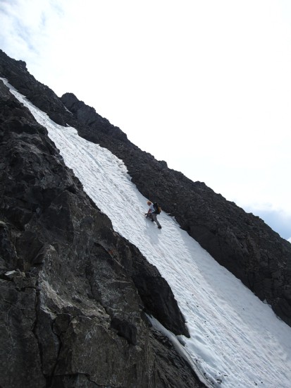
Ferenc suggested we ascend one of the snow-filled couloirs in the centre of the peak and then try to scramble to the summit from the ridge. There was a visible bergschrund, albeit a very tiny one, so we roped up to cross the small glacier and then started up the couloir. Ferenc, who loves steep snow and ice, led the 40-45 degree snow slope as if it were a flat surface. I followed, glad to have Ferenc’s steps to follow in. When the snow thinned and became too icy, we moved onto the rock alongside the couloir and continued up. Along the way there were definitely a few sections that would present a considerable down-climbing challenge and I hoped we could find an alternate descent route. We did have a fair amount of climbing paraphernalia, however, setting up rappel anchors on the down-sloping rock would be very difficult, if not impossible. Nearing the summit ridge, the weather started to deteriorate very rapidly and we hurried up to the ridge. A major storm was coming in from the southeast, but it appeared that it would miss us.
We turned left, trusting our instincts as to the location of
the summit, and scrambled to the “not” summit. Our instincts were wrong and the
map was right. The summit was at the right (west) side of the peak. 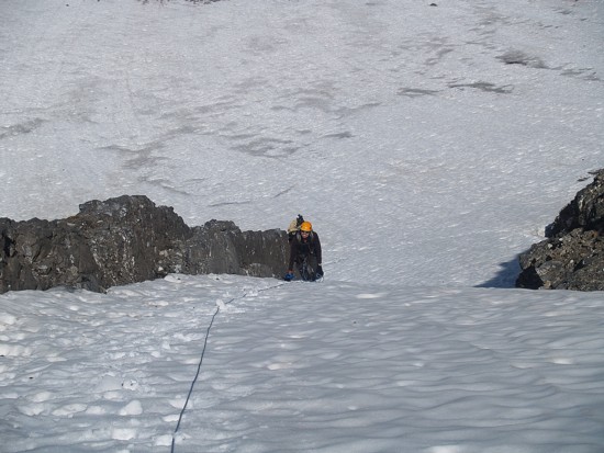 Quickly, we
backtracked and hurried over to the true summit. The summit panorama would have
been thoroughly outstanding on a clear day. It was still an amazing one, just a
little more dreary than we would have liked. As expected, the summit register,
placed there by none other than Mr. Alan Kane in 1998, was as barren as the
terrain below the peak – 6 ascents since then, including ours.
Quickly, we
backtracked and hurried over to the true summit. The summit panorama would have
been thoroughly outstanding on a clear day. It was still an amazing one, just a
little more dreary than we would have liked. As expected, the summit register,
placed there by none other than Mr. Alan Kane in 1998, was as barren as the
terrain below the peak – 6 ascents since then, including ours.
Our summit stay was suddenly cut very short when Ferenc’s ice axe started to buzz – I guess we were wrong about the storm too! We immediately started descending a rock rib, directly below the summit. The down-climbing for the next hour was painfully slow. Any slip here would have been disastrous and extreme caution was warranted, even if getting struck by lightening was still a concern. Thankfully, the storm moved on and we were able to continue down without being too worried about becoming human lightening rods.
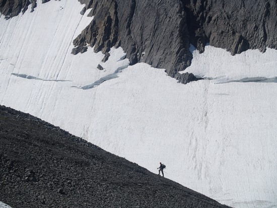
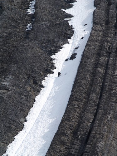
Once low enough, we moved back onto the snow and descended a parallel couloir to the one we had ascended. This one felt a little steeper in sections (my comfortable level for solo travel on snow slopes definitely maxes out at 45 degrees), but was straightforward. Again, I was extremely grateful for and in admiration of Ferenc’s skill and confidence on steep snow.
Once at the bottom of the couloir, the remainder of the return trip was easy, although very tiring for me. We reached the car, both very pleased about getting to the top of this significant, but infrequently ascended peak. Definitely a mountain that deserves more attention.
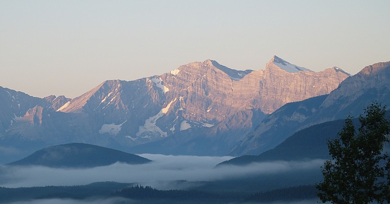
Mount Foch (centre) and Sarrail (right) in the early morning (photo by Ferenc)
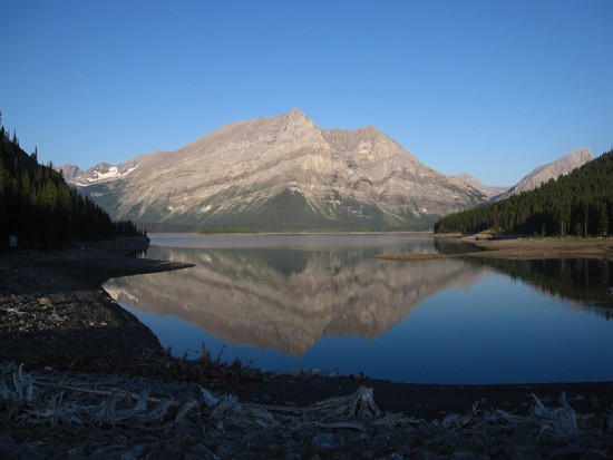
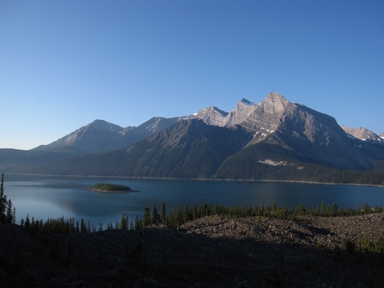
The eastern outliers of Lyautey reflected in the Upper Kananaskis Lake
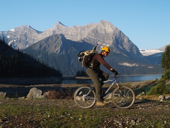
The bike ride begins (photo by Ferenc)
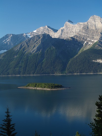
The island in the lake (photo by Ferenc)
Mount Worthington (just left on centre - distant) and Mount Putnik (right)
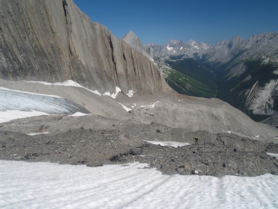
Looking up the ascent drainage
Approaching the headwall (photo by Ferenc)
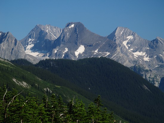
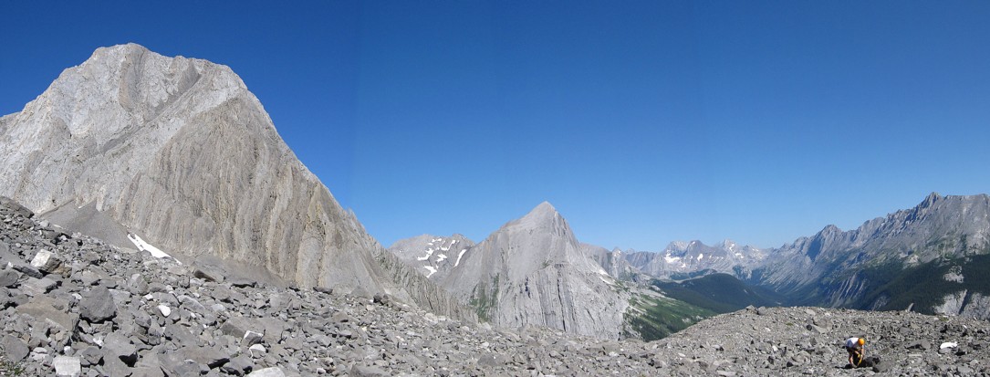
French (left), Jellicoe (centre), and Smith-Dorrien (photo by Ferenc)
Another of the multiple outliers of Lyautey
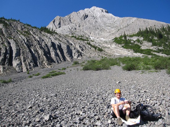
Ferenc in the upper cirque
The same outlier
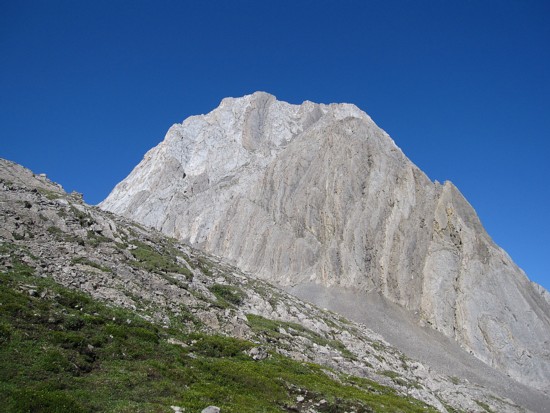
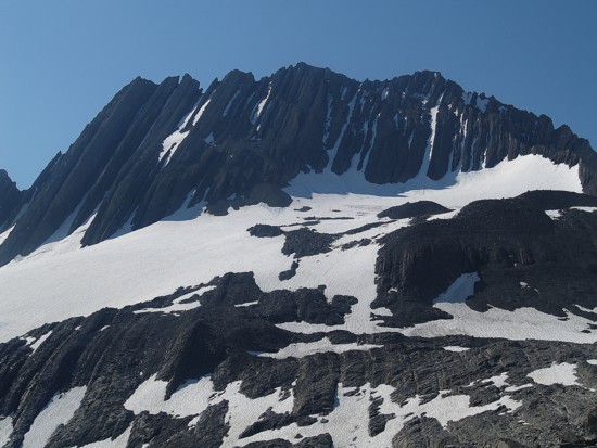
Mount Putnik
The western outliers
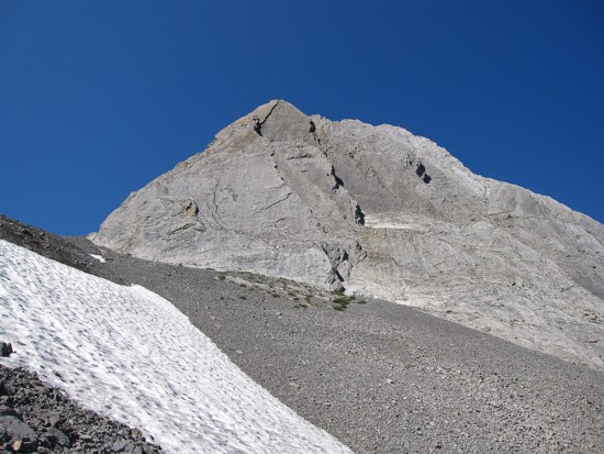
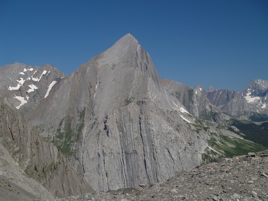
Lyautey - summit at the right (photo by Ferenc)
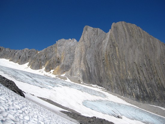
Approaching the glacier (photo by Ferenc)
Approaching the ascent couloir
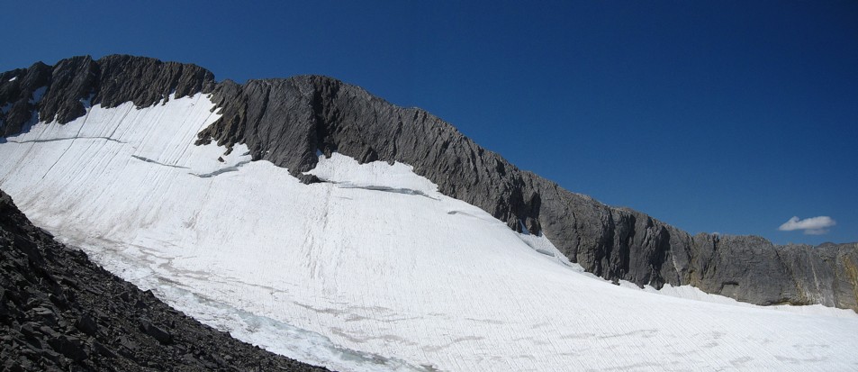
The western glacier
Checking out the right side (photo by Ferenc)
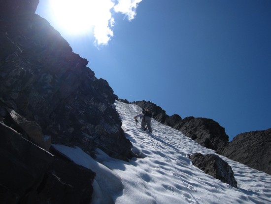
Ferenc leads the couloir

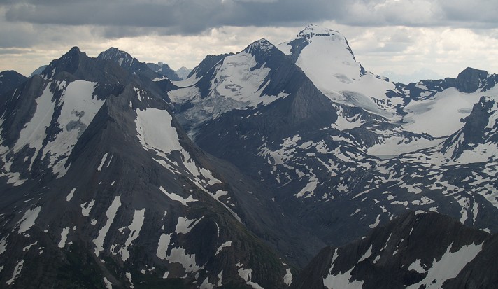
Mount King George, Prince George (flat mountain in front of the King), Prince Albert (photo by Ferenc)
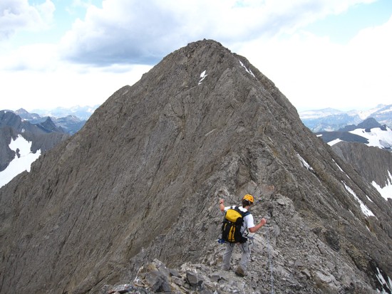
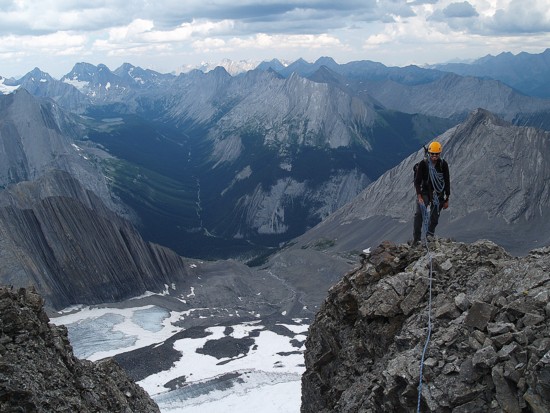
On the summit ridge
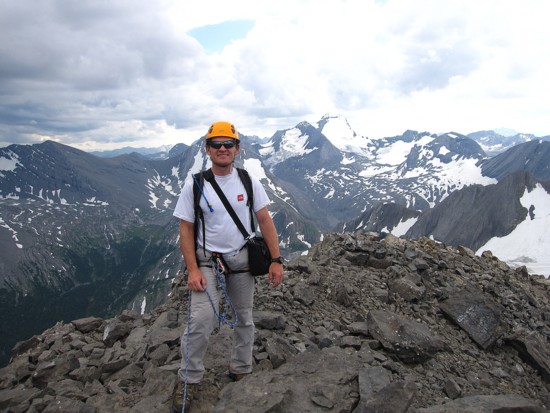
Ferenc at the summit
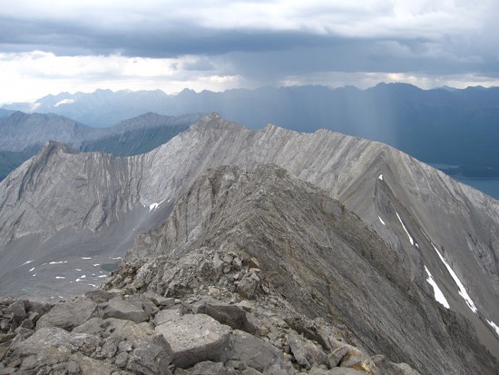
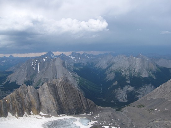
The storm to the east
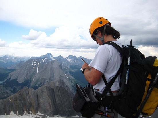
Ferenc signs the register
Me at the summit (photo by Ferenc)
Joffre (photo by Ferenc)
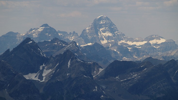
Assiniboine (photo by Ferenc)
The storm moves north
Ferenc descending the other couloir
Same as above, with increasingly black skies to the north
Me (little dot to the left) descending the couloir (photo by Ferenc)
A closer look (photo by Ferenc)
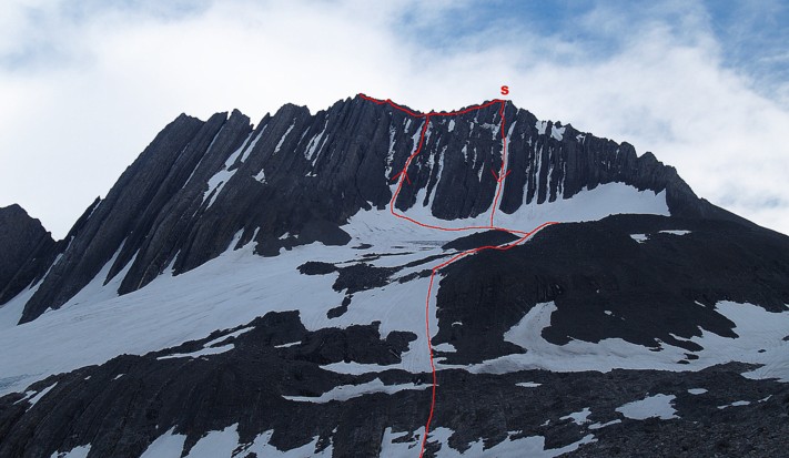
The ascent and descent routes - S marks the summit (photo by Ferenc)