Mountain height: 2,726 m (8,941
ft)
Elevation gain: approx.
1,200 m (we came up about 150 vertical metres short)
Roundtrip time: 8:25
Scrambling and snowshoeing with
Mark.
‘Tis the season when the word
“attempt” appears in our trip titles far too frequently. Nevertheless,
failure to reach the summit is part and parcel of winter scrambling/hiking and
when you get scenery and weather like we did on this day, who cares about the
summit?!
The last time we were on
Mount
McDougall
was actually an attempt of Old Baldy three years ago on December 8. On that
day, we made it to a subsidiary
peak
of
McDougall
, we like to call “
Volcano
Peak
”, because of its suggestive shape. The day’s goal was to achieve the summit
of Mount McDougall via the ridge connecting it and
Volcano
Peak
.
Like our first attempt, making
it up to the initial ridge leading to Volcano Peak, was long, tedious, and far
more time-consuming and energy-draining than we expected. The endless rubble,
covered by a light layer of snow, was terrible to ascend, and the bushwhacking
to get to those rubble slopes, though relatively short, was annoying at best.
Once out on open slopes, however, the terrific views of
Mount
Kidd
, and The Fortress group, were more than enough to make up for the drudgery of
the ascent. Finally, above the treeline, it was only a short hike before
Volcano
Peak
and more great scenery on its south side, came into view.
As is commonly the case for
winter trips on clear days, the view from the summit was amazing and although,
the wind made for bitterly cold temperatures, we had to stay awhile to enjoy the
magnificent snow-covered scenery. Fisher Peak, the craggy northeast profile of
Mount Tombstone peaks of the Opal Range were fantastic as well as the
overwhelming sea of peaks to the west – Lawson, Inflexible, James Walker, The
Wedge, The Fortress, Gusty Peak, Galatea, The Tower, Kidd, Bogart, Sparrowhawk,
Lougheed, Allan, Wind, and Collembola.
The connecting ridge to
McDougall’s true summit looked especially interesting. Unfortunately, by this
time, that summit was already a long shot – we would assuredly run out of
daylight and descending the rubble slopes by headlamp was a less than appealing
proposition. Of course, we had to give it a shot and so off we went. After
descending to a beautifully peaceful and scenic col (no wind!), we started up
the more narrow section of the ridge. Right away, it became evident that
crampons would be a good idea to negotiate the snow–covered terrain. A fall
down the steep north side would have been very bad (that’s code for death!),
and although the south side of the ridge was not terribly steep, a slip might
send one on a very unpleasant involuntary glissade. Crampons on foot, ice axes
in hand we once again started the traverse. Unfortunately, about five minutes
along, the strap on one of Mark’s crampons broke. The damage was irreparable
and although we did continue on for a short while, the risk of traveling with
only one crampon wasn’t worth it. Even with both crampons, we still wouldn’t
have made the summit anyway because of the lateness of the day.
Before turning around, Mark
asked me to ascend a little highpoint on the ridge to take a photo. I did, but
was suddenly completely blasted in the face by blowing snow. It lasted about a
minute and my face felt a frozen York Peppermint Patty afterwards – at least
Mark had a good laugh about it.
The nice thing about turning around
early was that we now had the time to explore a little and look for an easier
descent route. The exploring was great, revealing more wonderful scenery on the
south side of the ridge, however, finding an alternate route proved to be
fruitless. No matter where we went, there was no avoiding the annoying rubble
and the bushwhacking on the west descent slope was horrific – a small price to
pay, however, for the breath-taking scenery and gorgeous weather throughout the
trip.
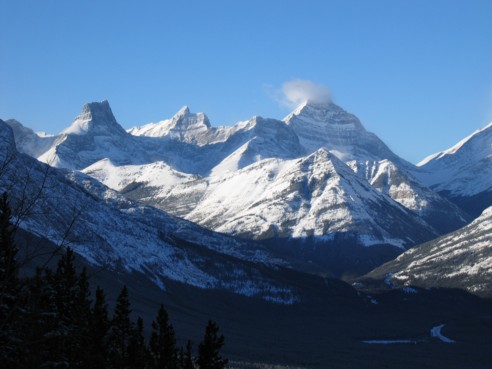
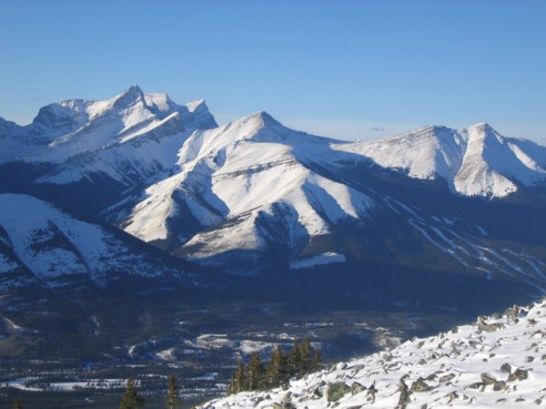
Left to right: The Fortress,
Gusty Peak and Mount Galatea
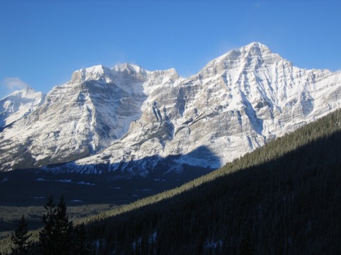
The two peaks of Mount
Kidd; The Tower is at the far left
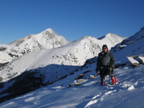
On the ascent slopes, with Old
Baldy Mountain (left) and the west ridge of Mount
McDougall behind
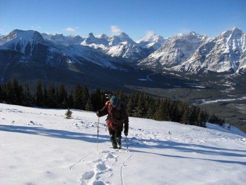
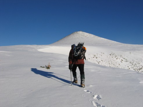
Gaining the ridge after the long and tedious slog
up; The Wedge is at the far left
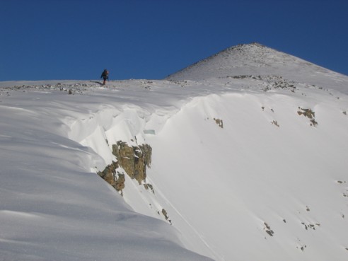
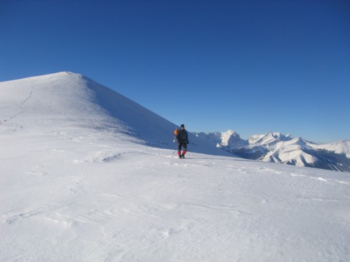
Volcano Peak in
sight
Same as above
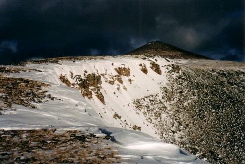
A very similar photo taken on December 8, 2001
(the weather was much better 3 years later!)
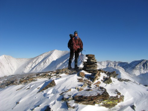
At the summit of Volcano Peak; the true summit of
McDougall is to my left
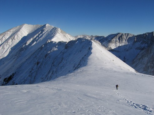
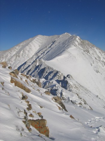
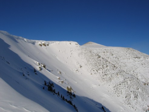
The ridgewalk route to the summit, as seen from Volcano
Peak
Descending from Volcano
Peak; the peaks to the right are Sparrowhawk,
Lougheed, Wind Mountain,
and Mount Allan
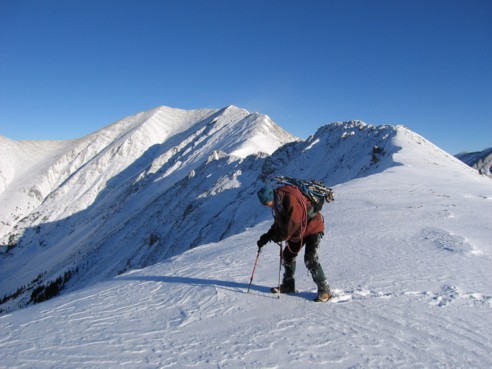
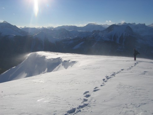
Checking to find where the cornice starts
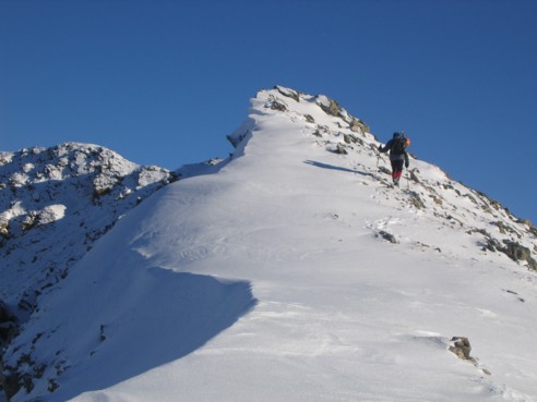
The beginning of the ridge
Another view of the route to the summit
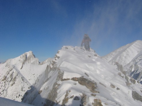
A little detour to a scenic highpoint, with a
little blowing snow; Old Baldy Mountain at the left
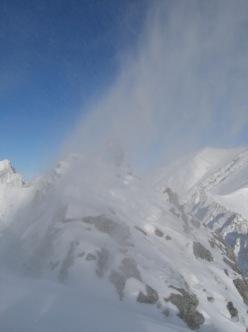
The same as above, with a lot
of blowing snow; yes.... the dark form in the middle of the picture is
me; I was very quick to retreat at this point
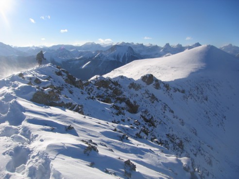
Mark, heading back along the ridge; Volcano
Peak at the far right
More great scenery on descent
Another little detour on descent; Volcano
Peak is just right of centre
Mounts Lougheed, Allan,
Collembola, and the Nakiska ski hill