Mount McGillivray
October 26, 2003
Mountain height: 2,450 m
Elevation gain: 1,140 m
Ascent time: 5:20
Descent time: 3:10
Mountaineering
with Mark.
From the Trans-Canada, the summit of Mount McGillivray
looks like a short and easy proposition. Don't be fooled! It's longer and more
challenging than you might think. We decided to take the 5.3 climbing route, as
described by Tony Swain on the Bivouac website. This route gains the ridge and
follows it up to the north buttress, traverses around the east side of the
mountain, and then gains the summit ridge up a couple of 5.3 climbing sections.
A compass might be a good idea at the beginning, as we encountered routefinding problems and
wandered too far east. Bushwhacking alongside the steep walls, we eventually
found a break in the rock and managed to scramble up to the ridge. From there,
a long and fairly interesting hike took us to the north buttress, where we
traversed around the east side of the mountain to the climbing section.
Immediately, we found a rope hanging down a steep section of rock. We tested
the rope and although it looked to be quite old and worn, it did hold my weight
and more. The plan was to hook the rope into my ATC and use it only as a
backup, in case I fell, and to avoid climbing up it.
The first
section of climbing proved to be quite difficult and more than once, I found
myself grabbing onto the rope for support and to pull myself up a couple of
difficult sections, where there were inadequate foot and handholds. It took me
a while, but I eventually made it up. My hands had turned in two huge ice-cubes
by then and I spent a good ten minutes trying to get feeling back in them. I’m
afraid that I’ll have to admit that without the aid of the other rope, I
probably wouldn’t have been able to make it up.
There was one
more climbing section before the summit ridge, but it was easier and shorter
than the first. Now on the ridge, we were assaulted by an intensely strong west
wind. It made travel along the ridge, slow and a little unpleasant. Only metres
away from one another, we had to shout to be heard. We made it to the first
summit, where we found shelter behind the cairn. After a quick rest, we decided
to try for the true summit (about 50 vertical metres higher, but quite far
along the ridge), with a turn around time of 30 minutes. Unfortunately, we
didn’t even come close and had to turn around, in order to ensure that we
wouldn’t be descending in the dark. The descent was easy and included two
enjoyable rappels. A worthwhile trip and a good day out.
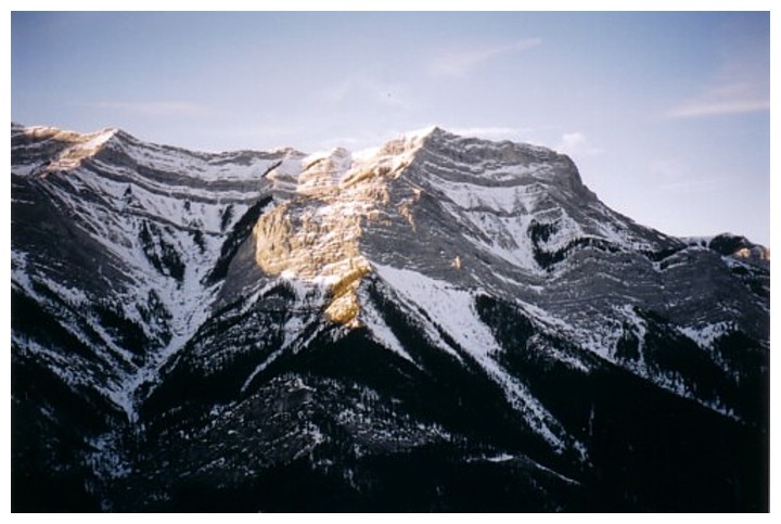
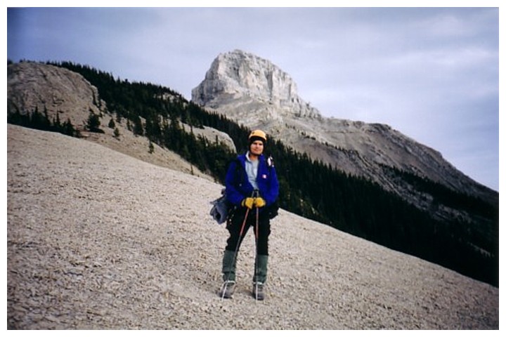
Mount McGillivray, as seen from the highway
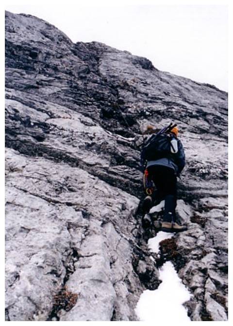
The lower part of the 5.3 climbing section
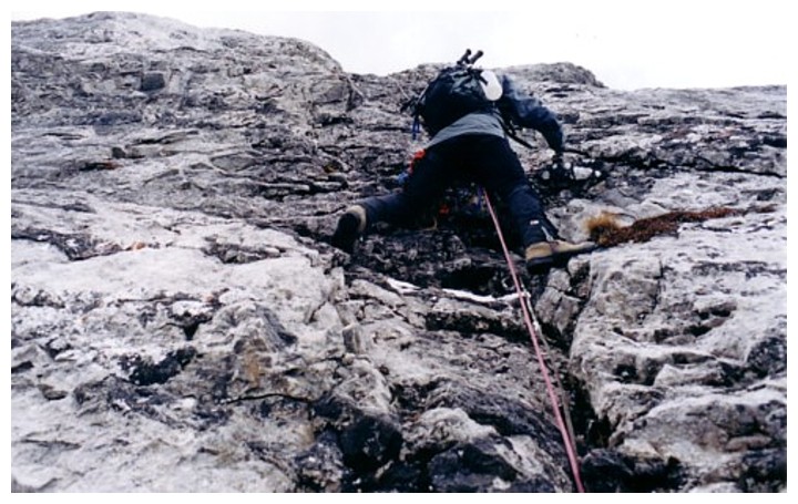
Making slow progress
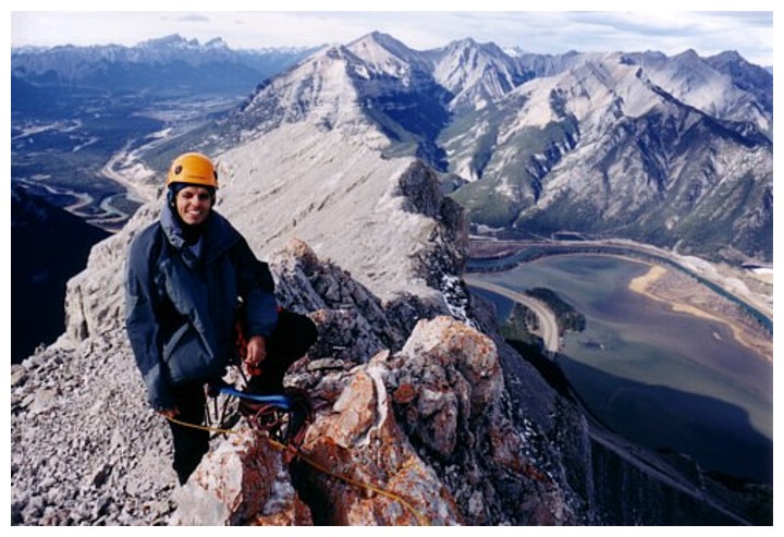
On the ridge and facing a stiff wind
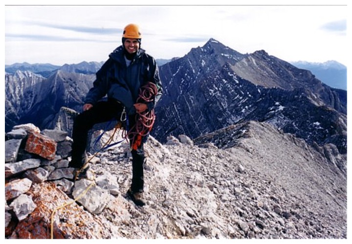
Highpoint of the day
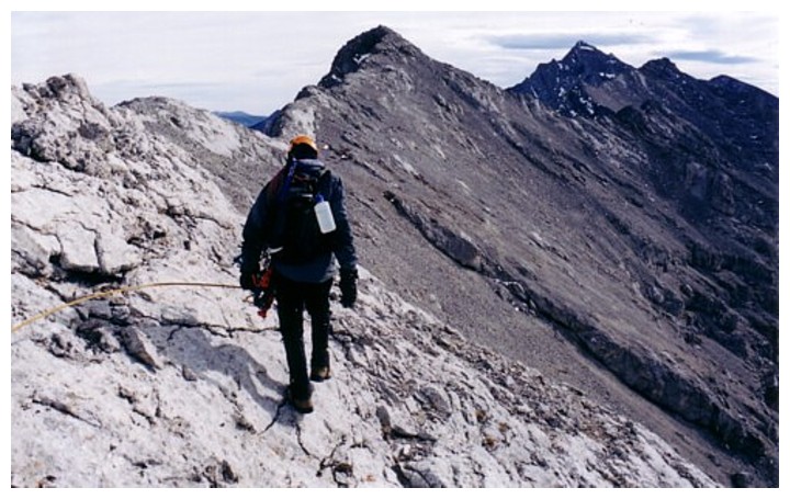
The highest peak behind me is Skogan Peak. The summit of McGillivray is to the right of Skogan.
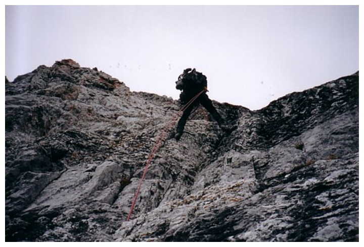
Rappelling
Parting look at McGillivray's summit block