Mount McPhail
September
17, 2005
Mountain height: 2,865 m (9,397 ft)
Elevation gain: 1,290 m
Ascent time: 6:20
Descent time: 3:30
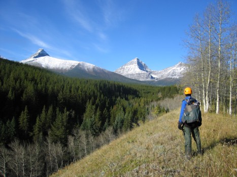
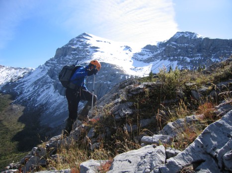
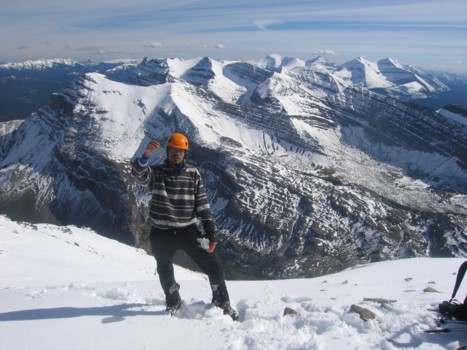
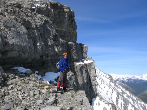
Scrambling with Mark.
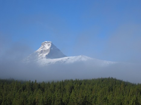
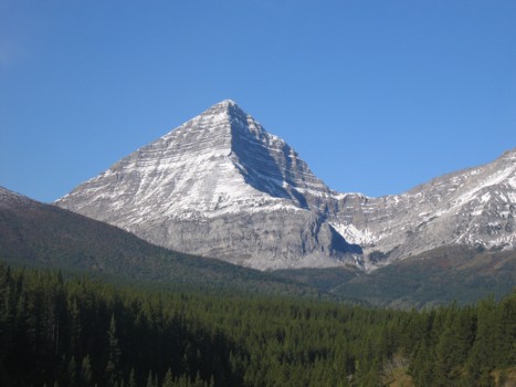
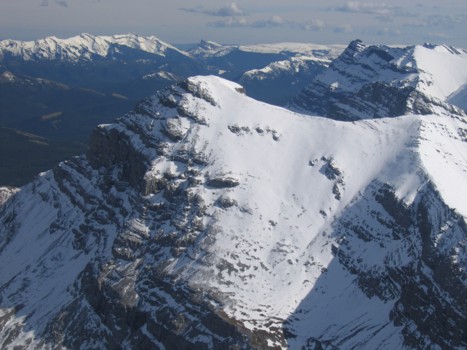
We first saw Mount McPhail
in October of 2004, while ascending GR617954. Its shapely pyramidal form
immediately caught everyone’s eye and we put it on our “hit-list” right away.
The perfect diagonal of the south ridge appeared to provide a straightforward
ascent route and could easily be approached via a 10 km bike ride, followed by
3.5 km hike up a headwall to a col shared by McPhail and Mount Muir.
We were prepared to bring along a full
compliment of climbing gear, however, as luck would have it, a recent message
on the “Live-the-Vision” website revealed the south ridge to be nothing more
than a steep hike and so we were able to travel light – a good thing, given
that the previous week’s excessive precipitation had turned much of the McPhail
Creek trail into a muddy swamp. The predicted 1.5-2 hour bike ride became a
grueling 3.5 hour combination of rough riding, walking the bikes through deep
puddles and sloppy mud, and several river/stream fords (hip-waders or runners,
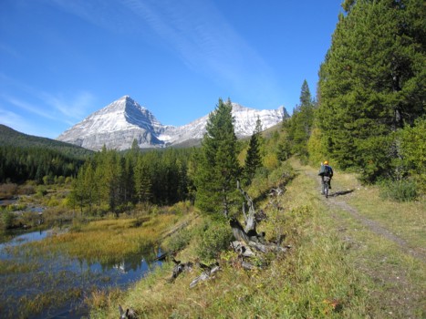
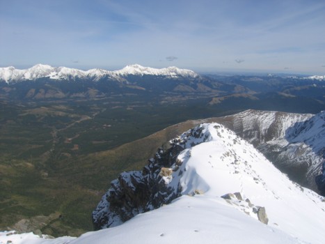
a must!). Fortunately, the views towards
Mounts McPhail and Muir were impressive throughout.
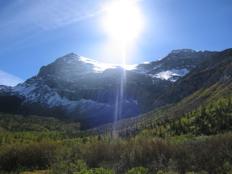
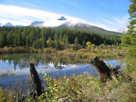
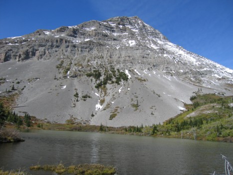
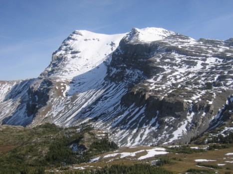
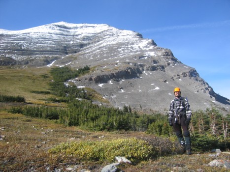
After ditching our bikes, we followed a
good trail up the very scenic headwall (great waterfall) to the even more
scenic landscape of the Weary Creek area: a shallow tarn, back-dropped by
McPhail, rolling hills, snow-covered Mount
Muir, and a host of other shapely peaks to the west.
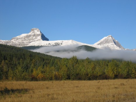
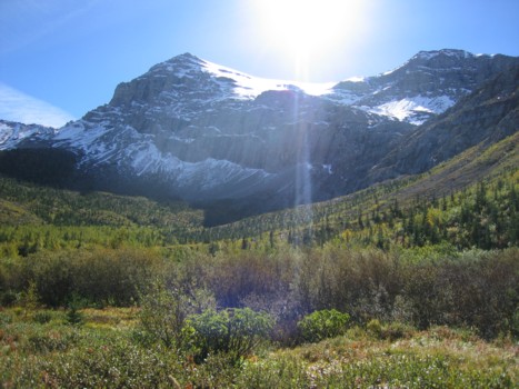
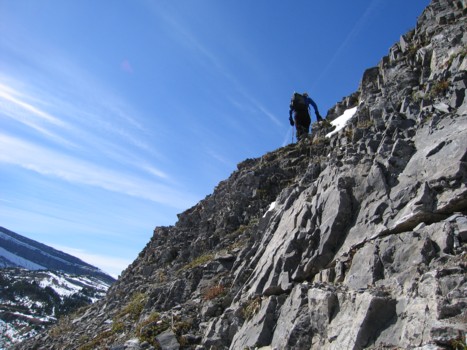
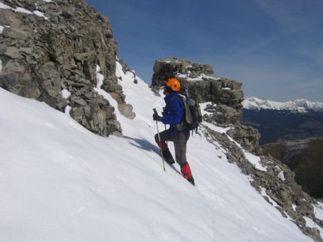
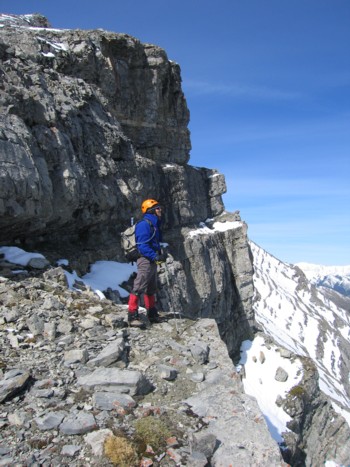
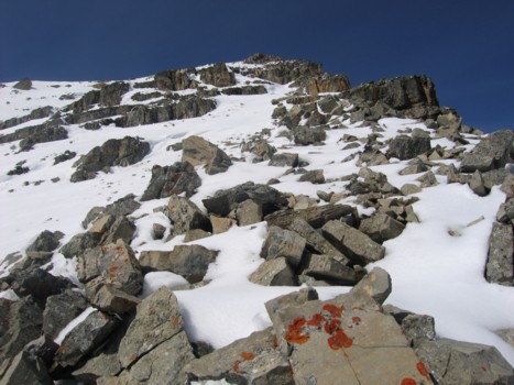
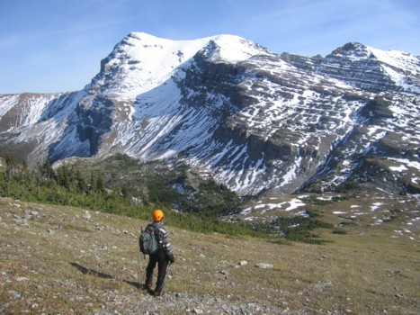
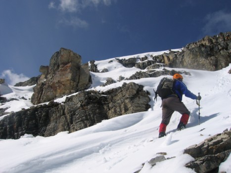
In order to try and make up some lost time,
we headed directly up McPhail’s southeast ridge – a somewhat foreshortened
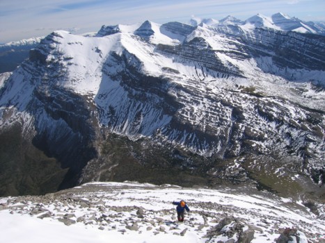
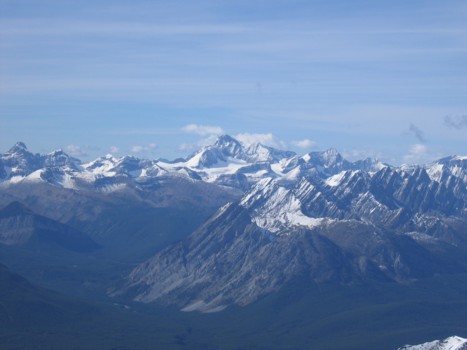
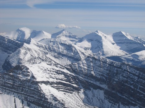
scree slog with some terrific scenery over the east face of the mountain. As we
gained elevation, the quality of the view to the south (Muir, Strachan,
Shankland, Armstrong, etc.) increased exponentially, more reminiscent of a
scene from the dead of winter than mid-September. The increasing volume and
depth of fresh snow also enhanced the ascent, although higher up we found ourselves
postholing past the knees.
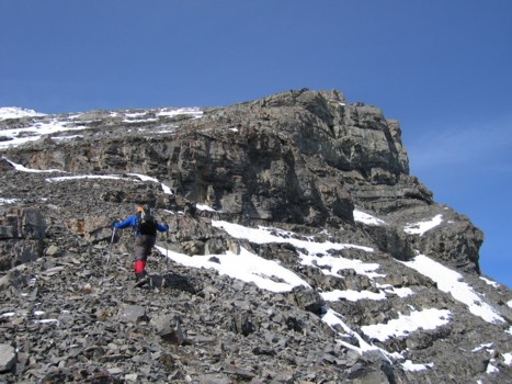
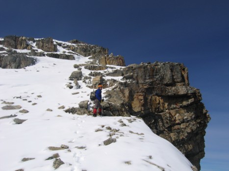
As mentioned, the slope was quite
foreshortened and our turn-around time of 1:45 pm soon became 2:00,
which then became 2:30,
which eventually ended up as 3 pm.
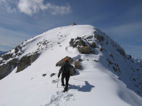
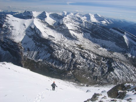
Great weather and outstanding scenery kept us moving, even though we had to be
back in Calgary
before 8:30 pm. We dragged
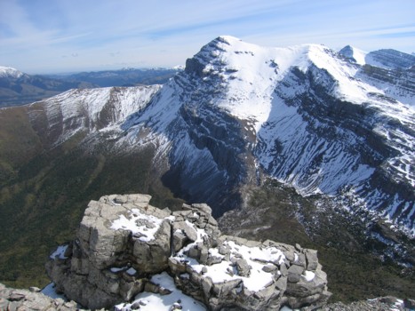
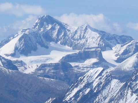
ourselves onto the summit at 3:05
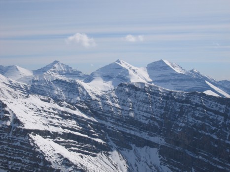
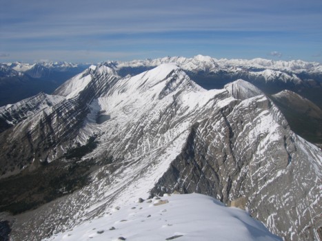
pm to an absolutely phenomenal view in all directions. While the valleys had
managed to rid themselves of the recent snow, significant amounts of the white
stuff clung to every mountain within eye-shot: Mounts Bishop and Loomis
dominated to the north, beautifully back-dropped by Mist Mountain and company;
the southeast face of Sir Douglas and Joffre towered over everything to the
northwest; and the Highwood Range, with Holy Cross and Mount Head at the south
end, looked particularly interesting with the snow-cover. Once again, however,
the array of striking peaks immediately to the south was the show-stopper.
Our summit stay amounted to no more than 10
minutes. We were approximately 2 hours behind schedule and wanted to get down
fast. Fortunately, the snowy terrain allowed for some rapid elevation loss
initially, as we went directly down the centre of the south face, glissading in
a few places. Lower down, a significant rockband forced us back to our ascent
route, left (east) of the centre gully. Without
the snow, this gully would have provided a great ascent route with lots of
hands-on scrambling. By the same token, with a great deal more snow, one could
probably glissade down the entire peak using our ascent route, more east of the
middle. The entire descent was thankfully quite fast and the slightly downhill,
the 10 km bike ride back to the car, mercifully easier than the its uphill
counterpart. Our only regret of the day was that we didn’t have the time (or
the energy, for that matter) to ascend equally easy Mount Muir,
south of Weary Creek Gap. A bivy at the tarn would be an excellent way of
getting both peaks and enjoying some outstanding scenery.
Overall, a wonderfully rewarding and scenic
day out.