Morrowmount
attempt –
Mountain height: 2,530
m (8,298 ft)
Elevation gain: 1,221 m (I came up about 75 vertical metres short)
Roundtrip time:
Solo scramble.
This may come as a big surprise to all…….. but I took the wrong route on this trip – twice!! Two reasons for this: I neglected to take a route description, but more importantly I didn’t mark the summit on my Gemtrek map (which doesn’t include Morrowmount). As a result, I didn’t make to the summit, however, I did make it close enough to get a good view of the surrounding peaks and the correct ascent route.
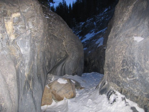
An early start and a brisk pace were key to having any chance of completing the 21.5 km trip, on this the 4th shortest day of the year (apparently, going the right way was also key!). Once again, the canyon at the beginning of Jura Creek and the false fault were very enjoyable. Except for a few patches of ice, the canyon was bone-dry and very easy to negotiate. After the false fault, the long and tedious grind up Jura Creek continued.
For some inexplicable reason, I had the happy idea that the correct route up was going hit me like a bolt of lightning. However, none of the very interesting high points to the east looked familiar (pictures from Bob Spirko's website) and so I kept following the dried-up creek. When I did arrive at a critical junction, I opted to continue up the creek, instead of trending left up an obvious gully (the correct route, I would later learn). This mistake was short-lived and in the end I’m glad I went this way, as the scenery was very satisfying.
Upon realizing my mistake, I returned to the aforementioned
junction where, in the spirit of tradition, I chose to go the wrong way again!
Here, I should have stayed in the gully or attained the ridge to my left.
Instead, I headed for the ridge on my right. At this point, I really didn’t
care if I made it to the summit, but I did want to get to a highpoint, where I
might get a decent view. A slog up a red shale scree slope, followed by another
slog up gray limestone scree and I found myself on the summit ridge, in between
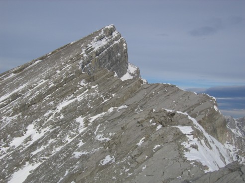
Morrowmount and the very striking form of
The panorama from the ridge
was excellent, with great views of the back of Yamnuska,
The canyon at the beginning of the trip
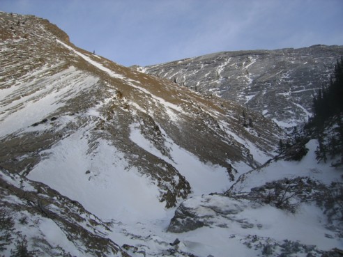
The "critical" junction; here, I should have gone up the ridge at the left; I went right and ended up south of the summit, instead of north
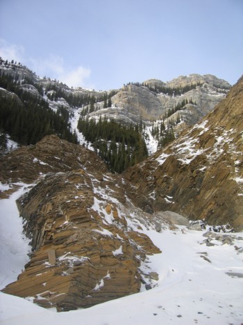
Splendid scenery too far up Jura Creek
Mount Fable
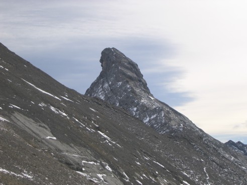
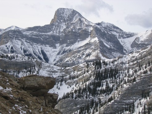
The eye-catching form of Hassel Castle
The summit of Morrowmount
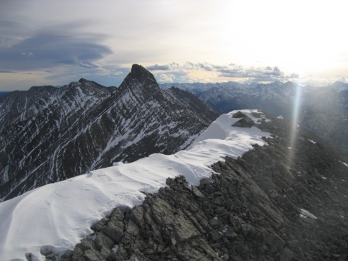
Looking south along the ridge toward Hassel Castle
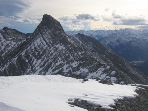
Same as above