Mosquito Mountain
August 14, 2008
Mountain height: 2970 m
Elevation gain: 1130 m
Ascent time: 3:30
Descent time: 4:40
Solo scramble.
 If I knew Graeme Pole personally, I’d give
him a big hug – or at least a manly handshake! This trip was based on another
route description posted by Mr. Pole on the Bivouac website, and like Rick
Collier’s, they are worth their weight in gold (let’s pretend that we are still
in the stone age and route descriptions are chiseled onto heavy stone tablets,
not printed on lightweight paper). Had I know this trip was going to be one of
the highlights of my year, I would have waited until the weekend when Mark
could have come along for the ride.
If I knew Graeme Pole personally, I’d give
him a big hug – or at least a manly handshake! This trip was based on another
route description posted by Mr. Pole on the Bivouac website, and like Rick
Collier’s, they are worth their weight in gold (let’s pretend that we are still
in the stone age and route descriptions are chiseled onto heavy stone tablets,
not printed on lightweight paper). Had I know this trip was going to be one of
the highlights of my year, I would have waited until the weekend when Mark
could have come along for the ride.
Mosquito Mountain is the unofficial
name of one of a group of three peaks that sit to the north of Noseeum Mountain. They are not visible from the
road, hence their lack of attention. I certainly never would have thought about
heading in their direction, until I stumbled upon Mr. Pole’s trip reports for
all three peaks.
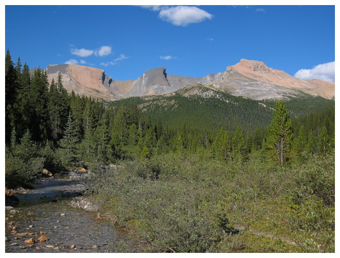
 The trip started with an easy hike
alongside Mosquito Creek to a backcountry campground and then a light bushwhack
to tree-line. Up to that point I would characterize the environs of Mosquito
Creek as pleasant, but nothing to get all riled up about. That certainly
changed once out of the trees. One second there’s nothing but bark and branches
in your face, the next nothing but open grassy slopes, meadows, and striking
mountains in every direction. It was actually a “shocking” experience.
The trip started with an easy hike
alongside Mosquito Creek to a backcountry campground and then a light bushwhack
to tree-line. Up to that point I would characterize the environs of Mosquito
Creek as pleasant, but nothing to get all riled up about. That certainly
changed once out of the trees. One second there’s nothing but bark and branches
in your face, the next nothing but open grassy slopes, meadows, and striking
mountains in every direction. It was actually a “shocking” experience.
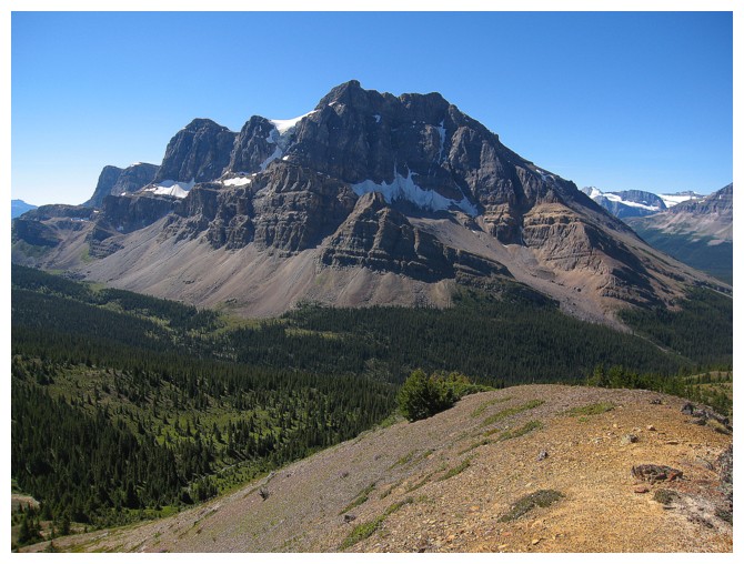
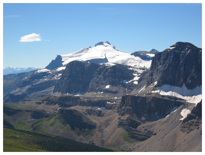
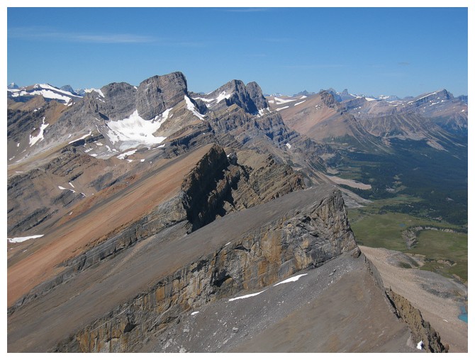
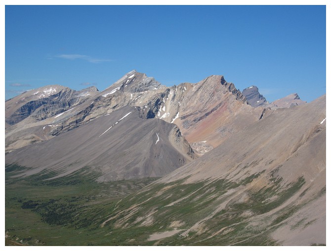
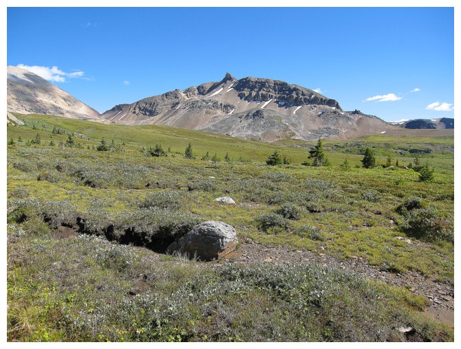
As well as the wonderful form of Mosquito Mountain,
his little brothers also came into view – Ramp
Peak (a very appropriate name) and Quartzite Peak. The colours and contours of the
three peaks were outstanding.
The hike to the summit of Mosquito Mountain
started off magnificently and just got better with every metre of elevation
gained. I followed the left edge of the peak and was rewarded with vertiginous
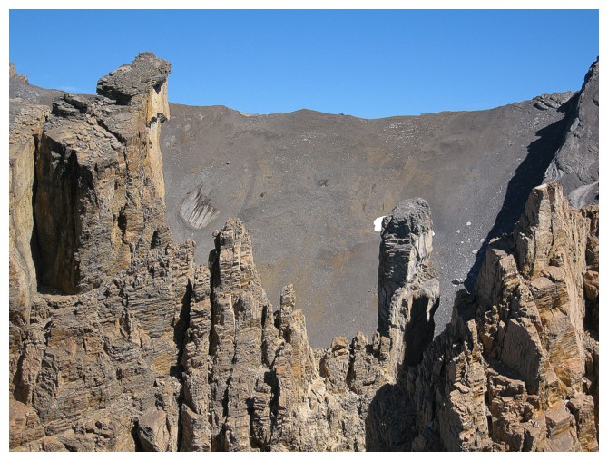
views down the north side of the mountain and some fantastic pinnacle scenery. My
lengthy ascent time is explained by the fact that I simply could not keep my
camera out of its case.
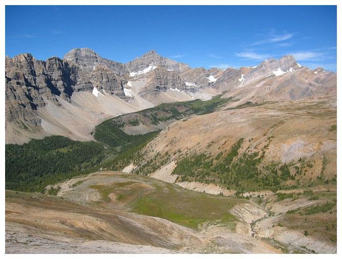
 The summit vista was phenomenal. The best
views were to the south, where stood Mount
Hector, distinctive Molar Mountain,
and Noseeum Mountain,
and to the east, with the three peaks of Mount
Willingdon and Cataract Peak
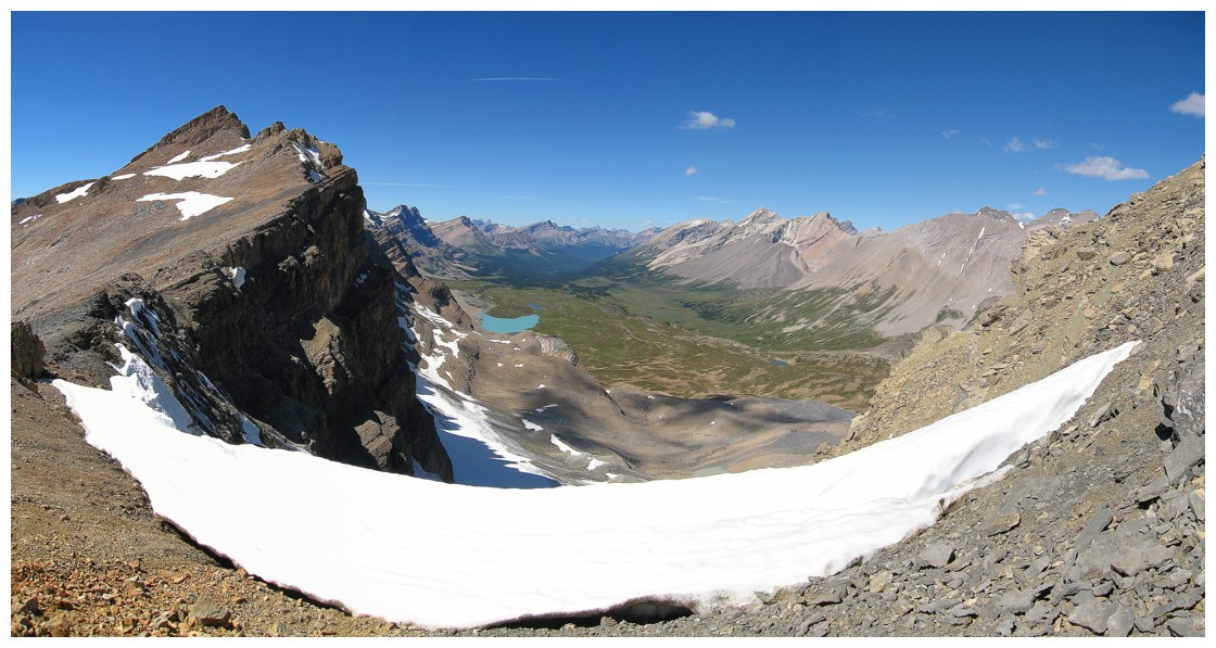
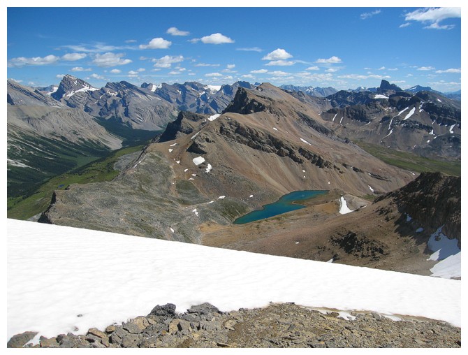
further south. The entire length of the Pipestone Valley
was also visible, enhanced by a small, but beautiful turquoise lake to the
north.
The summit vista was phenomenal. The best
views were to the south, where stood Mount
Hector, distinctive Molar Mountain,
and Noseeum Mountain,
and to the east, with the three peaks of Mount
Willingdon and Cataract Peak
further south. The entire length of the Pipestone Valley
was also visible, enhanced by a small, but beautiful turquoise lake to the
north.
Ready to return the same way I came, I
decided to first explore the ridge to the southeast a little. There appeared to
be infinite opportunities to descend easily into the Mosquito Creek valley.
This was one alternate descent route that didn’t elicit a flood of anxiety in
me!
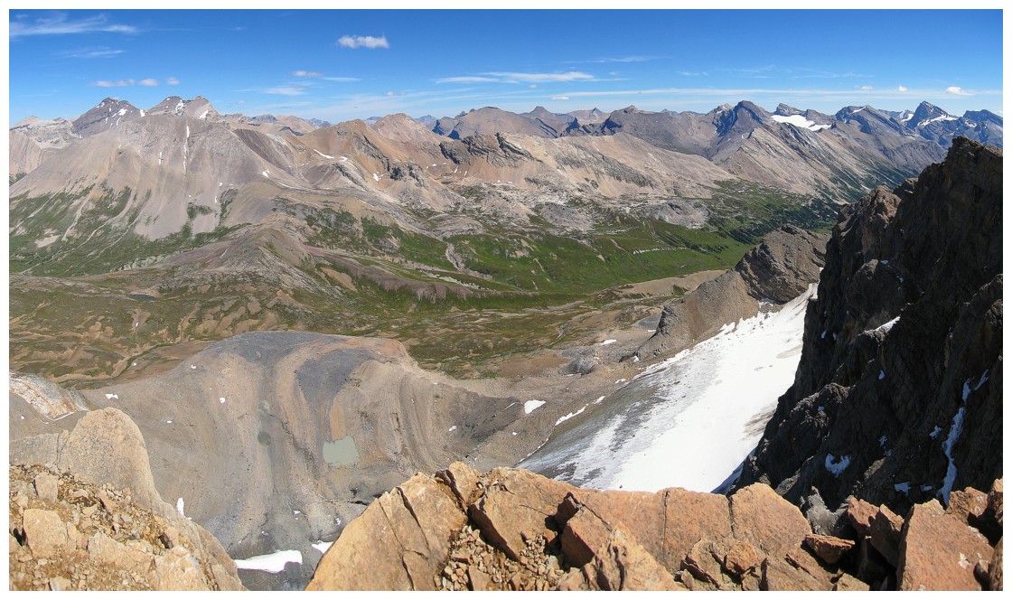
The southeast ridge was also fantastic, but
quite a bit more serious than the ascent route. There were a few sections of
downclimbing and a couple of easy but brutally exposed moves. At times,
drop-offs forced me away from the ridge, but easy terrain led back to it. The
views and scenery continued to inspire and so I continue to follow the ridge.
On at least five separate occasions I picked a spot to end the trip and return,
only to get to that point and decide to continue along the ridge.
I finally reached a fork in the ridge where I
promised myself I would turn around. That is until I accidentally wandered too
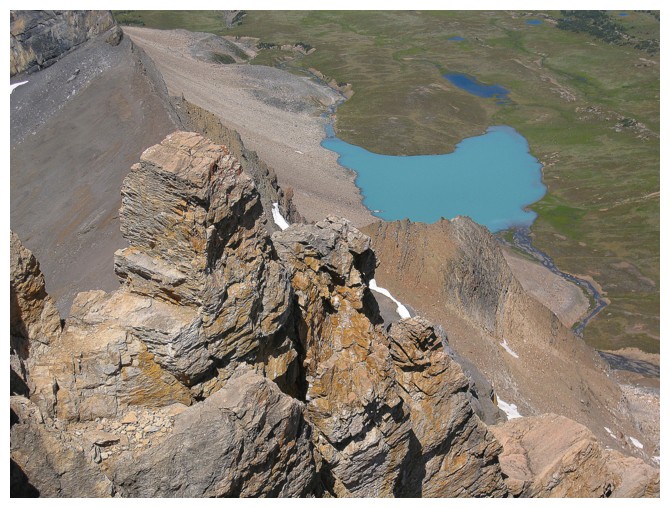
far over to one of the ridges to spot a stunning bluish-green lake to the
southeast. Of course, I had to get a better look and so I followed the ridge
south, enjoying some interesting scrambling and a whole lot of easy ridge-walking.
A quick visit to the peaceful and secluded lake completed a perfect day. The
descent route from the lake consisted of hiking across meadows and then down to
the prominent and busy Mosquito Creek Trail.
What a simply wonderful day! Thank
you Graeme.
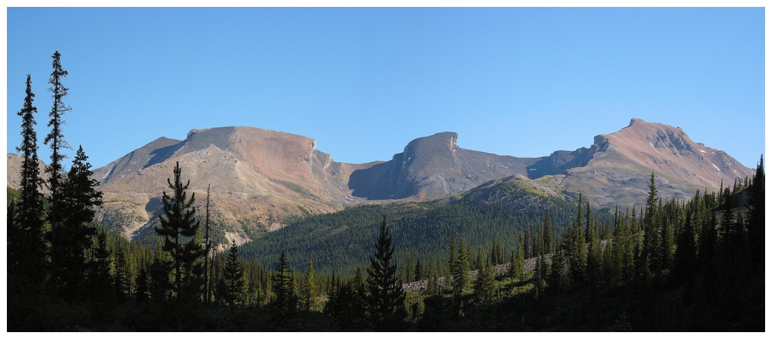
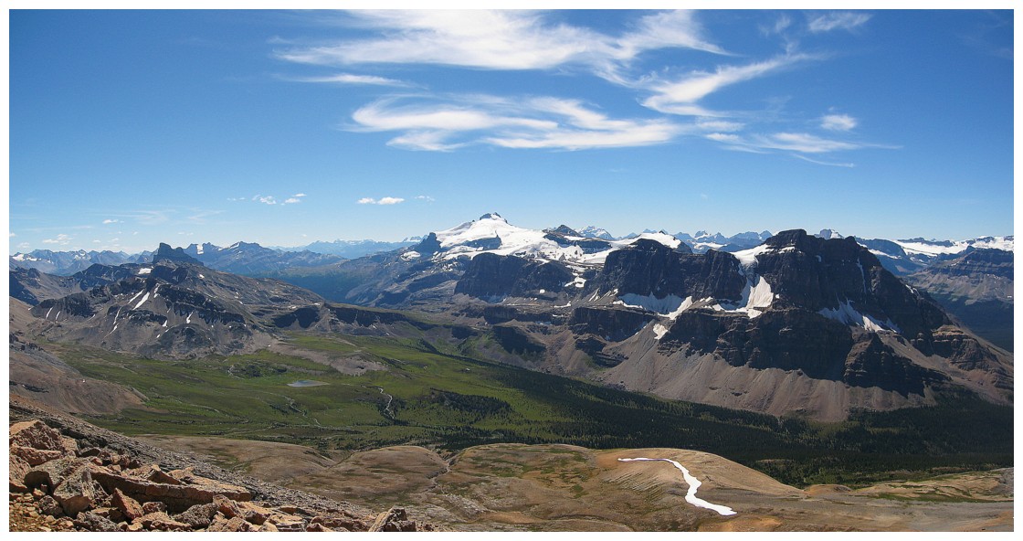
The photogenic mountain trio of Quartzite, Ramp, and Mosquito
Out of the trees and into the beautiful environs around Mosquito Mountain
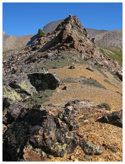
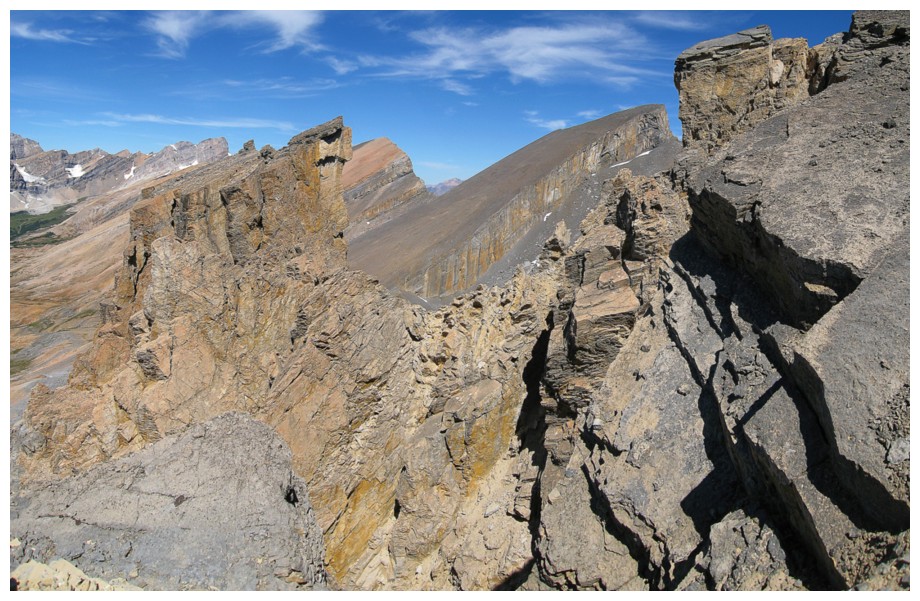
Interesting rock on the lower ridge
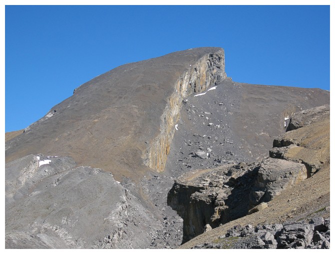
The steep north side of Noseeum Mountain; one of my favourite trips in the Rockies (I, II, III, IV, V)
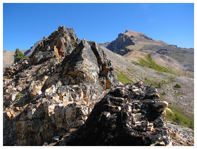
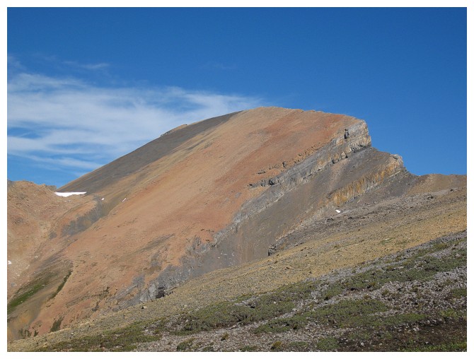
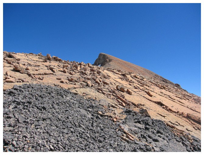
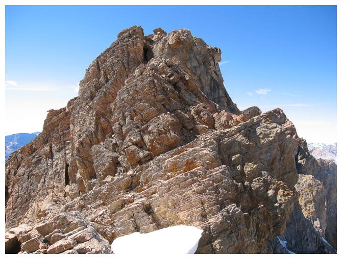
More interesting rock and the route up Mosquito
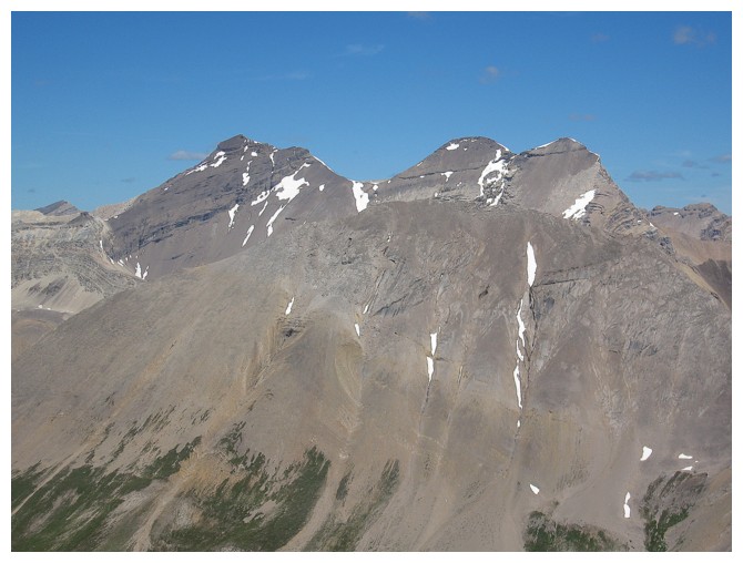
Quartzite and Ramp
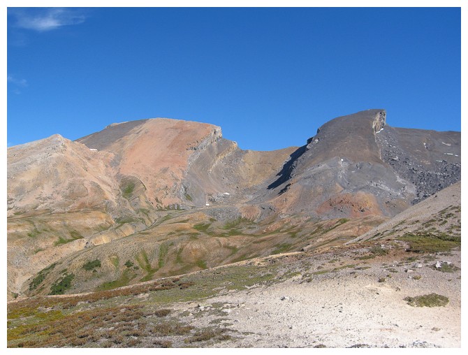
The view to the northwest includes OXO Peak (just left of centre) and Watermelon Peak (right)
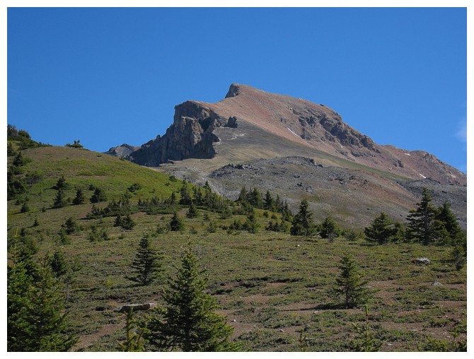
Ramp Peak is a most appropriate name!
I'm assuming there is lots of quartzite on Quartzite Peak
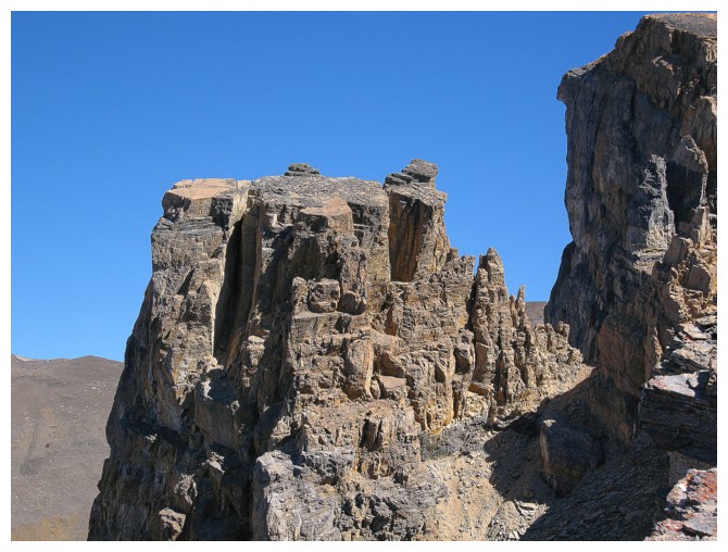
The rock scenery on Mosquito continues to impress
Yikes!
Mount Hector
The very clear delineations of different rock types are typical of the whole area
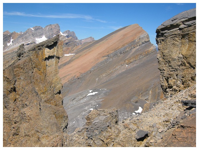
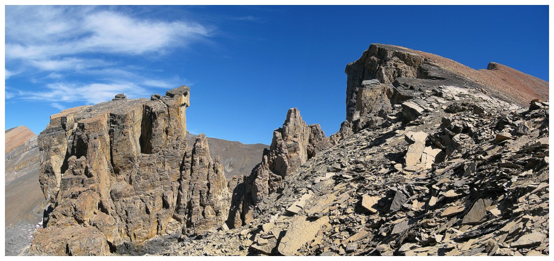
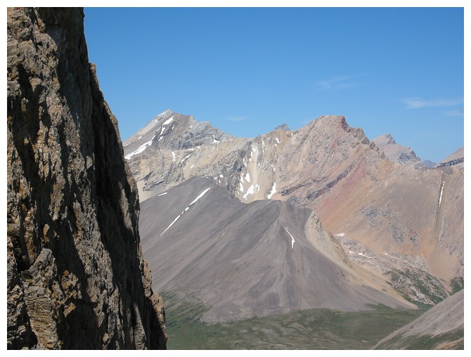
Looking through a gap to Quartzite Peak
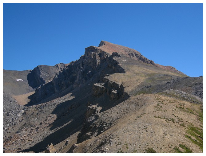
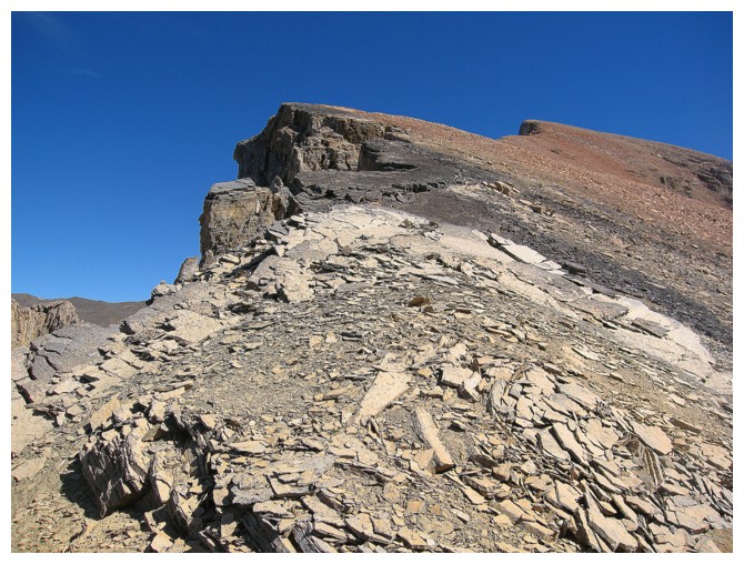
Approaching the summit
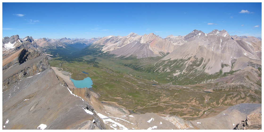
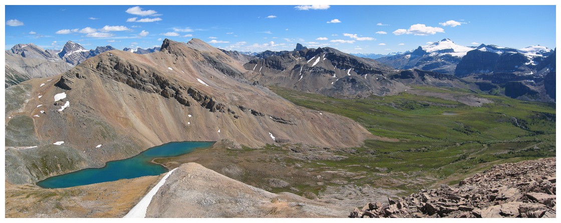
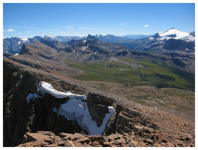
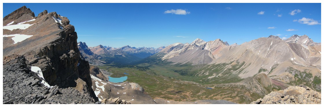
Summit view of the Pipestone Valley
The lakes in the valley
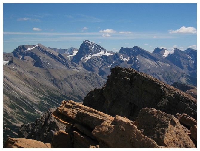
The view to the
northeast, east, and southeast includes the three summits of Mount
Willingdon (left) and near 11,000 er Cataract Peak (right)
Molar Mountain (left), Hector, and Noseeum are featured in the view to the south
Distant Cathedral Mountain (centre) and Cathedral Crags (right). Super good memories!
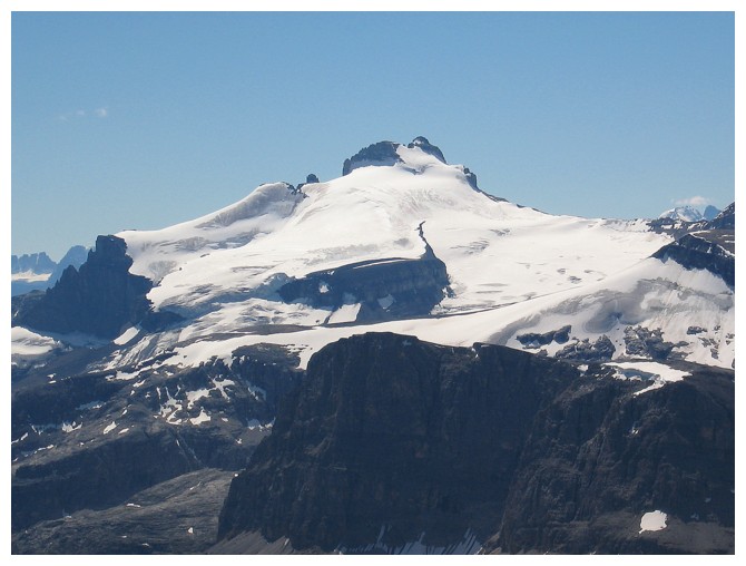
Closer look at Hector
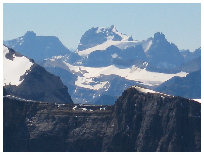
Closer look at Cataract Peak
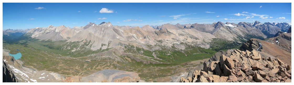
A more comprehensive panorama of the Pipestone Valley
Looking along the massif to the northwest.
Somewhat reminiscent of the summit view from The Fortress towards Gusty and Galatea
The Willingdons
Clearwater Mountain peeks out
Some challenging terrain on the traverse
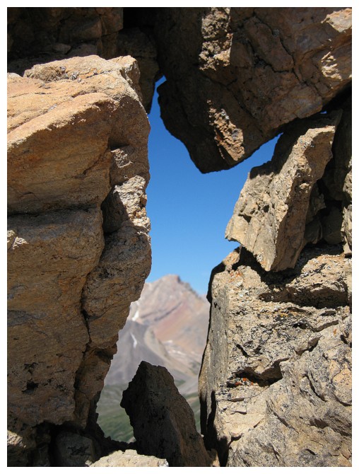
Looking at Clearwater through a gap in the rocks
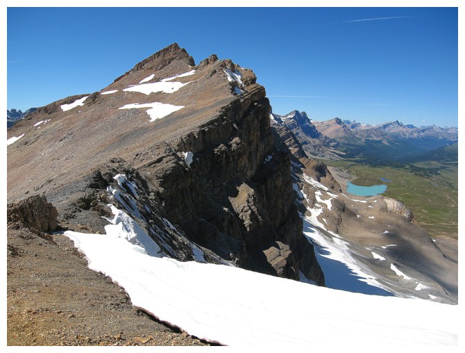
Looking back to the summit of Mosquito
A better look at beautiful Clearwater Mountain
The irresistible lake. The mountain above the lake is Molarstone Mountain and makes for an amazing day trip
Perhaps surprisingly, this was my favourite view of the day
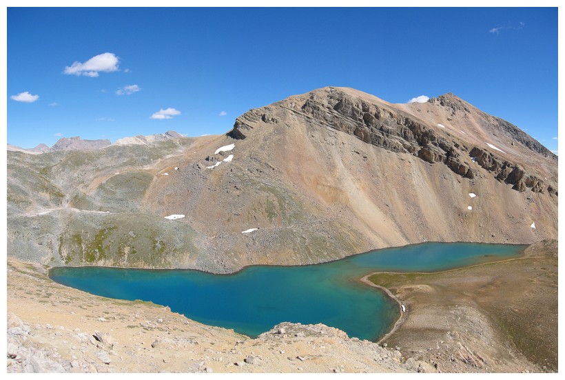
Descending to the lake
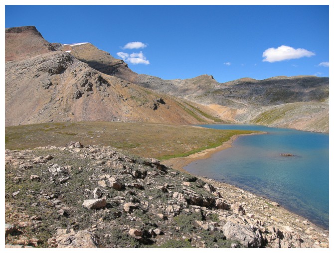
At the lake
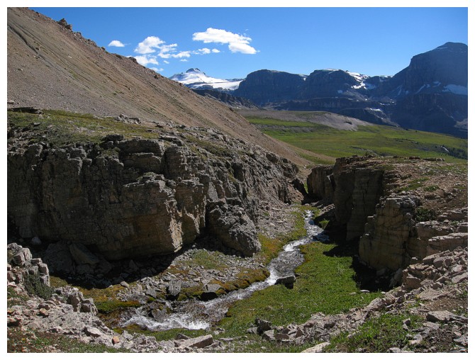
A stream emanating from the lake leads back to Molar Creek
"The Fang" is a terrific little side trip from Molarstone
A satisfying last look at the trio
The End